In compliance with FTC guidelines, please assume the following about all links on this website that are outbound links: Since I share products and services I use and love with my readers, assume that I may receive a small commision if you buy something or subscribe to a service from a link on this website (at no additional cost to you). If you do buy something, thanks for your support !
Among others, we are a participant in the Amazon Services LLC Associates Program, an affiliate advertising program designed to provide a means for us to earn fees by linking to Amazon.com and affiliated sites. Pages on this site may include affiliate links to Amazon and its affiliate sites on which the owner of this website will make a referral commission.
The shopping links above this notice go to our own store, NativeCrafts.us
At one time, more than fourty Assiniboine bands roamed North America. Modern scholars say they split from the main Sioux tribes in the early 1700s, but the Assiniboine people say they have always been a separate tribe.
The names of the Assiniboine bands are:
Aegitina (‘Camp Moves to the Kill’)
Bizebina (‘Gophers’)
Cepahubi (‘Large Organs’)
Canhdada (‘Moldy People’)
Canhewincasta (‘Wooded-Mountain People’ or ‘Wood Mountain People’ – ‘People Who live around Wood Mountain’)
Canknuhabi (‘Ones That Carry Their Wood’)
Hudesabina (‘Red Bottom’ or ‘Red Root’, split off from the Wadopabina in 1844)
Hebina (Ye Xa Yabine, ‘Rock Mountain People’, often called Strong Wood or Thickwood Assiniboine, later a core band of the Mountain Stoney-Nakoda)
Huhumasmibi (‘Bone Cleaners’)
Huhuganebabi (‘Bone Chippers’)
Hen atonwaabina (‘Little Rock Mountain People’)
Inyantonwanbina (‘Stone People’ or ‘Rock People’, later known as Nakoda (Stoney))
Inninaonbi (‘Quiet People’)
Insaombi (‘The Ones Who Stay Alone’, also known as Cypress Hills Assiniboine)
Indogahwincasta (‘East People’)
Minisose Swnkeebi (‘Missouri River Dog Band’)
Minisatonwanbi (‘Red Water People’)
Osnibi (‘People of the Cold’)
Ptegabina (‘Swamp People’)
Sunkcebi (‘Dog Band’)
Sahiyaiyeskabi (‘Plains Cree-Speakers’, also known as Cree-Assiniboine / Young Dogs)
Snugabi (‘Contrary People’)
Sihabi (‘Foot People’)
Tanidabi (‘Buffalo Hip’)
Tokanbi (‘Strangers’)
Tanzinapebina (‘Owners of Sharp Knives’)
Unskaha (‘Roamers’)
Wadopabina (‘Canoe Paddlers’)
Wadopahnatonwan (‘Canoe Paddlerrs Who Live on the Prairie’)
Wiciyabina (‘Ones That Go to the Dance’)
Waziyamwincasta (‘People of the North’)
Wasinazinyabi (‘Fat Smokers’)
Wokpanbi (‘Meat Bag’)
Enrollment requirements for the Assiniboine and Sioux Tribes of Fort Peck
A person must meet one of the following requirements to be enrolled in the Assiniboine and Sioux Tribes of Fort Peck:
(a)
Basic Rolls. Each living person of Assiniboine and/or Sioux blood whose name appears on either the 1932 annuity payment roll or an allotment schedule prepared and approved pursuant to the Acts of February 8, 1887 (24Stat. 388), February28,1891(26 Stat. 794), May 30,1908 (35 Stat. 558), August 1, 1914 (38 Stat. 593), February 14, 1920 (41 Stat. 408), and March 3, 1927 (44 Stat. 1401), provided that he or she is not enrolled as a member of some other tribe.
(b)
Descendants of Persons on Basic Roll. Each living person who is of one-fourth (1/4) or more Assiniboine or Sioux blood born prior to the effective date of this constitution who is a lineal descendant of a person whose name appears on one or both of the documents specified in (a) of this Section regardless of whether such annuitant or allottee is living or deceased, provided that he or she is not a member of some other tribe at the time of application for enrollment and provided further, that he or she is a citizen of the United States. Any such person may apply for enrollment at any time.
(AMENDMENT NO. 1 AS PER REFERENDUM VOTE OF 05/07/88.)
(c)
Adoptees. Each person adopted into tribal membership by the General Council prior to the effective date of this Constitution whose adoption was approved by the Secretary of the Interior, or his authorized representative, provided such adoptee has not subsequently become enrolled as a member of some other tribe.
(d)
Future Members. Each child of one-fourth (1/4) or more Assiniboine and/or Sioux blood born after the effective date of this ordinance to any member of the Assiniboine and Sioux Tribes, provided that the child is not a member of some other tribe at the time of application for enrollment and provided further, and that the child is a citizen of the United States at the time of the child’s birth.
(AMENDMENT NO. 2 AS PER REFERENDUM VOTE OF 05/07/88.)
(e)
Associate Members: Each child of one-eighth (1/8) or more but less than one-quarter (1/4), Assiniboine and/or Sioux blood born to any member of the Assiniboine and Sioux Tribes, provided the child is a citizen of the United States at the time of the child’s birth. Associate members shall not be eligible to vote in Tribal elections or to share in any distribution of tribal funds or property, but shall otherwise be eligible for benefits as Indians as provided by Law.
Enrollment requirements for the Aroostook Band of Micmacs
In order to become a member of the Aroostook Band of Micmacs, you must be able to prove pre-recognition ties to Aroostook County, Maine before November 26, 1991, and provide documentation to prove your Aroostook ancestry. Other requirements include:
You must have the certification within the application notarized.
Provide a Certified Birth Certificate, which will be returned to you after copies are made for your file.
You must be a United States citizen.
Proof of ties to Aroostook County
Ties to Aroostook County means having a significant connection through you or an immediate family member to the Aroostook County community. An immediate family member is, as defined in the Membership Ordinance, a person’s child, parent, grandparent, or sibling. Ties can be proven by official documents such as, but not limited to, birth certificates or school records that show residency in Aroostook County prior to November 26, 1991.
Micmac ancestry is prove with a band card or a letter from a recognized Micmac Tribe in Canada through Indian Affairs in Ottawa.
The only band cards accepted are those approved by Indian Affairs in Ottawa, Canada. There are other organizations throughout Canada that issue their members cards, however, if you do not have a band card issued by Indian Affairs in Canada, it will not be accepted as proof. You can be a member of the Aroostook Band of Micmacs as well as a member of a Tribe in Canada.
You cannot be a member of more than one tribe located in the United States. While you may be eligible for membership with more than one U.S. Tribe, you must choose which Tribe you want to obtain membership with.
The Enrollment Application Process
Once an application is returned to the Aroostook Band of MicMacs office, it will be reviewed by the Membership Committee. If the file is found to be complete by the Committee it is then forwarded to the Tribal Council for approval at their next meeting. If the application is approved, the applicant will be notified by mail.
If an application is submitted without meeting all of the requirements, the applicant will be notified by mail and given 90 days to complete the file. If the file is not completed within the 90 day time frame, the file will be mailed back to the applicant and no further action will be taken until a properly completed application with the required documentation is received.
Suggestions on tracing your Aroostook Micmac roots
There are 28 Micmac Tribes throughout Canada. Start by locating birth certificates for yourself and all ancestors leading back to your Aroostook roots. Once you have established a chain linking you back to the person whom you consider to be Micmac, your trace should lead you to Canada. On the birth certificate it should state where your ancestor was born. Once you have a location, check with Micmac tribes in the surrounding area.
Tracing your roots can be extremely time consuming, especially if you don’t have immediate family members to help point the way. Another alternative is to hire a professional genealogist to do the work for you. If you go that route, be prepared for considerable expense.
If you are tracing your ancestry back before the early 1900’s, keep in mind the Aroostook Band of Micmacs does not have any members born before this time.
Books that may help with starting your Micmac Genealogy research
Benefits of enrolling in the Aroostook Band of Micmacs
Once you become an Aroostook Band of Micmacs tribal member, you would be entitled to:
Voting Rights within the Tribe as outlined in the By-laws.
Health Care Services.
Tuition Waiver for Higher Education in Maine.
Housing as determined by eligibility and availability.
In order to receive direct service benefits most programs require that the members reside within Aroostook County. All services offered by the Aroostook Band of Micmacs are detailed within their web site.
There is a common misconception that being a member of an Indian Tribe allows an individual to receive a monetary disbursement. While some Tribes are capable of providing their members with this type of compensation, through economic development ventures, not all Tribe’s are able to provide this service. The Aroostook Band of Micmacs does not provide this service to its members at this time.
Many of the historical names of Apache groups that were recorded by non-Apache are difficult to match to modern-day tribes or their subgroups. Over the centuries, many Spanish, French and/or English-speaking authors did not differentiate between Apache and other seminomadic non-Apache peoples who might pass through the same area. Most commonly, Europeans learned to identify the tribes by translating their exonym, what another group whom the Europeans encountered first called the Apachean peoples. Europeans often did not learn what the peoples called themselves, referred to as their autonyms.
While anthropologists agree on some traditional major subgrouping of Apaches, they have often used different criteria to name finer divisions, and these do not always match modern Apache groupings. Some scholars do not consider groups residing in what is now Mexico to be Apache. In addition, an Apache individual has different ways of identification with a group, such as a band or clan, as well as the larger tribe or language grouping, which can add to the difficulties in an outsider comprehending the distinctions.
In 1900, the U.S. government classified the members of the Apache tribe in the United States as Pinal Coyotero, Jicarilla, Mescalero, San Carlos, Tonto, and White Mountain Apache. The different groups were located in Arizona, New Mexico, and Oklahoma.
In the 1930s, the anthropologist Grenville Goodwin classified the Western Apache into five groups (based on his informants’ views of dialect and cultural differences): White Mountain, Cibecue, San Carlos, North Tonto, and South Tonto. Since then, other anthropologists (e.g. Albert Schroeder) consider Goodwin’s classification inconsistent with pre-reservation cultural divisions. Willem de Reuse finds linguistic evidence supporting only three major groupings: White Mountain, San Carlos, and Dilzhe’e (Tonto). He believes San Carlos is the most divergent dialect, and that Dilzhe’e is a remnant, intermediate member of a dialect continuum that previously spanned from the Western Apache language to the Navajo.
John Upton Terrell classifies the Apache into western and eastern groups. In the western group, he includes Toboso, Cholome, Jocome, Sibolo or Cibola, Pelone, Manso, and Kiva or Kofa. He includes Chicame (the earlier term for Hispanized Chicano or New Mexicans of Spanish/Hispanic and Apache descent) among them as having definite Apache connections or names which the Spanish associated with the Apache.
In a detailed study of New Mexico Catholic Church records, David M. Brugge identifies 15 tribal names which the Spanish used to refer to the Apache. These were drawn from records of about 1000 baptisms from 1704 to 1862.
Apache, current usage generally includes six of the seven major, traditional, Apachean-speaking groups: Chiricahua, Jicarilla, Lipan, Mescalero, Plains Apache, and Western Apache. Historically, the term has also been used for Comanches, Mohaves, Hualapais, and Yavapais.
Arivaipa (also Aravaipa) is a band of the San Carlos local group of the Western Apache. Schroeder believes the Arivaipa were a separate people in pre-reservation times. Arivaipa is a borrowing (via Spanish) from the O’odham language. The Arivaipa are known as Tsézhiné (“Black Rock”) in the Western Apache language.
Carlana (also Carlanes) is an Apache group in southeastern Colorado on Raton Mesa. In 1726, they had joined with the Cuartelejo and Paloma, and by the 1730s, they were living with the Jicarilla. It has been suggested that either the Llanero band of the modern Jicarilla or James Mooney’s Dáchizh-ó-zhn Jicarilla division are descendants of the Carlana, Cuartelejo, and Paloma. The Carlana as a whole were also called Sierra Blanca; parts of the group were called Lipiyanes or Llaneros. Otherwise, in 1812, the term was used synonymously with Jicarilla. The Flechas de Palo might have been a part of or absorbed by the Carlana (or Cuartelejo).
Chiricahuaare one of the seven major Apachean groups, ranging in southeastern Arizona.
Chíshí (also Tchishi) is a Navajo word meaning “Chiricahua, southern Apaches in general”.[10]
Ch’úúkʾanén (also Č’ók’ánéń, Č’ó·k’anén, Chokonni, Cho-kon-nen, Cho Kŭnĕ́, Chokonen) refers to the Eastern Chiricahua band identified by Morris Opler. The name is an autonym from the Chiricahua language.
Cibecue is one of Goodwin’s Western Apache groups, living to the north of the Salt River between the Tonto and White Mountain groups, consisting of Ceder Creek, Carrizo, and Cibecue (proper) bands.
Coyotero usually refers to a southern division of the pre-reservation White Mountain local group of the Western Apache. But, the name has also been used more widely to refer to the Apache in general, Western Apache, or an Apachean band in the high plains of southern Colorado to Kansas.
Faraones (also Paraonez, Pharaones, Taraones, Taracones, Apaches Faraone) is derived from Spanish Faraón “Pharaoh”. Before 1700, the name was vague without a specific referent. Between 1720 and 1726, it referred to the Apache between the Rio Grande in the east, the Pecos River in the west, the area around Santa Fe in the north, and the Conchos River in the south. After 1726, Faraones was used only to refer to the peoples of the north and central parts of this region. The Faraones were probably part of the modern-day Mescalero or had merged with the Mescalero. After 1814, the term Faraones disappeared and was replaced by Mescalero.
Gileño (also Apaches de Gila, Apaches de Xila, Apaches de la Sierra de Gila, Xileños, Gilenas, Gilans, Gilanians, Gila Apache, Gilleños) was used to refer to several different Apachean and non-Apachean groups at different times. Gila refers to either the Gila River or the Gila Mountains. Some of the Gila Apaches were probably later known as the Mogollon Apaches, a subdivision of the Chiricahua, while others probably coalesced into the Chiricahua proper. But, since the term was used indiscriminately for all Apachean groups west of the Rio Grande (i.e. in southeast Arizona and western New Mexico), the reference in historical documents is often unclear. After 1722, Spanish documents start to distinguish between these different groups, in which case Apaches de Gila refers to the Western Apache living along the Gila River (and thus synonymous with Coyotero). United States writers first used the term to refer to the Mimbres (another subdivision of the Chiricahua). Later they used the term to refer to the Coyotero, Mogollon, Tonto, Mimbreño, Pinaleño, and Chiricahua, as well as the non-Apachean Yavapai (then also known as Garroteros or Yabipais Gileños). The Spanish also used Apaches de Gila to refer to the non-Apachean Pima living on the Gila River (whom they sometimes called Pimas Gileños and Pimas Cileños).
Jicarilla (from Spanish meaning “little gourd”). One of the 7 major Apachean groups, the Jicarilla Apache live in northern New Mexico, southern Colorado, and the Texas Panhandle.
Kiowa-Apache. See Plains Apache.
Llanero is a borrowing from Spanish meaning “plains dweller”. The name was historically used to refer to several different groups who hunted buffalo seasonally on the Great Plains, also referenced in eastern New Mexico and western Texas. (See also Carlanas.)
Lipiyánes (also Lipiyán, Lipillanes). A coalition of splinter groups of Nadahéndé (Natagés), Guhlkahéndé and Lipan of the 18th century under the leadership of Picax-Ande-Ins-Tinsle (Strong Arm), who fought and withstood the Comanche on the Plains. This term is not to be confused with Lipan.
Lipan (also Ypandis, Ypandes, Ipandes, Ipandi, Lipanes, Lipanos, Lipaines, Lapane, Lipanis, etc.). One of the 7 major Apachean peoples. They once travelled from the Pecos River in eastern New Mexico to the upper Colorado River, San Saba River and Llano River of central Texas across the Edwards Plateau southeast to the Gulf of Mexico, were close allies of the Natagés, therefore it seems certain that they were the Plains Lipan division (Golgahį́į́, Kó’l kukä’ⁿ– “Prairie Men”), not to be confused with Lipiyánes or Le Panis (French for the Pawnee). They were first mentioned in 1718 records as being near the newly established town of San Antonio, Texas.)
Mescalero. The Mescalero are one of the 7 major Apachean groups, generally living in what is now eastern New Mexico and western Texas.
Mimbreños is an older name that refers to a section of Opler’s Eastern Chiricahua band and to Albert Schroeder’s Mimbres and Warm Springs Chiricahua bands[11] in southwestern New Mexico.
Mogollon was considered by Schroeder to be a separate pre-reservation Chiricahua band, while Opler considered the Mogollon to be part of his Eastern Chiricahua band in New Mexico.
Ná’įįsha (also Ná’ęsha, Na’isha, Na’ishandine, Na-i-shan-dina, Na-ishi, Na-e-ca, Ną’ishą́, Nadeicha, Nardichia, Nadíisha-déna, Na’dí’į́shą́ʼ, Nądí’įįshąą, Naisha) all refer to the Plains Apache (see Kiowa).
Natagés (also Natagees, Apaches del Natafé, Natagêes, Yabipais Natagé, Natageses, Natajes). Term used 1726–1820 to refer to the Faraón, Sierra Blanca, and Siete Ríos Apaches of southeastern New Mexico. In 1745, the Natagé are reported to have consisted of the Mescalero (around El Paso and the Organ Mountains) and the Salinero (around Rio Salado), but these were probably the same group, were oft called by the Spanish and Apaches themselves true Apaches, had had a considerable influence on the decision making of some bands of the Western Lipan in the 18th century. After 1749, the term was used synonymously with Mescalero, which eventually replaced it.
Navajo. The most numerous of the 7 major Apachean-speaking groups. General modern usage separates the Navajo people culturally from the Apache.
Pelones (Bald Ones, lived far from San Antonio and far to the northeast of the Ypandes in the Red River of the South country of north central Texas, although able to field 800 warriors, more than the Ypandes and Natagés together, they were described as less warlike because they had fewer horses than the Plains Lipan, their population were estimated between 1,600 to 2,400 persons, were the Forest Lipan division (Chishį́į́hį́į́, Tcici, Tcicihi – “People of the Forest”, after 1760 the name Pelones was never used by the Spanish for any Texas Apache group, the Pelones had fled for the Comanche south and southwest, but never mixed up with the Plains Lipan division – retaining their distinct identity, so that Morris Opler was told by his Lipan informants in 1935 that their tribal name was “People of the Forest”)
Pinal (also Pinaleños). One of the bands of the Goodwin’s San Carlos group of Western Apache. Also used along with Coyotero to refer more generally to one of two major Western Apache divisions. Some Pinaleño were referred to as the Gila Apache.
Plains Apache. The Plains Apache (also called Kiowa-Apache, Naisha, Naʼishandine) are one of the 7 major Apachean groups, generally living in what is now Oklahoma. In historic times, they were found living among the (unrelated) Kiowa. The term has also been used to refer to any supposed Apachean tribe found on or associated (usually culturally) with the North American Plains.
Ramah. A group of Navajos currently living in the Ramah Navajo Indian Reservation in New Mexico. (The Navajo name for Ramah, New Mexico is Tłʼohchiní meaning “wild onion place”).
Querechos referred to by Coronado in 1541, possibly Plains Apaches, at times maybe Navajo. Other early Spanish might have also called them Vaquereo or Llanero.
San Carlos. A Western Apache group that ranged closest to Tucson according to Goodwin. This group consisted of the Apache Peaks, Arivaipa, Pinal, San Carlos (proper) bands.
Tonto. Goodwin divided into Northern Tonto and Southern Tonto groups, living in the north and west areas of the Western Apache groups according to Goodwin. This is north of Phoenix, north of the Verde River. Schroeder has suggested that the Tonto are originally Yavapais who assimilated Western Apache culture. Tonto is one of the major dialects of the Western Apache language. Tonto Apache speakers are traditionally bilingual in Western Apache and Yavapai. Goodwin’s Northern Tonto consisted of Bald Mountain, Fossil Creek, Mormon Lake, and Oak Creek bands; Southern Tonto consisted of the Mazatzal band and unidentified “semi-bands”.
Warm Springs were located on upper reaches of Gila River, New Mexico. (See also Gileño and Mimbreños.)
Western Apache. In the most common sense, includes Northern Tonto, Southern Tonto, Cibecue, White Mountain and San Carlos groups. While these subgroups spoke the same language and had kinship ties, Western Apaches considered themselves as separate from each other, according to Goodwin. Other writers have used this term to refer to all non-Navajo Apachean peoples living west of the Rio Grande (thus failing to distinguish the Chiricahua from the other Apacheans). Goodwin’s formulation: “all those Apache peoples who have lived within the present boundaries of the state of Arizona during historic times with the exception of the Chiricahua, Warm Springs, and allied Apache, and a small band of Apaches known as the Apache Mansos, who lived in the vicinity of Tucson.”
White Mountain. The easternmost group of the Western Apache according to Goodwin. Consisted of Eastern White Mountain and Western White Mountain.
The Muscogee were not one tribe but a union of several. This union evolved into a confederacy that was the most sophisticated political organization north of Mexico. Member tribes were called tribal towns. Within this political structure, each tribal town maintained political autonomy and distinct land holdings.
The confederacy was dynamic in its capacity to expand. New tribal towns were born of “Mother towns” as populations increased. The confederation was also expanded by the addition of tribes conquered by towns of the confederacy, and, in time, by the incorporation of tribes and fragments of tribes devastated by the European imperial powers. Within this confederacy, the language and the culture of the founding tribal towns became dominant.
Early ancestors of The Muscogee Creek Nation constructed magnificent earthen pyramids along the rivers of what is now the Southeastern United States as part of their elaborate ceremonial complexes. The Muscogee later built expansive towns within these same broad river valleys in the present states of Alabama, Georgia, Florida and South Carolina.
The Muscogee were not one tribe but a union of several. This union evolved into a confederacy that was the most sophisticated political organization north of Mexico. Member tribes were called tribal towns. Within this political structure, each tribal town maintained political autonomy and distinct land holdings.
The confederacy was dynamic in its capacity to expand. New tribal towns were born of “Mother towns” as populations increased. The confederation was also expanded by the addition of tribes conquered by towns of the confederacy, and, in time, by the incorporation of tribes and fragments of tribes devastated by the European imperial powers. Within this confederacy, the language and the culture of the founding tribal towns became dominant.
The world began, we are told through our songs, with the creation of twin brothers, Mukat and Temayawet.
Through the power of the Creator, the brothers made tobacco, the sacred pipe, the six directions, and the earth. From the earth’s colored clay they fashioned people – white, black, yellow, and red – and the animals, the rocks, and all aspects of the deserts and mountains.
Mukat and Temayawet argued over whose creations were best. When the people they had created began to leave, Mukat grasped the red people and kept them with him. They became the Cahuilla people. This is the story of our people and the land we have walked since the beginning of time.
Today, the Cahuilla people span nine reservations across southern California, linked by a shared language yet distinguished by tribal identities forged by geography, culture, and law. As Agua Caliente, our identity is rooted in Palm, Murray, Andreas, Tahquitz, and Chino Canyons and is inextricably linked to the hot mineral springs considered sacred by our ancestors.
The world began, we are told through our songs, with the creation of twin brothers, Mukat and Temayawet. In the creation, Mukat and Temayuwat were born from the union of twin balls of lightning, which were the manifestations of Amnaa (Power) and Tukmiut (Night).
Through the power of the Creator, the brothers made tobacco, the sacred pipe, the six directions, and the earth. From the earth’s colored clay they fashioned people – white, black, yellow, and red – and the animals, the rocks, and all aspects of the deserts and mountains.
Mukat and Temayawet argued over whose creations were best. When the people they had created began to leave, Mukat grasped the red people and kept them with him. They became the Cahuilla people. This is the story of the creation of our people and the land we have walked since the beginning of time.
Temayuwat was bested and fled with his ill-formed creations below the earth. Mukat taught his people the art of fighting with a bow and arrow, which incurred their displeasure. On account of this, they consorted with the Frog to bewitch him. Upon his death, he taught the people mourning ceremonies and a proper form of funerary ritual.
Today, the Cahuilla people span nine reservations across southern California, linked by a shared language and the hot mineral springs considered sacred by our ancestors, yet distinguished by tribal identities forged by geography, culture, and law. Our identity is rooted in Palm, Murray, Andreas, Tahquitz, and Chino Canyons.
According to oral traditions, the Ojibwe first lived on the Atlantic coast of North America. About 500 years ago, the ancestors of the Mille Lacs Band began migrating west. By the mid-1700s, the Ojibwe had established themselves in the region around Mille Lacs Lake in what is today East Central Minnesota. Read on for a timeline of important events in the history of the Mille Lacs Band of Ojibwe Indians.
1640 – The first written record of contact between Europeans (French fur traders) and Ojibwe occurs at what is now known as Sault Sainte Marie, Michigan.
1659 – Daniel Duluth negotiates an agreement of peace between the Ojibwe living near the south shore of Lake Superior and the Dakota people who lived near Mille Lacs Lake. Under the terms of the agreement, the two nations agree to share hunting territory in the area that would eventually become western Wisconsin and eastern Minnesota. This agreement encourages the Ojibwe to continue their western migration.
1727-1745 – Competition for trade with the French leads to conflicts and warfare between the Ojibwe and the Dakota.
1745-1750 – The Ojibwe arrive in the area around Mille Lacs Lake and force the remaining Dakota, who have already begun migrating west and south, out of the area. The Ojibwe establish their permanent homeland on and around the shores of Mille Lacs Lake.
1783 – The Treaty of Paris ends the American Revolution and establishes the boundary between Canada and the United States, placing the homeland of the Mille Lacs Ojibwe in American territory.
1825 – A treaty council is held at Prairie du Chien, Wisconsin. More than 1,000 leaders representing Ojibwe, Dakota, Sauk, Fox, Menominee, Iowa, Winnebago and other tribes gather with Indian agents and commissioners to settle intertribal conflicts. Boundaries are established between the Dakota and Ojibwe, and treaty provisions give mineral exploration rights on some Ojibwe land to the U.S.
1837 – With faulty maps and other misunderstandings of the geography involved, the Mille Lacs Band signs a treaty ceding its homeland to the U.S. government. The Treaty of 1837 protects the rights of the Mille Lacs Ojibwe to hunt, fish and gather on the ceded lands, but allows the land to be settled by non-Indians.
1855 – The Mille Lacs Band signs a treaty that sets aside 61,000 acres as its reservation on and around the south end of Mille Lacs Lake, including the southern part of the lake and southern islands. The Treaty of 1855 also opens up land just north of the new Mille Lacs Reservation to the advancing timber crews.
1858 – Minnesota joins the union.
1862 – During the Dakota War, Mille Lacs Band warriors defend non-Indians from aggression by neighboring Ojibwe bands.
1864 – In recognition of its good conduct during the Dakota War, the Mille Lacs Band receives a guarantee in a treaty with the U.S. government that Band members will not be forced to leave the Mille Lacs Reservation.
1879 – Despite the Treaty of 1864, the U.S. Interior Department proclaims the Mille Lacs Reservation available for purchase by timber companies and others. Congress later reverses the proclamation, but not in time to prevent non-Indians from squatting on the reservation and stripping large areas of pine trees.1880s – The U.S. government adopts a policy of assimilation, declaring that Indians must conform to the lifestyles of non-Indians.
1884 – The Band’s leaders receive assurances that the presence of non-Indians on Mille Lacs Band land would be investigated and resolved.
1889 – Congress passes the Nelson Act, which seeks to move Ojibwe populations to allotments of land on the White Earth Reservation in northern Minnesota, but also allows them to take allotments on their own reservations.
1902 – Government representatives visit Mille Lacs to negotiate an agreement for damages done to Mille Lacs Band members by settlers. During this negotiation, Band members discovered that the promises made to them in 1889 have been broken. Many Band members abandon hope of fair treatment from the U.S. government and move to White Earth. Others are harassed into moving over the next few years as their property is sold out from under them. However, a small group of Band members led by Chief Migizi and Chief Wadena refuse to leave their land.
1911 – The Mille Lacs Lake village of Chief Wadena is burned by a sheriff’s posse and its residents are forcibly removed so that the land they live on can be claimed by a developer.
1914 – Chief Migizi obtains a promise from Congress to purchase 40-acre home sites for the landless Band members. By the time the sites are distributed 12 years later, they have been reduced to five acres.
1917-1918 – Many Mille Lacs Band members join the U.S. Armed Forces to serve and defend America during World War I.
1924 – American Indians are recognized as U.S. citizens by the Indian Citizenship Act.
1930s – Many Mille Lacs Band children are sent to government boarding schools where they are forbidden from speaking the Ojibwe language in an attempt to assimilate them into mainstream society.
1934 – Congress passes the Indian Reorganization Act, which formally recognizes Indian tribal self-governance and is intended to restore Indian self-determination and tribal cultures. The Minnesota Chippewa Tribe is formed as a political union of six Ojibwe bands, including the Mille Lacs Band.
1941-45 – More than 25 Mille Lacs Band members serve in the U.S. Armed Forces during World War II. Many Mille Lacs Band families move to large cities to work in war-related industries.
1946 – Congress passes the Indian Claims Commission Act as part of an effort to resolve land claims between Indian tribes and the U.S. government.
1952 – The U.S. government adopts the Indian Termination and Indian Relocation policies, which seriously erode the notion of Indian self-government. The idea of assimilating Indians into mainstream society is once again supported by government policy.
1960 – Sam Yankee is elected Chairman of the Mille Lacs Band’s tribal government. Under his leadership, modern homes, public buildings, health services, educational opportunities, and social programs begin to appear on the reservation.
1972 – Arthur Gahbow is elected Chairman of the Mille Lacs Band’s tribal government. Gahbow leads the Band toward self-determination by advancing economic development on the reservation, pursuing land claims to expand the reservation’s land base, and overseeing a restructuring of the Band’s government to a separation-of-powers system.
1975 – Chairman Gahbow is instrumental in forming the Mille Lacs Band’s Nay Ah Shing School following a walkout by reservation youth from a public school in nearby Onamia.
1981 – The Mille Lacs Band advances its self-governance by adopting a separation-of-powers form of government with executive, legislative and judicial branches. The move strengthens the Band’s ability to work with the federal government on a government-to-government basis.
1988 – Congress passes the Indian Gaming Regulatory Act (IGRA) which recognizes that Indian tribes have the right to own and operate casino gaming businesses on reservation lands.
1988 – The Band is one of the original 10 tribes to participate in the first Tribal Self-Governance Demonstration Project.
1989 – Minnesota Governor Rudy Perpich signs gaming compacts with the Mille Lacs Band. The State of Minnesota approves Indian gaming in order to create jobs and boost the economy in Greater Minnesota.
1990 – Marvin Bruneau is elected District II Representative, a position he continues to hold.
1991 – The Mille Lacs Band opens Grand Casino Mille Lacs, fulfilling a dream of Chairman Gahbow, who was instrumental in its creation. The opening ushers in a new era of prosperity on the reservation and in the surrounding region.
1991 – Marge Anderson is appointed to replace Chairman Gahbow, who dies suddenly while in office. Under Anderson’s leadership, the Band uses casino revenues to strengthen its culture, and benefit the region.
1991 – The Band becomes the first tribe in the United States to issue community improvement bonds backed by casino revenues. These bonds supply $20 million to fund reservation construction projects including new schools, clinics, community centers, ceremonial buildings, housing, a water tower, water treatment plant, lagoon system, roads, other reservation infrastructure, and a long-term savings and investment fund.
1991 – The Mille Lacs Band Police Department becomes a professional law enforcement agency with officers who are licensed by the state of Minnesota in 1991. (The department started with one officer in 1984.)
1992 – The Mille Lacs Band opens Grand Casino Hinckley.
1993– The Band opens the new Ne-Ia-Shing Clinic, the first tribal health facility in the nation built with casino revenues.
1994 – Based on the success the Mille Lacs Band and other tribes have shown in their self-governance, President Bill Clinton signs legislation turning the Self-Governance Demonstration Project into a permanent project. Under the law, the Mille Lacs Band and other tribes sign compacts with several federal departments allowing an even greater degree of self-determination.
1995 – The Ojibwe Language Program, consisting of language and cultural activities aimed at youth, becomes a core element of the pre-K and K-12 curricula at the Band’s Nay Ah Shing Schools.
1996 – The Band secures federal regulatory approval to acquire First State Bank of Onamia through the formation of the nation’s first wholly Indian-owned holding company. This leads to the Band’s Woodlands National Bank, which today has six locations.
1999– The Band introduces Circle of Health, a health insurance program focused on paying Band members’ co-pays and deductibles.
1999 – The U.S. Supreme Court rules that the Mille Lacs Band retains the right to hunt, fish and gather on lands it ceded to the federal government through the Treaty of 1837 under tribal regulations. This decision ends the Band’s nine-year legal battle to have its 1837 treaty rights recognized.
2001-2002– The Band opens assisted living units in all three reservation districts.
2002– The Band purchases Eddy’s Lake Mille Lacs Resort, a popular resort dating back to 1960.
2004– The Band opens a state-of-the-art wastewater treatment facility, partnering with the Garrison Kathio West Mille Lacs Lake Sanitary District to provide treatment services to residents and businesses of the West Mille Lacs Lake region.
March 2004 – The U.S. Eighth Circuit Court of Appeals finds that Mille Lacs County’s lawsuit against the Mille Lacs Band failed to show that the Band’s reservation boundaries have harmed the county. The court’s dismissal of the lawsuit affirms that the county was “unable to point to any definite controversy that exists from the Band’s purported expansion of tribal jurisdiction over the disputed portion of the reservation.”
November 2004 – The U.S. Supreme Court refuses to hear Mille Lacs County’s lawsuit challenging the existence of the 61,000-acre Mille Lacs Reservation boundaries. The case had previously been dismissed by a U.S. District Court chief judge and the U.S. Eighth Circuit Court of Appeals. The nearly three-year legal battle cost the county approximately $1.3 million.
Agua Caliente Band of Cahuilla Indians of the Agua Caliente Indian Reservation
The Agua Caliente Band of Cahuilla Indians is one of nine bands of Cahuilla Indians living in southern California. They are a federally recognized indian tribe. The Cahuilla tribe of Native Americans have inhabited California for more than 2,000 years.
The Ak Chin Indian Community of the Maricopa (Ak Chin) Indian Reservation is a Native American community located in the Santa Cruz Valley in Arizona. The community is composed mainly of Akimel O’odham (Pima), and Tohono O’odham (Papago), as well as some Hia-Ced O’odham members.
The Alabama and Coushatta formed an inter-tribal friendship shortly after each tribe migrated into Texas. In the early 1800s, their original homelands were taken over by white settlers.
Sam Houston recommended that the state purchase 1,280 acres for the Alabamas and set aside 640 acres for the Coushattas.
The land for the Coushattas never materialized, so either through marriage or special permission, the Coushatta came to live on the allotted lands of the Alabamas – uniting the two to become the Alabama-Coushatta.
Alabama-Coushatta Tribe of Texas entrance sign By ishwar via Wikamedia Commons
Official Tribal Name:Alabama-Coushatta Tribe of Texas
Address: 571 State Park Rd 56, Livingston, TX 77351 Phone: (936) 563-1100 Email:information@actribe.org
The Alabama-Coushatta Tribe of Texas was officially federally recognized as a sovereign tribe by the federal government in 1937. This recognition acknowledges the tribe’s political autonomy and provides access to various federal programs and services.
Traditional Name / Traditional Meaning:
Alibamu – Means “cleared thicket” or “vegetation gatherers”
Koasati – Means “white cane”
Common Name: Alabama-Coushatta
Meaning of Common Name: Alabama – Means “cleared thicket” Coushatta – Means “white cane”
Alternate names: Albaamaha, formerly Alabama-Coushatta Tribes of Texas
The Alabamas were once part of the Moundville chiefdom located in western Alabama and eastern Mississippi, and the Coushattas were connected with the Coste chiefdom, located near Bussell Island in present-day eastern Tennessee.
During the 19th century, both tribes moved to Western Louisiana and Eastern Texas.
The Alabama share the Alabama-Coushatta Indian Reservation in Texas with the Coushatta, who also speak a Muskogean language. Land Area: ,280 acres (5 km2) Tribal Headquarters: Livingston, Texas
Government:
The Alabama-Coushatta Tribe of Texas operates under a tribal government structure. The government consists of elected officials, including a tribal council or committee, which oversees the administration of tribal affairs and the implementation of tribal policies. The council is responsible for making decisions related to the welfare and development of the tribe.
Charter: Name of Governing Body: Tribal Council Number of Council members: The Alabama-Coushatta Tribal Council consists of a total of seven members.
Dates of Constitutional amendments: Number of Executive Officers: The number of executive officers within the Alabama-Coushatta Tribe of Texas may vary. However, typically, there are positions such as a tribal chairman, vice-chairman, secretary, treasurer, and other executive roles that are responsible for overseeing the day-to-day operations of the tribal government.
Elections:
Elections for the Alabama-Coushatta Tribal Council and executive officers are typically held at regular intervals, as determined by the tribal constitution and applicable laws. The specific frequency and procedures for elections may vary and are determined by the tribe’s governing body.
Population at Contact:
Registered Population Today:
In 1990, there were more than 1,000 Alabama and Coushatta, combined.
Language Classification: Hokan-Siouan >> Muskogean >> Apalachee-Alabama-Koasati
Language Dialects: Alabama and Koasati, which are mutually intelligible
Number of fluent Speakers:
Dictionary:
Origins:
Similar origin myths indicate these two tribes were connected long before encroachment by Europeans. The origin myths of both tribes focus on the interconnectedness of the tribes.
One myth states that the two tribes sprouted from either side of a cypress tree. According to their tribal folklore, the ancestors of the two groups traveled from deep beneath the Earth before reaching the surface. After much time had passed, they surfaced at the opposite ends of the tree’s roots, and once they saw the light of day, their ancestors discovered the great Alabama River. The emerging Alabamas and Coushattas established their villages in two separate bodies but often hunted together and eventually began to intermarry.
Another legend was recorded in 1857 from Se-ko-pe-chi, one of the oldest Creeks in Indian Territory. He said that the Alibamu and Koasati tribes “sprang out of the ground between the Cohawba and Alabama Rivers.”
Bands, Gens, and Clans
The Alabama-Coushatta Tribe of Texas is composed of two distinct groups: the Alabama and the Coushatta. Historically, they were separate tribes with their own bands, gens (also known as clans), and social structures. Each band or clan had its own leadership and played a vital role in the social and political organization of the tribe.
The Alabama-Coushatta Tribe of Texas had various alliances and relationships with neighboring tribes and groups. Some of their traditional allies included the Caddo, Choctaw, and Cherokee. These alliances often served as a means of mutual defense, trade, and cultural exchange.
Traditional Enemies: Chickasaw, and at various times, the Choctaw, and Cherokee.
Ceremonies / Dances:
Ceremonial dances held a significant place in the cultural and spiritual life of the Alabama-Coushatta people. These dances were performed for various occasions, including religious ceremonies, harvest celebrations, and social gatherings.
Each dance had its specific meaning and purpose, often tied to tribal mythology, historical events, or the natural world. Traditional dances incorporated intricate footwork, gestures, drumming, and singing. They served as a way to connect with ancestral spirits, seek blessings, and connect socially.
Modern Day Events & Tourism:
The Alabama-Coushatta Tribe of Texas has a rich cultural heritage that is rooted in their historical connection to the Southeastern United States.
The tribe actively participates in community involvement and outreach initiatives. They collaborate with neighboring communities, organizations, and government entities to promote cultural awareness, foster positive relationships, and contribute to the overall development of the region.
They have preserved and continue to practice many traditional customs, including language, crafts, music, and storytelling.
Powwows and other cultural events are held regularly to celebrate and share their traditions with both tribal members and the broader community.
The Alabama-Coushatta Tribe of Texas has a rich tradition of arts and crafts that reflect their cultural heritage and skills. Some popular arts and crafts among the tribe include:
Basketry: Basket weaving is a traditional craft practiced by the Alabama-Coushatta people. They create intricate and beautiful baskets using a variety of natural materials, such as river cane, palmetto, and sweetgrass. These baskets are often adorned with patterns and designs that have cultural significance.
Beadwork: Beadwork is another significant art form within the Alabama-Coushatta Tribe. They create intricate beadwork designs using a combination of traditional and contemporary techniques. Beaded items may include belts, purses, moccasins, and ceremonial regalia. The designs often incorporate traditional patterns, symbols, and vibrant colors.
Woodworking: Woodworking is a traditional skill among the Alabama-Coushatta people. They carve and shape wood to create various items, including intricate wooden masks, sculptures, and utensils. These objects may feature designs that reflect tribal symbols, animal motifs, or mythological figures.
Pottery: The Alabama-Coushatta Tribe also engages in pottery-making. They create handcrafted pottery vessels using traditional methods, including coiling and shaping clay by hand. The pottery is often decorated with intricate designs and may be used for both functional and ceremonial purposes.
Textile Arts: Textile arts, including weaving and embroidery, are practiced by the Alabama-Coushatta people. They create woven textiles using traditional looms, producing items such as blankets, sashes, and clothing. Embroidery techniques are used to add decorative elements and intricate designs to fabric.
Animals:
Historically, the Alabama-Coushatta people engaged in hunting, fishing, and gathering as their primary means of subsistence. They did not practice extensive animal husbandry or domestication of animals. Instead, they relied on hunting a wide range of animals, including deer, bear, small game, and various fish species from nearby rivers and lakes.
Clothing:
In the past, the Alabama-Coushatta people wore clothing made from animal hides, particularly deerskin. Men typically wore breechcloths or leggings, while women wore wraparound skirts or dresses. They decorated their clothing with intricate beadwork, quillwork, and shell ornaments.
Adornment:
Adornment with feathers, bone, and metal jewelry was also common, serving both decorative and ceremonial purposes.
Housing:
Traditional housing for the Alabama-Coushatta Tribe of Texas varied depending on the season and availability of resources. During the warmer months, they lived in dome-shaped, thatch-roofed houses called chickees. Chickees were constructed using a framework of wooden poles covered with palmetto thatch, providing shade and ventilation in the hot climate.
In colder seasons, they utilized larger communal structures known as Wattle and Daub houses, which were made of wooden frames and covered with a mixture of mud, grass, and other natural materials.
Subsistance:
The Alabama and Coushatta tribes had similar lifestyles. They farmed corn, beans, squash, sunflowers, and other crops. They would also hunt deer and gather berries, roots, and nuts. They used bows and arrows to hunt larger animals in the forests like deer. One favorite food was bear. To hunt smaller animals like birds and rabbits they used blow guns made from long lengths of cane.
Early European explorers reported finding the woods around Alabama and Coushatta towns cleared like a European park. The Indians would set fires in the woods to burn away the old taller grass and small shrubs and bushes without hurting the old trees with thick bark. Done every year or two, the fires kept the bushy undergrowth from taking over. The Indians would do this in the fall and winter.
In the spring the new green grass would get more sun and grow better on the burned areas than in heavy undergrowth and made hunting with a bow and arrows easier. This tender green grass would attract deer and animals to hunt. These fires also made it easier to find acorns and nuts on the ground. The Southeastern Indians used a lot of acorns for food.
Economy Today:
The tribe engages in various economic activities to support its community and promote self-sufficiency. These activities include tourism, gaming, agriculture, and forestry. The Alabama-Coushatta Casino, located on the reservation, is a significant source of revenue and employment for the tribe.
Religion Today: Traditional Tribal Religion, Protestant Christianity
Traditional Religion & Spiritual Beliefs:
Fire was an important part of their religious tradition. Each house kept a sacred fire going all the time. At the main temple there was also a fire that burned all the time. These fires were built a special way. They would place four logs in the shape of a cross around the central fire. One log would point north, one east, one south and one west. As the fire burned the ends of these logs the people would push them in to the center. A home fire would have small logs and a dance ground, would have big logs to last longer. Fire was believed to be a part of the sun and the sun represented the highest God.
Burial Customs:
The Alabama-Coushatta Tribe of Texas had various burial customs, which reflected their spiritual beliefs and traditions. Specific burial customs may have varied across different time periods and clans within the tribe.
However, in general, deceased individuals were often prepared for burial with personal belongings and items of significance. Burial sites were typically located in designated areas, such as communal graveyards or family plots.
Rituals and ceremonies accompanied the burial process, often involved prayers, songs, and offerings to honor the deceased.
Marriage customs within the Alabama-Coushatta Tribe of Texas traditionally involved complex rituals and ceremonies. The selection of marriage partners was often guided by familial and social considerations.
Courtship typically involved a series of negotiations and exchanges between the families of the bride and groom. Ceremonies included rituals such as the exchange of gifts, feasting, and the participation of tribal members in dances and songs.
Marriage was not only a union between two individuals but also a joining of families and a means of reinforcing social ties.
Education and Services:
The Alabama-Coushatta Tribe of Texas provides education and services to its members. The tribe operates a school on the reservation, offering educational programs from pre-school to high school. Additionally, they provide healthcare services, social services, and cultural preservation programs to support the well-being of tribal members.
Prior to the removal of the Muscogee Confederacy from their Southeastern homelands in the 1820’s and 30’s, the Alabama and Quassarte people each had a distinct identity as a Tribal Town(or Tribe) of the Confederacy. The Confederacy consisted of more than 44 of these “Towns” scattered throughout the Southeastern woodlands.
Due to the logistics (or locations) of their towns which were in near proximity to one another in what is now known as the State of Alabama, they shared many similar cultural characteristics such as certain aspects of their language, religious practices and social/familial structures.
With the advancement of European settlers into the region, many members of these two groups, in an attempt to avoid contact with the “invaders”, migrated Southwest into Louisiana and Texas in the 1790’s and early 1800’s where they remain today (Coushatta Tribe of Louisiana & Alabama-Coushatta Tribe of Texas). Those members who did not leave formed an alliance and became the Alabama-Quassarte Tribal Town. Alabama-Quassarte Tribal Town »»
The Alturas Indian Rancheria is a federally recognized tribe of Achumawi Indians in California. The Achumawi are also known as Pit River Indians.
Official Tribal Name: Alturas Indian Rancheria
Address: PO Box 340, Alturas, CA 96101 Phone: 530-233-5571 Fax: 530-233-4165 Email:
Official Website:
Recognition Status:
Federally Recognized
Traditional Name / Traditional Meaning:
The term Achumawi is an anglicization of the name of the Fall River band, ajúmmááwí, from ajúmmá meaning “river.”
Pit River Valley Photo By Robert F. Ettner, Natural Resources Staff Officer, Siskiyou National Forest, US Forest Service via Wikimedia
Common Name / Meaning of Common Name:
Pit River Indians – The Achumawi were also known as the Pit River Indians. The river got its name from the people’s custom of digging pits several feet deep and covering them with branches, to trap the deer.
Upper Pit River and countryside, near Alturas, in Modoc County, Northeastern California. By PGHolbrook, Licensed under CC BY-SA 3.0, via Wikimedia Commons.
Traditional Territory:
The Achumawi lived along the Pit River and along some of the rivers and streams that flowed into it. Much of their land away from the rivers was high mountain country, some forested with fir and pine but other parts covered with lava from eruptions of Mt. Shasta and Mt. Lassen volcanoes, where nothing grew. There were also large swampy areas.
Small clusters of villages, called tribelets, were connected by their common language and by a single headman chosen by the people. There were nine of these tribelets in Achumawi territory.
Confederacy: Pit River Indians
Treaties:
Reservation: Alturas Indian Rancheria
The tribe controls a 20-acre (81,000 m2) reservation near Alturas, California, in Modoc County. Land Area: 20-acre (81,000 m2) Tribal Headquarters: Alturas, California Time Zone: Pacific B.I.A. Office: Northern California Agency
People referred to each other by their relationship (aunt, brother) rather than by personal names. It was considered rude to call someone by their real name.
Government:
Charter: Name of Governing Body: Number of Council members: Dates of Constitutional amendments: Number of Executive Officers:
Elections:
Language Classification:Hokan -> Northern -> Shasta-Palaihnihan -> Palaihnihan -> Achumawi
The language of the Achumawi was much like that of the Atsugewi, to the south of them. The two groups are linked together as the Palaihnihan branch of the Hokan language family. Achumawi has a distinctive tone on every syllable.
Language Dialects:
The Achumawi language (also known as Achomawi or Pit River language) is the native language spoken by the Pit River people of present-day California. Originally there were nine bands, with dialect differences among them but primarily between upriver and downriver dialects, demarcated by the Big Valley mountains east of the Fall River valley.
Number of fluent Speakers:
Today, the Achumawi language is severely endangered. Out of an estimated 1500 Achumawi people remaining in northeastern California, perhaps ten spoke the language as of 1991, with only 8 as of 2000. However, out of these 8, 4 had a limited English proficiency.
The Achumawi often fought with the Modoc, to the north.
Ceremonies / Dances:
Not many Achumawi ceremonies are known. Simple rituals, including having their ears pierced, were held when a girl or a boy became an adult member of the group. A girl had to dance and sing for ten nights. A boy had to go out alone on the mountain for a night.
Modern Day Events & Tourism:
Legends / Oral Stories:
Art & Crafts:
Animals:
Clothing:
Achumawi men wore both a short apron-like skirt and a shirt made from a piece of animal skin with a hole cut in the middle and the sides sewn together below the armholes. Sometimes they wore leggings made from deerskin, and moccasins made either of deerskin or woven from tule reeds and stuffed with grass. Elk, antelope, badger, bear, beaver, and coyote skins were also used to make clothing. When skins were not available, cedar bark could be shredded and attached to a belt to make a skirt.
The women wore a shirt much like the men, and a separate skirt made by wrapping a piece of deerskin around them. Sometimes they wore a fringed apron-type skirt. On their heads they wore a cap made like a basket. The clothes were sometimes decorated with porcupine quills.
Adornment:
Tattooing was done on women’s faces, with three thin lines on the chins and a few lines on the cheek. Men had their noses pierced so they could wear a shell or bone ornament through the nose.
Housing:
Winter houses for the Achumawi were dug out of the ground, usually in a 15-foot square. A center pole with other poles or logs used as cross beams made a frame over the dug out area. Grass, tule reeds, and bark were placed over the frame, and then covered with a layer of earth. The main entrance to the house was through the smoke hole in the roof. A ladder made from two poles with crossbars tied on with plant fibers was used to climb down into the house.
The larger houses had two or three families living in them. The chief’s home was also large, as was the village dance house. Single families had simpler houses made from bark that formed a sloping roof over a shallow hole dug in the ground. The cold winters in this area, with deep snow, meant that a fire was important to keep the people warm. Sagebrush, juniper branches, and pine trees that had fallen were used as fuel for the fire.
Subsistance:
The basic foods of most early northern Californian people (acorns, deer meat, salmon) were not quite as plentiful in Achumawi territory, so the people here depended on a greater variety of foods, including grasshoppers. Acorns were eaten by all the people, but in the eastern sections they were gotten mostly through trade, as not many oak trees grew there.
The swampy areas in Achumawi territory were home to many kinds of waterfowl. Ducks, geese, and swans were used as food, as were their eggs. Cranes, mud hens, and pelicans were also eaten, as were sage hens, crows, hawks, magpies, and eagles that lived in the woodlands. Salmon could be found in large numbers only on the lower Pit River. More common were the bass, catfish, lamprey, pike, trout, crawfish and mussels caught in the rivers, streams, and lakes.
Besides deer, some elk were found near Mt. Shasta. Antelope were valued both as food, and for their hides, hoofs (used to make rattles), and antlers. Other animals used as food were jack rabbits, badgers, bears, beaver, coyotes, marmots (who lived near the lava flows), and other small animals.
Grassland areas provided many roots and bulbs including camas bulbs and wild onions. Epos, a carrotlike root, was popular. Sunflower seeds and other seeds from wild grasses were gathered; mustard seed was used for seasoning. They did not have true salt, but used leaves and seeds from the saltbush plant instead. Clover and young thistle plants were eaten. Berries and nuts came from the forests. The food supplies included angleworms; the larva (newly hatched form) of wasps, ants, bees, and hornets; crickets, grasshoppers, and caterpillars.
Dip nets, gill nets, seine nets and basket traps were used by the Achumawi to catch fish. For the string to make the nets, they used fibers from the dogbane or milkweed plant, or from the tule reeds that grew in marshy areas. Tules were also used to make mats that served as sleeping pads or as summer shelters. Simple dugout canoes made from pine or cedar logs were sometimes used on the rivers and lakes. Bundles of tule reeds were tied together to make rafts to cross streams and lakes.
Bows used in hunting were made of yew wood, or of mahogany or juniper, backed with sinew (animal tendons). The arrows had tips formed from obsidian (volcanic glass from Lassen Peak), with rattlesnake venom used to make them poisonous. Spear points and knives were also shaped from obsidian, which was plentiful in Achumawi territory. Bows and arrows were often decorated with colors of black, blue, white, red, and yellow. The paints came from colored minerals found in the area.
The Achumawi made baskets by the method known as twining, as did other northern California groups. Young willow shoots and plant fibers were used to make the baskets, which were decorated with ferns, pieces of roots, and redbud bark. Baskets were used to carry and store food, as cradles for babies, and as hats for the women.
The Achumawi probably used clamshell beads as money. These beads would have been acquired in trade from groups to the south, having been traded up from the central coast. The beads were small pieces of shell shaped into disks with a hole punched in the middle, and strung on cords. Wealth was not as important to the Achumawi as it was to some other groups. Their leaders were not the richest men, but the ones who could best carry out the duties of the headman.
Economy Today:
The tribe operates the Desert Rose Casino and the Rose Cafe in Alturas.
In Shasta County, the two main groups of Pit River Indians were the Achumawi (now known as the Alturas Indian Rancheria), who lived in and around the Fall River Valley, and the Atsuegewi, who lived primarily in the Hat Creek area (now known as the Pit River Tribe).
Before Europeans came to colonize the area, the tribes often were victims of slaving raids from the fierce Klamath and Modoc tribes from the north. Like many Indians, they were devastated by diseases early Spanish and American explorers inadvertently carried with them.
By the time of the Gold Rush in the mid-1800s, when thousands of gold-hungry settlers moved east to California, diseases had already decimated the tribe. That didn’t stop some from fighting back, often with devastating consequences.
In 1855, a group of settlers moved to the valley. The following year, they attempted to build a ferry crossing on the Pit River. The tribe’s warriors attacked, killing two men, dismembering and mutilating their bodies. The whites responded by gathering dozens for an armed militia and put a bounty of $5.00 each on Pit River Indians.
The massacre started as soon as they arrived in the valley. Every village they found was attacked. At one village, over 100 Indian people were killed. In later raids, whites bragged about taking scalps and cutting off tribe members’ ears as trophies. Later, whites used strychnine to poison flour left out for starving Indians to eat.
Whites also stole Indian children and gave them to white families. Languages and traditions were outlawed or beaten out of children.
Most of the tribe members who were left were forced onto reservations.
The lingering animosity between the tribe and the whites boiled over in the late 1960s and early 1970s, during a national movement in which Indians across the country tried to reclaim their ancestral lands.
The most famous of the national protests began on Nov. 20, 1969, when a group of Indians occupied Alcatraz Island in San Francisco for nearly two years.
In an effort to reclaim 3.4 million acres of ancestral land, the Pit River tribe members followed suit and began holding occupations of their own, including on Pacific Gas and Electric property near Big Bend and on U.S. Forest Service land near Burney.
In 1970, about 100 Indians, including men, women and children, occupied a piece of forest land near the four-corners intersection of highways 299 and 89, five miles east of Burney.
Although the Indians claimed the land was theirs, the U.S. Forest Service held legal ownership of the site.
The Indians built a Quonset hut on the site and told authorities, they’d have to be killed if authorities went to tear it down, according to news reports from the time.
On Oct. 27, 1970, 52 armed officers, including federal agents, state troopers and sheriff’s deputies, converged on the site with more than 50 Forest Service personnel, many of whom carried crowbars.
The authorities claimed they were there to arrest people on warrants charging them with illegal timber cutting and to demand the Indians tear down the hut, but he Indians said later in trial testimony the force was sent with one mission: to break the back of the tribe’s effort to reclaim their lands.
News reports of the time describe an all-out melee when authorities began tearing down the hut and wrestling with the Indians who tried to stop them.
Indians, both men and women, fought with bare fists, tree limbs and planks of lumber. Officers and sheriff’s deputies swung billy clubs and sprayed mace.
In the end, more than two dozen Indians were arrested, but only one, who pleaded guilty to a lesser assault charge, actually served any sort of a sentence for the alleged assaults on officers.
The rest had their charges dismissed or were acquitted after a nearly two-month federal trial.
There were other, less-violent occupations, confrontations and arrests in the few years that followed.
The tribe’s lawyers also fought in court in failed bids to sue to reclaim their ancestral lands.
The tribe lingered largely in poverty over the following decades.
Then, in the mid-1990s, the tribe followed the lead of dozens of other California Indian groups and built a small casino outside Burney.
Also known as the Plains Apache, there are many Apache tribes. The Apache Tribe of Oklahoma consider themselves as having always been a distinct linguistic and cultural group. They are descendants of Athabascan-speaking Apache groups who have inhabited the Plains since the 15th century and are members of the Eastern Apache branch which includes the Lipan, Jicarilla and Mescalero Apache tribes.
The Anglo theory is the Apache Indian migrated to the Southwest from Northern Canada in the 1500’s. The Apache indian history says it was the other way around, that most of the Athapaskan speaking people migrated to the North and a few stayed in their homeland. In any event, it is generally agreed that about 5,000 Apaches lived in the Southwest at the end of the 1600’s. The Apache people say they were always there.
Most Apaches prefer to call themselves Inde, their autonym, meaning “Apache, person” in the language of the Mescalero Apaches. Known historically as the Ka-ta-kas,
Common Name and Meanings:
The word Apache entered English via Spanish, but the ultimate origin is uncertain.
The first known written record in Spanish is by Juan de Oñate in 1598. The most widely accepted origin theory suggests Apache was borrowed and transliterated from the Zuni word a·paču meaning “Navajos” (the plural of paču “Navajo”).
The Spanish first used the term “Apachu de Nabajo” (Navajo) in the 1620s, referring to people in the Chama region east of the San Juan River. By the 1640s, they applied the term to southern Athabaskan peoples from the Chama on the east to the San Juan on the west.
Alternate names: Plains Apache
Alternate spellings / Mispellings:
Name in other languages:
Another theory suggests the term comes from Yavapai ačə meaning “enemy”. The Zuni and Yavapai sources are less certain because Oñate used the term before he had encountered any Zuni or Yavapai. A less likely origin may be from the Spanish word mapache, meaning “raccoon.”
Other sources say the word “apache” comes from the Yuma word for “fighting-men” and from the Zuni word meaning “enemy.”
The fame of the tribes’ tenacity and fighting skills, probably bolstered by dime novels, was widely known among Europeans. In early 20th century Parisian society, the word Apache was adopted into French, essentially meaning an outlaw.
During the mid-19th century, the United States federal government made a number of treaties with the Southern Plains tribes. In 1865, the unratified Treaty of the Little Arkansas assigned the Kiowa Apache, Cheyenne, and Arapaho to a common reservation. However, settlers continued to pour into tribal lands, with the Medicine Lodge Treaty of 1867 further reducing the tribal domain. Reservation lands were opened for allotment during the late 19th century, with most of their lands passing into non-Indian hands.
Land Area: The Apache Tribe of Oklahoma jointly owns 7,592.61 acres of federal trust land in Caddo County with the Kiowa and Comanche Tribes. The 1867 Medicine Lodge Treaty established a reservation in the southwestern corner of Indian Territory for the Kiowa Apache, Arapaho, Cheyenne, and Comanche. Allotment severely diminished the reservation during the early 20th century. Today, 274,312.53 allotted acres supplement the joint tribal land base.
Tribal Headquarters: Anadarko, Oklahoma Time Zone:
The Apache Tribe of Oklahoma is a federally recognized tribe. They have established tribal governments under the Indian Reorganization Act of 1934 (25 U.S.C. 461-279), also known as the Wheeler-Howard Act, and they successfully withstood attempts by the U.S. government to implement its policy during the 1950s of terminating Indian tribes.
They were granted U.S. citizenship under the Indian Citizenship Act of 1924. They did not legally acquire the right to practice their Native religion until the passage of the American Indian Religious Freedom Act of 1978 (42 U.S.C. 1996).
Other important rights, and some attributes of sovereignty, have been restored to them by such legislation as the Indian Civil Rights Act of 1966 (25 U.S.C. 1301), the Indian Self-Determination and Educational Assistance Act of 1975 (25 U.S.C. 451a), and the Indian Child Welfare Act of 1978 (25 U.S.C. 1901).
The Wheeler-Howard Act, however, while allowing some measure of self-determination in their affairs, has caused problems for virtually every Indian nation in the United States, and the Apaches are no exception. The act subverts traditional Native forms of government and imposes upon Native people an alien system, which is something of a mix of American corporate and governmental structures.
Invariably, the most traditional people in each tribe have had little to say about their own affairs, as the most heavily acculturated and educated mixed-blood factions have dominated tribal affairs in these foreign imposed systems.
Frequently these tribal governments have been little more than convenient shams to facilitate access to tribal mineral and timber resources in arrangements that benefit everyone but the Native people, whose resources are exploited. The situations and experiences differ markedly from tribe to tribe in this regard, but it is a problem that is, in some measure, shared by all.
Charter:
The Apache Tribe of Oklahoma incorporated in 1972, adopting a constitution and bylaws in accordance with the Indian Reorganization Act of 1934 and the Oklahoma Indian Welfare Act of 1936.
Name of Governing Body:
A Business Committee, composed of a chairman, vice-chairman, secretary/treasurer, and two members, serves as the tribe’s elected governing body. Number of Council members: 2 Dates of Constitutional amendments: Number of Executive Officers: 3
Elections:
Committee members serve two year terms, with elections occurring every two-years in March.
The Apache and Navajo tribal groups of the North American Southwest speak related languages of the Athabaskan language family. Other Athabaskan-speaking people in North America reside in a northern range from Alaska through west-central Canada, and some groups are found along the Northwest Pacific Coast. Linguistic similarities indicate the Navajo and Apache were once a single ethnic group.
Archaeological and historical evidence seems to suggest the Southern Athabaskan entry into the American Southwest was sometime after 1000 AD. Their nomadic way of life complicates accurate dating, primarily because they constructed less-substantial dwellings than other Southwestern groups.
For the Apaches, the family is the primary unit of political and cultural life. Apaches have never been a unified nation politically, and individual Apache tribes, until very recently, have never had a centralized government, traditional or otherwise.
Extended family groups acted entirely independently of one another. At intervals during the year a number of these family groups, related by dialect, custom, inter-marriage, and geographical proximity, might come together, as conditions and circumstances might warrant.
In the aggregate, these groups might be identifiable as a tribal division, but they almost never acted together as a tribal division or as a nation—not even when faced with the overwhelming threat of the Comanche migration into their Southern Plains territory.
The existence of these many different, independent, extended family groups of Apaches made it impossible for the Spanish, the Mexicans, or the Americans to treat with the Apache Nation as a whole. Each individual group had to be treated with separately, an undertaking that proved difficult for each colonizer who attempted to establish authority within the Apache homeland.
The plains Apache traded buffalo meat and hides to the Pueblos of the Rio Grande Valley in exchange for corn, beans, cotton blankets, turquoise and ceramics.
Because of their alliance with the more numerous Kiowa Tribe, the Plains Apache were known historically as the Kiowa Apache.
Traditional Enemies:
Spanish and Mexican peoples
Societies:
Ceremonies / Dances:
Apache ceremonies are invariably called “dances.” Among these are the rain dance, a puberty rite called the sunrise dance for young women, a harvest and good crop dance, and a spirit dance. Members maintain the ceremonial focus of tribal identity today through the Blackfeet Dance, and children are introduced into Apache society through the receiving of an Apache name and the performance of the Rabbit Dance.
Modern Day Events & Tourism:
Apache Museums:
Albuquerque Museum in Albuquerque, New Mexico American Research Museum in Santa Fe, New Mexico Art Center in Roswell, New Mexico Bacone College Museum in Muskogee, Oklahoma Black Water Draw Museum in Portales, New Mexico Coronado Monument in Bernalillo, New Mexico Ethnology Museum in Santa Fe, NM Fine Arts Museum in Santa Fe, NM Gilcrease Museum in Tulsa, Oklahoma Great Plains Museum in Lawton, Oklahoma Hall of the Modern Indian in Santa Fe, NM Heard Museum of Anthropology in Phoenix, Arizona Indian Hall of Fame in Anadarko, Oklahoma Institute of American Indian Arts in Santa Fe, NM Maxwell Museum in Albuquerque, NM Milicent Rogers Museum in Taos, New Mexico Northern Arizona Museum in Flagstaff, AZ Oklahoma Historical Society Museum in Oklahoma City, OK Philbrook Museum in Tulsa, OK Southern Plains Indian Museum in Anadarko, OK State Museum of Arizona in Tempe, AZ Stovall Museum at the University of Oklahoma in Norman, OK San Carlos Apache Cultural Center in Peridot, Arizona.
The arrival of the horse around 1680 transformed the Apache into highly mobile hunters and raiders.
Clothing:
At the time of contact, the primitive dress of the apache men was a deerskin shirt, leggings, and moccasins. They were never without a loin-cloth. A deerskin cap with attractive symbolic ornamentation was sometimes worn. The apache woman’s clothing consisted of a short deerskin skirt and high boot top moccasins.
In the 1800’s, many Apache men began to wear white cotton tunics and pants, which they adopted from the Mexicans, and many Apache women wore calico skirts and dresses. The Apaches wore moccasins or high moccasin boots on their feet. An Apache lady’s dress or warrior’s shirt was often fringed and beaded for decoration.
Adornment:
Housing:
Most Apache dwellings consisted of a dome shaped frame of cottonwood or other poles, thatched with grass or brush. The house itself was termed, “Kowa” and the grass thatch, “Pi”.
According to the Ndee from the beginning Is dzán naadleeshe’, Changing Woman lived alone. One day she received inspiration to go up on a hill and build a wickiup with four poles, where the first rays of the sun would strike in the morning. Is dzán naadleeshe’ went inside and lay there and as the sun came up, the sun shone between her legs. One of his rays went into her. This caused her first menstrual period.
After that she became pregnant. She conceived a son and called him Nayé nazgháné; (Slayer of Monsters). Four days later she was impregnated by Water- Old Man and gave birth to Túbaadeschine (Born of the Water-Old Man). These were the first Apache people.
Later, after the Apache aquired the horse, some tribes who traveled great distances to hunt buffalo, adopted the tipi used by other Plains Tribes. A tipi is a wood pole frame covered with animal skins.
Subsistance:
The Ka-ta-kas, or Plains Apache were plains hunters who followed the great southern bison herd across the grasslands of western Texas, Oklahoma and eastern New Mexico. Buffalo represented the centerpiece of Apache life, providing meat, clothing, tools, weapons and shelter.
Today, tribal members work in a variety of professions in the Anadarko and Fort Cobb areas, and tribal identity and tradition flourish.
Societies:
Religon Today: Traditional Tribal Religion, Native American Church, Christianity
Traditional Religion & Spiritual Beliefs:
The Apache are devoutly religious and pray on many occasions and in various ways. Recreated in the human form, Apache spirits are supposed to dwell in a land of peace and plenty, where there is neither disease or death. They also regarded coyotes, insects, and birds as having been human beings.
Apache religion is based on a complex mythology and features numerous deities. The sun is the greatest source of power. Culture heroes, like White-Painted Woman and her son, Child of the Water, also figure highly, as do protective mountain spirits (ga’an). The latter are represented as masked dancers (probably evidence of Pueblo influence) in certain ceremonies, such as the four-day girls’ puberty rite. (The boys’ puberty rite centered on raiding and warfare.)
Supernatural power is both the goal and the medium of most Apache ceremonialism. Shamans facilitate the acquisition of power, which can be used in the service of war, luck, rainmaking, or life-cycle events. Power could be evil as well as good, however, and witchcraft, as well as incest, was an unpardonable offense. Finally, Apaches believe that since other living things were once people, we are merely following in the footsteps of those who have gone before.
Burial Customs:
Wedding Customs:
Apache women were chaste before marriage. Apache culture is matrilineal. Once married, the man went with the wife’s extended family, where she is surrounded by her relatives.
Spouse abuse is practically unknown in such a system. Should the marriage not endure, child custody quarrels are also unknown: the children remain with the wife’s extended family.
Marital harmony is encouraged by a custom forbidding the wife’s mother to speak to, or even be in the presence of, her son-in-law. No such stricture applies to the wife’s grandmother, who frequently is a powerful presence in family life.
During the 18th century, French and Spanish traders brought guns, horses and disease to the Kiowa Apache. The latter drastically reduced the tribe’s population. Reservation years brought epidemics and an assault on the Apache way of life by the Indian Service.
The Northern Arapaho Tribe of the Wind River Reservation is one of four groups of Arapaho who originally occupied the headwaters of the Arkansas and Platte Rivers in what is now northeastern Colorado. Culturally, a Plains Indian tribe, the Arapaho are distinguished from other Plains tribes by their language, which is a variation of the Algonquin language.
Official Tribal Name: Arapaho Tribe of the Wind River Reservation
Wind River Reservation Photo Credit: Wyoming BLM via Flicker, CC BY 2.0
Traditional Territory:
The Arapaho Indians have lived on the plains of Colorado, Wyoming, Nebraska, and Kansas since the 17th Century. Prior to that, they had roots in Minnesota.
Arapaho territory once extended from the Big Horn Mountains in the north, south to the Arkansas River, and east to west from the Black Hills to the Rocky Mountains, corresponding to present-day western Nebraska and Kansas, southeastern Wyoming, and eastern Colorado.
Around 1800, the two Arapaho tribes shared a common territory with their allies, the Southern and Northern Cheyenne, while other allied groups, such as the Lakota, were allowed access to shared hunting territories. The Arapaho moved in and out of various mountain ranges, especially the Rocky Mountains, Big Horns, Black Hills, and the Medicine Bow Range. For trade, hunting, and ceremonies, Arapaho bands often traveled into allied tribes’ lands, such as those the Lakota and Gros Ventre.
By 1840, the northern and southern bands of the Arapaho had acquired separate identities as the Northern Arapaho and the Southern Arapaho. The approximate boundary between the two tribes was the South Platte River of Colorado. This area, encompassing modern-day Denver, was a common meeting place for the two tribes and for intertribal trade.
Today the principal communities of the Northern Arapaho in Wyoming are Arapahoe, St. Stephens, and Ethete. The central communities for the Southern Arapaho are Canton and Geary, Oklahoma with tribal administration centralized in Concho.
Confederacy: Arapaho
Treaties:
1851 Treaty of Fort Laramie
In 1851 a treaty was signed between the U.S. Government and the Northern Arapaho and Cheyenne which granted the tribes land encompassing one-sixth of Wyoming, one-quarter of Colorado and parts of western Kansas and Nebraska. As the gold rush of 1858 pushed even more of the white men into the vast west, the treaty with the Northern Arapaho was broken.
1861 Treaty of Fort Wise
In 1861, the Southern Arapaho and Cheyenne signed the Treaty of Fort Wise, ceding claims to all their lands demarcated in the 1851 Fort Laramie Treaty and setting aside a reservation in western Colorado. The Northern Arapaho chiefs and other Cheyenne leaders did not sign, accept, or recognize the treaty.
1863 Fort Bridger Treaty
1867 Treaty of Medicine Lodge
In 1867, the treaty of Medicine Lodge placed the Northern Arapaho on their present reservation in Wind River, Wyoming, along with their hereditary enemies, the Shoshone.
1868 Fort Bridger Treaty
1868 Treaty of Fort Laramie
When the Treaty of 1868 left the Northern Arapaho without a land base, in 1878, the Northern Arapaho bands were sent to the Shoshone Reservation in Wyoming to await a decision about their own reservation, which was never forthcoming. The Shoshone Reservation was later renamed the Wind River Indian Reservation and is shared by the two tribes still today.
1872 Brunot Agreement
1898 McLaughlin Agreement
1904 McLaughlin Agreement
Reservations: Wind River Reservation and Off-Reservation Trust Land
After signing the Treaty of 1851, the Arapaho and Cheyenne then shared land encompassing one-sixth of Wyoming, one-quarter of Colorado and parts of western Kansas and Nebraska. Later, when the Treaty of 1868 left the Northern Arapaho without a land base, they were placed with the Shoshone in west central Wyoming, on the Wind River Reservation.
The Northern Arapaho Tribe holds joint sovereignty with the Eastern Shoshone Tribe over the Wind River Indian Reservation in Wyoming. Extending over two million acres from the Wind River Range of the Rocky Mountains east onto the Plains, it is the fourth largest reservation in the United States. The Arapaho residences and communities of St. Stephens, Arapahoe, and Ethete extend along the Little Wind River in the southeast section of the reservation. Tribal administration and governance is centralized in the town of Ethete, Wyoming.
Land Area: 2.2 million acres – 4th largest reservation in the United States. Tribal Headquarters: Fort Washakie, WY B.I.A. Office: Fort Washakie, WY
Today, the Northern Band of the Arapaho occupy the Arapaho-St. Stevens area of the reservation which covers approximately 50 square miles and lies southwest of the town of Riverton and 28 miles east of Fort Washakie.
The reservation is an area about 3,500 square miles just east of the Continental Divide. The reservation is bordered roughly on the north by the Owl Creek Mountains which join the Rocky Mountains and east to Wind River Canyon. The Bridger and Shoshone National Forests and the Wind River Mountains serve as a border for the western segment. From these areas, streams flow south and east into the foothills and plains which constitute two-thirds of the reservation.
The Wind River Indian Reservation is located in central Wyoming and includes portions of Fremont, Hot Springs, and Sublette counties with 99.5 percent of the Indian people residing in Fremont county.
The Arapaho-St. Stevens area of the reservation covers approximately 50 square miles and lies southwest of the town of Riverton and 28 miles east of Fort Washakie. The major share of the homes are located in the vicinity of the Arapaho Public School and along the banks of the Big Wind River and Little Wind River. There is some farming and ranching in this area. There are approximately 2,067 Indian people residing in this area.
The total land area of the Northern Arapaho reservation is 2,268000 acres with 1,701,795 acres Tribally owned and 101,149 acres individually owned. The land is an integral part of the Arapaho culture and the economic base of the reservation.
The reservation was originally established by the Fort Bridger Treaty of July 2, 1863, and included 44,672,000 acres in Colorado, Utah, Idaho, and Wyoming. This area was reduced to 3,054,182 by the second Fort Bridger Treaty of July 3,1868. The Brunot Agreement, dated September 26, 1872, ceded 710,642 acres from the southern border of the reservation to the United States.
In 1957, the Shoshones received $443,013 for the land lost under this agreement. The McLaughlin Agreement of April 2, 1898, transferred 55,040 acres from the northeast comer of the reservation to the United States. The second McLaughlin Agreement, April 21, 1904, ceded 1,480,000 acres to the United States for homestead purposes and the Riverton Reclamation Withdrawal that covered 325,000 acres.
In 1938, the Shoshones restored to the reservation the land alienated under the second McLaughlin Agreement. These lands, with the exception of the Riverton Reclamation Withdrawal, now belong to the reservation. Through these transactions, the reservation has been gradually reduced to its present size.
The reservation is now the home of 2 Tribes, the Eastern Band of the Shoshones and the Northern Band of the Arapaho. The Shoshones are original inhabitants of the reservation, which was established solely for them. In 1878, the Arapahos were settled on the reservation when they were in need of a winter home.
The Shoshones were rewarded $4,453,000 in 1938 for the eastern half of the reservation occupied by the Arapahos and used part of this settlement to restore to the reservation the land mentioned above. The Shoshone Tribal members principally occupy the western areas of the reservation including Fort Washakie, Crowheart, Burris, and the Dry Creek Ranch area.
The Arapaho Tribe principally occupies the eastern segments of the reservation of Ethete and Arapaho. Members of both Tribes live in the Mill Creek-Boulder Flat areas.
Arapaho Flag
After the Choctaw of Oklahoma, the Arapaho of the Wind River Reservation may have the distinction of being the second tribe to adopt a flag.
The flag of the Arapaho dates back to the 1940s when the Arapaho saw their young men going off to war in Europe or the Pacific. After the first Arapaho to die in World War II – John L. Brown – the tribal elders decided there should be a symbol of the Arapaho nation since their sons were now dying not only for the United States, but for the Arapaho nation.
The elders designed a flag of seven stripes to indicate seven ceremonial and sacred ingredients. At the top of the flag (at that time flown vertically) a white triangle would contain a circular device of red white and black. Red because they are human beings and Arapaho, white because they wanted a long life, and black because they wanted happiness.
After the war ended the concept of a flag for the Arapaho nation faded until the Korean War started. At that time the Arapaho people requested of their tribal elders that they adopt a flag to let everyone know that they are Arapaho. On June 15, 1956, the flag of the Arapaho nation was adopted by the general council of the Arapahos.
That flag consists of seven stripes, the central stripe one half the width of the other six. The two outer most stripes are red, the second and sixth stripes are white, the third and fifth stripes black and the central narrow stripe is white. At the hoist is a white triangle edged in black. It bears a circle of red over black separated by a narrow white band.
Red is for the people, the Arapaho. Black is for happiness, so we will be strong and that we do not fear of death. White is for a long life and for representing knowledge to be passed to future generations. The seven strips symbolize the seven ingredients, Seven Medicines of Life, those that are sacred to the Arapaho People.
The triangle within the flag signifies that the way one begins is with prayer. The circle inside the triangle is black on the bottom side, this is to show where the heart is. The top side of the circle is red. This is to show that we are human beings. It stands for our happiness, strength, and our sorrows. There is a white line that divides this circle. This line reminds us that there is a creator and that he made us human beings. The entire circle represents the world as this is the center of our lives.
Population at Contact:
Registered Population Today: About 7,000 Northern Arapaho, with about 4,297 living on or near the reservation.
Charter: The Tribal government operates under a constitution approved by the Tribal membership which is the General Council and is not under the Indian Reorganization Act of
1934. Name of Governing Body: Business Council of the Northern Arapaho Tribe Number of Council members: The Business Council of the Northern Arapaho Tribe consists
of a Chairman, Vice-Chairman, and four additional Council members
which are elected by the Tribal members. Dates of Constitutional amendments: Number of Executive Officers: 2
Arapaho is one of five languages of the Algonquian family in the Plains culture area. The others are Cheyenne, Plains Cree, Plains Ojibwa, and Blackfoot. Arapaho diverges markedly, especially in grammar, from these and other languages in the group, suggesting a long separation from the Great Lakes proto-Algonquian (or Algic) stock.
Within the Arapaho language there were once at least five dialects, representing what were separate bands or subtribes, including Hitouunenno’, or “Beggar Men,” now known as the Gros Ventre. By the end of the eighteenth century, the Arapaho proper had separated from the Gros Ventre tribe, which then remained in the northern Plains in what is now Montana.
Number of fluent Speakers: At the beginning of the twenty-first century, approximately five hundred Northern Arapaho senior tribal members speak the “Arapaho proper” dialect.
The Arapaho Indians have lived on the plains of Colorado, Wyoming, Nebraska, and Kansas since the 17th Century. Prior to that, they had roots in Minnesota before European expansion forced them westward. At that time they were a sedentary, agricultural people, living in permanent villages in the eastern woodlands. However, that changed when they moved west and the tribe became a nomadic people following the great buffalo herds.
The Plains Arapaho soon split into two separate tribes, the northern and southern Arapaho. The Northern Arapaho lived along the edges of the mountains at the headwaters of the Platte River, while the southern Arapaho moved towards the Arkansas River.
Bands, Gens, and Clans
Social Organization:
Arapaho kinship is bilateral. The extended family remains at the core of Arapaho social life. Between same and opposite sex siblings-in-law relations were very open, even to the point of lewd teasing and joking.
Opposite sex adult siblings maintained extreme respect, even to the point of avoidance. A similar respect-avoidance relationship held between son-in-law and mother-in-law and between father-in-law and daughter-in-law. Communication in these respect relationships usually required a third party to mediate.
Extreme respect was also accorded to grandparents, especially those with religious authority or possession of medicine.
Arapaho kinship terminology classifies mother’s sisters with mother and father’s brothers with father. Separate terms equivalent to “aunt” and “uncle” were used for father’s sister and mother’s brother, respectively. Persons in these relations conversely used the terms “niece” and “nephew” for children of their opposite gender siblings.
Both parallel and cross-cousins were merged with brother or sister, according to gender.
Age was marked with separate terms to distinguish elder from younger sister and elder from younger brother.
All males and females in the grand parental generation were generally called grandfather or grandmother respectively. Conversely, one term was used for grandchild regardless of gender.
Within each tribe there were distinct bands, each with its own headman and name, e.g., Long Legs, Quick-to Anger, Greasy Faces, and Beavers. Each band was composed of a number of camps. Typically, a camp included several tipis, including at least one of the senior generation and several for daughters, their husbands, and children.
Most married couples resided in the wife’s camp. Thus, there was a strong matrifocal pattern that placed mothers, daughters, and sisters at the enduring core of family and camp life.
There was an elaborate age set system. Men in the same age set but from different camps and bands passed together through the same sequence of age grades, including, from youngest to oldest, the Kit-Foxes, Stars, Tomahawks, Spears, Crazies, Dogs, Old Men, and Water-Sprinkling Old Men.
Each band recognized a headman or chief, a position that was generally though not specifically inherited along lines of descent. Among all the bands the headman of one band was regarded as the principal chief.
Each of the men’s junior age set had specific functions in policing and defending the camp. Senior grades provided military leadership, political relations with non-Arapaho groups, and authority over ceremonies.
All decisions facing the tribe were decided in council by the chiefs, leaders of the age set lodges, and the oldest men.
In traditional Arapaho society, there were a few formal modes of social control, specific to times of critical subsistence activity and sacred ritual events. During the communal buffalo hunts, for example, the Spear Lodge Men patrolled the camp as military police to keep individual hunters or families from racing out ahead of the group.
A violator could be beaten or have his lodge destroyed. For certain crimes, specific actions were prescribed. A murderer, for example, had to send a senior relative to speak to the offended family and then make reparations usually in the form of payment of horses.
There also were various informal mechanisms of control. If a young man or woman stole, lied, or committed some other offense, a senior relative would lecture him or her. Those who did not conform after informal mechanisms were applied could be shunned from the camp.
As a result an offender would camp at a distance from the main camp permanently or until reform was evident to the band. On the reservation, functions of social control have gradually shifted to formal institutions involving police, social agencies, and courts.
Internal conflict was rare in the pre-reservation period but could arise, especially from adultery or murder. When such conflict did occur older family members or elders from outside intervened to negotiate compensation agreeable to all parties involved. This usually consisted of payment of horses from the offender to the offended party. In cases of irreparable conflict within a band, the two groups might separate into two separate bands.
There were two main types of intersocietal warfare. One consisted of planned raids in the late summer and early fall against enemy camps. War parties of young men traveled great distances, often on foot, to sneak into enemy camps and escape with as many horses as they could. If fighting ensued, scalps were taken from enemies killed.
Arapaho warriors also followed the Plains Indian custom of counting coup by striking their war clubs on living or fallen enemies, as well as accumulating honors from other war feats.
The second type of warfare occurred when an Arapaho and enemy band encountered each other in contested areas bordering their territories. Though rare, battles over several days’ duration with considerable loss of life could result from these encounters.
Traditional Allies: Close allies of the Cheyenne tribe and loosely aligned with the Sioux.
Traditional Enemies:
War parties raided on Eastern Shoshone and Utes to the west, the Crow to the north, the Pawnee to the east, and the Kiowa, Comanche, and Apache south across the Arkansas River.By 1840, the Arapaho had made peace with the Sioux, Kiowa, and Comanche, but were always at war with the Shoshone, Ute, and Pawnee until they were confined upon reservations. The reservation they were forced upon was home to the Shoshone, one of their fiercest enemies.
Ceremonies / Dances:
Once a year all of the bands would congregate together for the Sun Dance festival, an eight day event at the time of the Summer Solstice. The festival preceded the great summer buffalo hunt. In the middle of the camp, a large open air Sun Dance Lodge would be constructed of wooden poles with the Sun Dance pole standing in the middle. Individual teepees would be erected around the lodge in a large circle.
The participants of the dance fasted during the dance and painted their bodies in symbolic colors. Dressed in aprons, wristlets and anklets the dancers would stare at the Sun while dancing hypnotically before being impaled to the Sun Dance pole by way of tiny stakes punctured into the skin. The Sun Dancer was not to show any signs of pain during the ritual and, if able to do so, would be rewarded with a vision from the Great Spirit.
The annual Sun Dance was their greatest tribal ceremony but they were also active proponents of the Ghost Dance religion when it was made popular in the 1880s.
Ceremonies included those for life transitions that took place in the family and camp settings, such as marriage and childhood honor feasts. For childhood transitions families sponsored cradleboard presentation, naming, earpiercing, first tooth, first walk, and, for boys, the first hunt.
Another type encompassed highly sacred rites that took place in a specially prepared tipi, sweat lodge, or other small space closed to public view and access. These consisted of all the secret ceremonies of the oldest age groups and for fasting, offerings, sweats, and prayers to the Flat-Pipe, as well as the women’s sacred quillworking ritual.
There were also public ceremonies referred to as “all the lodges” (beyoowu’u), which included five men’s age grade ceremonies, the women’s Buffalo Lodge, and the Offerings Lodge, now commonly called the Sun Dance. Most ceremonies surrounding the Flat-Pipe have survived, but the only public ceremony to survive is the Sun Dance.
Modern Day Events & Tourism:
Museums:
St. Stephens Indian Mission & Heritage Center – Visit the historic mission to learn about the Northern Arapaho tribe. The mission’s Catholic Church is painted with colorful Native American designs. A gift shop showcases local Indian beadwork and crafts. Open 9-noon, 1-4 Mon.-Wed, and Friday.
Legends / Oral Stories:
Art & Crafts:
Traditional arts involved quillwork, beadwork, and painting on rawhide, buffalo hides, wood, and artifacts.
Paints were made from tallow mixed with earth, clay, berries, charcoal, or plants.
Quillwork applied to tanned hides was done only by women, supervised by the seven old women who were owners of sacred bundles containing the appropriate tools and materials. Beadwork was an introduced medium that adopted designs and styles once reserved for quillwork.
Women made buffalo robes, cradleboard covers, pillows, tipi ornaments, and other goods as gifts to relatives.
Animals:
Oral history holds that the Arapaho-Gros Ventre people once resided together to the east near the Great Lakes or farther north in Canada. There is no archeological or historical evidence to establish exactly when they entered the Plains. However, the linguistic distance between Arapaho and other Algonquian languages, and oral historical evidence such as stories about the use of dogs for transport, suggests that the Arapahos were on the Plains prior to the introduction of the horse and appearance of Euro-Americans.
By the middle of the eighteenth century it is clear that Arapahos were using horses. Equestrian transport increased the distance and speed of travel, thereby contributing to expanded trade, greater hunting productivity, accumulation of more material culture, and intensified intertribal warfare. The horse also became the central object of wealth for internal exchange, raiding, and external trade.
Clothing:
Adornment:
Housing: The Arapaho lived in teepees made from wood poles and buffalo skins that could be easily erected and taken down as the tribe moved from place to place. The tipi was a highly mobile dwelling consisting of scraped buffalo hides sewn together for the cover and supported by lodgepole pine or cedar poles. The poles in turn became legs for the horse-drawn travois upon which belongings were transported. Other structures included the dome-shaped sweat lodge, various types of sunshades, the pole windbreak surrounding a tipi, the large circular lodge structures for ceremonies, toy tipis for children’s play, and small huts for dogs.
Subsistance: Sedentary, agricultural people, living in permanent villages in the eastern woodlands.
Later becoming expert buffalo hunters, the buffalo provided them with virtually everything they needed. They also hunted for elk and deer, fished, and ate various berries, and plants. During hard times, they were also known to eat their dogs.When they moved further west, they became nomadic hunter-gatherers during temperate months and returned to winter in protected valleys.
The tribe lived together in small bands, predominantly determined by birth. However, members were free to move between bands at will.
By the mid-eighteenth century Arapaho peoples engaged in long-distance trade extending from the southwest to the Missouri River villages. Through raids and trade they acquired horses from Mexican settlements and other tribes to the west and southwest. In turn they traded buffalo hides, meat, and horses to Missouri River groups connected to English trade.
Women made the tipi and all domestic goods in it, including tipi liners, pillows, parfleches, rawhide boxes, and utensils. Women scraped, tanned, sewed, and decorated hides for robes, clothes, moccasins, and soft containers. Hides were prepared with a scraper made from an elk horn, a woman’s most important tool, then sewn with an awl and animal sinew. Designs were applied with dyed porcupine quills, beads, and paint.
Men produced and decorated the implements for hunting, horse care, ceremonies, and war. The bow and arrow made respectively from osage wood and a type of dogwood were used for hunting even after acquisition of guns in trade.
Young unmarried women remained close to the household, where they helped their mothers with domestic work, such as fetching water and gathering firewood, while learning subsistence activities, child care roles, and the rich culture of women’s artistic forms.
Young unmarried men moved into activities beyond the tipi and outside the camp, such as horse care, hunting, and service to older men.
For married adult women, roles included processing meat for cooking and storage; collecting and processing roots, berries, and other vegetable foods; hide preparation and artwork for clothing, containers, tipi covers, and household goods; and tipi construction and other preparations for moving camp.
Married men’s roles included horse care, hunting, scouting, warrior actions, camp security, and religious functions. The men’s division of labor was in part defined by membership in the age grades. Junior grades were servants to senior men. In intermediate grades men were organized for roles as warriors and military police.
In the senior grades they moved into positions of military-political leadership, followed in the old men’s groups by initiation to sacred knowledge and ceremonial leadership. As husband and wife moved into senior status, they took on increasing roles for economic exchange, including gift giving, redistributive feasts, and ceremonial duties.
There were two basic types of traditional Arapaho medicine. One involved knowledge of plants and other natural substances for curing illnesses.
The other was owned by a very few medicine men with great powers to cure, change the weather, predict the future, and perform other various miraculous deeds.
Medicine of either type could be acquired directly through visions or purchased and learned from a senior owner. Patients offered gifts of horses or other goods in return for treatment.
Economy Today:
By the 1850s, Northern and Southern Arapaho bands began to depend increasingly on trade goods and rations available at settlements and the military posts, such as Fort Laramie and Bent’s Fort.
In the early reservation period both tribes continued to hunt buffalo, but by the 1880s, with herds nearly extinct, they became completely dependent on agency-issued rations, domestic gardens, seasonal labor, and some farming.
The period from the 1880s to the 1920s was the most difficult in history for the survival of both tribes. Since World War II, farming and ranching declined significantly among individual allotment holders, who have become more dependent on a meager wage-labor economy, primarily based in the public sector of tribal administration, federal agencies, and education.
Since the 1940s, the Northern Arapaho tribe has earned some income from the Arapaho Ranch operation and fluctuating royalties from oil leases on the reservation.The Arapahoe Ranch is owned and operated by the Northern Arapahoe Tribe on the Wind River Indian Reservation. It is a 400,000 acre cow/ calf operation.
The tribe operates the Wind River Casino and the Little Wind Casino, the St. Stephens Indian Mission & Heritage Center, and a white water rafting and fishing tour guide service.
Leases in oil and gas are another large source of income for the reservation. Some private business and tourism also contribute to the economy.
Shopping and housing on the reservation itself is somewhat limited, although day-to-day amenities can be purchased there. The larger cities on the outskirts of the reservation, Lander, Riverton and Thermopolis, provide residents with more specialized shopping needs for their families. Recreational facilities such as swimming pools, golf courses, libraries, churches, and movie theaters are available in these three towns.
Unemployment on the Wind River Reservation is about 65%.
Traditional Religion & Spiritual Beliefs:
The Arapaho are a very spiritual people, believing in an overall creator who they call Be He Teiht. As with many Native American peoples they believe in a close relationship between themselves, the animals of their world and the land on which they live. The Arapaho also have a deep respect and appreciation for the wisdom of their elders.
To the Arapaho people all life depends on the Flat-Pipe. More than a sacred object, it was the original being on earth and the means through which Arapahos continue to communicate with all sacred beings and forces. Sitting highest, motionless, and directly above is the Creator and most powerful of all.
Other principal beings, each with its own power, include the Four Old Men of the four directions, Sun, Moon, Morning Star, Earth, Thunderbird, and Whirlwind Woman. There are also various lesser beings and forces that roam the earth, such as little people, ghosts, and other spirit forms.
Various new religious traditions emerged to address the severe conditions of early reservation life, as well as to replace the loss of the old ceremonies due to governmental suppression.
In 1890, Northern Arapahos became the first Plains people to follow the Ghost Dance. The Paiute prophet Wovoka predicted the destruction of the earth, removal of Euro-American presence, return of all deceased Indians, renewal of the buffalo, and return of the land to its original state.
Central to the religious movement were a dance and associated songs that stimulated followers to experience their own visions of the afterlife and world to come. After the massacre at Wounded Knee late in 1890 and the failed renewal of the world as predicted for the spring of 1891, these practices gradually disappeared.
By 1900 the Peyote religion had been accepted among Southern Arapahos and later the Northern Arapaho. The religion’s code of sobriety, good family life, charity, and compassion addresses many of the problems of individuals and families on the reservation.
Most Southern and Northern Arapahos also have readily selected and adopted aspects of Christianity that are compatible with traditional religion and aid in resolving many of the crises and challenges of reservation life.
Before relocation on the reservation, ultimate authority for the proper performance of all ceremonies rested in seven of the oldest men in a sacred society with a name translated as “Water-Sprinkling Old Men” for the ceremony held daily in the sweat lodge at the center of camp. Because of the harsh conditions of early reservation life, the positions were not passed on.
To replace them, the Northern Arapaho formed a group called the Four Old Men, who retain authority over all religious life today. Similarly, the Southern Arapaho formed a group of twelve chiefs for organizing social and religious events.
Specific roles that have endured to the present time include the Pipe Keeper, keepers of various other ceremonial objects, the Sun Dance leader, leaders of the tribal drum groups, and various other ceremonial positions passed from one generation to another through apprenticeship.
As a counterpart to the seven old men, seven women owned seven sacred bundles for performing the women’s ceremonial art form of quillwork. There were also medicine men with specific powers for curing, prophecy, and spiritual guidance.
Other religious practitioners have also emerged including the peyote road chiefs, who are responsible for directing the ceremonies of the Native American Church.
Burial Customs:
In pre-reservation culture, death was followed by burial within the same day. The ceremony usually involved only the deceased’s immediate family. The deceased was buried in a stone-covered grave, wearing his or her best traditional clothes, along with a number of personal belongings. Remaining belongings that were very close to the person were either burned or claimed by brothers and sisters.
The tipi, tent, or, later on, house where death occurred was usually abandoned or destroyed.
If the deceased was a warrior, his best horse was killed and left at the gravesite. The deceased’s spirit was believed to linger for four days, then travel to hiyei’in, “our home,” located above and somewhere to the west.
For a year following a death, close relatives maintained mourning behavior by appearing unkempt and withdrawing from public life. Women often gashed their legs or midsections, or vowed to sacrifice a portion of a finger for a deceased relative.
With the influence of the missions, military service in World War II, and Pan-Indian traditions, Arapaho funerals have become more elaborate and prolonged, involving all extended family and, for prominent people, the entire community.
However, mourning behavior has decreased in the modern wage labor economy.
The reservation period brought the problem of inheritance of estate property in land and assets, for which Euro-American probate laws apply.
Historically, lands and subsistence sites were not owned by individuals, families, or bands, though tribes recognized their own territories. Among allied tribes, territory was shared and mutually defended.
On the reservations, there are tribal and individual trust lands, both of which are subject to tribal administration and protected by federal authority from local and state taxation, private claims, and excessive regulation, all of which contributed to loss of land in the past. There are also fee simple patent lands owned outright by individual tribal members and non-Indians.
Some other lands are claimed by various federal agencies.
Inheritance of individual trust lands by multiple heirs can fragment the family land base in just a few generations. Use, sale, or leasing of estate lands is subject to the unanimous consent of all heirs; in the absence of such consent, lands can remain out of production, generating no income for many years.
Since 1978, the Indian Land Consolidation Act (ILCA) has allowed individuals to trade small fragments of inherited lands for contiguous parcels from tribal trust lands. The act also grants tribes first rights to bid on any non-Indian-owned fee lands put up for sale. As a result of the ILCA, both Arapaho tribes have been able to solve some problems of heirship.
Wedding Customs:
Marriage was of two types. One was arranged through the senior relatives of both the prospective spouses. A reciprocal exchange of horses and goods took place between the two families.
The second type was elopement, in which case the couple usually moved off together in secret, usually to reside with the husband’s relatives. As time proved the marriage to be successful, normal relations and exchanges between the families could follow.
Marriage was prohibited with anyone recognized as a relative. Polygyny ( a man has more than one wife) was permitted but rare, usually taking the form of sororal polygyny (wives are sisters). As a man proved to be a good husband, his wife’s family could offer to arrange a marriage with her sister, though the man was not obliged to agree. Upon death, the levirate (a man may be obliged to marry his brother’s widow) and sororate (a husband engages in marriage or sexual relations with the sister of his wife, usually after the death of his wife or if his wife has proven infertile) were also practiced.
It was typical for a newly married couple to reside with the wife’s family while the husband offered a form of bride service to his parents-in-law. As they had children their tipi could become more independent, perhaps even moving away to another camp or to form their own.
They in turn would also take on more and more support of grandparents’ tipis in the camp and band.
As boys reached about age ten they began to spend more and more time away from the tipi, while girls remained very close to their mothers until marriage.
If a man had more than one wife, an individual tipi was constructed for each wife and her children. In each camp, all were obligated to assist and support grandparents.
Mothers were primary providers of direct care in infancy and they continued to be responsible for the socialization of daughters in childhood and youth, while fathers were mainly responsible for their sons’ development.
Formal socialization of children and young people primarily involved storytelling, lecturing, and honor feasts or ceremonies to recognize personal achievements.
Physical punishment was rare to nonexistent in pre-reservation society. In childhood, families sponsored various ceremonies for such events as naming, ear-piercing, first tooth, first walk, and a boy’s first hunt.
Arapaho socialization was a lifelong process. The life cycle was divided into four stages, called “the four hills of life,” including childhood, youth, adulthood, and old age.
Specific types of knowledge and modes of learning were appropriate to each stage. In childhood, relatives honored and encouraged the development of human abilities to eat, walk, speak, and learn. From a young age, boys and girls learned to be useful by taking on various chores in the camp.
During the third stage, men and women took on roles as economic providers and leaders. In old age, Arapaho men and women were initiated to the most sacred knowledge of tribal mythology, ceremonies, and history.
There were ways for individuals to define their own unique identity, status, and life direction.
For men as well as for some women, life direction was gained from knowledge acquired through visions acquired in solitary fasts on hills or mountains for from four to seven days. Young men also defined their rank and status through feats in war and the stories they told.
For women, personal statement and achievement through various art forms were comparable to the war deeds of men.
By 1871 Southern Arapahos began sending their children to the agency boarding school. The Northern Arapaho also welcomed and encouraged establishment of a boarding school and mission on the reservation.
In 1884, Jesuits founded a Catholic mission and later a boarding school at St. Stephens. In 1910 the Shoshone Episcopal Mission established St. Michael’s Mission in what is now the town of Ethete and in 1917 added a boarding school.
Grades K-12 are available on the reservation, or in any of the three surrounding towns. For those choosing to go further in school, but do not want to leave the area, Riverton’s Central Wyoming College also offers a number of associate degree programs in association with the University of Wyoming.
Sand Creek Massacre – In 1851, the Arapaho and the Cheyenne Indians signed a treaty with the United States government designating parts of southeastern Wyoming, northeastern Colorado, western Kansas and western Nebraska as their territory. However, pressure from white settlement and gold-seeking prospectors soon began to create tension between Indians and whites, and the tribes found themselves in conflict with the U.S. government.
In 1864, a band of Cheyenne and Arapaho were camped on the banks of Sand Creek near what is now Lyons, Colorado. The group of several hundred, led by Black Kettle, consisted mostly of women, children and elderly men; the young men having gone out hunting when early on November 29, 1864, Colonel John Chivington ordered a surprise attack on the encampment. The attack was a massacre of innocents. Between 150 and 200 Indians, mostly women, old men and children, were gunned down that morning in spite of their white flag of surrender.
The Arapaho and Cheyenne were devastated by the massacre and many of the surviving young warriors began attacking white settlements to avenge the loss of their loved ones. War raged for several years forcing the Arapaho to wander and exhausting the tribe until finally in 1878, the remaining Northern Arapaho followed what is now known as the Sand Creek Massacre Trail from southeastern Wyoming to the Wind River Indian Reservation where they were given what was to be a temporary home with the Eastern Shoshone. Fifty years later, the U.S. government negotiated a treaty formalizing the shared reservation and establishing a joint governing council between the two tribes.
Tribe History:
To ensure the safe movement of immigrants through the Plains, the United States government held a treaty council in 1851 with all central Plains tribes at Horse Creek near Fort Laramie in what is now eastern Wyoming.
The resulting first Treaty of Fort Laramie recognized specific territories for the various Plains tribes including Arapaho-Cheyenne territory of 122,000 square miles extending north to the North Platte River, south to the Arkansas River, west to the Rocky Mountains, and east to the western parts of Kansas and Nebraska. The treaty also asked the tribes to allow roads and forts to be built, to cease hostilities among themselves, and to wage no depredations against non-Indians.
From that time on, recognized Arapaho chiefs officially maintained peace toward non-Indians, though at times some young men joined Cheyenne and Lakota war parties against Euro-Americans. In 1858 gold was discovered in Colorado, attracting thousands of settlers into Arapaho territory in a few years’ time.
Game disappeared rapidly and tensions intensified. After several Indian attacks on non-Indians, the territorial governor proclaimed that all peaceful bands must report to and remain at one of the forts, while total war would be waged against those who had not surrendered.
In 1861, the Southern Arapaho and Cheyenne signed the Treaty of Fort Wise, ceding claims to all their lands demarcated in the 1851 Fort Laramie Treaty and setting aside a reservation in western Colorado. The Northern Arapaho chiefs and other Cheyenne leaders did not sign, accept, or recognize the treaty.
In 1864, a Southern Arapaho band led by Chief Left Hand and a Southern Cheyenne band under Black Kettle complied with the governor’s orders, surrendering at Fort Lyon and then camping on Sand Creek near the post. On 29 November, Colonel John Chivington ignored the flag of peace flying above the camp and ordered his Third Colorado Regiment to attack the camp.
When what came to be called the Sand Creek Massacre was over, the soldiers had killed and mutilated over two hundred men, women, and children. In retaliation Lakota and Cheyenne warrior bands waged a war of resistance for the next twelve years, but, for the most part, Arapaho bands did not join the fight.
In 1867, the Southern Arapaho and Southern Cheyenne signed the Treaty of Medicine Lodge in which they again ceded claims to territory in the 1851 treaty and in return accepted a reservation in Indian Territory (Oklahoma), along with promises of assistance in food, education, and farming equipment.
By an 1869 presidential proclamation, the Cheyenne-Arapaho Reservation was established in the Canadian River area. In 1878, the Northern Arapaho bands were sent to the Shoshone Reservation in Wyoming to await a decision about their own reservation, which was never forthcoming. The Shoshone Reservation was later renamed the Wind River Indian Reservation.
Southern Arapaho leaders agreed to the General Allotment Act of 1887. By 1892 each Southern Arapaho head of household had been assigned 160 acres to improve and farm. The government then purchased the remaining 3.5 million acres of Cheyenne-Arapaho land for less than fifty cents an acre.
On one day in 1892, thousands of Euro-Americans raced onto these lands to stake their claims in the famous Oklahoma Land Rush. Most families in both Arapaho tribes soon realized that the promise of successfully farming allotments as the sole source of income was impossible to achieve.
Most allotments were non-irrigated, while others had poor soil and frequent pests. Many Northern and Southern Arapaho were forced to sell their allotments to non-Indians in order to pay outstanding bills or simply to feed their families.
From the 1920s until the late 1940s, Northern Arapaho tribal leaders worked aggressively to convince the federal government to disperse income to tribal members from reservation mineral and grazing leases. While major companies were extracting oil in the 1920s and 1930s, few if any profits from leases were shared with tribes.
In the late 1940s, the Shoshone and Arapaho tribes began receiving occasional per capita payments distributed to tribal members and some financial support for tribal administration and social programs. In 1954, monthly per capita payments were institutionalized on a regular basis. Though the income brought modern housing, technology, and some improvement in the standard of living, the Northern Arapaho Tribe still faces many problems familiar on reservations reflected in a high unemployment rate between about 60 and 70 percent.
Though the Southern Arapaho government was dissolved upon allotment, a group of twelve chiefs continued to retain authority over religious and social life. In 1937, the Cheyenne-Arapaho tribal government was officially reestablished to administer the few remaining tribal trust and individual trust lands.
The Southern Arapaho tribe and the Northern Arapaho in Wyoming have worked to return lost lands to tribal trust status. Currently, the Cheyenne and Arapaho tribal government administers about ten thousand acres of tribal trust land and seventy thousand acres of lands held in trust for individual Cheyenne and Arapaho tribal members.
Based on a constitution formed in 1975, tribal government is now administered by a Business Committee of eight elected members, four from each tribe, which in turn elects the chair. The tribal government also administers various social services, educational, legal, and economic development programs.
In 1961, the Northern Arapaho, Southern Arapaho, Northern Cheyenne, and Southern Cheyenne won a claims settlement case from the U.S. Court of Claims for the government violation of the original Treaty of Fort Laramie.
Altogether each of the four tribes received roughly a quarter share of the total $23.5 million settlement, calculated at about fifty cents per acre for their original territory, the value of the land the courts established for the time of the violation in 1858.
The Aroostook Band of Micmacs and 28 other bands that are based in Canada comprise the Micmac Nation. The Micmacs are members of the Wabanaki Confederacy, an alliance that was forged among the Maliseet, Passamaquoddy, Penobscot, and Abenaki tribes in the 18th century.
Aroostook means “beautiful river.” Mi’kmaq is the plural form of Mi’kmaw, meaning “our kin-friends” or “my friends.”
Common Name: Micmac
Meaning of Common Name: Same as above.
Alternate names:
Mi’kmaq is the traditional spelling, and is the plural form of Mi’kmaw. Refers to all the collective Micmac bands, of which the Aroostook are just one band. Previously listed as the Aroostook Band of Micmac Indians. Formerly the Aroostook Band of Micmac Indians of Maine.
Alternate spellings / Mispellings:
Mic Mac, Micmack, Micmac, Mi’kmaq, Aroostook, Alloostook, Oolastook
Traditionally, the Micmac people have lived along the 400-mile-long St. John River, which runs along the Canadian border in northern Maine. Native gatherers inhabited this region as early as 12,000 years ago. Tribal history suggests that the Maliseet peoples and the Micmac jointly inhabited this area for several thousand years.
No federally established reservations. Without reservation status, since their recognition, the tribe has acquired over 1,350 acres of land. The majority of tribal members live in the cities of Presque Isle, Caribou, and Houlton, Maine.
The Aroostook Micmac lands include a 188, 264, and 80 acre parcel in Caribou, 19 acres in Bridgewater, 104 acres in Littleton, 8 acres in Mount Vernon, 24 acres in Presque Isle (the Bonaire housing development with 69 units) and 4 acres in Connor (with 16 houses). The tribe also acquired 658 acres of land from the U.S. Air Force, Department of Defense, in Limestone. This latter parcel is part of the former Loring Air Force Base and has an active Superfund site contaminated with PCBs, heavy metals, petroleum products and chlorinated compounds.
Land Area: Approximately 1350 acres Tribal Headquarters: Presque Isle, Maine Time Zone: Eastern
Population at Contact:
Registered Population Today:
Approximately 1100 members of the Aroostook Band of Micmacs live within Aroostook County, located in Northern Maine. Additional Aroostook Micmacs live in Canada and are organized into a separate band with tribal government in Canada.
Charter: On November 26, 1991 after complex legal maneuvering and political lobbying the Aroostook Band of Micmacs finally achieved Federal Recognition with the passage of the Aroostook Band of Micmacs Settlement Act. Name of Governing Body: Tribal Council Number of Council members: 7 Dates of Constitutional amendments: Number of Executive Officers: 4 – Chief, Vice Chief, Secretary, Treasurer
Elections:
The Aroostook Band of Micmacs holds tribal elections every two years. Annual meetings are held in April with nominations to government happening on odd numbered years.
Language Classification:Algic -> Algonquin -> Eastern Algonquin -> Micmac
Language Dialect: Micmac
The Mi’kmaq language (spelled and pronounced Micmac historically and now often Migmaw or Mikmaw in English, and Míkmaq, Míkmaw or Mìgmao in Mi’kmaq) is an Eastern Algonquian language. The language’s native name is Lnuismk, Míkmawísimk or Míkmwei (in some dialects).
As far as we know, from time immemorial the Micmacs have occupied the lands south and east of the Gulf of Saint Lawrence, the Maritime Provinces and other regions along the Atlantic Seaboard of Northeastern America.
Glooscap is the main figure in Wabanaki creation stories and legends. He made the world habitable for human beings and taught people to live wisely. Glooscap stories have been told and retold over many generations. In the 1800s Tomah Joseph etched the stories in birchbark. You will see his name spelled in many ways, including: Koluskap, Gluskap, Keloskape, Glooskap and Gluskabe.
Bands, Gens, and Clans
The Micmac Nation is composed of seven districts with 29 bands and a population of approximately thirty thousand. There are Aroostook bands on both sides of the Canadian-US Borders, the other bands are all in Canada. Members of the Aroostook Band have free border-crossing rights guaranteed under the Jay Treaty of 1794, but do not have dual citizenship.
Social Organization:
Related Tribes:
Maliseets, Passamaquoddy, Penobscot and Abenaki.
Traditional Allies:
Maliseets, Passamaquoddy, Penobscot, Abenaki
Traditional Enemies:
Competition stemming from the fur trade intensified existing rivalries between the Micmacs and the neighboring Abenaki people.
Ceremonies / Dances:
Modern Day Events & Tourism:
Each year, on the third weekend in August, the Aroostook Band of Micmacs celebrates the Mawiomi of Tribes which is dedicated to all people of Mother Earth. The word “Mawiomi” is derived from the Mikmaq language meaning “Gathering.”The event is intended to showcase beauty, strength, spirit and endurance of the Micmac peoples’ culture and tradition.
The three-day event shares Micmac traditions and culture through songs, dances, food and expressions. Each day, various themes will feature traditional/cultural activities such as:
Sunrise Blessing Ceremony
Traditional Meals
Traditional Drumming and Dancing
Traditional Micmac Sweat Lodges
Traditional Native Craft Sales
Childrens’ games
The Mawiomi event takes place at Spruce Haven, 214 Doyle Rd in Caribou, Maine
Museums:
While in Presque Isle, visit the Cultural Community Education Center and tour the interpretation area which contains an exhibit about the Micmac whose culture dates back 9000 years.
The MicMac are known for a variety of traditional baskets made of splint ash wood, birch bark and split cedar. The Micmac are recognized as excellent producers of porcupine quill on birch bark boxes and wooden flowers made of strips of maple, cedar and white birch.
Animals:
Clothing:
Adornment:
Housing:
Micmac Bark Wigwam, Photo By Cortomaltais,GFDL, via Wikimedia Commons
The traditional Mic Mac house was a bark wigwam (pictured at left).
Into the 20th century, the Micmacs have supported themselves through seasonal labor, logging, river driving, blueberry raking, potato picking, and by selling splint basketry.
Religon Today: Roman Catholicism, Traditional Tribal Religon
For Micmacs; disease, increased warfare, different tools and technologies, and new religions would change their culture forever.
Tribe History:
As early as 1607, the Micmac people participated in the fur trade with French traders. The Micmacs served as the first “middlemen” to the interior Native population for the European fur trade. Competition stemming from the fur trade intensified existing rivalries between the Micmacs and the neighboring Abenaki people.
In July, 1776, the Micmac and Maliseet tribes agreed to support the American revolutionary forces against the British.
The Fort Peck Reservation is home to two separate American Indian nations, each including numerous bands and divisions. The Sioux divisions of Sisseton, Wahpetons, Yanktonais, and the Teton Hunkpapa are all represented. The Assiniboine bands of Canoe Paddler and Red Bottom are also included in this tribe. Scholars believe that the Assiniboine broke away from Yanktonai Dakota(Sioux) in the 16th century.
Official Tribal Name: Assiniboine and Sioux Tribes of the Fort Peck Indian Reservation
The Assiniboine called themselves Hohe Nakota. There are also many Assiniboine bands, which also have names for themselves.
Common Name / Meaning of Common Name:
Assiniboine and Sioux Tribe
The English borrowed Assiniboine from earlier French colonists, who had adapted it from what they heard from the Ojibwe.
Other tribes associated “stone” with the Assiniboine because they primarily cooked with heated stones. They dropped hot stones into water to heat it to boiling for cooking meat. Some writers see this as a confusion between “-boine” and French “bouillir”, to boil.
The Assiniboin are a Siouan-speaking group who separated from the Nakota (Yanktonnai) in northern Minnesota sometime before 1640 and moved northward to ally themselves with the Cree near Lake Winnipeg. Later in the century they began to move westward, eventually settling in the basins of the Saskatchewan and Assiniboine rivers in Canada, and in Montana and North Dakota north of the Milk and Missouri rivers. They were on the Ottawa River in 1836.
Reservation: Fort Peck Indian Reservation and Off-Reservation Trust Land
The Fort Peck Reservation is 110 miles long and 40 miles wide, encompassing 2,093,31 acres (approximately 3,200 square miles). Of this, approximately 378,000 acres are tribally owned and 548,000 acres are individually allotted Indian lands. The total of Indian owned lands is about 926,000 acres. It is the ninth-largest Indian reservation in the United States and second largest in Montana. It comprises parts of four counties.
Land Area: 2,093,31 acres (approximately 3,200 square miles) Tribal Headquarters: Poplar, MT Time Zone:
Population at Contact:
Registered Population Today:
There are an estimated 10,700 enrolled tribal members, of whom about 6,800 Assiniboine and Sioux live on the Fort Peck Reservation, with another approximately 3,900 tribal members living off the reservation.
Charter: Buy this Proud to be Assiniboine Fitted T-shirt The Fort Peck Tribes adopted their first written constitution in 1927. The Tribes voted to reject a new constitution under the Indian Reorganization Act in 1934. The original constitution was amended in 1952, and completely rewritten and adopted in 1960.
Name of Governing Body: Tribal Executive Board (TEB) Number of Council members: 12 Dates of Constitutional amendments: Number of Executive Officers: The TEB is comprised of a Chairman, Vice-Chairman, Sergeant-at-Arms, and twelve voting members.
Elections:
All members of the governing body, except the secretary-accountant are elected at large every two years.
Language Classification: Siouan => Nakoda, and Dakota
Language Dialects:
The Assiniboine speak varieties of Nakóda, a distant, but not mutually intelligible, variant of the Sioux language. The Sioux members speak Dakota, another branch of the Sioux language.
The Assiniboine were close allies and trading partners of the Cree. They worked with the Mandan, Hidatsa, and Arikara tribes, now known as the Three Affiliated Tribes. They did a lot of trading with European traders.
Traditional Enemies:
The Assiniboine and Cree engaged in wars together against the Atsina (Gros Ventre), and they also fought the Blackfoot together.
Ceremonies / Dances:
Modern Day Events & Tourism:
Fort Peck Tribes annual celebrations include Red Bottom Celebration in June, Badlands Celebration in June, Fort Kipp Celebration in July, Wadopana Celebration in August and Poplar Indian Days in September.
Museums:
The Fort Peck Culture Center and Museum features permanent exhibits of Assiniboine and Sioux heritage, arts and crafts.
The tribe supplies the majority of the employment, which provides work to 400 employees in government. A prosperous industrial park in Poplar is one of the largest employers in Montana. A variety of enterprises, including metal fabrication and production sewing, are housed here. Other industries, including an electronics manufacturer, flourish on the reservation. Farming, ranching and oil extraction also play a part in the reservation economy.
Educational history on the Reservation includes a government boarding school program which was begun in 1877 and finally discontinued in the 1920s. Missionary schools were run periodically by the Mormons and Presbyterians in the first decades of the 20th century, but with minimal success. The Fort Peck Reservation is served by five public school districts, which are responsible for elementary and secondary education.
Tribal College:Fort Peck Community College offers nine associate of arts, six associate of science, and ten associate of applied science degrees. Radio: Newspapers:
Frank W. Warner(Pisappih Timbimboo)1861–1919 The son of Sagwitch and his wife Tan-tapai-cci, he was one of the first Native Americans to serve as a missionary for The Church of Jesus Christ of Latter-day Saints. He was wounded at the Bear River Massacre.
Horse’s Ghost – Was a Sioux Chief in Montana at the Fort Peck Indian Reservation who argued for Native American rights with members of President Taft’s administration.
Chaske Spencer – Actor and producer. His heritage includes Lakota, Nez Perce, Cherokee, Creek, French, and Dutch, but he is a member of the Fort Peck Tribe.
Arthur Amiotte, (Oglala Lakota)-Painter, Sculptor, Author, Historian
Minnie Two Shoes (1950—2010), journalist, activist, co-founder of the Native American Press Association
During the winter of 1883/84, over 300 Assiniboines died of starvation at the Wolf Point sub-agency when medical attention and food were in short supply. Rations were not sufficient for needs, and suffering reservation-wide was exacerbated by particularly severe winters. The early reservation traumas were complicated by frequent changes in agents, few improvements in services, and a difficult existence for the agency’s tribes.
The Augustine Band of Cahuilla Indians are the smallest tribal nation in the United States, consisting today of six family members who are all related to Tribal Chairperson Mary Ann Green, who is the owner the Augustine Casino. The Augustine Band of Cahuilla Indians is a band of Native Americans based in Coachella, California. The namesake for the Augustine Tribe and Reservation was Captain Vee-Vee Augustine who was born in the year 1820.
Official Tribal Name: Augustine Band of Cahuilla Indians
Iviatim is their name in their language for themselves, and the name of their language is Ivia. Cahuilla is a name applied to the group by outsiders after mission secularization in the Ranchos of California.
Common Name: Cahuilla Indians, Mission Indians
Meaning of Common Name: The word Cahuilla is probably from the Ivia word kawi’a, meaning “master,” “the powerful one,” or “the one who rules.”
Alternate names: Formerly the Augustine Band of Cahuilla Mission Indians of the Augustine Reservation
The Cahuilla People are the first known inhabitants of the Coachella Valley in California. They have lived in the Coachella Valley and the surrounding mountains for over 3,000 years.
The Augustine Reservation was formally established by Congress on December 29, 1891. Land Area: Tribal Headquarters: Coachella, California
Time Zone: Pacific Augustine Band of Cahuilla Indians Executive Offices Photo by: Visitor 7 via Wikimedia Commons
Population at Contact:
In the late 1700’s, the Cahuilla population was estimated to number about 6,000. There are some Cahuilla who believe the number was actually closer to 15,000. In the mid 1800s, twenty two villages were recorded. In 1951, only 11 survivors were known. By 1972, Roberta Augustine was the last surviving adult member of the Augustine Tribe. Roberta had three children, Mary Ann, Herbert and Gregory. Roberta passed away in 1987.
Registered Population Today:
The children of Roberta Augustine went on to form the Tribal Government of the Augustine Band of Cahuilla Indians. Mary Ann, the great-great-granddaughter of Captain Vee-Vee Augustine, was elected Tribal Chairperson. Mary Ann and her descendants, along with the children of her two brothers comprise the official members of the Tribe today.
Tribal Enrollment Requirements:
Genealogy Resources:
Government:
Charter: Name of Governing Body: Number of Council members: Dates of Constitutional amendments: Number of Executive Officers:
Anthropological and archeological evidence suggests that the ancestral homeland of the Uto-Aztecan peoples was in the present day state of Nevada. Like all of the desert Tribes, the Cabazon share a common ancestry to the Uto-Aztecan family, Cahuilla linguistic group.
Cahuilla is a member of the Takic branch of the Uto-Aztecan language family. Within Takic, it is most closely related to Cupeño, Juaneño, and Luiseño, and more distantly to Gabrielino, Kitanemuk, Serrano, and Tataviam. The other Uto-Aztecan languages of California are Tubatulabal and the Numic languages (Chemehuevi-Southern Paiute-Ute, Comanche, Kawaiisu, Mono, Northern Paiute, Panamint, and Shoshone).
Language Dialects:
Three Cahuilla dialects are known to have existed, referred to as Desert Cahuilla, Mountain Cahuilla, and Pass Cahuilla. The Augustine Band of Cahuilla Indians spoke the Desert Cahuilla dialect.
Number of fluent Speakers:
Buy this Cahuilla Bear T-ShirtA 1990 census revealed 35 speakers in an ethnic population of 800. Cahuilla is nearly extinct, since most speakers are middle-aged or older.
The Cahuilla language was traditionally spoken in the San Gorgonio Pass (around Banning), to the east in the Coachella Valley to the vicinity of the Salton Sea, and to the south on the western slopes of the San Jacinto and Santa Rosa Mountains. In pre-contact times, there were around 2500 speakers of Cahuilla (Kroeber 1925). Today, there are half a dozen first-language speakers (Golla 2011).
The Cahuilla can be generally divided into three groups based on the geographical region in which they lived: Desert Cahuilla, Mountain Cahuilla and Western (San Gorgonio Pass) Cahuilla. All three spoke the Cahuilla language, had similar lifestyles and practiced the same traditions. The Augustine Band of Cahuilla Indians are Desert Cahuilla, and are one of a total of nine Cahuilla Indian nations living on ten indian reservations.
The Cahuilla People were divided into two moieties: Wildcat and Coyote.
The Cahuilla women were experts in making baskets called a “nèat.” The baskets were made of grass and were either twined or coiled. The colors that were chosen to decorate the baskets included dark yellow, rich red, white and black.
The particular designs included flowers, eagles, lightning and whirlwinds. In early times the baskets were put to multiple uses. They were used for storing, sifting and carrying food, carrying babies, roasting seeds and even cooking. Cahuilla women could weave a basket so tight it could be used to carry water. When used for cooking the baskets were filled with water and hot rocks were placed in the basket to bring the water to boil.
With the Europeans came metal. The Cahuilla People were soon exposed to such items as metal pots and pans, kettles, buckets and cans. There became less and less need for the Cahuilla basket and many women stopped making them. However, when more and more people started moving to the Coachella Valley, art collectors who valued the art and skill that went in to making a traditional Cahuilla basket, soon created a demand for them.
Animals:
Clothing:
Adornment:
Housing:
Subsistance:
Historians and researchers who visited Cahuilla villages in the 1890’s and early 1900’s reported that many of these villages were established near dense forests of honey mesquite trees. In fact, this was true of Temal Wakhish, later to become the Augustine Reservation. It’s easy to understand why. One of the most important food plant for the Cahuilla was the mesquite tree. It played a very important role in the life of a Desert Cahuilla. Not only did the mesquite bean, “menyikish,” provide a very nutritious food source, but the tree itself provided valuable construction material and provided a habitat that attracted important Cahuilla game animals, especially rabbits.
Mesquite trees produced edible blossoms in June and seed pods in July and August. The blossoms were roasted and eaten, or sun dried and placed in water to produce a refreshing beverage. The pods could either be eaten fresh or mashed and mixed with water to make a creamy fresh juice especially enjoyed by Cahuilla children. This drink was referred to as “menyikish pishpakhatem.” After a hard day’s work of gathering, children were happy to hear their grandmother say: “Today we’re going to drink menyikish.” The honey mesquite beans could be dried and eaten immediately without any preparation, or ground into a flour to be stored for later consumption. The ground powder would be made into a cake and stored. This cake could be consumed as either a drink or porridge, or eaten dry. The Cahuilla would also store the mesquite honey beans in large storage baskets.
The honey mesquite bean was considered very sweet and palatable. From a nutritional standpoint it was also very nutritious. Experts have described them to be approximately 8% crude protein, 54% carbohydrate and a little more than 2% fat.
Plant foods, like the mesquite bean, provided the majority of the sustenance for the Cahuilla. In addition to food, plants also provided material necessary for shelter, clothing and tools. The Cahuilla women were the gatherers. Each village was designated its own gathering area in which exclusive gathering rights were held. Boundaries were determined by individual mesquite trees.
If certain trees had a bad year in terms of yield, neighbors would allow others to pick from their trees. However, if intruders were found trespassing in another’s gathering area without permission this could result in fights between the women.
Many animals were also hunted and trapped for food and other raw materials. Cahuilla men were the hunters. Hunting would take place on an as needed basis. The Desert Cahuilla would hunt big game animals such as deer and mountain sheep in the Little San Bernardino Mountains to the north-east and the Santa Rosa Mountains to the west.
Before a big game hunt men would spend time in a sweat house for sweat bath purification. Special herbs would be used to remove human scent. During the purification process ceremonial songs would be sung that described the movements of the deer and asking for good luck during the hunt.
Small game animals provided the bulk of the meat protein in the Cahuilla diet. Small game was hunted in the Valley floor. Rabbits were especially bountiful and were prized not only for their meat, but also for their fur that was used to make soft warm clothing.
Rabbits were hunted in a variety of ways. In preparation for a ceremony when a great deal of meat was needed, communal hunts would be organized and nets would be used. Other times rabbits would be hunted using bows and arrows and a special boomerang-like weapon called a vukiva’al (“rabbit stick”). In the hands of a skillful hunter, the vukiva’al was an effective weapon at a distance of up to fifty feet.
The Desert Cahuilla would make seasonal trips to the Santa Rosa Mountains to visit the Mountain Cahuilla. It was a Cahuilla custom never to visit someone empty-handed. Desert Cahuilla woman would take mesquite meal, powder and cakes. When the Mountain Cahuilla would visit the desert to attend ceremonies, they too would bring special gifts such as roasted agave and piñon nuts.
During these seasonal visits up the mountain the Desert Cahuilla would spend up to two weeks. While the women gathered plant foods, the men would take advantage of the time and hunt deer. When it was time to return home both the dried meat and gathered plant food would be carried down the mountain in large burden baskets.
The Desert Cahuilla were one of the few American Indian tribes to dig their own water wells. A few of these ancient wells still exist in the desert floor today. The Cahuilla called these wells “temakawomal” or “earth olla.”
These hand-dug wells descended in a series of stair-steps down into the earth. The wells were dug gradually as the water table lowered. Paths were dug deeper and deeper to maintain access to the water. This practice also provided animals with access to water to drink, assuring their continued presence.
Economy Today:
The Tribal Government currently employs 8 people, has initiated a comprehensive economic development program designed to ensure the economic future of the Band for generations to come and the preservation and development of Cahuilla culture.
The initial steps in the implementation of this plan have thus far included an analysis of the economic development potential of the Reservation, the adoption of a Zoning Code to regulate land use on the Reservation, removing refuse dumped by trespassers on the Reservation, and, in 2002, the construction of a small casino on approximately 20 acres of the Reservation.
The casino has become the economic engine that will allow the Augustine Band to achieve its goal of cultural self-sufficiency.
The Casino is located adjacent to Indio and within minutes of many other Coachella Valley gaming & entertainment venues. Open 24 hours, the casino features slot machines, progressive jackpots, four and three card poker, single and Spanish 21, restaurants, live entertainment and many successful promotions.
Like the history of many other California Indians, this strange but true story has it origins in the smallpox epidemics and massacres that were all too common in the early years of the Golden State. These maladies had reduced the Augustine Band to 11 members by 1951.
Tribe History:
Recent history begins with Roberta Augustine who was born on September 21, 1937. Her daughter, MaryAnn Martin, the current Tribal Chairperson, was born in 1964, long after the Reservation had ceased to be occupied by members of the Augustine Band.
In 1986 the Tribe lost its sole remaining member when Roberta Augustine passed away that year. A few years after Roberta Augustine’s death, her granddaughter, Maryann Martin, who was raised by her African-American grandmother and previously unaware of her ancestry, found out about her Augustine heritage and decided to move back onto the reservation with her three children.
After her two brothers were killed by gang gunfire in Los Angeles, Martin acquired custody of their four children as well. The extended family currently comprises the entire Augustine Tribe.
It was Ms. Martin’s decision to embrace her Indian roots that marked a new beginning for the Augustine Band. Her exploration of this background eventually lead to her being elected Tribal Chairperson in 1988, re-establish a Tribal Government in 1994, and to resettle the Reservation in 1996.
The Bad River Band is one of six Ojibwe bands in Wisconsin that are federally recognized tribes. The Chippewa or Ojibwe Nation is one of the three largest native nations in North America.
Bad River Reservation Entrance Sign, Photo by Royalbroil (cropped) via Wikimedia Commons
Official Tribal Name: Bad River Band of the Lake Superior Tribe of Chippewa Indians of the Bad River Reservation
Traditional Name / Traditional Meaning: Anishinaabe – Original People.
Today the Anishinaabe have two tribes: Ojibway/Ojibwe/Chippewa (Algonquian Indian for “puckered,” referring to their moccasin style) and Algonquin (probably a French corruption of either the Maliseet word elehgumoqik, “our allies,” or the Mi’kmaq place name Algoomaking, “fish-spearing place).
Common Name / Meaning of Common Name:
The meaning of the word Ojibwe is unclear at this point: some would translate it as “he who writes”, referring to the fact that the people kept some of their records written on birchbark scrolls in a pictographic writing system they had developed.
Alternate names / Alternate spellings / Misspellings: Anishinaabe, Anishinabe, Lapointe Band, Ojibway, Ojibwe, Chippewa, Algonquin, More names for Ojibwe
The Ojibwe people traveled from the east coast St. Lawrence River area west around the great lakes to their present locations over a considerable period of time. Legend tells of a search for a place where food grows on the water; that food is Wild Rice and is located in most of the Ojibwe country today.
Odanah (meaning village) was originally located at the confluence of the Bad and White Rivers. The area was originally known as “Gete Gititaaning” meaning “at the old garden”. This area is rich in topsoil due to the flooding of the rivers; this is where the people used to plant their gardens and return in the fall to harvest.
Treaties: The Chippewa have signed 51 treaties with the U.S. government, more than any other tribe. They’ve also signed more than 30 treaties with the French, British, and Canadians.
Treaty of 1854.
Reservation: Bad River Reservation
The reservation is over 90% wild land kept in its natural state whenever possible by the tribe. The land base plus almost 200 acres on Madeline Island was set aside for the Bad River Band (then known as the Lapointe Band) in the treaty of 1854. Land Area: 125,000 acres Tribal Headquarters: Odanah, the Ojibwe word for town, is the main village and the seat of government for the tribe. Odanah is located ten miles east of Ashland on U.S. Highway 2.
Time Zone: Eastern B.I.A. Office:
Government:
Charter: Indian Reorganization Act of 1934 Name of Governing Body: The tribal government was originally the chiefs council which was made up of hereditary chiefs and head men from each clan. They made decisions for the tribe on a consensus basis. Today the governing board is the tribal council. Number of Council members: Two Senior Council Members and one Junior Council Member , plus the executive officers. Dates of Constitutional amendments: Number of Executive Officers: Tribal Chairman, Vice Chairman, Secretary, Treasurer
Elections: Elections are held annually with four positions up for election one year and three the following year.
Population at Contact: Made up of numerous independent bands, the entire Ojibwe bands were so spread out that few early French estimates of them were even close. 35,000 has been suggested, but there were probably two to three times as many in 1600. The British said there were about 25-30,000 Ojibwe in 1764, but the the Americans in 1843 listed 30,000 in just the United States. The 1910 census (low-point for most tribes) gave 21,000 in the United States and 25,000 in Canada – total 46,000. By 1970 this had increased to almost 90,000.
Registered Population Today: Over 7,000 members in the Bad River Band. Collectively, there are 130,000 Ojibwe in United States and 60,000 in Canada. The 190,000 total represents only enrolled Ojibwe and does not include Canadian Métis, many of whom have Ojibwe blood. If these were added, the Ojibwe would be the largest Native American group north of Mexico.
Origins of the Ojibwes: The Ojibwe Peoples are a major component group of the Anishinaabe-speaking peoples, a branch of the Algonquian language family. The Anishinaabe peoples include the Algonquin, Nipissing, Oji-Cree, Odawa and the Potawatomi.
Bands, Gens, and Clans:
They are a patrilineal society meaning their clan or “dodem” membership is passed down through the father. A person’s clan membership originally denoted what function in society the family and individual would fulfill. The primary clans surviving today are the Crane, Loon, Eagle, Bear, Marten, Lynx, Bullhead, Sucker and Turtle.
The oral tradition of the Ojibwa (Anishinabe, Ojibwa, Potawatomi, Chippewa) tells of the five original clans – Crane, Catfish, Loon, Bear, and Marten – traveling west from the Atlantic Ocean, through the Great Lakes and into what are now Minnesota, Ontario, and Manitoba. See Ojibwa, Chippewa and Potawatomi for a more detailed account of the migration of the bands and clans from the east coast to their present locations.
Their Midewiwin Society is well respected as the keeper of detailed and complex scrolls of events, oral history, songs, maps, memories, stories, geometry, and mathematics.
Buy this Bad River Chippewa Band T-ShirtTraditional Allies: Ottawa and Potawatomi. These three were once all part of the same Ojibwe tribe and are thought to have separated about 1550. For the most part, the Ojibwe were a peaceful nation. The Chippewa were located well north of the early flow of European settlement, so they rarely had any conflicts with settlers.They were friendly with the white men, and even served as middlemen in trading between French fur traders and the Sioux.
Traditional Enemies: Iroquois Confederacy and the Sioux. The Chippewa took scalps, but as a rule they killed and did not torture, except for very isolated incidents. Like other Great Lakes warriors, there was ritual cannibalism of their dead enemies.
The Dakota Sioux were by far their biggest enemy. For 130 years, the Ojibwe and Sioux battled contiuously until the Treaty of 1825, when the two tribes were separated. The Sioux recieved what is now southern Minnesota, while the Chippewas received most of northern Minnesota.
The Chippewa were the largest and most powerful tribe in the Great Lakes area. The Sioux are perhaps better known today, but the Chippewa were the tribe who defeated the Iroquois in wars, and forced the Sioux from their native lands.
The primary game animals are: deer, bear, rabbit, ruffed grouse, ducks and geese. The primary furbearers are: muskrat, beaver, mink, marten, raccoon, fox and fisher. There are a few moose and wolves on the reservation but these are highly protected due to their rarity. The rivers also provide spawning areas for the many species of fish in the area. The primary species are walleye and northern pike, sucker, trout/salmon, burbot, bass and sturgeon.
Clothing: The Chippewa wore buckskin clothing, with a buckskin shirt and fur cape in colder weather. In warmer weather men wore just breechcloths and leggings. Women also wore leggings with long dresses with removable sleeves. Later, the Chippewas adapted European costume such as cloth blouses and jackets, decorating them with fancy beadwork.
The Chippewa had distinctive moccasins with puffed seams that were colored with red, yellow, blue and green dyes. Men wore their hair in long braids in times of peace, and sometimes in a scalplock during wars. Women also wore their hair in long braids.
Many Chippewa warriors also wore a porcupine roach. In the 1800’s, Chippewa chiefs started wearing long headdresses like the Sioux.
Adornment: The Chippewas painted bright colors on their faces and arms for special occasions,using different patterns of paint for war and festive decoration. The Chippewas, especially men, also wore tribal tattoos.
Housing: Domed Wigwams covered with birch bark were the homes of the northern Chippewa. When a family moved, they rolled up the birch bark covering and took it with them, but left the pole frame behind. Plains Chippewa adopted the buffalo hide tipi of the Plains Culture, and took their poles with them when they moved, since trees were hard to find on the open Plains.
Subsistance: Ojibwe people are culturally known as semi-nomadic hunters, fishermen and gatherers. Their migration story says a medicine man had a vision which told him the people should travel until they found an area where food grew on water. That prophesy was fulfilled when they found the wild rice beds growing in what is now Wisconsin, Minnesota, and Michigan.
Not only was rice one of their principal foods in the old days, it is still important today, and also holds spiritual significance for the Chippewa (Ojibwe) people.
Economy Today:
The primary employer is tribal government, either in administration of social programs or for profit enterprises like the casino gaming operations.
Religion Today: Catholicism, Methodism, Midewiwin
Traditional Religion & Spiritual Beliefs:
The original religious society is known as Midewiwin or Grand Medicine. In modern times, the people may belong to the Midewiwin, one or more of the Big Drum societies, or a Christian Sect, primarily Catholic and Methodist.
Sandy Lake Tragedy – The Sandy Lake Tragedy was the culmination of a series of events centered in Sandy Lake, Minnesota, that resulted in the deaths in 1850 of about 400 Lake Superior Chippewa when officials of the Zachary Taylor Administration and Minnesota Territory tried to relocate several bands of the tribe to areas west of the Mississippi River.
Tribe History:
The Anishinabe, a long standing alliance that contains the Ojibwe, Potawatomi, and Ottawa, started traveling from the east as early as 1500. Carrying on past eastern states, the Anishinabe explored the southern shores of Lake Superior, finding Manoomin (wild rice) or “the Food that Grows on Water.” Settling in this area and learning to subsist on seasonal resources, Ojibwe bands fished, hunted, gathered food (including wild rice) and tended gardens.
The large island the Ojibwe settled on was renamed “Madeline” by 1792. Contact with french traders brought new tools, materials and weapons, which aided in conflict with the Dakota and Mesquakie. The friendly relationship with French traders sometimes included intermarriage, and the Ojibwe joined their allies to fight against the British in the 1600s. Also in the 1600s, missionaries began visiting La Pointe, leading to religious divisions among the Ojibwe.
These pressures, added to an expanding population and limited resources, caused bands of Ojibwe to leave the area for other parts of the great lakes region.
The Bad River Reservation is 124,655 acres of primarily undeveloped and wilderness land, of which 57,884 acres are in trust.
The band enjoys both on and off-reservation (ceded territory) hunting, fishing, and gathering rights as recognized in the Treaty of 1854 and LCO et al v. Voight, 700 F2.342 (7th Cir. 1983).
The Chippewa (also known as the Ojibwe or Anishinabe) Indians of present-day Wisconsin are the descendants of a northern Algonquian people who originally lived in an extensive area mainly north of lakes Superior and Huron. They began migrating across the Great Lakes region long before Europeans arrived. As the European fur trade penetrated into the Great Lakes region, the Chippewa moved from the backwoods and upriver areas and established villages at points of trade.
Soon after the organization of the new territory, a land cession treaty was signed that secured approximately half of the present state of Wisconsin from the Chippewa, Sioux, and Winnebago Indians. Officials sought the land cession to enable lumbering on a large scale along eastern tributaries of the Mississippi River. The land cession treaty of 1837 provided legal access to these lands.
After lumbering began, reports of copper deposits along the shores of Lake Superior led federal officials to push for new land cessions from the Chippewa Indians. Following the treaty of 1842, copper mining boomed and the region led the world in copper production by 1890.
The Treaty of 1854 finalized the ceding of the land south of Lake Superior. The treaty also established reservations for various bands, including Bad River, located on the south shore of Lake Superior and Madeline Island. The influx of white settlers progressively displaced the Chippewa from their traditional use of the ceded lands.
The Bay Mills Indian Community (BMIC), is an Indian reservation forming the land base of one of the many Sault Ste. Marie bands of Chippewa Indians. (Not to be confused with the “Sault Ste. Marie Tribe of Chippewa Indians” located in Sault Ste. Marie, MI). It is also the tribal name of this federally recognized Indian tribe.
Official Tribal Name: Bay Mills Indian Community
Address:12140 W. Lakeshore Drive, Brimley, MI 49715 Phone:906.248.3241 Fax: 906.248.3283 Email:
Reservations: Bay Mills Reservation and Off-Reservation Trust Land
In 1937, land was purchased for Bay Mills and the BMIC was organized with the adoption of their Constitution and Charter on November 27, 1937 in accordance with the IRA. These lands, along with the original Bay Mills Mission and a small area on Sugar Island, comprise the majority of the current reservation land holdings in Chippewa County. Land Area: 4.793 square miles (12.41 km2) – 3.761 square miles (9.74 km2), lies northwest of Brimley, Michigan, in the eastern parts of Bay Mills Township and Superior Township, while the remaining 1.032 square miles (2.674 km² or 660.67 acres), lies on Sugar Island in the St. Marys River.
The Tribe has also obtained additional land in the last few years, increasing the land base to approximately 3,494 acres (5.46 sq mi; 14.14 km²), of which 3,109 acres (4.86 sq mi; 12.58 km²) are in trust. Tribal Headquarters: Brimley, Michigan Time Zone: Eastern
Population at Contact:
Registered Population Today:
812 as of the 2000 Census, approximately 1,309 registered members as of the 2010 Census, 2,057 according to the official tribal website (no date given).
Tribal Enrollment Requirements:
Must be a descendant of a Sault Ste. Marie Chippewa Indian who is named on the Durant Roll of 1910 and not enrolled in any other Indian tribe.
Genealogy Resources:
Government:
Charter: 1936 in accordance with the Indian Reorganization Act. Name of Governing Body: General Tribal Council, which consists of all adult members of the tribe who are over 18. Daily decisions are made by the Executive Council. Number of Council members: 1,076 Dates of Constitutional amendments: Number of Executive Officers: President, vice-president, treasurer, secretary, councilman.
Elections: Held every two years.
Language Classification: Algic -> Algonquian -> Ojibwe–Potawatomi -> Ojibwe
This is the the fourth most widely spoken native American language in the United States behind Navajo, Inuit and Cree.
The Bear River Band of the Rohnerville Rancheria are the people of the Eel River Basin. They are located in Northern California on the Pacific coast in Loleta, California. Members are mostly Wiyot and Mattole.
In 1958 Rohnerville Rancheria was one of 34 California tribes that was terminated by an act of congress known as the Rancheria Act. In December of 1983, the Bear River Band of Rohnerville Rancheria, along with sixteen (16) other California Tribes, regained their federal recognition status by a class action lawsuit known as the Tillie-Hardwick case.
Official Tribal Name: Bear River Band of the Rohnerville Rancheria
The tribe’s traditional territory was along the Mattole and Bear Rivers near Cape Mendocino. Wiyot people lived along the Little River down to the Bear River and 25 miles eastward. The Mattole villages of Tcalko’, Chilsheck, Selsche’ech, Tlanko, Estakana, and Sehtla were located along Bear River.
Confederacy:
Treaties:
Buy this Bear River Band T-Shirt
Reservation: Rohnerville Rancheria. Land Area: Tribal Headquarters: In the city of Lolet.
The Rohnerville Rancheria is a federally recognized ranchería located in two separate parts. One is at the eastern edge of Fortuna, and the other to the southeast of Loleta, both in Humboldt County, California. The Tribe was originally established in 1910 as a home for homeless, landless Natives.
Time Zone: Pacific
Population at Contact: The number of these Bear River Indians was unknown until 1937, when they were listed as 23.
Registered Population Today: There are about 250 members of the Bear River, Mattole and Wiyot tribes. There are only about 50 living on the Rohnerville Rancheria, others live in neighboring communities (Fortuna, Eureka and Arcata). There are also about 50 people who do not belong to the tribe. They live poorly and without financial resources.
Tribal Enrollment Requirements:
Genealogy Resources:
Government:
Charter: Name of Governing Body: Number of Council members: Three council members at large, plus executive officers Dates of Constitutional amendments: Number of Executive Officers: Chairman, Vice-Chairman, Secretary, Treasurer
Elections:
Language Classification:
Mattole people spoke the Mattole language, an Athapaskan language, while Wiyots spoke the Wiyot language, an Algonquian language.
Buy this Mattole & Bear River Indians T-shirtBands, Gens, and Clans
Related Tribes: Mattole and Wiyot
Traditional Allies:
Traditional Enemies:
Ceremonies / Dances:
Modern Day Events & Tourism:
Museums:
Legends / Oral Stories:
Art & Crafts:
Animals:
Clothing:
Adornment: Mattole people differed from the neighboring tribes because their men traditionally tattooed their faces, instead of just women. Women of all the tribes in the area tattooed their faces as a form of adornment.
Housing:
Subsistance:
Economy Today:
Buy this Bear River Band T-ShirtThe Bear River Band owns and operate the Bear River Casino-Hotel resort, River’s Edge Restaurant, and the Thirsty Bear Sports Bar and Grill in Loleta, California.
Maidu comes from their self-designation and means “person.”
Konkow comes from the Anglicization of their word for “meadowland.”
Nisenan comes from their self-designation and means “among us” or “village.”
In the early 19th century,they were located on the eastern tributaries of the Sacramento River, south of Lasen Peak. Prior to about 1700, when they abandoned it to the Paiutes, Maidus also controlled territory east of Honey Lake into present-day Nevada.Of the three divisions of the Maidu — valley, foothill, and mountain groups — the valley group, or Nisenan, were the most prosperous and culturally developed.
Although some groups signed a treaty in 1851, it was never ratified; each Maidu received a land claims settlement payment of about $660 in 1971.
Reservation: Berry Creek Rancheria and Off-Reservation Trust Land
The Konkow Reservation was established as Nome Lackee in 1854, but its residents were forced nine years later to abandon it and march to the Round Valley Reservation. The few surviving Nisenan lived near foothill towns and worked in local low-paying industries at that time. Many Maidu children attended assimilationist boarding schools around the turn of the century. Maidu culture underwent a brief revival in the 1870s under the influence of the Ghost Dance. All rancherias were purchased between 1906 and 1937 under legislation providing for “homeless” California Indians. Following the death in 1906 of the last hereditary headman, much of the people’s ceremonial regalia was sold to a local museum. Land Area: 65 acres (260,000 m2), located in two geographically separate sites: one near Oroville, California in the community of Oroville East, and the other at the eastern edge of the community of Berry Creek, within a mile of the Feather River. Tribal Headquarters: Time Zone:
Population at Contact:
The Maidu numbered about 9,000 collectively in the late 18th century.
Registered Population Today: 304 enrolled members
Tribal Enrollment Requirements:
Genealogy Resources:
Government:
Charter: Name of Governing Body: Number of Council members: Dates of Constitutional amendments: Number of Executive Officers:
Elections:
Language Classification: Penutian -> Maiduan
Language Dialects:
Maiduan is a Penutian language. Its three divisions—northeastern or mountain (Maidu), northwestern or foothill (Konkow), and southern or valley (Nisenan)—were probably mutually unintelligible.
Number of fluent Speakers: The Berry Creek Rancheria has two Maidu language speakers.
Dictionary:
Origins:
Bands, Gens, and Clans
Maidu – 3 Divisions: Nisenan (Southern or Valley Maidu), Konkow (Northwestern or foothills), and Maidu proper (Northeastern or Mountain).
KonKow Valley Band of Maidu Indians (Koyom’kawi/Concow) (U)
Nevada City Rancheria (T)
Maidu Band of Strawberry Valley Rancheria (aka Strawberry Valley Rancheria or Strawberry Valley Band of Pakan’yani Maidu ) (T)
Tsi Akim Maidu Tribe of Taylorsville Rancheria (U)
United Maidu Nation (U)
Colfax-Todds Valley Consolidated Tribe of the Colfax Rancheria (T)
Ninsenan (U)
Traditional Allies:
Traditional Enemies: Achumawi
Ceremonies / Dances:
The Nisenan observed an annual fall mourning ceremony and other ritual dances.
Modern Day Events & Tourism:
The Maidu hold an annual bear dance in Janesville, California.
Museums:
Legends / Oral Stories:
Art & Crafts:
Fine arts include baskets; necklaces; shell, bone, and feather earrings; and other bead and feather work. Petroglyphs, mostly circles and dots, with a few people or animals, were created perhaps as early as 1000 B.C.E.
Animals:
Clothing:
Dress was minimal year-round. In summer, men wore nothing or a buckskin breechclout. Women wore apron skirts of buckskin, bark, or grass. Bear, deer (bird and fowl feather to the south), and mountain lion fur robes and blankets were added in cold weather. Only the northeastern group wore moccasins and snowshoes.
Adornment: Both sexes wore tattoos and shell, bone, feather, and wood ornaments.
Games:
Games include hoop-and-pole, tossing games, dice games, and hand games and often contained wagering, music, and song.
Musical Instruments:
The Maidu had no drum with head of deerskin. Instead, they used a foot-drum (ki’le) made of a huge log. The‘preparation of this log was a serious matter and the men entrusted with the task spent some time in the sweathouse before going down to the river where the drum was made.
Sycamore, the hardest wood obtainable in the region, was used for this drum. A tree was felled and a section, about five or six feet long and two feet in diameter, was cut from the trunk. It was split lengthwise, and the workers selected the best side, which had the fewest knots in it.
The center of this section was burned and scraped out, leaving a half-cylinder open at both ends. No one was allowed to see the process of making a drum, but there was a great feast when it was brought to the village. A shallow trench was dug in the ground, and the half-cylinder of wood was placed over the trench, with the hollow side downward.
The Maidu drum was “played” in two ways. Sometimes two or three men stood on top of the drum and “danced,” or stamped their feet in time with the singing. Sometimes two or three men stood beside the drum and pounded on it with heavy sticks or clubs. These sticks were four feet or more in length and were moved vertically, like pestles. The men stood side by side and lowered these heavy sticks in time with the singing. The sticks had no padding at the ends, like ordinary drumsticks, and they were used with “all sorts of dances.
A short board was used as a drum with many Maidu dances. The board was of suitable length to be held in the left hand, resting on the lower arm in a horizontal position, and was struck with any convenient stick.
The Maidu name for rattle is W U S ~ O ’ S ~ O said to suggest the “sound of swishing pebbles.” The instrument was used with the “night singing’’ of doctors. One doctor might give up a patient and they would send for another. Probably that man might use a rattle. From this it might appear that a rattle was used by the more expert doctors, called when others were unable to effect a cure.
A split-stick rattle or clapper (puk’pupu) was made only of green elder wood. A straight stick about a foot and a half in length was cut and allowed to dry, then split for a portion of its length. The pith was removed and the instrument “played” by holding it in the right hand and striking it against the palm of the left hand.
Kroeber designates an instrument called a mawu, or mawuwi, a sort of musical bow, as “a sort of jew’s harp,” the only stringed instrument of California. It was tapped as a restful amusement, and sometimes used to converse with spirits.
The bow was held by the left hand, with the string uppermost. It was held almost directly outward from the body-not forward as a violinis held, and the head of the player was turned slightly toward the left. The tip of the bow was against the player’s closed lips, pressed rather tightly, and the sound “ran out over the bow.” In his right hand the player held an arrow which he tapped against the string, producing a rhythmic accompaniment to the vocalization, which may bedescribed as humming with the lips closed.
It was said that “people could play any song on the flute, or they just played it.” This was intended as a love song and it was different from any other kind of singing. It is made of thin box-elder and is about eleven inches in length, with six holes burned in the wood, the group being equidistant from the ends of the flute. The holes are seven-eighths of an inch apart, closer than in a majority of Indian flutes.
Short whistles made of a crane’s wing-bone were used at dances, but the use of a whistle made of a swan’s bone was limited to the Hesi ceremony. Whistles were not used in connection with the treatment of the sick, as in many tribes.
The women blew whistles made of the leg-bone of the crane and blue heron during the AKi when a man climbed to the top of a pole, hung head downward, and descended slowly in that position. The women danced hard and blew the whistles, “making a pretty sound.”
Some of these were long and some were short, and the men blew them alternately high and low in a simple rhythm to make a tune. Often five or six men blew these at a time, at a social dance. If a number of men were performing together, these would be an understanding as to the pitch of the whistle that each man would use. This would produce the desired alternation of high, medium, and low tones.
A man might own several whistles of different lengths and blow them alternately if he were alone to achieve the high-low rhythm produced by a group.
In such a set of whistles we have a rudimentary panpipe, an instrument of great antiquity widely distributed throughout the world. There seems a possibility of oriental influence in the use of this set of whistles in northern California.
Housing:
Of the three main Maidu divisions, the valley people, or Nisenan, had the largest population and the most number of tribelets (permanent villages). Village communities (consisting of several villages, with size in inverse proportion to elevation) were autonomous. The central village had the largest dance or ceremonial chamber, which doubled as a home to the headman. This office, which was inheritable only among the Nisenan, was chosen by a shaman. He or she (women might become chiefs among Nisenan) was generally wealthy and served primarily as adviser and spokesperson.
The Maidu settled in small village groups, with the headman, dance hall, and ceremonial chamber in the central village. Hill dwellings were pole-framed, brush- or skin-covered houses in winter and brush shelters in summer. Most mountain people remained in their villages during the winter. In winter, valley people lived in earth-covered, domed pit houses, with door and smoke openings in the roof. They used brush shelters in summer.
Subsistance:
The Maidu culture was typical of tribes living in California. Maidus were mainly hunters and gatherers. Their staple was the acorn, from which they made mush, bread, and soup. They also ate pine nuts, manzanita, roots, and insects. Game included deer (hunted in communal drives), elk, antelope, and bear (for hides).
Meat was baked, dried, or roasted. Fish included eel, salmon, and trout. Nets, weirs, and spears served a fishing equipment.
Maidus drank wild mint tea and manzanita cider.
Most fishing and hunting areas were held in common. Theft from a neighbor was severely punished, although theft from someone of another community was not punished by the home community. Murder and rape were dealt with by blood revenge (of the guilty party or a near friend or relative) or by payment. Lying was generally avoided. The community policed its boundaries against poachers.
Tobacco was their only cultivated plant. It was smoked in elderberry pipes at bedtime and during ceremonies.
The people hunted with bow and arrow and stone (basalt and obsidian) spears and knives. Other tools (stone, grass, and wood) included scrapers, arrow straighteners, pestles, mortars, and pipes. They used a buckeye drill to start fires and tule mats for seats, beds, roofs, doors, skirts, rafts, and beds. Musical instruments included drums, rattles, flutes, whistles, and a bow.
Little individual travel occurred between villages greater than 20 miles apart, but trade was widespread among nearby villages and groups. Goods also changed hands as a result of gambling games. The Nisenan traded acorns, nuts, berries, wood, and skins for fish, roots, grasses, shells, beads, salt, and feathers. Goods could also be purchased with shell and baked magnesite cylinder beads.
Economy Today:
Religion Today:
Traditional Religion & Spiritual Beliefs:
Maidu religion was closely related to their mythology. Konkows and Nisenans, but not the Maidu proper, practiced the Kuksu cult, a ceremonial and dance organization led by a powerful shaman. Only those properly initiated could join. Members followed a dance cycle in which dances represented different spirits.
Shamans trucked with the spirits, cured, interpreted dreams, and conducted ceremonies. Spirits were said to live in natural geographic sites. Shamans had at least one spirit as a guardian and source of power. Female shamans were assumed to be malevolent.
Religious specialists included religious shamans, poison shamans, singing shamans, and weather shamans. Doctors could be of either sex, although women were considered less likely to hurt a patient (doctors could also poison people).
Taboos
The Maidu observed many life-cycle taboos and restrictions. If a woman gave birth to twins, she and the babies were often killed. Taboo foods among the Maidu proper included coyote, dog, wolf, buzzard, lizard, snake, and frog. Konkows refused to eat bear and mountain lion. The Nisenan ate neither owl, condor, nor vulture.
Burial Customs:
The Nisenan practiced cremation; the other two groups buried their dead with food and gifts. All three burned the house and possessions after death and held annual mourning ceremonies for several years thereafter.
Wedding Customs
Gender roles were fairly rigidly defined. There was no formal marriage ceremony other than mutual gift-giving. Couples lived in the woman’s family home at first and later in a home of their own near the man’s family.
The Maidu were relatively successful in avoiding missions, but many were killed in 1833 by a severe epidemic, possibly malaria. The 1849 gold rush led directly to theft of their land, disruption of their ability to acquire food, more disease, violence, and mass murder. Most survivors were forced into ranch and farm work and onto reservations.
Tribe History:
Maidus first met Spanish and U.S. expeditions and trappers in the early nineteenth century. Initial contact was peaceful.
Tribal enrollment is based on a minimum of 1/8 blood quantum and lineal descent from the Plan of Distribution on the Assets of the Big Lagoon Rancheria, created January 3, 1968.
Genealogy Resources:
Government:
The tribe was first recognized by the US federal government on July 10, 1918. Charter: Name of Governing Body: Number of Council members: Dates of Constitutional amendments: Number of Executive Officers:
Due to the highly sensitive environment of the reservation, the tribe has agreed with the state of California to not develop the reservation. Instead the tribe has partnered with the Los Coyotes Band of Cahuilla and Cupeño Indians to operate the Barstow Casino and Resort in Barstow, California.
The historical Arcata Hotel in Arcata is owned and operated by the Big Lagoon Rancheria.
Big Pine Paiute Tribe is federally recognized tribe of of Mono Paiute and Timbisha Shoshone Indians who live on the Big Pine Indian Reservation in Big Pine, California.
Official Tribal Name: Big Pine Paiute Tribe of Owens Valley
Address: 825 South Main Street, P.O. Box 700, Big Pine, California 93513 Phone: (760) 938-2003 Fax: (760) 938-2942 Email:info@BigPinePaiute.org
Reservation: Big Pine Reservation Land Area: 299.58 acres Tribal Headquarters: Big Pine, California Time Zone: Pacific
Population at Contact:
Registered Population Today:
Approximately two-thirds of the Tribe’s 600 members reside on the Big Pine Indian Reservation.
Tribal Enrollment Requirements:
Genealogy Resources:
Government:
Buy this Proud To Be Paiute Ladies Fitted T-ShirtCharter: Name of Governing Body: Tribal Council Number of Council members: An elected five-member council oversees a staff of approximately 20 employees. This includes a Chairman, Vice-Chairman, Treasurer, Secretary and one Member-At-Large. Dates of Constitutional amendments: Executive Officers: 5 executive officers
The Big Pine Paiute are known for their baskets and weavings from willows. In the video below, an elder shows how to make a baby basket.
Animals:
Clothing:
Adornment:
Housing:
Subsistance:
Pine nuts were a staple food of the Big Pine Paiute, providing a good source of carbohydrates that could be stored for a long time. For some unknown reason, pine nuts seem to predictively have a bumper crop about once every six years, with much smaller harvests in theintervening years. This video shows how they were harvested and prepared.
In 1909, the Bureau of Indian Affairs (BIA) purchased 280 acres of land to be held in trust for the benefit of the San Joaquin or Big Sandy Band of Western Mono Indians. This land became known as the Big Sandy Rancheria of Auberry.
In 1958, congress enacted the California act authorizing the termination of the trust status of the lands and the Indian status of the people of the 41 California Rancherias, including Big Sandy. It wasn’t until 1983 that this tribe was returned to federally recognized status.
Official Tribal Name: Big Sandy Rancheria of Western Mono Indians of California
As of 1958, the Auberry Band of the Mono people was called ?unaħpaahtyħ, meaning “that which is on the other side (of the San Joaquin River)” in the Mono language.
Formerly known as the Big Sandy Rancheria of Mono Indians of California;
San Joaquin, Big Sandy Band of Western Mono Indians, Big Sandy Rancheria, Western Mono, Mono, Monache, Mona, Mono Paiute, Northfork Mono
Reservation: Big Sandy Rancheria Land Area: Tribal Headquarters: Time Zone:
Population at Contact:
Registered Population Today:
Tribal Enrollment Requirements:
Any questions can be directed to Tribal Council Secretary, Regina Riley at 559 855-4003 ext 213 or via
e-mail at griley@bsrnation.com
Download an enrollment application
Genealogy Resources:
Government:
Charter: Name of Governing Body: Tribal Council Number of Council members: 5 Dates of Constitutional amendments: Number of Executive Officers: Chairman, Vice-Chairman, Secretary, Treasurer, Member-at-Large
In 1909, the Bureau of Indian Affairs (BIA) purchased 280 acres of land to be held in trust for the benefit of the San Joaquin or Big Sandy Band of Western Mono Indians. This land became known as the Big Sandy Rancheria of Auberry, and was purchased to provide the Band with a “secure land base on which to build homes, grow crops for food and sale, graze cattle, cut wood for fuel and sale and to be free from depredations by non-Indians.”
In 1958, congress enacted the California act authorizing the termination of the trust status of the lands and the Indian status of the people of the 41 California Rancherias, including Big Sandy. As a result of this act in 1966 Big Sandy Rancheria organized the BSR Association to receive common property and to approve the distribution plan prepared by the BIA for termination of the Rancheria.
According to the plan, a portion of the Rancheria was conveyed to the American Baptist Home Missionary Society as part of a land exchange agreement between the society and the BIA on behalf of Big Sandy. The distribution plan made no prevision for improvements to Rancheria housing, water, sanitation, or irrigation although all such facilities were needed.
The tribe approved the BIA’s distribution plan without having been informed of their rights and obligation, the advantages and disadvantages of accepting termination, or of the options available to them. Upon approval of the distribution plan by the Big Sandy members, the BIA revoked the recognized status of the governing body of the Band and ceased to regard the Band as having a government-to-government relationship with the federal government.
Other than preparing the distribution plan itself, the BIA never fulfilled the agreements with the Rancheria pursuant to the Rancheria Act. Despite this negligence by the BIA, the Rancheria had been regarded as terminated and its members regarded ineligible for federal services provided by the BIA for Indians.
The termination of the Rancheria has been the single most damaging factor restricting the social and economic development of the tribe, for termination occurred at a particularly unfortunate time when tremendous expansions of federal programs designed to assist the Indian Tribes began to occur.
Substandard housing conditions, low income, high unemployment, incidence of alcohol and drug abuse, and low educational attainment levels worsened during this time, this has persisted to the present.
As a result of a 1983 United States District Court Action, the BSR was officially restored as Indian Country and the people of the tribe restored as federally recognized Indians.
The final judgment stipulated that members holding land in accordance with the BIA distribution plan may return to their land to trust status at their pleasure and the Association joint properties be turned to trust status, the first step toward the development of a self-sufficient community.
The Pomo Indians are best known for their intricate basket weaving. Traditional Pomo Baskets are an expression of the soul of the weaver and are the most complex and developed in the world. In the video below, a local elder and a local anthropologist talk about basket making of the Sonoma area and the imminent loss of a sacred art form.
The Blackfeet and Blackfoot tribes are really the same tribe. There are three divisions of the Blackfoot Nation. When the US – Canadian border was drawn, those on the Canadian side of the boundary continued to be called by their traditional branch names.
However, those on the US side of the border, which may have belonged to any one of the three original branches, were lumped together as one tribe and renamed the Blackfeet Tribe of the Blackfeet Indian Reservation of Montana. Unfortunately, the US Government mispelled Blackfoot to Blackfeet, which is still a bone of contention for this tribe’s members as of today.
Official Tribal Name: Blackfeet Tribe of the Blackfeet Indian Reservation of Montana
Niitsítapi (we are…the Original People), referring to the Blackfoot Confederacy as a whole.
Siksika (‘black feet’, from siksinam ‘black’, ka the root of oqkatsh, ‘foot’. The origin of the name is disputed, but it is commonly believed to have reference to the discoloring of their moccasins by the ashes of the prairie fires. It may also have been a reference to black-painted moccasins worn by the Black Patched Moccasins gens of Blackfoot.
Siksika (black foot) was the term they called themselves to mean all the Blackfoot peoples collectively, but today is the name used by the Northern Blackfoot in Canada.
The Ah-hi’-ta-pe (blood people), commonly called Bloods today, are the same people as the Kainai (many chiefs), and were the Southern Blackfoot,now primarily in Canada.
Pikuni (scabby robes) and Piegan are used interchangeably to mean the Blackfoot people who lived even farther south than the Bloods. Most Pikuni or Piegans are known as the Blackfeet Tribe of Montana today, although there are some Peigans in Canada.
Canadian Peigans have treaty rights to freely cross the US – Canadian border and retain dual citizenship in both countries, while the Piegans on the US side of the border do not.
The border between the US and Canada was called the “medicine line” by the Blackfoot, because for some reason unknown and magical to them, the Canadian Mounties would stop chasing them when they crossed the line heading south with contraband whiskey. Likewise, the Americans would stop the chase when they ran to the north.
The term “Blood” was used by English speakers to refer to the people of the Kainai First Nation. The term originally derives from the Cree reference to the Kainai as mihkiwi novak, meaning “red people” because of the ochre they spread on their clothes. This was later translated to English as “blood people” or “blood.” They called themselves Aapátohsipikáni. Today, many of this band will self identify as “Bloods.”
According to legend, the name for this First Nation came from a traveler visiting the Kainai wishing to meet with the chief, but everyone he spoke to claimed to have Chief rank. The traveller referred to them as Akainai, which means “many chiefs.” Kainai is a derivative of Akainai, and is the name by which the members of the Kainai First Nation are called by the Canadian government today.
Piegan (US spelling) or Peigan (Canadian spelling) is an English corruption of Pikani, which is itself thought to be a corrupted version of the Cree word Apikuni, meaning “scabby hides”, and this term became commonly used to refer to the Piikani people. Spellings of this term vary depending on whether one is north or south of the Canada / United States border. The Canadian group is known simply as the “Northern Peigans” while their relatives south of the border are the “Southern Piegans”, officially incorporated as the “Blackfeet Tribe of Montana.” They call themselves Aamsskáápi pikani.
The Pikani (also spelled Piikuni and pronounced pih–kuhn–ee) are the southernmost nation of the Blackfoot, and the most populous. Due to contradictory traditions, it is difficult to know for sure where the term Piikani comes from. However, the word Apikuni which means “scabby hides” seems to make the most sense for the history of the term. “Scabby hides” referred to the poorly dressed robes of the women in this community.
The Northern Peigans or Aapátohsi pikáni are a First Nation, part of the Niitsítapi (Blackfoot Confederacy). Known as Piikáni, “Pekuni” or Aapátohsipikáni (Northern Piikáni/Peigan), they are very closely related to the other members of the Blackfoot Confederacy: Aamsskáápipikani (the Blackfeet of Montana or Southern Piikáni/Peigan), Káínaa or Blood and the Siksiká or Blackfoot.
At the time treaties were signed, the Northern Peigan were situated on the Oldman River, west of Lethbridge, Alberta, Canada, to the west of the Kainah tribe. The modern reserve (which includes the town of Brocket) is located near Pincher Creek.
The Southern Piegan (pronounced pay-gone) are mostly on the Blackfeet Reservation in Montana, USA, along with a few Siksika.
There was once a fifth band of Blackfoot, the Inaxix, meaning “Small Robes,” which were the southernmost Blackfoot band. They were struck by a smallpox epidemic in 1866, which killed more than 6,000 Blackfoot. The Inaxix band was nearly wiped out, and later the Crow massacred the remaing few members of that band. They are now extinct.
Common Name: Blackfeet (US) or Blackfoot (Canada)
Meaning of Common Name:
Same as Siksika. Note: Blackfeet is a mispelling by the US Government. The US Blackfeet are actually related to the Blackfoot tribes of Canada, which is the proper spelling. The US Blackfeet were part of the same tribes as their Canadian counterparts, and were only separated and considered a separate tribe when the US – Canadian border was drawn. Those who resided on the US side of the border then became known as the Blackfeet Tribe of Montana.
Siksika, Bloods, Kainai, Piegan, Pikuni, The Lords of the Plains, Scabby Robes, Short Robes
Alternate spellings / Mispellings:
Kainah, Kainaa, Peigan
Name in other languages:
Region:Great Plains
There is evidence of an earlier culture, possibly that of the Eastern timber tribes.
State(s) Today:Montana, USA (1 reservation) and Alberta, Canada (3 reserves)
Traditional Territory:
Due to language and cultural patterns, anthropologists believe the Niitsitapi did not originate in the Great Plains of the Midwest North America, but migrated from the upper Northeastern part of the country. They coalesced as a group while living in the forests of what is now the Northeastern United States. They were mostly located around the modern-day border between Canada and the state of Maine.
By 1200, the Niitsitapi were moving in search of more land. They moved west and settled for a while north of the Great Lakes in present-day Canada, but had to compete for resources with existing tribes. They left the Great Lakes area and kept moving west.
The Blackfeet held most of the territory stretching almost from North Saskatchewan river, Canada, to the southern headstreams of the Missouri in Montana, and from about the 105° longitutde to the base of the Rocky mountains. Their lands included what is now known as Glacier National Park.
A century earlier, or about 1790, they were found by Mackenzie occupying the upper and middle South Saskatchewan, with the Atsina on the lower course of the same stream. Both tribes were apparently in slow migration toward the north west (Mackenzie, Vol., lXX-lXXI, 1801). This would have made them the vanguard of the Algonquian movement from the Red River country.
With the exception of a temporary occupancy by invading Cree, this extreme northern region has always, within the historic period, been held by Athapascan tribes.
The Fort Laramie Treaty of 1851 (Peace of the Plains Treaty) was signed. Blackfeet legal dealings with the U.S. Government begin with this treaty (in which the Blackfeet did not participate) allotting them a large swath of the northern plains. Though they were not present, Article 5 defined their territory, using the Musselshell, Missouri, and Yellowstone Rivers and the Rocky Mountain Range as markers.
1861 – April 29, 1868 – The 2nd Fort Laramie Treaty
1877 – Treaty No. 7 signed with Blackfoot tribes in Canada.
1888 – Sweet Grass Hills Agreement
Reservations: Blackfeet Indian Reservation and Off-Reservation Trust Land
The Blackfeet Tribe is one of only 6 tribes that still lives on a portion of their ancestral lands. While there are a few Siksika on the Blackfeet Indian Reservation, most members are Southern Piegan or Pikuni. Land Area: Tribal Headquarters: Browning, Montana Time Zone: Mountain Time B.I.A. Office:
Population Centers:
The largest town and seat of government on the reservation is Browning, Montana(population 3,500, including surrounding areas). Other towns include Heart Butte, Blackfoot, Starr School, Babb, Saint Mary, Kiowa, and East Glacier. Away from our towns, many areas have population densities of less than 1 person per 5 or 10 square miles.
Tribal Flag / Tribal Emblem:
The Southern Blackfeet flag, which is not used extensively, is a medium blue and bears a ceremonial lance or coup stick, having 29 eagle feathers attached on the left of the tribal emblem.
In the center is a ring of 32 white and black eagle feathers surrounding a map of the reservation. On this appears a warbonnet and the name of the tribe in English and in the Algonquin based native tongue of the Blackfeet. All items appearing in the center are white with black edging and black lettering.
Population at Contact:
Many of the early estimates of Blackfoot population are plainly unreliable. The best appears to be that of Mackenzie, who estimated them about 1790 at 2,250 to 2,500 warriors, or perhaps 9,000 total. One source says there were 30,000 Blackfeet on the Missouri in 1834. In 1780-81, in 1837-38, in 1845, in 1857-58, and in 1869, the Blackfeet suffered great losses from smallpox. The epidemic in 1838 nearly wiped them out.
The first epedemic alone reduced their population by one third. In 1864 they were reduced by measles, and in 1883-84 500 to 600 of those in Montana died of sheer starvation due to the sudden extinction of the buffalo coincident with a reduction of rations provided by the US Government.
The official Indian report for 1858 gave the population as 7,300, but another estimate, quoted by Hayden as having been made “under the most favorable circumstances” about the same time, gives them 2,400 warriors and 6,720 total. In 1909 they were officially reported to number 4,635 for all the Blackfoot Nations, with 795 at Blackfoot agency, Alberta, Canada; 1,174 at Blood agency, Alberta, Canada; 471 at the Piegan agency, Alberta, Canada; and 2,195 at the Blackfeet agency (Piegan), Montana.
Registered Population Today:
With 16,000 enrolled members, the Blackfeet are the largest Indian tribe in Montana and one of the largest tribes in the United States. Many more claim Blackfeet ancestry: In the 2000 census, 85,750 people self identified themselves as having Blackfeet heritage. About 8,500 Blackfeet live on their reservation.
Tribal Enrollment Requirements:
Must be 25% Blackfeet for enrollment. Enrollment(406)338-3533 Fax Number(406)338-5233
Charter: 1934 Indian Reorganization Act Name of Governing Body: Blackfeet Tribal Business Council (BTBC) Number of Council members: 9 Dates of Constitutional amendments: 1978 Number of Executive Officers:
Elections:
Every 4 years with staggered terms (changed in recent years from the original 2 years terms to promote political stability) This is a much larger tribe than it was in 1934 with much more complex business to conduct, so another change from the original policies is that BTBC members work full-time and often meet several times a week.
There are about 100 fluent Piegan speakers on the Blackfeet Reservation, mainly adults.
Younger speakers prefer to use English as their primary language, although there is an immersion school on the Blackfeet Reservation that is hoping to restore the language to younger speakers in the future.
There are several different accounts of the creation of the Blackfeet people by Napi, also known as Old Man. One is that he married a female dog, and that their progeny were the first people. Others, and the ones most often told, have been given in the Old Man stories to be found under the Legends / Oral stories category.
Bands, Gens, and Clans
The three main divisions of the Blackfoot tribe seem to have been independent of each other, each having its own Sun dance, council, and elective head chief, although the Blackfoot proper appear to have been the original nucleus. Each of the three blackfoot divisions was subdivided into a number of bands, of which Grinnell enumerates 45 in all. Blackfeet and Blackfoot kinship bands
Related Tribes:
The Northern Piegan, the Kainai Nation, and the Siksika Nation, all located in Alberta, Canada
Traditional Allies:
The Atsina and the Sarsi were in close alliance with the Blackfoot tribes.
Traditional Enemies:
The Blackfeet were constantly at war with all their neighbors except the Atsina and Sarci, who lived under their protection. The Gros Ventre (Atsína) had been allies of the Blackfoot for generations, but a dispute with the Piegans over stolen horses in 1863 turned them into bitter enemies.
The Cree, Assiniboin, Sioux, Crows, Flatheads, and Kutenai were often under attack by the Blackfeet.
While never regularly at war with the United States, their general attitude toward Americans in the early days was one of hostility, while maintaining a doubtful friendship with the Hudson’s Bay Company.
The Niitsitapi were enemies of the Crow, Cheyenne, and Sioux (Dakota, Lakota, and Nakota) on the Great Plains; and the Shoshone, Flathead, Kalispel, Kootenai and Nez Perce in the mountain country to their west and southwest.
Their most dangerous enemy, however, were the political/military/trading alliance of the Iron Confederacy or Nehiyaw-Pwat (in Plains Cree: Nehiyaw – ‘Cree’ and Pwat or Pwat-sak – ‘Sioux, i.e. Assiniboine’) – named after the dominating Plains Cree (called Asinaa) and Assiniboine (called Niitsísinaa – “Original Cree”).
These included the Stoney (called Saahsáísso’kitaki or Sahsi-sokitaki – ″Sarcee trying to cut″), Saulteaux (or Plains Ojibwe), and Métisto the north, east and southeast.
With the expansion of the Nehiyaw-Pwat to the north, west and southwest, they integrated larger groups of Iroquois, Chipewyan, Danezaa (Dunneza), Ktunaxa, Flathead, and later Gros Ventre (called atsíína – “Gut People” or “like a Cree”), in their local groups. Loosely allied with the Nehiyaw-Pwat, but politically independent, were neighboring tribes like the Ktunaxa, Secwepemc and in particular the arch enemy of the Blackfoot, the Crow, or Indian trading partners like the Nez Perce and Flathead.
The Shoshone got horses much sooner than the Blackfoot and soon occupied much of present-day Alberta, most of Montana, and parts of Wyoming, and raided the Blackfoot frequently. Once the Piegan gained access to horses of their own and guns, obtained from the Hudson Bay Company via the Cree and Assiniboine, the situation changed.
By 1787 David Thompson reports that the Blackfoot had completely conquered most of Shoshone territory, and frequently captured Shoshone women and children and forcibly assimilated them into Blackfoot society, further increasing their advantages over the Shoshone.
Thompson reports that Blackfoot territory in 1787 was from the North Saskatchewan River in the north to the Missouri River in the South, and from Rocky Mountains in the west out to a distance of 300 miles (480 km) to the east.
Between 1790 and 1850, the Nehiyaw-Pwat were at the height of their power; they could successfully defend their territories against the Sioux and the Blackfeet Confederacy.
During the so-called Buffalo Wars (about 1850 – 1870), they penetrated further and further into their territory in search of the buffalo, so that the Piegan were forced to give way in the region of the Missouri River, the Kainai withdrew to the Bow River and Belly River, and only the Siksika could hold their tribal lands along the Red Deer River.
Around 1870, the alliance between the Blackfoot and the Gros Ventre broke, and the latter began to look to their former enemies, the Southern Assiniboine (or Plains Assiniboine), for protection.
But their biggest enemy was the white man, whom they called the Big Knives.
Ceremonies / Dances:
Medicine Lodge Ceremony (Blackfeet Sun Dance)
Tobacco Planting Ceremony
Making of Dreams (Vision Quest)
Sacred Places:
Chief Mountain
Two MedicineMedicine Rock of the Marias
Milk River Medicine Rock
Buffalo Bull Rock, opposite the eastern end of the Little Rocky Mountains, lying on the prairie
Smallest of the three buttes of the Sweet Grass Hills
Taboos:
The Blackfoot avoid eating fish or using canoes, because they believe that rivers and lakes hold special power through habitation of Underwater People called the Suyitapis. The Suyitapis are the power source for medicine bundles, painted lodge covers, and other sacred items. A traditional disdain for fishing persists for many, despite the rich on-reservation fisheries.
In the past, fish, reptiles, and grizzly bears were, except for a few bands, considered unfit for consumption, and still are not eaten much today.
Modern Day Events & Tourism:
2nd weekend in July – North American Indian Days at Browning, Montana, located 30 miles from the Gateway to Glacier National Park
Blackfoot oral traditions go back to a time when they had no horses and hunted their game on foot; but even before 1800, they already had many horses, taken from tribes farther to the south, and became noted for their great horse herds. They especially liked to raid Crow horse herds, for their mustang ponies from the Pryor Mountains were said to be able to run all day and go a week without eating.
While the Blackfoot aquired many horses in raids, they were also great horse breeders and developed their own breed of Blackfeet Buffalo Horse.
Many of the animals are regarded as typifying some form of wisdom or craft. They are not gods, yet they have power, which, perhaps, is given them by the Sun or by Old Man. Examples of this are shown in some of the stories. Among the animals especially respected and supposed to have great power, are the buffalo, the bear, the raven, the wolf, the beaver, and the kit-fox.
The primitive clothing of the Blackfeet was made of the dressed skins of certain animals. Women seldom wore a head covering. Men, however, in winter generally used a cap made of the skin of some small animal, such as the antelope, wolf, badger, or coyote. Sometimes a cap was made of the skin of some large bird, such as the sage-hen, duck, owl, or swan.
The women wore buckskin shirts with long sleeves tied at the wrist, a skirt reaching half-way from knees to ankles, and leggings tied above the knees, with sometimes a supporting string running from the belt to the leggings.
In more modern times, this was modified, and a woman’s dress consisted of a gown or smock, reaching from the neck to below the knees. There were no sleeves, the armholes being provided with top coverings, a sort of cape or flap, which reached to the elbows.
Leggings reached to the knee, and were generally made, as was the gown, of the tanned skins of elk, deer, sheep, or antelope.
Moccasins for winter use were made of buffalo robe with the hair on, and of tanned buffalo cow skin for summer wear. Summer moccasins were always made with parfleche soles, which greatly increased their durability, and were often ornamented over the instep or toes with a three-pronged figure, worked in porcupine quills or beads, the three prongs representing the three divisions of the nation.
The men wore a shirt, breech-clout, leggings which reached to the thighs, and moccasins. In winter both men and women wore a robe of tanned buffalo skin, and sometimes of beaver.
In summer a lighter robe was worn, made of buffalo cow skin or buckskin, from which the hair had been removed. Both sexes wore belts, which supported and confined the clothing, and to which were attached knife-sheaths and other useful articles. Clothing did not have any pockets.
Adornment:
Necklaces and earrings were worn by all, and were made of shells, bone, wood, and the teeth and claws of animals. Elk tushes (ivory teeth, of which there are only two per elk) were highly prized, and were used for ornamenting women’s dresses. A gown profusely decorated with them was worth two good horses.
Eagle feathers were used by the men to make head-dresses and to ornament shields and also weapons. Small bunches of owl or grouse feathers were sometimes tied to the scalp locks. Note in the picture above, the Blackfeet DID NOT use the full war bonnet or trailing war bonnet styles used by the Sioux Indians.
It is doubtful if the women ever took particular care of their hair. The men, however, spent a great deal of time brushing, braiding, and ornamenting their scalp locks.
Their hair was usually worn in two braids, one on each side of the head. Less frequently, four braids were made, one behind and in front of each ear. Sometimes, the hair of the forehead was cut off square, and brushed straight up; and not infrequently it was made into a huge topknot and wound with otter fur. Often a slender lock, wound with brass wire or braided, hung down from one side of the forehead over the face.
Housing:
It is said that very long ago, before the Blackfeet had horses, the Blackfeet people made houses of mud, sticks, and stones. It is not known what was their size or shape, and no traces of them are known to have been found. For a very long time, the lodge seems to have been their only dwelling.
In more recent times, the Blackfeet lived in buffalo hide tipis, also referred to as lodges, which is a movable structure made of buffalo cow skins stitched together and stretched over a conical frame of wooden poles.
At the top were two large flaps, called ears, which were kept extended or closed, according to the direction and strength of the wind, to create a draft and keep the lodge free from smoke. The lodge covering was supported by light, straight pine or spruce poles, about eighteen of which were required.
Twelve cow skins made a lodge about fourteen feet in diameter at the base, and ten feet high. I have heard of a modern one which contained forty skins. It was over thirty feet in diameter, and was so heavy that the skins were sewn in two pieces which buttoned together. An average-sized dwelling of this kind contains eighteen skins and is about sixteen feet in diameter.
The lower edge of this hide lodge is fastened by wooden pegs, to within an inch or two of the ground. In ancient times, before they had knives of metal, stones were used to hold down the edges of the lodge, to keep it from being blown away.
These varied in size from six inches to a foot or more in diameter. Everywhere on the prairie, one may now see circles of these stones, and, within these circles, the smaller ones, which surrounded the fireplace.
Some of them have lain so long that only the tops now project above the turf, and undoubtedly many of them are buried out of sight.
Inside the tipi, a lining made of brightly painted buffalo skin, reached from the ground to a height of five or six feet. An air space the thickness of the lodge poles, two or three inches, was thus left between the lining and the lodge covering, and the cold air rushing up through it from the outside, made a draft, which aided the ears in freeing the lodge of smoke. The space between the outer walls and the liner also helped block cold drafts from the people inside.
The door was three or four feet high and was covered by a flap of skin, which hung down on the outside. Thus made, with plenty of buffalo robes for seats and bedding, and a good stock of firewood, a lodge was very comfortable, even in the coldest weather.
It was not uncommon to decorate the outside of the lodge with buffalo tails and brightly painted pictures of animals. Painted tipis are sacred, each has a story and unique identity, may not copied or replicated, and can only be transferred by way of an elaborate ritual.
Inside, the space around was partitioned off into couches, or seats, each about six feet in length. At the foot and head of every couch, a mat made of straight, peeled willow twigs, fastened side by side, was suspended on a tripod at an angle of forty-five degrees, so that between the couches spaces were left like an inverted V, making convenient places to store articles which were not in use.
The owner of the lodge always occupied the seat or couch at the back of the lodge directly opposite the door-way. The places on his right were reserved for his wives and daughters, though sometimes a Blackfoot had so many wives that they occupied the whole lodge. The places on his left were reserved for his sons and visitors. When a visitor entered a lodge, he was assigned a seat according to his rank, the nearer to the host, the greater the honor.
Subsistance:
The Blackfeet wer nomadic hunter – gatherers. Their primary food source was the great buffalo herds of the Great Plains. They moved with the seasons, following the buffalo herds or going to favorite areas to dig roots or collect berries. They had no permanent habitations, had no pottery art or canoes, and did not practice agriculture except for the sowing and gathering of a species of native tobacco. The Blackfeet also gathered camas roots in the foothills.
Economy Today:
Chief Mountain Technologies LLC – Specializes in state and federal IT services contracts
In 1990, oil and gas was discovered along the Two Medicine and East Glacier borders.There are now 643 oil wells (producing 50 million barrels annually) and 47 producing gas wells, accounting for 90% of Blackfeet annual Income.
Pencil factory
Logging
Ranching, mainly cattle, some horses.
Glacier Peaks Casino opened in 2006.
Other Tourism : Campgrounds, Horseback riding trips, Guided Tours, Artist Co-op
Blackfeet National Bank, the first tribally-owned, federally chartered bank on an Indian Reservation
Religion & Spiritual Beliefs:
Chief Mountain is sacred to the Blackfeet Photo Credit: www.rodjonesphotography.co.uk, CC BY 2.0, via Wikimedia Commons
The Blackfeet have a great number of religious dances, war dances, and social dances. The most sacred is the Sun Dance.
They have secret societies for various purposes. Both sexes may be members of some societies. There is also a military and fraternal organization, similar to that existing in other Plains tribes, known among the Blackfeet as the Ikunuuhkahtsi, or ‘All Comrades,’ and consisting formerly, according to Grinnell, of at least 12 orders or societies, most of which are now extinct.
Practically every adult also has his personal “medicine.” There are also many “sacred bundles,” around each of which centers a ritual.
The principal deities are the Sun, and a supernatural being known as Napi, or ‘Old Man.’ Some say Old Man is synonomous with the Sun, others say he preceded the Sun and created it and all the world.
The Blackfeet believe ghosts can talk to people. There is a belief that sometimes the soul of a dead person may take up its abode in the body of an animal. An example of this is seen in the story of E-kus’-kini. Owls are thought to be the ghosts of medicine men.
Today many Blackfeet are Christians, but that doesn’t conflict with their ancient sense of spirituality and the supernatural. They still hope that an animal’s power or the power of a natural element will be bestowed upon them in a dream.
The animal, often appearing in human form, might provide them with a list of the objects, songs, and rituals necessary to use this power. Then the person should gather the objects into a medicine bundle and do what they have been told to do to avail themselves and others of the power.
Burial / Funereal Customs:
In the old days, the Blackfeet dead were usually deposited in trees or sometimes laid away in tipis erected for the purpose on prominent hills.
Belief in Afterlife
The Blackfeet believe in a sort of Heaven they call the Happy Hunting Ground. You reach the Happy Hunting Ground by crossing a big river in a boat. Once on the other side you will be rewarded for your good deeds in life, and continue to live a joyous life on another plane of existence.
They do not believe in a Hell where bad people are tortured, but rather immediately after death you will enter a state of limbo where every day is boringly the same. If you were a bad person in life, there will be no boat to cross the river and you will be trapped there for eternity.
If you are too attached to loved ones still living, you can be caught in this state of limbo for an undetermined amount of time before passing to the Happy Hunting Ground. The longer you stay there, the harder it will be for you to pass over to the other side of the river.
The Blackfeet believe in haunted places. The Blackfeet do not consider the Sand Hills a happy hunting ground. There the dead, who are themselves shadows, live in shadow lodges, hunt shadow buffalo, go to war against shadow enemies, and in every way lead an existence which is but a mimicry of this life. In this respect the Blackfeet are almost alone.
I know of scarcely any other American tribe, certainly none east of the Rocky Mountains, who are wholly without a belief in a happy future state. The Blackfeet do not especially say that this future life is an unhappy one, but, from the way in which they speak of it, it is clear that for them it promises nothing desirable. It is a monotonous, never ending, and altogether unsatisfying existence, a life as barren and desolate as the country which the ghosts inhabit.
Wedding Customs:
In the Blackfoot culture, men were responsible for choosing their marriage partners, but women had the choice to accept them or not. The male had to show the woman’s father his skills as a hunter and warrior. If the father was impressed and approved of the marriage, the man and woman would exchange gifts of horses and clothing and were considered married. There was no other formal ceremony.
The married couple would reside in their own tipi or with the husband’s family. A man was allowed to have as many wives as he could affort to support. Although the man was permitted more than one wife, he typically chose only one. In cases of more than one wife, quite often the male would choose a sister of the first wife, believing that sisters would not argue as much as total strangers. If a man’s brother were killed, he might take his brother’s widow as an additional wife.
1780 – A band of Blackfeet raided a Shoshone camp not knowing the Shoshone had small pox. The raid resulted in a smallpox epidemic among the Blackfeet band. One third of the Blackfeet band died.
1819 – Measles Epidemic kills one-third of the Blackfoot and Gros Ventre Population.
1836 – Many children die of diphtheria, by “strangulation of the throat.”
1837 – Smallpox epidemic, brought to the Upper Missouri on the steamboat St.Peters, of the American Fur Company, kills nearly 6,000 Blackfeet, two thirds of the total population. The impact of the Smallpox epidemic is so great and prolonged that it is recorded in the winter count for two years.
1846 – Small Robes Band of Piegans massacred by Crow Indians.
1864 – An epidemic of scarlet fever decimates the Blackfoot tribes. By the spring of 1865 over 1,100 Blackfoot had died.
1869 – Smallpox struck the Blackfoot, again originating with a Missouri River steamboat. By 1870, the death toll reached 1,080 Piegans, 630 Bloods, and 678 Northern Blackfoot.
1870 – The Blackfoot Massacre, often called the Bear River Massacre, the Baker Massacre or the Marias Massacre, occurred when U.S. Soldiers mistakenly attacked the camp of Heavy Runner, a friendly chief, during cold winter weather on January 23.
A column of cavalry and infantry under the command of Major Eugene Baker attacked the sleeping camp early in the morning. The attack was purportedly to be in response to the killing of an influential rancher, Malcom Clark.
Clark had been in several conflicts with Owl Child, a Piegan, who was not camped with Heavy Runner, but with Mountain Chief.
In the early morning hours the cavalrymen spread out in an ambush position along the snowy bluffs overlooking the Marias River. The encampment was unprotected as most of the men were out hunting and before the command to fire was made, Chief Heavy Runner emerged from his lodge waving a safe-conduct paper.
When an Army scout by the name of Joe Kipp shouted that this was the wrong camp, he was threatened into silence. Another scout, Joe Cobell, then fired the first shot, killing Heavy Runner and the massacre ensued.
At the end of the attack, 218 people were killed. The largest numbers of victims were women and children. The army gave the death count at 173. Another 140 women and children were captured. While some political leaders were outraged, no disciplinary actions were taken against any of the soldiers.
As the captives made their way to Fort Benton, Montana, some ninety miles away, many of them froze to death. In the meantime Owl Child, Mountain Chief and his people had escaped across the border into Canada.
1873 – Cypress Hills massacre.
1883 – Extermination of all large herds of buffalo is nearly complete.
1883-84 – Starvation Winter. Buffalo herds suddenly disappear. Over 600 Blackfeet starve during the winter and spring (more than one-fourth of the surviving members of the tribe). This is just the number with documented graves near the Indian Agency. It’s estimated the number may have been double that, counting the camps in outlying areas.
1920 – Blackfeet cattle herds wiped out by a severe winter. Starvation follows.
1964 – Two Medicine River Dam bursts killing 30 and leaving hundreds homeless.
The Bridgeport Indian Colony became a federally recognized indian tribe on October 17, 1974. This tribe is located just outside of Bridgeport, California in the Eastern Sierra Mountain range. The Bridgeport Indian Colony consists of descendants from the Miwok, Mono, Paiute, Shoshone, and Washoe tribes.
The Bridgeport Indian Colony has a federal reservation in Mono County, close to the Nevada border, in the unincorporated community of Bridgeport, California. Approximately twenty-one (21) Tribal Members live on the Colony, and there is currently one hundred and five Tribal members(105) enrolled. Land Area: 40 acres (160,000 m2) Tribal Headquarters: Bridgeport, CA Time Zone: Pacific
Population at Contact:
Registered Population Today: 120 tribal members
Tribal Enrollment Requirements:
Genealogy Resources:
Government:
Charter: Name of Governing Body: Number of Council members: 2 Members at Large, (one on the reservation and one off reservation), plus the executive officers. Dates of Constitutional amendments: Number of Executive Officers: Tribal Chairman, Vice-Chairman, Secretary-Treasurer
Elections:
Language Classification and Dialects:
The Bridgeport traditionally spoke the Northern Paiute language, which is part of the Western Numic branch of the Uto-Aztecan language family. Their dialect is sometimes called “Southern Nevada Northern Paiute.” They used the Bridgeport writing system.
The Buena Vista Rancheria of Me-Wuk Indians of California is a federally recognized tribe of Miwok people. The Sierra Miwok are indigenous to the state of California.
Official Tribal Name: Buena Vista Rancheria of Me-Wuk Indians of California
Buena Vista. The land once belonged to the Oliver family and was purchased by the federal government to establish an Indian rancheria in 1927. Land Area: is 67 acres (0.27 km2) Tribal Headquarters: Buena Vista, California Time Zone: Pacific
Population at Contact:
Registered Population Today:
Tribal Enrollment Requirements:
Genealogy Resources:
Government:
Charter: Name of Governing Body: Number of Council members: Dates of Constitutional amendments: Number of Executive Officers:
Miwok Wigwam Photo By Urban, GFDL via Wikimedia Commons
Housing:
Subsistance:
Economy Today:
Religion & Spiritual Beliefs:
Burial Customs:
Wedding Customs:
Radio: Newspapers:
Me-Wuk Leaders:
Catastrophic Events:
Tribe History:
The Buena Vista Rancheria was unilaterally terminated by Congress, along with 42 other rancherias, under the California Rancheria Act of 1958. In 1970, President Richard Nixon declared the Rancheria Act a failure. The Buena Vista Rancheria tribe joined 16 other native California tribes in a class action lawsuit, Hardwick v. United States to restore their sovereignty, and in 1987, the tribes won their lawsuit. On 22 December 1983 the Buena Vista Rancheria tribe ratified its constitution. The tribe has been federally recognized since 1985.
The Burns Paiute Tribe is a federally recognized tribe located north of Burns, Oregon in Harney County. The current tribal members are primarily the descendants of the “Wadatika” band of Northern Paiute Indians that roamed in central and southern Oregon.
Paite Wadatika Ma-Ni-Pu-Neen – The Burns Paiute Tribe descended from the Wadatika band, named after the wada seeds they collected near the shores of Malheur Lake.
The Paiutes also call themselves Numu, meaning “the People” or “original people.”
Common Name: Burns Paiute
Meaning of Common Name:
Paiute is generally accepted to mean “true Ute” or “water Ute.”
Formerly known as the Burns Paiute Tribe of the Burns Paiute Indian Colony of Oregon.
Paiute peoples were also historically called Snakes and Bannocks by whites and were even confused with Northern Shoshone who shared many cultural and linguistic traits, as well as overlapping traditional territories.
Early Euro-American settlers often called Paiute people “Diggers” (presumably due to their practice of digging for roots), although that term is now considered derogatory.
The Wadatika’s territory included approximately 52,500 square miles between the Cascade Mountain Range in central Oregon and the Payette Valley north of Boise, Idaho, and from southern parts of the Blue Mountains near the headwaters of the Powder River north of John Day, to the desert south of Steens Mountain.
Nine thousand years ago the northern Great Basin, which is now semi-arid desert, was probably a series of very large lakes. The ancestors of the Burns Paiute people lived in caves near their shores.
The Burns Paiute Reservation is located north of Burns, Oregon in Harney County. It is also known as the Burns Paiute Indian Colony. Land Area: 11,944 acres Tribal Headquarters: Burns, Oregon Time Zone:
Population at Contact:
First European contact with northern Paiute tribes occurred in the early 1820s but there wasn’t sustained contact until about 1840. Catherine S. Fowler and Sven Liljeblad put the total Northern Paiute population in 1859 at about 6,000.
Registered Population Today:
In 2008, 341 people were enrolled in the Burns Paiute Tribe, with about 35.5% of tribal members living on the reservation.
Tribal Enrollment Requirements:
Must be a lineal descendant of an ancestor on the 1940 Burns Paiute Roll and have a blood quantum of at least 1/8th Paiute. Enrollment application
Genealogy Resources:
Government:
Charter: The Constitution and Bylaws of the Burns Paiute Colony, adopted May 16, 1968, delineates the objectives, membership, powers of the General Council, and bill of rights of the Burns Paiute Tribe. Name of Governing Body: Tribal Council Number of Council members: 3 plus executive officers Dates of Constitutional amendments: The Constitution and Bylaws were revised in 1988 changing the five-member Business Council to the seven-member Tribal Council of today. This was necessary to avoid conflict between the two governing bodies, the Tribal Council and the General Council. Number of Executive Officers: Chairperson, Vice-Chairperson, Sargent-at-Arms, Secretary Elections: Each member of the Tribal Council is nominated and elected to a three-year term by the General Council. The General Council is made up of all voting members of the tribe, which is anyone 18 or older.
The three main Paiute regional groups spoke mutually unintelligible languages of the Numic branch of the Uto-Aztecan language family.
Language Dialects:
Northern Paiute, also known as Numu and Paviotso or Bannock, is the dialect spoken by the Burns Paiute.
Number of fluent Speakers: The Burns Paiute tribe had around 500 fluent speakers in 1994. Ethnologue reported the number of speakers in 1999 as 1,631. This language dialect is closely related to the Mono language.
The Paiute people believe that the Paiutes have lived in this area since before the Cascade Mountain Range was formed, because they have oral stories that tell of their formation. Anthropologists think that about 1,000 years ago an influx of Paiute-speaking people came from the south and migrated throughout the Great Basin.
This is when certain types of atlatl and spear points, and brownware pottery began to appear. Pottery was not found in the Great Basin before this time. However, the people of the Burns Paiute Tribe were basket makers and did not make pottery.
According to language researchers, the language spoken here before the arrival of the Paiute people is unknown. According to Paiute oral teaching, this is because the Paiute people have been living in the Great Basin for thousands and thousands of years. Some discoveries of anthropologists have been dated to at least 10,000 years ago. (See more below).
Bands, Gens, and Clans
Related Tribes:
Traditional Allies:
Relations among the Northern Paiute bands and their Shoshone neighbors were generally peaceful. In fact, there is no sharp distinction between the Northern Paiute and Western Shoshone cultures, and they often intermarried.
The Northern Paiute were generally, for the most part, a peaceful people who got along with and traded with most of their neighbors.
Traditional Enemies:
Relations with the Washoe people, who were culturally and linguistically very different, were not so peaceful, and occasional skirmishes happened. However, since these were all nomadic people for most of the year, they didn’t often come in contact with other tribes.
The Pah Ute War, also known as the Paiute War, was a minor series of raids and ambushes initiated by the Paiute, which also had an adverse effect on the development of the Pony Express. The incident started when some traders at a Pony Express station captured and raped two Paiute women. A raiding party was sent to liberate them, and five whites were killed in the process. This escalated into a series of both sides seeking retaliation for acts of the other side. It took place from May through June of 1860, though sporadic violence continued for a period afterwards.
As Euro-American settlement of the area progressed, several other violent incidents occurred, including the Pyramid Lake War of 1860 and the Bannock War of 1878. These incidents took the general pattern of a settler steals from, rapes or murders a Paiute, a group of Paiutes retaliate, and a group of settlers or the US Army counter-retaliates. Many more Paiutes died from introduced diseases such as smallpox than from warfare.
Ceremonies / Dances:
Popular Paiute songs are associated with hand games, Round Dances, and doctor’s curing. Variations on the Round, or Circle Dance were traditionally the most common dance form and the oldest. The Northern Paiute Hump Dance represented one variation. In a Round Dance, the participants form a circle and dance in a clockwise direction to music made by a singer situated in the center. A Round Dance is commonly held three times a year, during the Spring fishing season, just before fall pine-nut harvest, and during the November rabbit drives. Round Dances are a social dance.
Modern Day Events & Tourism:
Reservation Day is a special holiday celebrated on the Burns Reservation. It originally was celebrated by the Burns Paiute Tribe every June 13 in honor of the date the tribe received reservation lands. Today the celebration is held in October and includes a pow wow with traditional dancing and drumming, dance contests, a raffle, and crafts and food booths.
Legends / Oral Stories:
Art & Crafts:
The Great Basin cultures are best known for their fine, tight basketwork. Other crafts traditional to the Burns Paiute, which are practiced in the community, include beadwork and drum-making.
Animals:
Horses, camels, mammoths, bison, elk and deer roamed the Great Basin area in prehistoric times. By 7,500 years ago, large mammals such as horses, camels and mammoth were extinct and many of the lakes were drying up. People began seasonal migrations to take advantage of plants, animals, and water sources in certain areas at different times of the year.
The horse wasn’t reintroduced to the Paiutes until the very late 1800s. Even then, it’s use as a draft animal or for transportation was never widely adopted because their ecosystem did not have much resources for grazing animals that also need a lot of water.
Clothing:
The ancestors of the Burns Paiute Tribe used the fibers of the tule plant, willow, Indian hemp, and sagebrush bark to make woven sandals, coiled and twined baskets, and rope. They also made duck decoys, fish nets, and traps for small game with these fibrous plants.
Paiute men and women traditionally wore a skin breechcloth or double-apron of skin or vegetable fiber such as sagebrush bark or rushes. The cloth was suspended from a belt made from cliffrose bark or antelope skin. They also typically wore ankle high animal-skin moccasins or woven yucca or sagebrush bark sandals on their feet. Young children often went naked, except in winter.
In the winter, all family members used robes of rabbit fur strips or skin capes. Paiute men wore simple buckskin shirts. Throughout Paiute country men wore tanned hide hats. Members of some Paiute bands wore hats decorated with bird, often quail, feathers. The Paiute women in Oregon did not wear the basketry hats that were traditional for most other Paiute tribes. By the mid-nineteenth century men’s shirts and leggings and women’s full-length dresses were made from fringed hide, which was most likely adopted from the Ute.
Archeologists have found a beautiful soft blanket woven from the furs of rabbits and child’s sandals made from sagebrush fibers which had been preserved for close to 10,000 years in a cool, dry cave. They also found clothing made from deer and other animal and bird hides.
Adornment:
Face paint was used for special occasions and rituals. Both men and women pierced their ears to wear feathered quail bones. Some men and women wore tattoos on their face. Both men and women wore necklaces made of sea shells.
Housing:
Except for during the winter, the Paiute did not build permanent housing structures. They sometimes built a two or three sided temporary leanto to shelter them from the prevailing winds, but these temporary structures usually did not have a roof.
During winter they lived in caves or built small conical or rounded brush structures with a willow frame covered in brush or tule rushes called wickiups. The same wicikiup was used for about three years before a new one was constructed.
Subsistance:
The Paiute were a hunter/gatherer culture who moved with the seasonal migration of game and with the plant harvest seasons of their food substances. Their diet included a wide variety of items, such as fish (including a great deal of salmon), birds, deer, small animals, plants and seeds.
Pine nuts and acorns were the most important staple foods, which were ground into a flour or made into a mush. While pinenuts are produced every year, there is a heavy harvest available only about every six years. During those years with abundant pinenut production, many families would come together for the harvest and remain together for several weeks. This was the only time they camped in large groups for such an extended time.
Small family groups would travel separately collecting seeds, berries, and roots, and hunting small animals, deer, mountain sheep, elk and fishing. In drier areas they hunted for lizards, grubs and insects.
These smaller family groups came together several times each year to harvest seasonal food crops, join communal hunts, and to socialize and intermarry. However, these larger gatherings only lasted for a few days or at most for a couple weeks. Any longer would overtax their ecosystem resources. This is why they mostly stayed in small extended family groups.
In the Spring, the Paiute gathered roots and fished for salmon during the salmon runs. Camas roots were one of their staples during this season. Camas root is a little like a potato. They also gathered wild carrot, onions, turnips and other roots.
During the summer, berries and fruit were collected and dried for winter use. In late summer and early fall many different seeds were gathered. Rice grass was another staple gathered this time of the year. In early fall, individual family groups joined with many other bands for the communal antelope and rabbit drives.
Late fall was the time to collect plant material to make sandals, baskets, and clothing during the winter months. By November, each family gathered the cached goods they had put away during the spring and summer. Sagebrush was then gathered from the desert, or tules near lake shores, to build winter shelters near springs in which to spend the winter months.
Since they were living mostly on stored food sources in winter, if water was plentiful, a few families may have camped together for the winter, but groups were still generally small compared to the camps of many other indian tribes who lived in less harsh environments.
Economy Today:
For economic development, the Burns Paiute created the Old Camp Casino, the Sa-Wa-Be Restaurant, and an RV park in Burns. However, the Old Camp Casino has been closed.
Tribal members continue to hunt and gather traditional foods. Roots such as camas, bitterroot, and biscuitroot are dug in the spring. In late summer chokecherries and berries are gathered. Elk, deer, quail and groundhog are also still hunted. People also gather willow and tule for making baskets and cradleboards.
Religion & Spiritual Beliefs:
According to the original ancient Paiute religion, the earth was created by the sun, “Thuwimpu Unimpugnant,” and Coyote, one of their supernatural gods, and his wife, populated the earth. All of their supernatural beings were totemic animals and natural objects.
They would pray for rain or for a good hunt and prayed daily to the Sun for a good day.
Some Paiute medicine people were thought to delve into witchcraft, which was considered bad medicine that eventually had many consequences.
Two different Paiute prophets tried to start a pan religion that came to be called the Ghost Dance Religon.
Around 1870, a northern Paiute named Tavibo had prophezied that while all whites would be swallowed up by the Earth, all dead Indians would emerge to enjoy a world free of their conquerors if they would dance a special dance that had been given to him in a dream.
He urged his followers to dance in circles, already a tradition in the Great Basin area, while singing religious songs. They were instructed to dance for five days and four nights, then go home. Tavibo’s movement spread to parts of Nevada, California, and Oregon, but did not gain many followers and eventually all but died out.
Then on January 1, 1889, his son, Wovoka, began to make similar prophecies, which he said came to him during a dream during the eclipse of the Sun on that day. Wovoka began to weave together various cultural strains into the Ghost Dance religion.
He had a rich tradition of Paiute religious mysticism upon which to draw, and also combined Christian elements into his teachings. Many of his prophesies closely follow those in the Book of Revalations in the Holy Bible, with slight changes to fit the indian understanding and perspective on life.
Wovoka’s invocation of a “Supreme Being,” immortality, pacifism and explicit mentions of Jesus (often referred to with such phrases as “the messiah who came once to live on Earth with the white man but was killed by them”) all speak of an infusion of Christian beliefs into Paiute mysticism.
Wovoka’s Ghost Dance spread throughout much of the West, especially among the more recently defeated Indians of the Great Plains. Local bands would adopt the core of the message to their own circumstances, writing their their own songs and dancing their own dances.
In 1889 the Lakota sent a delegation to visit Wovoka. This group brought the Ghost Dance back to their reservations, where believers made sacred shirts — said to be bullet-proof — especially for the Dance. As we now know from the Wounded Knee Massacre, this proved not to be true.
Wovoka gained a reputation as a powerful shaman. He was adept at magic tricks. One trick he often performed was being shot with a shotgun, which may have been similar to the bullet catch trick. Reports of this trick may have convinced the Lakota that their “ghost shirts” could stop bullets. Wovoka is also reported to have performed a levitation trick.
Burial Customs:
Generally, Northern Paiutes buried their dead with all their possessions. Usually the body was buried with the head facing west where the spirit would travel until reaching the land of the dead. Singing and dancing was thought to help the dead leave their family and friends to head to the next life.
However, if the person was suspected of witchcraft, the corpse was burned, along with their shelter and posessions, and then that location was abandoned. The Northern Paiutes believed in ghosts and feared the deceased’s ghost would haunt them if they stayed in the area where the death occurred.
Wedding Customs
Though marriage traditionally had no important associated rituals, the Paiutes did observe two related rituals. One was for young women at the time of their first menstrual period, and the other for young couples expecting their first child.
In the menarche ritual, the young woman was isolated for four days. During this time, she observed taboos against touching her face or hair with her hands, eating animal-based foods, and drinking cold liquids. She also ran east at sunrise and west at sunset, and sat with older women of the tribe to learn about her responsibilities as a woman.
After the four days of isolation, a series of rituals were performed to bring the menarche ceremony to a close. The young woman was bathed in cold water, her face was painted, the ends of her hair were singed or cut, and she had to eat animal foods and bitter herbs and to spit into a fire.
The ritual for couples expecting their first child was very similar, but traditionally lasted 30 days. The pregnant woman observed the same taboos and received advice from older women, while the expectant father ran east at sunrise and west at sunset.
Radio: Newspapers:
Historical Leaders:
Wovoka (1856-1932), also known as Jack Wilson, was a Northern Paiute religious leader and founder of the Ghost Dance movement. Wovoka means “wood cutter” in the Northern Paiute language. Wovoka’s Ghost Dance Vision
Last Updated: 12 months The members of the Cabazon Band of Mission Indians of today are descendants of Chief Cabazon who was a leader of the desert Cahuilla Tribe from the 1830’s to the 1870’s and have called the valley home for more that 2,500 years.
The Cabazon Band of Indians were never conquered by the Spanish missionaries, although the European-American settlers still called them “Mission Indians.” Cabazon Band of Mission Indians »»
Cachil DeHe Band of Wintun Indians of the Colusa Indian Community of the Colusa Rancheria
Iviatim is their name in their language for themselves. Cahuilla is a name applied to the group by outsiders after mission secularization in the Ranchos of California.
Common Name / Meaning of Common Name:
Cahuilla Indians – The word Cahuilla is probably from the Ivia word kawi’a, meaning “master.”
The traditional Cahuilla territory was near the geographic center of Southern California. It was bounded to the north by the San Bernardino Mountains, to the south by Borrego Springs and the Chocolate Mountains, to the east by the Colorado Desert, and to the west by the San Jacinto Plain and the eastern slopes of the Palomar Mountains.
Confederacy: Cahuilla
Treaties:
Reservation: Cahuilla Reservation
The present-day reservation is located within the ancestral lands of the tribe on the site of an ancient community called Paui. The reservation was established by Executive Order on December 27, 1875. The acreage was increased on March 14, 1877, and was reduced two months later. The land base increased again with additions on April 14, 1926, and March 4, 1931. All land is held in trust. Only 2,000 acres belong to the tribe in common; the remainder is allotted to individual members of the Cahuilla Band. Land Area: 18,884 acres Tribal Headquarters: Time Zone:
Population at Contact:
Prior to European contact, when they occupied the better part of Riverside County and the northern portion of San Diego County, the collective Cahuilla bands numbered from 6,000 to 10,000 people. Some people estimate the population as high as 15,000 Cahuilla people, collectiively. There were once 22 bands of Cahuilla.
Registered Population Today:
Tribal Enrollment Requirements:
Genealogy Resources:
Government:
The tribal council serves as the Overall Economic Development Committee. Additional committees are formed around issue-specific concerns such as personnel, economic development (Cahuilla Economic Ad Hoc Committee/C.E.A), housing (All Mission Indian Housing Authority/A.M.I.H.A), health (Riverside-San Bernardino County Indian Health), and education (Title V). The standing committees function within established policies and procedures.
Charter: The Cahuilla tribe is organized under a non-IRA constitution which was revised in 1983. It is a PL-638 Tribe. Name of Governing Body: Tribal Council Number of Council members: Two tribal council members, plus executive officers. Dates of Constitutional amendments: Number of Executive Officers: Tribal council officers include a chairperson, vice-chairperson, a tribal administrator.
Elections:
Members age 21 or older make up the tribe’s General Council, and they elect a Tribal Council every two years.
Language Classification: Uto-Aztecan => Takic
Language Dialects: Ivia
Number of fluent Speakers: Elder reservation residents continue to speak their ancestral language.
Dictionary:
Origins:
Members of the Cahuilla tribe have long resided in the area of southern California where the present reservation exists for thousands of years.
Bands, Gens, and Clans
The Cahuilla can be generally divided into three groups based on the geographical region in which they lived: Desert Cahuilla, Mountain Cahuilla and Western (San Gorgonio Pass) Cahuilla. All three spoke the Cahuilla language, had similar lifestyles and practiced the same traditions. The Augustine Band of Cahuilla Indians are Desert Cahuilla, and are one of a total of nine Cahuilla Indian nations living on ten indian reservations.
The Cahuilla People were divided into two moieties: Wildcat and Coyote based on their family heritage. Those animals were the totem figures (symbols) for the groups. Members of both groups might live in the same village.
Some forms of traditional music, such as Bird Songs and Peon Songs, remain important and are preformed regularly on social occasions.
Modern Day Events & Tourism:
Legends / Oral Stories:
Art & Crafts:
The Cahuilla were one of the few early California people to make pottery. The methods they used were like those used in the Colorado River area to the east, in Arizona. The clay was rolled into long ropes and then coiled in circles to form pots, bowls, or dishes.
Crushed rock was sometimes mixed with the clay, to make it stronger. After the bowl or pot was formed, it was allowed to dry in the sun and then was baked in a fire. Sometimes the pots were decorated with designs in red dye. The pottery was light and thin, and broke easily.
Cahuilla baskets were made using several kinds of grasses woven together, and decorated with yellow, red, brown, and green fibers of the juncus plant. Baskets made by the coiling method were either flat to be used as plates or trays, round to be used for storing things, or deep and cone-shaped for carrying things.
Animals:
Clothing:
Unlike many early Californians, the Cahuilla often wore sandals on their feet. The sole of the sandal was made either of several layers of deerhide, or of mescal (a type of cactus) fibers woven together and bound with cord. The sole was held onto the foot by thongs of cord or deerhide. The cord was made by twisting together mescal or yucca plant fibers.
Cahuilla women wore skirts made from the bark of the mesquite tree, which was softened by pounding it. The skirt was a double apron type, with one piece covering the front and another piece in the back. Sometimes the skirt was made of tule reeds, and sometimes of deerskin. Cahuilla men usually wore a loincloth of deerskin. Blankets were made by sewing together strips of rabbit skin.
Adornment:
Housing:
The Cahuilla built several kinds of shelters. Some were open all across the front. They were made by setting several poles in a line in the ground and topping them with a ridge pole. More poles were slanted down from the ridge pole to form back and side walls, which were covered with brush.
Other houses were dome-shaped with an entrance opening. These houses were also made on a framework of poles covered with brush. Sometimes earth was packed against the brush on the outside walls. The home of the village leader was usually the largest house in the village.
Shade roofs were sometimes attached to the house, to provide working areas outside that were protected from the sun.
Some Cahuilla villages had sweathouses, built low to the ground, and ceremonial houses used for special rituals and social activities.
The village leader inherited the position from his father. He organized the food gathering and hunting, settled disputes, arranged ceremonies, and decided issues of trade and war.
Subsistance:
Game animals were not as plentiful in much of the Cahuilla area as they were for many early Californians. Although the men hunted deer and rabbits, the people depended more on desert plants for their food supply.
Acorns were important to the Cahuilla, but because of the lack of water and the desert conditions, oak trees did not grow in much of Cahuilla territory. A more common food for the desert dwellers was the fruit of the mesquite tree, which has roots that can go deep down for water. In the spring, mesquite blossoms were boiled and eaten.
In the summer, the green bean pods from the tree were ground up and used to make a drink. After the pods dried on the mesquite trees in the fall, they were gathered and either eaten right from the tree, or ground into a meal and made into mesquite cakes, which could be stored for a long time.
The agave and yucca plants were also used for food. A variety of desert cacti produced edible fruit, as did the palm tree. Seeds from the juniper and pine trees were harvested by the Cahuilla. They also had chia seeds and the seeds of other plants.
The seeds were dried or roasted with coals shaken in a basket, and then ground into a meal which could be eaten dry, boiled, or baked into cakes. In addition, several kinds of berries were dried and ground into meal.
The Cahuilla men hunted with bows made of willow or mesquite wood and strung with mescal fiber or a strip of sinew (animal tendon). They used curved, flat throwing sticks when hunting small animals.
Stone mortars and pestles were used to grind seeds and nuts. The Cahuilla of the desert areas also used a wooden mortar sunk into the ground for grinding mesquite beans. For this grinding process, a slender stone pestle about two feet long was needed.
Cahuilla territory was crossed by a major trade route, the Cocopa-Maricopa Trail, that brought people from the east to the Pacific Coast. The Santa Fe and Yuman trade routes also bordered Cahuilla land.
Some Cahuilla people became known as expert traders, traveling west to the ocean and east to the Gila River carrying goods for trade.
From the Gabrielino they got steatite (soapstone) and objects made from steatite. The shell beads that served as money also came to the Cahuilla by way of the Gabrielino. These were the olivella shells, shaped into disks and strung on strings.
From people living along the Colorado River, the Cahuilla traded for food (corn, melons, squash, and gourds), turquoise, and axes. With all of their neighbors, they traded their crafted items such as baskets, pottery, bows and arrows.
The Cahto Tribe of the Laytonville Rancheria are a federally recognized tribe who live on Cahto Rancheria in the Pacific Coast Mountain range. Cahto Rancheria is located in the center of Long Valley, and about halfway between Eureka, California, and Santa Rosa, California. It is about two miles from Laytonville, California and 26 miles from the Pacific Ocean.
Cahto settlements were located in three small valleys along the upper part of the South Fork of Eel River in Calkifornia. These valleys were surrounded by redwood forests. There may have been as many as 50 Cahto villages. There was no tribal organization.
The territory of the Cahto was bordered on three sides by that of Yukian-speaking people (the Yuki and Huchnom), and they had many things in common with the Yuki. However, they also shared much with the Pomo, so that for a time it was thought that the Cahto were part of the Pomo tribe.
Confederacy: Cahto
Treaties:
Reservation: Laytonville Rancheria
Laytonville Rancheria was purchased for the Cahto people in 1908 by missionaries.
Land Area: 202 acres Tribal Headquarters: Time Zone: B.I.A. Office:
Tribal Flag:
The Cahto flag, representing their sovereign nation, features a stylized bear claw outlined in white and centered on a black pictograph representing the Cahto ancestral lake home. The pictograph is centered on a red field surrounded with a white and red border. The Words “CAHTO TRIBE” are written in white block letters above the lake pictograph. The bear claw is placed to indicate the importance of the bear as one of the their most important tribal totems.
The lake symbol denotes their ancestral lands, the color red indicates the blood of their people, white is for the purity of their spirit, and the black is for the rich lake bottomland that sustained their ancestors. This flag is of modern creation and not traditional. It was adopted in 2013.
Population at Contact: Approximately 1100 in the early 1700s, living in about 50 villages.
Registered Population Today: About 250 living on the reservation.
Tribal Enrollment Requirements:
Genealogy Resources:
Government:
Charter: Name of Governing Body: Tribal Executive Committee Number of Council members: 1 Member at Large, plus executive officers Dates of Constitutional amendments: Number of Executive Officers: Tribal Chairman, Vice-Chairman, Secretary-Treasurer
Elections:
Language Classification: Athabascan -> Wailakian
Language Dialects:
The Athabaskan languages formerly spoken in the northern third of Mendocino and the southern half of Humboldt counties in northwestern California fall into three broad groups of closely related dialects: Hupa-Chilula, Mattole-Bear River, and Eel River (including Cahto and the “Kuneste” (from koneest’ee’, “person”) dialects: Lassik, Nongatl, Sinkyone, Wailaki). Of these languages only Hupa is still spoken fluently.
Although their territory extended further south than that of the five groups known as the Southern Athapaskans, the Cahto are not grouped with the other five. Their Athapaskan dialect was quite different from the other Southern Athapaskans, and their way of life was more like the Yuki and Pomo, to the east and south of them. Some Cahto people also spoke the Pomo language.
Links to Cahto Language resources.
Number of fluent Speakers:
No fluent speakers remain. However, efforts are being made to revitalize the language.
The Cahto were generally peaceful, but had occasional skirmishes with neighboring tribes over trespassing issues. These confrontations seldom resulted in deaths on either side. Their closest neighbors were the Athapascan Sinkyone and Wailaki to the north, and the Yuki and Huchnom to the east of them. The Cahto made a yearly trip to trade with the Waillaki about twenty miles away, so were generally on good terms most of the time.
Ceremonies / Dances:
Ceremonies were held each winter and summer, with guests from nearby villages often invited. Dances might last for a week, with both men and women participating in the dancing. The Acorn Dance was held in the winter, in the hopes of having a good crop of acorns the next year.
Dances that were done just for fun included the Feather Dance, performed by six men, women, and children. The Necum Dance was done by six women on one side of a fire and six men on the other side. More serious were the War Dances done before each battle.
Modern Day Events & Tourism:
The Cahto tribe operates Red Fox Casino, which is an alcohol free facility containing 93 slot machines.
Legends / Oral Stories:
A Prayer for Eels
A Supernatural Experience
Coming of the Earth
Coyote Competes with Grey-squirrels
Coyote and the Gambler
Coyotes Seen Fishing
Coyotes Set Fires for Grasshoppers
Coyote Tricks the Girls
Coyote Recovers Kangaroo Rat’s Remains
Dancing Elk
Description of Man Eater
Duck and Otter Have a Diving Contest
Flood and Creation
Geese Carries off Raven
Grizzly Woman Kills Doe
Gopher’s Revenge
Great Horned Serpent
How Coyote and Skunk Killed Elk
How Turtle Escaped
Making the Valleys
The Maneater
Milk-snake among the Eels
Meadowlark’s Breast
Placing the Animals
Polecat Robs her Grandmother
Rattlesnake Husband
Securing Light
Stealing of Fire
Stealing the Baby
Supernatural Child
Treatment of the Stranger
Turtle’s Exploit
Water-Panther’s Escape
Water-people and the Elk
Wolf Steals Coyote’s Wife
Yellow-Hammer’s Deeds
Art & Crafts:
In basketmaking, the Cahto used both the northern California method of twining and the southern California method of coiling. Their baskets were made much like those of the Yuki, their neighbors on the west, south, and east.
Animals:
Two important totem symbols for the Cahto are the bear and quail. The only domesticated animal was the dog. Dogs were used to help in hunting game.
Clothing:
Both men and women wore a tanned deer-skin wrapped about the waist, and a close-fitting knitted cap, which kept in place the knot of hair at the back of the head. An alternate Cahto garment was a shirt made of two deer-skins, laced down the front and reaching to the knees.
In the summer, they used tanned hides that had the hair removed from them. For winter clothes, they used hides with the hair still on, so the clothes would be warmer. Both men and women wore an apron-type garment around their waist. Those worn by the women were longer, coming down to their knees.
Cahto men and women kept their hair long. They covered it with hairnets made of iris fibers. This is one custom that shows the Cahto lived more like the central California tribes than like the northwestern tribes. The Cahto women did not wear basket hats, as those in the northwestern tribes did.
Adornment:
In addition to wearing shell or seed ornaments in their ears and nose, the Cahto wore bracelets made of strips of deerhide.
Both sexes generally had tattoos on their faces and chest designs consisted mostly of upright lines, both broken and straight, but not everyone chose to get tattoos.
Housing:
Permanent Cahto houses were circular, built over an excavation about two feet deep. The space between the supporting posts was stuffed with slabs of wood and bark. There was a smoke hole in the roof, and the doorway was a narrow opening from the ground to the roof, which sloped towards the back of the house. The fireplace was centered in the pit area inside.
In the summers when they were traveling, they built temporary leanto shelters from brush.
The Cahto winter houses were often large enough to have two or three families living in one house. A house was used for two winters, and then the families built new houses.
Some Cahto villages had a dance house, made in a style similar to the family houses, but with the circle being about 20 feet in diameter. The dance house was used for ceremonies; sometimes it was used as a sweathouse, but not like the northwestern tribes where the men slept in the sweathouse.
Each village had one or two headmen, who gave advise to the others. Decisions, however, were generally made by the elders of the village. The position of village headman was usually passed on from father to son.
Subsistance:
The Cahto were hunter gatherers who followed the harvest seasons of their important food sources. They took a yearly trip to the Mendocino coast to fish, and gather shellfish and seaweed. The primary animals they hunted were deer, rabbits, and quail.
The men also caught bears (both black bears and cinnamon bears) in the woods, as well as smaller animals like squirrels, gophers, raccoons, moles, and skunks.
Some birds were used as food, and some insects such as caterpillars, grasshoppers, bees, and hornets were eaten.
From the Eel River and the streams that ran down the valleys, the Cahto caught salmon and other fish. They preserved salmon to eat all year long by drying the extra fish when the salmon were plentiful.
The women added to the food supply by gathering acorns and other nuts, seeds, berries, and roots from the forest. The acorns were made into a thick soup called acorn mush, and sometimes into a bread. The acorn mush was cooked in baskets, to which hot stones were added. Constant stirring of the mush and stones kept the basket from burning.
Pieces of bone and deer or elk antler were used by the Cahto to scrape and cut other materials like wood, roots, and hides. They could split large logs by hitting a wedge of elk antler with a stone maul (hammer). They made bows and arrows and spears from hazel wood. Pieces of bone were chipped off to make spear points for catching fish. Arrow points and knives were shaped from stone.
The men used bows and arrows for hunting and as weapons in battles with other tribes. They also used spears and deerhide slingshots. Traps and snares for catching small animals, as well as nets for catching fish and birds, were made from the fibers of the iris plant or from slender willow branches.
The streams along which the Cahto lived were too shallow for canoes. Instead, the Cahto made rafts by lashing together five or six logs. They used a long pole to push the raft in the direction they wanted to go.
The Yuki supplied them with salt, mussels, seaweed, abalone, and ocean fish.
As money, the Cahto used clamshells, flint, and magnesite. Clamshell beads were the most common form of money in early California, used by groups from the Mendocino coast southward. Although the Cahto lived on the edge of the northwestern California area, they did not use dentalium shells for money, as the northwestern groups did. Instead, pieces of clamshell were ground on stones until they were smooth and round. A little hole was drilled in each disk, and the disks were strung on strings. Older, more polished disks were considered of more value.
Magnesite is a stone found in northern California, in Pomo Indian territory. It was ground into small beads. When heated in a fire and polished, the beads turned pinkish or reddish in color. Magnesite beads were considered more valuable than shell money, and were traded as single pieces, or combined with shells on a string.
Economy Today:
The tribe operates its own housing authority, tribal police, and EPA office. Economic development comes from revenues generated by the tribe’s Red Fox Casino, located in Laytonville.
Religion & Spiritual Beliefs:
The religious conceptions of the Cahto tribe are grouped around two deities: Chénĕśh or T’cenes, the creator, who is identified with thunder and lightning, and his companion, Nághai-cho or Nagaicho, the Great Traveler. The latter is a somewhat mischievous personage, who in the myth, constantly urges Chénĕśh to acts of creation, while pretending that he has the knowledge and power to perform them, if only he has the desire to do so.
In mythology, as in other phases of their culture, the Cahto tribe showed their susceptibility to the double influence to which they had been exposed. With a creation story of the type prevailing in central California, they preceded it with an account of a race of animal-people who were swept from the earth by the deluge — a theme characteristic of North Pacific Coast mythology.
The creator, Chénĕśh, who is identified with lightning, dwelt in the sky. Below was an expanse of water, with a rim of land in the north. With his companion, Nághai-cho, he descended and turned a monstrous deer into land. Chénĕśh created the people, but Nághai-cho made the mountains and the streams. In everything, the latter tried to outdo Chénĕśh, playing the role of the buffoon and trickster.
The shamans of the Cahto tribe were of three classes:
‘ŭtiyíņ’, who removed, by sucking, the foreign object that caused disease;
‘náchǔlna‘, who cured illness caused by woodland creatures; and
‘chģhályiśh‘, who were not healers at all but the restored victims of the diminutive “outside people”, possessing the faculty of foreseeing the future in dreams.
The ŭtiyíņ became medicine men by instruction, not by supernatural agencies. The two other classes acquired their power solely through dreams. When the old men of a village deemed it advisable to have a new ŭtiyíņ or “sucking doctor”, either because of the death of some of the shamans or because of their waning power, the active and the retired shamans selected a promising young man. With his consent, they took him away from the village to a solitary place in the hills. The one who had been selected to be his instructor and “father” would pray and instruct the young man in the secrets of the medicine men.
When a medicine man was summoned, any others of that profession who happened to be nearby could come and observe. If the medicine man first called upon could not effect a cure, he would ask the assistance of another. While engaged in his work, a shaman would beseech the unnamed powers for help, naming the various mountains of the region and asking the spirits resident there to assist him. He would also call on Nághai-cho, and occasionally on Chénĕśh.
Some Cahto people also belonged to the Kuksu Cult religion. Kuksu was personified as a spirit being by the Pomo people. Kuksu was the name for a red-beaked supernatural being, that lived in a sweathouse at the southern end of the world. Healing was his province and specialty. The person who played the Kuksu in dance ceremonies was often considered the medicine man, and dressed as him when attending the sick.
The practice of the Kuksu religion included elaborate narrative ceremonial dances and specific regalia. The men of the tribe practiced rituals to ensure good health, bountiful harvests, hunts, fertility, and good weather. Ceremonies included an annual mourning ceremony, rites of passage, and intervention with the spirit world. A male secret society met in underground dance rooms and danced in disguises at the public dances.
In the 1870s, the Cahto adopted a version of the Ghost Dance Religion from the Big Head Cult movement.
Burial Customs:
In preparation for burial, the corpse was washed, clothed in good garments, and wrapped in deer skins. A pit was excavated on a dry hillside. The bottom was laid with a floor of poles, covered with bark and several deer skins. On this was deposited the corpse, which was covered with bark before the attendees covered it with earth.
The entire population accompanied the bearers to the grave and wailed loudly. Women, and occasionally men, cut their hair short as a symbol of grief. For persons of prominence, a mourning ceremony would be held in the year following their death. This ceremony marked the end of the mourning period, and those who had previously wept became immediately cheerful and smiling.
Peuberty / Wedding Customs:
Children of both sexes were required to observe certain rites at the age of puberty. Annually in midsummer, a group of boys, ranging from 12 to 16 years old, were led out to a solitary place by two men, one of whom was the teacher. Here, they received instructions in mythology and mortuary rites, shamanistic practices and puberty observances. In the winter, these boys assembled again in the ceremonial house and remained there for the four winter months for instruction in tribal folklore.
At puberty, a girl began to live a very quiet and abstemious life for five months, remaining always in or near the house, abstaining from meat, and drinking little water. She was not permitted to work, lest she catch a cold.
Marriage was arranged between the two persons concerned, without consulting anybody else. Having secured a girl’s consent, her lover would sleep with her clandestinely at night, and at dawn steal away. The secret was preserved as long as possible, perhaps for several days, and the news of the match transpired without formal announcement, even to the girl’s parents, who would learn of their daughter’s marriage in this same, indirect fashion. His marriage no longer a secret, the young man might erect a house of his own.
The bond was as easily loosened, for either could leave the other for any reason, the man retaining any male children and the woman the female children. Children were not regarded as belonging any more to the paternal than to the maternal side. When adultery was discovered, the only result was a little bickering and perhaps an invitation to the offender to take up permanent relations with the new love.
Social Organization:
Each village had its chief, dog sled, and some villages, a second chief. Generally, the chief’s son succeeded to the office, but if a headman died without sons, the people, by common consent and without formal voting, selected from among themselves the man whom they regarded as best fitted for the place. The duty of a chief was to be the adviser of his people. When anything of great importance was to be decided, the village chief summoned the council, which comprised all the elder men. Each expressed his opinion, and the chief would go along with the consensus.
The California Valley Miwok Tribe is a federally recognized tribe of Miwok people in San Joaquin County and Calaveras County, California. The California Valley Miwok are Sierra Miwok, an indigenous people of California.
Official Tribal Name:California Valley Miwok Tribe
The Plains and Sierra Miwok (the Miwok of the Sacramento Valley and the Sierra Nevada), are a group that was once the largest group of Miwok Native American people. They lived in Northern California on the western slope of the Sierra Nevada between the Fresno and Cosumnes rivers and also in the Central Valley of California in the north portion of the Delta area, where the Cosumnes, Mokelumne, and Sacramento rivers converge.
Confederacy: Miwok
Treaties:
Reservations:
The Sheep Valley Rancheria was established in 1916 and is currently a cemetery. Land Area: .92 acres Tribal Headquarters: Time Zone: Pacific
Population at Contact:
Alfred L. Kroeber estimated there were 9,000 Plains and Sierra Miwok combined in 1770, but this is an arguably low estimate. Richard Levy estimated there were 17,800 collectively. In 1848 their population was estimated at 6,000, in 1852 at 4,500, in 1880 at 100, and in 1910 the population was estimated at 670. There were only 12 persons in the California Valley Miwok Tribe when the Sheep Valley Rancheria was established in 1916.
Registered Population Today:
There are only five members of this tribe at the present time (2013).
Tribal Enrollment Requirements:
Genealogy Resources:
Government:
Charter: Name of Governing Body: Number of Council members: 2 Dates of Constitutional amendments: Number of Executive Officers: Chairperson, Secretary-Treasurer
Elections:
Language Classification:
Language Dialects:
Number of fluent Speakers:
Dictionary:
Origins:
Bands, Gens, and Clans
There were four definite regional and linguistic Miwok sub-divisions: Plains Miwok, Northern Sierra Miwok, Central Sierra Miwok, and Southern Sierra Miwok.
Related Tribes:
Traditional Allies:
Traditional Enemies:
Ceremonies / Dances:
Modern Day Events & Tourism:
Legends / Oral Stories:
The record of myths, legends, tales, and histories from the Sierra Miwok is one of the most extensive in the state of California.
Art & Crafts:
The Miwok are known for their beautifully woven baskets.
Animals
Clothing:
Adornment:
Miwok Wigwam Photo By Urban, GFDL via Wikimedia Commons
Housing:
Subsistance:
The Sierra Miwok lived by hunting and gathering, and lived in small local tribes, without centralized political authority.
Economy Today:
Religion & Spiritual Beliefs:
The original Sierra Miwok world view included Shamanism. One form this took was the Kuksu religion that was evident in Central and Northern California, which included elaborate acting and dancing ceremonies in traditional ceremonial outfits, an annual morning ceremony, puberty rites of passage, shamanic intervention with the spirit world, and an all-male society that met in subterranean dance rooms.
Kuksu was shared with other indigenous ethnic groups of Central California, such as the Pomo, Maidu, Ohlone, Esselen, and northernmost Yokuts.
Miwok mythology is similar to other natives of Central and Northern California. The Sierra Miwok believe in animal and human spirits, and see the animal spirits as their ancestors. Coyote is seen as their ancestor and creator god.
Burial Customs:
Wedding Customs
Radio: Newspapers:
Miwok Chiefs and Leaders:
Catastrophic Events::
The towns of Marysville and Honey Lake paid bounties for Indian scalps. Shasta City offered five dollars for every Indian head brought to city hall. And California’s state treasury reimbursed many of the local governments for their expenses.
There were some 150,000 Indians in California before the Forty-niners came. By 1870, there would be fewer than 30,000. It was the worst slaughter of Indian peoples in United States history.
Miwok History:
The Sheep Ranch Tribe is a federally recognized, California Indian tribe that was established in 1915 by a land acquisition act of the U.S. government for homeless Indians. Of the original 12 individuals who were identified as members, Peter Hodge was listed as “the leading member of this little band.
Over the decades, various Indians (individuals and families) came and went to and from the Rancheria reservation, with the Hodge family being the primary residents through Mable Hodge Dixie and her son, Yakima Kenneth Dixie.
Also, in 1936, Jeff Davis is recorded as having voted for the Indian Reorganization Act; and it is documented that in the 1950’s the Carsoner family (Velma, Iva, Antone, Tom, Barbara, Cecelia, Linda, and Andrew) were raised on the reservation.
In 1996, Mable Hodge Dixie was identified by the government as the sole authority for the Tribe. By Miwok tradition, upon her death in 1971, the Chieftainship passed to her eldest son, Richard Dixie; and upon his death in 1975, the Chieftainship passed to the second eldest son, Yakima Dixie, who contines in that position today.
In 1998, upon the recommendations of the BIA, Mr. Dixie gave tribal status to one Silvia Burley, who is a distant relative, so that she might obtain medical and educational benefits for herself and her daughters that accrue to Indians through government programs. In return, Ms. Burley was supposed to help Mr. Dixie organize the Tribe.
Instead, she had the authority for the Tribe conveyed to herself and redirected huge sums of money to herself and her family – disenfranchising Mr. Dixie and all other rightful members of the Tribe.
In 1999, Mr. Dixie accidentally discovered his substitution; and the rightful authority for the Tribe has been in dispute since then. In February 2005, the BIA in Washington, D.C. determined that the issue of authority should be resolved by the formal organization the Tribe and that this process be supervised under the auspices of the BIA.
On November 6 2006, the local Agency of the Bureau issued a Notice that the organization would proceed; and that is where the matter stands at this time. Ms. Burley appealed that Notice.
In 2007, the Bureau of Indian Affairs had recommended that the Central California BIA superintendent should “assist” the tribe establishing its new government; however, Larry Echohawk, then Assistant Secretary of the Interior for Indian Affairs, declared that the tribe does not need BIA oversight and can organize its own government, ratify a new constitution, and create its own criteria and procedures for tribal enrollment.
In December of 2011, the US Federal Government reaffirmed its formal recognition of the California Valley Miwok Tribe.
The Campo Kumeyaay Nation is a federally recognized tribe in California. They were formerly known as the Campo Band of Diegueno Mission Indians of the Campo Indian Reservation. The Kumeyaay Nation once ecompassed the lands from northern San Diego county to the dunes of the Imperial Valley and south beyond Ensenada, Mexico.
Official Tribal Name: Campo Kumeyaay Nation
Address: 36190 Church Road, Campo, CA 91906 Phone: (619) 478-9046 Fax: (619) 478-5818 Email: info@campo-nsn.gov
Formerly known as the Campo Band of Diegueno Mission Indians of the Campo Indian Reservation
Campo Band of Kumeyaay Indians
Diegueno Indians
Mission Indians
Kumiai, Campi
Name in other languages:
Diegueno is the Spanish name for the Ipai–Kumeyaay–Tipai, now often referred to collectively as Kumeyaay.
Mexican Spelling – Kumiai.
The Kumeyaay Nation once ecompassed the lands from northern San Diego county to the dunes of the Imperial Valley and south beyond Ensenada, Mexico.
Confederacy: Kumeyaay – One of 13 bands that make up this tribe.
Treaties:
Reservations: Campo Indian Reservation
The Campo Indian Reservation is located in southeastern San Diego County atop the Laguna Mountains. The reservation was established on 710 acres on February 10, 1893, following an Executive Order on January 12, 1891. Eighty acres were added on February 2, 1907, and 13,610 acres were added on December 14, 1911. Later additions brought the reservation to its current size. All land on Campo is tribal-owned land; there are presently no allotments or assignments. Land Area: 15,010 acres (60.7 km2) Tribal Headquarters: Campo, CA Time Zone: Pacific
Population at Contact:
Registered Population Today:
Tribal Enrollment Requirements:
Genealogy Resources:
Government:
The tribe is organized under a non-IRA Constitution that established a legislative branch, an executive branch, and a judicial branch.
Charter: The tribal constitution was ratified on July 13, 1975, which established a governing council consisting of all band members aged 18 or over. Name of Governing Body: Tribal Council Number of Council members: 7, including the executive officers. Dates of Constitutional amendments: Number of Executive Officers: Includes a chairperson, vice-chairperson, secretary, and treasurer.
Elections:
Officers serve four-year terms. The executive committee serves as the overall economic development plan committee as well. The judicial branch represents the tribe in matters involving the BIA, the federal and state courts, and the tribal environmental court.
Hinton (1994:28) suggested a conservative estimate of 50 surviving Kumeyaay speakers. A more liberal estimate (including speakers of Ipai and Tipai), supported by the results of the Census 2000, is 110 people in the US, including 15 persons under the age of eighteen. This is a severely endangered language.
Dictionary:
Origins:
The coastal country where the Kumeyaay lived and the Salton Sea margins contain archaeological evidence suggesting that they are some of the oldest known Indian-inhabited areas in the United States; middens, or refuse heaps, have been found that date back some 20,000 years.
Bands, Gens, and Clans:
The Kumeyaay were organized along clan lines called Sh’mulq. The clans maintained complex familial, spiritual and militaristic alliances with each other. When threatened by an outside adversary the clans would come togther under a Kwachut G’tag to meet the threat. See Kumeyaay Bands
Related Tribes: See Kumeyaay Bands link above.
Traditional Allies:
Traditional Enemies:
Ceremonies / Dances:
Modern Day Events & Tourism:
Legends / Oral Stories:
Art & Crafts:
Animals:
Clothing:
Adornment:
Housing:
Subsistance:
Economy Today:
Muht Hei, Inc. is the tribe’s corporation, which oversees Golden Acorn Casino, Campo Materials, and Kumeyaay Wind, a wind farm with 25 turbines.The tribe owns and operates the Golden Acorn Casino, the Golden Grill Restaurant, the Del Oro Deli, and a travel center, all located in Campo.
Religion & Spiritual Beliefs:
Burial Customs:
Wedding Customs:
Radio: Newspapers:
Kumeyaay Leaders:
Tribe History:
The Kumeyaays first encountered Spanish explorers in 1542. Over the next 200 years, the Spanish continued to arrive along the Pacific coast and venture inland. Contact between the Spanish and the Kumeyaays was violent, but the Kumeyaays managed to escape capture or confinement numerous times.
Capitan Grande Band of Diegueno Mission Indians of California is a federally recognized indian tribe located in San Diego County, California. This tribe has two bands: Barona Group of Capitan Grande Band of Mission Indians of the Barona Reservation (Barona Band of Mission Indians), and Viejas (Baron Long) Group of Capitan Grande Band of Misiion Indians of the Viejas Reservation (Viejas Band of Kumeyaay).
Official Tribal Name: Capitan Grande Band of Diegueno Mission Indians of California
Barona Band of Mission Indians Viejas Band of Mission Indians or Viejas Band of Kumeyaay
Alternate names:
Barona Group of Capitan Grande Band of Mission Indians of the Barona Reservation Viejas Group of Capitan Grande Band of Misiion Indians of the Viejas Reservation Baron Long (Same as Viejas Group) Viejas Band of Kumeyaay (Same as Viejas Group) Diegueno Mission Indians (collectively all Diegueno Indians in California)
The Diegueno people have lived for thousands of years in the area known today as San Diego County, California.
Confederacy: Kumeyaay Nation – One of 13 bands that make up this tribe.
Treaties:
Reservations: Capitan Grande Reservation, Viejas Indian Reservation
Located in the mountain foothills of San Diego County, approximately 30 miles east of San Diego, the Barona Reservation spans 5,900 acres of flat and rocky terrain.
Barona Indian Reservation established in 1932. Land Area: 5,900 acres Tribal Headquarters: Time Zone:
Viejas Indian Reservation Land Area: Tribal Headquarters: Time Zone: B.I.A. Office:
Population at Contact:
Registered Population Today:
Tribal Enrollment Requirements:
Genealogy Resources:
Government: Barona Band of Mission Indians Charter: Name of Governing Body: Tribal Council Number of Council members: 5 council members plus executive officers Dates of Constitutional amendments: Number of Executive Officers: Chairman, Vice-Chairman Elections: Members of the council serve four years. The tribal council conducts all business for the band, including those activities related to planning and economic development. Decisions on land or other tribal resources are referred to the general council, composed of all the tribe’s voting members.
Viejas Band of Kumeyaay Charter: Name of Governing Body: Number of Council members: Dates of Constitutional amendments: Number of Executive Officers: Elections:
Language Classification: Hokan
Language Dialects:
Number of fluent Speakers:
Dictionary:
Origins:
The coastal country and the Salton Sea margins contain archaeological evidence suggesting that they are some of the oldest known Indian-inhabited areas in the United States; middens, or refuse heaps, have been found that date back some 20,000 years.
Bands, Gens, and Clans
The Kumeyaay were organized along clan lines called Sh’mulq. The clans maintained complex familial, spiritual and militaristic alliances with each other. When threatened by an outside adversary the clans would come togther under a Kwachut G’tag to meet the threat. See Kumeyaay Bands
Related Tribes: See Kumeyaay Nation link under Confederacy above.
Traditional Allies:
Traditional Enemies:
Ceremonies / Dances:
Modern Day Events & Tourism:
Barona Valley Ranch Resort & Casino Barona Cultural Center & Museum
Legends / Oral Stories:
Art & Crafts:
Animals:
Clothing:
Adornment:
Housing:
Subsistance:
Economy Today:
Religion & Spiritual Beliefs:
Burial Customs:
Wedding Customs
Education and Media:
Tribal School: Barona Indian Charter School – K-8 grades Tribal College: Kumeyaay Community College Radio: Newspapers:
Kumeyaay Chiefs and Leaders:
Tribe History:
During the 1840s and 1850s, the town of San Diego experienced such growth that some groups of Indians living in the Mission Valley area were pushed into what is now the East County. In 1853, many of these people established a village in a canyon of the upper San Diego River. In Spanish, this area was called Capitan Grande, or “Great Captain.”
Colonel John Bankhead Magruder of the U.S. Army issued a federal permit for the Indians to inhabit the area. At that time, Capitan Grande was part of the public domain and, after the permit was issued, the general public was warned against disturbing the Indians who resided there.
From then on, those Kumeyaay/ ‘Iipay/Diegueño people and their descendants were known as the “Capitan Grande group of Mission Indians.” The descendents of these Capitan Tribal members also call themselves either Kumeyaay, ‘Iipay, or Diegueño, depending upon family preference.
The Viejas Group of Capitan Grande Band of Mission Indians of the Viejas Reservations are one of the three reservations that make up the Capitan Grande Band of Mission Indians. They, along with twelve other bands collectively make up the Kumeyaay Nation of California.
Official Tribal Name: Viejas (Baron Long) Group of Capitan Grande Band of Mission Indians of the Viejas Reservation
Land Area: Tribal Headquarters: Time Zone: B.I.A. Office:
Population at Contact:
Registered Population Today:
Tribal Enrollment Requirements:
Genealogy Resources:
Government:
Charter: Name of Governing Body: Number of Council members: Dates of Constitutional amendments: Number of Executive Officers:
Elections:
Language Classification:
Language Dialects:
Number of fluent Speakers:
Dictionary:
Origins:
The coastal country where the Kumeyaay lived and the Salton Sea margins contain archaeological evidence suggesting that they are some of the oldest known Indian-inhabited areas in the United States; middens, or refuse heaps, have been found that date back some 20,000 years.
Bands, Gens, and Clans
The Kumeyaay were organized along clan lines called Sh’mulq. The clans maintained complex familial, spiritual and militaristic alliances with each other. When threatened by an outside adversary the clans would come togther under a Kwachut G’tag to meet the threat. See Kumeyaay Bands
The Catawba Indians have lived on their ancestral lands along the banks of the Catawba River dating back at least 6000 years. Before contact with the Europeans it is believed that the tribe inhabited most of the Piedmont area of South Carolina, North Carolina and parts of Virginia. First contact with the Catawbas was recorded in 1540 when the Spanish explorer Hernando de Soto marched his troops through the Piedmont while headed west looking for gold.
Confederacy: Catawba
Treaties:
The Treaty at Nations Ford with South Carolina was illegal because it was not ratified by the federal government.
Reservation: Catawba Reservation Land Area: Tribal Headquarters: Rock Hill, South Carolina Time Zone:
Population at Contact:
Registered Population Today: There are currently over 2800 enrolled members.
Tribal Enrollment Requirements:
The Catawba Nation uses three base tribal membership rolls. The dates of these rolls are 1943, 1961, and 2000. Anyone wishing to be added to the official membership roll has to prove lineal descent from someone listed on these rolls.
Genealogy Resources:
Government:
Under the Indian Reorganization Act, the tribe created a constitution in 1944. In 1959 the Catawba tribe was terminated by the US Government. They regained federal recognition on on November 20, 1993.
Charter: Name of Governing Body: Executive Committee Number of Council members: 5 Dates of Constitutional amendments: 1975 Number of Executive Officers: 3 – Chief, Assistant Chief, Secretary-Treasurer
Elections:
Elections are held every four years.
Language Classification:
Language Dialects:
Number of fluent Speakers:
Dictionary:
Origins:
Bands, Gens, and Clans
Related Tribes:
Traditional Allies:
Traditional Enemies:
Catawba warriors were known as the fiercest in the land. The tribe claimed at least eleven other tribes as enemies. They were especially in conflicts with the Cherokee.
Ceremonies / Dances:
Modern Day Events & Tourism:
Every spring the Catawba Pow Wow is held in conjunction with the Rock Hill Come See Me Festival. The 2013 Pow Wow will be held at Winthrop Coliseum April 12-14, 2013.
Yap Ye Iswa (Day of the Catawba) is celebrated every year on the Saturday after Thanksgiving.
The Catawba Cultural Center provides an overview of the rich culture and history of the Catawba Indian Nation. There are exhibits that can be seen at no charge, and special presentations with dancers and storytellers can be arranged for groups of 35 or more for a nominal charge. Off site speakers or a 45 minute presentation of drumming, dancing, and history can also be arranged.
Legends / Oral Stories:
Art & Crafts:
The Catawba people are known for their clay pottery, which is a skill that has been passed down generation to generation for over 6,000 years. They were making pottery long before Southwest pottery became popular. There are at least 50 Catawba potters in each generation.
Animals:
Clothing:
Adornment:
Housing:
Early Catawbas lived in villages which were surrounded by a wooden palisade or wall. There was a large council house in the village as well as a sweat lodge, homes, and an open plaza for meetings, games, and dances. The homes were rounded on top and made of bark. The dwellings were small with extended families living in a single structure.
Subsistance:
The Catawbas were farmers. They planted crops like corn and squash along the banks of the river. They also fished and hunted.
Economy Today:
Religion & Spiritual Beliefs:
Burial Customs:
Wedding Customs
Radio: Newspapers:
Famous Catawbas Chiefs and Leaders:
King Hagler – Chief from 1750 to 1763.
Catastrophic Events:
In 1759, smallpox swept through the Catawba villages for the fourth time in a century, bringing the population of the tribe to less than 1,000 by 1760.
In the 12th century, the Cayuga Nation, along with the Seneca, Onondaga, Oneida and Mohawk Nations united under the Great Law of Peace to form the Haudenosaunee (People of the Longhouse) Confederacy in order to end inter-tribal fighting and bring a sustainable peace to the land.
This structure of government and its constitution influenced the creation of many modern day constitutions. Many goverance principles of the Haudenosaunee were installed into the American form of government. These principles were given to the Haudenosaunee as gifts from the Peacemaker.
Official Tribal Name: Cayuga Nation of New York
Address: 2540 SR-89 – Seneca Falls, NY 13148 or P.O. Box 803 – Seneca Falls, NY 13148 Phone: (315) 568-0750 Fax: (315) 568-0752 Email:
The Cayuga Nation’s homeland is found in the Finger Lakes Region of a territory now called New York. Cayuga Lake and its northern shores were the primary locations of many villages of the Cayuga people.
Confederacy: Iroquois
The Six Nations or Haudenosaunee (“People of the Longhouse”) are also referred to as the Iroquois Confederacy. The Haudenosaunee is an alliance of Native Nations that reside in what is now called New York, including the Senecas, the Cayugas, the Onondagas, the Oniedas, the Mohawks and the Tuscaroras. Before the Tuscaroras joined the alliance, they were referred to as the Five Nations. They were also known as the League of the Iroquois.
Treaties:
Jay’s Treaty – John Jay and Alexander Hamilton negotiated a treaty with Great Britian to avert War and establish peace.
1784 – Treaty of Fort Stanwix signed Oct. 22, 1784 between the Haudenosaunee and the United States.
1794 – The Treaty of Canandaigua was signed between the Sachems of the Six Nations Confederacy Nations and the United States of America on November 11, 1794. This Treaty affirmed the Cayuga Nation’s rightful reservation as 64,000 acres of sovereign land. Unfortunately, the Treaty was ignored by New York. The Cayuga homeland was not returned to its owners.
Reservation: Allegany Reservation
Over a series of illegal land transactions and treaties, New York State has taken all the lands of the Cayuga Nation. In accordance with the Treaty of Canandaigua and the Constitution of the United States of America, the State of New York neglected to seek Federal approval for these land transactions and claimed powers of the state in Indian Affairs, for which they have none. As a result, the State of New York still claims that the Cayuga Nation has no reservation and will not permit the Cayuga Nation free use and enjoyment of a Treaty established reservation. Some Cayuga people live on the Allegany Reservation, which was reserved for the Seneca people.
All lands the Cayuga Nation now holds have been privately purchased by the tribe.
In 1660, there were approximately 1,500 Cayuga. In the beginning of the 18th century, the Cayuga primarily lived in three villages, composed of at least 30 longhouses. About 500 people lived in each of these villages.
Registered Population Today:
The Cayuga Nation has approximately 493 enrolled members who primarily live in Western New York, but also can be found throughout the United States.
Tribal Enrollment Requirements:
A Cayuga Mother and all her children will be members of the Cayuga Nation, regardless of blood quantum. Descent and inheritance are passed through the maternal lines. The tribe requires members to have a mother who is Cayuga.
The Cayuga Nation does track the genealogy of each member. It goes from the farthest back ancestor up to the present of the enrolled member. Today, the Cayuga Nation can go back to the early 1800’s when they were at Buffalo Creek.
Genealogy Resources:
Government:
The Cayuga Nation, like all other Haudenosaunee Nations (People of the Longhouse) are governed in accordance with the Great Law of Peace. The Great Law of Peace was established to provide peace and emphasizes the principle of “consensus” instead of “majority rule”. This principle requires more cooperation and negotiation for each of the Hoyaneh (Chiefs of the Confederacy) to come to a unanimous decision.
The Grand Council is comprised of Elder Brothers, Younger Brothers and one Firekeeper. The Mohawk Nation (Keeper of the Eastern Door) and the Seneca Nation (Keeper of the Western Door) are the Elder Brothers. The Onondaga Nation is the Firekeeper. The Oneida Nation, Tuscarora Nation and the Cayuga Nation are the Younger Brothers. Each of the Hoyaneh represents their respective clan and is a caretaker of the peace.
Chieftainships are hereditary.
Charter: Name of Governing Body: Council of Chiefs Number of Council members: Dates of Constitutional amendments: Number of Executive Officers: 3
Elections:
Language Classification:
Iroquois -> Northern Iroquoian -> Lakes Iroquoian -> Five Nations and Susquehannock -> Seneca–Onondaga -> Seneca–Cayuga ->Seneca and Cayuga
Language Dialects:
There were at one time two distinct dialects of Cayuga. One is still spoken in Ontario, the other, called “Seneca-Cayuga,” was spoken in Oklahoma until the 1980s. The Lower Cayuga dialect is spoken by those of the Lower End of the Six Nations and the Upper Cayuga are from the Upper End. The main difference between the two is that the Lower Cayuga use the sound [ɡj] and the Upper use the sound [dj]. Also, pronunciation differs between individual speakers of Cayuga and their preferences.
Cayuga is the traditional dialect of the Cayuga Nation. However, because many members of the Cayuga Nation have integrated and are living among the Senecas, many members are now familiar with the Seneca language.
Number of fluent Speakers:
Cayuga is spoken on Six Nations of the Grand River First Nation, in Ontario, Canada. As of 2012, 79 people are said to be fluent speakers of Cayuga.
The Cayuga Nation is made up of five clans. These clans signify family lineage and a Cayuga citizen’s clan is determined by the clan of their mother. Today, there are five clans – Bear, Heron, Snipe, Turtle and Wolf.
Each clan has a Clan Mother, whose role it is to take care of her clan members.
Each Clan has Council Representatives who form the decision making body of the Nation, which are called Chiefs, Sub-Chiefs, or Seat Warmers.
Related Tribes:
Seneca-Cayuga Tribe of Oklahoma and the Canadian-recognized Six Nations of the Grand River First Nation in Ontario, Canada.
Traditional Allies:
Senecas, Onondagas, Oniedas, Mohawks and the Tuscaroras.
The Cayuga tribe was one of the original Five Nations of the League of the Iroquois, who traditionally lived in New York.When the Tuscarora joined the Iroquois Confederation in 1722, the confederacy was then known as the Six Nations.
Traditional Enemies:
Ceremonies / Dances:
Green Corn Ceremony
Modern Day Events & Tourism:
Legends / Oral Stories:
Art & Crafts:
Animals:
Clothing:
Adornment:
Housing:
Subsistance:
Economy Today:
The Cayuga Nation controls several businesses, including Lakeside Trading convenience stores; Pullens Towing and Recovery service; Harford Glen Water, a pure water bottler; Gakwiyo Garden, which grows 35 types of fruits and vegetables and provides food for over one hundred member households; Cayuga Corner, which sells fresh produce and flowers; and Cayuga Sugar Shack, an ice cream stand and miniature golf course in Seneca Falls. They own Lakeside Entertainment, which includes two Class II Gaming facilities; however, both are temporarily closed due to ongoing legal battles with the State of New York.
The Chemehuevi Indian Tribe of the Chemehuevi Reservation is a federally recognized indian tribe, who are the southernmost branch of the Southern Paiute people.
Official Tribal Name: Chemehuevi Indian Tribe of the Chemehuevi Reservation
Address: P.O. Box 1976, Havasu Lake CA 92363 Phone: 760-858-4219 Fax: 760-858-5400 Email:
Official Website: www.chemehuevi.net
Recognition Status: Federally Recognized
Traditional Name / Traditional Meaning:
The Chemehuevi called themselves nüwü, meaning people in their language, or Tantdwats, meaning “Southern Men.”
Common Name / Meaning of Common Name:
Chemehuevi is a Mojave term meaning “those that play with fish.”
The lands of the Chemehuevi covered a large area in the southeastern part of the state. Since the late nineteenth and early twentieth centuries, the people have lived in the Chemehuevi Valley, California (part of the Colorado River Valley east of Joshua Tree National Monument, and southwestern California). Their traditional territory was located in southwestern Utah, the Mojave Desert, and finally the Chemehuevi Valley, near the present Lake Havasu.
Most of the area was part of the Mohave Desert, and not many places were good for settlements. Though they had one of the largest areas of the early California people, they had few settlements and few people.
A settlement might consist of just one or two families, or as many as 10 or 20 families who searched for food together, traveling from place to place but coming back often to one fixed area. Most groups chose a leader who was expected to be wealthy as well as wise in advising the group as to when and where to hunt for food. The position of leader was usually inherited by the eldest son.
Confederacy: Paiute – The Chemehuevi people are considered to be the most southern group of the Southern Paiute Indians, who are linguistically related to the greater Uto-Aztecan language family which includes languages spoken by peoples from the Great Basin south into central Mexico.
Treaties:
Reservations: Chemehuevi Reservation
The original Chemehuevi Reservation was created in 1907 and contained 36,000 acres, almost 8,000 of which were subsequently lost to Lake Havasu.
The Chemehuevi Reservation is located on the shores of Lake Havasu, in southeastern California on the Arizona border; 25 miles of the reservation boundary run along the shores of the lake, and 27 acres are located on prime lakefront property. The current Chemehuevi Reservation was established by an Executive Order in 1970.
Most Chemehuevis live on the Colorado River Reservation, created in 1865, and are members of the Colorado River Indian Tribe (CRIT). This reservation contains roughly 270,000 acres. It is governed under a constitution approved in 1937 and is dominated politically by the Mojave tribe.
Chemehuevis are also represented on the Morongo, Cabazon, and Agua Caliente Reservations (Cahuilla) in California.
Land Area: Tribal Headquarters: Time Zone: B.I.A. Office:
Population at Contact: There were perhaps 500 Chemehuevis in 1600. 1770 estimates: 800, 1910 Census: 260
Registered Population Today: In 1990, there were 95 Indians at Chemehuevi and 2,345 at the Colorado River Reservation (out of these, perhaps 600 identified themselves as Chemehuevi).
Tribal Enrollment Requirements:
Genealogy Resources:
Government:
Before their move to the Colorado River, the Chemehuevi had little tribal consciousness or government per se. They roamed their territory in many bands, each with a relatively powerless chief. They assumed a tribal identity toward the mid-nineteenth century. At the same time, the chief, often a generous, smart, wealthy man succeeded by his eldest son, assumed a stronger leadership role.
Charter: Indian Reorganization Ace of 1934 Name of Governing Body: Tribal Council Number of Council members: Six, plus executive officers. Dates of Constitutional amendments: Number of Executive Officers: Chairperson, Vice-Chairperson, and a Secretary-Treasurer
Elections:
Tribal officers serve for three-year terms. In addition, various standing committees such as the resource development committee, the administration committee, and the human resource committee, report to the tribal council.
Traditional Allies: Traditional allies included the Mojave (especially), Quechan, Yavapai, and Western Apache.
Traditional Enemies: The Chemehuevi did not shy away from fighting. Enemies included the Cocopah, Pima, O’odham, Pee-Posh, and on occasion their allies, the Mojave. Warriors generally clubbed their sleeping victims in predawn raids. They also used the bow and arrow.
Ceremonies / Dances:
The Chemehuevi had four groups of songs, called the Salt, Deer, Mountain Sheep, and Shamans’ or Doctoring song cycles, which were used in their ceremonies. Each group of songs was connected with a story which was told during the ceremony. The Deer and Mountain Sheep songs were sung both for fun, and to insure success in the hunt.
Modern Day Events & Tourism:
Legends / Oral Stories:
Art & Crafts:
It appears that the Chemehuevi sometimes made pots from the clay in their area. However, baskets were more common. Their coiled baskets were made from slender willow branches, with other fibers sewn through the coils and are among the finest in the world.
They also made baskets by the twining method, used especially for caps, trays, and carrying baskets. Instead of working in designs with colored fibers, as other Californians, the Chemehuevi often painted designs on the basket after it was completed. It seems that the Chemehuevi did not use baskets for cooking, as many early Californians did.
The following video shows some examples of their baskets. The song in the background is a traditional Salt Song.
Besides using pottery water jars and cooking pots, the Chemehuevi made a large pottery container which they used to carry children across the Colorado River. Adults sometimes used log rafts to cross the river, or they swam across, pushing the pot with the children in front of them.
Animals: In addition to horses (acquired while they were still leading a nomadic existence in the desert) for basic mobility on land, the Chemehuevi used reed or log rafts for river travel, as well as large pots to hold provisions or even small children for short travels in the water.
Clothing: After contact with the Mojaves, men began wearing their hair in thin “ropes” that hung down the back. Generally, men and women wore double aprons. Women also wore willow-bark aprons. Both went barefoot except when traveling, when rawhide sandals were worn.
Chemehuevi women probably wore an apron-like skirt with one piece in the front and one in the back. The skirt was made of plant fibers attached to a waist band. The men wore a piece of animal skin wrapped around their hips or, in warm weather, went without clothes. For colder weather, a cape made of animal skins was worn over the shoulders by both men and women. The skins for clothing came from antelope or mountain sheep, or from a number of rabbit skins cut in strips and sewn together with cord.
Both men and women often wore caps on their heads. The women’s cap was woven of plant fibers, like a basket, and served to protect the head when a large load was carried in a basket supported by a head strap. Caps worn by the men were made of animal skin. A leader or a skillful hunter might have a few quail feathers on his cap, to show his importance.
Though they went barefoot much of the time, there were occasions when sandals or moccasins were worn. Bark or plant fibers (particularly from the yucca plant) was used to make sandals. Some Chemehuevi made moccasins from pieces of deerhide, or from the whole skin of a squirrel or other small animal.
Adornment:
Both as decoration and to protect their skin from the sun and wind, men and women painted their faces and bodies with red, white, black, yellow, and blue clays.
Housing: The traditional Chemehuevi shelter consisted of a small, temporary hut covered with dirt.
Protection from the sun and wind was the main need in the desert. Houses were often brush-roofed shelters made by placing poles in the ground in a rectangular pattern, joining the upright poles with cross poles at the top, and covering the roof frame with branches. A brush side-wall on the side from which the wind usually came gave more protection.
In colder weather, the people might build their houses with three side walls. Covering the brush with earth made the house warmer inside.
Caves were used by the Chemehuevi when they were available. A cave made a snug home when the weather was cold. Little caves or crevices in the rocks were used for storing food and supplies.
A settlement might consist of just one or two families, or as many as 10 or 20 families who searched for food together, traveling from place to place but coming back often to one fixed area.
Most groups chose a leader who was expected to be wealthy as well as wise in advising the group as to when and where to hunt for food. The position of leader was usually inherited by the eldest son.
Subsistance: Following their move to the river, a diet based on foods obtained by hunting and by gathering desert resources was partially replaced by crops such as corn, beans, pumpkins, melons, grasses (semicultivated), and wheat. The Chemehuevi also ate fish from the river; game, including turtles, snakes, and lizards; and a variety of wild plants, such as mesquite beans (a staple) and pinon nuts.
Chemehuevi technology in the nineteenth century consisted largely of adaptations of Mojave items, such as reed rafts, baskets and pottery, a headring for carrying, gourds for storage and rattles, planting sticks and wooden hoes, and fish and carrying nets. They also adopted Mojave floodplain irrigation methods.
The Chemehuevi had to work hard to find food in their desert home. They hunted small game like rabbits, wood rats, mice, gophers, squirrels, chipmunks, lizards and tortoises. Sometimes hunters joined together in a rabbit drive.
Large game such as deer, antelope, and mountain sheep were scarce. Some men owned the rights to hunt these larger animals in certain areas, and passed these rights on to their sons. The hunting areas were described in songs. The owner of the rights to the hunting area must know the proper song to show that it was indeed his area.
The Chemehuevi did not like to eat fish, but they would if food supplies were short. They caught birds, gathered bird eggs, and ate caterpillars and locusts.
The Chemehuevis traditionally gathered seeds and, after the coming of the Spanish, planted wheat along the Colorado River. The agave plant was a basic food which grew all year round. The leaves were cut off and part of the stalk was baked. The people also gathered seeds and a type of cactus called mescal. The seeds were dried and then ground into flour to be used for mush or for bread. To gather pine nuts, the people had to go to the mountains.
The Chemehuevi were one of the few early Californians to do a little farming, having learned from their neighbors to the east how to grow beans, corn, wheat, and melons. Only in a few spots was there enough water to grow these crops.
The agave plant was the source of fibers which the Chemehuevi made into rope and cord. It was a man’s job to make rope, and a woman’s job to make the lighter cord or twine. The men used the cord to make nets, which were used in hunting small game and for carrying loads. Chemehuevi nets were made double; they could be opened up to carry a larger load.
The Chemehuevi traveled a lot and had contacts with many other groups. They were especially influenced by the Mohave people, with whom they traded ideas as well as goods.
Since they moved often in the search for food, the people did not accumulate lots of belongings as wealth. One valuable possession was a spring of water, which was considered to be private property. Wealthy men would be those who owned a spring or the hunting rights for large game in a certain area.
In the nineteenth century, the Chemehuevi participated in the general regional trade, extending into southern California, which saw the exchange of agricultural products for shells, feathers, and other items.
Economy Today: The tribal resort on Lake Havasu provides most of the employment and income for members of that reservation.
CRIT, which boasts notably low unemployment (10 percent in 1985), features an 11,000-acre farming cooperative (primarily cotton, alfalfa, melons, and lettuce), a sheep herd, a resort (Aha Quin Park), and employment with the tribe, the Bureau of Indian Affairs, numerous small and large businesses, and the local health center.
Long-term leases provide further income. There are also hydroelectric, oil, and uranium resources.
Religion & Spiritual Beliefs: After migrating to the Colorado River Valley, the Chemehuevi became strongly influenced by Mojave beliefs. Specifically, they acquired both interest and skill in dreaming and in using the power conferred by dreams to cure illness and spiritual imbalance.
The Chemehuevi also adopted some of the Mojave song cycles, which referred to dreams as well as mythological events.
Burial Customs: After the early nineteenth century, the Chemehuevi burned the body and possessions of their dead, following preparations by relatives. Their mourning ceremony, or “cry,” in which a wealthy family gave a feast and destroyed goods, had its roots in Southern Paiute culture.
The Cry was held several months after the death of a relative. Many neighbors were invited to a big feast where presents were given. Objects belonging to the deceased were burned in a ceremonial fire.
Wedding Customs: Intermarriage on the Colorado River Reservation has tended to blur the identities of the individual constituent tribes of CRIT, with the possible exception of the Mojave, which dominate by their sheer numbers. The other tribes both concede Mojave domination and search for ways to maintain their individuality. Toward this end, a museum has been built that details the heritage of the separate tribes.
Education: Children from both reservations attend public schools. Radio: Newspapers:
Chemehuevi People of Note:
Catastrophic Events:
Tribe History:
Toward the end of the eighteenth century, the Chemehuevi and the Las Vegas band of Southern Paiutes may have exterminated the Desert Mojave. In the mid-nineteenth century, the Chemehuevi took over their territory as well as that of the Pee-Posh (Maricopa) Indians, who had been driven away by the Mojave Indians and had gone to live on the Gila River.
The Mojave either actively or passively accepted the Chemehuevi. On the Colorado River, the Chemehuevi developed a crop-based economy and at the same time began to think of themselves as a distinct political entity.
They also became strongly influenced in many ways by the Mojave, notably in their interest in warfare and their religious beliefs. Some Chemehuevis raided miners in northern Arizona from the 1850s through the 1870s.
In 1865 the Chemehuevi and Mojave fought each other. The Chemehuevi lost and retreated back into the desert. Two years later, however, many returned to the California side of the Colorado River, where they resumed their lives on the Colorado River Reservation, established two years earlier.
Many Chemehuevi also remained in and around the Chemehuevi Valley, combining wage labor and traditional subsistence. By the turn of the century, most Chemehuevis were settled on the Colorado River Reservation and among the Serrano and Cahuilla in southern California. In 1885, after a particularly severe drought, a group moved north to farm the Chemehuevi Valley. When a reservation was established there, in 1907, the tribal split became official.
The creation of Hoover Dam in 1935 and Parker Dam in 1939 spelled disaster for the Chemehuevi. The Hoover stopped the seasonal Colorado River floods, which the Chemehuevi people had depended upon to nourish their crops. The Parker Dam created Lake Havasu, placing most of the Chemehuevi Valley under water.
At that point, most Indians in the Chemehuevi Valley moved south again to join their people at the Colorado River Reservation. A government relocation camp operated on the reservation from 1942 to 1945.
By the end of World War II, 148 Navajo and Hopi families had also colonized the reservation; they, with the Chemehuevi and Mojave, became known as the Colorado River Indian Tribes (CRIT). As a result of a 1951 lawsuit, the Chemehuevi were awarded $900,000 by the United States for land taken to create Lake Havasu.
The tribe was not formally constituted until they adopted a constitution in 1971. At about that time, some Chemehuevis began a slow return to the Chemehuevi Valley, where they remain today, operating a resort on their tribal lands.
The Cher-Ae Heights Indian Community of the Trinidad Rancheria is a federally recognized tribe made up of of Chetco, Hupa, Karuk, Tolowa, Wiyot, and Yurok people in Humboldt County, California.
Official Tribal Name: Cher-Ae Heights Indian Community of the Trinidad Rancheria
Address: P.O. Box 630, Trinidad, CA 95570 Phone: (707) 677-0211 Fax: (707) 677-3921 Email:Email Form
The Cherokee Nation is descended from those Cherokees who were removed to the Indian Territory in what is now Oklahoma on the long journey now referred to as the Trail of Tears.
Official Tribal Name: Cherokee Nation
Address: 17675 S. Muskogee Ave, P. O. Box 948, Tahlequah, OK 74465 Phone: 800-256-0671 Email: communications@cherokee.org
They seem to be identical with the Rickohockans, who invaded central Virginia in 1658, and with the ancient Talligewi, of Delaware tradition, who were represented to have been driven southward from the upper Ohio River region by the combined forces of the Iroquois and Delawares.
Name in other languages:
Ani’-Kitu’hwagi – From one of their most important ancient settlements, and extended by Algonquian tribes to the whole.
Alligewi or Alleghanys, a people appearing in Delaware tradition who were perhaps identical with this tribe. Baniatho, Arapaho name. Choctaw word Cha-la-kee, which means “those who live in the mountains” Choctaw Chi-luk-ik-bi, meaning “those who live in the cave country” Entari ronnon, Wyandot name, meaning “mountain people.” Lower Creek word, Ciló-kki, meaning someone who speaks another language Manteran, Catawba name, meaning “coming out of the ground.” Ochie’tari-ronnon, a Wyandot name. Oyata’ ge’ronon, Iroquois name, meaning “inhabitants of the cave country.” Shanaki, Gaddo name. Shannakiak, Fox name. Talligewi, Delaware name. Tcaike, Tonkawa name. Tcerokieco, Wichita name. Uwatayo-rono, Wyandot name, meaning “cave people.”
Their northern kinsmen, the Iroquois, called them Oyata’ge‘ronoñ, ‘inhabitants of the cave country.’
Traditional Territory: Originally, the Cherokee were part of the Iroquois tribe, living around the Great Lakes. When they split off from the Iroquois they migrated South. When Europeans came upon them, they held the whole mountain region of the south Alleghenies, in southwest Virginia, western North Carolina and South Carolina, north Georgia, east Tennessee, and northeast Alabama, claiming land to the Ohio River.
Disbursements to Cherokees under the Treaty of May 6, 1828
Improvements to Annexed Cherokee Lands
Treaty of February 14, 1833
Agreement of March 14, 1835
Treaty of August 24, 1835
Treaty of December 29, 1835
Treaty of August 6, 1846
Agreement of September 13, 1865
Treaty of July 19, 1866
Treaty of April 27, 1868
Reservations:
Land Area: Tribal Headquarters: Time Zone:
Population at Contact:
In 1708 Gov. Johnson estimated the Cherokee at 60 villages and “at least 500 men.” In 1715 they were officially reported to number 11,210 (Upper, 2,760; Middle, 6,350; Lower, 2,100), including 4,000 warriors, and living in 60 villages (Upper, 19; Middle, 30; Lower, 11).
In 1720 were estimated to have been reduced to about 10,000, and again in the same year reported at about 11,500, including about 3,800 warriors. In 1729 they were estimated at 20,000, with at least 6,000 warriors and 64 towns and villages.
An estimate in 1730 placed the Cherokee at about 20,000. By 1758 they were computed at only 7,500. The majority of the earlier estimates are probably too low, as the Cherokee occupied so extensive a territory that only a part of them came in contact with the whites.
Those in their original homes had again increased to 16,542 at the time of their forced removal to the west in 1838, but they lost nearly one-fourth on the journey, 311 perishing in a steamboat accident on the Mississippi. Those already in the west, before the removal, were estimated at about 6,000.
The civil war in 1861-65 again checked their progress, but they recovered from its effects in a remarkably short time, and in 1885 numbered about 19,000, of whom about 17,000 were in Indian Territory, together with about 6,000 adopted whites, blacks, Delawares, and Shawnee, while the remaining 2,000 were still in their ancient homes in the east.
Of this eastern band, 1,376 were on Qualla reservation, in Swain and Jackson Counties, North Carolina; about 300 on the Cheowah River, in Graham County, North Carolina, while the remainder, all of mixed blood, were scattered over east Tennessee, north Georgia, and Alabama.
The eastern band lost about 300 by smallpox at the close of the civil war. In 1902 there were officially reported 28,016 persons of Cherokee blood, including all degrees of admixture, in the Cherokee Nation in the Territory, but this includes several thousand individuals formerly repudiated by the tribal courts.
There were also living in the nation about 3,000 adopted black freedmen, more than 2,000 adopted whites, and about 1700 adopted Delaware, Shawnee, and other Indians. The tribe has a larger proportion of white admixture than any other of the Five Civilized Tribes.
Charter: Name of Governing Body: Number of Council members: Dates of Constitutional amendments: Number of Executive Officers:
Elections:
Language Classification: Iroquoian -> Southern Iroquoian -> Cherokee
Language Dialects:
The language has three principal dialects:
Elatĭ, or Lower, spoken on the heads of Savannah River, in South Carolina and Georgia;
Middle, spoken chiefly on the waters of Tuckasegee River, in western North Carolina, and now the prevailing dialect on the East Cherokee reservation;
A´tăli, Mountain or Upper, spoken throughout most of upper Georgia, east Tennessee, and extreme western North Carolina. The lower dialect was the only one which had the r sound, and is now extinct. The upper dialect is that which has been exclusively used in the native literature of the tribe.
They are said to have lost 1,000 warriors in 1739 from smallpox and rum, and they suffered a steady decrease during their wars with the whites, extending from 1760 until after the close of the Revolution.
Tribe History:
This 26 minute video explains events leading up to the Trail of Tears with stories of hardship, endurance, love, and loss, and comes alive as a grandfather experiences removal with his granddaughter.
Traditional, linguistic, and archeological evidence shows that the Cherokee originated in the north, but they were found in possession of the south Allegheny region when first encountered by De Soto in 1540. Their relations with the Carolina colonies began 150 years later.
In 1736 the Jesuit (?) Priber started the first mission among them, and attempted to organize their government on a civilized basis. In 1759, under the leadership of A´ganstâ´ta (Oconostota), they began war with the English of Carolina. In the Revolution they took sides against the Americans, and continued the struggle almost without interval until 1794.
During this period parties of the Cherokee pushed down the Tennessee River and formed new settlements at Chickamauga and other points about what is now the Tennessee-Alabama line.
Shortly after 1800, missionary and educational work was established among them, and in 1820 they adopted a regular form of government modeled on that of the United States. In the meantime large numbers of the more conservative Cherokee, wearied by the encroachments of the whites, had crossed the Mississippi and made new homes in the wilderness in what is now Arkansas.
A year or two later Sequoya, a mixed-blood, invented the alphabet, which at once raised them to the rank of a literary people.
At the height of their prosperity gold was discovered near present day Dahlonega, Georgia, within the limits of the Cherokee Nation, and at once a powerful agitation was begun for the removal of the Indians.
After years of hopeless struggle under the leadership of their great chief, John Ross, they were compelled to submit to the inevitable, and by the treaty of New Echota, Dec. 29, 1835, the Cherokee sold their entire remaining territory and agreed to remove beyond the Mississippi to a country there to be set apart for them-the present (1890) Cherokee Nation in Indian Territory.
The removal was accomplished in the winter of 1838-39, after considerable hardship and the loss of nearly one-fourth of their number, the unwilling Indians being driven out by military force and making the long journey on foot.
On reaching their destination they reorganized their national government, with their capital at Tahlequah, admitting to equal privileges the earlier emigrants, known as “old settlers.”
A part of the Arkansas Cherokee had previously gone down into Texas, where they had obtained a grant of land in the east part of the state from the Mexican government.
The later Texan revolutionists refused to recognize their rights, and in spite of the efforts of Gen. Sam Houston, who defended the Indian claim, a conflict was precipitated, resulting, in 1839, in the killing of the Cherokee chief, Bowl, with a large number of his men, by the Texan troops, and the expulsion of the Cherokee from Texas.
When the main body of the tribe was removed to the west, several hundred fugitives escaped to the mountains, where they lived as refugees for a time, until, in 1842, through the efforts of William H. Thomas, an influential trader, they received permission to remain on lands set apart for their use in western North Carolina.
Their descendants are the present Eastern Band of Cherokee, residing chiefly on the Qualla reservation in Swain and Jackson counties, with several outlying settlements.
The Cherokee in the Cherokee Nation were for years divided into two hostile factions, those who had favored and those who had opposed the treaty of removal.
Then the Civil War began. Being slave owners and surrounded by southern influences, a large part of each of the Five Civilized Tribes of the territory enlisted in the service of the Confederacy, while others adhered to the National Government.
The territory of the Cherokee was overrun by both armies. By treaty in 1866 they were readmitted to the protection of the United States, but obliged to liberate their black slaves and admit them to equal citizenship.
In 1867 and 1870 the Delawares and Shawnee, respectively, numbering together about 1,750, were admitted from Kansas and incorporated with the Cherokee Nation.
In 1889 a Cherokee Commission was created for the purpose of abolishing the tribal governments and opening the territories to white settlement, with the result that after 15 years of negotiation an agreement was made by which the government of the Cherokee Nation came to a final end March 3, 1906.
The Indian lands were divided, and the Cherokee Indians and native adopted became citizens of the United States.
The Cheyenne and Arapaho Tribes have a long history as allies and friends. Southern Cheyenne and Arapaho tribes have endured many hardships and changes throughout history from the Black Hills of South Dakota to the plains of Colorado and finally the open fields of Oklahoma.
Official Tribal Name: Cheyenne and Arapaho Tribes
Address: 100 Red Moon Circle, Concho, OK 73022 Phone: 1-800-247-4612, 405-262-0345 Fax: 405-422-1184 Email:
Official Website: http://www.c-a-tribes.org/
Recognition Status: Federally Recognized
Traditional Name / Traditional Meaning:
The Cheyenne Nation is composed of two united tribes, the Só’taa’e (more commonly as Sutai) and the Tsé-tsêhéstâhese (Tsististas). The Northern Cheyenne are known in Cheyenne either as Notameohmésêhese meaning “Northern Eaters” or simply as Ohmésêhese meaning “Eaters.”
The Arapaho recognize themselves as Hiinono’ei, variously translated as “our people,” “wrong rooters,” or “cloud people.”
Common Name: Cheyenne, Arapaho
Meaning of Common Name / Alternate names:
Arapaho is possibly derived from the Pawnee word tirapihu, which means “trader” or the Crow term for “tattooed people.” Formerly the Cheyenne-Arapaho Tribes of Oklahoma
Arapaho territory once extended from the Big Horn Mountains in the north, south to the Arkansas River, and east to west from the Black Hills to the Rocky Mountains, corresponding to present-day western Nebraska and Kansas, southeastern Wyoming, and eastern Colorado.
By 1840, the northern and southern bands of the Arapaho had acquired separate identities as the Northern Arapaho and the Southern Arapaho. The approximate boundary between the two tribes was the South Platte River of Colorado. This area, encompassing modern-day Denver, was a common meeting place for the two tribes and for intertribal trade.
Today the principal communities of the Northern Arapaho in Wyoming are Arapahoe, St. Stephens, and Ethete. The central communities for the Southern Arapaho are Canton and Geary, Oklahoma with tribal administration centralized in Concho.
The Cheyenne were originally a Woodland people living in the eastern portion of the U.S. and later migrated into the plains. Although they are identified as Plains Indians who followed the buffalo, they retain ties to their woodland heritage.
Confederacy: Arapaho and Cheyenne Confederation
Treaties:
Treaty of July 6, 1825 – Friendship Treaty of 1825
Treaty signed at the mouth of the Teton River: Officially recognized a friendship between the United States and the Cheyenne Nation; established trading between the Nations; and placed the Cheyenne under the “protection” of the United States.
Treaty of September 17, 1851 – Fort Laramie Treaty of 1851
Unratified treaty signed at Fort Laramie, Indian Territory with many different tribes, including the Cheyenne: Established peace among the tribes present, Sioux or Dahcotahs, Cheyennes, Arrapahoes, Crows, Assinaboines, Gros-Ventre Mandans, and Arrickaras. This treaty also established the territory for the Cheyenne and Arapahos: The territory of the Cheyennes and Arrapahoes, commencing at the Red Bute, or the place where the road leaves the north fork of the Platte River; thence up the north fork of the Platte River to its source; thence along the main range of the Rocky Mountains to the head-waters of the Arkansas River; thence down the Arkansas River to the crossing of the Santa Fé road; thence in a northwesterly direction to the forks of the Platte River, and thence up the Platte River to the place of beginning.
Treaty of February 15, 1861 – Fort Wise Treaty of 1861
A treaty between the United State and the Confederated Tribes of Arapaho and Cheyenne, signed at Fort Wise, Kansas Territory: The Arapaho and Cheyenne Confederation agreed to cede all land claimed by them in the present states of Colorado, Kansas, Nebraska and Wyoming, except one reserved tract, which would be called the “Reservation of the Arapahoes and Cheyennes of the Upper Arkansas.” This reserved tract would be ceded in the treaty of 1865, less then five years later. In return the United States agreed to: Spend $450,000 by building them houses, and by furnishing them with agricultural implements, stock animals, and other necessary aid and facilities for commencing agricultural pursuits; build a mill at the cost of no more then $25,000 over 5 years.
Called the Treaty of Little Arkansas River, this treaty was signed at a camp on the Little Arkansas River in the State of Kansas: Established “perpetual peace” between the United States and the Arapaho and Cheyenne Confederation; the tribes agreed to cede the lands set aside for them in the treaty of 1861 and to settle on a new reserve in Colorado; this cession practically covers only the reserve assigned them by treaty of February 18, 1861. The remainder of their country had already been ceded by that treaty and the cession is reiterated here only to satisfy a dispute by some of the Indians on that point; this reserve was intended only as a temporary reserve, the treaty providing that as soon as practicable a new reserve should be designated, no part of which should be within the state of Kansas.
This was done by treaty of October 28, 1867, and the reserve here described was relinquished. It included part of the Cherokee and Osage lands and a portion of the public domain in Kansas. As it was never their reserve except in name, it is not shown on any of our maps; the United States agreed to issue lands of 340 acres to several chiefs of the Cheyenne for the depradations of the Sand Creek massacre, and to set aside 640 acres of land within the area specified in the treaty of 1861 for various families who were all related to the Arapaho and Cheyenne; agreed to pay $20 per annum, spread out over three payments, to each member of the Arapaho and Cheyenne confederation.
This treaty was signed at a camp on the Little Arkansas River in the State of Kansas. This treaty recognized that the Apache tribe wished to detach itself from the Comanche and Kiowa confederation and attach itself to the Arapaho and Cheyenne confederation; the Apache agreed to the terms of the treaty done three days earlier by the Arapaho and Cheyenne; and the Arapaho and Cheyenne confederation agreed to receive and be united with the Apache.
Treaty of October 21, 1867 – Memorandum
This treaty was signed at a camp on the Little Arkansas River in the State of Kansas. This treaty recognized that the Apache tribe wished to detach itself from the Arapaho and Cheyenne confederation and attach itself to the Comanche and Kiowa confederation; and the Comanche and Kiowa confederation agreed to receive and be united with the Apache.
Treaty of October 28, 1867 – Medicine Lodge Treaty
This treaty, referred to by some as the 1867 Medicine Lodge Treaty, was signed at the Council Camp on Medicine Lodge Creek, Kansas. The Arapaho and Cheyenne agreed to relinquish right to occupy territory outside of the reservation being set aside for them; the Arapaho and Cheyenne agreed to relinquish the reserve set apart by treaty of October 14, 1865 and to settle upon the new reservation and peacefully coexist with the white and black settlers in the area, as well as other Indian tribes. In return the United States agreed to establish 1 school for every 30 students willing to attend, to provide a physician, farmer, blacksmith, carpenter, engineer, and miller to enable the tribe over the following ten years to establish itself in the new territory. The United States further agreed to provide various clothing for each Indian on an annual basis, as well as set aside for the tribe over the following thirty years $20,000 annually, this amount to be in lieu of the treaty of 1865.
Treaty of May 10, 1868 – Fort Laramie Treaty of 1868
This treaty was signed at Fort Laramie, Dakota Territory by the Northern Cheyenne and Northern Arapaho Indians and the United States. This is the first treaty recognizing a distinct northern branch of the Arapaho and Cheyenne confederation. The Northern Cheyenne and Arapaho agreed to accept a home either on Southern Cheyenne and Araphoe reservation or on Big Sioux reservation. They became established upon the Big Sioux reservation in Dakota with the Sioux. They also agreed to cede all claim to territory outside of foregoing reserves.
Reservations: Land Area: Tribal Headquarters: Time Zone:
Population at Contact:
Registered Population Today:
Tribal Enrollment Requirements:
At least one enrolled parent and a blood quantum equal to or greater than ¼ Cheyenne and/or Arapaho blood. Enrolled parent must be present on Birth Certificate.
Genealogy Resources:
Government:
Charter: Name of Governing Body: Number of Council members: Dates of Constitutional amendments: Number of Executive Officers:
Arapaho is one of five languages of the Algonquian family in the Plains culture area. The others are Cheyenne, Plains Cree, Plains Ojibwa, and Blackfoot. Arapaho diverges markedly, especially in grammar, from these and other languages in the group, suggesting a long separation from the Great Lakes proto-Algonquian (or Algic) stock.
Within the Arapaho language there were once at least five dialects, representing what were separate bands or subtribes, including Hitouunenno’, or “Beggar Men,” now known as the Gros Ventre. By the end of the eighteenth century, the Arapaho proper had separated from the Gros Ventre tribe, which then remained in the northern Plains in what is now Montana.
Number of fluent Speakers: At the beginning of the twenty-first century, approximately five hundred Northern Arapaho senior tribal members speak the “Arapaho proper” dialect.
Traditional Allies: Arapaho, Cheyenne, Lakota Sioux (sometimes)
In the centuries before European contact, the Cheyenne were at times allied with bands of the Lakota (Sioux) and Arapaho. In the 18th century, they migrated west away from Lakota warriors, but by the next century, bands of Lakota had followed them into the Black Hills and Powder River Country. By the mid-nineteenth century, they were sometimes allied with other Plains tribes. The Arapaho were allied with the Cheyenne, Gros Ventre and sometimes the Lakota.
Traditional Enemies:
Alone among the Plains tribes, the Cheyenne waged war at the tribal level, first against their traditional enemy, the Crow, and later (1856–1879) against US forces. They were also enemies of the Pawnee. Arapaho war parties raided on Eastern Shoshone and Utes to the west, the Crow to the north, the Pawnee to the east, and the Kiowa, Comanche, and Apache south across the Arkansas River. By 1840, the Arapaho had made peace with the Sioux, Kiowa, and Comanche, but were always at war with the Shoshone, Ute, and Pawnee until they were confined upon reservations.
Ceremonies / Dances:
Sun Dance
Modern Day Events & Tourism:
Legends / Oral Stories:
Art & Crafts:
Animals:
French traders reported that the Cheyenne Indians in Kansas got their first horses in the year of 1745.
Clothing:
Adornment:
Housing:
Subsistance:
Economy Today:
Religion & Spiritual Beliefs:
Burial Customs:
Wedding Customs
Education and Media:
Tribal College: Cheyenne and Arapaho Tribal College Radio: Newspapers: The Cheyenne and Arapaho Tribal Tribune
The Chickasaw Nation is a federally recognized Native American nation, located in Oklahoma. They are one of the members of the Five Civilized Tribes. The Chickasaw Nation was created after the Chickasaw people were forcibly removed by the US federal government to Indian Territory in the 1830s.
Official Tribal Name: The Chickasaw Nation
Address: 520 E. Arlington, P.O. Box 1548, Ada, Oklahoma 74821 Phone: (580) 436-2603 Email:Contact Form
Related Tribes: The Five Civilized Tribes are the Cherokee, Chickasaw, Choctaw, Creek (Muscogee), and Seminole. They are so called because they were some of the first tribes to adopt European culture as their own.
Traditional Allies:
Traditional Enemies:
Choctaw – The Chickasaw and Choctaw were once one tribe.
Ceremonies / Dances:
Modern Day Events & Tourism:
Legends / Oral Stories:
Art & Crafts:
Animals:
Clothing:
Adornment:
Housing:
A traditional Chickasaw town or village consisted of several compounds or households. Each household contained a winter house, summer house, corn storage building or “corn crib” and menstrual hut. Some Chickasaw towns were reported to have numbered over two hundred households. In addition, each village had a log palisade fort, council, ceremonial and ball grounds and a ceremonial rotunda and council house for the conducting of religious exercises and local government.
Subsistance:
The Chickasaw planted the three sisters – corn, squash and beans.
There are many offerings that are considered traditional Chickasaw recipes. Most notably this includes grape dumplings, Indian fry bread and pishofa. You can find these recipes and other traditional Chickasaw fare in Ilimpa’chi’ (We’re Gonna Eat!): A Chickasaw Cookbook by JoAnn Ellis and Vicki May Penner.
Economy Today:
Religion Today:
Traditional Religion & Spiritual Beliefs:
The Chickasaws do not have a tradition of a time when they were without belief in a supreme being, who is called Abaꞌ Binniꞌliꞌ (Sitting or Dwelling Above) also called Inki Abu (Father Above) under Christian influence.
There were ancient beliefs in a multitude of celestial powers. There were four “Beloved Things” above: the clouds, the sun, the clear sky and “He that lives in the clear sky.”
It was believed that Abaꞌ Binniꞌliꞌ lived above the clouds and on earth with “unpolluted” people. He is the sole creator of warmth, light and all animal and vegetable life. The Chickasaws worshipped Abaꞌ Binniꞌliꞌ, “in smoke and cloud, believing him to reside above the clouds and in the element of the holy fire.”
Lightning and thunder were called Hiloha (Hiloha-thunder) and its rumbling noise ROWAH. When it rained, thundered and strong winds blew for a long time; the beloved or holy people were thought to be at war above the clouds. Many Chickasaw used to fire off their guns, pointed at the sky, at such times. This was to show that the warriors were not afraid to die so that they could aid the holy people.
Fire was very much respected by the ancestors. Trees were deadened and later used to keep the annual holy fire burning. It was unlawful—and considered the work of evil spirits—to extinguish even the cooking fire with water.
In ancient times, Chickasaws placed great importance and meaning on those locations defined as important by history and tribal religion. The great migration legend, describing how the tribe moved from the “place of the setting sun” to the east as ordained by Abaꞌ Binniꞌliꞌ (God), was central in explaining the importance of the homelands.
Explanations of natural phenomena and descriptions of one’s place in the universe were common themes as well. Chickasaw elders conveyed ancient knowledge as a sacred obligation, thereby instilling in younger generations cultural identity and tribal cohesiveness. The stories of the elders had significance in describing tribal history, not in terms of chronological dates, but more in terms of how events and locations impacted nature and people.
The Chicken Ranch Rancheria of Me-Wuk Indians of California is a federally recognized tribe of Miwok people in Tuolumne County, California. The Chicken Ranch Rancheria Miwok are Central Sierra Miwok, an indigenous people of California.
Official Tribal Name:Chicken Ranch Rancheria of Me-Wuk Indians of California
Originally, the Miwok lived in over 100 villages along the San Joanquin and Sacramento Rivers, from the area north of San Francisco Bay east into the western slope of the Sierra Nevada. The Sierra Mewuk traditional territory was in the Sierra Nevada foothills of the central part of California.
Confederacy: Miwok (Me-Wuk or Mewuk)
Treaties:
Reservation: Chicken Ranch Rancheria
Many of the Sierra Mewuk still live today around their traditional territory. Some live on the federal trust lands of the Jackson, Shingle Springs, and Tuolumne rancherias, and some live on the Sheep Ranch, Buena Vista, and Chicken Ranch rancherias, which have little or no trust lands. Others live in the surrounding areas of these rancherias. Land Area: 2.85-acre parcel of land, located in Tuolumne County, California. Tribal Headquarters: Jamestown, CA Time Zone: Pacific
Population at Contact: In the 1700s there were collectively about 22,000 Miwok people in the three branches.
Registered Population Today: Collectively, in the three branches, there are about 3,500 Miwok people today.
Tribal Enrollment Requirements:
Genealogy Resources:
Government:
Charter: Name of Governing Body: Number of Council members: Dates of Constitutional amendments: Number of Executive Officers:
Elections:
Language Classification: Penutian -> Utian -> Miwokan -> Sierra Miwok
Language Dialects: Coast and Lake dialects
Number of fluent Speakers: Today few tribal elders under the age of 60 speak the Mewuk language.
Dictionary:
Origins:
Bands, Gens, and Clans: Coast Miwok, the Lake Miwok, and the Sierra Mewuk, all from north-central California.
Related Tribes:
Traditional Allies:
Traditional Enemies:
Ceremonies / Dances:
Modern Day Events & Tourism:
Legends / Oral Stories:
Art & Crafts:
The Miwok are known for their tightly woven baskets.
Animals:
Clothing:
Adornment:
Housing:
Subsistance:
King salmon and acorns were the principle staples of the Sierra Miwok. They also gathered other plant foods and hunted deer and small game.
Economy Today: The tribe owns Chicken Ranch Bingo and Casino, located in Jamestown, California, as well as the Ranch House Restaurant.
Religion & Spiritual Beliefs:
Burial Customs:
Wedding Customs
Radio: Newspapers:
Miwok Chiefs and Leaders:
Catastrophic Events:
Tribe History:
In the News:
Further Reading:
Chippewa-Cree Indians of the Rocky Boy’s Reservation
The Rocky Boy’s Reservation lies in north-central Montana near the Bear Paw Mountains. The smallest of all the Montana reservations, it is home for about half of the 4,714 enrolled members of the Chippewa-Cree Tribe.
The reservation, part of the old Fort Assiniboine Military Reserve, is the smallest in Montana and was established by executive order in 1916. Chief Rocky Boy (Chippewa) and Little Bear (Cree) were instrumental in getting the reservation set aside for their people.
Official Tribal Name: Chippewa-Cree Indians of the Rocky Boy’s Reservation
Traditional Name / Traditional Meaning: Annishinabe Ne-i-yah-wahk – Original People. (Chippewa)
Today the Anishinaabe have two tribes: Ojibway/Ojibwe/Chippewa (Algonquian Indian for “puckered,” referring to their moccasin style) and Algonquin (probably a French corruption of either the Maliseet word elehgumoqik, “our allies,” or the Mi’kmaq place name Algoomaking, “fish-spearing place).
Common Name / Meaning of Common Name:
The Chippewa and the Cree on the Rocky Boy Reservation were once two separate tribes with different cultural backgrounds.
Chippewa-Cree – Hypenation of the two English names for the tribes that live on this reservation
Alternate names: Rocky Boy Cree, Rocky Boy Chippewa
Alternate spellings / Mispellings: Chipewa, Chipawa, Anishinaabe, Anishinababe, Anishinabeg, Ojibway, Ojibwe, Ojibwa, Chippewa, Algonquin, More names for Ojibwe
Land Area: 203, 015 acres, with 112,512 acres remaining that are tribally owned. The rest was sold to non-Indians during the Allotment period.
Tribal Headquarters: Rocky Boys Agency, Montana Rocky Boy Agency is located 14 miles southeast of Box Elder, between Havre and Great Falls on U.S. Highway 87. The Tribal Building, BIA Office, Tribal Health Center, elementary school, high school, service station, day care center, Housing Office, Parker Youth Center, and Stone Child College are located here. Time Zone: Mountain B.I.A. Office: Rocky Boy
The Rocky Boy’s Reservation lies in north-central Montana and is the smallest indian reservation in Montana. It is near the Canadian border and near the Missouri River on its southern edge. Rocky Boy lies partially in the Bear Paw Mountains, while the remainder of the reservation is made up of plains and foothills.
The Rocky Boy’s Reservation is part of the old Fort Assiniboine Military Reserve, and was established by executive order in 1916.
The spring and summers on the Rocky Boy Reservation are fairly mild with an average rainfall of about 8 inches, and a temperature that is rarely greater than 100 degrees farenheit. The winters are cold and the temperature occasionally drops to -40. However, there are frequent mild Chinook winds.
There are three communities on the reservation besides the tribal headquarters at Rocky Boy’s Agency: Box Elder, Duck Creek, and Haystack – which are all quite tiny and limited for commercial services.
BOX ELDER – This community is named after the creek which flows through it and is located approximately 14 miles west of the Agency and is the closest settlement. It consists of a general store, a service station, post office, and school K-12. The town is on U.S. Highway 87, 87 miles from Great Falls, and 20 miles from Havre, Montana. The Bonneau Dam is the prominent topographical feature of the community, as well as a good spot for trout bed pike fishing. Although the creek bottom is fairly wide in most places , very little of it is cleared. Agriculture is currently limited to gardening and hay production on a small scale. Future plans call for cleaning more of the creek bottom so that it may be used for a Christmas tree enterprise and/or the raising of forage crops. At present, most of the community members are wage eamers. Approximately 662 Indian people reside here.
DUCK CREEK – This community begins on the western outskirts of the Agency and is situated along several miles of the creek for which it is named. It is the gateway to the fishing here. Most residents gain a livelihood from ranching and within the community which has a common water system, recently connected to the main water system for the reservation. Approximately 223 Indian people reside here.
HAYSTACK – Situated around the prominent Haystack Butte (elevation 4,768 feet) and is one of the largest communities on the reservation. It begins about 2 miles east of the Agency and extends northward for several miles. Most of the community is situated in the grassy foothills of the mountains in the northeastern portion of the reservation. It’s residents are ranchers and/or wage earners at the Agency. Approximately 688 Indian people reside here.
The Rocky Boy Housing Authority manages units in the communities and on rural scattered sites through HUD Low Rent and Mutual Help home ownership housing programs. Other housing is available through the Bureau of Indian Affairs and Indian Health Service for their employees. Private housing stock is limited.
About half an hour’s drive north of the reservation is the off-reservation town of Havre, MT, where one can find retail stores, chain supermarkets, gas stations, etc. Havre also has affordable housing, a modern hospital, churches, schools and a library.
The Baldy Butte Ski Resort is a favorite downhill ski retreat in the winter. Hunting and fishing are excellent in the area, as are camping, hiking, backpacking and just plain exploring. Many deer, elk, and antelope inhabit the area, as well as the tribally-owned herd of buffalo.
Tribal Emblem:
The seal represents the circle of life on Rocky Boys reservation. Baldy Butte is the sacred mountain of the Tribe:. The Sun represents life rising from the east, to greet the Sun Spirit each morning and to wish for good health and life.
The Sun’s rays also represent the fifteen Sacred Grass Dance Chiefs who are active in preserving the culture of the Chippewa Cree Tribe. The Sun represents the Sacred Grass Dance Drum of the Tribe.
The Sacred Four Bodies writing under the Sun represents good health and good fortune for the Tribe, that we can prosper into the future in education, as well as our customs and traditions integrated into the schools of Rocky Boy.
The Eagle represents strength, wisdom, bravery, and honor. These are all elements conceived from the sacred bird that represents the thunder and lightening of the sacred sky.
The Buffalo, a source of food and shelter for the Indian for many years, is also a sacred animal in the universe representing the source of life, a Sundance element, being the main power of its presence.
Bear Paw tracks represent the Bear Paw Mountains where the Chippewa Cree now make their present home. They also represent the sacred animal, “The Bear,” who is highly regarded as a powerful spirit of the Tribe.
The Teepee is where all values and customs are derived from, the life, and traditions, that the Chippewa Cree have held since the creation of the Red Man.
The Sacred Pipes were held by the last official chiefs of the Chippewa and Cree, Chief Rocky Boy and Chief Little Bear.
The Braid of Sweet grass is an element of communication to the Creator and the Spirits.
The nine Eagle feathers represent the nine elected Chiefs of the Chippewa Cree Business Committee.
Population at Contact: Made up of numerous independent bands, the entire Ojibwe (Chippewa) bands were so spread out that few early French estimates of them were even close. 35,000 has been suggested, but there were probably two to three times as many in 1600. The British said there were about 25-30,000 Ojibwe in 1764, but the the Americans in 1843 listed 30,000 in just the United States. The 1910 census (low-point for most tribes) gave 21000 in the United States and 25,000 in Canada – total 46,000. By 1970 this had increased to almost 90,000.
Registered Population Today: 4,714 members in the Chippewa-Cree Indians of the Rocky Boy’s Reservation tribe. Collectively, there are 130,000 Ojibwe in United States and 60,000 in Canada. The 190,000 total represents only enrolled Ojibwe and does not include Canadian Métis, many of whom have Ojibwe blood. If these were added, the Ojibwe would be the largest Native American group north of Mexico.
Tribal Enrollment Requirements:
Genealogy Resources:
Government:
The Chippewa Cree Reservation was established by executive order of the President in 1916. The Tribal governments maintain jurisdiction within the boundaries of the reservation including all rights-of-way, waterways, watercourses and streams running through any part of the reservation and to such others lands as may hereafter be added to the reservation under the laws of the United States. The Tribal government operates under a constitution consistent with the Indian Reorganization Act of 1934 and approved by the Tribal membership.
Charter: Indian Reorganization Act of 1934 Name of Governing Body: The administration of Tribal government is conducted by the Chippewa Cree Business Committee.
Number of Council members: 6 Dates of Constitutional amendments: Number of Executive Officers: The Business Committee consists of a Chairman, Vice-Chairman, Secretary/Treasurer, and six additional Council members which are elected by the Tribal membership.
Annual Pow Wow 3rd weekend of August near Rocky Boys Agency (Open to the Public) Hunting and Fishing, Camping
Legends / Oral Stories:
Art & Crafts: Beadwork
Animals:
Clothing:
Adornment:
Housing:
Subsistance:
Economy Today:
Religion & Spiritual Beliefs:
Burial Customs:
Wedding Customs: Polygamy was rare.
Education and Media:
Tribal College:Stone Child College at the Rocky Boy’s Agency offers post-high school studies and associate degrees in Art and Science. Another option for those who choose to further their education is Montana State University – Northern, in Havre.
Headstart and grades K-12 are available in the Rocky Boy’s school system, and are also available in both Box Elder and the off-reservation city of Havre.
The Chitimacha Tribe of Louisiana is a federally recognized Tribe that once occupied about one-third of what is now Louisiana, and were some of the original inhabitants of the Atchafalaya Basin, Mississippi River Delta and the Gulf Coast.
Official Tribal Name: Chitimacha Tribe of Louisiana
The Mount Tabor Indian Community is made up of the lineal descendants of the six remaining families of Cherokee, Choctaw, Chickasaw and Muscogee-Creek Indians, who have continued to reside in rural Rusk, Smith (and after 1873 Gregg) counties of east Texas from historical times to present day.
Official Tribal Name: Mount Tabor Indian Community
Address: P.O. Box 2472, Kilgore, TX 75662-2472
Phone:
Email:
Official Website: mounttaborcommunity.org
Recognition Status: Unrecognized (Seeking Federal Recognition)
The Choctaw signed nine treaties with the United States before the Civil War, beginning with the Treaty of Hopewell in 1786 – which set boundaries and established universal peace between the two nations. Subsequent treaties, however, reshaped those borders and forced the Choctaw to cede millions of acres of land. In 1830, the United States seized the last of the Choctaw’s ancestral territory and relocated the tribe to Indian Territory west of the Mississippi
Reservations: Land Area: Tribal Headquarters: Time Zone:
The Choctaw like all of the Muscogean tribes was a matriarchal and clan culture. There were two distinct Moieties: Imoklashas (elders) and Inhulalatas (youth). Each moiety had several clans or Iskas, it is estimated there were about 12 Iskas altogether. Identity was established first by Moiety and Iska, so a Choctaw identified himself first as Imoklasha or Inhulata and second as Choctaw. The Choctaw clans include the Wind, Bear, Deer, Wolf, Panther, Holly Leaf, Bird, Raccoon and Crawfish Clans.
Related Tribes: The Five Civilized Tribes are the Cherokee, Chickasaw, Choctaw, Creek (Muscogee), and Seminole. They are so called because they were some of the first tribes to adopt European culture as their own.
The Chickasaw and Choctaw were once one tribe. Some Choctaw were once members of the Cherokee tribe.
Traditional Allies:
The Choctaw were early allies of the French, Spanish and British during the 18th century.
Traditional Enemies:
In the 1750’s the tribe was involved in a Civil War that decimated whole villages. The division was driven by factions affiliated with the Spanish and the other the French. In the 18th century the Choctaw were generally at war with the Creeks or the Chickasaw Indians.
Cal McLish (1925–2010) – Major League Baseball pitcher
Devon A. Mihesuah (b. 1957) – author, editor, historian
Joseph Oklahombi (1895-1960) – Choctaw code talker
Peter Pitchlynn (1806–1881) – Chief from 1860–1866
Gregory E. Pyle (b. 1949) – former Chief of the Choctaw Nation
Summer Wesley – attorney, writer, and activist
Wallis Willis – composer and Choctaw freedman
Scott Aukerman (b. 1970) – actor, comedy writer, podcaster
Catastrophic Events:
Tribe History:
Although their first encounter with Europeans ended in a bloody battle with Hernando de Soto’s fortune-hunting expedition in 1540, the Choctaw would come to embrace European traders who arrived in their homeland nearly two centuries later.
Following the Revolutionary War, many Choctaw had already intermarried, converted to Christianity and adopted other white customs. The Choctaw became known as one of America’s Five Civilized Tribes, which also included the Chickasaw, Cherokee, Creek and Seminole.
The Choctaw Tribe of Oklahoma ended up in Oklahoma after a forced march from their homeland, now referred to as the Trail of Tears. Many different Indian tribes had their own trail of tears, but the Choctaw were the first tribe to make this trek to what was then Indian Territory, now called Oklahoma.
During World War I and II, the U.S. Military used members of the Choctaw Nation for secure communications. They became the first code-talkers.
The Choctaw Nation of Oklahoma was native to the Southeastern United States and members of the Muskogean linguistic family, which traces its roots to a mound-building, maize-based society that flourished in the Mississippi River Valley for more than a thousand years before European contact.
Official Tribal Name: The Choctaw Nation of Oklahoma
The Choctaw signed nine treaties with the United States before the Civil War, beginning with the Treaty of Hopewell in 1786 – which set boundaries and established universal peace between the two nations. Subsequent treaties, however, reshaped those borders and forced the Choctaw to cede millions of acres of land. In 1830, the United States seized the last of the Choctaw’s ancestral territory and relocated the tribe to Indian Territory west of the Mississippi
Reservations: Land Area: Tribal Headquarters: Time Zone:
The Choctaw like all of the Muscogean tribes was a matriarchal and clan culture. There were two distinct Moieties: Imoklashas (elders) and Inhulalatas (youth). Each moiety had several clans or Iskas, it is estimated there were about 12 Iskas altogether. Identity was established first by Moiety and Iska, so a Choctaw identified himself first as Imoklasha or Inhulata and second as Choctaw.TheChoctaw clans include the Wind, Bear, Deer, Wolf, Panther, Holly Leaf, Bird, Raccoon and Crawfish Clans.
Related Tribes: The Five Civilized Tribes are the Cherokee, Chickasaw, Choctaw, Creek (Muscogee), and Seminole. They are so called because they were some of the first tribes to adopt European culture as their own.
The Choctaw were early allies of the French, Spanish and British during the 18th century.
Traditional Enemies:
In the 1750’s the tribe was involved in a Civil War that decimated whole villages. The division was driven by factions affiliated with the Spanish and the other the French. In the 18th century the Choctaw were generally at war with the Creeks or the Chickasaw Indians.
Cal McLish (1925–2010) – Major League Baseball pitcher
Devon A. Mihesuah (b. 1957) – author, editor, historian
Joseph Oklahombi (1895-1960) – Choctaw code talker
Peter Pitchlynn (1806–1881) – Chief from 1860–1866
Gregory E. Pyle (b. 1949) – former Chief of the Choctaw Nation
Summer Wesley – attorney, writer, and activist
Wallis Willis – composer and Choctaw freedman
Scott Aukerman (b. 1970) – actor, comedy writer, podcaster
Catastrophic Events:
Tribe History:
Although their first encounter with Europeans ended in a bloody battle with Hernando de Soto’s fortune-hunting expedition in 1540, the Choctaw would come to embrace European traders who arrived in their homeland nearly two centuries later.
Following the Revolutionary War, many Choctaw had already intermarried, converted to Christianity and adopted other white customs. The Choctaw became known as one of America’s Five Civilized Tribes, which also included the Chickasaw, Cherokee, Creek and Seminole.
The Choctaw Tribe of Oklahoma ended up in Oklahoma after a forced march from their homeland, now referred to as the Trail of Tears. Many different Indian tribes had their own trail of tears, but the Choctaw were the first tribe to make this trek to what was then Indian Territory, now called Oklahoma.
During World War I and II, the U.S. Military used members of the Choctaw Nation for secure communications. They became the first code-talkers.
The Citizen Potawatomi Nation is a federally recognized tribe of Algonquian-speaking people who originally occupied the Great Lakes region of the United States. The Potawatomi were part of the Three Fires Council made up of the Potawatomi, Ojibwe, and Odawa, collectively known as Anishnabek peoples.
Official Tribal Name: Citizen Potawatomi Nation
Address: 1601 S. Gordon Cooper Dr., Shawnee, OK 74801 Phone: (800) 880-9880 Fax: Email:
Potawatomi is an Algonquian language closely related to the Ojibwayan dialect complex.
Number of fluent Speakers:
The Potawatomi language is critically endangered and nearly extinct. It has about 50 first-language speakers in several widely separated communities in the US and Canada. These include the Hannahville Indian Community (Upper Peninsula of Michigan), the Pokagon and Huron Bands (southern Michigan), the Forest County Band (northern Wisconsin), the Prairie Band (eastern Kansas), and the Citizen Potawatomi Nation of Oklahoma. A few Potawatomi speakers also live among the Eastern Ojibwe in Ontario, particularly at the Walpole Island Reserve. The largest speech communities are in the Forest County and Prairie Bands, each with about 20 speakers, several conservatively fluent.
Mary Killman – Olympic synchronized swimmer, b. 1991
Robin Wall Kimmerer – environmental scientist, educator, author,[5] b. 1953
Tyler Bray – quarterback, b. 1991
Kellie Coffey – singer, songwriter, 1971-, Winner Academy of Country music Award Top New Female 2003
Jim Thorpe whose indian name was Wathohuck , meaning Bright Star (Sauk/Pottawatomi 1888–1953), athlete who won gold medals in the decathlon and pentathlon at the 1912 Stockholm Olympics
Catastrophic Events:
Tribe History:
In the News:
Further Reading:
Cloverdale Rancheria of Pomo Indians of California
The Cloverdale Rancheria of Pomo Indians of California is a federally recognized tribe of Pomo Indians who are indigenous to Sonoma County in northern California.
Official Tribal Name:Cloverdale Rancheria of Pomo Indians of California
Address: 555 South Cloverdale Boulevard, Suite A, Cloverdale, CA 95425 Phone: (707) 894-5775 Fax: (707) 894-5727 Email: info[at]cloverdalerancheria.com
Best known for intricate basket weaving. Basketry was integral to Pomo culture, and both men and women wove baskets.
Animals:
Clothing:
Adornment:
Housing:
Subsistance:
Economy Today:
Religion & Spiritual Beliefs:
Burial Customs:
Wedding Customs
Radio: Newspapers:
Famous Pomo Chiefs and Leaders:
Catastrophic Events:
Tribe History:
Russian fur traders were the first non-Indians to settle in Pomo land in the late 18th century. They established Fort Ross in 1812 and hunted sea otter. The gold rush of the mid-19th century brought an onslaught of European-Americans to the region, who disrupted tribal life and destroyed tribal lands.
In the early 20th century, the US government created a system of rancherias, or small reservations, for displaced Californian Indians.
In 1921 the US recognized the Cloverdale Rancheria and deeded 27.5 acres (111,000 m2) to the tribe; however, in 1953 the California Rancheria Act divided the reservation lands into individual allotments. The act also terminated relations between the US federal government and the Cloverdale Rancheria, as well as 43 other Californian tribes.
Tillie Hardwick (1924–1999), a Pomo woman, sued the United States in the 1979 over the California Rancheria Act and termination policy. In 1983 she won the lawsuit, paving the way for 17 California tribes to regain federal recognition, including the Cloverdale Rancheria.
In 1994, tribal landowners were forced by California Department of Transportation to sell their land for a U.S. Route 101 bypass. The freeway ran directly through the middle of the reservation, rendering much of it uninhabitable.
The Cocopah Tribe of Arizona, also known as the River People, have long lived along the lower Colorado River and delta. The Cocopah Indian Tribe is one of seven descendant Tribes from the greater Yuman language-speaking people who occupied lands along the Colorado River. Cocopah Tribal ancestors also lived along the Lower Colorado River region near the river delta and the Gulf of California.
Official Tribal Name:Cocopah Tribe of Arizona
Address: 14515 S. Veterans Drive, Somerton, AZ 85350 Phone: (928) 627-2102 Fax: (928) 627-3173 Email:administrator@cocopah.com
State(s) Today:Arizona, Baja California and Sonora, Mexico
Traditional Territory:
The traditional home of the Cocopah is near the Colorado River delta. Historical records show that the Cocopah domain once included portions of Arizona, southern California and Sonora, Mexico.
Ancestors of the Cocopah probably migrated from the north during the first millennium. By 1540 the Mojave and Quechan Indians had forced them down the Colorado River, to a place where they farmed 50,000 acres of delta land, made rich by the annual spring floods. The Cocopah encountered Spanish soldiers and travelers during the mid-sixteenth century but remained in place and relatively unaffected by contact with the Europeans until U.S. dams stopped the Colorado from flooding in the late nineteenth century.
The Treaty of Guadalupe Hidalgo divided the U.S.-Mexican border and the Cocopah lands between the two countries in 1848.
In 1853, the Gadsden Treaty separated the four bands of Cocopah: Two remained in Mexico, and two moved north to near Somerton, Arizona. By the mid-1800s, with the cessation of warfare with their ancient enemies, the Quechans, the Cocopah lost a certain sense of purpose. A generation of men obtained employment as river pilots and navigators along the Colorado River, whetting their appetite for American goods and foods. Riverboat traffic ended when the railroad reached Yuma in 1877. In 1905, an accidental diversion of the Colorado River (the Salton Sea debacle) led to the Cocopahs’ final displacement.
Since 1930, the Cocopah (U.S.) and the Cucapá (Mexico) peoples have been forced to end Tribal unity.
Confederacy:
Treaties:
Reservations: Cocopah Reservation
President Woodrow Wilson signed Executive Order No. 2711 in 1917 which established a 1,700 acre Reservation. In 1985, the Cocopah Tribe gained an additional 4,200 acres, including the North Reservation, through the Cocopah Land Acquisition Bill signed by President Ronald Reagan.
The Cocopah Tribe of Arizona is comprised of three noncontiguous bodies of land known as the North, West and East Reservations. Today, the East, West and North Reservations comprise over 6,500 acres, much of which is leased as agricultural land to non-Indian farmers. The Cocopah Reservation is located 13 miles south of Yuma, AZ, and 15 miles north of San Luis, Mexico, in Yuma County along the Colorado River. The reservation’s unique geographical location borders the United States, Mexico, Arizona and California.
In 1985, the tribe received 4,000 acres in land claims settlements.
Land Area: 10,700 acres Tribal Headquarters: Somerton, AZ Time Zone:
Population at Contact:
When Don Juan de Onate and Father Escobar sailed up the river, there were estimated to be about 6,000-7,000 Cocopah people living along the delta and the lower Colorado River. The first significant contact of the Cocopah with Europeans probably occurred in 1540, when the Spanish explorer Hernando de Alarcón sailed into the Colorado River delta. The Cocopah were specifically mentioned by name by the expedition of Juan de Oñate in 1605.
Registered Population Today:
As of the 2000 United States Census, the Cocopah Tribe of Arizona numbered 891 people. There are also at least 200 Mexican Cocopahs living in Baja California and Sonora.
Tribal Enrollment Requirements:
Genealogy Resources:
Government:
The Cocopah traditionally maintained little political leadership. They lived in small settlements, or rancherias, of 10 to 12 families. Society was organized into clans, with each clan having a leader. Other quasi officials included dance and war leaders and funeral orators. Leadership was generally determined by experience, ability, and, as with everything else, dreams.
Charter: In 1964, the Cocopah Indian Tribe founded its first Constitution. Name of Governing Body: Tribal Council Number of Council members: 5, including the executive officers Dates of Constitutional amendments: Number of Executive Officers:
Number of fluent Speakers: Most Cocopahs speak their language.
Dictionary:
Origins:
Bands, Gens, and Clans
Related Tribes:
American Cocopahs are working to restore dual citizenship for their kin in Mexico.
Traditional Allies: Allied peoples included the O’odham, Pee-Posh (now called the Maricopa), and Pai.
Traditional Enemies: Traditional enemies included the Mojave and the Quechan.
Ceremonies / Dances: Most ceremonies, including karuk, a six-day mourning rite featuring long, “dreamed” song cycles, centered around death. The onset of puberty was also an occasion for ceremonies. The Cocopah sometimes wear traditional grass skirts during ceremonies.
Modern Day Events & Tourism:
Cocopah Museum. There is a casino and bingo hall on the reservation.
Legends / Oral Stories:
Art & Crafts: Women made pottery that was mostly utilitarian, as was the basketry (made by men and women and used for storage, carrying, and cradles). In later historic times the Cocopah also learned loom weaving.
Animals: Dogs were kept as pets.
Clothing: Men wore tanned skin loincloths. Women wore bundles of feathers or willow-bark skirts in front and back. For both, clothing was minimal. People wore rabbit-skin robes or blankets in cold weather. Sandals were made of untanned skins. Men wore their hair long and braided. In the early twentieth century they tucked it under a bandanna. Women wore their hair long and straight, with bangs.
Adornment: Both men and women painted their faces and bodies for ornamental and ritual purposes. Men wore shell ornaments in pierced ears. Deer-bone blades hung on cords from the arms were used to wipe off perspiration.
Housing: Originally concentrated in nine rancherias, the Cocopah built two different types of homes. In winter they built conical, partially excavated (later four-post rectangular) structures, covering the walls of sticks with earth. In summer they built oval-domed, brush-covered huts. They also used a circular, unroofed ramada for dwelling and/or cooking and small granaries with elevated floors for storing food.
As recently as the 1960s, a number of tribal families lived in traditional arrow weed-thatched homes, and until 1968, there were few houses and gravel roads. In the late 1970s and 1980s, the Tribe began acquiring additional land, constructing homes, installing utilities, developing an infrastructure system and initiating economic development.
Subsistance: Corn, beans, black-eyed peas, pumpkins, and later melons were planted, usually in July. Gathered food, such as the seeds of wild saltgrass, roots, fruits, eggs, and especially mesquite, were also important, as was fish (such as mullet and bass) from the river and the Gulf of California.
Wild game included deer, boar, and smaller animals. Much of the food was dried and stored for the winter. In general, the women gathered and cooked food, and the men hunted.
The Cocopah planted seeds in holes rather than rows in order to preserve topsoil. They used pottery (jars, seed-toasting trays), crude baskets, fire drills, vegetable-fiber fishing nets, clubs and bow and arrow for warfare, stone and wooden mortars, and stone and clamshell tools. Their musical instruments included a scraped and drummed basket, gourd rattles, and cane flutes and whistles. They also used small earthen dikes for irrigation.
Trade contacts stretched west to the Pacific, northwest to northern California, northeast to much of Arizona, and southeast well into the Sonoran Desert. Cottonwood dugouts (the larger ones featured clay floors) or tule or brush rafts were used for river travel. Large baskets were used to transport small items or children on the river.
Their weapons were the war club, bow and arrow, lance, and deerskin shield. Warfare united the Cocopah. They observed formalized war patterns and respected special war leaders. They prepared for war by dreaming, fasting, and painting their bodies and underwent purification rituals upon their return.
The term Patayan is used by archaeologists to describe the prehistoric Native American cultures that inhabited parts of modern day Arizona, California and Baja California, including areas near the Colorado River Valley, the nearby uplands, and north to the vicinity of the Grand Canyon. The makers of this prehistoric culture may have been ancestral to the Cocopah and other Yuman-speaking groups in the region. The Patayan peoples practiced floodplain agriculture where possible, but they relied heavily on hunting and gathering.
Economy Today: A few people practice subsistence farming, but most Cocopah Indians work off-reservation for wages. Much land is leased to non-Indian farmers. The Cocopah Bend recreational vehicle park provides numerous public recreation facilities. There are also a bingo hall and casino on the reservation. Unemployment peaked at around 90 percent in the 1970s. Tourists buy fry-bread and crafts such as beadwork and reproductions of ceremonial clothing.
A small health clinic on the reservation attempts to cope with the people’s numerous health problems. Local housing, formerly grossly substandard (consisting of cardboard hovels as late as the 1970s), is now generally considered adequate. Elders may live in special housing on the reservation.
Religion & Spiritual Beliefs: The Cocopah creation myth, like that of other Yumans, mentions twin gods living under the waters who emerged to create the world. Cocopahs revered the sun. They believed that life is directed by dreams in nearly every regard and relied on the dreams of shamans for success in war and curing.
Burial Customs: The Cocopah cremated their dead, including their possessions, following a special rite. Relatives cut off their hair in mourning, and the name of the dead person was never spoken.
They still burn and otherwise dispose of the possessions of their dead and perform the mourning ceremony.
Wedding Customs: Marriage and divorce ceremonies were informal.
Education: Children attend public schools.
Radio:
Newspapers:
Famous Cocopah People:
Catastrophic Events:
Tribe History:
Spanish explorer Hernando de Alarcon, a member of Coronado’s marine expedition, traveled the river in 1540 and described members of the Cocopah Indian Tribe as tall, well-built people who carried wooden maces and bows and arrows.
Westward expansion in the 1840s and the discovery of gold in California in 1849 brought many migrants through the area near the mouth of the Colorado River and the Grand Canyon region. The strategic importance of the river crossing was recognized by the U.S. government, and the United States Army established Camp Independence in 1850 to protect the entry route through the tribe’s territories. The following year the camp was moved to the site of an old Spanish Mission later named Fort Yuma, which still stands today.
Throughout the mid 1800s and early 1900s, the Cocopah Indian Tribe effectively resisted assimilation to an established reservation and maintained its social, religious and cultural identities.
In the last half of the nineteenth century, the steamboat business became important to the Cocopah people. Cocopah men, known for their skillful river navigating, were valued pilots.
The Coeur D’Alene Tribe is a Salish speaking people located in Northern Idaho. They call themselves Schitsu’umsh, meaning “Those who were found here” or “The discovered people.”
Official Tribal Name: Coeur D’Alene Tribe
Address: 850 A.Street, Plummer, ID 83851 Phone: 208-686-1800 Fax: Email:
The place “where the old ones walked” included almost 5,000,000 acres of what is now north Idaho, eastern Washington and western Montana. Their reservation is on part of their traditional lands. Coeur d’Alene Indian villages were numerous and permanent, each village and the people there had a distinct name in the ancestral language.
Treaties: The Coeur d’Alene were originally bound to their reservation by a treaty negotiated in 1855.
Reservation: Coeur d’Alene Reservation
The Coeur d’Alene Reservation is near the town of Plummer, Idaho. Much of the land is now in non-Indian hands due to the after-effects of the Dawes Act. Less than 10% remains in individual or tribal trust. Land Area: 69,299 acres Tribal Headquarters: Coeur d’Alene, ID Time Zone: Pacific
Population at Contact:
Registered Population Today: 1,216 Enrolled Members
Tribal Enrollment Requirements:
Genealogy Resources:
Government:
Charter: The Coeur d’Alene constitution provides for a general council form of government. They operate under a constitution written subsequent to the Wheeler-Howard Act. Name of Governing Body: Number of Council members: Dates of Constitutional amendments: Number of Executive Officers:
Elections:
Language Classification:
Language Dialects:
Number of fluent Speakers:
Dictionary:
Origins:
Bands, Gens, and Clans
Related Tribes:
Traditional Allies:
Traditional Enemies:
Ceremonies / Dances:
Modern Day Events & Tourism:
Legends / Oral Stories:
Art & Crafts:
Animals:
Clothing:
Adornment:
Housing:
Subsistance:
The Coeur d’Alene people lived a hunting, fishing, and gathering existence among high plains and forested mountain regions, powerful rivers, and lakes. Coeur d’Alene Indian villages were established along the Coeur d’Alene, St. Joe, Clark Fork and Spokane Rivers. The homeland included numerous permanent sites on the shores of Lake Coeur d’Alene, Lake Pend Orielle and Hayden Lake. They were not nomadic. They did their hunting and gathering in the areas surrounding their home village and did not travel with the seasons or animal migrations.
With the coming of horses, young Coeur d’Alene men journeyed east to hunt buffalo on the Plains. These journeys, however, were not necessary for survival. They were viewed as adventures, and even rites of passage.
Economy Today:
Forest products, tourism and mining (abrasive garnets in Benewah and silver, gold, copper, lead and sand and gravel in Kootenai) are the principal industries.
The Coeur d’Alene Tribe has an 18,750 square foot health care facility built in two phases and named the Benewah Medical Center. It opened June 4, 1990 and is a well equipped outpatient facility that has an in-house pharmacy, laboratory and x-ray. There are 10 exam rooms and an urgent care treatment room.
The clinic provides comprehensive primary care services including dental, mental health services and community health outreach services to both the Native American population and general community.
The Tribe’s Medical Center employs 70 individuals on either a part-time or full-time basis and is supported partially under a PL 93-638 self -governance compact. There are 4 Board-Certified family practice physicians, 1 physician assistant, 6 registered nurses, 2 licensed practical nurses, and several other medical, dental and administrative support staff. These positions are direct tribal hires.
Through P.L. 93-638 contracts Community Health, Mental Health, Dental Health, Medical Services, Alcohol & Drug, Youth Shelter, and Indian Child Welfare services are offered.
The Tribal Clinic provides comprehensive primary care services including dental, mental health services and community health outreach services to both the Native American population and general community. Contract Health provides some ambulatory health care to this population as well as hospital care.
An excellent selection of primary and secondary medical specialties are available in Spokane, Washington and Coeur d’Alene, Idaho, and are an integral component of the health care system. The Coeur d’Alene Tribe has had no IHS operated programs since January 1, 1990.
There are 20 other tribal buildings which house the following tribal programs: Forestry, Planning, Tribal Court, Substance Abuse Program, Veterans HQ, Youth Shelter, Food Distribution Center, Education Department (two buildings), Tribal School and gym, Community Hall, (two: Worley and DeSmet locations), Automotive Center (tribal business), Development Corporation Office, Senior Citizen’s Hall, Benewah Market Center on Main Street, Plummer ID (grocery, Post Office, beauty parlor, arts and crafts, laundry), HUD Complex, Tribal Farm Buildings. In all, the tribe employs about 250 people.
The Coeur D’Alene Resort Hotel located 30 minutes south of Coeur d’Alene offers bingo, slot machines, off-track betting, six restaurants, a golf course, and a day spa.
Religion & Spiritual Beliefs:
Burial Customs:
Wedding Customs
Radio:
Newspapers:
People of Note:
Sherman Alexie (Spokane-Coeur d’Alene) – author and filmmaker
Mildred Bailey (1907–1951) – jazz singer
Janet Campbell Hale – writer
Paulette Jordan – Member of the Idaho House of Representatives
Catastrophic Events:
Tribe History:
These tribes traded among themselves and with dozens of tribes far away on the Pacific coast. Ancient trade routes connected the Coeur d’Alene’s with the Nez Perce, the Shoshones and the Bannocks to the south and southeast. To the east were the tribes of the Great Plains and the vast herds of buffalo.
All ancient tribal trade routes and paths remain today and are where the Interstate highways were built in modern times.
The first white people to encounter the Coeur d’Alene’s were French trappers and traders. It was one of these Frenchmen who found the tribe to be vastly experienced and skilled at trading, thus the name “Coeur d’Alene,”meaning “heart of the awl.” The nickname stuck. One Frenchman described the tribe as “the greatest traders in the world.”
In the News:
Further Reading:
Cold Springs Rancheria of Mono Indians of California
The Cold Springs tribe is composed of Western Mono Indians, whose traditional homeland is in the southern Sierra Nevada foothills of California. Cold Springs Rancheria is the name of the tribe’s reservation, which is located in Fresno County, California.
Official Tribal Name:Cold Springs Rancheria of Mono Indians of California
Reservation: Cold Springs Rancheria Land Area: Tribal Headquarters: Time Zone:
Population at Contact:
Registered Population Today: There are 265 to 275 enrolled members of the tribe.
Tribal Enrollment Requirements:
Tribal enrollment to the Cold Springs Rancheria of Mono Indians of California is limited to those members listed on the 1960 Plan for Distribution of Assets of the Cold Springs Rancheria roles and their lineal descendants that have a blood quantum of at least one-quarter degree of Californian Indian blood.
Genealogy Resources:
Government:
Charter: Name of Governing Body: Number of Council members: Dates of Constitutional amendments: Number of Executive Officers:
The Colorado River Indian Tribes are federally recognized, and include four distinct Tribes – the Mohave, Chemehuevi, Hopi and Navajo. The four tribes continue to maintain and observe their traditional ways and religious and culturally unique identities.
Official Tribal Name: Colorado River Indian Tribes of the Colorado River Indian Reservation
The reservation stretches along the Colorado River on both the Arizona and California side. Land Area: Their reservations cover 432.22 sq. mi. of land in Riverside and San Bernardino counties in California, and La Paz County, Arizona. Tribal Headquarters: Time Zone:
Population at Contact:
Registered Population Today: 4,070 active Tribal members. They are primarily located in communities in and around Parker and Poston, AZ. Parker is their largest community.
Tribal Enrollment Requirements:
Genealogy Resources:
Government:
Charter: Name of Governing Body: Tribal Council Number of Council members: The combined tribe is governed by a council of nine members, including the executive officers. Dates of Constitutional amendments: Number of Executive Officers: Chairman, Secretary and Treasurer
Elections:
Language Classification:
Language Dialects:
Number of fluent Speakers:
Dictionary:
Origins:
Bands, Gens, and Clans
Related Tribes:
Traditional Allies:
Traditional Enemies:
Ceremonies / Dances:
Modern Day Events & Tourism:
Legends / Oral Stories:
Art & Crafts:
Animals:
Clothing:
Adornment:
Housing:
Subsistance:
Economy Today: The main economy for the tribes is derived from the agricultural industry, growing cotton, alfalfa and sorghum. Recently, they’ve added tourism to the economy with the opening of the BlueWater Resort and Casino.
The Comanche historic territory, known as Comancheria, consisted of present day eastern New Mexico, southeastern Colorado, southwestern Kansas, western Oklahoma, and most of northwest Texas, which endured until the mid-nineteenth century.
Reservations: Land Area: Tribal Headquarters: Lawton, Oklahoma
Population at Contact: There may have been as many as 40,000 to 45,000 Comanches in the late 18th century.
Registered Population Today:
Today, the Comanche Nation has 15,191 members, approximately 7,763 of whom reside in tribal jurisdictional area around the Lawton, Fort Sill, and surrounding areas of southwest Oklahoma.
Tribal Enrollment Requirements:
Membership in the tribe requires a 1/8 blood quantum (equivalent to one great-grandparent).
Genealogy Resources:
Government:
Charter: Name of Governing Body: Number of Council members: Dates of Constitutional amendments: Number of Executive Officers:
Elections:
Language Classification: Uto-Aztecan->Shoshonean->Numic
Language Dialects: Numic, a Shoshone dialect.
Number of fluent Speakers: About 1% of Comanches speak their language today.
Dictionary:
Origins:
The Comanche emerged as a distinct group shortly before 1700, when they broke off from the Shoshone people living along the upper Platte River in Wyoming. The Comanche language and the Shoshone language are still almost the same.
Their original migration took them to the southern Great Plains, into a sweep of territory extending from the Arkansas River to central Texas. They reached present-day New Mexico and the Texas Panhandle by 1700, forcing the Lipan Apache people southward, defeating them in a nine-day battle along the Rio del Fierro (Wichita River) in 1723.
By 1777, the Lipan Apache had retreated to the Rio Grande and the Mescalero Apache to Coahuila, Mexico.
During that time, their population increased dramatically because of the abundance of buffalo, an influx of Shoshone migrants, and their adoption of significant numbers of women and children taken captive from rival groups.
Bands, Gens, and Clans
The Comanche Indians were organized as bands, not as a collective tribe. Each band had its own name. Each Comanche band had its own leader. There were groups of families in the bands. In the Comanche culture, groups or families could leave one band and join another. But, there was no one leader or chief over all the Comanche bands.
Each band did what it wanted to when it wanted to. The bands might join together to fight a common enemy too big for just one band to fight. Sometimes several bands would camp together for a while to hunt or hold ceremonies. Before the 1750s, there were three Comanche divisions: Yamparikas, Jupes, and Kotsotekas. In the 1750s and 1760s, a number of Kotsoteka bands split off and moved to the southeast. This resulted in a large division between the original group, the western Comanches, and the break-away Kotsotekas, the eastern Comanches.
There were about 12 bands of Comanches, but this number probably changed. The most famous band was the Penatekas. Penateka means honey eater in Comanche. Some other band names were; The Quahadies, Quahadie means antelope, the Buffalo -eaters, and the Yap-eaters, yap is the name of a plant root.
Related Tribes: Shoshone – The Comanche split from the Shoshone about 1500 A.D.
Traditional Allies: Kiowa and Apache
Traditional Enemies: Ute
Ceremonies / Dances:
Modern Day Events & Tourism:
The Comanche Nation Homecoming Powwow is held annually in Walters, Oklahoma in mid-July. This is the biggest event of the year. The Comanche Nation Fair is held every September. The Comanche Little Ponies host two annual dances—one over New Year’s and one in May.
Legends / Oral Stories:
Art & Crafts:
Animals:
The Comanche got their first horses around 1680 from the Spanish and Pueblo Indians. Many experts have said that the Comanche were the finest light cavalry in the world. When it came to riding and fighting on horseback only the Cheyenne Indians came anywhere close.
The Comanche may have been the first group of Plains natives to fully incorporate the horse into their culture and to have introduced the animal to the other Plains peoples.
Clothing:
Adornment:
Housing: The Comanche lived in they typical Plains hide tipi.
Subsistance: The Comanches were hunter-gatherers with a horse culture. Buffalo was their principal food.
Economy Today:
The tribe operates its own housing authority and issues tribal vehicle tags. They have their own Department of Higher Education, primarily awarding scholarships and financial aid for members’ college educations. Additionally, they operate the Comanche Nation College in Lawton, Oklahoma. They own ten tribal smoke shops and four casinos. The casinos are Comanche Nation Games in Lawton; Comanche Red River Casino in Devol; Comanche Spur Casino, in Elgin; and Comanche Star Casino in Walters, Oklahoma.
Religion & Spiritual Beliefs:
Burial Customs:
Wedding Customs:
Education and Media:
Tribal College: In 2002, the tribe founded the Comanche Nation College, a two-year tribal college in Lawton. Radio: Newspapers:
Catastrophic Events: The Comanches were stricken by a smallpox epidemic from 1780 until 1781. As the epidemic was very severe, the Comanche temporarily suspended raids, and some Comanche divisions were disbanded. A second smallpox epidemic struck during the winter of 1816–1817. The best estimates are that more than half the total population of the Comanche were killed by these epidemics.
Tribe History:
The Comanches were the dominant tribe on the Southern Plains and often took captives from weaker tribes during warfare, selling them as slaves to the Spanish and later Mexican settlers. They were estimated to have taken captive thousands of people from the Spanish, Mexican and American settlers in their lands.
By the mid-19th century, the Comanche were supplying horses to French and American traders and settlers, and later to migrants passing through their territory on the way to the California Gold Rush, along the California Road. The Comanche had stolen many of the horses from other tribes and settlers; they earned their reputation as formidable horse thieves, later extended to their cattle rustling. Their stealing of livestock from Spanish and American settlers, as well as the other Plains tribes, often led to war.
The Comanche also had access to vast numbers of feral horses, which numbered approximately 2,000,000 in and around Comancheria, and which the tribe was particularly skilled at breaking to saddle. In the late 18th and early 19th centuries, the Comanche lifestyle required about one horse per person (though warriors each possessed many more). With a population of about 30,000 to 40,000 and in possession of herds many times that number, the Comanche had a surplus of about 90,000 to 120,000 horses.
They were formidable opponents who developed strategies for using traditional weapons for fighting on horseback. Warfare was a major part of Comanche life. Comanche raids into Mexico traditionally took place during the full moon, when the Comanche could see to ride at night. This led to the term “Comanche Moon”, during which the Comanche raided for horses, captives, and weapons. The majority of Comanche raids into Mexico were in the state of Chihuahua and neighboring northern states.
The Confederated Salish and Kootenai Tribes are a federally recognized tribe which includes the Bitterroot Salish, the Pend d’Oreille and the Kootenai tribes. Their aboriginal territory exceeded 20 million acres at the time of the 1855 Hellgate Treaty.
These people never practiced head flattening, but the Columbia River tribes who shaped the front of the head to create a pointed appearance spoke of their neighbors, the Salish, as “flatheads” in contrast.
Official Tribal Name: Confederated Salish & Kootenai Tribes of the Flathead Reservation
The original territory of the Salish included western Montana, parts of Idaho, British Columbia and Wyoming. The Flatheads lived between the Cascade Mountains and Rocky Mountains. The Salish (Flatheads) initially lived entirely east of the Continental Divide but established their headquarters near the eastern slope of the Rocky Mountains. Occasionally, hunting parties went west of the Continental Divide but not west of the Bitterroot Range. The easternmost edge of their ancestral hunting forays were the Gallatin, Crazy Mountain, and Little Belt Ranges.
Reservation: Flathead Reservation Land Area: 1.317 million acres Tribal Headquarters:
Population at Contact:
Registered Population Today:
The tribe has about 6,800 members with approximately 4,000 tribal members living on the Flathead Reservation as of 2013
Tribal Enrollment Requirements:
Genealogy Resources:
Government:
Charter: This tribe was the first to organize a tribal government under the Indian Reorganization Act of 1934. Name of Governing Body: Tribal Council Number of Council members: 10, including the executive officers. Dates of Constitutional amendments: Number of Executive Officers: Chairman, Vice Chairman, Secretary and Treasurer.
Two Salish speaking groups, the Upper and Lower Chehalis, are the principle tribes that make up today’s Confederated Tribes of the Chehalis Reservation. Some Klallam, Muckleshoot, Nisqually, and Quinault peoples are also members of this federally recognized tribe.
Official Tribal Name: Confederated Tribes of the Chehalis Reservation
The Confederated Tribes’ traditional territories were along the Black, Chehalis, Cowlitz, Elk, Johns, Newaukum, Satsop, Shookumchuck, and Wynoochee Rivers, and near Grays Harbor and on the lower Puget Sound of Washington State. The Chehalis River watershed, which extends from the foothills of the Cascade Mountains to the Pacific Ocean in southwest Washington State, was home to bands of Salish-speaking Indians for numerous generations before the advent of pioneers.
Two main tribes, the Lower Chehalis and the Upper Chehalis, inhabited that area between Grays Harbor in the west and the headwaters of the Chehalis River to the southeast. They communicated with similar Salish languages and kept close relations through frequent contact, bartering and intermarriage.
Rejecting the unacceptable terms of the treaties offered by the US Government, the Chehalis were regarded as a “non-treaty” tribe. This meant financial aid from the government would be limited and unpredictable. The Chehalis did not sign a treaty but by executive order in 1864 land was set aside for a Chehalis Reservation. The Confederated Tribes of the Chehalis Reservation was formed and approved by the federal government in 1939 and its constitution was amended in 1973.
Reservations: Chehalis Reservation and Off-Reservation Trust Land
The Chehalis Reservation is situated approximately 26 miles southwest of Olympia and 6 miles northwest of Centralia. The City of Oakville is adjacent to the northwest corner of the reservation.
The Chehalis Reservation was first established in 1860 for the Lower and Upper Chehalis people. Originally 4,224.63-acres, 3,753.63 acres of this land was distributed to non-native settlers through an 1866 Executive Order.Thirty-six people received homesteads. A third executive order took another section of the reservation for public domain in November 11, 1909, when an additional 471 acres were given to schools, leaving them without any land. In 1906, only 149 Chehalis people remained on the reservation, and only 382 lived there in 1984.
Land Area: 4,438 acres today Tribal Headquarters: Oakville, WA Time Zone: Pacific
Population at Contact:
The Native American population in the region during those years is impossible to ascertain, but one report suggests that an 1855 gathering of the Upper Chehalis at Ford’s Prairie numbered up to 5,000. Two decades later, an Indian agent and settler named Sydney Ford estimated that the native population in western Washington below the Puget Sound had dwindled to only 1,200. The flu, measles, small pox, and other white-borne diseases and alcohol-related health problems had reduced the previously flourishing river village populations by nearly 75%.
Registered Population Today: Total enrolled population in 2010 was 833. The Chehalis Reservation was home to 661 individuals, most of which were members of the Confederated Tribes of the Chehalis Reservation.
Tribal Enrollment Requirements:
Genealogy Resources:
Government:
The Chehalis Tribe provides a wide variety of public services to the community including Law Enforcement, Corrections, a Tribal court system, Medical/Dental Services, Head Start/Early Head Start, Elders meals and center, Vocational Rehabilitation, Education, Planning, Natural Resources, cultural and heritage programs and mental and behavioral health services including substance abuse counseling.
Charter: They ratified their constitution and bylaws on July 15, 1939. Name of Governing Body: The Chehalis tribal governing body is the General Council, which is comprised of all enrolled members 18 years of age and older. The Elected Business Committee members govern the Reservation and all trust lands belonging to the tribe’s members. This body is the equivalent of a tribal council at other reservations. Number of Council members: 5 – Fifth Council Member, plus executive officers Dates of Constitutional amendments: Number of Executive Officers: Chairman, Vice Chairman, Treasurer, Secretary
Elections: A five-member General Council is elected for two-year terms.
Language Classification: Salishian -> Central Coast Salish ->Tsamosan -> Quinault
Language Dialects: Upper Chehalis and Lower Chehalis
Number of fluent Speakers: The last native speaker of the Upper Chehalis language died in 2001.
Quinault Indian Nation (Quinault, Queets, Quileute, Hoh, Chehalis, Chinook, and Cowlitz)
Scia’new First Nation (Becher Bay Indian Band or Beecher Bay Indian Band), (Becher Bay Indian Reserve No. 1, Becher Bay Indian Reserve No. 2, Fraser Island Indian Reserve No. 6, Lamb Island Indian Reserve No. 5, Long Neck Island Indian Reserve No. 9, Twin Island Indian Reserve No. 1, Village Island Indian Reserve No. 7, and Whale Island Indian Reserve No. 8), Vancouver Island, British Columbia
Traditional Allies:
Traditional Enemies:
Ceremonies / Dances:
Modern Day Events & Tourism:
Legends / Oral Stories:
Art & Crafts: The Chehalis people made fine baskets which they used to store food.
Animals:
Clothing:
Adornment:
Housing:
For many centuries, two large groups of Salish-speaking people lived along the Chehalis River in cedar plank longhouses with one end open to the water from which they received a bounty of salmon and other river-based sustenance.
Subsistance:
In the old days, the Chehalis gathered sacred roots and berries. They fished the Chehalis, Black, Cowlitz, Satsop, Wynoochee, Elk, Johns, Skookumchuck, and Newaukum rivers. The Chehalis people fished and hunted from the mountains, across the prairies, to Grays Harbor and in the lower Puget Sound.
Both tribes were river-oriented out to the sea. They relied upon the rivers for salmon, their principal staple. The natives were expert fishers, and paddlers of shallow shovel-nose canoes. In addition, there was an abundance of steelhead, eels, freshwater clams and crayfish.
The rivers also served as trading routes. The Chehalis peoples’ economy went beyond hand to mouth. They traded fish, clams, oysters and furs. Dried salmon was a popular export to inland tribes. The Chehalis had developed an elaborate trading network among the several bands that comprised their tribes, and with other peoples at a considerable distance.
Their trading route went from the Chehalis river system to the Cowlitz river system. This canoe highway with its negotiable portages was utilized well into the 1900s, not only by tribes, but increasingly by non-natives as well.
Economy Today:
Chehalis Tribal Enterprises (also known as CTE) is the enterprise arm of the Chehalis Tribal Government. Tribal businesses include the Great Wolf Lodge, Lucky Eagle Casino, Eagle Landing Hotel, three End of the Trail Convenience Stores, Burger Claim Fast Food Restaurant, Eagle RV Park and Confederated Construction Company, among others.
Religion & Spiritual Beliefs:
Honne, the spirit of the Chehalis, was the creator of animals and people. He gave names to various species important to the Chehalis.
Twelve bands or tribes make up the federally recognized Confederated Tribes of the Colville Reservation indian tribe. Before the reservation era, each of these were separate tribes with their own culture and language.
The Nez Perce tribe is probably the best known tribe in Pacific Northwest history. Chief Joseph’s band of Nez Perce were the last tribe sent to the Colville reservation in Washington state and are now part of the Colville Confederacy, while the other Nez Perce bands were assigned primarily to the Nez Perce Reservation in Idaho and recognized by the US Government as a separate tribe. There are also a few Nez Perce in the present day Coeur d’Alene Tribe.
In common conversation, the long official name Confederated Tribes of the Colville Reservation is often shortened, and they are referred to simply as the Colville tribe, to collectively mean all twelve tribes on this reservation.
Official Tribal Name: Confederated Tribes of the Colville Reservation
Address: 515 Birch, Coulee Dam, WA 99116 Phone and Email: Contact Directory
Reservations: Colville Reservation and Off-Reservation Trust Land Land Area: Tribal Headquarters: Nespelem, WA Time Zone: Pacific
Population at Contact:
Registered Population Today:
Tribal Enrollment Requirements:
Genealogy Resources:
Government:
Charter: Name of Governing Body: Colville Business Council Number of Council members: 14 council members, including the executive officers. Dates of Constitutional amendments: Number of Executive Officers: A Chairman, Vice-Chairman, and Secretary are appointed from within the 14 council members.
Elections:
Staggered elections are held each year, with 7 council positions filled each year for a two year term. There is a Primary election in May and the General Election in June.
The Confederated Tribes of Coos, Lower Umpqua, and Siuslaw Indians trace their ancestry back to the aboriginal inhabitants of the South-Central coast of Oregon. The confederation is made up of three tribes (four Bands): two bands of Coos Tribes: Hanis Coos (Coos Proper), and Miluk Coos; the Lower Umpqua Tribe; and Siuslaw Tribe.
Official Tribal Name:Confederated Tribes of the Coos, Lower Umpqua and Siuslaw Indians of Oregon
Address: 1245 Fulton Avenue, Coos Bay, OR 97420 Phone: 1-888-280-0726 Fax: Email: Contact Form
Their historic homelands extended from the richly forested slopes of the Coastal Range in the East to the rocky shoreline of the Pacific Ocean in the West, a vast region of some 1.6 million acres.
The Coos tribe lived on the southwest Oregon Pacific Coast. The Hanis speaking Coos lived in what is now North Bend, while the Miluk speaking Coos lived on the South Slough. The Lower Umpqua lived up the Umpqua River which is named after them. The Siuslaw indians lived up the Siuslaw River.
Confederacy:
Treaties:
In 1855, four years before Oregon attained Statehood, a treaty was drafted by the federal government to allow for the peaceful acquisition and settlement of the Confederated Tribes ancestral lands. The treaty provided for compensation to the Tribes in terms of food, clothing, employment, education and health benefits. The three Tribes agreed to the Treaty of 1855, and patiently waited for Congress to ratify it.
However, they waited in vain. The federal government chose to ignore the treaty, and it was never ratified by the United States Senate.
Reservations: Coos, Lower Umpqua, and Siuslaw Reservation and Off-Reservation Trust Land
Land Area: Tribal Headquarters: Time Zone:
Population at Contact:
Registered Population Today:
Tribal Enrollment Requirements:
Genealogy Resources:
Government:
Charter: Name of Governing Body: Number of Council members: Dates of Constitutional amendments: Number of Executive Officers:
Elections:
Language Classification:
Language Dialects:
Number of fluent Speakers:
Dictionary:
Origins:
Bands, Gens, and Clans
Related Tribes:
Traditional Allies:
Traditional Enemies:
Ceremonies / Dances:
Modern Day Events & Tourism:
Legends / Oral Stories:
Art & Crafts:
Animals:
Clothing:
Adornment:
Housing:
The people lived in villages of cedar plank houses on the margins of the extensive estuaries of the Siuslaw, Umpqua, and Coos rivers. This is an area of rugged cliffs and open beaches, bordered by shifting sand dunes and steep, heavily vegetated mountainsides. Each village was independent of the others, with each village having their own form of government that did not affect the other villages.
Most people within a village were related to each other by blood or marriage. People often visited other villages for social occasions, and to trade. During the summers, they would move to hunting camps in the surrounding mountains. They also navigated the rivers, and mountain ridge trails, to trade with other villages or journey to the Willamette and Camas Valleys for certain prized foods.
The Tribes had a distinct social stratification based on wealth measured in quantities of dentalium shells, woodpecker scalps, abalone shells, grey pine seeds, and clam shell disk money. The chief of the village was the wealthiest man. He was obligated to his people to use his wealth to benefit the people, and people in turn brought him food and gifts.
Subsistance:
They were hunter-gatherer societies who also fished. The men of the village hunted and fished, made projectile points, canoes, traps and house planks. The women picked berries, dug for roots and clams, helped fish, wove baskets, processed hides, dried meat, sewed clothing and cooked the food. Those who were too elderly or ill to help in gathering or processing of food, were given food by everyone else in the village. Food was always shared, and no one went hungry.
Economy Today:
Religion & Spiritual Beliefs:
The Tribal youth participated in “spirit quests,” a rite of passage allowing them to come to terms with their spiritual values, and obtain a spiritual helper. Some would then begin their path to become shamans, doctors and ceremonial leaders amongst the tribes.
Burial Customs:
Wedding Customs
Radio: Newspapers:
Historical Leaders:
Actors:
Athletes:
Artists:
Authors:
Drum Groups:
Musicians:
Other Famous Contemporary People:
Catastrophic Events:
In 1824 smallpox entirely wiped out the Hanis Coos Indian village at Tenmile Lakes. In 1836 a measles outbreak struck indian villages on the Coos Bay reducing the population from 2,000 to 800.
Tribe History:
Within a year of the Indians’ signing of the 1855 treaty, the Coos Indians were rounded up and forcefully marched to a military fort, Fort Umpqua, where they were held prisoner for four years along with the Lower Umpqua.
Four years later, they were marched 60 miles up the coast to a reservation on the Yachats River. This long trek was their “Trail of Tears”, and within a short time at the reservation, many died of hunger, exposure, mistreatment, and sheer exhaustion.
Once there, they were imprisoned for 17 years and forced to give up their traditional culture for farming, on a coastal plain ill-suited to agriculture. Fifty percent of the Tribal members died during this period due to the deplorable conditions including starvation, mistreatment, and disease.
Along with loss of their homelands to white settlement, federal promises of just treatment were persistently broken over the ensuing 100 years.
In 1856, the bloody Rogue River War broke out between whites and Indians to the south. The military decided to prevent the Coos from getting involved by rounding up most of them and putting them in Fort Umpqua, a new structure on a spit of the Umpqua River.
In 1860, they were moved to the Alsea subagency in Yachats. In 1876, the subagency was handed over to white settlement and the tribes were assigned to the Siletz Reservation, which created a major disruption among the Coos, Lower Umpqua and Siuslaw bands. Many declined to move.
In 1876, the Yachats area was opened for pioneer settlement, and the Tribal members were released to return to their homelands that had been changed forever. Indeed, they found that their homes no longer existed and they became wanderers, settling wherever they could fit in amongst the new pioneer homesteads.
Those Tribal members who stayed in the area found menial jobs or worked in the fields as harvesters. They kept their Tribal identity alive by meeting monthly and observing special celebrations through the year. In 1916, the Tribes established a formal, elected tribal government that they have maintained ever since.
Then, in 1941, the Bureau of Indian Affairs (BIA) took a small privately donated parcel (6.12 acres) into trust for the Confederated Tribes in the city of Coos Bay. On this small “reservation”, the BIA also erected a Tribal Hall that included an assembly hall, kitchen, offices and medical clinic. It is still in use today and is on the Register of Historic Places.
In the late 1940’s, the U.S. government started action to withdraw recognition of some Indian tribes. The Coos, Lower Umpqua and Siuslaw Indians voted to strongly oppose termination. However, without their knowledge or consent, they were included in the Western Oregon Termination Act of 1954. To quote:
”The blatant lack of participation in the process is most evident among the Indians of Southwest Oregon. The Coos, Lower Umpqua and Siuslaw never passed a resolution in favor of termination, and were adamantly opposed [to it]. In 1948, the Coos, Lower Umpquas [sic] sent forty-eight delegates to the Siletz Reservation to express their disapproval of termination; but were not allowed to make their case, as they had been locked out of the meeting and [were] told the termination bill did not affect them”.
Even though the U.S. government officially terminated them, the Confederated Tribes never sold their small reservation and Tribal Hall, and, instead, maintained it. During the Termination Years (1954 to 1984), the Confederated Tribes attempted to provide services to its members with the few resources that they had. They also continued to fight for restoration, and recognition as a sovereign nation.
Then, on October 17, 1984, as a result of a long moral, legal and legislative battle, President Ronald Reagan restored the Tribes to federal recognition by signing Public Law 98-481. The Tribes’ sovereignty was once again recognized and funding was restored for education, housing and health programs. In 1987, the Tribe approved a constitution and began to lay the groundwork for a self-sufficiency plan.
The Confederated Tribes of the Goshute Reservation include members of the Goshute, Paiute and Bannock tribes. They have retained strong ties to their culture and homeland, still depending heavily on wildlife and plant species on and off reservation. Most of the Goshute reside on the 113,000 acre reservation at the base of the Deep Creek mountain range.
The Goshutes are a band of Western Shoshone that lived in the area between the Oquirrh Mountains on the east and the Steptoe Mountains in eastern Nevada, and from the south end of the Great Salt Lake to an area almost parallel with the south end of Utah Lake. Their culture has long been recognized as the simplest of any to be found in the Great Basin. In aboriginal times they lived at a minimum subsistence level with no economic surplus on which a more elaborate sociopolitical structure could be built.
The Bannock are a tribe of Northern Paiute whose traditional lands include southeastern Oregon, southeastern Idaho, western Wyoming, and southwestern Montana. Today they are enrolled in the Shoshone-Bannock Tribes of the Fort Hall Reservation of Idaho and the Confederated Tribes of the Goshute Reservation.
Some members of other various Northern Paiute bands are also enrolled in this tribe.
Official Tribal Name: Confederated Tribes of the Goshute Reservation
State(s) Today: Western Utah and Northeastern Nevada
Traditional Territory:
Their traditional territory extends from the Great Salt Lake to the Steptoe Range in Nevada, and south to Simpson Springs. Within this area, the Goshutes were concentrated in three areas: Deep Creek Valley near Ibapah on the Utah-Nevada border, Simpson’s Springs farther southeast, and the Skull and Tooele Valleys.
Confederacy: Shoshone, Paiute, Bannock
Treaties:
On October 12, 1863, Tabby and Autosome, Tints-pa-gin and harry-nap, the designated chiefs of the Shoshone-Goship Tribe, signed a “Treaty of Peace and Friendship” at Tale (Toolele) Valley. This treaty required that they give up their nomad lifestyle and live on a reservation. The treaty was ratified by Congress and signed into law on January 17th, 1865 by President Abraham Lincoln. The federal government and Mormon Church organized indian farms near Ibapah, Utah.
The treaty did not give up land or sovereignty but did agree to end all hostile actions against the whites and to allow several routes of travel to pass through their country. They also agreed to the construction of military posts and station houses wherever necessary. Stage lines, telegraph lines, and railways would be permitted to be built through their domain; mines, mills, and ranches would be permitted and timber could be cut. The federal government agreed to pay the Goshutes $1,000.00 a year for twenty years as compensation for the destruction of their game.
Reservation: Goshute Reservation
A permanent resevation was established south of Ibapah in 1914. The federal government built a log school, a log assembly hall, and log cabins, but many of the Goshute people continued to occupy traditional dwellings for many years. In 1939, the reservation was extended to include the Eight Mile, Goldsmith and Gash Ranches and in 1914, the Will Cession homestead and Kelly Ranch were purchased. The reservation lies half in Utah and half in Nevada on the Utah/Nevada state borders. The Tooele County section, located south of Ibapah, Utah, is disconnected geographically from the rest of the reservation.
Land Area: Approximately 112, 870 acres in White Pine County Nevada as well as 177.42 square miles (459.517 km²) in Juab and Tooele Counties in Utah. Tribal Headquarters: Ibapah, Utah Time Zone: Mountain
Population at Contact:
Registered Population Today: In 1993, the Confederated Goshute Tribe had 413 enrolled members.
Charter: Constitution and By-Laws were approved on November 25, 1940 Name of Governing Body: Goshute Business Council Number of Council members: 5 Dates of Constitutional amendments: Number of Executive Officers: The five council members elect a chairman.
Elections: Terms are for three years.
Language Classification:
Language Dialects:
Number of fluent Speakers:
Dictionary:
Origins:
The Goshute people have resided in Western Utah and Northeastern Nevada for at least 1,000 years.
In the 18th and 19th centuries, Navajo and Ute slave raiders preyed upon the Goshute.
Ceremonies / Dances:
Modern Day Events & Tourism:
Annual Goshute Powwow, First weekend in August in Ibapah, celebrates traditional Goshute and Shoshone culture and dance.
Legends / Oral Stories:
Art & Crafts: Basketry, beadwork.
Animals:
Clothing:
Adornment:
Housing:
At winter camps, the Goshutes lived in dug out houses built of willow poles and earth, known as wiki-ups.
Subsistance:
The Goshute were hunter-gatherers, roaming large tracts of land. Hunting of large game was usually done by men. They hunted lizards, snakes, small fish, birds, gophers, rabbits, rats, skunks, squirrels, and, when available, pronghorn (antelope), bear, coyote, deer, elk, and Bighorn sheep.
Women and children gathered insects, seeds, roots, and medicinal plants. They harvested nearly 100 species of wild vegetables and seeds. The most important food staple was the pine nut. The most common insects they ate were red ants, crickets and grasshoppers.
Economy Today:
Religion & Spiritual Beliefs:
Burial Customs:
Wedding Customs
Radio: Newspapers:
Famous Goshute Chiefs and Leaders:
Famous Paiute Chiefs and Leaders
Famous Bannock Chiefs and Leaders
Tabby, Autosome, Tints-pa-gin, Harry-nap, Goship
Catastrophic Events:
Tribe History:
In the News:
Further Reading:
Confederated Tribes of the Grand Ronde Community of Oregon
Rogue River (Historically an erroneous name conglomerating Takelma, Upper Umpqua and Athapaskan tribes)
Klickitat
Chinook (Thomas Band Chinook, Williams Band Chinook, Wal-la-lah band of Tumwaters, Johns Band Chinook, Clackamas Chinook (Oregon City))
Tillamook (Salmon River, Nehalem, Nestucka)
French-Canadian (Iroquoian)
These tribes all have a long history in present-day Western Oregon between the western boundary of the Oregon Coast and the eastern boundary of the Cascade Range, and the northern boundary of southwestern Washington, and the southern boundary of Northern California.
Official Tribal Name: Confederated Tribes of the Grand Ronde Community of Oregon
Address: 9615 Grand Ronde Road, Grand Ronde, OR, 97347 Phone: (800) 422-0232 or (503) 879-5211 Fax: (503) 879-2117 Email:info@grandronde.org
Land Area: 11,040-acre (45 km²) Tribal Headquarters: Time Zone:
Population at Contact:
Registered Population Today:
Tribal Enrollment Requirements:
Genealogy Resources:
Government:
Charter: Name of Governing Body: Number of Council members: Dates of Constitutional amendments: Number of Executive Officers:
Elections:
Language Classification:
Language Dialects:
Historically the tribe had people from 27 distinct languages. Members of these tribes could speak many languages due to the close proximity of many different tribes. Oregon had one of the most linguistically diverse regions in the world. But on the reservation, most people began communicating using Chinook Jargon, the trade language. The Chinook Jargon was widely spoken throughout the northwest among tribes and new-comers to the region. At Grand Ronde reservation Chinook Jargon became a creole, a first language in most native homes. This language has persisted throughout the history of the tribe and through the termination era (1954-1983), when all other tribal languages became extinct at Grand Ronde.
In the 1970s, Grand Ronde elders began teaching Chinook Jargon language classes in the community. In the 1990s the restored Confederated tribes of Grand Ronde began a language program. Chinook Jargon was reinvisioned as Chinuk Wawa (Talking Chinuk). The Grand Ronde tribe’s immersion program is now one of half a dozen Native immersion language programs in the United States that is producing speakers. This program begins in preschool classes (Lilu) and continues into Kindergarten. The immersion program is making plans to expand to a pre-8 grade program. This will create speakers of the language that will help the language survive into perpetuity.
Number of fluent Speakers:
Dictionary:
Origins:
Bands, Gens, and Clans
Related Tribes:
Traditional Allies:
Traditional Enemies:
Ceremonies / Dances:
Modern Day Events & Tourism:
Each July, members of the tribe travel to New York City, to see Tomanowos, a sky person who fell as a meteorite and is now on display at the American Museum of Natural History’s Rose Center for Earth and Space.
The Confederated Tribes of Siletz Indians of Oregon generally include Clatsop, Chinook, Klickitat, Molala, Kalapuya, Tillamook, Alsea, Siuslaw/Lower Umpqua, Coos, Coquelle, Upper Umpqua, Tututni (including all the lower Rogue River Bands and those extending up the coast to Floras Creek and down to Whales Head), Chetco (including all of the villages from Whales Head to the Winchuck River), Tolowa, Takelma (including the Illinois Valley/mid-Rogue River and Cow Creek peoples), Galice/Applegate, and Shasta peoples.
Official Tribal Name: Confederated Tribes of Siletz Indians of Oregon
Address: 201 SE Swan Avenue, P.O. Box 549, Siletz, OR 97380 Phone: 1-800-922-1399 Fax: (541) 444-2307 Email:List of Email Contacts
Rogue River Treaty of September 10, 1853 Cow Creek Treaty of September 19, 1853
Reservation: Siletz Reservation and Off-Reservation Trust Land
Land Area: Tribal Headquarters: Time Zone:
Population at Contact:
Registered Population Today:
Tribal Enrollment Requirements:
Genealogy Resources:
Government:
Charter: Name of Governing Body: Number of Council members: Dates of Constitutional amendments: Number of Executive Officers:
Elections:
Language Classification:
Language Dialects:
The ancestors of the Confederated Tribes of Siletz spoke at least 10 different base languages. 11 if you include a few Sahaptin speaking Klickitat people who were living in the Willamette and Umpqua Valleys when the reservation was created – and so found themselves being removed to Siletz along with the original people of those valleys. Many of these separate languages have so many strong dialectic divisions even within the same language, that from one end of the same language group’s territory to the other, it was sometimes impossible for fellow speakers to understand each other.
Number of fluent Speakers:
Dictionary:
Origins:
Bands, Gens, and Clans:
Each of the “tribes” can be further broken down into individual bands. There was no central government between the various bands. Compiling a list of tribal groups that became incorporated into the Confederated Tribes of Siletz Indians as a tribe, or who had individual members who became incorporated into the Confederated Tribes is in itself a daunting task. The easiest way to accomplish it is to mention only the more general term for the language group or larger tribal affiliation, rather than getting down into the specifics of village based identity. However most of the old time people and many tribal members even today prefer to identify their tribal ancestry with as much detail as possible.
Some examples of more general terms would be “Tillamook Tribe” rather than “Salmon River, Siletz, Nestucca or Nehalem Band of the Tillamook Tribe” or “Kalapuya Tribe” rather than the “Yamhill, Yoncalla or Luckimute Band of the Kalapuya Tribe.”
Generally, villages operated with complete local autonomy. Sometimes, though, it is said that there was a recognized headman for an entire region consisting of many individual villages. Headmen were not considered (for the most part) a substitute for the roles of the kings of Europe.
Headmen were mostly planners, organizers of work parties, and mediators – often being responsible for paying fines for poor villagers who had offended someone. Such responsibilities needed to be carried out in order to maintain peace & friendly relationships around the area.
In the old days, just about any infraction (including murder) could be taken care of with a fine established in a negotiated settlement, though a person was considered to be stained by blood for life and could not be active in certain ceremonies after causing wrongful death.
The peoples houses for almost the entire region was primarily a cedar or sugar pine plank structure with the hearth area at least slightly below ground level. Although sometimes the people lived parts of the year practically under the open sky as they traveled from one seasonal camp to the next. In the northern area along the Columbia River and the north coast, these plank houses were sometimes well over 100 feet long, and sometimes had several hearths and separate family areas partitioned off within the structure.
Subsistance:
The coastal people’s diet and economy was quite different than that of the inland valley people. Sea lion, whale, shellfish, ocean fishes, salmon, etc. being staples for the coast, while some inland people found deer and elk (along with salmon and acorn soup) to be their common food.
Economy Today:
Religion & Spiritual Beliefs:
Burial Customs:
Wedding Customs
Radio: Newspapers:
People of Note:
Peter “Last Walking Bear” DePoe – Drummer for the band Redbone. His tribal descents are Northern Cheyenne, Arapaho, Chippewa, Siletz, Rogue River Tututni and Iroquois. DePoe is also of French and German descent. In 1969 he became the drummer for the Native American rock band Redbone. He was credited with developing a style of drumming known as “King Kong”.
Sister Francella Mary Griggs – advocate for the restoration of federal recognition
Mary “Dolly” Fisher – Named the tribal casino “Chinook Winds.” Started the restoration of the Confederated Tribes of Siletz Indians since 1974. She won the Nanwood Honeyman Award for significant contribution to the advancement of women in Oregon. She won The National Congress of American Indians award, honoring Indian and Native Women’s leadership.
Catastrophic Events:
Tribe History:
The north coast and many of the Willamette Valley people practiced intentional head shaping (pressing a padded board, which was attached to the cradle board, against a baby’s forehead – eventually forcing it to slope back & upwards). It was considered a distinguishing mark of beauty and status among the tribes who practiced it, but was usually not so admired by others.
In the News:
Further Reading:
Confederated Tribes of the Umatilla Indian Reservation
The Cayuse,Umatilla and Walla Walla tribes make up the Confederated Tribes of the Umatilla Indian Reservation. The reservation is located near Pendleton, Oregon in northeastern Oregon at the base of the Blue Mountains in the Columbia River Plateau.
Official Tribal Name: Confederated Tribes of the Umatilla Reservation
Address: 46411 Timíne Way, Pendleton, OR 97801 Phone: 541-276-3165 Fax: 541-276-3095 Email: Contact Form
Cayuse: Cailloux – name given to them by French Canadian fur trappers, meaning “Rock People,” because of the rocky nature of parts of their homeland. Cayuse – also attributed to French Canadian fur trappers. Probably from Chinook Jargon from Spanish caballos, meaning “horses,” for which the Cayuse were especially known.
Alternate names: Formerly known in modern times as the Confederated Tribes of the Umatilla Reservation.
The Cayuse Indians occupied territories at the heads of the Walla Walla, Umatilla, and Grande Ronde Rivers, and from the Blue Mountains to the Deschutes River in Washington and Oregon.
Confederacy:
Treaties:
Treaty of 1855
Reservations: Umatilla Indian Reservation, Celilo Village, Land Area: 172,000 acres Tribal Headquarters: Time Zone:
Population at Contact:
Registered Population Today:
Tribal Enrollment Requirements:
Genealogy Resources:
Government:
Charter: Name of Governing Body: Number of Council members: Dates of Constitutional amendments: Number of Executive Officers:
Elections:
Language Classification: Cayuse is a language isolate.
Language Dialects:
Number of fluent Speakers: Cayuse – Extinct since the 1800s.
Dictionary:
Origins:
Bands, Gens, and Clans
Related Tribes:
Traditional Allies: Cayuse – Nez Perce and Walla Walla.
Traditional Enemies: The Cayuse were enemies of the Snake Indians and other smaller tribes in their area.
Ceremonies / Dances:
Modern Day Events & Tourism:
Legends / Oral Stories:
Art & Crafts:
Animals:
The Cayuse bred horses for speed and stamina and developed a type now known as the Cayuse Pony. While used as a derogatory term in the American West by white ranchers to usually mean an inferior wild or ferrel horse or indian pony, the Cayuse pony has a deep chest for endurance, and has shorter legs and a shorter, more muscular hindquarters, which makes them especially agile in rough terrain and able to carry heavy loads easier.
The shorter stature also made them easier to mount bareback. They were also bred to better withstand harsh winters than European purebred hotblood breeds, with shaggier, longer winter coats. Their compact stature also helped them to retain body heat.
The Cayuse were known as excellent horsemen and as warriors especially known for their bravery.
Clothing:
Adornment:
Housing:
Subsistance:
Economy Today:
Religion & Spiritual Beliefs:
Burial Customs:
Wedding Customs
Radio: Newspapers:
Historical Leaders:
Tauitau (known as Young Chief), Head Chief, uncle and predecessor of the next Young Chief (Weatenatemany), was a well-known leader and warrior
Young Chief (Weatenatemany, c.18??–1859), Head Chief, nephew of Tauitau, became the new Young Chief in October 1853, leader of the more conciliatory faction of the Cayuse, killed in a skirmish with the Snake during the summer of 1859.
Five Crows (also known as Hezekiah), principal rival to Young Chief (Weatenatemany) for the role of Head Chief, brother of Tauitau, and leader of the hostile Cayuse.
Contemporary People of Note:
Shoni Schimmel and Jude Schimmel – basketball players respectively with the WNBA’s Atlanta Dream and University of Louisville women’s basketball team, who made the Women’s Final Four in April 2013
Catastrophic Events:
Tribe History:
In the News:
Further Reading:
Confederated Tribes of the Warm Springs Reservation of Oregon
The Walla Walla (later called the Warm Springs), Wasco, and Paiute tribes collectively make up the modern day Confederated Tribes of the Warm Springs Reservation of Oregon. Each tribe has its own unique history and heritage.
The Wascoes
The Wasco bands on the Columbia River were the eastern-most group of Chinookan-speaking Indians. Although they were principally fishermen, their frequent contact with other Indians throughout the region provided for abundant trade. Roots and beads were available from other Chinookan bands such as the Clackamas. Game, clothing and horses came from trade with Sahaptin bands such as the neighboring Warm Springs and the more distant Nez Perce. In exchange for these goods, the Wasco traded root bread, salmon meal, and bear grass.
The Warm Springs (Walla Walla)
The Warm Springs bands who lived along the Columbia’s tributaries spoke Sahaptin. Unlike the Wascoes, the Warm Springs bands moved between winter and summer villages, and depended more on game, roots and berries.
However, salmon was also an important staple for the Warm Springs bands and, like the Wascoes, they built elaborate scaffolding over waterfalls which allowed them to harvest fish with long-handled dip nets. Contact between the Warm Springs bands and the Wascoes was frequent, and, although they spoke different languages and observed different customs, they could converse and traded heavily.
The Paiutes
The Paiutes lived in southeastern Oregon and spoke a Shoshonean dialect. The lifestyle of the Paiutes was considerably different from that of the Wasco and Warm Springs bands. Their high-plains existence required that they migrate further and more frequently for game, and fish was not an important part of their diet.
The Paiute language was foreign to the Wasco and Warm Springs bands, and commerce among them was infrequent.
In early times, contact between them often resulted in skirmishes. Although Paiute territories historically included a large area from southeastern Oregon into Nevada, Idaho, and western Utah, the Paiute bands which eventually settled at Warm Springs lived in the area of Lake, Harney, and Malheur counties in Oregon.
Official Tribal Name:Confederated Tribes of the Warm Springs Reservation of Oregon
Address: 1233 Veterans St., Warm Springs, OR 97761 Phone: (541) 553-1161 Fax: (541) 553-1924 Email:info@warmsprings.com
Reservations: Celilo Village, Warm Springs Reservation and Off-Reservation Trust Land Land Area: Tribal Headquarters: Time Zone:
Population at Contact:
Registered Population Today:
Tribal Enrollment Requirements:
Genealogy Resources:
Government:
In 1937, the three tribes organized as the Confederated Tribes of the Warm Springs Reservation of Oregon by adopting a constitution and by-laws for tribal government.
Charter: In 1938, they formally accepted a corporate charter from the United States for their business endeavors. Name of Governing Body: Number of Council members: Dates of Constitutional amendments: Number of Executive Officers:
Elections:
Language Classification:
Language Dialects:
Number of fluent Speakers:
Dictionary:
Origins:
Bands, Gens, and Clans
Related Tribes:
Traditional Allies:
Traditional Enemies:
Ceremonies / Dances:
Modern Day Events & Tourism:
Legends / Oral Stories:
Art & Crafts:
Animals:
Clothing:
Adornment:
Housing:
Subsistance:
Economy Today:
Religion & Spiritual Beliefs:
Burial Customs:
Wedding Customs
Radio: Newspapers:
Historical Leaders:
Other Famous Contemporary People:
Catastrophic Events:
Tribe History:
In 1855, Joel Palmer, superintendent for the Oregon Territory, received his orders to clear the Indians from their lands. He did so by negotiating a series of Indian treaties including the one establishing the Warm Springs Reservation.
Under the treaty, the Warm Springs and Wasco tribes relinquished approximately ten million acres of land, but reserved the Warm Springs Reservation for their exclusive use. The tribes also kept their rights to harvest fish, game and other foods off the reservation in their usual and accustomed places.
The settlement of the Paiutes on the Warm Springs Reservation began in 1879 when 38 Paiutes moved to Warm Springs from the Yakama Reservation. These 38 people, along with many other Paiutes, had been forced to move to the Yakama Reservation and Fort Vancouver after joining the Bannocks in a war against the U.S. Army. Eventually more of them came, and they became a permanent part of the Warm Springs Reservation.
The Death Valley Timbi-sha Shoshone Tribe has a 40-acre federal reservation in Death Valley (Inyo County), in south-central California, near the Nevada border. This site is commonly known as Indian Village. They also have additional lands in and near Death Valley National Park.
Official Tribal Name: Death Valley Timbi-sha Shoshone Tribe
Address: PO Box 20,6 900 Indian Village Rd., Death Valley, CA. 92328 Phone: 760-786-2374 Fax: 760-786-2376 Email:
Recognition Status:The Timbisha Shoshone tribe was federally recognized in 1983. In this effort, they were one of the first tribes to secure tribal status through the Bureau of Indian Affairs’ Federal Acknowledgment Process.
Traditional Name / Traditional Meaning:
Buy this Proud to be Shoshone T-ShirtPrior to European contact, the Western Shoshone called themselves the Newe or Numa, both meaning “the people.” The difference is Newe is the singular form, while Numa is the plural form of this word.
The group that traditionally lived in the Death Valley region called themselves Timbisha, named after what is now known as Furnace Creek. Timbisha translates to “red rock face paint” in English.
In the Indian Entities Recognized and Eligible To Receive Services From the United States Bureau of Indian Affairs periodically listed in the Federal Register, their name is presented as “Timbi-Sha”, but this is a typographical error and ungrammatical in Timbisha. The tribe never hyphenates its name. Both the California Desert Protection Act and the Timbisha Shoshone Homeland Act spell their name correctly.
The term Shoshone is a relatively modern one. Its etymology reveals that it was coined about the year 1700 by the Shoshone themselves, (then, Numa people) when they first acquired horses. It literally means “men who ride.” The Shoshone people made a distinction between those people who were wealthy enough to own horses, and those who were not. Those who did not have horses were referred to among the Shoshone as Shoshocou, meaning “men who walk.” A person could move between the two designations, depending on whether he acquired or lost his horses.
Common Name: TimbiSha Shoshone
Alternate names:
Panamint, Panamint Shoshone, Koso, California Shoshone, Northern Death Valley Shoshone, Southern Death Valley Shoshone, Kawaiisu, Tümpisa Shoshoni, O’hya and the Tu’mbica
Alternate spellings / Mispellings:
Formerly known as the Death Valley TimbiSha Shoshone Band of California, and Death Valley Timbi-Sha Shoshone Tribe
Timbi-sha is a misspelling. In the Federal Register, their name is presented as “Timbi-Sha,” (with a hyphen) but this is a typographical error and ungrammatical in Timbisha. This is an impossible spelling since “timbisha” is from tɨm ‘rock’ + pisa ‘paint’ and cannot be divided into Timbi-sha. The tribe never hyphenates its name.
Name in other languages:
Many other tribes called the Shoshonean people Snakes. In fact, the Plains sign language symbol for Shoshone is a slithering S motion of the hand and arm like the movement of a snake.
The Great Basin Culture , under which most anthropologists classify all of the Western Shoshone along with the Southern Paiute and Northern Paiute, are considered nomadic foragers, and indeed most are. Two exceptions would be the San Juan Southern Paiutes who were farmers, and the Panamint Shoshone (Timbisha) who were semi-sedentary hunter/gatherers, more like the classic California tribes to the west.
State(s) Today: south-central California, near the Nevada border.
Traditional Territory:
The Timbisha have lived in the Death Valley region for over a thousand years.They also lived in the Great Basin Saline Valley and northern Mojave Desert, and Panamint Valley areas of present day southeastern California.
Congress ratified the Treaty of Ruby Valley in 1866. The treaty was a statement of peace and friendship between the United States and the Western Shoshone. But, it also granted the United States rights-of-way across Western Shoshone territories.
Reservation: Timbi-Sha Shoshone Reservation and Off-Reservation Trust Land
President Hoover took the tribe’s ancestral lands to create the Death Valley National Monument in 1933. After unsuccessful efforts to remove the band to nearby reservations, National Park Service officials entered into an agreement with Timbisha Shoshone tribal leaders to allow the Civilian Conservation Corps to construct an Indian village for tribal members on 40 acres near park headquarters at Furnace Creek in 1938.
With the help of the California Indian Legal Services, Timbisha Shoshone members led by Pauline Esteves began agitating for a formal reservation in the 1960s. However, the tribe’s reservation, the Death Valley Indian Community, wasn’t formally established until 1982.
By the time the federal government officially took the Panamint Shoshone primary ancestral lands with the creation of Death Valley National Monument in 1933, most of the men of the tribe were working in the mines or in construction. The tribe had been living in three villages in Grapevine Canyon, Wildrose Canyon, and Furnace Creek.
It would be three years before the Park Service would set aside 40 acres for the tribe. Twelve small adobe structures were built to house the 150 or so tribal members. These structures had no water, indoor plumbing, or electricity.
Several of these homes were bulldozed by the Park Service when their Panamint Shoshone inhabitants left to spend time in the nearby mountains to escape 120+ degrees summer heat.
In the ‘70’s and ‘80’s, trailers and mobile homes were added to the small village and utilities were added with funds provided by several federal agencies.
The Panamint Shoshone finally became a federally recognized tribe in 1983, naming their tribe the Timbisha Shoshone. But few of the benefits of being federally recognized were realized.
As a result of continued mistreatment by Park Service employees and feeling like they were being “corralled like cattle”, most of the Timbasha Shoshone removed from Death Valley and ventured north to Bishop, California to live as guests of their distant cousins the Northern Paiute on the Bishop Reservation. There many were able to find employment, some in the casino owned and operated by the Bishop Paiute.
In 1994, the Desert Land Protection Act instructed the Secretary of the Interior to work with the Timbasha Shoshone in finding a suitable reservation for the tribe. Nonetheless, Interior Secretary Bruce Babbit decided to throw the Tribe off the last remnant of its traditional homelands in Death Valley. Mr. Babbit was unsuccessful, and in September, 1998 the tribe reached an agreement with the Department of the Interior to establish a Timbisha Shoshone reservation.
The Timbisha Shoshone Homeland Act was ratified in November, 2000. A total of 7,700 acres were restored to the tribe as a reservation. But, the tribe was forced to waive certain rights to secure ratification of this act, rights related to economic viability such as rights to game, construction of a casino, and others. As a result, the restored reservation was not an economically viable one, and was still in violation of the Desert Land Protections Act, except that it also provided that “… the Secretary of the Interior shall acquire additional lands for the tribe for the purpose of economic development …” This provision gave the tribe the right to place into trust land in the City of Hesperia, which falls within the tribe’s traditional ancestral homelands.
In September 1998 the U.S. Department of Interior reached a long negotiated agreement with the Timbisha Shoshone tribe, resolving the grievance dating back to 1933 when the Death Valley National Monument took over their lands.
In November 2000, 17 years after the Timbisha Shoshone Tribe gained federal recognition, President Clinton signed the Timbisha Homeland Act providing for a reservation of about 12 square miles (nearly 10,000 acres) near the Nevada-California border to include land in and outside of Death Valley National Park. The park is full of sites that hold cultural significance to the Timbisha Shoshone people, such as Klare Spring, where their ancestors hunted bighorn sheep and left behind centuries-old petroglyphs. Land Area: About 10,000 acres Tribal Headquarters: Time Zone:
Population at Contact:
Estimates for the pre-contact populations of most native groups in California have varied substantially. Alfred L. Kroeber put the combined 1770 population of the Timbisha (Koso) and Chemehuevi at 1,500.He estimated the population of the Timbisha and Chemehuevi in 1910 as 500.
Julian Steward’s figures for Eastern California are about 65 persons in Saline Valley, 150-160 persons in Little Lake (springs) and the Coso Range, about 100 in northern Panamint Valley, 42 in northern Death Valley, 29 at Beatty, and 42 in the Belted Range.
It is impossible to know exactly what the population of the Panamint Shoshone was in 1849, but one would expect it to have been in the range of 150 or so persons living in four small winter villages on the floor of Death Valley. Their population was estimated at less than 100 in 1891.
Registered Population Today:
Currently the Timbisha Shoshone Tribe consists of around 300 members, usually 50 of whom live at the Death Valley Indian Community at Furnace Creek within Death Valley National Park. Many members spend the summers at Lone Pine in the Owens Valley to the west.
Tribal Enrollment Requirements:
Genealogy Resources:
Government:
Charter: Name of Governing Body: Number of Council members: Dates of Constitutional amendments: Number of Executive Officers:
Elections:
Language Classification: Aztec-Tanoan -> Uto-Aztecan -> Northern Uto-Aztecan -> Numic -> Central Numic -> Shoshoni-Goshiute -> Timbisha
The Shoshone are part of a great language phylum known to linguists as Aztec-Tanoan. Evidence indicates Aztec-Tanoans were probably a component of the hunter/gatherer Cochise Culture of southwestern New Mexico, southeastern Arizona, and northern Mexico. This culture began about 10,000 years ago, and lasted to about 500 B.C. But since this period began about the time of the end of the last Ice Age, flora and fauna were becoming sparse and even extinct and many tribes, including the Uto-Aztecan ancestors of the Shoshone, apparently fissioned about that time from this Cochise Culture.
Evidence indicated that the Uto-Aztecans eventually appeared along the vast shores of huge Lake Lahontan which covered most of northern Nevada and reached into neighboring states. Lake Lahontan began to dry up between 9,000 and 7,000 years ago due to global warming, and another fissioning happened to the culture. Only the Numic ancestors of the Shoshone remained in the general region. Those who dispersed would become the Aztecs, Hopi, Pima, Serrano, Cahuilla, and numerous other tribes of the southwest and Mexico.
About 3,000 years ago, there would be more dispersal among the Numics with the Western Shoshone being a component of the Central Numic language along with what would become the Comanche, Koso, and Northern Shoshone. Linguistic evidence indicates that the Panamint, the ancestors of the Timbisha Shoshone, arrived in Death Valley within the last millennium (1,000 years), though there are many claims that they arrived earlier.
Language Dialects: Panamint
Number of fluent Speakers: No monolinguals. No speakers who did not also learn English as children.
Shoshoneans believe that they descended from a tribe which lived in Yellowstone they call the Sheepeaters. Legend has it that the Sheepeaters made bows of bighorn sheep horns cooked in the hot springs of Yellowstone and then pounded into shape. Some believe that big horn sheep depicted in California petroglyphs reflect a spiritual tie to these ancestors.
Bands, Gens, and Clans
Related Tribes:
The Shoshone and Paiute tribes often hunted together, shared hunting and gathering territories, had common ceremonial gatherings, and often intermarried with each other.
Paiutes and other Shoshone bands in particular. Visiting tribes were always welcome and trading was conducted vigorously. Coastal tribes traded shells for the inland obsidian. Other trade items included steatite (soapstone), flint, chert, crafted items, white sage, and feathers. White sage is the most important religious plant to all of the tribes of the southwest. However, it grows well only on the up-slope areas facing the coast where fog is common. The Cajon Pass area was a prime growing area for white sage and it was an important trade item.
Traditional Enemies:
All of the tribes of the Mojave Desert were peaceful and friendly except for the Mojave and Yuma of the Colorado River.
Ceremonies / Dances:
Modern Day Events & Tourism:
Legends / Oral Stories:
The Timbisha maintained many cultural traits of their Great Basin relatives, including stories and ceremonies. Winter was a time for storytelling for all of the tribes of North America. The stories, besides being entertaining, held the tribal history, religion, laws, mores, traditions, and explanations of natural phenomena. More often that not, the stories were poems and songs, who’s circularity, meter, and verse ensured against deviation over time.
Art & Crafts:
The Timbisha Shoshone were among the best basket weavers in North America. Their basketry included both water-tight coiled baskets and beautiful, functional twined carrying, leaching, and winnowing baskets.
Animals:
Western Shoshone, Southern Paiute, and Kawaiisu rock art can be found as far west as Black Canyon, 35 mile northwest of Barstow and Inscription Canyon, 42 miles northwest of Barstow. These petroglyphs depict bighorn sheep and fantastic animistic deities and rites. Petroglyphs attributed to Western Shoshone, Southern Paiute, and Vanyume can be found at Surprise Tanks, about 20 miles east of Barstow. These petroglyphs depict rattlesnakes, other animals, a large bee, a plant, and other fantastic images.
The sheep depicted in the aforementioned petroglyphs were not commonly found prehistorically in the Barstow region. They were common in the mountains around Death Valley, however, as well as San Jacinto Range far to the south and mountains as far to the east as the Rockies. Interestingly, bighorn sheep were not an important food source of the Western Shoshone. Nonetheless, at least half of the petroglyphs attributed to the Western Shoshone are of the sheep.
Some believe that these petroglyphs reflect a spiritual tie to ancestors from the Yellowstone region who were called Sheep Eaters.
If they depicted their most important animal food source, they would probably depict rabbits. Community roundups of huge amounts of rabbits using nets occurred each fall. This is one of the times the small foraging patriachial family groups came together as a community to combine their efforts for the hunt. Afterwards, they would stay together for a few days of ceremonies, dancing, gambling, games, and courting.
Clothing:
Adornment:
Housing:
The Timbisha Shoshone lived in modest conical shaped huts. It seldom got uncomfortably cold in Death Valley during the winter, so substantial houses were not needed and Death Valley was relatively safe from marauding Mojaves who preyed on the tribes of Arizona and Southern California during the winter months.
Subsistance:
The Timbisha Shoshone were semi-sedentary hunter/gatherers, more like the classic California tribes to the west. California’s classic semi-sedentary tribes typically owned a winter village and would travel from spring to fall hunting, gathering foods, and collecting materials for tools and utensils. This would be typical behavior for all tribes from northern Baja California north to the Central Valley and excluding the tribes east of the Sierras, except for the Panamint Shoshone.
Life was generally easy wintering in Death Valley. The Panamint would spend the preceding months, (about 3/4 of the year), gathering non-perishable pine nuts, mesquite beans, and various seeds. They would augment these foods with what fresh plants and game they could accumulate during the winter.
In discussing the Mojave Desert, the National Park Service says, “To American Indian peoples known as Mojave, Shoshone, Paiute, Serrano, Chemehuevi, and Kawaiisu, the lands were occupied and used in many ways, with flexible boundaries among these tribal groups.” Indeed, the modern concepts of boundaries was non-existent in this pre-historic setting. Save the immediate villages, sacred sites, and certain prized food gathering sites, the great Mojave Desert was public lands … owned by all and visited by all as well.
The steatite (soapstone) quarries of Lucerne Valley and Death Valley were visited by all. The obsidian gathering spots dotted the desert and were likewise visited by all.
In drought years when the piñon pines produce not one nut, the Panamint Shoshone traveled west to the Transverse Range to gather acorns lest they experience a winter of famine. There were no oak trees in the eastern Sierra. And, the region of present Hesperia provided the California juniper from which all of the Mojave Desert tribes preferred to fashion their hunting bows. “The bow is of juniper, short, and sinew backed.”
Acorns were the most important food of most of the tribes of California except along the immediate coast and in the northwest. The meat of the acorn was ground and leached in a basket in running water for eight or so hours. The resulting acorn mush was then cooked in a water tight basket by removing a heating stone form a fire and placing it in the mush. This would bring it to a quick boil and it could then be eaten in the same vessel. A common name for acorn mush was we-wish. Many joke that it means we wish we had something else to eat. Not the case, though it is bland.
Though California has been inhabited by Whites since 1769, prehistory for the Panamint Shoshone did not end until 1849 when gold rush settlers first entered Death Valley. From that point on, the Panamint Shoshone, later called the Timbisha Shoshone, would be among, if not the most oppressed people in the United States.
Throughout California, Indians who lived anywhere there was a possibility of gold or other riches were fair game. California’s rush of American settlers continued the Indian genocide that had been begun by the Spanish and Mexicans. The exception was that Spanish and Mexican genocide had not reached the Shoshone. American genocide did.
Even if they didn’t kill the Shoshone outright, masses of prospectors and settlers headed to the gold fields and coastal areas of California and Oregon devasted the fragile plant and animal ecosystems the Timbisha depended on for survival in their passage through Shoshone territories.
Only one year later in 1850 during the California State Constitutional Convention, California’s first law was enacted. It was the Act for the Government and Protection of Indians. This act was essentially a slave act. Any White citizen could take any Indian child to any justice of the peace and state that he wanted to adopt the Indian child. The Indian child was immediately placed in the custody of that person. Not only could Indians not testify in this hearing, none could speak English. Likewise, any White could follow the same process with an Indian family and they would be immediately indentured to that person’s property. To leave was punishable by death at the hands of the property owner or others. This law was only enforced to the benefit of the White population. This law was finally repealed in 1863.
Squatters grabbed the nearby mountains in 1849 which the Panamint depended upon for food, especially their staple, pine nuts. Violent miners ran the Panamint from the water resources of the valley floor. Many of those who survived became slaves. Others foraged meager lives in the wilderness on drastically reduced resources, while still others perished from famine or execution on sight by Whites. The repeal of the act turned most who survived into virtual slaves of abusive employers for meager wages. Indian/White violence reached its zenith in the 1860’s.
The federally recongnized Coqille Indian Tribe is descended from people who inhabited the watersheds of the Coquille River system, a small portion of Coos Bay at the South Slough, and areas north and south of the Coquille River mouth where it enters the ocean at present day Bandon, Oregon.
Official Tribal Name: Coquille Indian Tribe
Address: 3050 Tremont Street, North Bend, OR 97459 Phone: 541-756-0904 Fax: 541-756-0847 Email:jonivy@coquilletribe.org
Cortina Indian Rancheria is a reservation for a federally recognized tribe of Wintun people. It is located about 15 miles west of Arbuckle, California. Wintun is the name generally given to a group of related Native American tribes who live in Northern California, including the Wintu (northern), Nomlaki (central), and Patwin (southern) tribes.
Linguistic and archaeological evidence suggests that the Wintun people probably entered the California area around 500 AD from what is now southern Oregon, introducing bow and arrow technology to the region. Their territory was from approximately present-day Lake Shasta to San Francisco Bay, along the western side of the Sacramento River to the Coast Range.
Confederacy: Wintun Indians
Treaties:
Reservation: Cortina Indian Rancheria Land Area: Tribal Headquarters: Time Zone:
Population at Contact:
Registered Population Today:
Tribal Enrollment Requirements:
Genealogy Resources:
Government:
Charter: Name of Governing Body: Number of Council members: Dates of Constitutional amendments: Number of Executive Officers:
The Coushatta Tribe of Louisiana is a federally recognized Native American Tribe. The Coushatta people live primarily in Louisiana, with most living in Allen Parish, just north of the town of Elton, Louisiana, and east of Kinder, Louisiana.
Official Tribal Name: Coushatta Tribe of Louisiana
Address: P.O. Box 818, Elton, LA 70532 Phone: (337) 584-1401 Email: Contact Form
Official Website: www.coushattatribela.org/
Recognition Status: Federally Recognized
Traditional Name / Traditional Meaning:
Common Name / Meaning of Common Name: Louisiana Coushatta
The Coushatta people have called the piney woods of Southwest Louisiana home for more than a century After the Spanish explorer Hernando DeSoto encountered a Coushatta community on a Tennessee River island in 1540, the Coushattas relocated, beginning a long series of moves aimed at avoiding European encroachment.
By the 1700s, the Coushattas had resettled near the convergence of the Coosa and Tallapoosa Rivers in Alabama and had become part of the powerful Creek Confederacy. Despite this association, the Coushatta maintained their own culture and language and, throughout the eighteenth century, tribal leaders played an increasingly important role in Creek politics.
In 1797, the influential Coushatta chief Stilapihkachatta, or “Red Shoes,” led a group of 400 followers to Spanish Louisiana and, in the spring of 1804, another group of 450 Coushattas joined them in the territory. Over the next several decades, the Coushattas moved their villages from place to place, crossing the Red,
Sabine, and Trinity Rivers, in an effort to remain in neutral areas between French, Spanish, American, and Mexican territories. In the 1880s, a group of approximately 300 Coushattas settled at Bayou Blue north of Elton, Louisiana, where they remain today.
Confederacy: Creek Confederacy
Treaties:
Reservation: Coushatta Reservation Land Area: The Coushatta Tribe now owns roughly 5,000 acres of land in Allen Parish and more 1,000 acres in surrounding parishes. Tribal Headquarters: Time Zone:
Population at Contact:
Registered Population Today: Approximately 910 members.
Charter: Name of Governing Body: Number of Council members: Dates of Constitutional amendments: Number of Executive Officers:
Elections:
Language Classification:
Language Dialects: Koasati
Number of fluent Speakers:
Dictionary:
Origins:
Bands, Gens, and Clans
Related Tribes:
A small number of Coushatta share a reservation near Livingston, Texas with the members of the Alabama Tribe. Collectively, they are known as the Alabama-Coushatta Tribe.
Art & Crafts: Known for long leaf pine needle basketry.
Animals:
Clothing:
Adornment:
Housing:
Subsistance:
The Coushatta were traditionally agriculturalists, growing maize and other food crops, and supplementing their diet by hunting game and harvesting wild rice and crawfish.
The Cow Creek Band of Umpqua Tribeof Indians located in South Western Oregon is one of nine federally recognized Indian tribal governments in the State of Oregon.
Official Tribal Name: Cow Creek Band of Umpqua Tribe of Indians
Address: 2371 NE Stephens Street, Roseburg, Oregon 97470 Phone: 541-672-9405 or (800) 929-8229 Fax: Email:
The Cow Creek Tribe of Umpqua Indians lived between the Cascade and Coast Ranges in Southwestern Oregon, along the South Umpqua River and its primary feeder stream, Cow Creek. This territory included the entire Umpqua watershed; however, the Tribe was very mobile. A vast area surrounding this watershed was known as their trade, hunting and gathering area.
This area extended north into the Willamette Valley and to the east to Crater Lake and the Klamath Marsh area, as well as reaching as far west as the Coast Range and south through the Rogue River Watershed into the Siskiyous.
The Cow Creek Tribe made extensive use of the huckleberry patches along the Rogue-Umpqua Divide and the hunting areas and “medicine” trees in the watershed of Jackson Creek. There was more broad usage of the South Umpqua Falls and Big Rocks for fishing and general subsistence purposes.
Confederacy:
Treaties:
Reservations: Cow Creek Reservation and Off-Reservation Trust Land Land Area: The Cow Creek Tribe never received the reservation their Treaty promised. As a result of the 1854 Treaty, the Cow Creek Tribe became a landless tribe, ceding more than 800 square miles of Southwestern Oregon to the United States. The Tribe was paid 2.3 cents an acre for their land. The U.S. Government was selling that same land, through the Donation Land Claims Act, for $1.25 an acre to pioneer settlers. Tribal Headquarters: Roseburg, OR Time Zone:
Population at Contact:
Registered Population Today: About 1,594 enrolled members
Tribal Enrollment Requirements:
Genealogy Resources:
Government:
Charter: Name of Governing Body: Tribal Board of Directors Number of Council members: 11 Dates of Constitutional amendments: Number of Executive Officers:
Elections:
Language Classification:
Language Dialects: Takelma
Number of fluent Speakers:
Dictionary:
Origins:
Bands, Gens, and Clans
Related Tribes:
Traditional Allies:
Traditional Enemies:
Ceremonies / Dances:
Modern Day Events & Tourism:
Legends / Oral Stories:
Art & Crafts: Cow Creek women were known for woven baskets made of wild-hazel bark, bear grass and maidenhair fern stems.
Animals:
Clothing:
Adornment:
Housing:
The Cow Creek Tribe constructed their winter houses primarily of pine boards over shallow excavations in the earth. There are records that rock shelters, with animal hides, were also used for homes.
Subsistance:
The Cow Creek Band of Umpqua were hunter-gatherers. Deer and elk were abundant as were summer runs of silver salmon and winter runs of steelhead. During the salmon runs, the Cow Creek Tribe built weirs across the streams and placed funnel-shaped basket traps made of hazel shoots in the narrow channels.
Plant life was also an important source of food.In addition to gathering huckleberries, blackberries and blackcaps, the Cow Creek Tribe gathered tarweed, hazel and chinquapin nuts, wild onions, Indian lettuce, acorns, camas, mushrooms and lambs quarters.
Plants served medicinal purposes as well. Snakeweed was used for burns, cuts and blood poisoning. Mullen leaves were steeped and made into cough syrup. Wild ginger teas cured fevers.
Economy Today:
Religion & Spiritual Beliefs:
Burial Customs:
Wedding Customs
Radio: Newspapers:
Umpqua Chiefs and Leaders:
Catastrophic Events:
The Umpqua suffered mass mortality in the California smallpox epidemic of 1837-8, and from malaria and other diseases.
The Cowlitz Indian Tribe is a federally recognized tribe of ancient Northwest Coast Salish people in Southwestern Washington state.
Official Tribal Name: Cowlitz Indian Tribe
Address: 1055 9th Avenue Suite B, Longview, WA 98632 Phone: (360) 577-8140 Email: Contacts – Choose a department, then click on a name for their email address
The Cowlitz tribe was historically based along the Cowlitz and Lewis Rivers, as well as having a strong presence at Fort Vancouver.
Confederacy: Salish
Treaties:
Reservations: The Cowlitz Reservation was established in 2010 near La Center, in Clark County, Washington. Land Area: Tribal Headquarters: Longview, Washington Time Zone: Pacific
Population at Contact:
Registered Population Today: Over 2,000.
Tribal Enrollment Requirements:
Genealogy Resources:
Government:
Charter: Name of Governing Body: Number of Council members: 16, plus executive officers Dates of Constitutional amendments: Number of Executive Officers: Chairman, Vice-Chairman, Secretary, Treasurer
Elections:
Language Classification:
Salishian -> Tsamosan -> Inland -> Cowlitz
Language Dialects:
The Cowlitz people were originally two distinct tribes: the Lower Cowlitz and the Upper Cowlitz. Only the Lower Cowlitz (Northwest Coast) spoke Cowlitz; the Upper Cowlitz, (east of the Cascade Mountains), were a Sahaptin speaking tribe, and spoke a dialect of Yakama.
Ceremonies / Dances: Smelt, Salmon and River Ceremonies
Modern Day Events & Tourism:
The Cowlitz Pow-Wow is one of the largest in southern Washington.
Legends / Oral Stories:
Art & Crafts:
The Cowlitz produced fully imbricated (scalloped or overlapping edges), coiled baskets with strong geometric designs. These were made of bear grass, cedar root, horse tail root and cedar bark and were used to gather berries and fruits. Such baskets were often repaired and kept through many generations.
The Coyote Valley Band of Pomo Indiansof California descended from the Shodakai Pomo. Shodakai means “Valley in the East.” In 1850, before Lake Mendocino existed, the land belonged to the Shodakai Pomo. This land was also a major Indian trail from Ukiah Valley to Potter Valley and Lake County.
Official Tribal Name: Coyote Valley Reservation
Address: 7751 North State Street, P.O. Box 39, Redwood Valley, CA 95470 Phone: (707) 485-8723 Fax: (707) 485-1247 Email:coyotevalley1@aol.com
Official Website: coyotevalleytribe.com (Under construction as of Nov 2014)
Recognition Status: Federally Recognized
Traditional Name / Traditional Meaning:
Common Name: Coyote Valley Band of Pomo Indians
Meaning of Common Name:
Alternate names: Formerly known as the Coyote Valley Reservation
The Pomo people are from northwestern California, where they still occupy their ancestral lands. They are derived from seven culturally similar but politically independent villages or tribelets. Pomo-speaking people have traditionally occupied land about 50 miles north of San Francisco Bay, on the coast and inland, especially around Clear Lake and the Russian River, in what is now Mendocino , Sonoma, and Lake counties.
Confederacy: Pomo
Treaties:
Reservations: Coyte Valley Reservation Land Area: Approximately 70 acres located in Mendocino County, California. Tribal Headquarters: Time Zone: Pacific
Population at Contact:
There were an estimated 300,000 to 400,000 California Indians around the middle of the 18th century when the Europeans arrived in the new world. Due to contact with the Spanish and other Europeans in the region, and the introduction of diseases and warfare, the population in the region of Native Americans fell by more than 90%, from upward of 200,000 in the mid-19th century to roughly 15,000, within the span of a generation or two. By 1915, their population had been reduced to just 16,000.
Registered Population Today:
Today there are approximately 5,000 Pomo people who live on or near the rancherias of Big Valley, Cloverdale, Dry Creek, Grindstone, Guidiville, Hopland, Lytton, Manchester-Point Arena, Middletown, Pinoleville, Potter Valley, Redwood Valley, Robinson, Scotts Valley, Sherwood Valley, Stewarts Point, and Upper Lake, and on the Coyote Valley and Round Valley reservations, and another 140 Pomo live on the Sulphur Bank Rancheria/Elem Indian Colony.
Membership in the Coyote Valley Band of Pomo Indians, now known as the Coyote Valley Reservation, is about 325 enrolled members. Of that number, about 170 reside on the reservation.
Tribal Enrollment Requirements:
Genealogy Resources:
Government:
Charter: Name of Governing Body: Number of Council members: Dates of Constitutional amendments: Number of Executive Officers:
Elections:
Language Classification: They had seven related but mutually unintelligible languages belonging to the Hokan language.
Language Dialects: Dialects included Southern Pomo, Central Pomo, Northern Pomo, Eastern Pomo, Northeastern Pomo, Southeastern Pomo, and Southwestern Pomo (Kashaya).
Along the Pacific coast they fished and gathered shellfish, relying secondarily on acorns and game. Along the rivers they caught king salmon and also ate acorns and game.
Economy Today:
Religion & Spiritual Beliefs:
Burial Customs:
Wedding Customs
Radio: Newspapers:
Pomo Chiefs and Leaders
Catastrophic Events:
Tribe History:
The Pomo Indians were forcibly removed from Coyote Valley and sent to government sponsored reserves in 1850. When the reserve system failed, the Indians went back to their land and it had been settled by whites.
In 1909 the Federal government, through the Bereau of Indian Affairs, purchased 101 acres in Coyote Valley for the benefit of the local Indians, some living on the Old Rancheria and some living on rancherias in Ukiah.
This official Coyote Valley Rancheria existed until 1957 when the Corp of Engineers aquired the property for the dam and much of the land was flooded, creating Lake Mendocino.
Today there is a Pomo cultural center where the old rancheria stood at Lake Mendocino. The Corp of engineers and the Mendo-Lake Pomo Council agreed to this to replace land lost by the Indians before 1978.
The Crow Tribe of Montana is a federally recognized indian tribe which split off from the Hidatsa tribe in the 1400s. The Battle of the Little Big Horn occurred near where the agency headquarters is located today, about 100 miles from the present day city of Billings, Montana. Crow Tribe of Montana »»
Crow Creek Sioux Tribe of the Crow Creek Reservation
The Crow Creek Sioux Tribe consists of the members of the Isanti and Ihanktowan divisions of the Great Sioux Nation. The Crow Creek Sioux Tribe is composed of descendants of two Divisions of Dakota and Nakota people. The Ihanktowan, or Yankton and Yanktonais are called the Middle Sioux. The Isanti or Dakota people are comprised of four bands that lived on the eastern side of the Dakota Nation.
Official Tribal Name: Crow Creek Sioux Tribe of the Crow Creek Reservation
Address: PO Box 50, Ft. Thompson, SD 57339-0050 Phone: (605) 245-2221 Fax: (605) 245-2789 Email:
Official Website:
Recognition Status: Federally Recognized
Traditional Name / Traditional Meaning:
Dakhóta and Nakhóta, usually said to mean “allies or friends.” (See below.) Ihanktowan, meaning “Village at the End” or Ihanktowana, meaning “little village at the end.” Isanti (Santee), meaning “knife” (originating from the name of a lake in present-day Minnesota) or Isáŋyáthi , meaning “Knife Makers.”
Common Names:
Dakota and Nakota Yankton and Yanktonai or Yanktonais (plural form) Middle Sioux (Yankton and Yanktonais) Western Dakota (Isanti or Santee)
Meaning of Common Name:
Dakota and Nakota, along with Lakota, are all accepted to mean “allies or friends.” However, the real definition of Lakota is “those who consider themselves kindred.” The Da syllable in Dakota means “like (or related)[to Lakota].”
Dakotah derives from the word ‘WoDakotah,” meaning “harmony – a condition of being at peace with oneself and in harmony with one another and with nature. A condition of lifestyle patterned after the natural order of nature.”
These are all the same base language, with a slight variation in dialect, similar to the differences between American English and Australian English and European English.
Sioux – The United States government took the word Sioux from (Nadowesioux), which comes from a Chippewa (Ojibway) word which means little snake or enemy. The French traders and trappers who worked with the Chippewa( Ojibway) people shortened the word to Sioux. The term Sioux can refer to any ethnic group within the Great Sioux Nation or any of the nation’s many language dialects.
Mdewakantonwan – One of the sub-tribes of the Isanti. Their historic home is Mille Lacs Lake in central Minnesota, which in the Dakota language was called mde wakan (mystic/spiritual lake). Together with the Wahpekute (Waȟpékhute – “Shooters Among the Trees”), they form the so-called Upper Council of the Dakota or Santee Sioux.
At one time The Great Sioux Nation extended from the Big Horn Mountains in the west to the east side of Minnesota. Canada was the northern boundary and the Platte River was the southern boundary.
The Tribes of the Great Sioux Nation signed treaties in 1824, 1851,1863 and the Fort Laramie Treaty of 1868 with the United States.
Reservation: Crow Creek Reservation
Crow Creek is located on the Missouri River 60 miles southeast of Pierre and is inside Buffalo County, South Dakota. The reservation and the Crow Creek Sioux Tribe are organized into three Districts: Big Bend, Crow Creek, and Fort Thompson. Crow Creek Sioux Reservation Overview Land Area: Total Area: 225,000 acres Tribal Owned/Use: 64,578 acres Individual Allotted: 60,905 acres Total Tribal/Allotted: 125,483 acres Non-Indian Owned: 99,517 acres Reservoir Taken area: 16,000 acres
Tribal Headquarters: Ft. Thompson, South Dakota Time Zone: Central
3,000 enrolled members, with 2,816 tribal members and non-members living on the reservation as of 1996.
Tribal Enrollment Requirements:
Genealogy Resources:
Government:
Charter: None Name of Governing Body: Tribal Council Number of Council members: The Tribal Council consists of a Chairman, Vice-Chairman, Secretary/Treasurer and four additional Councilmen which are elected by the tribal members. Dates of Constitutional amendments: Constitution and Bylaws Approved: April 26, 1949 Number of Executive Officers:
Elections:
The Tribal Chairman, Officers and Council serve a term of two years. One Council member is elected from two districts, Big Bend and Crow Creek, and two are elected from the largest district.
The Tribal Chairman and all other positions are elected every two years and elections are not staggered. Primaries occur in March and General Elections taking place in June. The Tribal Council appoints the Vice-Chairman, Secretary, and Treasurer from among their membership. The chosen individual serves for two years. The Chairman is elected at-large.
Number of Election districts or communities: 3
The majority of the population now lives in the community and district known as Fort Thompson.
Prior to the inundation of lands along the Missouri River, many of the people lived on the river bottom lands. The entire community of Fort Thompson, schools and a hospital had to be completely relocated to higher ground. The infrastructure, schools and hospitals were never rebuilt as promised.
Language Classification: Siouan
Language Dialects: Primarily Dakota.
The Isanti and Ihanktowan speak the ‘D’ and ‘N’ dialect of Siouan language. The government identified all the Tribes with similar languages as the Sioux people. The oral tradition of our people state that the Lakota and Dakota people were one nation. The Lakota people broke away and formed their own nation.
Lakota (Lakhóta), spoken by about 9,000 people in seven tribes, the Oglala, in the US states of Northern Nebraska, southern Minnesota, North and South Dakota and northeastern Montana, and also in Canada
Western Dakota (Dakhóta), spoken by a few hundred people in two tribes: the Yankton and Yanktonai.
Eastern Dakota (Dakhóta), spoken by a few hundred people in four tribes: the Santee, Sisseton, Wahpeton and Wahpekute.
The two Nakoda languages (Assiniboi and Stoney) are not considered part of the “Sioux” language as they are not mutually intelligible or politically affiliated with the Sioux. They do belong to the Siouan language family, as do many other languages.
Written Sioux
The first alphabet for Sioux, known as Riggs, was devised by the missionaries Samuel and Gideon Pond, Stephen Return Riggs and Dr Thomas S. Williamson in 1834. They based their spelling system on the Santee dialect (Dakota) and used it to translate biblical texts into that dialect. The Dakota translation of the bible was well known and used among the Dakota and Lakota.
A revised version of this system was used in Riggs’ Dakota Grammar, published in 1852, and in his Dakota-English dictionary, published in 1890. Since then a number of other Lakota and Dakota spelling systems have been devised.
The Lakota/Dakota people still practice their sacred and traditional ceremonies which encompass the seven rites of the Lakota Nation brought by the White Buffalo Calf Woman.
Modern Day Events & Tourism:
Social activities such as powwow, rodeos, and races are celebrated in the summer months. Special powwows are held for individuals who have accomplished a stage in their lives such as graduation or acceptance in the armed forces, along with traditional honoring ceremonies, give-aways, and feasts to celebrate their accomplishments.
The Crow Creek Sioux Tribe sponsors two annual pow wows, one in early June and the Lower Brule Fair and Pow Wow the second week in August. This event also includes a rodeo, horse racing, and a softball tournament. During the year other sports activities such as softball, volleyball, and basketball tournaments are also held.
The Tribe operates the Lode Star Casino and Restaurant. Tribal organizations sponsor high stakes bingo games most nights of the week.
The Crow Creek Sioux Tribe has some of finest hunting and fishing around with guided hunts provided by the Wildlife Management Department. The community of Fort Thompson has a campground near the Big Bend dam with several beach areas and boat ramps for fishing and water sports.
Sioux craftsmen are best known for their beautiful beadwork, using thousands of small glass beads called seed beads.
Animals:
Clothing:
Adornment:
Housing:
Subsistance:
Both were a river-plains people who did some farming as well as buffalo hunting.
Economy Today:
The Crow Creek Sioux Tribe’s major economic occupation is cattle ranching and farming for 20 tribal operators. The Bureau of Indian Affairs NRIS data identifies a total of 15,121 acres of farmland on the Crow Creek reservation, including 3,480 of irrigated acres.
The Tribe operates a large irrigated farm under the Big Bend Farm Corporation, guided hunting for small game, big game, and a goose camp operation. The Tribe also operates the Lode Star Casino and liquor store.
Commercial business by private operators include a convenience store, laundromat, and a video arcade/fast food shop, hunting/fishing guide service, arts and handcrafts, and a small motel.
The majority of employment is provided by the Crow Creek Sioux Tribe, Lode Star Casino, Bureau of Indian Affairs, and the Indian Health Service.
Problems with water quality and inadequate supply are common throughout the reservation. This condition has a detrimental effect on health and quality of life as well as deterring economic growth. The availability of a plentiful and high quality water supply is vital to the health and well being of the people living on the Crow Creek Reservation. The level of health and quality of life of the general population is directly related to the quality of their domestic water supply.
Many residents currently depend on poorly-constructed or low-capacity individual wells. These sources are often contaminated with bacteria or undesirable minerals, provide an inadequate quantity of water, and are costly to maintain and operate. Many people wish to return to their family lands or relocate to rural areas to raise their families but are limited by the unavailability of water.
Agriculture is the primary industry on the Crow Creek Reservation and the key to the full development of this industry is water. Surface water in small streams, lakes, and dugouts is scattered throughout the area. Surface water, however, is unreliable year-round and generally available only during the wet periods of spring. During drought periods, these sources often dry up, and livestock must be sold or moved off the reservation.
Shallow groundwater is scarce and unreliable and deep groundwater, while generally more plentiful, is highly mineralized and of poor quality. This lack of an adequate water supply has also reduced the livestock production on the reservation. The grazing lands cannot be fully utilized and valuable resource is wasted. The lack of stability in the production of feeder-cattle also discourages related industrial development such as cattle feeding, packing plants, and other value added industries.
Shallow groundwater is not obtainable on most of the Crow Creek Indian Reservation, and where it is found, it is often of poor quality. Surface waters, with the exception of the Missouri River, though valuable and widely distributed resources, are undependable because of scanty and erratic precipitation. Artesian water from deeply buried bedrock aquifers underlies all of the reservation. These aquifers are not, and probably will not become highly developed sources of water because of the high-to-very-high salinity and other mineral content of artesian water in most of the area.
Surface water is the major water source for the reservation with the Missouri River providing by far the largest part of the surface water supply. Other reservation streams have extremely variable flow patterns and are not reliable enough for a year-round supply. Groundwater is not as abundant as surface water and where available it is usually adequate for only small scale use. For these reasons, the Missouri River is the obvious source for a reservation water supply system.
The Crow Creek Sioux Tribe currently utilizes the Missouri River as the source for the Fort Thompson community water system at a current level of 150/200,000 gallons per day. Well water systems serve the Big Bend and Crow Creek communities located on the northwest and southeast corners of the reservation. The Tribe under a PL. 93-638 contract with the Bureau of Reclamation has completed a rural water needs assessment and plans to seek funds for a rural water system to serve the reservation.
Water is the key to increasing the quality of life and promoting full economic development on the Crow Creek Reservation.
Shawn Hawk – (born 17 May 1984 in Sioux Falls, South Dakota, United States) is a professional boxer who fights in the light heavyweight division having previously boxed at Cruiserweight.
Artists: Arthur Amiotte, (Oglala Lakota)-Painter, Sculptor, Author, Historian
Oscar Howe – artist (painter and corn mural artist at the Corn Palace in Mitchell, SD) He was artist laureate of South Dakota.
Authors:
Elizabeth Cook-Lynn – Taught Native American Studies for 20 years before becoming a full-time writer. She is the author of two novels and a collection of short stories
Major Stephanie R. Griffith – Soldier (Marines) and Bronze Star recipient.
Elizabeth Cook-Lynn – Professor Emerita of English and Native American Studies at Eastern Washington University in Cheney, Washington.
Catastrophic Events:
Tribe History:
The Crow Creek Sioux Tribe is part of the Great Sioux Nation which retains our land base in accordance with Treaties in the mid 1800’s which identified lands in eastern South Dakota and Minnesota. The Treaty of 1863 established the original land base along the Missouri River. The reservation was increased in size in the 1889 Act referred to as the Great Sioux Settlement. At one time The Great Sioux Nation extended from the Big Horn Mountains in the west to the east side of Minnesota. Canada is the northern boundary and the Platte River in the southern boundary.
The eastern land holdings of the Dakota and Nakota were subsequently reduced by Homestead Acts, other Congressional action, and the courts. The Great Sioux Nation total land ownership was further reduced in the 1868 Fort Laramie Treaty to the east side of the Missouri River and parts of North Dakota, Nebraska, Wyoming, and Montana. This includes all of western South Dakota in the middle of the treaty lands.
Crow Creek retained land on the east side of the Missouri River. The present day tribal lands are about one half of the original reservation due to Homestead Acts allowing white settlers to locate within the reservation boundaries.
The Black Hills are located in the center the Great Sioux Nation. The Black Hills are sacred to the Lakota/ Dakota people and today considered an important part of our spiritual lives. A direct violation of the 1868 Treaty was committed in 1874 by General George A. Custer and his 7th Cavalry. The 7th Cavalry entered the Black Hills, the center of the Great Sioux Nation and found gold in the Black Hills. The Gold Rush started the conflict between the United States and Great Sioux Nation.
The Great Sioux Nation opposed this violation of the treaty. The United States Government wanted to buy or rent the Black Hills from the Dakota/Lakota people. The Great Sioux Nation refused to sell or rent their sacred lands.
The 7th Cavalry under General George A. Custer was requested to bring the Sioux bands in and place them on the reservation lands. On June 25, 1876, the Battle of the Little Big Horn between the 7th Cavalry and Lakota Nation with their allies Cheyenne and Araphos at Greasy Grass, Montana took place. The Sioux Nation won a victory over General George A. Custer and his 7th Cavalry.
The Great Sioux Nation scattered, some to Canada and others surrendered to the reservations. The United States Government demanded that the Lakota nation move to the reservations. The people finally surrendered after being cold and hungry and moved on the reservations. The government still insisted buying the Black Hills from the Lakota people.
The Sioux Nation refused to sell their sacred lands. The United States Government introduced the Sell or Starve Bill or the Agreement of 1877, which illegally took the Black Hills from the Great Sioux Nation. The Dakota/Lakota people starved but refused to sell their sacred land.
The Allotment of 1887 also allotted Indian lands into 160 acre lots to adult male heads of household and 80 acre lots to adult males to further divide the nation. The Act of 1889 broke up the Great Sioux Nation into smaller reservations, the remainder of which exist today at about one half their original size in 1889.
The Delaware Nation, or Lenape, also known as Lenni Lenape, signed the first-ever “Indian treaty” with the United States of America in 1778, and are the oldest known nation in the Eastern US.
Official Tribal Name: Delaware Nation
Address: 31064 State Highway #281, Building 100, P.O. Box 825, Anadarko, OK 73005 Phone: 405-247-2448 Fax: 405-247-9393
Traditional Name / Traditional Meaning: Lenni Lenape, meaning The People (Pronounced len-ah’-pay)
Common Name: Delaware
Meaning of Common Name:
It has long been said that the name applied to the Native people who lived along the Delaware River was taken from the title of an Englishman, Lord de la Warr, whose name was Sir Thomas West. He was appointed governor of the English colony at Jamestown, Virginia in 1610.
One of his followers, Captain Samuel Argall, once sailed into a majestic bay which he named “de la Warr Bay” in honor of the governor. The river that flowed into the bay was given the same name, and they both were later contracted into Delaware. So, the Delaware were the people who lived along the Delaware River.
The Lenape have their own story about the origin of the name “Delaware.” It is as follows:
The Lenape story is that when the Europeans first arrived a white man kept trying to ask a Lenape what tribe he belonged to, and he told him “Lenape.” For some reason the white man had trouble saying the word properly, and would say “Lenuhpee,” “Renahpay” and other mispronunciations.
Finally he said “Lenape” correctly, and the Lenape said, “Nal në ndëluwèn! Nal në ndëluwèn!” (That’s what I said! That’s what I said!).
The whiteman heard the DULUWEN part and he said, “Oh, you said Delaware! So you are a Delaware. Now I know what to call you,” and the name stuck.
Alternate names: Formerly Delaware Tribe of Western Oklahoma, Lenni-Lenape
Originally located in the river valleys and woodland mountains of Delaware, New York, New Jersey, and some areas of Pennsylvania, the Delaware peoples have achieved an extraordinary record of negotiations with both the United States and Canadian governments.
The Delawares traded with the Dutch, and early in the 17th century sold much of their land, and began moving inland to the Susquehanna valley. In 1682 they made a treaty of friendship with William Penn, which he did his best to honor. In 1720 the Delaware fell victim to Iroquois attacks and were forced to move into what is now Ohio.
In 1782 a peaceful settlement of Christian Delaware at Gnadenhutten was massacred by a force of white men. Anthony Wayne defeated and subdued the Delaware in 1794, and by the Treaty of Greenville (1795) they and their allies ceded their lands in Pennsylvania and Ohio. They crossed the Mississippi River and migrated to Kansas and then to Texas. They were later moved to the Indian Territory and settled with the Cherokee.
Confederacy:
Delaware – The Delawares evolved into a loose confederacy of three major divisions: the Munsee (wolf), the Unalachtigo (turkey), and the Unami (turtle). They occupied the territory from which most of the Algonquian tribes had originated and were accorded the respectful title of grandfather by these tribes.
Treaties:
The Delaware, or Lenape, signed the first-ever “Indian treaty” with the United States in 1778. Succeeding treaties included:
Treaty of 1785 (known as the Wyandotte Treaty)
Treaty of Greenville in 1795
Treaty of 1803
Treaty of 1804
Treaty of 1809
Treaty of 1818
Treaty of 1829
Treaty of 1854
Treaty of 1860
Reservations: Land Area: Tribal Headquarters: Time Zone:
Population at Contact:
Registered Population Today:
In 1990 there were close to 10,000 Delaware in the United States, most of them in Oklahoma and Wisconsin. Around 600 Delaware live in Ontario, Canada.
Tribal Enrollment Requirements:
Genealogy Resources:
Government:
Charter: Name of Governing Body: Number of Council members: Dates of Constitutional amendments: Number of Executive Officers:
Elections:
Language Classification:
Language Dialects:
Number of fluent Speakers:
Dictionary:
Origins:
Bands, Gens, and Clans
Related Tribes:
The Delaware Tribe of Indians, sometimes called the Eastern Delaware and formerly known as the Cherokee Delaware, are based in Bartlesville, Oklahoma.A small group of separately-organized Delawares (the Absentees) called the Delaware Nation are located in Anadarko, Oklahoma on lands they jointly control with the Wichitas and Caddos. The Stockbridge Munsee Community is made up of Mohican and Munsee (Lenape) peoples. They are located in Shawano County, Wisconsin. More Lenape or Delaware people live in Canada.
Traditional Allies:
The western Delaware sided with the French in the last of the French and Indian Wars, took part in Pontiac’s Rebellion, and sided with the British in the American Revolution. Some of the Delaware in Pennsylvania had been converted to Christianity by the Moravians.
While the Delaware Indians were the first tribe to sign a treaty with the United States, they have just been successful in regaining federal recognition in 2002 as a separate tribe, now given the title of Delaware Tribe of Indians.
Official Tribal Name: Delaware Tribe of Indians
Oklahoma Headquarters Address: 170 NE Barbara, Bartlesville, OK 74006 Phone: 918-337-6590 Fax: 918-337-6540 Email: tribe@delawaretribe.org
Occupying the area between northern Delaware and New York, the Lenape were not really a single tribe in 1600 but a set of independent villages and bands. There was no central political authority, and Lenape sachems, at best, controlled only a few villages usually located along the same stream. The three traditional Lenape divisions (Munsee, Unami, and Unalactigo) were based on differences in dialect and location.
Confederacy:
Treaties:
Reservations: Land Area: Tribal Headquarters: Time Zone:
Tribal Emblem:
After over 40 years, the Delaware Tribe has adopted a new version of the official tribal seal. The changes to the artwork and lettering were developed in collaboration with tribal community members. It was approved by a resolution of the Tribal Council on January 7, 2013. Look for the new seal on tribal flags, stationery, official documents, and tribal vehicles.
Colors: Red and black are the main colors used by the Lenape. These are on a white background.
Mesingw Face: The Mesingw face in the center of the seal is the Keeper of the Game Animals on which the Lenape depended for food. The face was carved on the center post of the Big House Church (“Xingwekaown”), a wooden structure which held the tribe’s historic religious ceremony (though no longer practiced).
Clan Symbols: These represent the three clans of the Lenape: Turtle, Wolf and Turkey.
Fire Drill: The Fire Drill next to the Mesingw face is used to build ceremonial fires.
Prayer Sticks: These are around the outer edge of the seal and represent the twelve prayer sticks that were used in the Big House Church.
Cross: There is also a Christian cross to represent those Lenape who accepted Christianity. Some of the Lenape people had converted to Christianity as early as the 17th Century.
Population at Contact:
Registered Population Today:
Tribal Enrollment Requirements:
All Delaware members are also eligible to enroll with the Cherokee Nation.
In pre-reservation days, the tribal council was composed of three sachems (captains), one each from the Turtle, Wolf, and Turkey clans with the “head chief” almost always being a member of the Turtle. These were hereditary positions from selected families but still required election for confirmation. War chiefs, however, were chosen on the basis of proven ability.
Charter: Name of Governing Body: Tribal Council Number of Council members: 3 council members plus executive officers Dates of Constitutional amendments: Number of Executive Officers: Chief, Assistant Chief, Secretary, Treasurer
Elections:
Language Classification:
Language Dialects:
Number of fluent Speakers:
Dictionary:
Origins:
A common tradition shared by most Algonquin maintains that the Lenape, Nanticoke, Powhatan, and Shawnee were, at some point in the past, a single tribe which lived in the Lenape homeland. Linguistic evidence and migration patterns tend to support this, leaving only the question of “when.” In 1836 Constantine Rafinesque published a book in which he described the Walam Olum, a series of pictograph-etched wooden sticks which were used by the Lenape to record their history.
It begins with their departure from Siberia and follows their movement across North America until they reached the Atlantic Ocean. Rafinesque’s reputation has ranged from pioneering genius to charlatan, and the sticks have since disappeared. The question is whether an oral tradition like the Walam Olum could have survived for 14,000 (perhaps 40,000) years, and most scholars question its authenticity.
Bands, Gens, and Clans
Despite the European insistence that they were one, the Lenape were not a unified tribe until after they had moved to Ohio in the 1740s. Even then their tribal organization followed the pattern of their traditional clans.
There was, however, a common sense of being “Lenape” from a shared system of three matrilineal clans which cut across their village and band organizations. Among the Unami and Unalactigo, the Turtle clan ranked first, followed by the Wolf and Turkey. The Munsee apparently only had Wolf and Turkey.
Related Tribes:
The Delaware Tribe of Indians, sometimes called the Eastern Delaware and formerly known as the Cherokee Delaware, are based in Bartlesville, Oklahoma.A small group of separately-organized Delawares (the Absentees) called the Delaware Nation are located in Anadarko, Oklahoma on lands they jointly control with the Wichitas and Caddos. The Stockbridge Munsee Community is made up of Mohican and Munsee (Lenape) peoples. They are located in Shawano County, Wisconsin. More Lenape or Delaware people live in Canada.
Traditional Allies:
Traditional Enemies:
The Lenape have been described as a warm and hospitable people. Their natural instinct was to be accommodating and peaceful, but this masked a temper which, if provoked, could react with terrible violence.
Ceremonies / Dances:
Modern Day Events & Tourism:
Legends / Oral Stories:
According to an American legend, the Lenape chief Tammany sold Manhattan to the Dutch in 1626 for twenty-five dollars in trade goods – an event commemorated in the name of a New York City political machine noted mainly for its corruption.
There are a few things wrong with this story: his name was Tammanend, not Tammany; and he sold Philadelphia to the English in 1682, not Manhattan to the Dutch in 1626!
Art & Crafts:
Animals:
Clothing:
Clothing was made from deerskins, and decorated with shell beads or porcupine quills, feather mantels, and other ornaments.
The Lenape used a lot of copper which they obtained from the western Great Lakes through trade. Hammered into ornaments, it was also fashioned into pipes and arrowheads.
By 1750 the Lenape had become very stylish in their dress, favoring silver nose rings and clothing decorated with bright cloth purchased from European traders.
Adornment:
Men removed all facial hair and the women often colored their faces with red ocre. Tattooing was common to both sexes.
Older men wore their hair long, but warriors usually had a scalp lock greased to stand erect. Although t This hairstyle is often called a “Mohawk,” and it was common to most of the eastern tribes.
Lenape sachems wore only a single eagle feather and there was nothing that resembled the Sioux war bonnet.
Housing:
Unami and Unalactigo villages were generally not fortified, but because of their proximity to the Mohawk, the Munsee towns were. Villages were occupied during summer with populations of several hundred.
Three types of wigwams were used: round with dome roof, oblong with arched roof, and oblong with a ridge pole.
Subsistance:
There was no concept of individual land ownership, but Lenape separated to defined family hunting territories (sometimes community owned) in the winter.
Men did the hunting and fishing, but most of the Lenape’s diet came from farming which was solely the responsibility of the women. Corn, squash, beans, sweet potatoes, and tobacco were grown, and fields often covered more than 200 acres.
Dugout canoes were used rather than the familiar birchbark variety from the Great Lakes.
Economy Today:
Religion & Spiritual Beliefs:
Religious ceremonies were centered around a dedicated “big house.” Dreams were considered very significant, so Lenape priests were divided into two classes: those who interpreted dreams and divined the future; and those dedicated to healing.
The Lenape believed in a afterlife, but without the Christian concept of heaven and hell – a source of considerable frustration for Moravian missionaries.
The Lenape were reluctant to tell their real name, and the use of nicknames was very common.
Burial Customs:
The dead were buried in shallow graves, but method varied considerably, as did the position of the body, which could be flexed, extended, individually, and sometimes in groups.
Wedding Customs:
There was no formal marriage ceremony, but the Lenape were usually monogamous.
The name DELAWARE was given to the people who lived along the Delaware River, and the river in turn was named after Lord de la Warr, the governor of the Jamestown colony. The name Delaware later came to be applied to almost all Lenape people.
In the Lenape language, which belongs to the Algonquian language family, they call themselves LENAPE (len-NAH-pay) which means something like “The People.”
Their ancestors were among the first Indians to come in contact with the Europeans (Dutch, English, & Swedish) in the early 1600s.
The Delaware were called the “Grandfather” tribe because they were respected by other tribes as peacemakers since they often served to settle disputes among rival tribes. The Delaware were also known for their fierceness and tenacity as warriors when they had to fight, however, they preferred to choose a path of peace with the Europeans and other tribes.
Many of the early treaties and land sales signed by the Delaware people with the Europeans were in their minds more like leases. The early Delaware had no idea that land was something that could be sold. The land belonged to the Creator, and the Lenape people were only using it to shelter and feed their people.
When the poor, bedraggled people got off their ships after the long voyage and needed a place to live, the Delaware shared the land with them. The newcomers gave them a few token gifts for their people’s kindness, but in the mind of the Europeans these gifts were actually the purchase price for the land.
The Delaware people signed the first Indian treaty with the newly formed United States Government on September 17, 1778. Nevertheless, through war and peace, their ancestors had to continue to give up their lands and move westward (first to Ohio, then to Indiana, Missouri, Kansas, and finally, Indian Territory, now Oklahoma). One small band of Delawares left our group in the late 1700s and through different migrations are today located at Anadarko, Oklahoma.
Small contingents of Delawares fled to Canada during a time of extreme persecution and today occupy two reserves in Ontario (The Delaware Nation at Moraviantown and The Munsee-Delaware Nation).
The Pomo Indians, who are not one tribe but rather a group of more than 70 different tribes, have ties to the Alexander Valley, located along the Russian River between Healdsburg and Cloverdale in northern California, that date back as far as 12,000 years ago. Some of the descendants of these early inhabitants are now members of the Dry Creek Rancheria Band of Pomo Indians.
Official Tribal Name: Dry Creek Rancheria Band of Pomo Indians
The Pomo Indians were known for their intricate basketry used for food gathering and storage, and for household items such as baby cradles.
Tribal members also designed ornate jewelry for tribal celebrations and used the pieces as a means for trade. In addition to jewelry, shaped clamshells were produced as a source of money and were traded.
Animals:
Clothing:
Adornment:
Tribal members also designed ornate jewelry for tribal celebrations and used the pieces as a means for trade. In addition to jewelry, shaped clamshells were produced as a source of money and were traded. Perhaps it was this affinity for trading that attracted the migrating Russians.
Housing:
Subsistance:
Historically, the Pomo Indians had a rich and affluent culture. The Pomo Indians were hunter/gatherers who relied on several hundred regional plants and animals for food, with their primary harvest being acorns.
Economy Today:
Casino profits are helping the Tribe provide its people with a better quality of life while restoring their rich cultural heritage. New opportunities are becoming available for the Tribe that once were unimaginable. The Pomo are now able to provide better housing for tribal members, generate funding for improved education and invest in the future of their youth by assisting in college educations, as well as sustaining better elder care and child health care.
Additionally, the tribe has committed to making a positive impact in the local community – enhancing the economy by providing jobs, supporting local organizations and working with agencies to improve local infrastructure. By capitalizing on the casino’s available resources the tribe has been able to donate to local schools and fire departments and maintains long lasting relationships with their neighbors
The federally recognized Eastern Band of Cherokee Indians is the only federally recognized tribe in the state of North Carolina.
The Eastern Cherokee are those Cherokee people who remained on their traditional homelands when most of the Cherokee were forcibly relocated to Oklahoma on the infamous Trail of Tears. Eastern Band of Cherokee Indians »»
The Eastern Shawnee Tribe of Oklahoma are descended from the mixed Seneca-Shawnee band which left Lewistown, Ohio and came to the Indian Territory in 1832. Recognized as a separate tribe in 1867, they organized as the Eastern Shawnee Tribe of Oklahoma during the 1930s.
Official Tribal Name: Eastern Shawnee Tribe of Oklahoma
Address: 127 West Oneida Street, PO Box 350, Seneca, Missouri 64865 Phone: 866-674-3786 Fax: 888-971-3905 (Please indicate department) Email:
Shawnee comes from the Algonquin word “shawun” (shawunogi) meaning “southerner.” However, this referred to their original location in the Ohio Valley relative to other Great Lakes Algonquin rather than a homeland in the American southeast. Shawnee usually prefer to call themselves the Shawano – sometimes given as Shawanoe or Shawanese.
Common Name: Shawnee
Meaning of Common Name:
Alternate names:
South Carolina colonists knew them as the Savannah or Savannuca. Also Cumberland Indians
The Shawnee Indians originally inhabited areas around what is now Ohio, Pennsylvania and West Virginia. In the late 17th Century, however, the were invaded by their traditional enemy, the Iroquois and driven from their lands. They were driven into South Carolina, eastern Pennsylvania and southern Illinois. With the coming of the white man the Shawnee were again forced to move from their home country. They were gradually driven west, first to Missouri, then Kansas and finally Oklahoma.
The 1817 Treaty of Fort Meigs granted the Shawnees still in northwest Ohio three reservations: Wapakoneta, Hog Creek, and Lewistown. By 1824, about 800 Shawnees lived in Ohio and 1,383 lived in Missouri. In 1825, Congress ratified a treaty with the Cape Girardeau Shawnees ceding their Missouri lands for a 1.6 million-acre reservation in eastern Kansas. After the Indian Removal Act of 1830, the Ohio Shawnees on the Wapakoneta and Hog Creek reservations signed a treaty with the US giving them lands on the Kansas Reservation.
The Lewistown Reservation Shawnees, together with their Seneca allies and neighbors, signed a separate treaty with the federal government in 1831 and moved directly to Indian Territory (Oklahoma). The Lewistown Shawnees became the Eastern Shawnee Tribe of Oklahoma, while their Seneca allies became the Seneca-Cayuga Tribe of Oklahoma.
In 1854, the US government decimated the Kansas Reservation to 160,000 acres. This, coupled with the brutal abuses perpetrated against them by white settlers during and after the Civil War, forced the Kansas Shawnees to relocate to Cherokee Nation in northeastern Oklahoma. The 1854 Shawnee Reservation in Kansas was never formally extinguished and some Shawnee families retain their Kansas allotments today.
The federal government caused the former Kansas Shawnees and the Cherokees to enter into a formal agreement in 1869, whereby the Shawnees received allotments and citizenship in Cherokee Nation.
The Shawnees settled in and around White Oak, Bird Creek (Sperry), and Hudson Creek (Fairland), maintaining separate communities and separate cultural identities. Known as the Cherokee Shawnees, they would also later be called the Loyal Shawnees.
Initial efforts begun in the 1980s to separate the Shawnee Tribe from Cherokee Nation culminated when Congress enacted Public Law 106-568, the Shawnee Tribe Status Act of 2000, which restored the Shawnee Tribe to its position as a sovereign Indian nation.
Reservations: Land Area: Tribal Headquarters: Time Zone: Central
Population at Contact:
The pre European Shawnee population numbered somewhere around 10,000. The first US Census in 1825 gave 1400 Shawnee in Missouri, 1100 in Louisiana, and 800 in Ohio.
Registered Population Today:
Today, there are three official groups of the Shawnee. The largest group is the Loyal Shawnee. They number about 8,000 individuals. They were originally recognised by the United States Government as part of the Cherokee Nation, however they finally gained federal recognition as a separate Shawnee Tribe in 2000. The Eastern Shawnee tribe of Oklahoma has about 1,600 members. There are about 2,000 Absentee Shawnee. A fourth group is the Shawnee Nation United Remnant Band who number about six hundred. However, they are not recognised by the Federal Government. The total modern Shawnee population, then, stands at about 14,000.
Tribal Enrollment Requirements:
Genealogy Resources:
Government:
Charter: Name of Governing Body: Number of Council members: Dates of Constitutional amendments: Number of Executive Officers:
Elections:
Language Classification: Algonquin
Language Dialects: Southern Great Lakes (Wakashan) dialect closely related to Fox, Sauk, Mascouten, and Kickapoo.
Number of fluent Speakers:
Dictionary:
Origins:
The Shawnee considered the Delaware as their “grandfathers” and the source of all Algonquin tribes. They also shared an oral tradition with the Kickapoo that they were once members of the same tribe. Identical language supports this oral history, and since the Kickapoo are known to have originally lived in northeast Ohio prior to contact, it can safely be presumed that the Shawnee name of “southerner” means they lived somewhere immediately south of the Kickapoo. However, the exact location is uncertain, since the Iroquois forced both tribes to abandon the area before contact.
Kispoko Sept of Ohio Shawnee (Hog Creek Reservation), Ohio (U)
Lower Eastern Ohio Mekoce Shawnee, Ohio Letter of Intent to Petition 3/5/2001. (U)
Lower Eastern Ohio Mekojay Shawnee, Ohio (U)
Morning Star Shawnee Nation, Ohio (U)
Platform Reservation Remnant Band of the Shawnee Nation (U)
Shawnee Nation Blue Creek Band, of Adams County, Ohio. Letter of Intent to Petition 8/5/1998. (U)
Piqua Sept of Ohio Shawnee Tribe—Letter of Intent to Petition 04/16/1991. (U)
Ridgetop Shawnee, Kentucky. In 2009 and 2010, the State House of the Kentucky General Assembly recognized the Ridgetop Shawnee Tribe of Indians by passing House Joint Resolutions 15 or HJR-15 and HJR-16. (U)
Traditional Allies: The closest allies of the Shawnee were the Kickapoo and Delaware. Further to the south, the most important neighbors of the Shawnee tribe were the Cherokee, Chickasaw, and Creek Indians. Sometimes the Shawnees traded with these tribes, and other times they fought them.
Traditional Enemies: They always considered the Iroquois to be enemies.
Bands and Clans:
Bloodlines are patriarchial, meaning they are traced through the father’s lines.
Ceremonies / Dances:
Many important Shawnee ceremonies were tied to the agricultural cycle: the spring bread dance at planting time; the green corn dance when crops ripened; and the autumn bread dance to celebrate the harvest.
Modern Day Events & Tourism:
Legends / Oral Stories:
Crafts / Musical Instruments: The Eastern Shawnee tribe is known for their beadwork, pottery, and wood carving. Like other eastern American Indians, the Shawnee also crafted wampum out of white and purple shell beads. Wampum beads were traded as a kind of currency, but they were more culturally important as an art material. The designs and pictures on wampum belts often told a story or represented a person’s family. Musical instruments included drums and deer-hoof rattles. The Shawnees made dugout canoes by hollowing out large trees.
Animals: Before Europeans brought horses back to North America, the Shawnee used dogs as pack animals.
Clothing: Shawnee women wore skirts with leggings. Shawnee men wore breechclouts and leggings. Shirts were not necessary for either sex in the Shawnee culture, but both men and women often wore ponchos in cool weather. The Shawnees wore moccasins on their feet. As they migrated from place to place, the Shawnees adopted clothing styles from many other Indian tribes and from white settlers.
The Shawnees didn’t wear full headdresses like the Sioux. Sometimes they wore a beaded headband with a feather or two in it. Shawnee people usually wore their hair long, though Shawnee warriors sometimes shaved their heads in the Mohawk style. Many Shawnees painted designs onto their faces, and some wore tribal tattoos.
Housing:
During the summer the Shawnee gathered into large villages of bark-covered long houses, with each village usually having a large council house for meetings and religious ceremonies. In the fall they separated to small hunting camps of extended families.
Subsistance:
The Shawnee were semi-sedentary farmers who left their central villages in the fall for hunting excursions in smaller family groups. Men were warriors and did the hunting and fishing. Care of their corn fields and building homes were the responsibility of the women.
Economy Today:
Religion & Spiritual Beliefs:
Burial Customs:
Wedding Customs
Radio: Newspapers:
Famous Shawnee Chiefs and Leaders:
Public Domain via Wikimedia Commons Tecumseh – Tenskwatawa (The Prophet, brother of Tecunseh) – Cornstalk – Blackfish – Black Hoof – Bluejacket –
Catastrophic Events:
Tribe History:
The loss of their homeland has given the Shawnee the reputation of being wanderers, but this was by necessity, not choice. The Shawnee have always maintained a strong sense of tribal identity, but this produced very little central political organization. During their dispersal, each of their five divisions functioned as an almost autonomous unit. This continued to plague them after they returned to Ohio, and few Shawnee could ever claim to the title of “head chief.”
Like the Delaware, Shawnee civil chiefships were hereditary and held for life. They differed from the Delaware in that, like most Great Lakes Algonquin, the Shawnee were patrilineal with descent traced through the father. War chiefs were selected on the basis of merit and skill.
During their stay in the southeast, the Shawnee acquired a some cultural characteristics from the Creek and Cherokee, but, for the most part, they were fairly typical Great Lakes Algonquin.
In the News:
Further Reading:
Elem Indian Colony of Pomo Indians of the Sulphur Bank Rancheria
The Elem Indian Colony of Pomo Indians is the only Southeastern Pomo indian tribe that is a federally recognized tribal government. The Southeastern Pomo Tribes of Lake County, California were a united sovereign fishing and gathering nation that consisted of four main villages. Today, there are roughly 20 Pomo rancherias in northern California.
Official Tribal Name: Elem Indian Colony of Pomo Indians of the Sulphur Bank Rancheria
Address: 13300 E Highway 20 Suite B, P. O. Box 989, Clearlake Oaks, CA 95423 Phone: 707-998-2292 Fax: 707-998-2993 Email:
Official Website:
Recognition Status: Federally Recognized
Traditional Name / Traditional Meaning:
Pomo is a combination of Northern Pomo words meaning “those who live at red earth hole.”
Common Name / Meaning of Common Name:
Alternate names:
Elem Indian Colony, Sulphur Bank Rancheria
Elem also known as:
Rattlesnake Island
Elem Indian Colony
Sulfur Bank Rancheria
towns of Clearlake & Oaks, CA
Cigom also known as:
Indian Island
town of Clearlake, CA
Koi also known as:
Lower Lake, CA
Komdot also known as:
Buckingham Island
town of Rivera, CA Komdot was the traditional Chief’s Village.
About 80,000 arcres around the area now known as Clear Lake, California, was the home area of this tribe. They also ranged over an additional 2 million acres around the lake and along the Pacific Coast.
Confederacy: Pomo
Treaties:
Reservations: Sulphur Bank Rancheria Land Area: About 80 acres northwest of Clear Lake, California Tribal Headquarters: Clear Lake Oaks, California Time Zone: Pacific
Population at Contact:
In 1770, the first census count was taken and that census listed 8,000 tribe members for all Pomo, collectively. However, in pre-contact times, the population was much greater, some estimates are as high as between 10,000 and 18,000. The size of the Pomo tribes diminished quickly during the 1800s. In 1851, there were around 4,000 members, and only 30 years later the number dropped to 1,450.
Registered Population Today:
Today the Pomo people number just over 4,000, collectively, with about 250 belonging to the Elem Pomo tribe today. About 80 Elem Pomo members live on their reservation.
Tribal Enrollment Requirements:
Genealogy Resources:
Government:
Charter: Name of Governing Body: Number of Council members: Dates of Constitutional amendments: Number of Executive Officers:
Elections:
Language Classification:
There are four Pomoan language branches: western, eastern, southern, and northern Pomo, with seven distinct dialects each spoken by one Pomo tribe. There is no political alliance among the Pomo tribes, they are related only by their language origins.
Language Dialects:
Southeastern Pomo, an 8,000-year-old dialect spoken by a people who once flourished along the shores of Clear Lake (Lake County) was handed down orally and never written, and the language has nearly vanished.
Number of fluent Speakers:
As of 2007, there was only one fluent speaker remaining.
Pomos often fought Patwins, Wappos, Wintuns, and Yukis.
Modern Day Events & Tourism:
Legends / Oral Stories:
Art & Crafts:
Items made by the Pomo included baskets (cooking pots, containers, cradles, hats, mats, games, traps, and boats); fish nets, weirs, spears, and traps; tule mats, moccasins, leggings, boots, and houses; and assorted stone, wood, and bone tools. Feathers and beads were often used for design. Hunting tools included the bow and arrow, spear, club, snares, and traps.
Pomo baskets were of extraordinarily high quality. Contrary to the custom in many tribes, men assisted in making baskets. Best known for weaving watertight baskets made from bullrush (also known as tule or cattails) and willow strands decorated with feathers and beads made from shells. This process requires chewing and holding the fibers with your teeth. Because the water they grow in is now heavily polluted with mercury, this creates a health hazard, and has lead to a huge decline in people who still remember how to make these baskets.
Exchange also occurred on special trade expeditions. Objects of interest might include finished products such as baskets as well as raw materials. The Clear Lake Pomo had salt and traded it for tools, weapons, furs, and shells. All groups used money of baked and polished magnesite as well as strings of clam shell beads. The Pomo could count and add up to 40,000.
Animals:
Clothing:
Dress was minimal. Such clothing as people wore they made from tule, skins, shredded redwood, or willow bark. Men often went naked. Women wore waist-to-ankle skirts, with a mantle tied around the neck that hung to meet the skirt. Skin blankets provided extra warmth.
Adornment:
A number of materials were used for personal decoration, including clamshell beads, magnesite cylinders, abalone shell, and feathers. Bead belts and neck and wrist bands were worn as costume accessories and as signs of wealth.
Housing and Social Organization:
Along the coast, people built conical houses of redwood bark against a center pole. Inland, the houses were larger pole-framed, tule-thatched circular or elliptical dwellings. Other structures included semi-subterranean singing houses for ceremonies and councils and smaller pit sweat houses.
The Pomo were divided into tribelets, each composed of extended family groups of between 100 and 2,000 people. Generally autonomous, each tribelet had its own recognized territory. One or more hereditary, generally male, minor chiefs headed each extended family group.
All such chiefs in a tribelet formed a council or ruling elite, with one serving as head chief, to advise, welcome visitors, preside over ceremonies, and make speeches on correct behavior. Groups made regular military and trade alliances between themselves and with non-Pomos. A great deal of social control was achieved through a shared set of beliefs.
The Pomo ranked individuals according to wealth, family background, achievement, and religious affiliation. Most professions, such as chief, shaman, or doctor, required a sponsor and were affiliated with a secret society. The people recognized many different types of doctors. Bear doctors, for instance, who could be male or female, could acquire extraordinary power to move objects, poison, or cure.
The position was purchased from a previous bear doctor and required much training. Names were considered private property.
Boys, who were taught certain songs throughout their childhoods, were presented with a hair net and a bow and arrow around age 12.
For girls, the onset of puberty was a major life event, with confinement to a menstrual hut and various restrictions and instructions.
Subsistance:
The Pomo were hunter gatherers who practiced both hunting and fishing, but fish were their primary source of protein. Blue gill fish and bread and other foods made from ground acorns were their primary foods. They also gathered many other roots and berries, and also ate the tule leaves and roots.
The Pomo mainly ate seven kinds of acorns. They hunted deer, elk, antelope, fowl, and small game. Gathered foods included buckeyes, pepperwood nuts, various greens, roots, bulbs, and berries. Most foods were dried and stored for later use. Coastal groups considered dried seaweed a delicacy. In some communities the good food sources were privately owned.
Clear Lake Pomo were also involved in long distance trading networks. Pomo people traded with the Coast Miwok for clamshells and other shells. These would be used for beads and basket embellishments. Magnesite and obsidian, prevalent in the Lake County area from ancient volcanic activity, were traded in exchange.
The Pomo participated in a vast northern California trade group. Both clamshell beads and magnesite cylinders served as money. People often traded some deliberately overproduced items for goods that were at risk of becoming scarce. One group might throw a trade feast, after which the invited group was supposed to leave a payment. These kinds of arrangements tended to mitigate food scarcities.
Coastal residents crossed to islands on driftwood rafts bound by vegetal fiber. The Clear Lake people used boats of tule bound with split grape leaves.
Poaching (trespass), poisoning, kidnapping or murder of women or children (usually for transgressing property lines), or theft constituted most reasons for warfare. Pomos occasionally formed military alliances among contiguous villages.
Warfare began with ritual preparation, took the form of both surprise attacks and formal battles, and could end after the first casualty or continue all the way to village annihilation. Women and children were sometimes captured and adopted.
Chiefs of the fighting groups arranged a peace settlement, which often included reparations paid to the relatives of those killed. Hunting or gathering rights might be lost or won as a result of a battle.
They made weapons of stone, bone, and wood.
Economy Today:
Pomo country is still relatively poor. People engage in seasonal farm work as well as skilled and unskilled work. Some work with federal agencies, and some continue to hunt and gather their food.
Religion, Dances & Spiritual Beliefs:
Pomo myths involve stories of creationism that center around a healer spirit named Kukso or Gukso, various spirits that embody the six cardinal directions, and the spirit of the Coyote, which is their central god. The religion the Pomo practice is shamanism in relation to the coyote spirit.
The Kuksu cult was a secret religious society, in which members impersonated a god (kuksu) or gods in order to obtain supernatural power. Members observed ceremonies in colder months to encourage an abundance of wild plant food the following summer.
Dances, related to curing, group welfare, and/or fertility, were held in special earth-covered dance houses and involved the initiation of 10- to 12-year-old boys into shamanistic, ritual, and other professional roles. All initiates constituted an elite secret ceremonial society, which conducted most ceremonies and public affairs.
Secular in nature, and older than the Kuksu cult, the ghost-impersonating ceremony began as an atonement for offenses against the dead but evolved into the initiation of boys into the Ghost Society (adulthood). A very intense and complex ceremony, especially among the Eastern Pomo, it ultimately became subsumed into the Kuksu cult.
The Bole-Maru in turn grew out of the Ghost Dances of the 1870s. The leader was a dreamer, and a doctor, who intuited new rules of ceremonial behavior. Originally a revivalistic movement like the Ghost Dance, this highly structured, four-day dance ceremony incorporated a dualistic worldview and thus helped Indians to step more confidently into a Christian-dominated society.
Other ceremonies included a women’s dance, a celebration of the ripening of various crops, and a spear dance (Southeastern, involving the ritual shooting of boys). Shamans were healing or ceremonial professionals. They warded off illness, which was thought to be caused by ghosts or poisoning, from individuals as well as the community.
Doctors (mostly men) were a type of curing specialist, who specialized in herbalism, singing, or sucking.
Burial Customs:
The dead were cremated after four days of lying in state. Gifts, and occasionally the house, were cremated along with the body.
Wedding and Marriage Customs:
Pomos often married into neighboring villages. The two families arranged a marriage, although the couple was always consulted (a girl was not forced into marriage but could not marry against the wishes of her family). Methods of population control included birth control, abortion, sexual restrictions, infanticide, and occasionally geronticide.
Radio: Newspapers:
Famous Pomo Chiefs and Leaders:
Catastrophic Events:
An outbreak of smallpox in 1837 devastated the Pomo population. 1850 Bloody Island Massacre at Clear Lake.
Tribe History:
Many great tribes lived around Clearlake, one of the largest masses of natural water in an area so beautiful and pristine that many tribes would make a pilgrimage to the area to heal themselves in the rich mineral springs and to fish in the large freshwater lake. Natural geysers, rich minerals, fauna and fish, and abundant game were all found in this area. The tribes around Clearlake were rich in everything.
For thousands of years, the Southeastern Pomo consisting of the Elem, the Cignom, the Koi, and Komdot lived in peace. It was a matriarchal system, which perhaps stopped a lot of warring amongst them, built consensus, and brought about immense prosperity and longevity.
In recent times, having lost control over 2 million acres of pristine land, 50 miles of lake shoreline, their matriarchal system, the language, and their culture, all that remains of the Elem Nation is a population of 250 of which only 80 have chosen to stay on the grounds of the Elem Nation Colony which is about 50 acres.
The Bureau of Indian Affairs calls them the Elem Indian Colony and states that they live on land surrounded by a Superfund site – the Sulfur Bank Rancharia.
They do not eat fish from the lake as it is contaminated with mercury. They drink bottled water even though water is abundant in the area.
Still, many members of this tribe who live on the reservation suffer from cancer and other diseases brought about by coming into contact with contaminants – some so toxic that the Environmental Protection Agency has put them on the Superfund List, which includes the most toxic sites in the US.
The Elem Pomo tribe dates its history back to about 6000 B.C., and as it perfected the arts of bluegill fishing, making bread from acorns and weaving watertight baskets with bullrush and willow strands, it came to occupy 80,000 acres around the lake. Pomos also carved highly abstract petroglyphs beginning about 1600.
However, the advent of white settlers in the 1800s brought the usual displacement crises, the most notorious being the 1850 Bloody Island Massacre at Clear Lake – in which 200 Elem Pomo and other Indians were killed by the U.S. Army. The massacre was in retaliation for the slaying of white ranchers Andrew Kelsey and Charles Stone, who were killed by Pomo braves retaliating for the pair’s enslavement and rape of local Indians.
Before the 1840’s some 3000 Pomo peoples lived in 30 villages around Clear Lake. Life changed dramatically when ranchers like Charles Stone and Andrew Kelsey captured and bought hundreds of Pomo, forcing them to work as slaves on a large ranch. Tribal historian William Benson reported later in his diaries: “From severe whippings, four died.
A nephew of an Indian lady who was forced to live with Stone (as his whore) was shot to death by Stone. When a father or mother of a young girl was asked to bring the girl to his house [for sex] by Stone or Kelsey, if this order was not obeyed , he or she would be hung up by the hands and whipped.”
Kelsey also forced Pomo men into the mountains as virtual slaves to help him look for gold. Eventually Shak and Xasis, two Pomo cowboys, took the law into their own hands and executed both settlers, prompting the other Pomos to flee to the north end of the lake and up to the Russian River in Mendocino County.
In May 1850, the United States Army, led by Nathaniel Lyon, arrived to find the former slaves. Unable to find them, they ransacked Pomo villages.
A Pomo oral history says, “The white warriors went across in their long dugouts. The Indians said they would meet them in peace so when the whites landed the Indians went to welcome them … Ge-Wi-Lih said he threw up his hand … but the white man fired and shot him in the arm … An old woman said when they gathered the dead, they found all the little ones were killed by being stabbed and many of the women were also killed by stabbing … this old lady also told about how the whites hung a man on the Emerson Island … and a large fire built under him. And another … was tied to a tree and burnt to death,” records a Pomo history.
The following year, on August 18, 1851, Redick McKee, a federal Indian agent, arrived at Clear Lake, to negotiate a treaty of ‘Peace and Friendship’ with eight chiefs of the Native community, under which the community gave up title to their land in exchange for 10 head of cattle, three stacks of bread and sundry clothing.
Elk Valley Rancheria is a federal reservation of Tolowa Indians in Del Norte County, near Crescent City, on the Pacific Coast just south of the Oregon border. Some Yurok people are also enrolled in this ranceria. The Tolowa also live on the Smith River Rancheria.
The Tolowa were located on Crescent Bay, Lake Earl and the Smith River, living in 8 to 10 villages. The Pacific Coast Athapaskans arrived in the area late in the first millennium from Canada.
Confederacy: Tolowa
Treaties:
Reservations: Smith River Rancheria and Elk Valley Rancheria Land Area: 105 acres on Elk Valley Rancheria Tribal Headquarters: Time Zone: Pacific
Population at Contact: Kroeber estimated 450 in 1770.
Registered Population Today: 77 members live on the Elk Valley Rancheria.
Tribal Enrollment Requirements:
Genealogy Resources:
Government:
Charter: Name of Governing Body: Number of Council members: Dates of Constitutional amendments: Number of Executive Officers:
From an excavation of an abandoned village site, Point St. George, it was learned that before white people came there, the Tolowa made villages with separate locations for living, working and cemeteries to bury their dead.
The Tolowa made square-shaped semi-subterranean houses of redwood planks set into the earth along the sides, with earth, clay, flat beachstone or wood plank floors, and plank roofs meeting at a single central peak with a smokehole in the center and a rounded entrance hole at one end, similar to the dwellings of the Yurok, their near neighbors.
A ledge all the way around the inside of the house was used to store baskets full of dried food. In the working area, they worked.flint harpoons and arrowheads,and knives for butchering animals, and made stone adzes to hollow out redwood logs for canoes.
From an excavation of an abandoned village site at Point St. George, it was learned that before white people came there, the Tolowa made villages with separate locations for living, working and cemeteries to bury their dead.
Subsistance:
The Tolowa were a sedentary coastal hunter/gatherer tribe that relied heavily on fishing.
The Tolowa also hunted seals and sea-lions, using redwood dugouts, going as far as Seal Rocks, about 6 miles offshore, and they fished for smelt, perch and cod from the beach and gathered shellfish, and got salmon, and eel from the rivers. They also hunted deer and elk, but this was not as important a supply of food for them as the rivers and sea provided.
They would travel inland to gather acorns Like most of the people in the area, they prized the dentalia shell, and large shells were reserved for their elite people, and shamen. Strings of dentalia were used as money in trade.
Obsidian did not naturally occur in the area, and the Tolowa would trade for it. Some obsidian actually came from as far away as Bend, in east-central Oregon.
The Tolowa gave the Karok smelt and dentalia, and got from them soaproot and pine nut beads. They gave the Rogue River Athabaskans women’s basketry caps, eating baskets and trinket baskets. They obtained redwood dugouts from the Yurok.
The Tolowa were nearly decimated from diseases brought with the White influx.
Following unspecified Indian-white conflicts during 1851-1852, Del Norte settlers attacked and burned the northernmost Tolowa village of Howonquet in 1853. About 70 people were killed.
A well-remembered massacre occurred in the late fall of that year, at the Tolowa village of Yontocket on Lake Earl, north of Crescent City. During a winter dance, probably a ten-day World Renewal Dance, an armed contingent of Crescent City settlers attacked, killing a large number of dance participants, and burned the village to the ground.
Tribe History:
1775
Bodega visited Trinidad Bay, but did not meet Tolowa
1793
Capt. George Vancouver visited Trinidad Bay and did not meet tribe, but may have caused Cholera epidemic which spread to Tolowa
1828
First White contact with Jedediah Smith
1850
Decade of measles and cholera epidemics as White settlers and miners encroached into territory
The Ewiiaapaayp Band of Kumeyaay Indians is a federally recognized Kumeyaay Indian tribe in California formerly known as the “Cuyapaipe Band of Mission Indians” or the “Cuyapaipe Community of Diegeuno Mission Indians of the Cuyapaipe Reservation.”
Official Tribal Name: Ewiiaapaayp Band of Kumeyaay Indians
The Cuyapaipe Reservation was established on February 10, 1891, following the executive order of January 12, 1891. The Cuyapaipe Reservation is located 10 miles north of Interstate 8 and 68 miles east of San Diego in Pine Valley and the Laguna Mountains in the southeastern part of San Diego County. Ewiiaapaayp Band of Kumeyaay Indians »»
The Bureau of Indian Affairs bought a 15-acre tract near Graton to be the “village home” of the Marshall, Bodega, Tomales and Sebastopol Indians in 1920. The government consolidated these neighboring groups into the Graton Rancheria thus establishing them as federally recognized tribes of American Indians, known today as the Federated Indians of Graton Rancheria. They are Southern Pomo and Coast Miwok peoples.
Official Tribal Name: Federated Indians of Graton Rancheria
Address: 6400 Redwood Drive, Suite 300, Rohnert Park, CA 94928 Phone: (707) 566-2288 Fax: Email:
The Flandreau Santee Sioux Tribe of South Dakota is a federally recognized tribe of Santee Dakota people. Their reservation is the Flandreau Indian Reservation. The tribe are members of the Mdewakantonwan people, one of the sub-tribes of the Isanti (Santee) Dakota originally from central Minnesota.
Official Tribal Name: Flandreau Santee Sioux Tribe of South Dakota
Address: PO Box 283, Flandreau, SD 57028-0283 Phone: (605) 997-3891 Fax: (605) 997-3878 Email:Contact Form
The Flandreau Santee Sioux Tribe is comprised primarily of descendents of “Mdewakantonwan”, a band of the Isanti division of the Great Sioux Nation, and refer to themselves as Dakota, which is commonly reported to mean “friend or ally.” This is actually incorrect. The real definition of Dakota/Nakota/Lakota is “those who consider themselves kindred.” See this detailed explanation of Sioux Names and the Sioux Nation.
Common Name: Santee Sioux
Alternate names:
Sioux – The United States government took the word Sioux from (Nadowesioux), which comes from a Chippewa (Ojibway) word which means little snake or enemy. The French traders and trappers who worked with the Chippewa( Ojibway) people shortened the word to Sioux. The term Sioux can refer to any ethnic group within the Great Sioux Nation or any of the nation’s many language dialects.
At one time, The Great Dakota Nation extended from the Big Horn Mountains in the West to the west side of Wisconsin in the East. The Dakota inhabited the eastern part of the Nation in what is now Minnesota, Wisconsin, Iowa, North Dakota, and South Dakota.
At European contact, the Dakota lived in Minnesota and Wisconsin. After many years of semi-nomadic existance, and due to pressure from white settlers, the Santee ceded their land and entered a reservation in 1851.
1805, 1851, 1858, 1863, and 1868 treaties with the U.S. government.
Reservation: Flandreau Reservation
The Flandreau Santee Sioux Indian Reservation is 5,000 acres of combined trust and fee tribal land located along and near the Big Sioux River in Moody County, South Dakota, in a region know as the Prairie Coteau, which consists primarily of undulating or gently rolling land.
The Flandreau Santee Sioux Reservation is located near Pipestone National Monument, the source of the stone used to make the sacred pipe for prayer, healing and ceremonies. This is a sacred site to all the Dakota Nation as it is the blood of our people remaining after a great flood at the change of one of the ages of Mother Earth. The area is protected from unauthorized removal of pipestone and desecration by the Tribal and the federal governments.
The Flandreau Santee Sioux Reservation is located in the southeastern region of the state and borders the State of Minnesota on the east. The reservation is located in a region of South Dakota known as the Prairie Coteau, consisting primarily of undulating or gently rolling land. The Big Sioux River flows through the center of the area.
The headquarters of the Flandreau Santee Sioux Tribe is adjacent to the community of Flandreau in Moody County, South Dakota. The Flandreau Santee Sioux Tribe maintains the right and responsibility to provide environmental authority in compliance with tribal and Federal law for protection of the land and resources within the exterior boundaries of the reservation through code development and regulatory mechanisms. The maintenance and protection of the land is very important to the Dakota people for future generations.
Land Area: 5,000 acres Tribal Headquarters: Flandreau, SD Time Zone: Central
Population at Contact:
Registered Population Today:
Tribal Enrollment Requirements:
Genealogy Resources:
Government:
The Tribe claims jurisdiction over all right-of-way, waterways, watercourses and streams running through any part of the reservation and to such others lands as may hereafter be added to the reservation under the laws of the United States.
Charter:In 1934, the Flandreau Santee Sioux Tribe was formally organized and recognized under the authority of the Indian Reorganization Act of 1934. Name of Governing Body: Flandreau Santee Sioux Tribal Council Number of Council members: 4 additional Trustees who are elected by the tribal members. Dates of Constitutional amendments: October 16, 1967, November 14, 1984, May 23, 1990, May 13, 1997 Number of Executive Officers: President, Vice-President, Secretary, Treasurer. Tribal Treasurer is appointed.
General Council meeting are the first Saturday of February, May, August, and November of each year. Executive Committee holds meetings at least once a month established by the President.
Elections:
The Flandreau Santee Sioux Tribe has an Executive Committee that includes a President, Vice-President, Secretary, and Treasurer. The Treasurer is NOT elected and is an appointed, non-voting member of the Executive Committee. Elected Executives serve 4 year terms; elections are staggered.
The Flandreau Santee Sioux Tribe has 4 elected Tribal Trustees that are voted for at- large by FSST members. Trustees serve 4 year terms; elections are staggered.
Special powwows are held for individuals who reached a certain stage in their lives such as graduation or acceptance into the armed forces with traditional honoring ceremonies, give aways, and feasts to celebrate their accomplishments.
The oral tradition is still passed down from the elders to the youth.
The Dakota people still practice their sacred and traditional ceremonies which encompass the seven rites of Dakota Nation brought by the White Buffalo Calf Woman.
Modern Day Events & Tourism:
Royal River Casino
Social activities such as powwow, rodeos, and races are celebrated in the summer months.
Radio: Newspapers: Moody County Enterprise, Flandreau,
Famous Sioux Chiefs and Leaders:
Chief Little Crow spent much of his life in Minnesota, where he was the head of a Santee band. Little Crow, a bold and passionate orator, established himself as a spokesman for his people. After becoming chief around 1834, he sought justice for his people, but also tried to maintain relations with the whites. In 1862, he led the fight now known as the Minnesota Santee Conflict. In fact, this war was launched only in the face of starvation and only after the federal government didn’t present land payments as promised. Little Crow was killed the following year. He is buried near Flandreau.
Artists: Arthur Amiotte, (Oglala Lakota)-Painter, Sculptor, Author, Historian
Tribe History: In 1862, the Santee revolted against reservation life, when the government did not meet its treaty obligations and white traders refused to allow food and provisions to be distributed. This uprising, led by Little Crow, was quickly crushed. Twelve hundred Indians, many innocent of any involvement in the uprising surrendered.
After Little Crow’s War in Minnesota in 1862, many of the Isanti people were scattered across the western parts of the Nation and Canada to escape persecution and live life in peace.
In 1866, the Ft.Thompson and Davenport groups were re-united at Santee Agency at the mouth of the Niobrara in Nebraska. One third were converted to Christianity. In 1869, twenty-five families gave up tribal rights and annuities to become citizens, and acquired homesteads along the Big Sioux River at an area that would become Flandreau, South Dakota.
The 7th Cavalry under General George A. Custer was requested to bring the Sioux bands in and place them on the reservation lands. On June 25, 1876, the Battle of the Little Big Horn took place at Greasy Grass, Montana between the 7th Cavalry and the Dakota/Lakota Nations with their allies the Cheyenne and Arapahos. The Dakota Nation won one of the largest victories ever over General George A. Custer and his 7th Cavalry.
The rest of the 1,200 survivors were eventually rounded up and relocated to Fort Thompson and present-day Niobrara, Nebraska. Some of the Isanti moved to Fort Totten, North Dakota and Flandreau, South Dakota while the remainder live on the Sisseton-Wahpeton Reservation in northeastern South Dakota.
The Allotment Act of 1887 allotted Indian lands in 160 acre lots to adult male heads of household and 80 acre lots to adult males to further divide the nation. The Act of 1889 broke up the Great Dakota Nation into smaller reservations, the remainder of which exist today at about one half their original size in 1889.
The Black Hills are located in the center the Great Sioux Nation. The Black Hills are sacred to the Lakota/ Dakota people and today are considered an important part of their spiritual lives. A direct violation of the 1868 Treaty was committed in 1874 by General George A. Custer and his 7th Cavalry. The 7th Cavalry entered the Black Hills and found gold in the Black Hills.
The Gold Rush started the conflict between the United States and Great Dakota Nation. The Great Dakota Nation opposed this violation of the treaty. The United States Government wanted to buy or rent the Black Hills from the Lakota people. The Great Dakota Nation has refused to sell or rent their sacred lands to this day.
The Forest County Potawatomi Community belongs to an alliance known as the “Council of Three Fires” that was started long ago among three brothers who shared similar lands and backgrounds. Their decendants are of the Anishinabe (Ojibwe, Ojibwa, Ojibway) tribes and once lived mostly in the eastern part of North America.
Official Tribal Name: Forest County Potawatomi Community
Address: 5416 Everybody’s Rd., Crandon, WI 54520 Phone: 1-800-960-5479 Fax: Email:Contact Form
The Potawatomi, or Keeper of the Fire, belong to an alliance known as the “Three Fires.” The oldest brother, Chippewa (Ojibwa), was given the responsibility of Keeper of the Faith. The middle brother, Ottawa (Odawa), was the Keeper of the Trade, and the youngest brother, Potawatomi (Bode Wad Mi), was responsible for keeping the Sacred Fire; hence the name, “Keeper of the Fire.”
Treaties:
Reservations: Forest County Potawatomi Community and Off-Reservation Trust Land
Forest County Potawatomi Reservation is located on tribal lands near Crandon is Sugar Bush Hill. At 1,950 feet above sea level, Sugar Bush Hill is the second highest point in Wisconsin. From it, one can observe an incredible panoramic view of the surrounding forests and lakes. Land Area: Approximately 12,000 acres Tribal Headquarters: Time Zone: Central
Located on tribal lands near Crandon is Sugar Bush Hill. At 1,950 feet above sea level, Sugar Bush Hill is the second highest point in Wisconsin. From it, one can observe an incredible panoramic view of the surrounding forests and lakes.
Population at Contact:
Registered Population Today:
Currently, the Forest County Potawatomi Community consists of approximately 980 tribal members, of which about half reside on or near the reservation.
Tribal Enrollment Requirements:
Genealogy Resources:
Government:
Charter: Name of Governing Body: Number of Council members: Dates of Constitutional amendments: Number of Executive Officers:
Potawatomi is an Algonquian language closely related to the Ojibwayan dialect complex.
Number of fluent Speakers:
The Potawatomi language is critically endangered and nearly extinct. It has about 50 first-language speakers in several widely separated communities in the US and Canada. These include the Hannahville Indian Community (Upper Peninsula of Michigan), the Pokagon and Huron Bands (southern Michigan), the Forest County Band (northern Wisconsin), the Prairie Band (eastern Kansas), and the Citizen Potawatomi Nation of Oklahoma. A few Potawatomi speakers also live among the Eastern Ojibwe in Ontario, particularly at the Walpole Island Reserve. The largest speech communities are in the Forest County and Prairie Bands, each with about 20 speakers, several conservatively fluent.
Dictionary:
Origins:
Bands, Gens, and Clans
The Potawatomi, or Keeper of the Fire, belong to an alliance known as the Three Fires Confederacy that was started long ago among three brothers who shared similar lands and backgrounds. Their decendants are of the Anishinabe (Ojibwe, Ojibwa, Ojibway) tribes and live mostly in the eastern part of North America.
After various wars and migrations, the tribes moved to the Great Lakes Area. The oldest brother, Chippewa (Ojibwa), was given the responsibility of Keeper of the Faith. The middle brother, Ottawa (Odawa), was the Keeper of the Trade, and the youngest brother, Potawatomi (Bode Wad Mi), was responsible for keeping the Sacred Fire; hence the name, “Keeper of the Fire.”
The tribe is experiencing an unprecedented era of growth and prosperity due mainly to the Potawatomi Bingo /Northern Lights Casino which is located on Highway 32 just north of Carter, Wisconsin. Adjacent to it is the Indian Springs Lodge which is a 99-room hotel with whirlpool suites, conference rooms, a swimming pool and a spa.
Religion & Spiritual Beliefs:
Burial Customs:
Wedding Customs: A person is not allowed to marry someone within the same clan. Polygamy was rare.
Jim Thorpe whose indian name was Wathohuck , meaning Bright Star (Sauk/Pottawatomi 1888–1953), athlete who won gold medals in the decathlon and pentathlon at the 1912 Stockholm Olympics
Catastrophic Events:
Tribe History:
In the News:
Further Reading:
Fort Belknap Indian Community of the Fort Belknap Reservation of Montana
Reservation: Fort Belknap Reservation and Off-Reservation Trust Land Land Area: Tribal Headquarters: Time Zone: Mountain
Population at Contact:
Registered Population Today:
Tribal Enrollment Requirements:
Genealogy Resources:
Government:
Charter: Name of Governing Body: Number of Council members: Dates of Constitutional amendments: Number of Executive Officers:
Elections:
Language Classification:
Language Dialects:
Number of fluent Speakers:
Dictionary:
Origins:
Bands, Gens, and Clans
Related Tribes:
Traditional Allies:
Traditional Enemies:
Ceremonies / Dances:
Modern Day Events & Tourism:
Annual Indian celebrations such as the Milk River Indian Days, Hays Powwow, and Chief Joseph Memorial Days feature traditional dancing and various cultural activities.
James Welch (1940 – August 4, 2003) was an award-winning A’aninin (Gros Ventre) author and poet.
Bein Es Kanach (Red Whip) was a famous A’aninin (Gros Ventre) chief.
Theresa Lamebull (1896 – August 2007) At 111 years of age, she is believed to have been be the oldest living member of the Gros Ventre Tribe of Montana and possibly the oldest Native American ever recorded.
George Horse-Capture (1937 – 2013) was a Gros Ventre anthropologist and author, who became a curator at the Plains Indian Museum and the National Museum of the American Indian.
Arthur Amiotte, (Oglala Lakota)-Painter, Sculptor, Author, Historian
The Fort Bidwell Indian Community of the Fort Bidwell Reservation of California is a federally recognized tribe of Northern Paiute Indians. The Paiute members are descended from the Northern Paiute Kidütökadö Band (Gidu Ticutta – “Yellow-bellied marmot-Eaters,” also called “Northern California Paiute”).
Official Tribal Name: Fort Bidwell Indian Community of the Fort Bidwell Reservation of California
Address: P.O. Box 129, Fort Bidwell, CA 96112 Phone: 530-279-6310 Fax: 530-279-2233 Email:
The Fort Independence Indian Community of Paiute Indians of the Fort Independence Reservation is a federally recognized tribe of Paiute and Shoshone people in Inyo County, California.
Official Tribal Name: Fort Independence Indian Community of Paiute Indians of the Fort Independence Reservation
The Fort Independence Reservation was officially established through executive orders Number 2264 and 2375 in 1915 and 1916, respectively. Land Area: This provided the Tribal members with 360 acres of land adjacent to Oak Creek in Independence, California. In 2000, the Tribe received an additional 200 acres through the California Indian Land Transfer Act for a total of 560 acres. Tribal Headquarters: Independence, California Time Zone: Pacific
Population at Contact:
Registered Population Today:
The membership consists of 136 tribal members of which approximately half live on the Reservation.
Charter: The formal Tribal government was established in 1965. Name of Governing Body: Number of Council members: Dates of Constitutional amendments: Number of Executive Officers:
In the early 1850’s, the United States Army established the Fort Independence military camp on what is known today as the Fort Independence Indian Reservation. The Army diverted water, grew crops and started wood lots to provide for the soldiers. This drew many Paiute people to the surrounding area around the camp because of the food and supplies that were there.
By this time, many farmers and ranchers had been diverting water for crops thereby reducing the amount of water the native plants and grasses so intimately depended on. Living off the land was becoming increasingly harder and forced the native people to work for the settlers in order to provide for their families. When the military left the valley, the native people of the area held various allotments adjacent to the Fort and eventually assumed control of the land.
In the News:
Further Reading:
Fort McDermitt Paiute and Shoshone Tribes of the Fort McDermitt Indian Reservation
The Fort McDermitt Paiute and Shoshone Tribe is a federally recognized tribe of Northern Paiute and Western Shoshone peoples, located in McDermitt, Nevada and Oregon.
Official Tribal Name: Fort McDermitt Paiute and Shoshone Tribes of the Fort McDermitt Indian Reservation
Reservation: Fort McDermitt Indian Reservation Four miles southeast of McDermitt, Humboldt County, Nevada. A major portion of the reservation is located in Malheur County, Oregon.
The Fort McDermitt Indian Reservation, near the town of McDermitt on the Nevada-Oregon border and along a section of the Quinn River, is among the state’s oldest government-sanctioned sites of Native American relocation.
Originally established as a military outpost and adjacent Paiute and Shoshone camp in 1865, the tract became an official reservation in 1889. The outpost was frequented by Sarah and Chief Winnemucca and others from their family in the late 1800s; Sarah even lived there on several occasions.
Every June, the reservation and nearby town of McDermitt host the annual Indian Rodeo. Land Area: 17 January, 1936 – By act of Congress (49 Stat. 1094) 20, 414.46 acres were set aside by Authority of the Indian Reorganization Act (48 Stat. 984)
16 November, 1936 – 1,554.35 acres
09 November, 1940 – 3,542.40
18 July, 1941 – 1,240 acres
24 February, 1943 – 3,919.37 acres
16 June, 1944 – 449.92 acres
03 February, 1956 – 160 acres Tribal fee purchase
20 April, 1949 – relinquished allotments approved
09 May, 1957 – relinquished allotments approved
16 May, 1957 – 3,900.10 acres of relinquished allotments added to Tribal land
04 April, 1960 – added 160 acres
16 November, 1973 – 2.63 acres were added
16,354.52 acres of Tribal Land – Nevada
145 acres of allotted land – Nevada
160 acres of Tribal fee land – Nevada
18,828.79 acres of Tribal land – Oregon
Tribal Headquarters: McDermitt, Nevada Time Zone: Pacific
Charter: Organized under the Indian Reorganization Act of 18 June 1934 (48 Stat. 984) as amended. Constitution and By-Laws of the Fort McDermitt Paiute & Shoshone Tribe approved 02 July, 1936. Name of Governing Body: Number of Council members: Dates of Constitutional amendments: Number of Executive Officers:
Elections:
B.I.A. Agency:
Western Nevada Agency Carson City, Nevada 89706 Phone:(702) 887-3500
The Shoshone and Paiute were hunter-gatherers who hunted small game like rabbits and squirrels, and some larger game such as deer and antelope. They gathered seeds, roots, and berries from nearly 100 plant species. Approximately 70% of their food supply came from plants. The most important of these was the Pine Nut harvest.
Economy Today:
The median income for Humboldt County is nearly ten percent higher than the national average, but the average in the McDermitt area sits at an abysmal fifty percent of the national average. The Fort McDermitt area is dominated by mining, ranching, and farming, although these industries have provided only sporadic employment to tribal members. The area’s population has been in decline due to lack of employment opportunities. However, the discovery of a rare mineral used to make semiconductors, gallium, may prove profitable in the future.
The Fort McDowell Yavapai Nation calls Central Arizona’s upper Sonoran Desert home. Located to the northeast of Phoenix within Maricopa County, Arizona, the 40-square mile reservation is a small part of the ancestral territory of the once nomadic Yavapai people, who hunted and gathered food in a vast area of Arizona’s desert lowlands and mountainous Mogollon Rim country.
Official Tribal Name: Fort McDowell Yavapai Nation
Physical Address: 17661 E. Yavapai Road, Fort McDowell, AZ 85264 Mailing Address: P.O. Box 17779, Fountain Hills, AZ 85269 Phone: 480-837-5121 Fax: Email:
Reservation: Fort McDowell Yavapai Nation Reservation
Created by Executive Order on September 15, 1903. The reservation is a small parcel of land that was formerly the ancestral territory of the once nomadic Yavapai people. Land Area: 40-square mile Tribal Headquarters: Time Zone:
Population at Contact:
Registered Population Today:
About 900.
Tribal Enrollment Requirements:
Genealogy Resources:
Government:
Charter: Name of Governing Body: Number of Council members: 2 council members, plus executive officers Dates of Constitutional amendments: Number of Executive Officers: President, Vice-President, Secretary, Treasurer
When the Spanish arrived in the late 1500s, the Mojaves were the largest concentration of people in the Southwest. The land of the Mojave, the most northern of the Yuman tribes, stretched from Black Canyon to the Picacho Mountains below today’s Parker Dam, straddling the Colorado River. Today, this tribe is known as the Fort Mojave Indian Tribe of Arizona, California, and Nevada.
Official Tribal Name: Fort Mojave Indian Tribe of Arizona, California, and Nevada
Traditional Name / Traditional Meaning: Pipa Aha Macav, meaning People by the River.
Common Name / Meaning of Common Name:
Mojave is pronounced “mo-hah-vee.” This name is a shortened form of the Mojave word Hamakhaave, which means “beside the water.”
Alternate names / Spellings / Misspellings:
The spelling Mojave comes from Spanish, and the spelling Mohave comes from English. Both are used today, although the tribe officially uses the spelling Mojave.
The tribal name has been spelled in Spanish and English transliteration in more than 50 variations, such as Hamock avi, Amacava, A-mac-ha ves, A-moc-ha-ve, Jamajabs, and Hamakhav. This has led to misinterpretations of the tribal name, also partly traced to a translation error in Frederick W. Hodge’s 1917 Handbook of the American Indians North of Mexico (1917).
This source incorrectly defined the name Mohave as being derived from hamock, (three), and avi,’ (mountain). According to this source, the name refers to the mountain peaks known as The Needles in English, located near the Colorado River. But, the Mojave call these peaks Huqueamp avi, which means “where the battle took place,” referring to the battle in which the God-son, Mastamho, slew the sea serpent.
Name in other languages: Tzi-na-ma-a. Mojave is a Hispanicization of the Yuman Aha-makave, meaning “beside the water.”
The Mojave Tribe lived in three groups – the northern Matha lyathum villages were from Black Canyon to the Mojave Valley, the central Hutto-pah inhabited the central Mojave Valley, and the southern Kavi lyathum extended from the Mojave Valley to below Needles Peaks.
Ancestors of the modern Mojave Indians settled the Mojave Valley around 1150. These people farmed soil enriched from sediment left by the annual spring floods. The Mojave may have encountered non-natives as early as 1540. Although they served as scouts for Father Francisco Garces’s Grand Canyon expedition in 1776, among others, they generally resisted Spanish interference and maintained their independence.
Confederacy: Yuman
Treaties:
Reservation: Fort Mojave Reservation and Off-Reservation Trust Land
The Fort Mojave Indian Reservation is located along the Colorado River in the vacinity of Needles, California. The land is divided into three major segments: 23,669 acres in Mojave County, Arizona; 12,633 acres adjacent to Needles, California; and 5,582 acres in Clark County, Nevada.
Most Mojave Indians live on two reservations. The Colorado River Reservation (1865), containing roughly 270,000 acres, has an active tribal council (1937) and several subcommittees. The Fort Mojave Reservation (1870), within sight of Spirit Mountain and on ancestral lands, contains 32,697 acres, exclusive of about 4,000 acres in Nevada. Each reservation has its own tribal council. Both contain extremely irrigable land. Mojaves also live on the Fort McDowell Reservation in Arizona (24,680 acres, 765 population in 1992). The last traditional Mojave chief died in 1947.
Land Area: 42,000 acres Tribal Headquarters: Needles, California Time Zone: Pacific
Population at Contact:
In the 16th Century when the Spanish arrived, the Mojaves were the largest concentration of people in the Southwest, numbering approximately 20,000. The Franciscan missionary-explorer Francisco Garcés estimated the Mohave population in 1776 as approximately 3,000 Mojave Indians.
A.L. Kroeber estimated the population of the Mohave in 1910 as 1,050. Lorraine M. Sherer’s research revealed that by 1963, the population of Fort Mojave was 438 and that of the Colorado River Reservation approximately 550.
Registered Population Today: The 1990 census showed roughly 600 Indians living at Fort Mojave (of a tribal enrollment of 967) and roughly 2,350 Indians living on the Colorado River Reservation, a majority of whom identified themselves as Mojave.
Tribal Enrollment Requirements:
Genealogy Resources:
Government:
Positions of authority such as subchiefs or local leaders derived from dreaming or oratory. Hereditary chiefs in the male line did exist, although with obscure functions. Despite their loose division into bands and local groups, the Mojave thought of themselves as a true tribe; that is, they possessed a national consciousness, and they came together for important occasions such as warfare.
Charter: Name of Governing Body: Number of Council members: Dates of Constitutional amendments: Number of Executive Officers:
Elections:
Language Classification: Hokan -> Yuman -> River Yuman
Language Dialects: Mojave
Number of fluent Speakers:
In 1994 approximately 75 people in total on the Colorado River and Fort Mojave reservations spoke the Mohave language.
Dictionary:
Origins:
Mojave culture traces the origins of its people to Spirit Mountain, the highest peak in the Newberry Mountains, located northwest of the present reservation inside the Lake Mead National Recreation Area.
Bands, Gens, and Clans
The Mojave clan system was given to them in First Time by Mastamho. They were named for things above the Earth – the sun, clouds and birds: and for things of the Earth and below the Earth. Mastamho gave the Mojaves 22 patrilinear clans (today that number is reduced to 18), and the children took the name of their father’s clan, though only women used the clan name.
Allies included the Quechan, Chemehuevi, Yavapai, Western Apache, Cahuilla and Mission Indians.
Traditional Enemies:
The Mojaves were fierce fighters. A warrior society (kwanamis) led three different fighting groups: archers, clubbers, and stick (or lance) men. In addition to those three types of weapons, they also used deer-hide shields, mesquite or willow bows, and arrows in coyote or wildcat quivers. War leaders experienced dreams conferring power in battle. Traditional enemies included the Pima, O’odham, Pee-Posh, and Cocopah. The Maricopa and Pima tribes were frequent enemies.
The Mojave often took girls or young women as prisoners, giving them to old men as an insult to the enemy.
Ceremonies / Dances:
The Mojaves performed few public ceremonies or rituals. Instead, they sang song cycles for curing, funerals, and entertainment. The cycles consisted of dreams and tribal mythology and were accompanied by people shaking rattles and beating sticks on baskets. A complete cycle could take a night or more to sing, and the Mojave knew about 30 cycles, each with 100-200 songs.
The Mojave believed that performing rain dances would bring forth rain that would help them grow bountiful crops.
Modern Day Events & Tourism:
Annual Pow Wow each February.
Legends / Oral Stories:
Art & Crafts:
Mojave artists are famous for their fine coiled pottery and beaded jewelry. Mojave women were especially known for making intricate beaded collars to wear around their necks. In more recent times Mojaves are known for making glass beadwork.
Animals:
Clothing:
Originally, Mojave people didn’t wear much clothing– men wore only loincloths and women wore knee-length skirts. Shirts were not necessary in Mojave culture, but the Mojaves sometimes wore rabbit-skin robes or ponchos at night when the weather became cooler.
After Europeans arrived, the Mojaves began to adapt some Mexican fashions such as cotton blouses and colorful blanket shawls. Unlike most Native American tribes, the Mojaves never wore moccasins. They either went barefoot or wore sandals.
The Mojaves did not wear war-bonnets like the Plains Indians. Mojave men twisted their hair into hair rolls, which looked a little like dreadlocks. Sometimes they would wind these hair rolls up around their heads or attach eagle feathers to them. Mojave women wore their hair long and straight.
Women carried babies on the hip, never on the back.
Adornment:
Both male and female Mojaves wore facial tattoos and also painted their faces and bodies for special occasions. They used different colors and patterns for war paint, religious ceremonies, and festive decoration. Many Mojave people also painted horizontal white or yellow stripes on their hair. Slaves were identified by their chin tattoos.
Housing / Social Structure:
Bands and families lived in scattered rancherias, or farms.Mojave people built two different types of houses. Close to the Colorado River, the Mojaves lived in thatched huts raised off the ground with stilts, to protect against summer flooding. Further from the river, the Mojave people built sturdier earthen houses, which were made of a wooden frame packed with clay. The thick earth walls kept this kind of house cool in the heat and warm in the cold, making it good shelter in the desert.
Doors faced south against the cold north winds. The people also used cylindrical granaries with flat roofs.
A hereditary chief, called the aha macav pina ta’ahon, along with leaders from the three regional groups of the Mojave, governed the people, but only with their continued support and approval.
Subsistance:
They were prosperous farmers with well-established villages and trade networks that stretched as far away as the Pacific Ocean.
Mojave people were known as excellent swimmers and runners. They often traveled widely for trade and fun, covering up to 100 miles by foot in a day. Mojaves traded agricultural products with tribes near the Gulf of California and the Pacific Ocean for shells and feathers. They also acted as brokers between a number of tribes for various indigenous items.
Leaders addressed the people from rooftops in the morning about proper ways of living.
Men planted the crops and women harvested them. Crops such as corn, beans, and pumpkins (and wheat and melons after the Spanish arrived) constituted 50 percent of the Mojave diet. They also caught fish; hunted game such as rabbits and beaver with bows and arrows, traps, or deadfalls; and fished in the rivers, while women gathered nuts, fruits, and herbs.
Mesquite beans in particular were a staple, used for food, drink, flour (pith from pods), shoes and clothing (bark), hair dye, instruments (roots), glue (sap), fuel for firing pottery, and funeral pyres.
Favorite Mojave recipes included baked beans, hominy, and flat breads made from corn and bean flour.
They used reed rafts to cross the river; headrings for carrying; gourds for storage of seeds and water and, with wooden handles fastened with greasewood and arrowweed, for rattles; bows and arrows; planting sticks and wooden hoes; and assorted pottery and baskets. They also caught fish using drip and drag fish nets, traps, and basketry scoops.
Reed or log rafts were used for long river trips. Also, swimmers used “ferrying pots” to push food or small children ahead of them while they swam.
For the Aha Macav, the river was the center of existence. They practiced a dry farming method, relying on the regular overflow of the Colorado River to irrigate crops planted along the banks. Preparation was painstaking; trees were felled, brush cleared. After planting, there was constant weeding and watching for pests. They supplemented this with wild seeds and roots, especially mesquite beans.
Mojave hunters used bows and arrows, and fishermen used nets and wooden fish traps. In war, Mojave men fired their bows or fought with clubs or spears. Some Mojave warriors used leather shields to protect themselves from enemy archers. Hunters generally gave away what they killed.
The Mojaves traded regularly with neighboring tribes, particularly Southern California tribes like the Cahuilla and Mission Indians. They especially liked to trade corn and beans for shell beads from the Pacific coast, which they used to make jewelry.
Economy Today:
The Fort Mohave Indian tribe operates two Tribal casinos on the reservation, two RV parks, a marina, the Aha Quin Park, a full service hotel, gift shop, and restuarant, and the Mojave Resort PGA Championship Golf Course.
Farming remains important on the Colorado River Reservation, where unemployment stood at 10 percent in 1985. An 11,000-acre farming cooperative produces mainly cotton, alfalfa, wheat, melons, and lettuce. Tourism is also important.
Motorboat races are held in the spring and a rodeo in November. Some people herd sheep or work for the BIA or the public health service. Long-term leases provide significant income, as do numerous large and small businesses, such as a 10-acre recycling plant that opened in 1992.
Although agriculture (primarily cotton) remains important at Fort Mojave, that reservation is harder to irrigate successfully because it contains a checkerboard of private lands. Unemployment there hovers around 50 percent. There are plans to build a huge residential and commercial development, including a casino, in the Nevada part of the reservation.
Fort Mojave also leases some land and some opportunities exist in and around the reservation for wage labor.
Religion & Spiritual Beliefs:
The Mojaves believed, as did all Yumans, that they originally emerged into this world from a place near Spirit Mountain, Nevada. The Tribe’s spirit mentor, Mutavilya, created the Colorado River, its plants and animals, and instructed the Pipa Aha Macav in the arts of civilization.
Dreaming was the key to the Mojave religious experience. Dreams were seen as visits with ancestors. There were omen dreams and, more rarely, great dreams, which brought power to cure, lead in battle, orate a funeral, or do almost anything. However, dreams were considered of questionable authenticity unless they conferred success. Dreams permeated every aspect of Mojave culture. They were constantly discussed and meditated upon.
The dreams, su’mach, were viewed as the source of knowledge. Through them the dreamer could return to the time of creation where the origin of all things would be revealed. Great dreams and visions were related to the tribe as Great Tellings and Sings. They shared the history and legends of the people, deeds of bravery and war, magic and heroes.
And through sumach a’hot, a person was given a gift to do one thing better than others, or called upon to receive a gift of knowledge to know how to cure or treat a special kind of illness. A person called to receive such a gift had to go through much fasting and other trials, sometimes not passing the test and remaining like ordinary people. For those who passed such a test, the Mojaves say of them, “sumach a’hot,” meaning they are gifted.
Shamans had the most elaborate great dreams, which were considered to have begun in the womb. Shamans could cause disease as well as cure it, a situation that made for a precarious existence for them.
They have traditionally used Datura in a religious sacrament. A Mohave who is coming of age must consume the plant in a rite of passage, in order to enter a new state of consciousness.
Today, many Mojaves are Christians.
Burial Customs:
The Mojaves used cremation to enter the spirit world. The property and belongings of the deceased were placed on a pyre along with the body, to accompany the spirits. Mourners often contributed their own valuables as a showing of love. Song cycles for the dead were sung while the cremation took place.
The names of the dead were never spoken again.
Today, the Mojave continue to cremate their dead, and mourn them with some of the old songs and ceremonies. Few other myths or song cycles are remembered.
Wedding Customs:
No formal marriage ceremony existed. Marriages were arranged by the couple, and divorce was easy and common.
Education and Media: Children attend public schools. Radio: Newspapers:
Famous Mojave People:
Catastrophic Events:
Tribe History:
Contact with non-natives remained sporadic until the nineteenth century. At about that time they began raiding Anglo-American fur trappers. They also allowed a band of Paiute Indians called the Chemehuevi to settle in the southern portion of their territory. The Mexican cession and discovery of gold in California brought more trespassers and led to more raids.
In 1857, the Mojave suffered a decisive military loss to their ancient enemies, the Pima and Pee-Posh (Maricopa) Indians. Two years later, the United States built a fort on the east bank of the Colorado River to stem Mojave raiding and give safe passage to American immigrants traveling from east to west. Initially, this outpost was called Camp Colorado, but it was soon renamed Fort Mojave. Fort Yuma was built the same year. By this time, however, the Mojave, defeated in battle and weakened by disease, settled into peace.
After the military fort was closed in 1891, the buildings were transformed into a boarding school, which operated until 1930. Ruins of Fort Mojave still exist today as a reminder of the once-troubled historic relationship between Pipa Aha Macav and American civilization. The ruins are located on a bluff overlooking the Colorado River just south of the boundary of present-day Bullhead City.
In 1865, the Mojave leader Irrateba (or Yara Tav) convinced a group of his followers to relocate to the Colorado River Valley area. The same year, Congress created the Colorado River Reservation for “all the tribes of the Colorado River drainage,” primarily the Mojave and Chemehuevi. Roughly 70 percent of the Mojaves had remained in the Mojave Valley, however, and they received a reservation in 1880. This split occasioned intratribal animosities for decades.
The early twentieth century was marked by influenza epidemics and non-Indian encroachment. The first assimilationist government boarding school had opened at the Colorado River Reservation in 1879. Legal allotments began in 1904. Traditional floodplain agriculture disappeared in the 1930s when the great dams tamed the Colorado River. During World War II, many U.S. citizens of Japanese heritage were interned on the Colorado River Reservation. For this operation the United States summarily appropriated 25,000 acres of Indian land.
For 19 years after the war, until 1964, the Bureau of Indian Affairs (BIA) opened the reservation to Hopi and Navajo settlement (tribal rejection of this rule in 1952 was ignored by the BIA). Now all members of four tribes call the reservation home, having evolved into the CRIT (Colorado River Indian Tribes) Indians, a difficult development for the few remaining Mojave elders. In 1963 a federal court case guaranteed the tribes title to federal water rights. They received a deed to the reservation the following year.
The Fort Sill Apache Tribe of Oklahoma is made up of the descendants of the Chiricahua and Warm Springs Apache people that lived in Southern New Mexico until 1886, when they were forcibly removed and held by the U.S. Government as prisoners in Florida for 28 years. The Chiricahua were the last American Indian group to be relocated to Indian Territory.
Official Tribal Name: Fort Sill Apache Tribe of Oklahoma
The Fort Sill Apache Tribe of Oklahoma is a federally recognized tribe. They have established tribal governments under the Indian Reorganization Act of 1934 (25 U.S.C. 461-279), also known as the Wheeler-Howard Act, and they successfully withstood attempts by the U.S. government to implement its policy during the 1950s of terminating Indian tribes.
The Wheeler-Howard Act, however, while allowing some measure of self-determination in their affairs, has caused problems for virtually every Indian nation in the United States, and the Apaches are no exception. The act subverts traditional Native forms of government and imposes upon Native people an alien system, which is something of a mix of American corporate and governmental structures.
Invariably, the most traditional people in each tribe have had little to say about their own affairs, as the most heavily acculturated and educated mixed-blood factions have dominated tribal affairs in these foreign imposed systems.
Frequently these tribal governments have been little more than convenient shams to facilitate access to tribal mineral and timber resources in arrangements that benefit everyone but the Native people, whose resources are exploited. The situations and experiences differ markedly from tribe to tribe in this regard, but it is a problem that is, in some measure, shared by all.
Charter: Name of Governing Body: Number of Council members: Dates of Constitutional amendments: Number of Executive Officers:
For the Apaches, the family is the primary unit of political and cultural life. Apaches have never been a unified nation politically, and individual Apache tribes, until very recently, have never had a centralized government, traditional or otherwise.
Extended family groups acted entirely independently of one another. At intervals during the year a number of these family groups, related by dialect, custom, inter-marriage, and geographical proximity, might come together, as conditions and circumstances might warrant.
In the aggregate, these groups might be identifiable as a tribal division, but they almost never acted together as a tribal division or as a nation—not even when faced with the overwhelming threat of the Comanche migration into their Southern Plains territory.
The existence of these many different, independent, extended family groups of Apaches made it impossible for the Spanish, the Mexicans, or the Americans to treat with the Apache Nation as a whole. Each individual group had to be treated with separately, an undertaking that proved difficult for each colonizer who attempted to establish authority within the Apache homeland.
Albuquerque Museum in Albuquerque, New Mexico American Research Museum in Santa Fe, New Mexico Art Center in Roswell, New Mexico Bacone College Museum in Muskogee, Oklahoma Black Water Draw Museum in Portales, New Mexico Coronado Monument in Bernalillo, New Mexico Ethnology Museum in Santa Fe, NM Fine Arts Museum in Santa Fe, NM Gilcrease Museum in Tulsa, Oklahoma Great Plains Museum in Lawton, Oklahoma Hall of the Modern Indian in Santa Fe, NM Heard Museum of Anthropology in Phoenix, Arizona Indian Hall of Fame in Anadarko, Oklahoma Institute of American Indian Arts in Santa Fe, NM Maxwell Museum in Albuquerque, NM Milicent Rogers Museum in Taos, New Mexico Northern Arizona Museum in Flagstaff, AZ Oklahoma Historical Society Museum in Oklahoma City, OK Philbrook Museum in Tulsa, OK Southern Plains Indian Museum in Anadarko, OK State Museum of Arizona in Tempe, AZ Stovall Museum at the University of Oklahoma in Norman, OK San Carlos Apache Cultural Center in Peridot, Arizona.
Religion & Spiritual Beliefs: Apache religion is based on a complex mythology and features numerous deities. The sun is the greatest source of power. Culture heroes, like White-Painted Woman and her son, Child of the Water, also figure highly, as do protective mountain spirits (ga’an). The latter are represented as masked dancers (probably evidence of Pueblo influence) in certain ceremonies, such as the four-day girls’ puberty rite. (The boys’ puberty rite centered on raiding and warfare.)
Supernatural power is both the goal and the medium of most Apache ceremonialism. Shamans facilitate the acquisition of power, which could be used in the service of war, luck, rainmaking, or life-cycle events. Power could be evil as well as good, however, and witchcraft, as well as incest, was an unpardonable offense. Finally, Apaches believe that since other living things were once people, we are merely following in the footsteps of those who have gone before.
Burial Customs:
Wedding Customs”
Apache women were chaste before marriage. Apache culture is matrilineal. Once married, the man went with the wife’s extended family, where she is surrounded by her relatives.
Spouse abuse is practically unknown in such a system. Should the marriage not endure, child custody quarrels are also unknown: the children remain with the wife’s extended family.
Marital harmony is encouraged by a custom forbidding the wife’s mother to speak to, or even be in the presence of, her son-in-law. No such stricture applies to the wife’s grandmother, who frequently is a powerful presence in family life.
The people of the Gila River Indian Community of the Gila River Indian Reservation are descencded from the Akimel O’odham, also known as Pima Indians, and the Pee Posh (Maricopa).
Official Tribal Name: Gila River Indian Community of the Gila River Indian Reservation
District 1 – Shuckma hudag or Oos Kek, which translates to “Blackwater” and “Stick Stand.” Address: 15747 N. Shegoi Road, Blackwater, Arizona Telephone: (520) 215-2110 Fax: (520) 215-2119
District 2 – Hashan Kek, or “Saguaro Stand.” Address: P.O. Box 713, Sacaton, AZ 85247 Telephone: (520) 562-3450 or (520) 562-3358 or (520) 562-1807 Fax: (520) 562-2032
District 3 – Sacaton, known as Ge e Ke or “Big House,” (unofficial capital of the Community). Address: P.O. Box 546, Sacaton, AZ 85247 Telephone: (520) 562-2700 Fax: (520) 562-3435
District 4 – Santan (Olberg, Santan (Upper and Lower), Stotonic, Chandler Heights, Gila Butte, Goodyear, and East Lone Butte Village) Address: P.O. Box 557, Sacaton, AZ 85247 Telephone: (520) 418-3661 / (520) 418-3228
The federally recognized Grand Traverse Band of Ottawa and Chippewa Indians are the people of the Three Fires Confederacy, the Odawa (Ottawa) the Ojibwa (Chippewa) and Bodowadomi (Pottawatomi) people.
Official Tribal Name: Grand Traverse Band of Ottawa and Chippewa Indians
Address: 2605 N. West Bay Shore Dr., Peshawbestown, MI 49682 Phone: 1-866-534-7750 Fax: Email:Doris.Winslow@gtbindians.com
Traditional Name / Traditional Meaning: Anishinaabe- Original People.
Today the Anishinaabe have two tribes: Ojibway/Ojibwe/Chippewa (Algonquian Indian for “puckered,” referring to their moccasin style) and Algonquin (probably a French corruption of either the Maliseet word elehgumoqik, “our allies,” or the Mi’kmaq place name Algoomaking, “fish-spearing place).
Traditional Territory: The Chippewa remember a time when they lived close to a great sea, traditionally called the Land of the Dawn (Waabanakiing), where they were ravaged by sickness and death. It is theorized that they lived as far away as the Atlantic near the gulf of the St. Lawrence, but more than likely it was Hudson Bay. They have a pictograph engraved scroll written on birchbark that records their migration, which began more than 600 years ago.
Colder weather forced the Chippewas south to the East side of Lake Huron. They continued to expand west, south, and east through fur trade and wars with the Iroquois.
By the early 1700s the Chippewa controlled most of what would now be Michigan and southern Ontario. Further fur trade with the French brought them west of Lake Superior, and into a war with the Dakota Sioux in 1737. During their battles in the next century, they were able to force the Sioux out of northern Minnesota and Wisconsin.
By 1800 Chippewa people were living in Ontario, Manitoba, Saskatchewan, Michigan, Minnesota, North Dakota, Illinois, Indiana, and Ohio. No other tribe has ever controlled so much land. Canada recognizes more than 130 Ojibwe First Nations in Ontario, Manitoba, Saskatchewan, and Alberta. The United States gives federal recognition to 22 Chippewa groups.
Treaties: The Chippewa have signed 51 treaties with the U.S. government, more than any other tribe. They’ve also signed more than 30 treaties with the French, British, and Canadians.
Treaty of 1836 Treaty of 1855
Reservation: Grand Traverse Reservation and Off-Reservation Trust Land
Land Area: Tribal Headquarters: Time Zone: Eastern
Population at Contact: Made up of numerous independent bands, the entire Ojibwe bands were so spread out that few early French estimates of them were even close. 35,000 has been suggested, but there were probably two to three times as many in 1600. The British said there were about 25-30,000 Ojibwe in 1764, but the the Americans in 1843 listed 30,000 in just the United States. The 1910 census (low-point for most tribes) gave 21000 in the United States and 25,000 in Canada – total 46,000. By 1970 this had increased to almost 90,000.
Registered Population Today: Collectively, there are 130,000 Ojibwe in United States and 60,000 in Canada. The 190,000 total represents only enrolled Ojibwe and does not include Canadian Métis, many of whom have Ojibwe blood. If these were added, the Ojibwe would be the largest Native American group north of Mexico.
Tribal Enrollment Requirements:
Genealogy Resources:
Government:
Charter: Name of Governing Body: Number of Council members: 3 council members plus executive officers Dates of Constitutional amendments: Number of Executive Officers: Council Chair, Vice-Chair, Secretary, Treasurer
The Ojibwe language is known as Anishinaabemowin or Ojibwemowin. Ojibwemowinis the fourth-most spoken Native language in North America (US and Canada) after Navajo, Cree, and Inuktitut. Many decades of fur trading with the French established the language as one of the key trade languages of the Great Lakes and the northern Great Plains.
Its sister languages include Blackfoot, Cheyenne, Cree, Fox, Menominee, Potawatomi, and Shawnee among the northern Plains tribes. Anishinaabemowin is frequently referred to as a “Central Algonquian” language; however, Central Algonquian is an area grouping rather than a linguistic genetic one.
Language Dialects: Ojibwemowin
Chippewa (also known as Southwestern Ojibwa, Ojibwe, Ojibway, or Ojibwemowin) is an Algonquian language spoken from upper Michigan westward to North Dakota in the United States. It represents the southern component of the Ojibwe language.
Chippewa is part of the Algonquian language family and an indigenous language of North America. Chippewa is part of the dialect continuum of Ojibwe (including Chippewa, Ottawa, Algonquin, and Oji-Cree), which is closely related to Potawatomi. It is spoken on the southern shores of Lake Superior and in the areas toward the south and west of Lake Superior in Michigan and Southern Ontario.
The speakers of this language generally call it Anishinaabemowin (the Anishinaabe language) or more specifically, Ojibwemowin (the Ojibwa language). There is a large amount of variation in the language. Some of the variations are caused by ethnic or geographic heritage, while other variations occur from person to person. There is no single standardization of the language as it exists as a dialect continuum: “It exists as a chain of interconnected local varieties, conventionally called dialects.” Some varieties differ greatly and can be so diverse that speakers of two different varieties cannot understand each other.
The Chippewa Language or the Southwestern dialect of the Ojibwe language is divided into four smaller dialects:
Upper Michigan-Wisconsin Chippewa: on Keweenaw Bay, Lac Vieux Desert, Lac du Flambeau, Red Cliff, Bad River, Lac Courte Oreilles, St. Croix and Mille Lacs (District III).
Central Minnesota Chippewa: on Mille Lacs (Districts I and II), Fond du Lac, Leech Lake, White Earth and Turtle Mountain.
Red Lake Chippewa: on Red Lake
Minnesota Border Chippewa: on Grand Portage and Bois Forte
Number of fluent Speakers: Treuer estimates only around 1,000 first-language speakers of the Chippewa dialect in the United States, most of whom are elderly.The Chippewa dialect of Ojibwemowin has continued to steadily decline. Beginning in the 1970s many of the communities have aggressively put their efforts into language revitalization, but have only managed to produce some fairly educated second-language speakers. Today, the majority of the first-language speakers of this dialect of the Ojibwe language are elderly, whose numbers are quickly diminishing, while the number of second-language speakers among the younger generation are growing. However, none of the second-language speakers have yet to transition to the fluency of a first-language speaker.
Dictionary:
Origins of the Ojibwes: The Ojibwe Peoples are a major component group of the Anishinaabe-speaking peoples, a branch of the Algonquian language family. The Anishinaabe peoples include the Algonquin, Nipissing, Oji-Cree, Odawa and the Potawatomi.
Bands, Gens, and Clans:
The oral tradition of the Ojibwa (Anishinabe, Ojibwa, Potawatomi, Chippewa) tells of the five original clans – Crane, Catfish, Loon, Bear, and Marten – traveling west from the Atlantic Ocean, through the Great Lakes and into what are now Minnesota, Ontario, and Manitoba. See Ojibwa, Chippewa and Potawatomi for a more detailed account of the migration of the bands and clans from the east coast to their present locations.
Their social organization was eventually based on approximately 15-20 patrilineal clans which extended across band lines and provided their initial sense of tribal unity.
Their Midewiwin Society is well respected as the keeper of detailed and complex scrolls of events, oral history, songs, maps, memories, stories, geometry, and mathematics.
Traditional Allies: Ottawa and Potawatomi. These three were once all part of the same Ojibwe tribe and are thought to have separated about 1550. For the most part, the Ojibwe were a peaceful nation. The Chippewa were located well north of the early flow of European settlement, so they rarely had any conflicts with settlers.They were friendly with the white men, and even served as middlemen in trading between French fur traders and the Sioux.
Traditional Enemies: Iroquois Confederacy and the Sioux. The Chippewa took scalps, but as a rule they killed and did not torture, except for very isolated incidents. Like other Great Lakes warriors, there was ritual cannibalism of their dead enemies.
The Dakota Sioux were by far their biggest enemy. For 130 years, the Ojibwe and Sioux battled contiuously until the Treaty of 1825, when the two tribes were separated. The Sioux recieved what is now southern Minnesota, while the Chippewas received most of northern Minnesota.
The Chippewa were the largest and most powerful tribe in the Great Lakes area. The Sioux are perhaps better known today, but the Chippewa were the tribe who defeated the Iroquois in wars, and forced the Sioux from their native lands.
Animals: Woodland Ojibwe rarely used horses or hunted buffalo, although there was a now extinct species of Woodland Bison in the Northeastern woods. Dogs were the only domestic animal and a favorite dish served at their feasts.
The more southerly Chippewas did adopt the horse and hunted buffalo like other Plains Cultures.
Clothing: The Chippewa wore buckskin clothing, with a buckskin shirt and fur cape in colder weather. In warmer weather men wore just breechcloths and leggings. Women also wore leggings with long dresses with removable sleeves. Later, the Chippewas adapted European costume such as cloth blouses and jackets, decorating them with fancy beadwork.
The Chippewa had distinctive moccasins with puffed seams that were colored with red, yellow, blue and green dyes. Men wore their hair in long braids in times of peace, and sometimes in a scalplock during wars. Women also wore their hair in long braids.
Many Chippewa warriors also wore a porcupine roach. In the 1800’s, Chippewa chiefs started wearing long headdresses like the Sioux. The Chippewas painted bright colors on their faces and arms for special occasions,using different patterns of paint for war and festive decoration. The Chippewas, especially men, also wore tribal tattoos.
Housing: Domed Wigwams covered with birch bark were the homes of the northern Chippewa. When a family moved, they rolled up the birch bark covering and took it with them, but left the pole frame behind. Plains Chippewa adopted the buffalo hide tipi of the Plains Culture, and took their poles with them when they moved, since trees were hard to find on the open Plains.
Subsistance: Most Ojibwe were classic Woodlands culture, but since different groups lived across such a wide area, there were significant differences in individual groups. Some Ojibwe villages in the southern part of their range were larger and permanent with the cultivation of corn, squash, beans, and tobacco; while others in the plains adopted the Buffalo culture, and developed different ceremonies, art, and clothing.
Most Chippewa lived in the northern Great Lakes area with a short growing season and poor soil. They were hunter-gatherers whose main harvests were wild rice and maple tree sap, which was boiled down into a thick syrup. The Chippewa generally mixed everything with maple syrup as seasoning.
Woodland Ojibwe had no salt to preserve food and kept their food in birch bark baskets because birch bark contains tannin, which is a natural preservative. Food in tightly sealed birch bark containers can be preserved for years. They often hid food in underground caches stashed along their seasonal routes, so when fresh foods were scarce there was always a stash of food nearby.
They were skilled hunters and trappers. Fishing, especially for sturgeon, which grow to over six feet long, provided much of the protein in their diet and became progressively more important in the northernmost bands.
Bark from birch trees was very important to the Chippewa. They used birchbark for almost everything: utensils, storage containers, wigwam covers and, most importantly, canoes. Coming in a variety of sizes depending on the purpose they were to be used for, the birchbark canoe was lighter than the dugouts used by the Sioux and other tribes.
Economy Today:
Religion & Spiritual Beliefs: The original religious society is known as Midewiwin or Grand Medicine. In modern times, the people may belong to the Midewiwin, one or more of the Big Drum societies, or a Christian Sect, primarily Catholic and Methodist.
Burial Customs:
Wedding Customs: A person is not allowed to marry someone within the same clan. Polygamy was rare.
Long before European settlers came onto Indian lands, the Chippewas lived in the east. Their westward migration may have happened as far back as 11,500 years ago. They followed the Saint Lawrence River and settled in several location including Mooniyaang (Montreal) and Baweting (Sault Ste. Marie). At Baweting, the Chippewas agreed to colonize new lands to the south, north, and west.
Those Chippewas who migrated south into the Lower Peninsula of Michigan, Ohio, Illinois, and Indiana are known as the Illini, Menominee, Miami, Potawatomi, Sac or Sauk, and Shawnee. Those Chippewas who migrated south all the way to the Gulf of Mexico including Florida, are the Chickasaw, Choctaw, Creek, and Seminole. In the Louisiana, Texas, and Mississippi region the Chippewas are known as the Atakapa, Natchez, Chitimacha, Tunica, and Tonkawa. In the far south, the Chippewas were largely mixed with other Indian Nations and blacks who all were under Chippewa protection.
The Chippewas who migrated to the north and northwest are the Chipewyan and Cree. The Chipewyan migrated northwest into far northern Ontario, Manitoba, Saskatchewan, Alberta, British Columbia, Northwest Territories, Nunavut, and Alaska. The Cree migrated up to northern Ontario, central Manitoba, central Saskatchewan, and central Alberta.
From Baweting, the Chippewas and Odawa or Ottawa of the Upper Peninsula of Michigan, migrated west along both the northern and southern shores of Lake Superior. They migrated into the region in northwestern Ontario, between the Ontario-Minnesota border and Fort Severn, Ontario. They eventually colonized the lands of southern Manitoba, southern Saskatchewan, southern Alberta, and southern British Columbia. They also colonized Wisconsin, Minnesota, the Dakotas, Nebraska, Kansas, Oklahoma, Texas, Mexico, Wyoming, Colorado, New Mexico, Arizona, Utah, California, Montana, Idaho, Washington, and Oregon. In California, they are known as the Wappo, Wiyot, Yuki, and Yurok.
Once they learned that Europeans were settling westward, they followed prophecies that were part of their culture and attempted to stop the settlements of Indian lands by the whites. For nearly 400 years they were constantly at war with the white invaders and their Indian allies.
Baweting was a very important location. Baweting was the capital of the eastern Lake Superior Chippewas who are also known as the Saulteaux Indians and the Nez Perce. The Amikwa Chippewas are also known as the Nez Perce.
The federally recognized Greenville Rancheria of Maidu Indians of California is currently located in the Indian Valley at the 3,500 foot level in the Sierra Nevada Mountains of Northern California.
Official Tribal Name: Greenville Rancheria
Address: 1405 Montgomery Road, Red Bluff, CA 96080 Phone: Fax: 530-527-7488 Email:
The Northern Maidu, the native inhabitants of Plumas, Tehama and surrounding counties in California, occupied the Feather River region, Sacramento region and its many tributaries. The terrain is mostly forested ridges dotted with high lakes and green valleys. Big Meadows is now Lake Almanor. Indian Valley, Genesee, American and Sierra valleys are now occupied by Plumas County settlements, but once were occupied solely by the Maidu. The areas to the east, namely Mohawk and Sierra valleys were claimed for hunting grounds, containing few, if any, permanent villages due to heavy winter snow. During snow season, the Maidu moved west to Paynes Creek and to the Sacramento River Region.
Confederacy: Maidu
Treaties:
Reservation: Greenville Rancheria
Land Area: Tribal Headquarters: Greenville, California Time Zone:
Population at Contact:
Registered Population Today:
Tribal Enrollment Requirements:
Genealogy Resources:
Government:
Charter: Name of Governing Body: Number of Council members: 2 plus 2 executive officers Dates of Constitutional amendments: Number of Executive Officers: Chairman, Secretary/Treasurer
The Grindstone Indian Rancheria of Wintun-Wailaki Indians is a federally recognized tribe and ranchería of Wintun and Wailaki Indians from northern California.
Official Tribal Name: Grindstone Indian Rancheria of Wintun-Wailaki Indians of California
Address: County Road 305 #13A, P.O. Box 63, Elk Creek, CA 95939 Phone: 530-934-5365 Fax: 530-968-5366 Email:

 The names of the Assiniboine bands are:
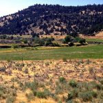
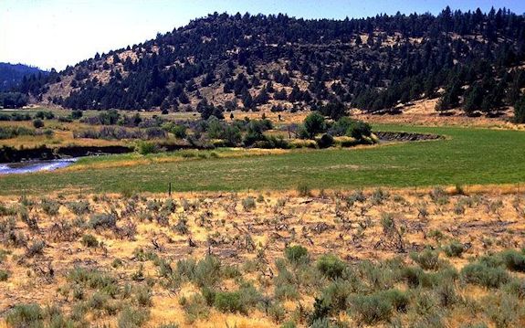
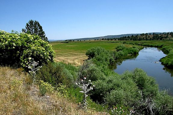

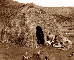
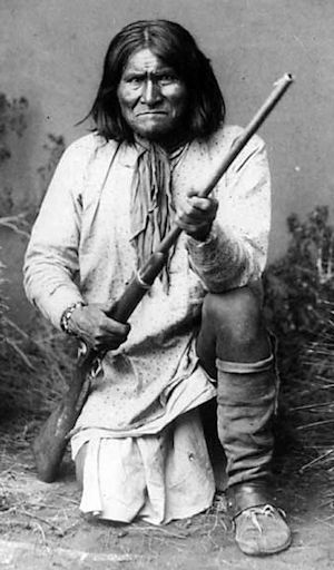
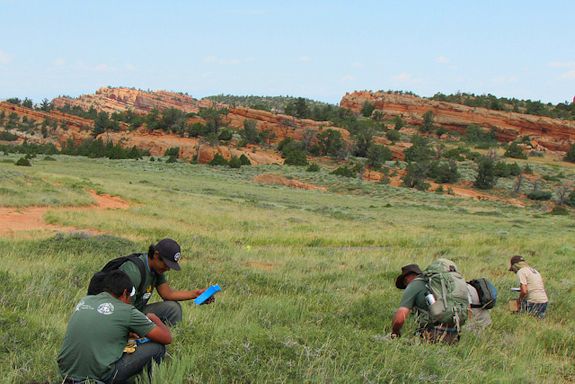

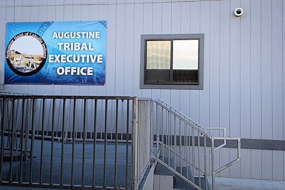

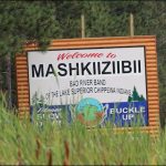
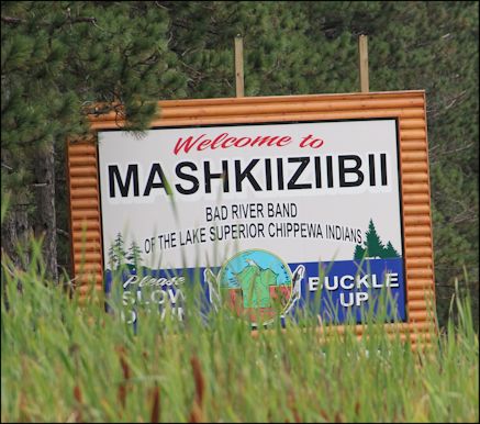


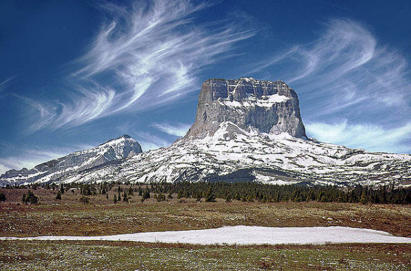


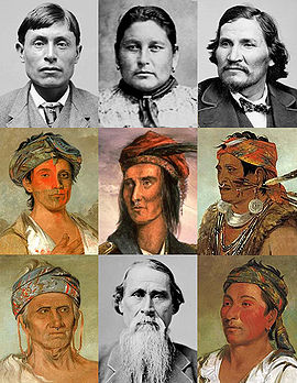 Tecumseh –