In compliance with FTC guidelines, please assume the following about all links on this website that are outbound links: Since I share products and services I use and love with my readers, assume that I may receive a small commision if you buy something or subscribe to a service from a link on this website (at no additional cost to you). If you do buy something, thanks for your support !
Among others, we are a participant in the Amazon Services LLC Associates Program, an affiliate advertising program designed to provide a means for us to earn fees by linking to Amazon.com and affiliated sites. Pages on this site may include affiliate links to Amazon and its affiliate sites on which the owner of this website will make a referral commission.
The shopping links above this notice go to our own store, NativeCrafts.us
The federally recognized Guidiville Rancheria of California is a Pomo tribe located in Mendocino County, California. During the California Gold Rush, an influx of non-Indian settlers drove the Guidiville Pomos from their ancestral lands near Lake County, California into Mendocino County.
Official Tribal Name: Guidiville Rancheria of California
The US government sent commissioners to negotiate treaties with the tribe in 1851. Although the Guidiville Band, among other Pomo bands, ceded their ancestral lands, the US congress did not ratify the treaties and the Guidiville never received their promised treaty lands. These treaties were locked away in Washington DC and not rediscovered until the 20th century.
Reservation: Guidiville Rancheria and Off-Reservation Trust Land
Land Area: 44-acre (180,000 m2) Tribal Headquarters: Talmage, CA Time Zone: Pacific
Population at Contact:
Registered Population Today:
Tribal Enrollment Requirements:
Genealogy Resources:
Government:
Charter: Name of Governing Body: Number of Council members: Dates of Constitutional amendments: Number of Executive Officers: Chairperson
The Pomos, along with the Patwin and Wintun, were actually made up of numerous small bands or villages spread throughout the area North of the Sacramento River Delta and between the Russian River and the California River Valleys, as well as along the Pacific Coast.
Confederacy: Pomo
Treaties:
Reservations: Upper Lake Rancheria
Land Area: Tribal Headquarters: Time Zone:
Population at Contact:
Registered Population Today:
Tribal Enrollment Requirements:
Genealogy Resources:
Government:
Charter: Name of Governing Body: Number of Council members: Dates of Constitutional amendments: Number of Executive Officers:
The Hannahville Indian Community is a Potawatomi tribe located in the south-central section of Michigan’s Upper Peninsula in Menominee Country, 20 miles west of Escanaba, MI and 95 miles northeast of Green Bay, WI.
Official Tribal Name: Hannahville Indian Community
Address: N14911 Hannahville B-1 Rd., Wilson MI 49896 Phone: (906)466-9933 Fax: (906) 723-2027 Email:
Prior to 1450, the Potawatomi lived further north in the upper Great Lakes, but then they begin a migration the led them to the south to settle in warmer climates and better agricultural lands. The rich soils along the eastern shore of Lake Michigan and into northern Indiana and Illinois and southeastern Wisconsin now became their new homelands.
By 1550 they had established dozens of villages in what is now Michigan from Ludington to the north to St. Joseph River area in the south, and again in the northern regions of Indiana, Illinois and southeastern Wisconsin. They first encountered the French explorer Jean Nicolet in 1634 in the Detroit area.
Confederacy:
The Potawatomi Tribe as a whole, has resided in the Great Lakes area for over 500 years. With the Ojibwa and Ottawa they formed the Council of Three Fires Confederacy. Before this, all three tribes were one tribe, who called themselves Anishnabek (The People or Good People) of the Algonquian linguistic stock, and the name Potawatomi is said to mean People or the Place of the Fire, or Keepers of the Fire, and at times were referred to as the Fire Nation.
Treaties:
The various Potawatomi bands in total were party to in part or entirely to a record 43 treaties in the United States and seven in Canada. This is the most treaties of any of the Indian tribes that exist today.
The Michigan Potawatomi were party to 11 different treaties, with the major treaty being the 1833 Treaty of Chicago. This treaty, was ratified under President Andrew Jackson in the era of Indian Removal (1932-1940), and set the stage for the justification of removing them West to Indian Territory (Oklahoma and Kansas).
Part of these southern Potawatomi were rounded up and forcefully removed to Indian Territory where they are now known as the Prairie Band Potawatomi of Kansas and Citizens Band Potawatomi in Oklahoma.
Those in southern Wisconsin fled north, settling around what is now Forest County, WI and became known as the Forest County Potawatomi of Crandon, WI. Another part of the tribe moved into the Upper Peninsula and are now known as the Hannahville Indian Community Potawatomi.
Some of the Potawatomi escaped removal and hid out on Walpole Island, and on other Canadian First Nation Anishnabek Reserves; some returned and became known as the Nottawaseppi Huron Band Potawatomi. The band that became known as the Pokagon Band of Potawatomi, (numbering 280) in 1835 were led by Chief Leopold Pokagon and through his skillful negotiations were able to allude removal. under Chief Leopold Pokagon
Today, all of these 6 Potawatomi Tribes and the Gun Lake Pottawatomi along with their Canadian kinfolk, meet collectively from time to time for cultural, language, spiritual sharing and the like.
Reservation: Hannahville Indian Community and Off-Reservation Trust Land
Hannahville Indian Community Land Area: The tribe had a land base in 1999 consisting of 4,025 acres with 3,200 of it being in federal trust. Tribal Headquarters: Wilson, MI Time Zone:
The reservation was established by an act of Congress in 1913, although descendants of the northern Illinois and southern Wisconsin Potawatomi have been residing in the Wilson, Bark River, and Harris, MI area since 1853, specifically along the Cedar River.
In 1883 a Chippewa Methodist missionary by the name of Peter Marksman lent the Potawatomi at Cedar River money to establish a permanent location around the towns of Harris and Wilson. Eventually, the reservation became known as Hannahville, named after the wife of the missionary.
Currently, they continue to buy lands around Wilson and Harris, MI for future expansion and development.
Population at Contact:
Registered Population Today:
The current Hannahville Potawatomi Indian Community tribal membership in 1999 was 703, with an unemployment rate of only 3%, and of those employed, 19% were living below the poverty line.
Tribal Enrollment Requirements:
Membership is ¼ or more Hannahville Potawatomi bloodline. Dillution of blood quantum through mixed marriages accounts for the small tribal population at the present time.
Genealogy Resources:
Government:
Charter: Organized under the terms of the 1934 Indian Reorganization Act. Name of Governing Body: Hannahville has a 12 member elected tribal council Number of Council members: 12 Dates of Constitutional amendments: Number of Executive Officers:
Potawatomi is an Algonquian language closely related to the Ojibwayan dialect complex.
Number of fluent Speakers:
The Potawatomi language is critically endangered and nearly extinct. It has about 50 first-language speakers in several widely separated communities in the US and Canada. These include the Hannahville Indian Community (Upper Peninsula of Michigan), the Pokagon and Huron Bands (southern Michigan), the Forest County Band (northern Wisconsin), the Prairie Band (eastern Kansas), and the Citizen Potawatomi Nation of Oklahoma. A few Potawatomi speakers also live among the Eastern Ojibwe in Ontario, particularly at the Walpole Island Reserve. The largest speech communities are in the Forest County and Prairie Bands, each with about 20 speakers, several conservatively fluent.
The Potawatomi traditional means of subsistence included farming, hunting, fishing, gathering of wild fruits and berries, and later lumbering. Their bands lived in clan-based villages which were more complex then those of the Ojibwa or Ottawa as it relates to dodem and extended family structures duties, roles and responsibilities and social interactions protocol, because their communities were larger.
During the 1880s, the Hannahville Potawatomi Indian Community primarily subsisted by small scale farming and seasonal work in the woods as part of the area’s thriving lumbering industry. By the early 1900s the forestry activities had dwindled and the community farmlands, always marginal at best, were worn out.
The members of the Hannahville Potawatomi Indian Community survived anyway they could and sought employment in whatever was possible. They continued to be basically ignored by the federal and state governments and had to turn inward for strength and survival purposes. In essence, health services were all but nonexistent and abject poverty was the norm.
Economy Today:
The Hannahville Potawatomi Indian Community struggled through the 20s, 30s, 40s and 50s like the rest of Michigan Anishnabek country, with little hope or help for their peoples. Incidents of tuberculosis was high at Hannahville during the 40s & 50s, as well as short life expectancy, high rates of diabetes, alcoholism and inadequate educational and employment opportunities. The Tribal infrastructure was barely developed during these hard times.
After 1965, through President Lyndon Johnson’s War on Poverty and national initiatives, their living conditions begin to improve, hope was reestablished and the infrastructure begin making significant gains. They joined Bay Mills, Keweenaw Bay and Saginaw Chippewa with the establishment of the Inter-Tribal Council of Michigan, Inc. in 1966.
In the early 1990s the Hannahville Potawatomi Indian Community signed a gaming compact with the Governor of the State of Michigan and opened a casino. It has evolved into the new Chip-In Casino – Hotel – Resort.
The gaming operations in this rural, high unemployment area of Michigan, has proved to be a major industry and economic boom to the region, for both the Native and non-native communities.
Today Hannahville has a host of new tribal facilities and membership services. They now possess the financial wherewithal to regularly interact with their other Potawatomi band relatives and it has really ignited their cultural-language-spirituality renewal.
The Hannahville Indian Community continues to operate and have for a number of years, a long-term treatment facility for Men, called The Three Fires Halfway House, an indication of their long commitment to substance abuse issues, and as indicated by the name, supportive of their Ojibwa and Ottawa Anishnabek brothers as well.Religion & Spiritual Beliefs:
Burial Customs:
Wedding Customs
Education and Media:
In 1975, they opened their own K-8 tribal school, via a grant from the American Bicentennial Commission for a community arts and crafts building. It is now a K-12 BIA funded tribal grant and Michigan Charter Public School Academy, and is housed in a beautiful state-of-the-art educational complex. The school and the welfare of the community children, continues to be the heartbeat of the Hannahville Potawatomi.
Jim Thorpe whose indian name was Wathohuck , meaning Bright Star (Sauk/Potawatomi 1888–1953), athlete who won gold medals in the decathlon and pentathlon at the 1912 Stockholm Olympics
The Havasupai Tribe of the Havasupai Reservation is a federally recognized American Indian tribe who has lived in the Grand Canyon for at least the past 800 years.
Official Tribal Name: Havasupai Tribe of the Havasupai Reservation
Address: Havasupai Tribe, P. O. Box 10, Supai, Arizona 86435 Phone: 928 448 2731 Fax: 928 448 2731 Email:info@havasupai-nsn.gov
With the Hualapai, from whom they may be descended, they are also called the Pai (Pa’a) Indians (“the People”; Hualapai are Western Pai, and Havasupai are Eastern Pai). With the Hualapai and the Yavapai, the Havasupai are also referred to as Upland Yumans, in contrast to River Yumans such as the Mojave and Quechan.
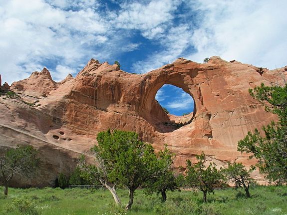
Beaver Falls in the Grand Canyon on the Havasupai Reservation Photo By Gonzo fan2007 (Own work) CC BY-SA 3.0, via Wikimedia Commons
The Havasupais have dwelt in the Grand Canyon and the rest of north-central Arizona for over 1,000 years.
Confederacy: Yuman
Treaties:
Reservation: Havasupai Reservation
The Havasupai Reservation was established from 1880 to 1882, near Supai, Arizona, along the Colorado River, 3,000 feet below the rim of the Grand Canyon. It was substantially enlarged in 1975, when the tribe regained a portion (185,000 acres) of their ancestral homeland along the South Rim of the Grand Canyon.
Land Area: 188,077 acres of canyon land and broken plateaus abutting the western edge of the Grand Canyon’s south rim, with year-to-year permits issued for grazing in Grand Canyon National Park and the adjacent National Forest. Tribal Headquarters: Supai, Arizona Time Zone: Mountain
Population at Contact: Of roughly 2,000 Pai, perhaps 250 Havasupai Indians lived at Cataract Canyon in the seventeenth century.
Registered Population Today: Approximately 400 lived there in 1990.
Tribal Enrollment Requirements:
Genealogy Resources:
Government:
The Havasupai Tribal Government consists of 87 employees made up of Havasupai Tribal members. The Tribal-Member employees operate and manage the Havasupai Tribe programs and enterprises.
Charter: The tribe adopted a constitution and by-laws in 1939 and a tribal corporate charter in 1946. Name of Governing Body: Tribal Council Number of Council members: The Havasupai Tribe is governed by a seven-member Tribal Council. The executive officers of the Havasupai Tribe is the Chairman and in the absence of the Chairman, the Vice Chairman. Dates of Constitutional amendments: Number of Executive Officers:
Elections:
Language Classification: Yuman–Cochimí -> Pai -> Upland Yuman (aka Northern Yuman) -> Havasupai
Language Dialects:
Havasupai is a dialect of the Upland Yuman language spoken by fewer than 450 people on the Havasupai Indian Reservation at the bottom of the Grand Canyon.As of 2005, Havasupai remained the first language of residents of Supai Village, the tribal government seat.
The Havasupai dialect is nearly identical to the dialect of the Hualapai, although the two groups are socially and politically distinct (Kendall 1983:5). It is a little more distantly related to the Yavapai dialects.
Number of fluent Speakers: It is the only Native American language in the United States spoken by 100% of its indigenous population.
Dictionary:
Origins: The Havasupai probably descended from the prehistoric Cohoninas, a branch of the Hakataya culture. Thirteen bands of Pai originally hunted, farmed, and gathered in northwest Arizona along the Colorado River. By historic times, the Pai were divided into three subtribes: the Middle Mountain People; the Plateau People (including the Blue Water People, also called Cataract Canyon Band, who were ancestors of the Havasupai); and the Yavapai Fighters.
Traditional Allies: Traditional allies included the Hualapai and Hopi.
Traditional Enemies: This peaceful people needed no war chiefs or societies. In the rare cases of defensive fighting, the most competent available leader took charge. Enemies included the Yavapai and Western Apache.
Ceremonies / Dances: Only girls went through a formal puberty ritual.
People continue to celebrate the traditional fall “peach festival,” although the time has been changed to accommodate the boarding school schedule. People continue to celebrate the traditional fall “peach festival,” although the time has been changed to accommodate the boarding school schedule.
Modern Day Events & Tourism: Pack trips into the bottom of the Grand Canyon on mules and helicopter flights into the canyon provide the bulk of today’s economy for the Havasupai people. They also have a campground, hostel, and restaurant in the canyon.
Legends / Oral Stories:
Art & Crafts: Baskets, created by women, were especially well made. They were used as burden baskets, seed beaters and parching trays, pitch-coated water bottles, and cradle hoods. Brown and unpainted pottery was first dried in the sun, then baked in hot coals.
Animals: With the possible exception of Francisco Garces, in 1776, few if any Spanish or other outsiders disturbed them into the 1800s. Spanish influences did reach them, however, primarily in the form of horses, cloth, and fruit trees through trading partners such as the Hopi in the 1600s.
Clothing: Buckskin, worked by men, was the main clothing material. Women wore a two-part dress, with a yucca-fiber or textile belt around the waist, and trimmed with hoof tinklers. In the nineteenth century they began wearing ornamental shawls. Moccasins, when worn, were made with a high upper wrapped around the calf. Men wore shirts, loincloths, leggings, headbands, and high-ankle moccasins.
Adornment: Both sexes painted and tattooed their faces. Personal decoration consisted of necklaces and earrings of Pueblo and Navajo shell and silver.
Housing: In winter and summer, dwellings consisted of domed or conical wikiups of thatch and dirt over a pole frame. People also lived in rock shelters. Small domed lodges were used as sweat houses and clubhouses.
Subsistance:
The Havasupai tribe practice summertime irrigated farming in the canyons and wintertime hunting in the plateaus.
In Cataract Canyon the people grew corn, beans, squash, sunflowers, and tobacco. During the winter they lived on the surrounding plateau and ate game such as mountain lion and other cats, deer, antelope, mountain sheep, fowl, and rabbits, which were killed in communal hunting drives.
Wild foods included pinon nuts, cactus and yucca fruits, agave hearts, mesquite beans, and wild honey.
Formal authority was located in chiefs, hereditary in theory only, of ten local groups. Their only real power was to advise and persuade. The Havasupai held few councils; most issues were dealt with by men informally in the sweat lodge.
The Havasupai were individualists rather than band or tribe oriented. The family was the main unit of social organization. With some exceptions, work was roughly divided by gender. Babies stayed mainly on basket cradle boards until they were old enough to walk.
Leisure time was spent in sweat lodges or playing games, including (after 1600 or so) horse racing. The Havasupai often sheltered Hopis in times of drought.
Traditional implements included stone knives, bone tools, bows and arrows, clay pipes for smoking, and nets of yucca fiber. The Havasupai tilled their soil with sticks. Baskets and pottery were used for a number of purposes. Grinding was accomplished by means of a flat rock and rotary mortars.
The Havasupai often traded with the Hopi and other allied tribes, exchanging deerskins, baskets, salt, lima beans, and red hematite paint for food, pottery, and cloth. They also traded with tribes as far away as the Pacific Ocean.
Economy Today: Tourism constitutes the most important economic activity. The tribe offers mule guides, a campground, a hostel, a restaurant, and a lodge, and they sell baskets and other crafts. Farming has almost entirely disappeared. The tribe owns a significant cattle herd. Some people work for wages at Grand Canyon Village or in federal or tribal jobs. Fearing contamination from a new uranium mine, the tribe has banned mining on tribal lands and the people are fighting an ongoing legal battle over uranium pollution of a sacred site in the Kaibab National Forest.
Life among the Havasupai remains a mixture of the old and the new. Unlike many Indian tribes, their reservation includes part of their ancestral land.
Some people never leave the canyon; many venture out no more than several times a year. The nearest provisions are 100 miles away. Many still ride horses exclusively, although they may be listening to a portable music player at the time. Havasupai people often mix with tourists who wind up in the village at the end of the Grand Canyon’s Hualapai Trail. Some people own satellite dishes and video cassette recorders, but much remains of the old patterns, and intermarriage beyond the Hualapai remains rare.
Residents live in Supai Village in the 3,000 foot deep Havasu Canyon, near the South Rim of Grand Canyon National Park. Tourism is the main base of their economy today. A favorite destination of tourists are the beautiful Havasu Falls, Navajo Water Fall, and Mooney Falls in Havasu Canyon. There are fees to enter the canyon, which are subject to change without notice before arrival.
Havasu Canyon is a fragile environment and is subject to flash floods that can rise with little warning. Some areas in the canyon are off limits to visitors due to continuing repair work or unstable ground conditions. Immediate closure of the canyon is possible at any given time during your visit.
Lodging and camping facilities are available. There is a Trading Post and a café with limited service. Visitors can hike, swim, ride horses, or fly by helicopter the last 8 miles into the canyon where the Havasupai Indians live. They have the last US Mail mule train in the country. Many tribal members work for the tribe in the tourist industry, and local artists sell arts and crafts to the tourists.
The tribe owns and manages the 24-room Havasupai Lodge, Havasupai Café, Havasupai Trading Post and General Store, and Havasupai Tourism, which manages and operates tourism related activities including guided and unguided tours, a 200-person campground near Havasu Falls and a horse packing business in which tribal members serve as guides and provide saddle and pack horses that carry goods and visitors in and out of the canyon. Advance reservations are recommended.
Religion & Spiritual Beliefs: The Havasupai performed at least three traditional ceremonies a year, the largest coming in the fall at harvest time and including music, dancing, and speechmaking. They often invited Hopi, Hualapai, and Navajo neighbors to share in these celebrations.
Although the Hopi influenced the Havasupai in many ways, such as the use of masked dancers, the rich Hopi ceremonialism did not generally become part of Havasupai life. Curing was accomplished by means of shamans, who acquired their power from dreams. The Havasupai accepted the Ghost Dance in 1891.
Variants of traditional religion remain alive, while at the same time Rastafarianism is also popular, especially among young men.
Burial Customs: One important ceremony was cremation (burial from the late nineteenth century) and mourning of the dead, who were greatly feared.
Wedding Customs: In place of a formal marriage ceremony, a man simply took up residence with a woman’s family. The couple moved into their own home after they had a child. Women owned no property.
Education and Media: Students attend school on the reservation through the eighth grade, then move to boarding school in California or to regular public schools. Most children entering the tribal school (self-administered since 1975) speak only Pai. Unlike many tribes that focus on relearning tribal identity, Havasupai children are encouraged to learn more about the outside world.
Radio: Newspapers:
Famous Yuman Chiefs and Leaders
Catastrophic Events: Severe epidemics in the early twentieth century reduced their population to just over 100.
Tribe History:
The Blue Water People were comfortable in an extreme range of elevations. They gathered desert plants from along the Colorado River at 1,800 feet and hunted on the upper slopes of the San Francisco peaks, their center of the world, at 12,000 feet.
In the early 1800s, a trail was forged from the Rio Grande to California that led directly through Pai country. By around 1850, with invasions and treaty violations increasing, the Pai occasionally reacted with violence. When mines opened in their territory in 1863, they perceived the threat and readied for war. Unfortunately for them, the Hualapai War (1865-1869) came just as the Civil War ended. After their military defeat by the United States, some Pai served as army scouts against their old enemies, the Yavapai and the Tonto Apache.
Although the Hualapai were to suffer deportation, the United States paid little attention to the Havasupai, who returned to their isolated homes. At this point the two tribes became increasingly distinct. Despite their remote location, Anglo encroachment eventually affected even the Havasupai, and an 1880 executive order established their reservation along Havasu Creek.
The final designation in 1882 included just 518 acres within the canyon; the Havasupai also lost their traditional upland hunting and gathering grounds (some people continued to use the plateau in winter but were forced off in 1934, when the National Park Service destroyed their homes).
The Havasupai intensified farming on their little remaining land and began a wide-scale cultivation of peaches. In 1912 they purchased cattle. Severe epidemics in the early twentieth century reduced their population to just over 100. At the same time the Bureau of Indian Affairs, initially slow to move into the canyon, proceeded with a program of rapid acculturation.
By the 1930s, Havasupai economic independence had given way to a reliance on limited wage labor. Traditional political power declined as well, despite the creation in 1939 of a tribal council.
Feeling confined in the canyon, the Havasupai stepped up their fight for permanent grazing rights on the plateau. The 1950s were a grim time for the people, with no employment and little tourism.
Conflict over land led to deep familial divisions, which in turn resulted in serious cultural loss. Food prices at the local store were half again as high as those in neighboring towns. In the 1960s, however, an infusion of federal funds provided employment in tribal programs as well as modern utilities.
Still, croplands continued to shrink, as more and more land was devoted to the upkeep of pack animals for the tourists, the tribe’s limited but main source of income. In 1975, after an intensive lobbying effort, the government restored 185,000 acres of land to the Havasupai.
The Ho-Chunk Nation of Wisconsin, formerly known as the Wisconsin Winnebago Tribe, is one of two federally recognized tribes of Ho-Chunk people.
Official Tribal Name: Ho-Chunk Nation of Wisconsin
Address: P.O. Box 667, W9814 Airport Road, Black River Falls, WI 54615 Phone: (800) 294-9343 Fax: (715) 284-2632 Email:michael.rave@ho-chunk.com (Administration)
Traditional Name / Traditional Meaning: Bāwa’tigōwininiwŭg, means ‘people of the big voice’ a.k.a. Hocák (Hochunk), Hochank, Hocangara, Hotcangara, Hochangara
Hocągara or Hocaks, means “People of the Big Voice,” or “People of the Sacred Language.”
Common Name / Meaning of Common Name: Winnebago (see below for meaning)
Alternate names: Formerly known as the Wisconsin Winnebago Tribe
Winnebago was a name given by the Sauk and Fox, who called the people Ouinepegi, or People of the Stinky Waters. This name was heard as Winnebago by the government agents, and was the name the United States government took for the Ho Chunk people. This remained the official name of the Nation until the Constitution Reform in 1993, when the Ho Chunk reclaimed their original name.
Ho Chunks have always occupied lands in Wisconsin, Iowa, Illinois, Nebraska, South Dakota and Minnesota. Red Banks (Wisconsin) is the traditional homeland of the Hocąk Nation. It is situated on Green Bay, which the Hocągara called Te-rok, the “Within Lake”. Lake Michigan as a whole was called Te-šišik, “Bad Lake”, which may well have led the Algonquian peoples round about Lake Winnebago to call them “the people of the Bad Waters”, or Winnibégo in Menominee.
The Ho Chunks eventually controlled more than 10 million acres of land in Wisconsin, Iowa, Illinois, Nebraska, South Dakota and Minnesota. Eventually some of the Chiefs took their people south along the Mississippi and migrated to warmer climates. Those people are now known as the Otoe, Ponca, and Iowa tribes.
Reservation: Ho-Chunk Nation Reservation and Off-Reservation Trust Land
The Ho-Chunk Reservation, established in 1875, is spread over Dane, Jackson, Juneau, Monroe, Sauk, Shawano, and Wood Counties, Wisconsin. Land Area: 4,200 acres Tribal Headquarters: Black River Falls, Wisconsin Time Zone: Population at Contact:
Registered Population Today:
Tribal Enrollment Requirements:
Genealogy Resources:
Government:
Charter: Name of Governing Body: General Council Number of Council members: 1 Advocate, plus executive officers Dates of Constitutional amendments: Number of Executive Officers: Presidient, Administrator, Secretary
Elections:
Language Classification:
Siouan–Catawban -> Western Siouan -> Mississippi Valley -> Chiwere–Winnebago -> Winnebago
Language Dialects: Ho-Chunk
Number of fluent Speakers:
Only 250 to 300 of the approximately 6,200 enrolled members of the Ho-Chunk Nation speak their own language fluently. Most of these speakers are 45 years or older. Unless something happens soon, the rich complexity of spoken Ho-Chunk that has preserved the traditions and nuances of a largely oral, storytelling culture for centuries will die with the current generation.
Dictionary:
Origins:
The Bear Clan is strongly associated with the kaǧi, a term that denotes the raven and northern crow. It is also the name by which the Hocągara know the Menominee.
On account of his vision, a great Menominee (Kaǧi) chief commanded that all manner of supplies be assembled at a white sand beach on Lake Michigan. And when all this had been done and set in order, as the sun reached its zenith the vision came to life: in the pure blue sky of the eastern horizon a single dark cloud began to form and move irresistibly towards them.
It was a great flock of ravens (kaǧi), spirit birds with rainbow plumage of iridescent colors. The instant that the first of these landed, he materialized into a naked, kneeling man. The Menominee chief said to his people, “Give this man clothing, for he is a chief.” And the others landed in like fashion, and were given great hospitality. They were the Hocąk nation, and that is how they came to Red Banks.
Bands, Gens, and Clans
Related Tribes:
Winnebago Tribe of Nebraska, Otoe, Ponca, and Iowa tribes. They are most closely related to the Chiwere peoples (the Ioway, Oto, and Missouria), and more distantly to the Dhegiha (Quapaw, Kansa, Omaha, Ponca, and Osage).
Traditional Allies:
Menominee
Traditional Enemies:
Lakota, Ojibwe
Ceremonies / Dances:
Modern Day Events & Tourism:
Legends / Oral Stories:
Art & Crafts:
Ho Chunk men were gifted in the art of metal working and were knownf for creating copper jewelry. They designed jewelry and body decorations for both men and women. This jewelry, particularly earrings showed the wealth of the individual.
Animals:
Clothing:
Housing:
The Ho Chunk people are credited as being the mound builders within the region. The large effigy and conical mounds are found in southern Wisconsin and along the Mississippi and Ohio Rivers, these were solely the long inhabited areas of the pre-Columbian Ho Chunk people. These effigy mounds appear in the shapes of animals and birds, and many contain burials. It is important to note that all of these mounds were built with primitive equipment and by hand. They are so symmetrically accurate that it is amazing to view them today with the assistance of a compass.
Subsistance:
The HoChunk were hunter gatherers. The men hunted while the women foraged for plant foods. Food staples consisted of corn, squash, green plants, roots, berries, making maple syrup and maple candy, venison, fresh fish, and small game. They were also seasonal gardeners who grew specialized crops in raised beds.
Economy Today:
The Ho-Chunk Nation owns and operates several casinos, Ho-Chunk Gaming, in Black River Falls, Baraboo, Madison, Nekoosa, Tomah, and Wittenberg, Wisconsin. The tribe also owns numerous restaurants and hotels connected to the casinos.
Religion & Spiritual Beliefs:
Burial Customs:
Wedding Customs
Radio: Newspapers:
Ho-Chunck People of Note:
Truman Lowe (b. 1944) – Artist, curator, professor
Mitchell Red Cloud Jr. (1924–1950) – US Marine, decorated veteran of the Korean War
Bronson Koenig (b.1994) – Point guard, University of Wisconsin Badgers basketball team
The Hoh Indian Tribe are considered to be a band of the Quileutes but are recognized as a separate tribe. Located at the mouth of the Hoh River on the western Olympic Peninsula in Washington State, the tiny Hoh Indian Tribe is dependent on the fish and wildlife of the Hoh River for their subsistence and commercial economy. This federally recognized indian tribe takes it’s name from the principal river in their territory.
Official Tribal Name: Hoh Indian Tribe of the Hoh Indian Reservation
Address: PO Box 2196, Forks, Washington 98331 Phone: (360) 374-6582 Fax: (360) 374-5426 Email: Email Contacts
The Hoh River takes its name from the Quinault language name for the river, Hoxw. No meaning can be associated with the Quinault name. Smitty Parratt, in his God and Goblins study of Olympic National Park place names, claims that Hoh means “fast, white water” but, in fact, no etymology for the name can be found in either the Quinault or Quileute languages. The tribe is named after the river.
The Hoh Indian Reservation was established by an Executive Order of September 11, 1963. Land Area: 1.929 square kilometres (477 acres) Tribal Headquarters: Forks, Washington Time Zone:
Population at Contact:
Registered Population Today: 212 enrolled members.
Tribal Enrollment Requirements:
Genealogy Resources:
Government:
Charter: Name of Governing Body: Number of Council members: Dates of Constitutional amendments: Number of Executive Officers:
Elections: The Governing body is elected by secret ballot biannually in November.
Language Classification: Salishan -> Coast Salish -> Quinault
Language Dialects:
The original Hoh language was the Quinault language. Though Hoh are considered to be a band of the Quileute tribe, they are originally related to the Quinault tribe, but after marrying together with the Quileute tribe, the Hoh tribe became a bilingual tribe, speaking both Quileute and Quinault, until, ultimately, just speaking Quileute.
Number of fluent Speakers:
Dictionary:
Origins:
Bands, Gens, and Clans
Related Tribes:
Traditional Allies:
Traditional Enemies:
Ceremonies / Dances:
Modern Day Events & Tourism:
Legends / Oral Stories:
Art & Crafts:
Cedar is used for cultural purposes, for baskets, carvings, and canoes.
Animals:
Clothing:
Housing:
Subsistance:
The Hoh were hunter/gatherers and many traditional foods are still harvested. Salmon fishing was the primary food source, and remains the primary income source for the tribe today.
Economy Today:
The livelihood of the Hoh Indians is primarily fishing although a few of the residents make traditional decorative baskets, carved canoes for ocean going or river use and other decorative carvings. The local people dip for smelts on the beaches and still use smokehouses for preserving food for future use. The tidelands are abundant with razor clams, butter clams, crab and perch fishing. Twenty people are employed in various enterprises administered by the tribe.
The People of Hoopa Valley are one of California’s first cultures. They came up the Trinity River into the rich valley which has always been the center of the Hupa World, the place where the trails return. Legends say this is where the people of the Hoopa Valley Tribe came into being.
Archeologists say they have been there at least 500 to 600 years before contact with Europeans.
Official Tribal Name: Hoopa Valley Tribe
Address: PO Box 1348 Hoopa, CA 95546 Phone: (530) 625-4211 Fax: Email:
Official Website:
Recognition Status: Federally Recognized
Traditional Name / Traditional Meaning:
Natinixwe –
The Hoopa called themselves Natinnoh-hoi, after Natinnoh, the Trinity River.
Common Name / Meaning of Common Name: The Hupa name came from the Yurok word for the valley, Hupo.
Alternate names / Alternate spellings / Misspellings: Hupa is the older spelling. Tsulu refers to the Bald Hills, the name given the hills in this area because there are no trees on the hill tops.The Chilula are also called the Bald Hills Indians.
Name in other languages:
Chilula comes from a Yurok term, Tsulu-la, meaning people of Tsulu.
The larger Hupa villages were located in the Hupa (or Hoopa) valley, an eight-mile stretch along the Trinity River in California that has more level land than other sections of the river valley. The valley, one or two miles wide, is surrounded by mountains. Twelve Hupa villages were strung out less than a mile apart on the eastern side of the river, so that they received the warm afternoon sun. Each village was near a spring or small stream that supplied drinking water.
Chilula villages were built along Redwood Creek, which ran southwest of the Klamath River and emptied into the ocean north of Humboldt Bay. The Chilula, however, occupied only a portion of the land along Redwood Creek. They were cut off from the ocean by the Yurok, whose lands extended across the mouth of Redwood Creek and who were not friendly with the Chilula. The upper reaches of Redwood Creek were occupied by the Whilkut.
There were high hills along both sides of Redwood Creek in Chilula territory. On the western side, thick forests of redwood and oak trees came down to the creek. On the eastern side of the creek, the hills were broken by valleys with little streams running down them. It was here that the Chilula built their homes. There were more than 20 villages, with an average size of about 30 people each. The Chilula were absorbed into the Hoopa Tribe in the reservation era.
Confederacy:
Treaties:
Peace and Friendship Treaty of 1864 Treaty of 1876
In 1864, a Peace and Friendship Treaty was negotiated with the United States. In 1896, the Department of the Interior began preparing a land allotment list and in 1909 a Proclamation was handed down by President Theodore Roosevelt. This list was not completed and approved until 1923.
Reservation: Hoopa Valley Reservation
Land Area: Tribal Headquarters: Time Zone:
Population at Contact: The Chilula population was estimated at 500-600 in 1770. The Hupa population was estimated at 1,000 in 1770 and was 500 on the 1910 Census.
Registered Population Today:
Tribal Enrollment Requirements:
Genealogy Resources:
Government:
Charter: Name of Governing Body: Number of Council members: Dates of Constitutional amendments: Number of Executive Officers:
Elections:
Language Classification: Athabaskan ->
Language Dialects: The Hupa shared close language ties with the Chilula and Whilkut, their neighbors to the west. These three groups differed in dialect from other California Athapaskans.
The language spoken by the Chilula was very close to that of the Hupa. The Whilkut people, who lived south of the Chilula, also shared this language. By the late 1800’s, the few remaining Chilula people had become integrated with the Hupa on the Hoopa Valley Reservation.
Athabascans from the interior of Alaska and northern Canada, and Navajo and Apaches Tribes of the Southwest
Traditional Allies:
Traditional Enemies:
Ceremonies / Dances:
The Hupa held two ceremonies to celebrate the new year or harvest. One was in the spring when the salmon began their run upriver, and the second was in the autumn when the acorns began to fall from the trees. Feasting on the salmon in the spring and on the acorns in the fall was a part of the ceremonies.
The most elaborate ceremonies were the White Deerskin Dance and the Jumping Dance. Each of these dances lasted 10 days. In the White Deerskin Dance, the dancers held white deerskins up on long poles as they danced. When doing the Jumping Dance, the men wore headbands decorated with woodpecker scalps. Before each dance, there was a long recital of sacred words that told how the ceremony came to be.
Modern Day Events & Tourism:
Legends / Oral Stories:
Art & Crafts: Hupa people have traditionally excelled at basketry, elk horn carving, and since the 17th century, they have created many petroglyphs.
Animals:
It was thought dangerous to speak to a dog, as he might be provoked to answer, which would be a fatal portent.
Clothing:
The area where the Hupa lived had a mild climate, and heavy clothing was seldom necessary. Men wore a piece of deerskin or several smaller animal skins sewn together, around their hips. Women wore skirts made from tree bark. For ceremonies, women wore double aprons, with a larger section in back and a narrower section in front. The aprons, which reached from the waist to below the knees, were usually fringed. When more warmth was needed, robes made of animal skins were worn over the shoulders by both men and women. Moccasins made of deerskin were used when going on a journey. The women wore basket hats to protect their foreheads from the straps of carrying baskets and baby cradles, and fancier caps for ceremonies.
Hupa women had tattoos of three broad stripes on their chins. Both women and men had their ears pierced so they could wear shell ornaments in them. Men and women wore their hair long, tied back in rolls with thongs.
Housing:
The Hupa built their houses from cedar or fir planks which they cut from logs. The planks were set upright in a rectangular shape surrounding a pit which had been dug to form the inside of the house. A lower spot in the middle of the pit was lined with stones so a fire could be built there. A dirt shelf around the pit was used for storage. The pitched roof of the house was also made from cedar planks placed in an overlapping pattern. People entered the house through a small round hole cut at one corner, and climbed down a notched plank to the dug-out area of the house.
Each family had its own house where they ate their meals. The women and children slept in the house. The men and older boys slept in the sweathouses. There were several in each village, built in much the same way as the larger houses but with lower walls. The door was an opening cut into the roof.
Villages varied in size from about 50 to 200 people living in from six to 28 houses. Each village had a name taken from a landmark (such as deep-water place) or an incident that occurred there (place where he was dug up). Each village had a headman who was the richest man. He had certain hunting and fishing rights, and others in the village obeyed him because he gave them food when they needed it. If the headman’s son inherited his wealth, he also inherited the position of headman.
Subsistance:
Acorns and salmon were the two main foods of the Hupa. The salmon were caught in the Trinity River in the spring and in the fall as they swam upriver. Enough fish were preserved by smoke-drying them to last all year. Other fish such as trout and sturgeon were also eaten. Acorns were gathered each fall. After being ground into flour, the acorns were cooked into a thin mush. Heated stones were put into a cooking basket with water and meal, and it was stirred with a long wooden paddle.
Adding to the food supply for the Hupa were nuts, berries, roots, and greens that they gathered in the woods. Deer and elk were hunted in the forests, sometimes with the help of trained dogs. Traps made of iris-fiber rope nooses were placed along deer trails. The hunters used short bows with stone-tipped arrows to kill the deer and elk. Rabbits, squirrels, and birds were captured in traps or shot with the bow and arrow.
Many articles were made from wood by Hupa men. They used tools made from stone and shell to shape storage chests, platters and bowls out of cedar. Low stools and headrests were also made from cedar logs. For their bows and arrow shafts, they used yew wood. The men also made utensils from elk horn. Elkhorn spoons were used just by the men. Women used mussel shells as spoons.
The Hupa women did most of the basket weaving. The technique was called twining. Hazel branches were used as the basis for most baskets. Pieces cut from tree roots were woven in between the hazel branches to form firm baskets that were used to carry and store all types of food. The women also wove cradles for the babies, caps for the women to wear, and special ceremonial items. Baskets were decorated with patterns made with grasses and ferns.
Canoes were used by the Hupa for transportation on the Trinity River, but they did not make the canoes themselves. They traded for them with the Yurok, who lived near the redwood trees along the coast.
In addition to bows and arrows, the Hupa used short spears and stone knives as weapons. To protect themselves in battle, men wore heavy shirts made of elkhide, or armor made from wooden rods held together with thongs.
The Hupa carried on trade with the Yurok who lived along the coast near the mouth of the Klamath River. From the Yurok they got canoes, salt (made from dried seaweed), and salt-water fish. They traded acorns and other inland foods for these things. Some things were purchased with dentalium shells, which served as the money for the people of northwestern California. The tube-like dentalium shells could be strung on a string, matched for size. Only the shells that were more than an inch and one-half in length were considered to be money.
Wealth was important to the Hupa. Besides the dentalium money, they valued deerskins that were especially light colored, red woodpecker scalps, and black or red obsidian (volcanic glass). These prized objects were displayed at ceremonies to show what good luck had come to that person.
Economy Today:
Religion & Spiritual Beliefs:
Burial Customs:
Wedding Customs:
When girls married, they usually went to live in the villages of their husbands.
Traditional Territory: The Hopi are the westernmost of the Pueblo peoples. First, Second, and Third Mesas are all part of Black Mesa, located on the Colorado Plateau between the Colorado River and the Rio Grande, in northeast Arizona. Of the several Hopi villages, all but Old Oraibi are of relatively recent construction.
Confederacy: Pueblo
Treaties:
Reservation: Hopi Reservation and Off-Reservation Trust Land
The Hopi Reservation was established in 1882.
Land Area: Consisting originally of almost 2.5 million acres, the total land base stood at just over 1.5 million acres in 1995.
Tribal Headquarters: Kykotsmovi, AZ Time Zone: Thirteen Hopi villages now stand on three mesas. Major villages include Walpi (First Mesa), Shungopavi (Second Mesa), and Oraibi (Third Mesa).
Population at Contact: Hopi population was perhaps 2,800 in the late seventeenth century.
Registered Population Today: The population was roughly 7,000 in 1990.
Tribal Enrollment Requirements:
A person must be one-fourth (1/4) Hopi-Tewa Indian blood or more and be a lineal descent from any Hopi-Tewa Indian person whose name appears on the December 31, 1937 Hopi Basic Membership Roll, and not be enrolled in another tribe.
Government: A tribal council was created in 1936, although only two of the villages were represented in 1992. Some Hopi people are also members of the Colorado River Indian Tribes Reservation.
The Hopi Reservation was carved in 1882 from traditional Hopi lands plus three villages of Navajos living on Hopi lands (settlers and refugees from U.S. Indian wars).
A major dispute has emerged within the tribe and among the Hopi tribal council, the Navajos, and the U.S. government over the lands around the part of the reservation known as Big Mountain.
Technically the land belongs to the Hopis, but it has been homesteaded since the mid-eighteenth century by Navajos because, in their view, the Hopis were just “ignoring” it.
The Hopi council wants the land for mineral exploitation. Hopi traditionalists want the Navajos to remain, out of solidarity, friendship with their old enemies, and their inclination to share. They would prefer that the land remain free of mineral exploitation.
In 1986, the United States recognized the squatters’ rights by proclaiming 1.8 million acres of “joint use area.” Each tribe got half, and those on the “other” side were to move. In effect, the Hopis lost half of their original reservation to the Navajo.
More than 100 Hopis moved, but many Navajos remained. This conflict remains ongoing, with the Hopis still trying to hold onto their land. Many Indians believe that coal company profits are at the root of the dispute and forced relocations.
The Hopi way continues; they are among the most traditional of all Indians in the United States. Hopis maintain a strong sense of the continuity of life and time. The split between “progressive” and “traditional” factions continues. Hopi High School, between Second and Third Mesas, opened in 1986 with an entirely local board.
The school emphasizes Hopi culture and a new written language as well as computers and contemporary American curricula. The Hopi are making progress in solving not only the land dispute with the Navajo but also a host of social problems, including substance abuse and suicide.
Charter: Name of Governing Body: Tribal Council Number of Council members: 14 representatives from the villages of Upper Moenkopi, Bacavi, Kykotsmovi and Sipaulovi. Currently, the villages of Mishongnovi, Shungopavi, Oraibi, Hotevilla, Lower Moenkopi and First Mesa Consolidated Villages (Walpi, Shitchumovi and Tewa) do not have a representative on council. Representatives to the council are selected either by a community election or by an appointment from the village kikmongwi, or leader. Dates of Constitutional amendments: Number of Executive Officers: Chairman, Vice-Chairman, Secretary, Treasurer, Sargent at Arms
Elections:
Each representative serves a two-year term.
Language Classification: Uto-Aztecan => Hopi
Language Dialects: Hopi is a language isolate.
Although the Hopi are composed of elements that must have spoken diverse tongues, their speech is readily recognized as a dialog of the Shoshonean language, which in various forms was spoken in a large part of the Great Basin between the Rocky mountains and the Sierra Nevada, in southwestern Oregon, and in southern California even to the coast and on Santa Catalina island; and which is undoubtedly allied to the great Aztecan language. A linguistic map would represent the Hopi as an isolated people surrounded by alien tongues.
Number of fluent Speakers: This language is alive and well. In 1990, it was estimated that more than 5,000 people could speak Hopi as a native language (approximately 75% of the population); at least 40 of them were monolingual in Hopi.
Dictionary: The first dictionary of written Hopi is in preparation.
Origins:
Evidence suggest that the Hopi consist of the descendants of various groups that entered the country from the north, the east, and the south, and that a series of movements covered a period of probably three centuries, and perhaps considerably longer.Their ancestors, the Anasazi, appear to have been related to the Aztecs of Mexico, and may have arrived in their current location 5,000 to 10,000 years ago.
During the fourteenth century, Hopi became one of three centers of Pueblo culture, along with Zuni/Acoma and the Rio Grande pueblos. Between the fourteenth and sixteenth centuries, three traits in particular distinguished the Hopi culture: a highly specialized agriculture, including selective breeding and various forms of irrigation; a pronounced artistic impulse, as seen in mural and pottery painting; and the mining and use of coal (after which the Hopi returned to using wood for fuel and sheep dung for firing pottery).
Bands, Gens, and Clans
The traditional Hopi are organized into matrilineal clans. When a man marries, the children from the relationship are members of his wife’s clan. The Bear Clan is one of the more prominent clans.
Traditionally, the Hopi favored a weak government coupled with a strong matrilineal, matrilocal clan system. They were not a tribe in the usual sense of the word but were characterized by an elaborate social structure, each village having its own organization and each individual his or her own place in the community.
The “tribe” was “invented” in 1936, when the non-native Oliver La Farge wrote their constitution. Although a tribal council exists, many people’s allegiance remains with the village kikmongwi (cacique). A kikmongwi is appointed for life and rules in matters of traditional religion.
Related Tribes:
The Hopis didn’t have a single group identity–they were independent villages, sharing with the Zuni and other Pueblos to the East a basic culture and view of the sacred, while sharing among themselves their own language base.
The Hopi, more than most Native American peoples, retain and continue to practice their traditional ceremonial culture. Many of their ceremonies are private and not open to outsiders. They do however have several celebrations that are open to the public where they perform ceremonial dances. Photography and recording of these ceremonies is strictly forbidden.
The cliff painting of the Mesa Verde and other areas are said to be “guides” for their warriors and they claim that the “snake-shaped” mounds in the eastern United States were built by their ancestors.
The “Snake Dance” is still performed. The dance takes about two weeks to prepare and the snakes are gathered and watched over by the children. The snakes are usually rattle snakes and are dangerous but no harm seems to befall the children.
Before the dance begins the dancers take an emetic (probably a sedative herb or hallucinogenic) and then dance with the snakes in their mouths.
There is usually an Antelope Priest in attendance who helps with the dance, sometimes stroking the snakes with a feather or supporting their weight. After the dance the snakes are released to carry the prayers of the dancers.
First Mesa artists are known for their pottery and Kachina Dolls. There are three villages on First Mesa: Walpi, Tewa, and Sichomovi. Driving to the top of First Mesa is like climbing to the top of the world as the vistas take in a great expanse of the surrounding desert. Walpi is a unique village that is accessible to visitors on a Walking Tour that begins at Ponsi hall. There is no electricity or running water in the village of Walpi. Hano was settled by the Tewa people who were the last group to become Hopi over 600 years ago.
Second Mesa artists are known for intricately coiled baskets and Katsina dolls, commonly referred to as Kachina dolls in the craft trade. There are three villages on Second Mesa: Shungopavi (where most religious and ceremonial activities are centered), Sipaulovi (the last village to be established after the Pueblo Revolt) and Mishongnovi. Visitor services on Second Mesa include picnic areas, a campground, a restaurant, the Hopi Arts and Crafts Silvercraft Cooperative Guild, the Hopi Cultural Center, and a hotel. Second Mesa has road-side venders where locally made crafts are sold, as well as a number of galleries.
Third Mesa artists are known for wicker and twill basketry as well as Kachina Dolls. There are four villages on Third Mesa: Hotevilla, Bacavi, Oraibi, and Kykotsmovi which is where Hopi tribal offices are located. Oraibi is the oldest of the Third Mesa villages, one of the original Hopi villages dating back over a thousand years of continuous occupancy. Moenkopi is also known as a Third Mesa Village but is situated approximately 50 miles west of the other Third Mesa villages at the Western Gateway to Hopi.
Pottery was made for everyday use, including cooking, storage, bathing, and religious ceremonies.They were painted and carved with designs that told a story. The Hopi are also accomplished weavers and are especially known for their fine rugs.
Modern earthen ware is considerably softer and of coarser texture than the pieces that have been exhumed in large numbers from the ruins of this region.
The most successful imitator of this ancient ware, who is not a Hopi at all, but the Tewa woman Nampeyo, of the village Hano, says that its superiority was obtained by the use of lignite, by which the prehistoric potters were able to fire their vessels for several days. A well-informed Hopi traditionalist asserts that it is the result of burying the clay in moist sand for a long time, perhaps two moons, which caused something in the clay to rot.
When train travel opened up the Southwest to tourists, some Hopi artists learned silver smithing from a Navajo man and this skill has been passed down through the subsequent generations in some Hopi families.
They also make fine baskets decorated with intricate designs which are a contrasting color to the the background of the basket, which are considered to be some of the finest created by Southwestern people. The Hopi method of basket making has not changed for hundreds of years.
The very first Southwest Native Americans hunted mammoths until they became extinct. Then people began to hunt buffalo, also known as bison. Horses arrived with the Spanish in the sixteenth century.
Clothing:
The clothing the Hopi wore in traditional times depended on what they did. They lived in a warm climate so they wore little clothing. They would dress in flowers and paint with feather headdresses. They also used clothing to signify their fighting skills. Later clothing was usually made of cotton and included long dresses for women and loincloths for men. Both wore leather moccasins and rabbit-skin robes as well as blankets and fur capes for warmth. Unmarried women wore their hair in the shape of a squash blossom; braids were preferred after marriage.
Housing:
Hopis live in pueblos that are made of stone and mud and stand several stories high.
The walls of some Hopi houses are constructed of undressed stone fragments bound with mud plaster. The flat roof consists of beams resting on the tops of the walls, pole battens, rod and grass thatching, a layer of gumbo plaster, and a covering of dry earth. Most of the houses are more than single story, some as much as four stories. The upper apartments are reached by outside ladders.
The Kivas are an underground chamber in the pueblo home that they use to talk and have religious ceremonies. The center of the floor has a fire pit. You climb down a ladder to get to the south end of the kiva, where there is a bench for spectators.
In general, women owned (and built) the houses and other material resources while men farmed and hunted away from the village.
Today, most Hopis still live in the traditional pueblos, many of which now have glass windows. Perhaps 1,500 Hopis live and work off the reservation, although many return for ceremonies. Especially in some of the modern villages, houses contain plumbing and electricity and are constructed of cement blocks without benefit of a central plaza.
Subsistance:
The Hopi were traditionally farmers, who created extensive irrigation systems to water their crops. Corn, which was first domesticated in Mexico, was the staple plant. The Hopi grew 24 different kinds of corn, but the blue and white kernaled corn was the most common.They also grew beans, squash, melons, pumpkins, and fruit.
Corn is the central food of daily life, and piki – paper thin bread made from corn and ash–is the dominant food at ceremonies. Corn relies on the farmer to survive, and the Hopi relies on the corn – all life is designed to be interrelated. Many of their biggest ceremonies are dedicated to fertility rites for a successful corn crop.
The Spanish brought crops such as wheat, chilies, peaches, melons, and other fruit. Men were the farmers and hunters of game such as deer, antelope, elk, and rabbits. The Hopi also kept domesticated turkeys. Women gathered wild food and herbs, such as pine nuts, prickly pear, yucca, berries, currants, nuts, and seeds. Crops were dried and stored against drought and famine.
The women and men each have specific jobs or duties they perform. The women own the land and the house. They also cook and weave the baskets. The men plant and harvest, weave cloth, and perform the ceremonies.
Farming technology included digging sticks (later the horse and plow), small rock or brush-and-dirt dams and sage windbreaks, and an accurate calendar on which each year’s planting time was based. Grinding tools were made of stone. Men wove clothing and women made pottery, which was used for many purposes. Men also hunted with the bow and arrow and used snares and nets to trap animals.
When a child is born they get a special blanket and a perfect ear of corn. On the 20th day after birth, they take the child to the mesa cliff and hold it facing the rising sun. When the sun hits the baby, it is given a name.
Hopi children learn their traditions through katsina dolls, including scare-katsinas, as well as social pressure, along with an abundance of love and attention. This approach tends to encourage friendliness and sharing in Hopi children.
The Hopi obtained gems, such as turquoise, from Zuni and Pueblo tribes. Shell came from the Pacific Ocean and the Gulf of Mexico. They also traded for sheep and wool from the Navajo, buckskins from the Havasupai, and mescal from various tribes.
Economy Today:
With the installation of electricity and the necessity of having a motor vehicle and the other things which can be purchased, the Hopi have been moving into a cash economy with many people seeking and holding outside jobs as well as earning money from traditional crafts.
Today there are 12 Hopi villages on or below the three mesas, with Moencopi to the west (on Dinetah), and Keams Canyon to the east. Each village has its own village chief, and each contributes to the annual cycle its own ceremonies. Each village presents its own distinct cast of katsinam, and each village has maintained its own balance of engagement with the Euro-American culture and traditional Hopi practices and views.
Today, the Hopi Indians are divided into the traditional –which preserve ancient lands and customs, and new Hopi people – who work with outsiders. The Hopi Indians today love their traditions, arts, and land, but also love the modern American life. Their kids go to school and they use medical centers. The Hopi live and work outside of the reservations. Troubles with the Navajo whose reservations surround the Hopi still continue today.
There are now eight Hopi pueblos, all of them on the tops of mesas. The Hopi villages were established on their present almost inaccessible sites for purposes of defense; and with the same object in view the builders formerly never left a door in the outer walls of the first story, access to the rooms invariably being through hatchways in the roof.
Most Hopi people still prefer to keep their traditions and spiritual beliefs and ceremonies private, except for a very few celebrations which are open to the public with a strict set of etiquette rules for attendees. Travel off Hwy 264 into areas other than the villages is allowed only with a Certified Hopi Guide.
As they have for centuries, Hopis continue to farm for their food. They also raise sheep and cattle.
Crafts for the tourist trade— especially silver jewelry, katsina dolls, and pottery—bring in some money.
Seventy percent of the tribe’s operating budget comes from coal leases, but mineral leases remain exploitative, and their effects include strip mining, radiation contamination, and depletion of precious water resources.
The tribal council has also invested in factories and in a cultural center/motel/museum complex.
Religion & Spiritual Beliefs:
The Hopi have brought with them in their migration from other regions or have borrowed from other pueblo a mass of religious practices, and the result is a complex presenting many anomalies and obscurities. They recognize a very large number of deities, and of none can it be said that he is supreme over all others.
Special societies included katsina and other men’s and women’s organizations concerned with curing, clowning, weather control, and war.
Numerous ceremonies are performed at proscribed times, which are determined by the position of the rising sun with reference to certain landmarks or by the moon.
Maasaw is the principal God, the ancient caretaker of the earth.
The Kachinas, or Gods, were beings of a great might and power. There are over 300 different kachinas. Each katsina, as they are spelled by the Hopi, held a different power or skill. They were known to come down to Earth and help the native Americans tend their fields bringing wisdom about agriculture, law and government. They physically interacted with the people themselves. There are drawings of them on cave walls. Some people today believe the katsinas were extraterrestrial beings who visited the Hopis long ago.
The famous Hopi Prophecy speaks about the return of the Blue Kachina to herald in the Fifth Age of Man.
Kachinas are still an important part of many ceremonies and ceremonial dances. They believe that Mythic Mountain is actually the home of the Kachinas. This mountain top is a sacred one. Being the home of the kachina spirits it is the place where all of the large mythic beings they honor in their rituals land. “We come as clouds to bless the Hopi people” is a quote passed from generation to generation.
Hopi Star Knowledge says that beyond the land where they live, is the sky, and that beyond that are dimensional portals or sky holes. Beyond the Sky Holes is an area that they call the Ocean of Pitch, where the beauty of the night sky and the galaxies spun out towards them. Beyond that are the boundaries of the universe, and set along the rim at the boundaries of the universe were four different exterrestrial groups.
The Hopis called the Pleiadians the Chuhukon, meaning those who cling together. They consider themselves direct descendents of the Pleiadians.
Kokopelli is a god worshipped by many southeastern tribes. He is a humpbacked flautist. Among the Hopi, he brought the fetuses to pregnant women, and took part in many rituals relating to marriage.
Taiowa is the creator god. He made Sotuknang and ordered him to make the universe. The first world was called Topela and had land, water and air, as well as Koyangwuti (spider woman), who then created twins, Poqanghoya and Palongawhoya. They made rivers, oceans and mountains. Koyangwuti then made all organisms, but most of the men did not obey the gods, so Sotuknang killed them with a flood. Two more bad worlds were created and destroyed.
The fourth world, the modern world we live in now, is Tuwaqachi.
Tokpela was the endless, primordial space before creation.
The religious and ceremonial life of the Hopi centers in the kiva, which is simply a room, wholly or partly subterranean and entered by way of ladder through an opening in the flat roof. While the membership of the kiva consists principally of men and boys from certain clan or clans, there is no case in which all the members of a kiva belong to one clan- a condition inseparable from the provision that a man may change his kiva membership, and in fact made necessary by the existence of more clans than kivas. It is probable that originally the kivas were clan institutions.
According to legend, the Hopi agreed to act as caretakers of this Fourth World in exchange for permission to live here. Over centuries of a stable existence based on farming, they evolved an extremely rich ceremonial life. The Hopi Way, whose purpose is to maintain a balance between nature and people in every aspect of life, is ensured by the celebration of their ceremonies.
The Hopi recognize two major ceremonial cycles, masked (January or February until July) and unmasked, which are determined by the position of the sun and the lunar calendar. The purpose of most ceremonies is to bring rain. As the symbol of life and well-being, corn, a staple crop, is the focus of many ceremonies. All great ceremonies last nine days, including a preliminary day. Each ceremony is controlled by a clan or several clans. Central to Hopi ceremonialism is the kiva, or underground chamber, which is seen as a doorway to the cave world from whence their ancestors originally came.
Katsinas are guardian spirits, or intermediaries between the creator and the people. They are said to dwell at the San Francisco peaks and at other holy places. Every year at the winter solstice, they travel to inhabit people’s bodies and remain until after the summer solstice. Re-created in dolls and masks, they deliver the blessings of life and teach people the proper way to live. Katsina societies are associated with clan ancestors and with rain gods. All Hopis are initiated into katsina societies, although only men play an active part in them.
Perhaps the most important ceremony of the year is Soyal, or the winter solstice, which celebrates the Hopi worldview and recounts their legends. Another important ceremony is Niman, the harvest festival. The August Snake Dance has become a well-known Hopi ceremony.
Like other Pueblo peoples, the Hopi recognize a dual division of time and space between the upper world of the living and the lower world of the dead. Prayer may be seen as a mediation between the upper and lower, or human and supernatural, worlds. These worlds coexist at the same time and may be seen in oppositions such as summer and winter, day and night, life and death. In all aspects of Hopi ritual, ideas of space, time, color, and number are all interrelated in such a way as to provide order to the Hopi world.
A Hopi bride grinds corn for three days at her future husband’s house to show she has wife skills. The groom and his male relatives weave her wedding clothes. After they are finished, the bride to be walks home in one wedding outfit, and carries the other in a container. A Hopi man wears several bead necklaces on his wedding day.
Burial Customs:
According to Hopi beliefs, good people go west and become kachinas, but there is no absolute connection between the former soul and the kachina.
Following a death, the deceased’s hair was washed with yucca suds and decorated with prayer feathers. The face was covered with a mask of raw cotton, to evoke the clouds. He or she was then wrapped in a blanket and buried in a sitting position, with food and water. Cornmeal and prayer sticks were also placed in the grave, with a stick for a spirit ladder.
Women are also buried in their wedding outfit so when they enter the spirit world they will be dressed appropriately.
The Hopi first met non-native Americans when members of Coronado’s party came into their country in 1540. The first missionary arrived in 1629, at Awatovi. Although the Spanish did not colonize Hopi, they did make the Indians swear allegiance to the Spanish Crown and attempted to undermine their religious beliefs. For this reason, the Hopis joined the Pueblo rebellion of 1680. They destroyed all local missions and established new pueblos at the top of Black Mesa that were easier to defend. The Spanish reconquest of 1692 did not reach Hopi land, and the Hopis welcomed refugees from other pueblos who sought to live free of Spanish influence. In 1700, the Hopis destroyed Awatovi, the only village with an active mission, and remained free of Christianity for almost 200 years thereafter.
During the nineteenth century the Hopi endured an increase in Navajo raiding. Later in the century they again encountered non-natives, this time permanently. The U.S. government established a Hopi reservation in 1882, and the railroad began bringing in trading posts, tourists, missionaries, and scholars. The new visitors in turn brought disease epidemics that reduced the Hopi population dramatically.
Like many tribes, the Hopi struggled to deal with the upheaval brought about by these new circumstances. Following the Dawes Act (1887), surveyors came in preparation for parceling the land into individual allotments; the Hopis met them with armed resistance. Although there was no fighting, Hopi leaders were imprisoned. They were imprisoned as well for their general refusal to send their children to the new schools, which were known for brutal discipline and policies geared toward cultural genocide. Hopi children were kidnapped and sent to the schools anyway.
Factionalism also took a toll on Hopi life. Ceremonial societies split between “friendly” and “hostile” factions. This development led in 1906 to the division of Oraibi, which had been continuously occupied since at least 1100, into five villages. Contact with the outside world increased significantly after the two world wars. By the 1930s, the Hopi economy and traditional ceremonial life were in shambles (yet the latter remained more intact than perhaps that of any other U.S. tribe). Most people who could find work worked for wages or the tourist trade. For the first time, alcoholism became a problem.
In 1943, a U.S. decision to divide the Hopi and Navajo Reservations into grazing districts resulted in the loss of most Hopi land. This sparked a major disagreement between the tribes and the government that continues to this day. Following World War II, the “hostile” traditionalists emerged as the caretakers of land, resisting cold war policies such as mineral development and nuclear testing and mining. The official (“friendly”) tribal council, however, instituted policies that favored exploitation of the land, notably permitting Peabody Coal to strip-mine Black Mesa, beginning in 1970.
The Houlton Band of Maliseet Indians belonged to the loose confederation of eastern American Indians known as the Wabanaki Alliance, together with the Passamaquoddy, Penobscot, Mi’kmaq, and Abenaki Indians. The Maliseet live primarily in Canada, especially New Brunswick, with one band across the border in nearby Maine.
Official Tribal Name: Houlton Band of Maliseet Indians of Maine
Address: Phone: Toll Free 1-800-564-8524 (In State), Toll Free 1-800-545-8524 (Out of State) Fax: (207) 532-2660 Email:
The Maliseet’s own name for themselves is Wolastoqiyik (Maliseet is a Mi’kmaq word for someone who can’t talk very well,) but today they are usually known as Maliseets or Malecites.
Wolastoqiyik, Wolastoqewi, Etchemin, St. John’s Indians, Malécites, Malecite, Malécites, Skicin. Formerly known as the Houlton Band of Maliseet Indians of Maine.
The Maliseet and Passamaquoddy, near relatives and long-time allies who spoke dialects of the same language, banded together against European and Iroquois aggression with their neighbors the Abenakis, Penobscots, and Micmacs. The resulting Wabanaki Confederacy was no more than a loose alliance, however, and neither the Passamaquoddy nor the Maliseet nation ever gave up their sovereignty.
Treaties:
Reservation: Houlton Maliseet Reservation and Off-Reservation Trust Land
Land Area: Tribal Headquarters: Time Zone:
Population at Contact:
Registered Population Today:
Tribal Enrollment Requirements:
Each living person whose name appears on the membership roll of the HBMI approved by Congress in the Act of October 10, 1980, Pub. L. 96-420, 25 U.S.C. 1721 et seq., and each living person accepted for enrollment is an enrolled member of the HBMI.
A living person who is a Direct Lineal Descendant of a person, whose name appears on the membership roll of the HBMI, approved by Congress in the Act of Congress of October 10, 1980, Pub. L. 96-420, 25 U.S.C. 1721 et seq. or of a currently enrolled Collateral Member, provided that the applicant is a citizen of the United States, may apply for enrollment.
A person who is the child of a Direct Lineal Decendant or Collateral Member, and is a minor or is under any other legal disability or is a member the Armed Forces stationed outside the United States may apply for enrollment through a parent, recognized guardian, next of kin, spouse, or otherperson responsible for the applicant’s care.
A Direct Lineal Descendant is a person in the direct line of descent such as, a child, grandchild, or great-grandchild of a person on the above referenced membership roll.
A Collateral Member is a registered member of the HBMI who does not have a parent/grandparent listed as a member on the 1980 base roll.
Genealogy Resources:
Government:
Charter: Name of Governing Body: Number of Council members: 6 council members plus Chief Dates of Constitutional amendments: Number of Executive Officers: Tribal Chief
Elections:
The chief is elected every four years. Tribal council members are elected every four years on staggered terms.
Language Classification: Algonquuian ->Maliseet-Passamaquoddy ->Maliseet and Passamaquoddy
Language Dialects:
Maliseet-Passamaquoddy is an Algonquian language with two major dialects: Maliseet (or Malécite), spoken mainly in New Brunswick, and Passamaquoddy (or Peskotomuhkati), spoken mostly in Maine.
Number of fluent Speakers:
There are 1500 speakers of both dialects combined. Very few people in the younger generations speak Maliseet or (especially) Passamaquoddy, which means that the language will die out within this century unless language revival efforts can successfully restore its use among Passamaquoddy and Maliseet children.
Dictionary:
Origins:
Bands, Gens, and Clans
Related Tribes:
Traditional Allies:
Traditional Enemies:
Ceremonies / Dances:
Modern Day Events & Tourism:
Legends / Oral Stories:
Art & Crafts:
Animals:
Clothing:
Housing:
Subsistance:
Economy Today:
Religion & Spiritual Beliefs:
Burial Customs:
Wedding Customs
Radio: Newspapers:
Famous Maliseet Chiefs and Leaders
Catastrophic Events:
Tribe History:
The Maliseet tribe belonged to the loose confederation of eastern American Indians known as the Wabanaki Alliance, together with the Passamaquoddy, Penobscot, Mi’kmaq, and Abenaki Indians. The Maliseet and Passamaquoddy people were closely related neighbors who shared a common language, but though the French referred to both tribes collectively as Etchemin, they always considered themselves politically independent.
The tribes of the east coast were extremely confusing to the Europeans, who couldn’t understand why there were dozens of small groups of Native Americans who lived together yet claimed to be separate nations.
What the Europeans did not realize was that the east coast had not been nearly as empty before they got there. Smallpox and other European diseases had decimated the Indian populations, killing an estimated 90% of the indigenous population on the east coast over a short ten year peiod in the early 1600s. The survivors regrouped as best they could with whatever survivors they found in neighboring tribes.
The Maliseet and Passamaquoddy, near relatives and long-time allies who spoke dialects of the same language, banded together against European and Iroquois aggression with their neighbors the Abenakis, Penobscots, and Micmacs. The resulting Wabanaki Confederacy was no more than a loose alliance, however, and neither the Passamaquoddy nor the Maliseet nation ever gave up their sovereignty.
Maliseet Language:
Maliseet-Passamaquoddy is an Algonquian language with two major dialects: Maliseet (or Malécite), spoken mainly in New Brunswick, and Passamaquoddy (or Peskotomuhkati), spoken mostly in Maine. There are 1500 speakers of both dialects combined. Very few people in the younger generations speak Maliseet or (especially) Passamaquoddy, which means that the language will die out within this century unless language revival efforts can successfully restore its use among Passamaquoddy and Maliseet children.
SOURCE: This history first appeared at www.native-languages.org, one of the best online resources for Native Languages of the Americas.
The Iipay Nation of Santa Ysabel is a part of the larger Kumeyaay people that once populated much of the geographic area of present day San Diego County. On November 20, 2007, the Iipay Nation of Santa Ysabel, by a majority ballot vote of the General Membership, certified the adoption of a new Tribal Constitution for self-governance.
Official Tribal Name:Iipay Nation of Santa Ysabel
Address: Schoolhouse Canyon Rd, P.O. Box 130, Santa Ysabel CA 92070 Phone: 760-765-0846 Fax: 760-765-0320 Email: Contact Form
Official Website: http://www.iipaynation-nsn.com
Recognition Status: Federally Recognized
Traditional Name / Traditional Meaning:
Iipay, meaning “the people.”
Common Name / Meaning of Common Name:
Alternate names:
Formerly the Santa Ysabel Band of Diegueno Mission Indians of the Santa Ysabel Reservation
Historically, the area surrounding the Santa Ysabel Valley was known by the Indian name “Ellykwanan.” The Iipay of “Ellykwanan” have lived in the general vicinity of the Santa Ysabel Valley as well as the villages of Mataguay and San Felipe for at least 12,000 years, or 600 generations.
Confederacy: The Santa Ysabel Band is part of the Kumeyaay Nation, which extends from San Diego and Imperial counties in California to 60 miles south of the Mexican border.
Treaties:
Reservation: Santa Ysabel Reservation
The Santa Ysabel Reservation is located about 40 miles east of Escondido, on Highway 76, south of Los Coyotes Reservation. Santa Ysabel is situated on the slopes of the Volcano Mountains, at nearly 4,500 feet. The rugged, wooded area provides a sense of solitude for the reservation’s residents. Land Area: 15,527 acres Tribal Headquarters: Santa Ysabel, California Time Zone: Pacific
Population at Contact:
Registered Population Today:
Tribal Enrollment Requirements:
Genealogy Resources:
Government:
Charter: Name of Governing Body: Number of Council members: 1 Councilman and 1 Councilwoman, plus executive officers. Dates of Constitutional amendments: Number of Executive Officers: The tribe is governed by a council comprised of a tribe spokesman, a vice-spokesman, a secretary, a treasurer, a councilman, and a councilwoman. The tribe is in the process of developing a tribal court system.
Elections:
Language Classification: Hokan => Yuman
The Hokan language group is wide ranging, covering most of the costal lands of southern California. It includes tribes as far north as the Kuroks of Northern California.
Language Dialects:
The Kumeyaays are members of the Yuman language branch of the Hokan group. Included with the Kumeyaays in the Yuman branch are the PaiPais, Kiliwas, Cocopas, Mojaves, Maricopas, Quechans, Yavapais, Havasupais, and Hualapais.
Number of fluent Speakers:
Dictionary:
Origins:
The coastal country where the Kumeyaay lived and the Salton Sea margins contain archaeological evidence suggesting that they are some of the oldest known Indian-inhabited areas in the United States; middens, or refuse heaps, have been found that date back some 20,000 years.
Bands, Gens, and Clans
The Kumeyaay were organized along clan lines called Sh’mulq. The clans maintained complex familial, spiritual and militaristic alliances with each other. When threatened by an outside adversary the clans would come togther under a Kwachut G’tag to meet the threat. See Kumeyaay Bands
Related Tribes: See link to Kumeyaay Bands, above.
Traditional Allies:
Traditional Enemies:
Ceremonies / Dances:
Modern Day Events & Tourism:
Legends / Oral Stories:
Art & Crafts:
Animals:
Clothing:
Housing:
Subsistance:
Economy Today:
Religion & Spiritual Beliefs:
The Iipay were governed by a “Kuseyaay” or “Captain” who managed the religious, political and economic life of the people as well as trade relations with other tribes.
Burial Customs:
Wedding Customs
Radio: Newspapers:
Famous Kumeyaay Chiefs and Leaders
Catastrophic Events:
Tribe History:
In the News:
Further Reading:
Inaja Band of Diegueno Mission Indians of the Inaja and Cosmit Reservation
The Inaja Band of Diegueno Mission Indians of the Inaja and Cosmit Reservation is a federally recognized tribe of Kumeyaay Indians, who are sometimes known as Mission Indians.
Official Tribal Name: Inaja Band of Diegueno Mission Indians of the Inaja and Cosmit Reservation
Address: 2005 S. Escondido Blvd., Escondido CA 92025 Phone: 760-737-7628 Fax: 760-747-8568 Email:
Official Website:
Recognition Status: Federally Recognized
Traditional Name / Traditional Meaning:
Common Name / Meaning of Common Name:
Alternate name / Alternate spellings / Misspellings:
The Inaja and Cosmit Reservation was established in 1875. It consists of two parcels of land, one at Inaja, the other at Cosmit, that sit at the base the Cuyamaca Peak and is accessed only by one unpaved road that is usually fenced off to prevent trespassers. Older houses exist at Inaja, but harsh winter conditions and lack of facilities hinder development. Cosmit used to have residences and tribal dances and fiestas in years past, but no one lives there now. Land Area: 852 acres Tribal Headquarters: Escondidio, California Time Zone: Pacific
These are two parcels of rather remote and inaccessible land under the silhouette of Cuyamaca Peak. At present, there are no permanent inhabitants, although some remodeling is underway on Inaja. Deep winter snows and lack of facilities make these locations inhospitable.
Population at Contact:
Registered Population Today: 21 enrolled members as of 1973.
Tribal Enrollment Requirements:
Genealogy Resources:
Government:
Charter: Name of Governing Body: Number of Council members: Dates of Constitutional amendments: Number of Executive Officers: Tribal Chairman
Elections:
Language Classification: Hokan => Yuman
Language Dialects:
Number of fluent Speakers:
Dictionary:
Origins:
The coastal country where the Kumeyaay lived and the Salton Sea margins contain archaeological evidence suggesting that they are some of the oldest known Indian-inhabited areas in the United States; middens, or refuse heaps, have been found that date back some 20,000 years.
Bands, Gens, and Clans
The Kumeyaay were organized along clan lines called Sh’mulq. The clans maintained complex familial, spiritual and militaristic alliances with each other. When threatened by an outside adversary the clans would come togther under a Kwachut G’tag to meet the threat. See Kumeyaay Bands
The Miwok lived in more than 100 villages along the San Joaquin and Sacramento rivers, and from the region north of San Francisco Bay eastward to the foothills of the Sierra Nevada mountains. The traditional territory of the Sierra Miwok, ancestors of the Ione Band of Miwok Indians, included the Sierra Nevada foothills of Central California. Ione Miwok oral history says the tribe came from the Buena Vista Peaks, south of Ione, California, when the Sacramento Valley was covered by water.
Confederacy: Miwok
Treaties:
European contact came in the 19th century, when Spanish explorers descended upon Miwok lands. They enslaved thousands of Indians. Smallpox and other epidemics hit the Miwok between 1820 and 1840. John Sutter built his fort in 1839 and continued enslaving Indians. He raided around Ione.
Reservations:
Land Area: Tribal Headquarters: Time Zone: Pacific
Population at Contact:
Registered Population Today:
Tribal Enrollment Requirements:
Genealogy Resources:
Government:
Charter: Name of Governing Body: Number of Council members: 1 Member at Large, plus Executive Officers Dates of Constitutional amendments: Number of Executive Officers: Chairmain, Vice-Chairman, Secretary, and Treasurer
Elections:
Language Classification:
Penutian -> Yok-Utian -> Utian -> Miwokan -> Eastern Sierra -> Miwok -> Northern Sierra Miwok
Language Dialects: Nisenan, Northern Miwok, and Plains Miwok
Number of fluent Speakers:
Dictionary:
Origins:
Bands, Gens, and Clans
Related Tribes:
Traditional Allies:
Traditional Enemies:
Ceremonies / Dances:
Modern Day Events & Tourism:
Legends / Oral Stories:
Art & Crafts:
Animals:
Clothing:
Housing:
Subsistance:
Economy Today:
Religion & Spiritual Beliefs:
Burial Customs:
Wedding Customs
Education and Media:
Radio: Newspapers:
Famous Miwok Chiefs and Leaders:
Catastrophic Events:
European contact came in the 19th century, when Spanish explorers descended upon Miwok lands. They enslaved thousands of Indians. Smallpox and other epidemics hit the Miwok between 1820 and 1840. John Sutter built his fort in 1839 and continued enslaving Indians. He raided around Ione.
The Iowa Tribe of Kansas and Nebraska is located along the Missouri River on an approximately 2,100-acre reservation straddling the borders of northeast Kansas (Brown County) and southeast Nebraska (Richardson County).
Official Tribal Name:Iowa Tribe of Kansas and Nebraska
Address: 3345 B. Thrasher Rd., White Cloud,KS 66094 Phone: (785) 595-3258 Fax: (785) 595-6610 Email:
Baxoje/Pahoja – Báxoje is commonly reported to mean “dusty noses,” based on the misunderstanding of the first syllable bá as pá, or “nose.” However, the Iowa Tribe of Oklahoma says Bah-Kho-Je means “grey snow,” due to their winter lodges being covered with snow stained grey by the smoke of their fires.
Common Name / Meaning of Common Name:
Ioway – From a word in their language meaning “sleepy,” unclear how this came to be a tribal name.
The Iowa, Oto, and Missouri homelands were in Iowa, southern Minnesota, and northern Missouri. Originally the Iowa (or Ioway – the two terms are interchangeable) and Otoe (or Oto) were part of the same moundbuilder Indian nation of the upper Mississippi, along with the Missouri (Missouria) and Winnebago (Hochunk; Hocak).
The original nation split up by the 1600s into their historical identities as Ioway, Otoe, Missouri, etc. By the mid-1700s, the Otoe had moved to Nebraska. After disasterous wars, the remaining Missouri joined the Otoe in Nebraska by the early 1800s.
The Iowa remained in Iowa and northern Missouri until 1836, when they were removed to a new reservation in Kansas. Some Iowa eventually moved to Oklahoma. All of the Otoe moved to Oklahoma.
Treaty of 1805 Treaty of 1815 Treaty of 1824 Treaty of 1825 Treaty of 1830 Treaty of 1836 Treaty of 1837 Treaty of 1838 Treaty of 1854 Treaty of 1861
Reservation: Iowa (KS-NE) Reservation and Off-Reservation Trust Land
Land Area: According to 1995 figures, the Tribe owns 947.63 acres in Kansas, and 181.01 acres are in tribal member allotments. In Nebraska the Tribe owns 280 acres and 210.06 acres are in tribal member allotments. The BIA indicated there were 1,618.7 acres of Iowa tribal lands in trust status in 1995.
Tribal Headquarters: Time Zone: Central
Population at Contact:
Registered Population Today:
Tribal Enrollment Requirements:
Genealogy Resources:
Government:
Charter: The Iowa Tribe of Kansas and Nebraska is organized and chartered under the Indian Reorganization Act of 1934. Its first constitution and bylaws were adopted on November 6, 1978. Name of Governing Body: Executive Committee Number of Council members: 5, including executive officers Dates of Constitutional amendments: Number of Executive Officers: Chairman, Vice-Chairman, Secretary, and Treasurer
Elections: Elections are held every three years.
Language Classification:
Siouan -> Western Siouan -> Mississippi Valley -> Chiwere–Winnebago -> Chiwere
Language Dialects:
Chiwere (also called Iowa-Otoe-Missouria or Báxoje-Jíwere-Ñút’achi) was the language of the Ioway, Otoe, and Missouria. It is a is a Siouan language originally spoken by the Missouria, Otoe, and Iowa peoples, who originated in the Great Lakes region but later moved throughout the Midwest and Plains. The language is closely related to Ho-Chunk, also known as Winnebago.
Christian missionaries first documented Chiwere in the 1830s, but since then virtually nothing has been published about the language. Chiwere suffered a steady decline after extended European-American contact in the 1850s, and by 1940 the language had almost totally ceased to be spoken.
Currently, neither the Iowa of Kansas-Nebraska or the Iowa of Oklahoma have language programs.
Number of fluent Speakers:
The last two fluent speakers died in the winter of 1996, and only a handful of semi-fluent speakers remain, all of whom are elderly, making Chiwere critically endangered. As of 2006, an estimated four members of the Otoe-Missouria Tribe of Indians still speak the language semi-fluently, while 30 members of the Iowa Tribe of Oklahoma are also semi-fluent. There are no speakers left in the Iowa Tribe of Kansas and Nebraska.
Dictionary:
Origins:
Bands, Gens, and Clans
Related Tribes:
Traditional Allies:
Traditional Enemies:
Ceremonies / Dances:
Modern Day Events & Tourism:
The Missouri River borders the reservation providing good fishing opportunities, and limited hunting for turkey, whitetail deer, rabbits, quail, and pheasants. Check with the tribe for permission and regulations. In the nearby town of Highland, Kansas is the Native American Heritage Museum which has some information and exhibits on the tribe. Housed in the old Iowa, Sac and Fox Mission building, the Museum is operated by the Kansas State Historical Society. Annual events at the reservation include the Chief White Cloud Rodeo, held in June, and the Baxoje Fall Encampment (powwow), held in September.
Legends / Oral Stories:
Art & Crafts:
Animals:
Clothing:
Housing
Subsistance:
Economy Today:
The tribe owns a farm, gas station, a utility company, and Casino White Cloud. The tribe’s economy is primarily based on agriculture. The tribal farm raises cattle, and operates the Flaky Mills (grain-processing) and a grain elevator. The tribe has been engaged with gaming operations, first with Iowa Tribal Bingo, and then in 1998 with the opening of the tribal casino. The tribe operates various social services as well as a gas station and a fire station.
Religion & Spiritual Beliefs:
Burial Customs:
The tribe provides $4,000 burial assistance for tribal members.
Wedding Customs
Education and Media:
Tribal College:Nebraska Indian Community College located on the Omaha Reservation at Macy, on the Santee Sioux Reservation at Santee, and in South Sioux City, was a group project of all the Indian tribes of Nebraska. Read more: Nebraska Indian Community College – Tribal Colleges – AAA Native Arts http://www.aaanativearts.com/tribal-colleges/nebraska-indian-community-college.html#ixzz48eavPF88 Radio: Newspapers:
The Iowa Tribe of Oklahoma is a federally recognized indian tribe which split off from the main Iowa Tribe now located in Kansas and Nebraska in the late 1800s.
Official Tribal Name:Iowa Tribe of Oklahoma
Address: 335588 E. 750 Rd, Perkins, OK 74059 Phone: (405) 547-2402 Fax: Email:Email Form
Baxoje (pronounced Bah-Kho-Je) or Pahojais commonly reported to mean “dusty noses,” based on the misunderstanding of the first syllable bá as pá, or “nose.” However, the Iowa Tribe of Oklahoma says Baxoje means “grey snow,” due to their winter lodges being covered with snow stained grey by the smoke of their fires.
Common Name:
The name Iowa is a French term for the tribe and has an unknown connection with ‘marrow.’
Meaning of Common Name:
Others say it is from a word in their language meaning “sleepy.” It is unclear how this came to be their tribal name.
The Iowas began as a Woodland culture, but because of their migration to the south and west, they began to adopt elements of the Plains Culture, eventually combining elements of the cultures of the two regions.
The Iowa, Oto, and Missouri homelands were in Iowa, southern Minnesota, and northern Missouri. Originally the Iowa (or Ioway – the two terms are interchangeable) and Otoe (or Oto) were part of the same moundbuilder Indian nation of the upper Mississippi, along with the Missouri (Missouria) and Winnebago (Hochunk; Hocak). The original nation split up by the 1600s into their historical identities as Ioway, Otoe, Missouri, etc. By the mid-1700s, the Otoe had moved to Nebraska. After disasterous wars, the remaining Missouri joined the Otoe in Nebraska by the early 1800s. The Iowa remained in Iowa and northern Missouri until 1836, when they were removed to a new reservation in Kansas. Some Iowa eventually moved to Oklahoma. All of the Otoe moved to Oklahoma.
The Iowa Tribe relocated many times during its history, from the mouth of the Rock River in present day Illinois, the Root River in what is now Iowa, the Red Pipestone Quarry in southwestern Minnesota, and the Spirit Lake/Lake Okiboji area of what is now Iowa.
In the earliest historical period of 1600, the Ioways, descendants of the Oneota, were in the area of the Red Pipestone Quarry in southwestern Minnesota. In 1730 they were found living in villages in the Lake Okoboji and Spirit Lake Region of Northwest Iowa. They moved south to the vicinity of Council Bluffs, Iowa. In the middle of the 18th century, part of them moved up the Des Moines River. The remainder established themselves on the Grand and Platte Rivers in Missouri.
For many years they maintained a village near Council Bluffs, Iowa, abandoning it because of aggression by the Sioux and a desire to locate closer to the French traders. Thereafter, the Iowa lived primarily near the Des Moines River on the Chariton/Grand River Basin.
With the encroachment of white settlers into western lands, the Iowa Tribe ceded their lands in 1824 and were given two years in which to vacate. Additional lands were ceded in 1836 and 1838, and the Tribe was removed to an area near the Kansas-Nebraska border. The Iowas, whose native lands once encompassed an area of the Missouri and Mississippi River Valleys in what is presently Wisconsin, Iowa, Minnesota, Missouri, Kansas, and Nebraska, now found themselves with a strip of land ten miles wide and twenty miles long. Subsequent treaties would find this land even further reduced.
Dissatisfaction with their conditions and treatment resulted in a number of Iowa tribal members leaving the Kansas-Nebraska reserve in 1878 and moving to Indian Territory (now Oklahoma). In 1883 an Iowa reservation was created there, but Iowas who wished to remain on the land in the north were allowed to do so. Today the two are recognized as separate entities. The Northern Iowa are headquartered in White Cloud, Kansas, while the Iowa Tribe of Oklahoma has offices in Perkins, Oklahoma.
Treaty of 1805 Treaty of 1815 Treaty of 1824 Treaty of 1825 Treaty of 1830 Treaty of 1836 Treaty of 1837 Treaty of 1838 Treaty of 1854 Treaty of 1861
Reservations:
The original Iowa Reservation in Oklahoma was established by Executive Order dated August 15, 1883. Land Area: Tribal Headquarters: Perkins, Oklahoma Time Zone: Central
Tribal Seal:
The Iowa Tribe of Oklahoma seal was adopted in 1978 from a design submitted by Bob Murray, after tribal members were urged to create a meaningful symbol. Inside the circle, signifyling the Circle of Life, is the bonnet of an Iowa warrior adorned with sacred eagle feathers. Also within the circle is the sacred pipe.
The plow represents the agricultural tradition of the Iowa Tribe. The Iowas practiced some horticulture, growing crops such as beans, squash, and corn. The plow, however, did not become a part of Iowa life until their removal from their homelands. The fringe hanging from either side of the circle represents the quiver which was traditionally fashioned from buffalo hide and was used to carry the bow and arrows which were essential tools of early everyday Iowa life. The four eagle feathers at the bottom of the circle represent the four winds and the four seasons.
Population at Contact:
Registered Population Today:
Tribal Enrollment Requirements:
To be eligible for enrollment in the Iowa Tribe of Oklahoma, one must have a parent on the roll and have at least 1/16 Iowa of Oklahoma blood quantum.
Genealogy Resources:
Government:
Charter: Name of Governing Body: Number of Council members: Dates of Constitutional amendments: Number of Executive Officers:
Elections:
Language Classification:
Siouan -> Western Siouan -> Mississippi Valley -> Chiwere–Winnebago -> Chiwere
Language Dialects:
Chiwere (also called Iowa-Otoe-Missouria or Báxoje-Jíwere-Ñút’achi) was the language of the Ioway, Otoe, and Missouria. It is a is a Siouan language originally spoken by the Missouria, Otoe, and Iowa peoples, who originated in the Great Lakes region but later moved throughout the Midwest and Plains. The language is closely related to Ho-Chunk, also known as Winnebago.
Christian missionaries first documented Chiwere in the 1830s, but since then virtually nothing has been published about the language. Chiwere suffered a steady decline after extended European-American contact in the 1850s, and by 1940 the language had almost totally ceased to be spoken.
Currently, neither the Iowa of Kansas-Nebraska or the Iowa of Oklahoma have language programs.
Number of fluent Speakers:
The last two fluent speakers died in the winter of 1996, and only a handful of semi-fluent speakers remain, all of whom are elderly, making Chiwere critically endangered. As of 2006, an estimated four members of the Otoe-Missouria Tribe of Indians still speak the language semi-fluently, while 30 members of the Iowa Tribe of Oklahoma are also semi-fluent. There are no speakers left in the Iowa Tribe of Kansas and Nebraska
Dictionary:
Origins:
The Iowa Nation was probably indgenous to the Great Lakes ares and part of the Winnebago Nation. At some point a portion moved southward, where they separated again. The portion which stayed closest to the Mississippi River became the Iowa; the remainder became the Otoe and Missouria.
Bands, Gens, and Clans
Related Tribes:
Traditional Allies:
Traditional Enemies:
Ceremonies / Dances:
Modern Day Events & Tourism:
Legends / Oral Stories:
Art & Crafts:
Animals:
Clothing:
Housing: Ioway traditional homes were long houses covered with bark.
The Jackson Band of Miwuk Indians was first recognized by the Federal Government in 1898. The Tribe held a meeting in 1979 and established a formal government. They are a federally recognized tribe of Miwok people.
Official Tribal Name: Jackson Band of Miwuk Indians
Address: 12222 New York Ranch Rd., Jackson, CA 95642 Phone: 1-800-822 9466 Fax: (209) 223-8385 Email: Email Form
Official Website: Jackson Rancheria
Recognition Status: Federally Recognized
Traditional Name / Traditional Meaning:
Common Name / Meaning of Common Name:
Alternate names: Formerly known as Jackson Rancheria Band of Miwuk Indians or Jackson Rancheria of Me-Wuk Indians of California
Land Area: Tribal Headquarters: Time Zone: Pacific
Population at Contact:
Registered Population Today:
Tribal Enrollment Requirements:
Genealogy Resources:
Government:
Charter: Name of Governing Body: Tribal Council Number of Council members: 2, plus executive officers Dates of Constitutional amendments: Number of Executive Officers: Chairman, Vice-Chairman, Secretary-Treasurer
The Jamestown S’Klallam Tribe is a federally recognized Salish indian tribe that resides on the northeastern portion of the Olympic Peninsula, in northwestern Washington.
Official Tribal Name: Jamestown S’Klallam Tribe of Washington
Address: S’Klallam Tribe,1033 Old Blyn Hwy, Sequim, WA 98382 Phone: 360-683-1109 Fax: Email:Contact Form
Reservation: Jamestown S’Klallam Reservation and Off-Reservation Trust Land
Land Area: Tribal Headquarters: Time Zone:
Population at Contact:
Population in 1855 was about 100.
Registered Population Today:
Tribal Enrollment Requirements:
Genealogy Resources:
Government:
Charter: Name of Governing Body: Number of Council members: Dates of Constitutional amendments: Number of Executive Officers:
Elections:
Language Classification:
Language Dialects:
Number of fluent Speakers:
Dictionary:
Origins:
Bands, Gens, and Clans
Related Tribes:
The Lower Elwha Klallam Tribe is one of the four Klallam tribes. Three are based in the Pacific Northwest of the United States and one in British Columbia, Canada. There are also Klallam people on several other reservations in the US. They are also related to the Sook and other Tribes of British Columbia, and to most of the Tribes of the Puget Sound Area.
Quinault Indian Nation (Quinault, Queets, Quileute, Hoh, Chehalis, Chinook, and Cowlitz)
Scia’new First Nation (Becher Bay Indian Band or Beecher Bay Indian Band), (Becher Bay Indian Reserve No. 1, Becher Bay Indian Reserve No. 2, Fraser Island Indian Reserve No. 6, Lamb Island Indian Reserve No. 5, Long Neck Island Indian Reserve No. 9, Twin Island Indian Reserve No. 1, Village Island Indian Reserve No. 7, and Whale Island Indian Reserve No. 8), Vancouver Island, British Columbia
Traditional Allies:
Traditional Enemies:
Ceremonies / Dances:
Modern Day Events & Tourism:
Legends / Oral Stories:
Art & Crafts:
Animals:
Clothing:
Housing:
Subsistance:
Economy Today:
Religion & Spiritual Beliefs:
Burial Customs:
Wedding Customs
Radio: Newspapers:
Famous Salish (Jamestown S’Klallam) Chiefs and Leaders:
Catastrophic Events:
Tribe History:
With the signing of the Treaty of Point No Point in 1855, came provisions for a payment of $60,000 to the signatory Tribes payable over 20 years (with no indicated means of distribution), and the right to fish at their “usual and accustomed places.” A reservation was established at Skokomish, however the Tribes did not have a friendly relationship and the S’Klallams attempted to remain near their traditional fishing areas.
After 1870, white settlers in Washington Territory began to bring pressure upon the Bureau of Indian Affairs to move all treaty Indians to reservations. Many of the Indians merely squatted on the land, and without a clear title, were easily and frequently dispossessed.
By 1874, a band of S’Klallams under the leadership of Lord James Balch, whose father had signed the 1855 treaty, raised enough money to pay $500 in gold coin for a 210-acre tract near Dungeness, Washington Territory. This began the Jamestown S’Klallam community. The Tribe supported itself by gardening, fishing and working in the surrounding pulp mills.
During the Indian Reorganization Act period (1935-1939), the Jamestown S’Klallams were nearly organized as part of a larger S’Klallam Tribe. Since land had already been purchased for two other S’Klallam Tribes, the Jamestown S’Klallams were given the choice of moving to another reservation or staying where they were and remaining unrecognized. They chose the latter rather than giving up the land they purchased themselves and losing a great deal of the independence they worked so hard to preserve.
The Jamestown S’Klallams received services from the Federal government until 1953, when the government no longer “recognized” them. However, the Tribe maintained a considerable cohesion, and have been recognized as a distinct community by other S’Klallam groups and other Washington Indians. Characterized as a “progressive” Indian community, Tribal citizens sought new educational opportunities and aggressively integrated into the non-Indian community and its economy.
A major factor in the stability and continuity of the Tribe was the land base purchased when it was formed in 1874. This provided a geographical center for group identity and independence.
In the 1970’s, the mood of the Jamestown Tribal membership changed as it saw that fishing and hunting rights were denied them due to the lack of federal recognition. Because of overall economic conditions, the membership also became aware of the difficulty in providing for health and educational care. The Tribe soon realized that only through Federal recognition would they be able to provide for these basic needs. This effort began around 1974 and was established after a long struggle on February 10, 1981.
Sixty-five years ago a small band of Tipai found themselves with six acres upon which to settle – a tiny plot in the rolling hills east of the town of Jamul. After 65 years of tenacious endurance, the Jamul Indian Village of California was rewarded with their village finally being declared a reservation and federally recognized indian tribe.
Official Tribal Name: Jamul Indian Village of California
Confederacy: The Jamul Tribe is one of 13 bands of the Kumeyaay Nation or Diegueño Tribe of southern California.
Treaties:
Reservation: Jamul Indian Village
Jamul Indian Village is a small reservation located in rolling hills about 10 miles southeast of El Cajon in southern California, along State Highway 94 in San Diego County. In 1912 the San Diego Diocesan Office of Apostolic Ministry allowed Jamul Indian Village use of 2.34 acres of land for a cemetery; however, the Diocesan Office still retains ownership of the land. The Delay Corporation of San Diego deeded an additional 4.0 acres. The residents of Jamul Indian Village attained federally recognized reservation status in 1981. Land Area: Tribal Headquarters: Time Zone: Pacific
Population at Contact:
Registered Population Today:
Tribal Enrollment Requirements:
Genealogy Resources:
Government:
The federal government recognized the Jamul Indian Village’s executive council as a tribal government in 1981. The Jamul tribal government operates under articles of association and bylaws that established an executive tribal council. The executive council meets regularly or as necessary to conduct urgent business. The tribal council, which usually meets monthly, handles health matters, social services, drug prevention, housing, childcare, education, job training, and infrastructure.
Charter: Name of Governing Body: Number of Council members: Dates of Constitutional amendments: Number of Executive Officers:
Elections:
The general tribal council is composed of the tribe’s entire voting membership, and an executive tribal council, whose members are elected every two years.
Language Classification: Hokan =>
Language Dialects:
Languages included in this group are spoken by peoples from southern Oregon to southern Mexico. The area’s heavy concentration of Spanish missionaries, with their zeal for assimilation, adversely affected the Kumeyaay people’s Native language and culture retention.
The coastal country where the Kumeyaay lived and the Salton Sea margins contain archaeological evidence suggesting that they are some of the oldest known Indian-inhabited areas in the United States; middens, or refuse heaps, have been found that date back some 20,000 years.
Bands, Gens, and Clans
The Kumeyaay were organized along clan lines called Sh’mulq. The clans maintained complex familial, spiritual and militaristic alliances with each other. When threatened by an outside adversary the clans would come togther under a Kwachut G’tag to meet the threat. See Kumeyaay Bands
Related Tribes:
The Kumeyaay people are related to the Colorado River people, who are believed to have been the first Native Americans in the Southwest to come into contact with Europeans. Also see theKumeyaay Bands link, above.
The Jena Band of Choctaw Indians are native to the Southeastern United States and members of the Muskogean linguistic family, which traces its roots to a mound-building, maize-based society that flourished in the Mississippi River Valley for more than a thousand years before European contact. They are a federally recognized indian tribe.
Official Tribal Name: Jena Band of Choctaw Indians
Address: Phone: (318) 992-2717, 1-877-595-6239 or 1-877-970-0109 Fax: Email: Contact Form
The earliest recorded records of the Choctaw Indians was about 1540 in the area of southern Mississippi, and in the early 1700s near present-day Mobile, Alabama, Biloxi, Mississippi, and New Orleans, Louisiana.
After the relinquishment of the Louisiana Colony by France, the Choctaw people moved across the Mississippi River. When the Treaty of Dancing Rabbit Creek was signed in September of 1830, the main Choctaw body ceded all of their land east of the Mississippi River. One band settled in a sizable village near present-day Enterprise, Louisiana and other groups migrated to the pine covered hills of what was then Catahoula Parish in Louisiana.
Eventually the Choctaw, located between present day Monroe and Natchitoches, Louisiana, joined the group in Catahoula Parish. Principle settlements were established on Trout Creek in LaSalle Parish and Bear Creek in Grant Parish.
The Choctaw signed nine treaties with the United States before the Civil War, beginning with the Treaty of Hopewell in 1786 – which set boundaries and established universal peace between the two nations. Subsequent treaties, however, reshaped those borders and forced the Choctaw to cede millions of acres of land. In 1830, the United States seized the last of the Choctaw’s ancestral territory and relocated the tribe to Indian Territory west of the Mississippi .
Reservation: Jena Band of Choctaw Reservation
Land Area: Tribal Headquarters: Time Zone:
Population at Contact: In 1910, there were only 40 Choctaws located in LaSalle and Catahoula Parishes.
Registered Population Today: Tribal membership now totals approximately 327.
Tribal Enrollment Requirements:
To become a member of the Jena Band of Choctaw Indians you must have a lineal ancestor listed on the 1995 Tribal Roll. You must fill out an Enrollment application and ancestry chart, and you will be asked to submit copied documents such as a certified birth certificate and social security card> A marriage license is not required, but you must have a DNA test done.
You are responsible for making an appointment with the Health Department for DNA testing. Please contact the Health Department at (318) 992-2763. It usually takes about one week for the results of the DNA testing to be mailed to the Health Department. Once the DNA results are back and all documents are completed, the Enrollment Specialist has 20 days to review all documents. If everything is in order, it will be sent to the Enrollment Committee which consists of 5 members. The Enrollment Committee has another 20 working days to review and approve. When approved by the Committee, it will be sent to the Chief and Tribal Council for their review and final approval.
The Choctaw like all of the Muscogean tribes was a matriarchal and clan culture. There were two distinct Moieties: Imoklashas (elders) and Inhulalatas (youth). Each moiety had several clans or Iskas, it is estimated there were about 12 Iskas altogether. Identity was established first by Moiety and Iska, so a Choctaw identified himself first as Imoklasha or Inhulata and second as Choctaw.TheChoctaw clans include the Wind, Bear, Deer, Wolf, Panther, Holly Leaf, Bird, Raccoon and Crawfish Clans.
The Choctaw were early allies of the French, Spanish and British during the 18th century. About 60 Muskogean speaking villages were located near their original villages.
Traditional Enemies:
In the 1750’s the tribe was involved in a Civil War that decimated whole villages. The division was driven by factions affiliated with the Spanish and the other the French. In the 18th century the Choctaw were generally at war with the Creeks or the Chickasaw Indians.
Prior to the end of World War II, Choctaw children were not allowed to attend school with white children. Indian children did not attend school for many years. In 1932, a small school building called The Penick Indian School was constructed and opened in Eden, Louisiana where twenty students attended the all-Indian school. When funding for the school was no longer available it closed. One year later the Department of Indian Affairs provided funding and the school was reopened.
During this time the Office of Indian Affairs proposed moving the Choctaws who were willing, to Federal Trust land in Mississippi. Many were willing to move but the beginning of World War II interrupted those plans and brought about the final closure of the Penick Indian School and the Jena Choctaw Indians did not attend school again until 1943. The year after the end of World War II Choctaw children were allowed to attend public schools.
Radio: Newspapers:
Famous Choctaw Chiefs and Leaders:
Catastrophic Events:
Tribe History:
Although their first encounter with Europeans ended in a bloody battle with Hernando de Soto’s fortune-hunting expedition in 1540, the Choctaw would come to embrace European traders who arrived in their homeland nearly two centuries later. Following the Revolutionary War, many Choctaw had already intermarried, converted to Christianity and adopted other white customs.
The Choctaw Tribe of Oklahoma ended up in Oklahoma after a forced march from their homeland, now referred to as the Trail of Tears. Many different Indian tribes had their own trail of tears, but the Choctaw were the first tribe to make this trek to what was then Indian Territory, now called Oklahoma.
During World War I and II, the U.S. Military used members of the Choctaw Nation for secure communications. They became the first code-talkers.
The Jicarilla Apache Nation is located in the mountains and rugged mesas of northern New Mexico. The Jicarilla people were one of six southern Athabaskan groups who migrated out of Canada sometime between 1300 AD and 1500 AD.
Dulce Lake, Jacarilla Apache Nation, New Mexico Photo By Christopher Nicol (Own work) CC BY-SA 3.0, via Wikimedia Commons
Official Tribal Name: Jicarilla Apache Nation
Address:Dulce, New Mexico Phone: 575-759-3242 Fax: Email:
Traditional Name / Traditional Meaning: The Jicarillas were originally two separate bands, the Llaneros, meaning “plains people” and the Olleros, meaning “mountain-valley people.” They call themselves Ndee, meaning “the People.”
Common Name / Meaning of Common Name: Jicarilla (pronounced hek-a- REH-ya) comes from a Spanish word meaning “little basket makers.”
Traditional Territory: The traditional American Southwest territory of the Jicarillas covered more than 50 million acres spread across the central and eastern regions of northern New Mexico and portions of Southern Colorado and Western Oklahoma. The Apache arrived in the Southwest from present-day Canada around 1400. By the early 1600s, the Jicarilla were living from the Chama Valley in present-day New Mexico east to present-day western Oklahoma.
Reservation: Jicarilla Apache Nation Reservation and Off-Reservation Trust Land
Jacarilla Apache Nation Reservation Sign Photo By Christopher Nicol (Own work) CC BY-SA 3.0, via Wikimedia Commons
The Jicarilla Reservation, established in 1887, is located in northwest New Mexico, west of Chama. Land Area: About 742,000 acres Tribal Headquarters:Dulce, New Mexico Time Zone:
Population at Contact: Approximately 800 Jicarilla Apaches lived in their region in the early seventeenth century.
Registered Population Today: The 1992, the Jicarilla population was 3,100. Most tribal members still live on the reservation today.
Tribal Enrollment Requirements:
Genealogy Resources:
Government:
Traditionally, the Jicarilla knew little tribal cohesion and no central political authority. They were a tribe based on common territory, language, and culture. As much central authority as existed was found in the local group, composed of extended families. Local groups were loosely associated as bands, which made up the tribe. Local group leaders, or chiefs, enjoyed authority because of personal qualities, such as persuasiveness and bravery, often in addition to ceremonial knowledge. Decisions were taken by consensus. One of the chief’s most important functions was to mitigate friction among his people.
Beginning around the nineteenth century, the Jicarilla recognized two distinct bands. The Llanero lived in the eastern Sangre de Cristo Mountains in adobe houses with nearby farms. From the pueblos, especially Taos, they learned pottery and social and religious customs. The Ollero gave up plains life somewhat later. In addition to hunting buffalo, they had picked up some Plains technology, such as tipis, parfleches, and travois.
The Jicarilla Apache Nation is a federally recognized tribe. They have established tribal governments under the Indian Reorganization Act of 1934 (25 U.S.C. 461-279), also known as the Wheeler-Howard Act, and they successfully withstood attempts by the U.S. government to implement its policy during the 1950s of terminating Indian tribes.
The Wheeler-Howard Act, however, while allowing some measure of self-determination in their affairs, has caused problems for virtually every Indian nation in the United States, and the Apaches are no exception. The act subverts traditional Native forms of government and imposes upon Native people an alien system, which is something of a mix of American corporate and governmental structures.
Invariably, the most traditional people in each tribe have had little to say about their own affairs, as the most heavily acculturated and educated mixed-blood factions have dominated tribal affairs in these foreign imposed systems.
Frequently these tribal governments have been little more than convenient shams to facilitate access to tribal mineral and timber resources in arrangements that benefit everyone but the Native people, whose resources are exploited. The situations and experiences differ markedly from tribe to tribe in this regard, but it is a problem that is, in some measure, shared by all.
Apaches were granted U.S. citizenship under the Indian Citizenship Act of 1924. They did not legally acquire the right to practice their Native religion until the passage of the American Indian Religious Freedom Act of 1978 (42 U.S.C. 1996).
Other important rights, and some attributes of sovereignty, have been restored to them by such legislation as the Indian Civil Rights Act of 1966 (25 U.S.C. 1301), the Indian Self-Determination and Educational Assistance Act of 1975 (25 U.S.C. 451a), and the Indian Child Welfare Act of 1978 (25 U.S.C. 1901).
Under the Indian Claims Commission Act of 1946, the Jicarillas have been awarded nearly $10 million in compensation for land unjustly taken from them, but the United States refuses to negotiate the return of any of this land.
Charter: The tribal government was established in 1937 with its own constitution and by-laws. Its first elected tribal council consisted mostly of traditional leaders. Name of Governing Body: The Jicarilla Nation is set up as a three branch government with the legislative branch making up the tribal council and executive officers. Number of Council members: 8, plus executive officers. Dates of Constitutional amendments: Number of Executive Officers: President, Vice-President
Social Organization: For the Apaches, the family is the primary unit of political and cultural life. Apaches have never been a unified nation politically, and individual Apache tribes, until very recently, have never had a centralized government, traditional or otherwise. Extended family groups acted entirely independently of one another.
At intervals during the year a number of these family groups, related by dialect, custom, inter-marriage, and geographical proximity, might come together, as conditions and circumstances might warrant. In the aggregate, these groups might be identifiable as a tribal division, but they almost never acted together as a tribal division or as a nation—not even when faced with the overwhelming threat of the Comanche migration into their Southern Plains territory.
The existence of these many different, independent, extended family groups of Apaches made it impossible for the Spanish, the Mexicans, or the Americans to treat with the Apache Nation as a whole. Each individual group had to be treated with separately, an undertaking that proved difficult for each colonizer who attempted to establish authority within the Apache homeland.
Women were the anchors of the Apache family. Residence was matrilocal, meaning lineage was traced from the mother’s side of the family and newly wed couples usually resided in the village of the bride’s kin. Besides the political organization, society was divided into a number of matrilineal clans.
Apaches in general respected the elderly and valued honesty above most other qualities. The Jicarilla more than most Apaches were influenced by the Plains and Pueblo tribes.
Gender roles were clearly defined but not rigidly enforced. Women gathered, prepared, and stored food; built the home; carried water; gathered fuel; cared for the children; tanned, dyed, and decorated hides; and wove baskets. Men hunted, raided, and waged war. They also made weapons, were responsible for their horses and equipment, and made musical instruments. For boys, training for the hunt began early; the first hunt was roughly equal to a puberty ceremony.
Girls as well as boys practiced with the bow and arrow, sling, and spear, and both learned to ride expertly.
Traditional Allies: Allies included the Utes and Pueblo peoples.
Traditional Enemies: The Jicarillas’ traditional enemies included the Comanche, Cheyenne, Arapaho, and Navajo. Historically, the Apache made formidable enemies. Raiding was one of their most important activities. The main purpose of raiding, in which one sought to avoid contact with the enemy, was to gain wealth, such as horses, slaves, and honor. It differed fundamentally from warfare, which was undertaken primarily for revenge. Jicarilla war leaders occasionally took scalps but only after the leaders had been ritually purified. Formal warrior societies did not exist. Like hunting, raiding and warfare were accompanied by complex rituals and rules, to which boys were introduced early.
Ceremonies / Dances:
Modern Day Events & Tourism:
The Jicarilla Apache host the Little Beaver Rodeo and Powwow, usually in late July, and the Gojiiya Feast Day on September 14-15 each year, at Dulce, New Mexico.
Apache Museums:
Albuquerque Museum in Albuquerque, New Mexico American Research Museum in Santa Fe, New Mexico Art Center in Roswell, New Mexico Bacone College Museum in Muskogee, Oklahoma Black Water Draw Museum in Portales, New Mexico Coronado Monument in Bernalillo, New Mexico Ethnology Museum in Santa Fe, NM Fine Arts Museum in Santa Fe, NM Gilcrease Museum in Tulsa, Oklahoma Great Plains Museum in Lawton, Oklahoma Hall of the Modern Indian in Santa Fe, NM Heard Museum of Anthropology in Phoenix, Arizona Indian Hall of Fame in Anadarko, Oklahoma Institute of American Indian Arts in Santa Fe, NM Maxwell Museum in Albuquerque, NM Milicent Rogers Museum in Taos, New Mexico Northern Arizona Museum in Flagstaff, AZ Oklahoma Historical Society Museum in Oklahoma City, OK Philbrook Museum in Tulsa, OK Southern Plains Indian Museum in Anadarko, OK State Museum of Arizona in Tempe, AZ Stovall Museum at the University of Oklahoma in Norman, OK San Carlos Apache Cultural Center in Peridot, Arizona.
Art & Crafts: Traditional arts included fine basketry, pottery, and tanned hides. The Jicarilla also excelled in beadwork, buckskin tanning, leather work, pottery, and making ceremonial clay pipes. They made baskets (pitch-covered water jars, cradles, storage containers, and burden baskets); gourd spoons, dippers, and dishes; and a sinew-backed bow. The people made musical instruments out of gourds and hooves. The so-called Apache fiddle, a postcontact instrument, was played with a bow on strings. The Jicarilla used a sinew-backed bow, which was more effective than the Pueblo wooden bow.
Animals: The Apaches were one of the earliest tribes to obtain horses from the Spanish in the 1600s.
Clothing: The Jicarilla traditionally wore buckskin clothing decorated with beadwork and whitened, Plains-style moccasins. Moccasins were sewn with plant fiber attached to mescal thorns.
As they acquired cotton and later wool through trading and raiding, women tended to wear two-piece calico dresses, with long, full skirts and long blouses outside the skirt belts. They occasionally carried knives and ammunition belts. Girls wore their hair over their ears, shaped around two willow hoops. Some older women wore hair Plains-style, parted in the middle with two braids. Male hairstyles included a middle part, braids, and bangs with a back knot, Pueblo-style. Men also liked large earrings.
Housing: Jicarilla Apaches lived in dome-shaped, pole-framed wikiups, covered with bark or thatch and with skins in cold weather. They also used hide tipis when on a buffalo hunt.
Subsistance: Jicarilla Apaches were primarily hunters and gatherers. They hunted buffalo into the seventeenth century, and afterward they continued to hunt deer, mountain sheep, elk, antelope, rabbits, and other game. They did not eat bear, turkey, or fish.
Wild foods included agave shoots, flowers, and fruit; berries; seeds; nuts; honey; and wild onions, potatoes, and grasses. Nuts and seeds were often ground into flour. The agave or century plant was particularly important. Baking its base in rock-lined pits for several days yielded mescal, a sweet, nutritious food, which was dried and stored.
In the late 1600s they learned farming from pueblos, and by the early nineteenth century they farmed river bottomlands and built irrigation ditches, growing some corn, beans, squash, pumpkins, peas, wheat, and melons. When supplies ran low, crops were obtained from the Pueblos by trade or raid.
Economy Today: Oil and gas resources provide much income. Other important economic assets include sheep, timber, and big game. The tribe and the government provide some employment opportunities. Indians in Dulce live in relatively modern homes or trailers, with water and sewer hookups.
The Jicarilla Apache also operate a ski enterprise, offering equipment rentals and trails for a cross-country ski program during the winter months. The gift shop at the Jicarilla museum provides an outlet for the sale of locally crafted Jicarilla traditional items, including basketry, beadwork, feather work, and finely tanned buckskin leather.
Tourism, especially for events such as tribal fairs and for hunting and fishing, provides jobs and bring money into the local economies at a number of Apache reservations. Deer and elk hunting are especially popular on the Jicarilla reservation. The Jicarilla also maintain five campgrounds where camping is available for a fee.
Religion & Spiritual Beliefs: Apache religion is based on a complex mythology and features numerous deities. The sun is the greatest source of power. Culture heroes, like White-Painted Woman and her son, Child of the Water, also figure highly, as do protective mountain spirits (ga’an). The latter are represented as masked dancers (probably evidence of Pueblo influence) in certain ceremonies, such as the four-day girls’ puberty rite. (The boys’ puberty rite centered on raiding and warfare.)
Supernatural power is both the goal and the medium of most Apache ceremonialism. They recognize two categories of rites: personal/shamanistic and long-life. In the former, power is derived from an animal, a celestial body, or another natural phenomenon. When power appears to a person and is accepted, rigorous training as a shaman follows. Shamans also facilitate the acquisition of power, which may be used in the service of war, luck, rainmaking, or life-cycle events. Power may be evil as well as good, however, and sickness and misfortune could be caused by the anger of a deity or by not treating properly a natural force. Witchcraft, as well as incest, was an unpardonable offense.
Long-life rites were taught by elders and connected to mythology. The most difficult was the bear dance, a curing rite that lasts for four days and nights and features a bear impersonator, shamans, songs, sacred clowns, and dancing. Another such ceremony is the (young boys’) relay race, actually a combined ceremony and harvest festival. It derives from mythological concepts of sun and moon and also the duality of the food supply. The race is between the Olleros—sun—animals and the Llaneros—moon—plants. Other important ceremonies include the four-day girls’ puberty ceremony, a five-day holiness or curing ceremony, and hunting, cultivation, and rainmaking ceremonies.
Roughly 70 percent of Jicarillas still practice some form of traditional religion. A large number of Jicarillas are Christian.
Burial Customs: All Apaches had a great fear of ghosts. Jicarilla who died were buried the same day. Their personal possessions were burned or destroyed, including their house and favorite horse. They pictured the afterworld as divided into two sections, a pleasant land for good people and a barren one for witches.
Wedding Customs:
Apache women were chaste before marriage. Apache culture is matrilineal. Once married, the man went with the wife’s extended family, where she is surrounded by her relatives.
Spouse abuse is practically unknown in such a system. Divorce was unusual though relatively easy to obtain. Should the marriage not endure, child custody quarrels were also unknown: the children remained with the wife’s extended family.
Marital harmony is encouraged by a custom forbidding the wife’s mother to speak to, or even be in the presence of, her son-in-law. No such stricture applies to the wife’s grandmother, who frequently is a powerful presence in family life. The mother’s brother also played an important role in the raising of his nephews and nieces.
Although actual marriage ceremonies were brief or nonexistent, the people practiced a number of formal preliminary rituals, designed to strengthen the idea that a man owed deep allegiance to his future wife’s family.
Radio:
KCIE-FM (90.5), P.O. Box 603, Dulce, New Mexico 87528
Apaches have suffered devastating health problems from the last decades of the nineteenth century and throughout most of the twentieth century. Many of these problems are associated with malnutrition, poverty, and despair. They have suffered incredibly high rates of contagious diseases such as tuberculosis.
Once tuberculosis was introduced among the Jicarilla, it spread at an alarming rate. The establishment of schools, beginning in 1903, only gave the tuberculosis bacteria a means of spreading rapidly throughout the entire tribe.
By 1914, 90 percent of the Jicarillas suffered from tuberculosis. Between 1900 and 1920, one-quarter of the people died. One of the reservation schools had to be converted into a tuberculosis sanitarium in an attempt to address the crisis. The sanitarium was not closed until 1940.
Court Cases:
In Merrion v. Jicarilla Apache Tribe, the U.S. Supreme Court ruled in favor of the Jicarillas in an important case concerning issues of tribal sovereignty, holding that the Jicarillas have the right to impose tribal taxes upon minerals extracted from their lands.
Tribe History:
Ancestors of today’s Apache Indians began the trek from Asia to North America in roughly 1000 B.C.E. Most of this group, which included the Athapaskans, was known as the Nadene. By 1300, the group that was to become the Southern Athapaskans (Apaches and Navajos) broke away from other Athapaskan tribes and began migrating southward, reaching the American Southwest around 1400 and crystallizing into separate cultural groups. Before contact with the Spanish, the Apaches were relatively peaceful and may have engaged in some agricultural activities.
In the mid-eighteenth century, the Apache asked for Spanish protection against the Comanche, who were pressing them from the north and east. Despite a promise to settle down and become Christian, the Spanish refused the request. The Comanche, who had acquired guns from the French (the Spanish did not officially sell or trade guns to Indians), so disrupted Apache agriculture and life on the plains that the Apache migrated into the mountains surrounding the Pueblo-held valleys. One Jicarilla group continued to live as far south as the Texas plains until around 1800.
Having acquired horses, the Apache increased their contact with Spanish and Pueblo settlements. This dynamic included trading as well as raiding and warfare, but the Spanish habit of selling captured Apaches into slavery led to Apache revenge and increasingly hostile conditions along the Spanish frontier, effectively establishing the northern limit of New Spain at about Santa Fe. After 1821, the Mexicans put a bounty on Apache scalps, increasing Apache enmity and adding to the cycle of violence in the region.
In an effort to settle its northern areas, Mexico in the early nineteenth century made large land grants to its citizens. In 1841, one such grant delivered 1.7 million acres of Jicarilla land to two Mexicans. U.S. recognition of this grant was to complicate the establishment of a Jicarilla reservation later in the century.
Following the war between Mexico and the United States (1848), the Apaches, who did their part to bring misery to Mexico, assumed that the Americans would continue as allies. They were shocked and disgusted to learn that their lands were now considered part of the United States and that the Americans planned to “pacify” them. Having been squeezed by the Spanish, the Comanches, the Mexicans, and now miners, farmers, and other land-grabbers from the United States, the Apache were more than ever determined to protect their way of life.
Increased military activity led to a treaty in 1851 that called for the cessation of hostilities on all sides and, in exchange for aid, bound the Jicarilla to remain at least 50 miles from all settlements. When U.S. promises of food and protection went unkept, however, the Jicarilla returned to raiding, and the region was plunged into a spiral of violence. Another treaty in 1855 created agencies: Options for the Jicarilla now included either begging for food at the agency or raiding.
In the 1860s, the tribe escaped confinement at the deadly Bosque Redondo (Fort Sumner) only because the camp failed before they could be rounded up. By 1873 they were the only southwestern tribe without an official reservation. At about this time, leaders of the two Jicarilla bands, the Ollero and the Llanero, began consulting with each other, creating a new tribal consciousness. They sent a joint delegation to Washington, D.C., where they lobbied for a reservation, but in 1883 the tribe was moved to the Mescalero Reservation. Finding all the good land already taken, the Jicarilla began shortly to drift back north to their old lands. In 1887, the government granted them an official home.
Unfortunately, the climate on the new reservation was unfavorable for farming, and in any case non-Indians owned whatever good arable land existed. This, plus the existence of individual allotments and centralized government control, slowed economic progress. The tribe sold some timber around the turn of the century. In 1903, the government established a boarding school in Dulce, the reservation capital, but turned it into a sanatorium in 1918 following a tuberculosis epidemic (90 percent of the Jicarilla had tuberculosis by 1914). The Dutch Reformed Church of America opened a school in 1921.
A major addition to the reservation in 1907 provided the Jicarilla with land appropriate to herding sheep. They began this activity in the 1920s, and the tribe soon realized a profit. Livestock owners and the “progressive,” proacculturation group tended to be Ollero, whereas the Llaneros were the farmers, the conservatives, and guardians of tradition. In the early 1930s bad weather wiped out most of the sheep herd, although by 1940 it had largely been rebuilt. Also by this time the people were generally healthy again, and acculturation quickened.
The postwar years saw a huge increase in tribal income from oil and gas development. With part of this money the tribe bought out most non-Indian holdings on the reservation. Education levels, health, and morale all rose. In the 1950s, a decline in the sheep industry brought much of the population to live in Dulce. The tribe began per capita payments at that time, partly to offset a lack of economic opportunities in Dulce. This action kept families going until more help arrived with the federal programs of the 1960s as well as an increasingly diversified economy. In the 1970s the tribe won $9 million in land claims.
In the News:
Further Reading:
Kaibab Band of Paiute Indians of the Kaibab Indian Reservation
The Kaibab Paiute Indian Reservation is located on the Arizona Strip, about 50 miles north of the Grand Canyon. The reservation hosts five tribal villages. The non-Indian community of Moccasin, and Pipe Spring National Monument are also located entirely within the reservation boundary. Land Area:120,413 acres Tribal Headquarters: Time Zone: Mountain
Population at Contact:
Registered Population Today: 233 enrolled members as of 2000 Census
Charter: In 1934, the Kaibab Band of Paiute Indians was established under the Indian Reorganization Act. Name of Governing Body: Tribal Council Number of Council members: 5 plus executive officers Dates of Constitutional amendments: Amendment No 1, May 29, 1965 Number of Executive Officers: Plus Chairman and Vice-Chairman
Elections: Elections are staggered.
Language Classification:
Language Dialects:
Number of fluent Speakers:
Dictionary:
Origins:
The Kaibab Paiute people say their traditional territory is the place of their origin. Their oral traditions says they were brought here by Coyote in a sack.
Seasonal dancing and games were the primary leisure time amusements. Gambling was a common activity among adults, especially during large gatherings of the various bands and tribes. Children’s games were often instructional.
Modern Day Events & Tourism:
Pipe Spring National Monument and Cultural Museum
Legends / Oral Stories:
Art & Crafts:
Animals:
Clothing:
Housing:
The Kaibab Paiutes built dwellings in different locations as they moved throughout their territory. The kahn was a home made from trees and brush such as juniper tree branches, willow, rabbitbrush, and sage, that was usually open on one side. Primarily used for sleeping, the kahn also provided an escape from the sun during the summer, and when lined with bark, a refuge from cold winds in the winter. All daily activities took place outside, including making fires for cooking or warmth.
Subsistance:
The Kaibab Paiute lifestyle included hunting, gathering plants and small-scale farming. They depended on a wide range of plants and animals found during different seasons and in different areas.
The Kaibab Paiutes knew how to use each plant, animal and mineral in this arid environment. Their deep understanding of these resources provided them with the basic needs of life: food, clothing, shelter, medicine and spiritual aids.
When you look at a yucca (Oos’eev), what do you see? To the Paiutes, Oos’eev was more than just a spiky desert plant – it was soap, shoes, fuel and rope.
Depending on the season, Oos’eev also provided food. The tender young fruit was good to eat raw or roasted. The pulp of the fruit was rolled and eaten like bread or used for trade. Flowers were eaten fresh.
Dead plants and dry, mature flower stalks became fuel for fires. The main part of the long tap-root was dug up and used as soap, which became a valued trade item. Smaller side roots produced a reddish dye.
Economy Today:
Tribal businesses include a gasoline station and convenience store, cattle ranching, sport hunting licensing and guiding, and a public R.V. park and campground. The Tribe also leases administrative office space to the National Park Service for Pipe Spring National Monument. The tribal government employs 40 people.
Religion & Spiritual Beliefs:
Within Paiute philosophy, plants, animals, humans, mountains, rocks, and water are viewed as intertwined, and each has a significant purpose to the connectedness of life in this land. All natural objects are seen as having a life force very similar to humans in that these have feelings and power that can help if used in a correct and reverent way.
The power of an animal or a plant may be used through a human, but it is power that belongs to that spirit that ultimately heals. It is in Paiute etiquette to speak to a plant before it is picked, to ensure the plant’s spirit that it will be used in the correct way….if a person harvests a plant without doing these things first, the plant’s power will not help or heal.
It is very similar with animals and the respect that must be shown to them when taking their lives. It must be explained to an animal what it will be used for, and the person must show gratitude by making an offering to the animal’s spirit….gratitude is shown to the spirits of the mountains for allowing the hunter to be successful since the spirits of the mountains are the caretakers of the animals. It is they that protect and hide the animals when it isn’t proper to take them.
Within the lives of Southern Paiutes, there is an inherent understanding that all things are placed on this land with the breath of life, just as humans. This land is considered to be their home, just as it is for man, and it is taught that one must consider that rocks, trees, animals, mountains and all other things are on the same level as man.
Each has a purpose in life, and the one who created every living thing on this earth placed all living things here to interact with one another….It is said that the plants, animals, and in fact, everything on this land, understands the Paiute language, and when one listens closely and intently enough, there is affirmation and a sense of understanding.
Burial Customs:
Wedding Customs
Radio: Newspapers:
Famous Paiute Chiefs and Leaders
Catastrophic Events:
Tribe History:
The Kaibab Paiute believe the E’nengweng were their ancestors. They believe Tumpee’po’-ohp – petroglyphs (pictures pecked into stone) and pictographs (pictures painted on stone) – made by the E’nengweng are the link that connects them together. The places where these pictures are found are revered. The early Paiutes continued the tradition of rock writing.
Certain families owned, or were in charge of, specific springs and farming areas. Extended families and their kinship band had larger areas where they seasonally hunted and gathered. Beyond the family and local group there were several levels or layers of leadership.
Territories were agreed upon between bands. Each territory contained nearly all of the resources necessary for the complex lifestyle of the People. They did, however, regularly travel into other territories to gather certain plants or minerals. This travel resulted in contact, trade and intermarriage with the other Paiute bands and different tribes. Cultural traditions and practices were exchanged and passed on – including basketry, songs and dances, and various beliefs.
The Kaibab Paiute passed on to their children and grandchildren their beliefs that they were to care for and nurture the land, which fed, cured and clothed them. They believed that when they were created they were given the right to use, and the duty to protect, the lands and resources. If plants and animals weren’t harvested and used appropriately, they would disappear and be gone from the People forever.
Knowledge was gained and passed on by and through the person who needed it and used it. Not everyone knew everything. This kept family members dependent upon each other and increased respect for individuals. Knowledge was passed on gradually over time. A lifetime of apprenticeship was the normal process for passing on the complex knowledge of an elder.
The division of labor placed various tasks in the hands of the most skilled. Men worked to prepare the ground before planting; both men and women tended the fields; women were responsible for the harvest. Men hunted, after which the women in camp identified the most needy and distributed the meat accordingly. Women made all the food, clothing and baskets. The building of the family home, the kahn, was generally a joint effort.
In the News:
Further Reading:
Kalispel Indian Community of the Kalispel Reservation
Traditional Territory: The Kalispel people are thought to have come from British Columbia. In the 18th century, Blackfeet people pushed them from the Great Plains to Pend d’Oreille River and Lake Pend Oreille. In 1809, the North West Company opened a trading post in their territory. A Roman Catholic mission was founded in the 1840s. The Upper Kalispel were forced onto an Indian reservation in Montana, while the Lower Kalispel remained on their homelands in Washington.
Treaties: The Lower Kalispel tribe, except for one band, refused to sign a treaty proposed by the US government in 1872, which would have removed them from their ancestral lands. Non-Natives claimed reservation lands under the Homestead Act, and economic opportunities for tribal members were minimal.The other band of Lower Kalispel, along with the Upper Kalispel were moved to a reservation in Montana.
Reservation: Kalispel Reservation and Off-Reservation Trust Land
The Kalispel Reservation was formed in 1914. Land Area: 4,557-acres Tribal Headquarters: Usk, Washington Time Zone: Pacific
Population at Contact: By 1875, there were only 395 Lower Kalispel.
Registered Population Today: Over 400 members. About 1/3 live on the Reservation, 1/3 live in Spokane, and 1/3 live throughout the rest of the United States.
Tribal Enrollment Requirements:
Genealogy Resources:
Government:
Charter: Name of Governing Body: Number of Council members: Dates of Constitutional amendments: Number of Executive Officers:
Elections:
Language Classification:
Language Dialects:
Number of fluent Speakers:
Dictionary:
Origins:
Bands, Gens, and Clans
Related Tribes: Upper Kalispel of Montana
Traditional Allies:
Traditional Enemies:
Ceremonies / Dances:
Modern Day Events & Tourism:
Legends / Oral Stories:
Art & Crafts:
Animals:
Clothing: They traditionally made clothing from rabbit pelts and deer hides. They embellished the hides with dyes, paints, beads, and porcupine quills.
Housing: In the summer, they sometimes used tipis. In winter they lived in tule mat huts.
Subsistance: The Kalispel Indians were semi-nomadic hunters, diggers and fishermen.
The Karuk tribe is the second largest indigenous tribe in the state of California. Most Karuk people are enrolled in the Karuk Tribe; however, some are enrolled in the Cher-Ae Heights Indian Community of the Trinidad Rancheria, located in Humboldt County, California. The Quartz Valley Rancheria of Karok, Shasta, and Upper Klamath Indians is also a federally recognized tribal entity.
Official Tribal Name: Karuk Tribe
Address:64236 Second Avenue, Happy Camp, California 96039 Phone: (530) 493-1600 Fax: (530) 493-5322 Email:
Karuk means “upriver people”, or “upstream” people. They were one of three tribes living along the Klamath River. The other two were the Modok and Yurok tribes.
Common Name: Karuk Tribe
Meaning of Common Name: Same as traditional.
Alternate names:
Formerly known as the Karuk Tribe of California, Tolowa: chum-ne
Since time immemorial, the Karuk have resided in villages along the Klamath River in California and what is now Southern Oregon, where they continue such cultural traditions as hunting, gathering, fishing, basket making and ceremonial dances.
Confederacy:
Treaties:
Reservation: Karuk Reservation and Off-Reservation Trust Land
The Karuk do not have a legally designated reservation, but do have a number of small tracts held in trust by the federal government as well as tracts owned by the tribe in fee-simple status. These small non-contiguous parcels of land are primarily located along the Klamath River in western Siskiyou County and northeastern Humboldt County in California. There are also a number of tracts located within the city of Yreka.
Land Area: 2.908 km² (1.123 sq mi, or 718.49 acres) Tribal Headquarters: Happy Camp, California located in the heart of their ancestral territory, which extends along the Klamath River from Bluff Creek (near the community of Orleans in Humboldt County) through Siskiyou County and into Southern Oregon. Time Zone: Pacific
First Contact:
Contact with outsiders was largely avoided until 1850 and the great gold rush. At that time miners, vigilantes, soldiers, and assorted Anglos seized Karuk lands, burned their villages, and massacred their people. Diseases for which they had no immunity also decimated their population. Many Karuk remnants were removed to the Hoopa Valley Reservation during that era.
Population at Contact:
Estimates for the pre-contact populations of most native groups in California have varied substantially.Alfred L. Kroeber proposed a population for the Karuk of 1,500 in 1770. Sherburne F. Cook initially estimated it as 2,000, later raising this figure to 2,700. Kroeber reported the surviving population of the Karuk in the year 1910 as 800.
Registered Population Today:
As of Fall 2007, the Karuk Tribe of California had 3,507 enrolled members.
Tribal Enrollment Requirements:
Contact:
Dolores Voyles, Enrollment Officer, E-Mail Dolores here Marsha Jackson Enrollment/Census Specialist E-Mail Marsha here. Phone number is (800)505-2785 Dolores Voyles ext. 2028, Marsha Jackson ext. 2039.
If you have any questions please feel free to call Dolores Voyles or Marsha Jackson. Office hours are 8:00 to 5:00 Monday through Friday.
Charter: Name of Governing Body: Tribal Council Number of Council members: 9 Dates of Constitutional amendments: Number of Executive Officers:
Elections:
Language Classification: Hokan -> Karuk
Karuk is an endangered language, and most Karuk people now speak English as their first language.
Language Dialects:
Karuk is a language isolate, sharing few if any similarities with other nearby languages. Historically, the American linguist Edward Sapir proposed it be classified as part of the Hokan family he hypothesized. However, little evidence supports this proposal. The Karok language is not closely or obviously related to any other in the area, but has been classified as a member of the northern group of Hokan languages, in a subgroup which includes Chimariko and the Shasta languages, spoken in the same general part of California as Karok itself, along with Chimariko, Esselen, the Palaihnihan languages (Achumawi and Atsugewi), the Pomoan languages (Central Pomo, Eastern Pomo, Kashaya, Northeastern Pomo, Northern Pomo, Southeastern Pomo, and Southern Pomo), Salinan, the Shastan languages (Konomihu, New River Shasta, Okwanuchu, and Shasta), Washo, Yana, and the Yuman languages (Cocopa, Kiliwa, Kumeyaay, Maricopa, Mojave, Pai, Paipai, and Quechan).
Karuk is a polysynthetic language known for its method of arranging old and new information. Skilled Karuk speakers use separate words to communicate new, salient detail, or to underscore known detail, while using affixes for background details so that a listener’s attention is not diverted.
Number of fluent Speakers:
William Bright documented the Karuk language and produced a grammar of it in 1957. Limited revitalization of the language followed. According to the 2000 Census, there are 55 people between the ages of 5 and 17 who can speak Karuk, including 10 with limited English proficiency.
Dictionary:
Origins:
The Kurok say they were created along the Klamath River and have always been there.
Bands, Gens, and Clans
Related Tribes:
Traditional Allies: Modok, Yurok, Hupa
Traditional Enemies:
Ceremonies / Dances:
The Brush Dance, Jump Dance and Pikyavish ceremonies last for several days and are practiced to heal and “fix the world,” to pray for plentiful acorns, deer and salmon, and to restore social good will as well as individual good luck.
On the first of September, the great Dance of Propitiation, at which all the tribe are present, together with tribal members from the Yurok, the Hupa, and others. They call it sif-san-di pik-i-a-vish which signifies, literally, “working the earth”. The object of it is to propitiate the spirits of the earth and the forest, in order to prevent disastrous landslides, forest fires, earthquakes, drought, and other calamities.
Unlike some public events conducted at other Native American ceremony demonstrations, it is particularly critical for Karuk ceremonialists to maintain their solitude and not be observed or interrupted by non-participants. Karuk ceremonial activities include prayers, meditation, fasting, cultural ceremonial dancing and arrow shoots.
Karuk river ceremonial observances are part of the Karuk World Renewal events which enhance and provide for the well being of the Karuk and the natural world. Interruptions to the ceremonies are thought to create negative impacts on the world.
Modern Day Events & Tourism:
Legends / Oral Stories:
The Great Flood
Art & Crafts:
Women wove vegetable fiber baskets, containers, cradles, and caps. The Karuk are best known for their conical basket hats and tightly woven baskets.
Animals:
The following were never eaten: dog, coyote, wolf, fox, wildcat, gopher, mole, bat, eagle, hawk, vulture, crow, raven, owl, meadowlark, blue jay, snake, lizard, frog, caterpillar, and grasshopper.
Clothing:
Hides, usually from deer, and furs were the basic clothing materials. Women wore hides with the hair on to cover their upper bodies, and they wore a double apron of fringed buckskin. They also had three vertical lines tattooed on their chins.
Men wore a buckskin breechclout or nothing at all. Both sexes wore buckskin moccasins with elkhide soles and perhaps leggings for rough traveling. Both sexes also wore basketry caps and ear and nose ornaments. They decorated their ceremonial clothing with fringe, shells, and pine nuts. Snowshoes were of hazelwood with iris-cord netting and buckskin ties.
Entertainment:
Games included gambling with a marked stick, shinny, cat’s cradle, archery, darts, and the women’s dice game.
Housing:
Dwelling structures (family houses and sweat houses) were made of planks, preferably cedar. Family houses were rectangular and semisubterranean, with an outside stone-paved porch and a stone-lined firepit inside. Doors were small and low. Males from about three years of age slept, sweat, gambled, and passed the time in sweat houses, which women, except for shaman initiates, could not enter.
Today, many people live in extended families. Most children attend public schools, and the tribe provides some scholarship money for those who attend college. Several villages have been inhabited since precontact times.
Subsistance:
The Karuk were hunter gatherers. They foraged for edible plants and medicines, and were known for their wide range of medicinal cures. The Karuk diet consisted mostly of salmon, deer (caught in snares or by hunters wearing deer head masks), and acorns (as soup, mush, and bread). The people also hunted bear, elk, and small game. Meat and fish were usually roasted, although salmon and venison could be dried and stored. Meat and bulbs were usually roasted in an oven of hot stones.
The only cultivated crop was tobacco, and they were the only tribe in California to grow it.
To catch fish, Karuks stood on fishing platforms holding large dip nets (the platforms were privately owned but could be rented). They also used harpoons and gaffs. They cut planks with stone mauls and horn wedges.
The Karuks purchased Yurok boats made from hollowed-out redwood logs. Wooden implements included seats, storage boxes, spoons (for men; women used mussel-shell spoons), and hand drills for making fire. Bows were made of yew wood, with sinew backings and strings. Arrows were obsidian-tipped, and elk hide or rod armor vests were often worn.
Economy Today:
The tribe employed about 80 people in 1995. It operates three health clinics and owns a hardware store. Tribal members also work for the U.S. Forest Service. The Karuk Community Development Corporation maintains formal development plans.
Religion & Spiritual Beliefs:
According to Stephen Powers, an amateur ethnographer who visited the Kurok in 1871 and 1872, “there were two classes of healers — the root doctors and the barking doctor. It is the province of the barking-doctor to diagnose the case, which she (most doctors are women) does by squatting down before the patient, and barking at him for hours together. After her comes the root-doctor, who with numerous potions, poultices, etc., seeks to medicate the part where the other has discovered the ailment resides.”
Woman doctors also cured by sucking out the cause of a disease with the help of a “pain,” an object, recoverable at will, that she kept within her body. Other kinds of doctors of both sexes cured by using medicinal plants. Medicine men and women usually receive their authority from an elder.
The Karuks observed many daily magical practices and taboos. They also underwent extensive ritual preparations for the hunt, including sweating, bathing, scarification, bleeding, smoking their weapons with herbs, fasting, and sexual abstinence.
Burial Customs:
Corpses were buried in a family plot, along with shell money and valuables. Clothing and tools were hung on a fence around the grave. After five days, the soul was said to ascend to a place in the sky (the relative happiness of the afterlife was said to depend on the level of a person’s wealth). Speaking a dead person’s name remained taboo until or unless given to a child.
Wedding Customs
The Kuruk had especially close marriage and ceremonial ties with the Yurok. They considered sex to be an enemy of wealth and did not often engage in it except during the fall gathering expeditions. Sex and children outside of marriage were acceptable in this scheme: “Legitimacy,” like almost everything else, had a price. Marriage was basically a financial transaction, as was divorce. A couple lived with the man’s parents.
Radio: Newspapers:
Famous Karuk Chiefs and Leaders:
Catastrophic Events:
Massacres during the Gold Rush Era
Tribe History:
In the News:
There is a pending land claim against the United States. Important contemporary issues include health care, water rights, proper natural resource management, and land acquisition.
Further Reading:
Kashia Band of Pomo Indians of the Stewarts Point Rancheria
The Kashia Band of Pomo Indians of Stewarts Point Rancheria is a Federally Recognized Pomo Tribe located in Sonoma County of California. The Kashia Band of Pomo Indians were the first inhabitants of the coastal Sonoma County area around Fort Ross.
Official Tribal Name: Kashia Band of Pomo Indians of the Stewarts Point Rancheria
The Kashia lived in lands that extended from the Gualala River in the North to Duncan’s Point south of the Russian River. From the West, Kashia territory extended from the pacific coast over coastal mountain ranges down the Warm Springs Creek to the confluence of Dry Creek, thirty miles inland.
Confederacy: Pomo
Treaties:
Reservation: Stewarts Point Rancheria
Land Area: Tribal Headquarters: Santa Rosa, California Time Zone:
Population at Contact:
An estimated 1,500 people inhabited this area pre-contact, and migrated seasonally throughout this territory to take full advantage of the resources for their subsistence. By 1870, only 3 villages remained and by 1914, the United States Federal Government began the process of taking land into Trust, establishing the Stewarts Point Rancheria.
Registered Population Today:
The Kashia Band of Pomo Indians has approximately 860 members, with the majority of Tribal members residing in Sonoma, Mendocino, Lake and Napa Counties which is the service area for the Kashia Band of Pomo Indians of Stewarts point Rancheria.
Tribal Enrollment Requirements:
Genealogy Resources:
Government:
Charter: Name of Governing Body: Tribal Council Number of Council members: 3 Members at Large, plus executive officers. Dates of Constitutional amendments: Number of Executive Officers: Chairman, Vice-Chairman, Secretary, Treasurer
Elections:
Chairman and 2 members are elected to a 2 year tern. Vice=Chairman, Secretary, Treasure, and one member at large are appointed to annual terms. Then elections are held annually, with staggard terms.
The Kaw Nation is a federally recognized indian tribe in Oklahoma that were originally from the Midwest area that is now Kansas. The state of Kansas is named after this tribe.
Official Tribal Name: Kaw Nation
Address: 698 Grandview Drive, Drawer 50 – Kaw City, OK 74641 Phone: 580-269-2137 Fax: 580-269-2116 Email: Email Addresses depend on the department you want to contact.
The Kaw, Osage, Ponca, Omaha, and Quapaw lived together as one people in the lower Ohio valley in the late 15th century when they were first encountered by Europeans.
Sometime prior to about 1750, the search for better sources of game and pressure from the more powerful Algonquians to the east prompted a westward migration of the Kaw, Osage, Ponca, Omaha, and Quapaw to the mouth of the Ohio River.
The Quapaws continued down the Mississippi River and took the name “downstream people” while the Kaw, Osage, Ponca, and Omaha — the “upstream people” — moved to the mouth of the Missouri near present-day St. Louis, and up the Missouri to the mouth of the Osage River, where another division took place.
The Ponca and Omaha moved northwest to present-day eastern Nebraska, the Osage occupied the Ozark country to the southwest, and the Kaws assumed control of the region in and around present-day Kansas City as well as the Kansas River Valley to the west. Their territory extended over most of present-day northern and eastern Kansas, with hunting grounds extending far to the west.
Confederacy: Dhegiha-Siouan division of the Hopewell cultures of the lower Ohio Valley
Treaties:
The treaty of 1825 reduced the tribe’s 20 million-acre domain to a 30-mile wide 2 million-acre reservation beginning just west of future Topeka. For this huge cession the Kaws were awarded a $3,500 annuity for 20 years, a quantity of cattle, hogs and domestic fowl, a government blacksmith and agricultural instructor, and schools to be funded from earlier Kaw land sales in the Kansas City area.
Promised annuities were seldom delivered or were obligated to unscrupulous traders, while disease decimated the tribal population.
As a special concession to Chief White Plume’s vigorous support of the treaty, 640-acre plots along the Kansas River just east of the new reservation were granted in fee-simple to all 23 half-bloods of the Kaw tribe.
When railroad, town and land speculators coveted the 1825 treaty lands, the Treaty of 1846 further reduced Kaw territory to 256,000 acres at present-day Council Grove.
The 1846 treaty required the sale of the 2 million-acre reservation to the government for just over 10 cents an acre. The money received was to be divided between a 30-year annuity at $8,000 per year, $2,000 for educational and agricultural improvement, a $2,000 grist mill.
A census in 1855 revealed that at least 30 white families had located illegal claims on the new Kaw reservation, but when a federal agent attempted to evict the squatters, his cabin was burned, and he and his family were forced to flee to Missouri. Then it was discovered that the Council Grove town site was actually on Kaw reservation land, too.
The subsequent Treaty of 1859 removed the town of Council Grove from Kaw lands and gave the tribe only 80,000 of the poorest acres, sub-divided into 40-acre plots for each family, with the remaining 176,000 acres to be held in trust by the government for sale to the highest bidder.
Forty acres of marginal Kansas land was wholly insufficient to support one Kaw family, and by the late 1860s the government was obliged to authorize emergency funds to prevent outright starvation of the Kaw people.
Finally, on May 27, 1872, over the strong protests of Chief Allegawaho and his people, a federal act moved the Kanza to a 100,137-acre site in northern Kay County, Oklahoma.
In June 1898, Charles Curtis sponsored a bill in Congress which upon passage came to be known as the Curtis Act. The reservation was broken into individual Indian allotments, and Congressman Curtis (one-eighth Kaw and future Vice President under Hoover) and his three children received 1,625 acres (Unrau, 1991).
With the enactment of the Kaw Allotment Act of July 1, 1902, approximately 400 acres of land was held under government trusteeship for 249 persons whose names were placed on the final allotment roll.
Reservations:
Land Area: Tribal Headquarters: Kaw City, Oklahoma Time Zone: Mountain
Tribal Emblem:
The Kaw Nation Seal symbolizes the relationship between the Southwind and the Kaw (Kanza) people. The Kaw’s lived long with the Southwind and the Southwind with them. The south wind travels far and fast and knows the movements of the buffalo and other foragers. The wind conducts reconnaissance on enemies and carries messages to and from allies. The wind knows where nuts, fruits, and grains grow, and the hiding place of squirrel, rabbit, and turkey.
Population at Contact: From a population of several thousand, the Kaw had declined through disease and starvation to 1,500 by 1800, to 553 by 1872, and to 194 within 16 years of the move to Oklahoma’s Indian Territory. Even here their land claim was not safe. The Kaw Allotment Act of 1902 legally obliterated the tribe until federal reorganization in 1959. Their former reservation land was inundated in the mid-1960s by the construction of Kaw Reservoir. This required the relocation of the tribal Council House and tribal cemetery.
Registered Population Today: About 3,376 enrolled members. The last full blood Kaw passed away in 2000.
Tribal Enrollment Requirements:
The primary requirement is a demonstrated line of ancestry from one or more individuals listed on the 1902 Kaw Indian Allotment Roll. However, there are some exceptions to this rule if you are also eligible for enrollment in another Indian tribe.
Genealogy Resources:
Government:
Charter: Reorganization in 1959. Name of Governing Body: Kaw Nation Tribal Council Number of Council members: All mentally competent tribal citizens above the age of 18 make up the Tribal Council. Dates of Constitutional amendments: Starting in the spring of 2009, the Constitution Committee set out the task of revising the Constitution. Over the next two years, the committee held nearly a dozen public meetings for tribal citizens to solicit comments, sent out two surveys, and drafted a new constitution. A signed petition was presented to the Chairman at the April 2011 General Council meeting. This petition was certified by the Kaw Nation District Court, and a vote was set for Aug. 20, 2011, for the Kaw people to vote for or against ratification. The Kaw people voted 58 percent to 42 percent to accept the new Constitution.
Number of Executive Officers:
Elections:
Language Classification:
Language Dialects:
Number of fluent Speakers:
The Kaw language, almost lost with the death of the last of the full-bloods, is being revived through lessons beginning with elementary school children and includes weekly conversational lessons for adults and children.
Dictionary:
In June 1974 Robert Rankin, linguist from the University of Kansas, worked with Maudie McCauley Rowe to preserve the language. He recorded her and developed a 3,500-word dictionary of the Kaw language.
Origins:
Bands, Gens, and Clans
Related Tribes:
Traditional Allies:
Osage, Ponca, Omaha, and Quapaw
Traditional Enemies:
Ceremonies / Dances:
I’Loshka Wachín, called I-Lo-Skah by the Osage
Modern Day Events & Tourism:
The Kaw Nation sponsors a Powwow during Council Grove’s annual Washunga Days in June. The Kaw Nation’s Annual Oklahoma Powwow is held at Washunga Bay the first weekend in October. Visitors are welcome at both events.
Legends / Oral Stories:
Art & Crafts:
Animals:
Clothing:
The men wore a blue or red breechcloth with a belt, deerskin leggings, moccasins with no ornamentation, and sometimes a blanket over the upper part of the body. Shells, beads, or metal ornaments were attached to the rim of the ear, sometimes in great profusion, and long slender hair pipes were common.
Kaw men shaved their heads, leaving only the scalp lock uncut. Sometimes the edge of the lock was colored with vermilion, or an eagle feather was inserted. On top of the head a roach (headdress) might be worn, made of deer tail, dyed red and parted longitudinally by a silver spreader (James, 1823).
Kaw women wore moccasins, knee-length leggings of blue and red cloth, a skirt and occasionally a cloth thrown over one shoulder. The hair was worn long, parted in the middle, the part colored with vermilion. Like the men, many of the women tattooed the body (Thwaites, 1906).
Housing:
The tribe used at least two different types of homes. Accounts by French observers refer to the “cabanas” of the Kanza, which were bark-covered lodges.
The first detailed description of the Kaw bark houses indicated they were 60 feet long and 25 feet wide, constructed of stout poles and saplings arranged in the form of an arbor and covered with skins, bark and mats. The place for the fire was a hole in the earth under the ridgepole of the roof, where an opening was left for the smoke to pass. All the larger lodges had two to sometimes three fireplaces, one for each family dwelling in it (Pike, 1810).
In 1819 Major Long’s party gave a different description of their appearance and construction. They were circular in plan, with the floor excavated one to three feet below the adjoining surface. The Chief’s house, differing only in size, had 12 posts set just within the excavated area, and eight longer ones forming an inner circle. In smaller houses four posts were sufficient.
Beams ran from post to post around each of the circles, and other poles, their butts resting on the outer series of beams, ran inward and upward to meet at the summit. Slender rods were laid parallel to each other and laced with bark, and these were covered with matted grass, reeds or bark slabs. A steeply sloping wall was built in similar fashion, with the whole structure banked and covered with earth.
A covered tunnel-like passageway to the east formed the doorway. The fireplace was an unlined circular basin in the center, where smoke found its way out through the hole left in the summit. Against the wall, between the outer circle posts were raised bunks, padded with buffalo robes and screened mats. To some of the mats, medicine bundles were attached. Beside the fireplace was an upright pole with an inclined arm to support a cooking pot over the hearth (James, 1823).
The portable skin-covered tipi was customary when the tribe was on the move, such as when hunting or traveling to gatherings.
Subsistance:
The Kaw were primarily semi-sedentary farmers who maintained small community vegetable gardens. However, their primary staple food was the bison. Kaw hunters engaged in semi-annual hunting expeditions onto the plains of western Kansas.
Economy Today:
Tribal Enterprises include the Braman, Okla., Travel Plaza properties at Interstate 35 and Highway 177, the Kaw Nation SouthWind Casino near Newkirk, an experimental pecan tree farm at Washunga Bay, and Discount Tobacco Shops at Ponca City and Newkirk. KEDA Enterprises also include Woodridge Market and Tobacco Row Inc. in Ponca City.
Religion & Spiritual Beliefs:
Wakanda – The Great Spirit
Burial Customs:
Wedding Customs:
Radio: Newspapers:
Kaw People of Note:
Allegawaho, b. ca. 1820, d. ca. 1897 – Kaw Chief, 1867-1873. Allegawaho Heritage Memorial Park in Council Grove, Kansas is named after him.
Charles Curtis – The only Native American to be elected Vice President of the United States (under Herbert Hoover (1929–1933)). More important was his Congressional career, where he served long terms both in the House and Senate, where he was elected Minority Whip and Majority Leader, reflecting his ability to manage legislation and build deals. Curtis’ mother Ellen Pappan Curtis was one-quarter each of Kaw, Osage, Potawatomi and French ancestry.
Lucy Tayiah Eads, b. 1888 – Adopted daughter of Washunga. Elected Chief of Kaw in 1920s and attempted to get federal recognition for the tribe.
Joseph James and Joseph James, Jr. (Joe Jim or Jojim) – 19th century interpreters and guides.
William A. Mehojah – The last Kaw full blood, died on April 23, 2000. The Allegawaho Memorial Heritage Park (AMHP) was dedicated in his name on June 19, 2005 near Council Grove, Kansas.
Jim Pepper – The U.S. jazz saxophonist, singer, and composer was of both Kaw and Creek ancestry.
Maude McCauley Rowe, died in 1978 – One of the last three native speakers of the Kansa language. Between 1974 and 1977 linguist Robert Rankin recorded many hours of Rowe speaking Kansa, thus enabling the survival of the language and many of its oral traditions.
Washunga – Principal chief of the Kaws from 1873 until his death in 1908. Washunga, Oklahoma was named for him.
White Plume (Monchousia) – Kaw Chief who visited President Monroe in 1822 in Washington D.C.
Mark Branch – Two-time NCAA-champion wrestler and University of Wyoming wrestling coach (2008–Present). Branch won NCAA championships in the 167-pound weight class in 1994 and 1997 and placed second in 1995 and 1996. Branch won four straight Western Wrestling Conference titles as the coach of Wyoming. He has been named WWC Coach of the Year three times.
Catastrophic Events:
It has been estimated that, as a consequence of epidemics (principally smallpox, cholera, and influenza) brought by the Europeans, to which they had no imunity, their population had been reduced to less than 50 percent, down to about 1,500 by 1800.
Beginning in 1825, formalized by the Indian Removal Act of 1830, and continuing for more than fifteen years, the federal government forcibly transplanted nearly 100,000 people comprising tribes such as the Shawnee, Delaware, Wyandot, Kickapoo, Miami, Sac and Fox, Ottawa, Peoria, and Potawatomie onto lands claimed by the Kaw and Osage.
This action required Kaws to sign treaties whereby vast acreage was ceded to the government in return for annuities and promises of educational, agricultural, and other forms of material assistance. This rapidly changed the Kaw from an independent, semi-sedentary people into individual family farmers on the model of white agricultural society.
Tribe History:
In the News:
Lena Sumner Lockhart, last full-blood Kaw woman, died on December 17, 1985. She had the woman’s drum and was the last woman drum keeper. In 1992 Bill Koch named one of his yachts after the Kaw Nation. Kanza was one of the yachts to be used in the American’s Cup race. Koch won the Cup that year racing against Dennis Conner.
In November 1994 a contract was signed with sculptor, Mark Sampsel of Council Grove, Kansas to cast bronze busts of the last five full-bloods. The Executive Council wanted to honor these individuals. They were: Edgar Pepper, Jesse Mehojah Jr., William A. Mehojah Sr., Clyde G. Monroe and Johnnie R. McCauley. The busts are displayed today in the Kaw Museum. The busts of five Kaw Chiefs are also displayed in the museum.
On August 5th, 1995 the Kaw Nation honored the last four Kaw Full Bloods. They were presented honor blankets during the dedication of the Kaw Museum. They were: Jesse Mehojah, William A. Mehojah, Clyde G. Monroe and Johnnie R. McCauley. An honor blanket identical to the one they received is hanging in the Kanza Museum today with their names embroidered on it.
In 1999 the Kaw Language Project is funded and revival of the Kaw language began.
The last Kaw full-blood, William A. Mehojah, died April 23, 2000, Easter morning, in Omaha, Nebraska.
Over 100 bodies were discovered by the Kaw Nation’s Environmental Department at Washungah Bay. The bodies had been left during relocation of the cemetery in the early 70s. The Corps of Engineers was contacted. The tribe relocated the remaining bodies to the Kaw Cemetery in Newkirk, Oklahoma in October 2000.
On August 20, 2011 Kaw Nation approved a new Ratified Constitution.
The Kewa Pueblo, formerly known as Santo Domingo Pueblo, is one of the best known tribes of the southwest, largely because of their skill in marketing their jewelry and other crafts. The Kewa Pueblo is fifth in population of the nineteen New Mexico pueblos, and is generally considered the most conservative in terms of customs and culture.
Official Tribal Name: Kewa Pueblo
Address: Phone: Fax: Email:
Official Website:
Recognition Status: Federally Recognized
Traditional Name / Traditional Meaning: Kewa Pueblo
Common Name / Meaning of Common Name: Santo Domingo Pueblo
Alternate names / Alternate spellings / Misspellings: Formerly known as the Pueblo of Santo Domingo
Reservations: Santo Domingo Pueblo, San Felipe/Santo Domingo joint use area
Land Area: Tribal Headquarters: Time Zone:
Population at Contact:
Registered Population Today:
Tribal Enrollment Requirements:
Genealogy Resources:
Government:
Charter: Name of Governing Body: Number of Council members: Dates of Constitutional amendments: Number of Executive Officers:
Elections:
Language Classification: Keres – Is a dialect cluster spoken by the Keres Pueblo people in New Mexico. The varieties of each of the seven Keres pueblos are mutually intelligible with its closest neighbors. Keres is a language isolate. Edward Sapir grouped it together with a Hokan–Siouan stock. Morris Swadesh suggested a connection with Wichita. Joseph Greenberg grouped Keres with Siouan, Yuchi, Caddoan, and Iroquoian in a super-stock called Keresiouan. None of these proposals has gained the consensus of linguists.
Language Dialects: Eastern Dialect.
Number of fluent Speakers:
Eastern Keres: total of 4,580 speakers (1990 census)
Cochiti Pueblo: 384 speakers (1990 census)
San Felipe – Santo Domingo: San Felipe Pueblo: 1,560 speakers (1990 census), Santo Domingo Pueblo: 1,880 speakers (1990 census)
Zia–Santa Ana: Zia Pueblo: 463 speakers (1990 census), Santa Ana Pueblo: 229 speakers (1990 census)
Western Keres: total of 3,391 speakers (1990 census)
Several seasonal feasts and ceremonial dances are open to the public. Photography and sketching is generally discouraged in all the Pueblos.
Before drawing the area and its people, or taking pictures, you should inquire if it is allowed, and if so, what the rules are. Some pueblos charge a fee for picture taking, depending on what you plan to do with your pictures. Your camera may be confiscated and you may be fined or asked to leave if you take pictures without following their procedures. They take this VERY seriously.
The Pueblo and surrounding houses are private homes and should be treated as such. Do not enter any buildings unless invited, or clearly marked as open to the public.
The Corn Dance of the patron saint’s day for Domingo St. Dominic on August 4th each year is very popular, as well as the Sandaro, which is a burlesque with lots of clowning. There are other ceremonies during the Christmas and Easter holidays which are open to the public.
Reservations: L’Anse Reservation and Off-Reservation Trust Land, Ontonagon Reservation
The L’Anse Indian Reservation is the land base of the Keweenaw Bay Indian Community of the Lake Superior Bands of Chippewa Indians. It is both the oldest and largest reservation in Michigan. Land Area: 54,000 acres with approximately 14,000 acres (57 km²) owned by the tribal community. Two thirds of the land is held in tribal common ownership and the remaining third is owned by Indians in fee, restricted fee, or allotted lands status.
Tribal Headquarters: Baraga, MI Time Zone: Eastern
Population at Contact:
Registered Population Today: In 1999, tribal enrollment was 3,159.
Tribal Enrollment Requirements:
Genealogy Resources:
Government:
Charter: Name of Governing Body: Number of Council members: Dates of Constitutional amendments: Number of Executive Officers:
The annual Keweena Bay Pow Wow is held the 4th weekend in June. 2015 will be the 36th annual celebration.
Legends / Oral Stories:
Art & Crafts:
Animals:
Clothing:
Housing:
Subsistance:
Economy Today:
The Ojibwa Recreation Area is located along the pristine shores of Lake Superior. The Keweenaw Bay Indian Community offers camping, fishing, beaches, and a marina with easy access to Lake Superior via Keweenaw Bay. Also located within the recreation area are the historic Sand Point Lighthouse and Sand Point Archeological Site. These sites are registered with the National Register of Historic Places.
The Keweenaw Bay Indian Community also operates the Ojibwa Casino.
Kialegee Tribal Town is headquartered in Wetumka, Oklahoma. It is a federally recognized indian tribe that was once part of the Muscogee Creek Confederacy.
Official Tribal Name: Kialegee Tribal Town
Address: Phone: Fax: Email:
Official Website:
Recognition Status: Federally Recognized
Traditional Name / Traditional Meaning: The name “Kialegee” comes from the Muscogee word, eka-lache, meaning “head left.”
Traditional Territory: Kialegee emerged as an independent town from a larger Creek town, Tuckabatche, located along rivers in what is now Alabama.
Confederacy: Muscogee Creek Confederacy
Treaties: On June 29, 1796 leaders from Kialegee signed a peace treaty with the new United States. But, within a decade the townspeople joined the Red Stick Upper Creeks in the Creek Civil War, in which traditionalists (Red Sticks) fought against the Lower Towns, which tended to have members who were more assimilated to European-American culture, as they had far more interaction with them. In 1813, US troops burned Kialegee. In 1814, 1818, 1825, and 1826, Kialegee representatives signed treaties with the United States. Finally 166 families of Kialegee were forced to relocate to Indian Territory in 1835 after Congress passed the Indian Removal Act.
Reservations:
Land Area: Tribal Headquarters: Wetumka, Oklahoma Time Zone:
Tribal Flag: The Kialegee tribal flag contains an inner sky blue circle against a dark blue background, featuring a pair of stickball sticks, used in the traditional game still played at ceremonial grounds today. The black cross at the top represents the Christian religion. To the left is a hollowed log and beater, which women used to grind corn meal, central to Muscogee diets. At the bottom is a ceremonial lodge with a rounded bark roof, sitting on a mound. This lodge was the center of the tribal town for religious and civic gatherings and also a shelter for the needy. The earthwork mound reflects the Mississippian culture heritage of modern Muscogee people and the complex mounds that culture left. The bald eagle at the right is a sacred animal, featured in many tribal stories.
Population at Contact:
Registered Population Today: Of 439 enrolled tribal members, 429 live within the state of Oklahoma.
Tribal Enrollment Requirements: Enrollment in the tribe requires an individual to be full-blood Native American: half to full-blood Muscogee Creek and up to one-half Indian of any other tribe.
Documentation for enrollment follows matrilineal descent. Any descendant of a female Kialegee tribal member is automatically eligible for tribal membership.
Spouses of Kialegee tribal members may petition for membership. In special circumstances, any full-blood Indian may petition the tribe for enrollment as an “Adopted Member.”
The Kickapoo Tribe of Indians of the Kickapoo Reservation in Kansas is a federally recognized tribe in the United States. The Kickapoo were once one of many Great Lakes Tribes that occupied the western portion of the woodland area in southern Michigan near Lake Erie until the Iroquois forced them out during the Iroquois War of 1641-1701.
Official Tribal Name: Kickapoo Tribe of Indians of the Kickapoo Reservation in Kansas
Kiikaapoi is the traditional name of this tribe. The word Kiikaapoi comes from Kiwigapawa, meaning “he stands about” or “he who moves about, stand now here, now there,” according to the Smithsonian Institution Handbook of American Indians.
The Kiikaapoi were one of many Great Lakes Tribes that occupied the western portion of the woodland area in southern Michigan near Lake Erie. When the Iroquois War (1641-1701) occurred, it forced the Kickapoo to move into Wisconsin.
The Kickapoo never returned to Michigan, instead they found an opportunity to eliminate their adversary, the Illinois Tribes and conquer the lands they claimed in the present-day Illinois and western Indiana. The Kickapoo and their allies occupied this territory throughout the remainder of the 1700’s and on into the middle of the 19th century. Up until around 1832, the Kickapoos resided in the Illinois country.
The Kickapoo Tribe lived in Wisconsin and Illinois in the days prior to diplomatic relations with the United States government. The Kickapoo Tribe was first encountered by the Catholic Missionary Father Allovez between the Fox- and Wisconsin Rivers in Southern Wisconsin about 1667. A few years later, they moved south into Illinois, gradually extending their area around the Sangamon River and toward the east along the Vermillion and Wabash Rivers. They played a prominent role in the history of this area up to the end of the War of 1812.
Confederacy: Kickapoo
Treaties:
The Kickapoo Tribe entered into 10 treaties with the United States government from 1795 to 1854.
In 1795, the first treaty between the Kickapoo Tribe and the United States was signed at Greenville. Later treaties (1809 and 1819) provided for the cession of all Kickapoo land claims in Illinois which consisted of about one half of the state. In exchange they were promised land on the Osage River in Missouri.
By 1820, most of the Kickapoos had moved to the new Missouri location but not to stay for long. The area had long been the hunting grounds of the Osages, and they protested the intrusion, claiming that the Kickapoos would spread out over the Osage country and would kill the game.
In St. Louis in July of 1820, the Kickapoos signed an amendment to the 1819 treaty granting them lands in Missouri, and accepted instead a reserve in Kansas. However, not until 1832 did the action to remove the Tribe get seriously underway. On October 24, at Castor Hill, St. Louis County, Missouri, the tribal leaders signed an agreement to leave Missouri for Kansas. Heading the list of signers were Pa-sha-cha-hah (Jumping Fish) and Kennakuk, the famous Kickapoo prophet.
The new reservation in Kansas consisted of 1200 square miles located in the present counties of Brown, Atchison, and Jackson. This was reduced to 150,000 acres located at the head of the Delaware River in Brown County in a treaty signed on March 16,1854. In 1864, another treaty was signed which further diminished their land holdings to an area measuring five miles by six miles. Land sales since then have reduced this to 3338 acres in tribal holdings and 3653.41 acres in individual ownership.
Reservation: Kickapoo Reservation (KS) /Sac and Fox Nation (KS-NE) joint use area
The Kansas Kickapoo Reservation is located in Brown County, Kansas, 5 miles West of Horton, Kansas. Kansas Highway 20 runs east and west across the southern portion of the reservation. Land Area: The Reservation is six miles long and five-miles wide. There are 3653 acres of allotted land and 3338 acres of tribal land. Tribal Headquarters: The Tribal Office is located six miles west of Horton on Highway 20, ½ Mile North, ¼ mile west at Senior Citizens Complex. Time Zone:
Population at Contact:
Original numbers of the Kickapoo have been placed at around 4,000 collectively. In 1684 French traders estimated that there were about 2,000 Kickapoos.
Registered Population Today:
About 1,600 enrolled members, (not counting the bands residing in Oklahoma, Texas, and Mexico), with 783 tribal members living on or near the reservation.
Tribal Enrollment Requirements:
Automatic Enrollment:
1. Must possess at least 1/4 degree of Kickapoo Tribe in Kansas blood.
2. Must have both parents enrolled with the Kickapoo Tribe in Kansas.
General Enrollment:
1. Must possess 1/4 Kickapoo Tribe in Kansas blood
2. Must have one parent enrolled with the Kickapoo Tribe in Kansas.
3. Must be voted on for acceptance by the General council.
Needed Information:
1. Certified Birth Certificate.
2. Social Security Number.
3. If the father’s name does not appear on the Certified Birth Certificate a Paternity Affidavit is required.
Genealogy Resources:
Government:
Charter: The Kickapoo Tribe operates under a constitution consistent with the Indian Reorganization Act of June 18, 1934 Name of Governing Body: Kiickapoo Tribal Council Number of Council members: 7 Dates of Constitutional amendments: Act of June 15, 1935 Number of Executive Officers: The Tribal Council consists of a Chairman, Vice-Chairman, Secretary, Treasurer and three additional Council members, all of whom are elected by the Tribal membership.
Elections:
The Tribal Council Chairman serves as the administrative head of the Tribe. The Tribal Chairman, Officers and Council members serve two year staggered terms at-large without regard to residence in a particular district of the reservation.
Language Classification:
Language Dialects:
Number of fluent Speakers:
Dictionary:
Origins:
Bands, Gens, and Clans
Related Tribes:
Sac & Fox Tribe and Shawnee Tribe – Both belong to the Algonquin linguistic family and have similar customs and languages.
Originally, the Kickapoos were allies of the Ojibway, Ottawa, and Sauk and Fox tribes. Together these tribes fought against the Illini and the British. They also fought with Tecumseh in the Shawnee wars.
Traditional Enemies:
During the 1650s the Kickapoo were invaded by tribes who had moved into the Great Lakes Region in search of beaver to trade with the French. The most fearsome of these was the Iroquois nation. Their attack forced the Kickapoo to leave their traditional homeland and travel west to the Mississippi River in south western Wisconsin.
Here, however, they were to encounter the even more fearsome Dakota. Tribal fighting erupted along the Mississippi. The Kickapoo also discovered, to their dismay, that their crops would not grow nearly as well in this new place. Hunting was to take precedence as their main source of sustenance. But before long the area was hunted out. The resulting lack of food, coupled with the introduction of European diseases, made this an unhappy time for the Kickapoo.
Despite this misery the Kickapoo had not yet met the white man. Their first encounter with Europeans didn’t happen until 1665 when they were first encountered by French trappers. The Frenchmen found the Kickapoo to be aloof and wary of the strange newcomers. Neither were they interested in the white man’s religion.
One French trader, however, was able to gain the confidence of the Kickapoo. His name was Nicolas Perrot. Perrot was allowed to establish a trading post on the Mississippi, not far from the Kickapoo village. Mainly due to this friendship the Kickapoo joined an intertribal alliance with the French against the Iroquois League of Nations in 1687. This war was to be fought out over the next 14 years, to end in the defeat of the Iroquois.
The alliance with the French was soon broken when the Europeans tried to stop their native allies from attacking their traditional enemies who were also French trading partners. This resulted in the First Fox War, in which the Kickapoo played a prominent part. After three years of bitter fighting the Kickapoo finally agreed to peace terms.
During the mid 1750’s the Kickapoo left the Wisconsin area and headed south to the prairies of Illinois and Indiana. Here they had better buffalo hunting as well as easier access to British traders. The Kickapoo,however, were still extremely wary of all contact with the whites and would generally only trade with them through the intermediary of their neighboring tribes.
During this time the Kickapoo separated into two separate bands. The Prairie Band lived in Northern Illinois and were allied with the Sauk and Fox. To the south the Vermillion band were friendly with the Illinois. The Prairie Band, however, were hostile to the Illinois.
During the American Revolution the Kickapoo tried to remain neutral. By the mid 1870’s, however, they were engaging on an increasing number of raids against the Americans. The Kickapoo were prominent in Little Turtle’s War, which began in 1790. After the capture of many of their women and children in 1792, however, they withdrew from the tribal alliance.
In 1795 they signed the Treaty of Fort Greenville, by which they ceded all of their territory in Ohio. Further treaties in the early 1800s moved the Kickapoo west of the Mississippi, to the territory of Missouri. But they were not moved easily. Lacking cohesion and with no strong leadership, individual groups rebelled, only to feel the force of the American Government.
It took until 1834 for the Army to move all of the Kickapoo to their new home in Missouri. But problems with white squatters arose in Missouri. The Kickapoo were moved on to Kansas, and in the 1880s were allotted some territory in Oklahoma. This is where the majority of Kickapoo live today.
Ceremonies / Dances:
Modern Day Events & Tourism:
Legends / Oral Stories:
Art & Crafts:
Kickapoo artists are known for their pottery, quillwork, and woodcarving.
Kickapoos and other eastern American Indians also occasionally crafted wampum out of white and purple shell beads to use as regalia, currency, and commemoration of important events. Like European tapestries or Celtic tartans, the designs and pictures on wampum often told a story or represented family affiliations.
Elaborately carved wooden war clubs were used in battle.
Animals:
Clothing:
Housing:
Subsistance:
Economy Today:
Religion & Spiritual Beliefs:
Burial Customs:
Wedding Customs
Radio: Newspapers:
Famous Kickapoo People:
Kennakuk – famous Kickapoo prophet Pa-sha-cha-hah (Jumping Fish) –
Reservation: Kickapoo Reservation/Sac and Fox Nation (KS-NE) joint use area
Land Area: Tribal Headquarters: McLoud, OK Time Zone: Central
Population at Contact:
Original numbers of the Kickapoo have been placed at around 4,000 collectively. In 1684 French traders estimated that there were about 2,000 Kickapoos.
Registered Population Today:
There were 2,522 enrolled Oklahoma Kickapoo in 2003.
Tribal Enrollment Requirements:
Genealogy Resources:
Government:
Charter: The Kickapoo Tribe of Oklahoma was organized under the Indian Welfare Act of 1936. Name of Governing Body: Business Committee Number of Council members: 5, including executive officers Dates of Constitutional amendments: Number of Executive Officers:
Elections:
Language Classification:
Language Dialects:
Number of fluent Speakers:
Dictionary:
Origins:
Bands, Gens, and Clans
Related Tribes:
Traditional Allies:
The Kickapoo were allies with the French, but by the time of the American Revolution they favored the British.
Traditional Enemies:
During the 1650s the Kickapoo were invaded by tribes who had moved into the Great Lakes Region in search of beaver to trade with the French. The most fearsome of these was the Iroquois nation. Their attack forced the Kickapoo to leave their traditional homeland and travel west to the Mississippi River in south western Wisconsin.
Here, however, they were to encounter the even more fearsome Dakota. Tribal fighting erupted along the Mississippi. The Kickapoo also discovered, to their dismay, that their crops would not grow nearly as well in this new place. Hunting was to take precedence as their main source of sustenance. But before long the area was hunted out. The resulting lack of food, coupled with the introduction of European diseases, made this an unhappy time for the Kickapoo.
Despite this misery the Kickapoo had not yet met the white man. Their first encounter with Europeans didn’t happen until 1665 when they were first encountered by French trappers. The Frenchmen found the Kickapoo to be aloof and wary of the strange newcomers. Neither were they interested in the white man’s religion.
One French trader, however, was able to gain the confidence of the Kickapoo. His name was Nicolas Perrot. Perrot was allowed to establish a trading post on the Mississippi, not far from the Kickapoo village. Mainly due to this friendship the Kickapoo joined an intertribal alliance with the French against the Iroquois League of Nations in 1687. This war was to be fought out over the next 14 years, to end in the defeat of the Iroquois.
The alliance with the French was soon broken when the Europeans tried to stop their native allies from attacking their traditional enemies who were also French trading partners. This resulted in the First Fox War, in which the Kickapoo played a prominent part. After three years of bitter fighting the Kickapoo finally agreed to peace terms.
During the mid 1750’s the Kickapoo left the Wisconsin area and headed south to the prairies of Illinois and Indiana. Here they had better buffalo hunting as well as easier access to British traders. The Kickapoo,however, were still extremely wary of all contact with the whites and would generally only trade with them through the intermediary of their neighboring tribes.
During this time the Kickapoo separated into two separate bands. The Prairie Band lived in Northern Illinois and were allied with the Sauk and Fox. To the south the Vermillion band were friendly with the Illinois. The Prairie Band, however, were hostile to the Illinois.
During the American Revolution the Kickapoo tried to remain neutral. By the mid 1870’s, however, they were engaging on an increasing number of raids against the Americans. The Kickapoo were prominent in Little Turtle’s War, which began in 1790. After the capture of many of their women and children in 1792, however, they withdrew from the tribal alliance.
In 1795 they signed the Treaty of Fort Greenville, by which they ceded all of their territory in Ohio. Further treaties in the early 1800s moved the Kickapoo west of the Mississippi, to the territory of Missouri. But they were not moved easily. Lacking cohesion and with no strong leadership, individual groups rebelled, only to feel the force of the American Government.
It took until 1834 for the Army to move all of the Kickapoo to their new home in Missouri. But problems with white squatters arose in Missouri. The Kickapoo were moved on to Kansas, and in the 1880s were allotted some territory in Oklahoma. This is where the majority of Kickapoo live today.
The Kickapoo Traditional Tribe of Texas were originally an offshoot of the Shawnee tribe (“Kickapoo” is thought to be a corruption of a Shawnee word for “wanderers,”) but their language and customs have more in common with the neighboring Fox and Sauk.
Official Tribal Name: Kickapoo Traditional Tribe of Texas
The Kickapoos were originalyl residents of what is now Wisconsin and the upper Michigan peninsula, but they fled further and further south to escape from European and American aggression. Fiercely resistant to European cultures, the Kickapoo tribe never assimilated, preferring to continue relocating further southward from their original Michigan-Illinois homeland. Some were captured and forced onto Kansas and Oklahoma reservations. Others escaped, and their descendants now live in Illinois, Texas, and northern Mexico.
Confederacy: Kickapoo
Treaties:
The Kickapoo participated in several treaties, including the Treaty of Vincennes, the Treaty of Grouseland, and the Treaty of Fort Wayne. They sold most of their lands to the United States and moved north to settle among the Wea.
Reservation: Kickapoo Reservation (TX)
The Kickapoo were forced to move many times by the government. Eventually, some of them settled in Oklahoma on a reservation. Others obtained land from the President of Mexico and lived there. After many years of hardship from droughts hurting their crops and poor hunting, the Mexican Kickapoo were forced to work as migrant workers in the United States.
They finally applied for US citizenship and were federally recognized as the Kickapoo Traditional Tribe of Texas in 1983. The Kickapoo were given land just south of Eagle Pass, Texas. The Kickapoo still spend a lot of time on their traditional land in Mexico. It is in Mexico that they are able to maintain their traditional way of life. They perform all their important ceremonies there and their houses are set up according to tribal custom.
Kickapoo Indian Reservation of Texas Land Area: 0.4799 square kilometres (118.6 acres) Tribal Headquarters: Rosita South, Texas, just south of the city of Eagle Pass on the Rio Grande on the US-Mexico border, in western Maverick County. Reservation Population: 420 as of 2000 Time Zone: Central
There are undetermined numbers of other Kickapoo in Maverick County, Texas, who constitute the “South Texas Subgroup of the Kickapoo Tribe of Oklahoma.” That band owns 917.79 acres (3.7142 km2) of non-reservation land in Maverick County, primarily to the north of Eagle Pass. It has an office in that city.
Population at Contact:
Original numbers of the Kickapoo have been placed at around 4,000. In 1684 French traders estimated that there were about 2,000 Kickapoos.
Registered Population Today:
Today, about 3,000 Kickapoo people live in three groups in the US (Kansas, Oklahoma, and Texas) and one in Mexico (Coahuila).
Tribal Enrollment Requirements:
Genealogy Resources:
Government:
Charter: The Texas Indian Commission officially recognized the tribe in 1977. They finally applied for US citizenship and were federally recognized as the Kickapoo Traditional Tribe of Texas in 1983. Name of Governing Body: Number of Council members: Dates of Constitutional amendments: Number of Executive Officers:
Elections:
Language Classification:
Kickapoo is an Algonquian language closely related to Mesquakie-Sauk (some linguists even consider it a dialect of Mesquakie-Sauk). Unlike Mesquakie-Sauk, however, Kickapoo is a tone language–the pitch of a vowel can change the meaning of a Kickapoo word. Kickapoo is closely related to the language of the Sauk and Fox. They were classified with the Central Algonquians, and were also related to the Illiniwek.
Language Dialects:
In the past, Kickapoo Indians also used a unique linguistic code called “whistle speech” to convey simple utterances, but today it is a lost art in the US. It is still used to some extent by the Kickapoos in Mexico.
Number of fluent Speakers:
Kickapoo is spoken in three distinct language areas, Kansas, Oklahoma, and northern Mexico, by a combined 800 people. There are no known fluent Kickapoo speakers in Texas.
The language is most vigorous in Mexico, where some children are still learning it at home; in the United States Kickapoo is in strong danger of dying out, though revitalization efforts are ongoing.
Shawnee – The Kickapoo were one of Tecumseh’s closest allies. Many Kickapoo warriors participated in Tecumseh’s War in 1811, the Battle of Tippecanoe and the subsequent War of 1812.
Wea – The Kickapoo joined the Wea people after they sold the bulk of their lands to the United States.
Traditional Enemies:
During the 1650s the Kickapoo were invaded by tribes who had moved into the Great Lakes Region in search of beaver to trade with the French. The most fearsome of these was the Iroquois nation. Their attack forced the Kickapoo to leave their traditional homeland and travel west to the Mississippi River in south western Wisconsin.
Here, however, they were to encounter the even more fearsome Dakota. Tribal fighting erupted along the Mississippi. The Kickapoo also discovered, to their dismay, that their crops would not grow nearly as well in this new place. Hunting was to take precedence as their main source of sustenance. But before long the area was hunted out. The resulting lack of food, coupled with the introduction of European diseases, made this an unhappy time for the Kickapoo.
Despite this misery the Kickapoo had not yet met the white man. Their first encounter with Europeans didn’t happen until 1665 when they were first encountered by French trappers. The Frenchmen found the Kickapoo to be aloof and wary of the strange newcomers. Neither were they interested in the white man’s religion.
One French trader, however, was able to gain the confidence of the Kickapoo. His name was Nicolas Perrot. Perrot was allowed to establish a trading post on the Mississippi, not far from the Kickapoo village. Mainly due to this friendship the Kickapoo joined an intertribal alliance with the French against the Iroquois League of Nations in 1687. This war was to be fought out over the next 14 years, to end in the defeat of the Iroquois.
The alliance with the French was soon broken when the Europeans tried to stop their native allies from attacking their traditional enemies who were also French trading partners. This resulted in the First Fox War, in which the Kickapoo played a prominent part. After three years of bitter fighting the Kickapoo finally agreed to peace terms.
During the mid 1750’s the Kickapoo left the Wisconsin area and headed south to the prairies of Illinois and Indiana. Here they had better buffalo hunting as well as easier access to British traders. The Kickapoo,however, were still extremely wary of all contact with the whites and would generally only trade with them through the intermediary of their neighboring tribes.
During this time the Kickapoo separated into two separate bands. The Prairie Band lived in Northern Illinois and were allied with the Sauk and Fox. To the south the Vermillion band were friendly with the Illinois. The Prairie Band, however, were hostile to the Illinois.
During the American Revolution the Kickapoo tried to remain neutral. By the mid 1870’s, however, they were engaging on an increasing number of raids against the Americans. The Kickapoo were prominent in Little Turtle’s War, which began in 1790. After the capture of many of their women and children in 1792, however, they withdrew from the tribal alliance.
In 1795 they signed the Treaty of Fort Greenville, by which they ceded all of their territory in Ohio. Further treaties in the early 1800s moved the Kickapoo west of the Mississippi, to the territory of Missouri. But they were not moved easily. Lacking cohesion and with no strong leadership, individual groups rebelled, only to feel the force of the American Government.
It took until 1834 for the Army to move all of the Kickapoo to their new home in Missouri. But problems with white squatters arose in Missouri. The Kickapoo were moved on to Kansas, and in the 1880s were allotted some territory in Oklahoma. This is where the majority of Kickapoo live today.
Ceremonies / Dances:
Modern Day Events & Tourism:
Legends / Oral Stories:
Art & Crafts:
Kickapoo artists are known for their pottery, quillwork, and woodcarving.
Kickapoos and other eastern American Indians also occasionally crafted wampum out of white and purple shell beads to use as regalia, currency, and commemoration of important events. Like European tapestries or Celtic tartans, the designs and pictures on wampum often told a story or represented family affiliations.
Elaborately carved wooden war clubs were used in battle.
Animals:
Clothing:
Deerskin was used for clothing until the arrival of the white man. Later, calico materials became popular.
Housing:
The Kickapoos lived in dome-shaped buildings called wickiups, which were usually covered with birch bark when they lived in the north, and woven cattail mats after they moved to Texas. Even today, the Kickapoos in Mexico live in wickiups, but most American Kickapoos live in modern houses and apartment buildings now, just like you.
Subsistance:
The Kickapoo were semi-sedentary farmers. The Kickapoo staple food was corn. Women planted and harvested corn as well as squash, beans, potatoes, pumpkin, and sweet potatoes. They primarily ground and baked the corn into a bread similar to cornbread, which they called pugna.
Kickapoo men hunted deer, bear and small game and the women also gathered roots, nuts, and berries. However, unlike the Plains tribes, most of their food sources were located in the forests near their homes and they did not have to travel far to gather their supplemental foods.
The wickiups were built by, and owned by the women, along with all household goods and food stored inside them.
Economy Today:
Religion & Spiritual Beliefs:
Burial Customs:
Wedding Customs:
Radio: Newspapers:
Famous Kickapoo Chiefs and Leaders:
Kennekuk – A non-violent spiritual leader who led the Kickapoo to their current tribal lands in Kansas.
Although in some ways the Kiowa Indian Tribe of Oklahoma displayed a typical Plains Indian culture, they had an effective and well organized military strategy and were thought to be one of the most warlike tribes.
Official Tribal Name: Kiowa Indian Tribe of Oklahoma
Address: 130 W Main St, Anadarko, OK 73005 Phone: (580) 654-2300 Email:Contacts List
Gaigwu orKǎ’-i-gwŭ (plural) or Kgoy-goo [kaw-eh-goo] or ‘koy-goo’ (singular) all meaning, “the principal people”, in their tribal language. The G and K are dialectal differences and are pronounced pretty much the same way. The word “Kiowa” comes from the Blackfoot language and originated after their migration through what the Kiowa refer to as “The Mountains of the Kiowa.” This location is in the present eastern edge of Glacier National Park, Montana, just below the Canadian border.
The mountain pass they came through was populated heavily by grizzly bear and Blackfoot people. The Blackfoot word for “grizzly bear” is “Kgyi-yo.” Kgyi-yo (it means “one who is lost”) was corrupted in English as the root translation for the word Ki-o-wa. Today, Kiowa, Montana is located on the very spot where ancient Kiowa passed through the mountains during their southward migration.
They now call themselves K’oigu, the “Principal People.” Earlier names, Kwuda, or T’epda, “Coming-Out People,” commemorate the Kiowa creation story, when they “came out” of the ground.
Common Name: Kiowa – from the pronunciation of Gaigwu.
Name in other languages: Other tribes who encountered the Kiowa used sign language to describe them, by holding two straight fingers near the lower outside edge of the eye and moving these straight fingers back past the ear. This corresponded to the ancient Kiowa hairstyle, cut horizontally from the lower outside edge of the eyes to the back of their ears. This was a functional practice to keep their hair from getting tangled as an arrow was let loose from a bow string. George Catlin painted Kiowa warriors with this hairstyle.
Be´shĭltcha—Na-isha Apache name.
Datŭmpa´ta—Hidatsa name, according to old T’ebodal. Perhaps another form of Witapähätu or Witapätu
Gahe´wă—Wichita name.
Gai´wa—Omaha and Ponca name, according to Francis La Flesche.
Kaî-wa—Comanche name, from the proper form Gâ´-i-gŭa. As the Comanche is the trade language of the southern plains, this form, with slight variations, has been adopted by most of the neighboring tribes and by the whites. The same word in the Comanche language also signifies “mouse.” The form Kai-wa is that used by the Pueblo Indians of Cochiti, Isleta, San Felipe, and Santa Ana—Hodge, MS. Pueblo notes, 1895, in Bur. Am. Eth.
Ko´mpabi´ănta—”Large tipi flaps,” a name sometimes used by the Kiowa to designate themselves.
Kompa´go—An abbreviated form of Ko´mpabi´anta.
Kwu´’dă´—”Coming out” or “going out;” the most ancient name by which the Kiowa designated themselves. See Te´pdă´.
Na’la´ni—”Many aliens,” or “many enemies;” the collective Navaho name for the southern plains tribes, particularly the Comanche and Kiowa.
Nĭ´chihinĕ´na—”Rivermen,” the Arapaho name, from nĭ´chia river and hinĕ´na (singular hinĕ´n) men. The Kiowa are said to have been so called from their long residence on the upper Arkansas.
Shi´sh-i-nu´-wut-tsi´t-a-ni-o—Hayden, Ethn. and Phil. Missouri Val., 290, 1862. Improperly given as the Cheyenne name for the Kiowa and rendered “rattlesnake people.” The proper form is Shĭ´shĭnu´wut-tsĭtäni´u, “snake [not rattlesnake] people,” and is the Cheyenne name for the Comanche, not the Kiowa, whom the Cheyenne call Witapä´tu. The mistake arose from the fact that the Comanche and Kiowa are confederated.
Te´pdă´—”Coming out,” “going out,” “issuing” (as water from a spring, or ants from a hole); an ancient name used by the Kiowa to designate themselves, but later than Kwu´`da, q. v. The two names, which have the same meaning, may refer to their mythic origin or to their coming into the plains region. The name Te´pdă´ may have been substituted for Kwu´`da´, in accordance with a custom of the tribe, on account of the death of some person bearing a name suggestive of the earlier form.
Tepk`i´ñägo—”People coming out,” another form of Te´pdă´.
Wi´tapähä´tu—The Dakota name, which the Dakota commonly render as people of the “island butte,” from wita, island, and pähä, locative pähäta, a butte. They are unable to assign any satisfactory reason for such a name. See Witapähät.
T’häpet’häpa´yit’he—Arbuthnut letter in Bur. Am. Eth. (given as the Cheyenne name for the Kiowa).
Vi´täpä´tu´i—Name used for the Kiowa by the Sutaya division of the Cheyenne.
Wi´tăpähät, Wităp´ätu—Cheyenne forms, derived from the Dakota form Witapähätu, or vice versa. The Dakota render the name “island butte.” Attempts have been made to translate it from the Cheyenne language as people with “cheeks painted red” (wi´tapa, red paint; tu, cheek bone), but there is no evidence that this habit was specially characteristic of the Kiowa. It may possibly be derived from the ancient name Te´pdă´, q.v.
Cahiaguas—Escudero, Noticias Nuevo Mexico, 87, 1849.
Cahiguas—Ibid., 83.
Caiawas—H. R. Rept., 44th Cong., 1st sess., I, 299, 1876.
Caigua—Spanish document of 1735, title in Rept. Columbian Hist. Exposition, Madrid, 323, 1895.
Caihuas—Document of 1828, in Soc. Geogr. Mex., 265, 1870. This form occurs also in Mayer, Mexico, II, 123, 1853.
Caiwas—American Pioneer, I, 257, 1842.
Cargua—Spanish document of 1732, title in Rept. Columbian Hist. Exp., Madrid, 323, 1895 (for Caigua).
Cayanwa—Lewis, Travels, 15, 1809 (for Cayauwa).
Caycuas—Barreiro, Ojeada Sobre Nuevo Mexico, app., 10, 1832.
Cayguas—Villaseñor, Teatro Americano, pt. 2, 413, 1748. This is the common Spanish form, written also Caygüa, and is nearly identical with the proper tribal name.
Cayugas—Bent, 1846, in California Mess. and Corresp., 193, 1850 (for Cayguas).
Ciawis—H. R. Rept., 44th Cong., 1st sess., I, 299, 1876.
Kaiawas—Gallatin, in Trans. Am. Eth. Soc., II, 20, 1848.
Kaí-ó-wás—Whipple, Pacific Railroad Report, pt. I, 31, 1856.
Kaiowan—Hodge, MS. Pueblo notes, 1895, in Bur. Am. Eth. (Sandia name).
Kaiowe´—Powell fide Gatschet, Sixth Ann. Rept. Bur. Eth., XXXIV, 1888.
Kai-wane´—Hodge, MS. Pueblo notes, 1895, in Bur. Am. Eth. (Picuris name).
Keawas—Porter, 1829, in Schoolcraft, Indian Tribes, III, 596, 1853.
Keaways—Farnham, Travels, 29, 1843.
Ki´-â-wâ—Lewis, Report, 1805, in Mess. from the President Communicating Discoveries by Lewis and Clark, etc, 37, 1806.
Kiaways—Gallatin, in Trans. American Ethn. Soc., II, cvii, 1848.
Kinawas—Gallatin, in Trans. American Antiq. Soc., II, 133, 1836 (misprint).
Kiniwas—Wilkes, U. S. Exploring Exped., IV, 473, 1845 (misprint).
Kiovas—Möllhausen, Journey to the Pacific, I, 158, 1858 (misprint).
Kiowas—Rept. Comm’r Ind. Affairs, 240, 1834. This is the American official and geographic form; pronounced Kai´-o-wa.
Kiowahs—Davis, El Gringo, 17, 1857.
Kioways—Brackenridge, Views of Louisiana, 80, 1814.
Kiwaa—Kendall, Santa Fé Ex., I, 198, 1844 (given as the pronunciation of Caygüa).
Kuyawas—Sage, Scenes in the Rocky Mountains, 167, 1846.
Kyaways—Pike (1807), Expedition, app. II, 16, 1810.
Riana—Kennedy, Texas, I, 189, 1841 (double misprint).
Ryawas—Morse, Rept. on Ind. Aff., app., 367, 1822 (misprint).
Ryuwas—Brackenridge, Views of Louisiana, 85, 1814 (misprint).
Ni-ci´-he-nen-a—Hayden, Ethn. and Phil. Missouri Valley, 326, 1862.
Nitchihi—Gatschet in American Antiquarian, IV, 281, 1881.
Watakpahata—Mallery in Fourth Ann. Rep. Bur. Eth., 109, 1886.
Wate-pana-toes—Brackenridge, Views of Louisiana, 85, 1814 (misprint).
Watepaneto—Drake, Book of Indians, xii, 1848 (misprint).
Wetahato—Lewis, Travels, 15, 1809 (misprint).
Wetapahato—Lewis and Clark, Expedition, Allen ed., I, 34, map, 1814. 150
We-te-pâ-hâ´-to—Lewis, Report, 1805, in Mess. from the President Communicating Discoveries by Lewis and Clark, etc, 36, 1806. (Incorrectly given as distinct from the Kiowa, but allied to them.)
Wetopahata—Mallery, in Fourth Ann. Rep. Bur. Eth., 109, 1886.
Wettaphato—Morse, Report on Indian Affairs, app., 366, 1882.
It has been archaeologically recorded that the Kiowa originated in the Kootenay Region of British Columbia, Canada. The tribe then migrated to Western Montana and continued to move until they inhabited present day Nebraska, Kansas, Oklahoma and Texas.
The Kiowa say they originated in the Bitterroot Mountains of Montana.
Historically, earliest written records indicate Kiowas in the northern basin of the Missouri River, but they migrated south to the Black Hills around 1650 where they lived with the Crow tribe.
The Kiowas moved down the Platte River basin to the Arkansas River area after they were pushed southward by the invading Cheyennes and Sioux who were being pushed out of their own lands in the great lake regions by the Ojibwa tribes. There they fought with the Comanches, who already occupied the land.
Around 1790, the two groups made an alliance and agreed to share the area. From that time on, the Comanches and Kiowas formed a deep bond; the people hunted, traveled, and fought wars together. An additional group, the Plains Apache (also called Kiowa-Apache), were also affiliated with the Kiowas at this time.
The fact that they speak Tanoan suggests they came from New Mexico. It is possible that they are a group of Puebloan Indians (who also speak Tanoan dialects) who migrated north long ago and then migrated back.
The Pueblo have old stories that say that they migrated in all four cardinal directions — north, south, east and west. This was long ago. The stories say that after they had migrated east, west, south and north they returned to New Mexico and Arizona. They say where they live now in New Mexico and Arizona is the center of the earth, the best place to be.
Some of these stories tell about monkeys and parrots that could only be found far to the south. Other stories tell about ice and deep snow, like what is found in the far north. The Kiowa also have stories of going south till they saw monkeys and parrots and of the far north and snow and ice. The Kiowa stories match up nicely with the Puebloan stories.
Linguists who study the history of languages, however, believe that Kiowa split from the Tanoan branch over 3,000 years ago.
Confederacy: Kiowa-Comanche and Kiowa-Apache
Treaties:
Provisions of the 1865 Little Arkansas Treaty forced the Kiowa and Comanche to relinquish lands in Kansas and New Mexico.
After 1840, the Kiowas joined forces with their former enemies, the Cheyennes, as well as the Comanches and the Apaches, to fight and raid the Eastern natives who were moving into the Indian Territory. The United States military intervened, and the Kiowas were part of the Medicine Lodge Treaty of 1867 and were assigned a 2.8 million acre reservation in southwestern Oklahoma in 1868. They never really confined their activities to the reservation, however, and in 1874 resumed warfare with the white settlers in the vicinity. It wasn’t until about a year later in September, when several of their leaders and many of their horses were captured, that the Kiowas ended their war with the white settlers.
Reservations:
On August 6, 1901 Kiowa land in Oklahoma was opened for white settlement, effectively dissolving the contiguous reservation. While each Kiowa head of household was allotted 80 acres, the only land remaining in Kiowa tribal ownership today is what was the scattered parcels of ‘grass land’ that had been leased to the white settlers for grazing before the reservation was opened for settlement.
Tribal Flag:
Tribal Emblem:
Population at Contact: The Kiowa population in the 1800s is estimated at between 1,000 to 1,600.
Name of Governing Body: Kiowa Tribe of Oklahoma’s Business Committee Number of Council members: Three council members plus executive officers. Dates of Constitutional amendments: Number of Executive Officers: Chairman or Lady Chairman, Vice-Chairman, Secretary-Treasurer
Elections:
Language Classification: The Kiowa speak a language called Tanoan or Kiowa-Tanoan. Tanoan is a large family of several related languages also spoken by some of the Pueblo tribes.
Language Dialect: Kiowa
Number of fluent Speakers:
At the beginning of the twenty-first century about three hundred Kiowas, who refer to themselves as Koigu, “the people,” still speak Kiowa, a Kiowa-Tanoan language related to Tiwa, Tewa, and Towa spoken in ten of the Rio Grande Pueblos. Kiowa cultural revitalization activities include classes to teach and thereby preserve the Kiowa language.
Origins: It has been archaeologically recorded that the Kiowa originated in the Kootenay Region of British Columbia, Canada and later migrated to Montana. The Kiowas say they originated in the Bitterroot Mountains of Montana. Read the Kiowa Creation Story.
Bands, Gens, and Clans
Nineteenth-century Kiowas practiced bilateral (both maternal and paternal lines) lines of descent and utilized a generational kin classification system similar to Hawaiian kinship systems, in which relatives are differentiated by sex and generation.
With exceptions, collateral relatives in the grandparents’ generation were recognized as grandparents, a person’s cousins were “brothers” and “sisters,” siblings’ children were “sons” and “daughters,” and great-grandparents and great-grandchildren reciprocally addressed one another as siblings.
Kin terminology included using the same word for parents’ siblings: mother and mother’s sister were called “mother,” father and father’s brother were called “father,” whereas mother’s brother and father’s sister were “aunt” and “uncle.”
Brothers and sisters practiced strict avoidance relationships after age ten, although men bonded closely with their sisters’ husbands, since brothers-in-law made good hunting and warrior companions.
This organization by age is called age grade social organization. This means people of certain age ranges would belong to social organizations. As a person got older he or she would move from one social organization to the next. The boys and young men’s organizations were the most important.
During the height of the horse and buffalo culture, ca. 1832 to 1869, Kiowa society was comprised of ten to twenty bands, or kindreds, extended family groups led by the eldest brother. A typical kindred was comprised of a man, his wife and children, his brothers and sisters, their spouses and children, and often his parents and their brothers.
The Kiowas recognized four classes: ondedau, or “rich” people; the ondegup’a, “second best”; the kwwn, “poor”; and the dapom, or “worthless.”
Upper echelon, ondedw or “rich” kindreds, were comprised of wealthy families called do’oi“family of many tipis,” signifying that wealthy kindreds attracted a large following. Every nuclear family inhabited a tipi, and where polygyny (multiple wives), typically sororal (marrying sisters), was practiced, each wife occupied her own tipi.
Younger, unmarried men shared a bachelors’ tipi.
After marriage, residence with the father’s family was preferred, though bilocality often resulted from residing with the wealthier of the two kindreds.
Ondedw kindreds (ten percent of the total population) were led by high-ranking men who possessed , “supernatural power” that contributed to their success as great warriors and owners of tribal or personal medicine bundles.
Next were Ondegupa, or “second rank” kindreds (thirty to fifty percent) represented by lesser ranked leaders, and below them were the kwwn (ten to fifty percent), the dapom, “bums,” or “no-accounts,” and the go.bop “captives”(ten percent).
Solidarity within ondedw kindreds was achieved by recruiting kwwn “poor” families that needed protection and the advantages of cooperative hunting.
Sharp contrasts between rich and poor characterized Kiowa society, although social mobility was occasionally achieved through the accumulation of war honors.
In the mid-nineteenth century each of the ten to twenty kindreds was led by a “main chief,” or dopadok’i, a term related to topadoga, “band.”
Average band size ranged from twelve to fifty tipis, and the bands were distributed into northern and southern groups.
The kindreds are not to be confused with the Kiowa “bands” or “subtribes” of the coalesced sun dance circle.
The tribal divisions in the order of the camp circle, from the entrance at the east southward, are:
Kaigwu
Kata
Kingeo
Kogui
Kongtalyui
Semat (i. e., Apache)
A 7th division, the Kuato is now extinct.
Related Tribes:
Traditional Allies:
The Kiowa and Plains Apache initially skirmished with the more populous Comanche before creating a confederation between 1790 and 1806, and by 1840 the Kiowa had also forged alliances with the Lakota, Cheyenne, Arapaho, and Osage.
Traditional Enemies:
Enemies of the Kiowa included the Cheyenne, Arapaho, Navajo, Ute, and occasionally Lakota to the north and west of Kiowa territory. East of Kiowa territory they fought with the Pawnee, Osage, Kickapoo, Kaw, Caddo, Wichita, and Sac and Fox.
To the south they fought with the Lipan Apache, Mescalero Apache, and Tonkawa.
The Kiowa also came into conflict with Indian nations from the American south and east displaced to Indian Territory during the Indian Removal period including the Cherokee, Choctaw, Muskogee, and Chickasaw.
The Kiowas joined forces with their former enemies, the Cheyennes, as well as the Comanches and the Apaches, to fight and raid the Eastern natives who were moving into the Indian Territory, including the Lakota initially.
Close proximity to the Spanish settlements south of the Red River in Texas and Mexico was conducive to the development of a raiding economy and social differentiation based on the acquisition of plunder, captives, and horses.
Combined Kiowa-Comanche raiding parties heading south frequently skirmished with Mexican and Texan enemies, while Kiowa war parties traveling west fought against the Ute and Navajo, often stopping to trade with the easternmost Pueblo peoples in New Mexico. Other enemies included the Pawnee, who came from the north to steal horses from the three horse-rich allies.
Modern Day Events & Tourism:
Legends / Oral Stories:
Art & Crafts: The Kiowa are known for their beautiful beadwork.
Animals: The Kiowa were great horsemen, who captured and trained the many feral horses in their territory and introduced the horse to several other tribes along their trade and raiding routes.
Clothing:
Housing: Kiowa housing was the tipical hide covered conical tipi of the Plains tribes.
Subsistance:
The Kiowas lived a typical Plains Indian lifestyle. Mostly nomadic, they survived on buffalo meat, gathered vegetables, lived in teepees and depended on their horses for hunting and military uses.
The Kiowas were notorious for long-distance raids south into Mexico and as far north as Canada. Even though the winters in their homeland were harsh, the Kiowas tended to enjoy this climate and did not spend much time south of their land.
Economy Today:
The Kiowa tribe operates a casino, a local transportation service, a museum and giftshop. The Kiowa receive income from various other ventures, including their participation in the Oklahoma Indian Arts and Crafts Cooperative.
Religion & Spiritual Beliefs:
Nineteenth-century Kiowa religious beliefs centered around the animistic beings who represented in various degrees the animatistic, orenda-like power force dw′ dw′ that permeated the universe and became manifest in natural phenomena (thunder, lightning, whirlwind, the four directional winds) and in birds and animals.
In accordance with Kiowa hierarchy, spirit beings possessed varying degrees of dw′ dw′ transferrable to humans through the vision quest. The most powerful source of warfare-related dw′ dw′ came from Sun, life force of the universe and provider/protector of the Kiowa people. Sun was father to Son of the Sun, who divided into the Split Boys, one of whom mutated into the eucharistic Talyi-da-i “Boy Medicines,” known today as the Ten Medicines.
The ten nineteenth-century keepers maintained Kiowa spiritual integrity and negotiated conflict resolution; today, gifts and prayers are still offered to the sacred bundles.
Ceremonies / Dances:
The sacred taime bundle survives, but the Sun Dance ritual it represents has not been performed in its entirety since 1887.
In its void, some Kiowas practiced the Ghost Dance between 1890 and 1916, a movement that attracted shamans and followers of the peyote religion.
In 1918 the Native American Church of Oklahoma was chartered, and today, several Kiowa roadmen conduct periodic tipi meetings.
Permanent missions appeared on the Kiowa-Comanche-Apache Reservation in 1887, as evident by extant Baptist and Methodist churches scattered throughout Kiowa country. Contemporary Kiowa beliefs often reflect indigenous and Christian elements, yet Kiowa peoples believe that all prayers go to Dwk’i, “God,” possessor of dw′ dw′.
World War II rekindled the Kiowa warrior spirit, which endures to this day. Currently, Kiowa veterans and soldiers in the armed forces commemorate the defiant, warlike spirit of nineteenth-century leaders Set’aide (White Bear) and Setangya (Sitting Bear) in warrior society dances performed by the Kiowa Gourd Clan and Black Leggings Warrior Society, and other organizations.
The Klamath Tribes include Klamath, Modoc, and Yahooskin, another band of Klamath erroneously believed to be a group of Paiute or Shoshone because they were designated the Yahooskin Band of Snake in the 1864 treaty. They all lived in the Klamath Basin of Oregon.
Official Tribal Name: Klamath Tribes
Address: P.O. Box 436, 501 Chiloquin Blvd., Chiloquin, OR 97624 Phone: (800) 524-9787 or (541) 783-2219 Fax: (541) 783-2029 Email:taylor.david@klamathtribes.com
Both the Klamath and Modoc called themselves maklaks, meaning “people.” To distinguish between the tribes, the Modoc called themselves Moatokni maklaks, from muat meaning “South,” or moowatdal’knii, meaning “people of the south.”
The Klamath were also called ?ewksiknii, meaning “people of the [Klamath] Lake.”
The six tribes of the Klamaths lived along the Klamath Marsh, on the banks of Agency Lake, around Klamath Lake, near the mouth of the Lower Williamson River, on Pelican Bay, beside the Link River, and in the uplands of the Sprague River Valley.
The Modoc’s lands included the Lower Lost River, around Clear Lake, and the territory that extended south as far as the mountains beyond Goose Lake.
The Yahooskin Bands occupied the area east of the Yamsay Mountain, south of Lakeview, and north of Fort Rock.
Confederacy: Klamath-Modoc-Yurok
Treaties:
The United States, the Klamath, the Modoc, and the Yahooskin band of Snake tribes signed a treaty in 1864 that established the Klamath Reservation.
The treaty required the tribes to cede the land bounded on the north by the 44th parallel, on the west and south by the ridges of the Cascade Mountains, and on the east by lines touching Goose Lake and Henley Lake back up to the 44th parallel.
The Modoc surrendered their lands near Lost River, Tule Lake, and Lower Klamath Lake in exchange for lands in the Upper Klamath Valley under the leadership of Chief Schonchin.
In all, the Klamath Tribes ceded more than 23 million acres of land, but retained rights to hunt, fish, trap and gather other foods on their former lands forever.
In return, the United States was to make a lump sum payment of $35,000, and annual payments totaling $80,000 over 15 years, as well as providing infrastructure and staff for a reservation.
The treaty provided that if the Indians drank or stored intoxicating liquor on the reservation, the payments could be withheld and that the United States could locate additional tribes on the reservation in the future.
The land of the reservation did not provide enough food for both the Klamath and the Modoc peoples. Illness and tension between the tribes increased. The Modoc requested a separate reservation closer to their ancestral home, but neither the federal nor the California governments would approve it.
In 1870 Kintpuash (also called Captain Jack) led a band of Modoc to leave the reservation and return to their traditional homelands. They built a village near the Lost River. These Modoc had not been adequately represented in the treaty negotiations and wished to end the harassment by the Klamath on the reservation.
The quest for economic self-sufficiency was pursued energetically and with determination by the remaining Tribal members. Many, both men and women, took advantage of the vocational training offered at the Agency and soon held a wide variety of skilled jobs at the Agency, at the Fort Klamath military post, and in the town of Linkville.
Many Tribal members took up ranching, and were successful at it.
Due to the widespread trade networks established by the Tribes long before the settlers arrived, another economic enterprise that turned out to be extremely successful during the reservation period was freighting. In August of 1889, there were 20 Tribal teams working year-round to supply the private and commercial needs of the rapidly growing county.
A Klamath Tribal Agency sponsored sawmill was completed in 1870 for the purpose of constructing the Agency.
By 1873, Tribal members were selling lumber to Fort Klamath and many other private parties, and by 1896 the sale to parties outside of the reservation was estimated at a quarter of a million board feet. With the arrival of the railroad in 1911, reservation timber became extremely valuable. The economy of Klamath County was sustained by it for decades.
They owned and managed for long term yield, the largest remaining stand of Ponderosa pine in the west.
By the 1950’s the Klamath Tribes were one of the wealthiest Tribes in the United States and were entirely self-sufficient. They were the only tribes in the United States that paid for all the federal, state and private services used by their members.
However, despite appearances, 82% of the tribe members living “on the reservation” had no jobs and most still engaged in hunting and fishing for subsistence. As for acculturation, although Klamath students were enrolled in public high schools, only 10 graduated between 1934 and 1947 and in the mid-1950s more than half of the Klamath students enrolled did not pass to the next grade.
Though the Klamath who lived “off the reservation” were more prepared for living in the mainstream society, the occupants of the reservation had no concept of rent, utility payments, taxes, banking or even how they would meet their dietary needs if they left the reservation.
Reservation: Klamath Reservation
The present-day Klamath Indian Reservation consists of twelve small non-contiguous parcels of land in Klamath County. These fragments are generally located in and near the communities of Chiloquin and Klamath Falls. Land Area: 1.248 km² (308.43 acres) Tribal Headquarters: Chiloquin, Oregon Time Zone: Pacific
Population at Contact:
Estimates for the pre-contact populations of most native groups in California have varied substantially. James Mooney put the aboriginal population of the Modoc at 400. Alfred L. Kroeber estimated the Modoc population within California as 500 at the year 1770. University of Oregon anthropologist Theodore Stern suggested that there had been a total of about 500 Modoc. The Indian agent estimated the total population of all three tribes at about 2,000 when the treaty of 1864 was signed.
Registered Population Today:
There are approximately 4,500 enrolled members in the Klamath Tribes, as of 2009, with the population centered in Klamath County, Oregon. Of these, about 600 people are Modoc. Only 9 people lived on the reservation lands as of 2009, and 5 of those were whites.
Tribal Enrollment Requirements:
To be eligible for enrollment in the Klamath Tribes a person shall:
(a) be named on the official Klamath Final Roll of August 3, 1954; or (b) possess one-eighth (1/8) degree or more Klamath, Modoc, or Yahooskin Indian blood; and (c) not be enrolled in any State or other Federally recognized Indian Tribe.
Genealogy Resources:
Government:
Charter: Name of Governing Body: Tribal Council Number of Council members: 6 council members, plus executive officers Dates of Constitutional amendments: Number of Executive Officers: Tribal Chairman, Vice Chairman, Secretary, Treasurer
Elections: Elections are held every 3 years.
Language Classification: Penutian -> Plateau Penutian ->Klamath (a.k.a. Klamath-Modoc)
Language Dialects: The Klamath and Modoc peoples each spoke a dialect of the Klamath language, Klamath and Modoc, respectively.
Number of fluent Speakers: As of April 1998, it was spoken by only one person. As of 2003, the last fluent Klamath speaker in Chiloquin, Oregon was 92 years old. As of 2006 there were no fluent native speakers of either the Klamath or Modoc dialects.
Dictionary:
Origins:
The Klamath and Modoc believe they have lived on their traditional lands since time immemorial. They were once one people, later separating as the Modoc settled farther to the south. That they spoke dialects of the same language provides some support for this belief.
Bands, Gens, and Clans
The Klamath had six bands or “tribelets” before the reservation era. This distinction was dropped once they went onto the original reservation.
Some Klamath live in the Quartz Valley Indian Community in Siskiyou County, California. Other Klamaths live on rancherias together with Wiyot, Hupa, Tolowa, and Maidu Indians. The Modoc Tribe of Oklahoma is made up of the descendants of Captain Jack and others sent to Indian Territory after the Modoc Wars.
Traditional Allies:
The Klamath were most closely linked with the Modoc people. They were also friendly and peaceful with the Molala and Wishram-Wasco.They traded with the Chinook people at The Dalles.
Traditional Enemies:
The Klamath, unlike most tribes in Northern California, were warlike. All Klamath tribelets fought together, perhaps under the direction of a principal chief.
Chieftainship was weakly developed, with some Villages having chiefs and others having none. Chiefs were men who had acquired prestige through warfare or wealth, were able public speakers and had some spirit experiences.
The intensification of trade before placement on the reservation led a few men to acquire much wealth and increase their authority.
Traditional enemies included the Shasta, Northern Paiute, Takelma, Kalapuya, and Pit River groups.
They often raided neighboring tribes, such as the Achomawi on the Pit River and the Shasta, plundering and taking captives to use as slaves, or for revenge. Upon signing the treaty in 1864 they agreed to give up slavery.
Blood feuds between tribelets were not uncommon and were often precipitated by the murder of a man living with a wife of another tribelet. The feuds were usually ended by a negotiated payment of compensation.
At other times, they were friendly with these tribes.
Ceremonies / Dances:
Shuyuhalsh – a five-night dance rite of passage for adolescent Modoc girls.
In the spring the c’waam (Suckerfish) swim up the Williamson, Sprague, and Lost Rivers to spawn, and the Klamath have traditionally held a ceremony to give thanks for their return. This celebration includes traditional dancing, drumming, feasting, and releasing of a pair of c’waam into the river. This ceremony is held each year after the first big Fish-Blanket snow in March, in Chiloquin, Oregon.
Modern Day Events & Tourism
Klamath Legends / Oral Stories:
Modoc Legends / Oral Stories:
Art & Crafts:
The Klamath and Modoc people are best known for their fine basketry. Basketry was well developed into an art form, used for caps and shoes, as well as baskets for carrying food.
Tree shoots, reeds, rushes, and colorful grasses were used in the Modoc baskets. The baskets were used for ceremonies, collecting materials, and gambling.
Baby cradles were made out of cattails, porcupine quills, and tule wood which was used for the back and twine was used to tie it all up so the baby would stay in.
The Klamath made a flute, three types of rattles, and a hand drum.
Klamath people also practice such traditional crafts as beadwork and bone work.
Animals: In the pre-reservation days horses were considered an important form of wealth.
Clothing:
Klamath men wore short wraparound kilts made of deerskin. Klamath women wore longer skirts made of buckskin and plant fiber, decorated with beads. Shirts were not necessary in Klamath culture for either men or women, but in cool or rainy weather, both genders wore deerskin ponchos and leggings made of woven tule. The Klamaths wore sandals woven of fibers similar to their baskets, or moccasins on their feet.
The Klamaths didn’t wear long headdresses like the Sioux. Klamath women wore woven basket caps, and sometimes beaded necklaces. The Klamaths painted their faces different colors for festivities, war, and everyday life. Some Klamath men also wore tribal tattoos on their arms.
Housing:
In winter, the Klamath and Modoc built earthen dug-out lodges shaped like beehives, covered with sticks and plastered with mud, located near lake shores with reliable sources of seeds from aquatic wokas plants and fishing. The entrance was in the roof.
Earthlodges housed a number of nuclear families, with the residents all related to one another. In addition, most residents of a village were kin.
Circular wooden frame houses covered in mats were used in summer and on hunting trips. They also constructed sweat lodges of a similar style to their dwellings. These were used for prayer and other religious gatherings.
Weapons and Tools:
Klamath hunters used bows and arrows. Klamath warriors fired arrows at their opponents or fought with war clubs. They also wore armor and shields made of elk hide, and once horses were introduced, they became skilled at fighting from horseback. The United States frontiersman Kit Carson admired their arrows, which were reported to be able to shoot through a house.
Klamath fishermen used nets, spears, and basket fish traps.
The Klamath and Modoc tribes made dugout canoes by hollowing out large logs from pine, cedar, or fir trees. They used these canoes to travel and fish on the rivers during the summer. In the winter they traveled on snowshoes.
They made a large canoe, called a vunsh which could hold 4 to 5 people and a smaller canoe called a vunshaga which could hold two people and was used for maneuvering into tight places where the larger canoe couldn’t go.
Subsistance:
Prior to the 19th century, when European explorers first encountered the Klamath and Modoc, like all Plateau Indians, they caught salmon during salmon runs and migrated seasonally to hunt and gather other food. They depended heavily on wild plants, particularly the seeds of the yellow water lily (Wókas) which were gathered in late summer and ground into flour.
While the staple fish was salmon, Klamath and Modoc men used nets and fish traps to catch many different types of fish in the rivers and lakes. They also hunted deer and small game such as water fowl. Klamath women gathered berries, nuts, and other roots such as wild carrots and onions.
Economy Today:The tribe operates Kla-Mo-Ya Casino. Many Klamath are cattle ranchers.
Religion & Spiritual Beliefs:
The religion of the Modoc is not known in detail. According to Modoc mythology, the world was transformed by Gopher and peopled by Gmukamps (Mythic Old Man). Gmukamps was also thought to be responsible for earthquakes, which were probably frequent during episodes of volcanic activity.
Spirits were an integral part of the Modoc’s natural world; they inhabited animals and plants and could also have humanisticd characteristics. The Modoc afterworld, no-lisg-ni, was located past a mountain in the west.
Supernatural power was sought to improve luck in hunting, fishing, gaming and love. Those seeking power undertook a power quest at the places inhabited by sacred beings.
Both men and postmenopausal women could be shamans. As with other northwestern California cultures, the Modoc shamans were healing doctors and clairvoyants. They were paid a fee to facilitate cures, which they did by sucking illness-causing objects from the patient.
Most Modoc illnesses were caused by “breaking taboos or being frightened by a spirit.”
If a shaman was suspected of causing an illness through sorcery, or if their patients died, they might be killed by the other villagers.
The number five figured heavily in ritual, as in the Shuyuhalsh, a five-night dance rite of passage for adolescent girls. A sweat lodge was used for purification and mourning ceremonies.
The Klamath Creator God who created the world and animals was called gmok’am’c.
Klamath mythology was dominated by the culture hero Kemukemps, a trickster figure who had created men and women.
Every Klamath sought spiritual power in vision quests, which took place at life crises such as puberty and mourning. The spirits were poorly defined, but primarily took the form of nature spirits or anthropomorphic beings.
Shamans enjoyed considerable prestige and authority, often more than did chiefs. Shamans were people who had acquired more spiritual power than had others.
Shamanistic performances, during which the shamans became possessed, were the main forms of Klamath ceremonialism. These performances were held in the winter and lasted five days and nights.
The shamans’ services could be invoked at any time during the year for such purposes as prophecy, divination, or weather control, in addition to curative funtions.
Burial Customs:
The deceased were cremated, and their possessions, along with valuables given by others in their honor were burned with the body. Mourning was a personal matter with a mourning period and behavioral restrictions without public ceremony.
Wedding Customs:
Marriage was by gift exchange, with the bride’s family generally giving more than the groom’s. Since marriage to kin was forbidden, village exogamy predominated, with a slight tendency toward marriage within the tribelet.
Wealthy men might take more than one wife, with sororal polygyny and the levirate present.
Postmarital residence was generally patrilocal, though matrilocal residence did occur, particularly when the groom was poor.
In 1826 Peter Skeen Ogden, a fur trapper from the Hudson’s Bay Company, was the first white man to visit Klamath lands.
Brothers Jesse and Lindsay Applegate, accompanied by 13 other white settlers, established the Applegate Trail, or South Emigrant Trail, in 1846. It appears to be the first regular contact between the Modoc and the European-American settlers. Many of the events of the Modoc War took place along this trail.
From 1846 to 1873, thousands of emigrants entered the Modoc territory. Beginning in 1847, the Modoc raided the invading emigrants on the Applegate Trail under the leadership of Old Chief Schonchin.
In September 1852, the Modoc destroyed an emigrant train at Bloody Point on the east shore of Tule Lake, killing all but three of the 65 persons in the party. The Modoc took two young girls as captives. One or both of them may have been killed several years later by jealous Modoc women.
The only man to survive the attack made his way to Yreka, California, where settlers organized a militia under the leadership of Sheriff Charles McDermit, Jim Crosby, and Ben Wright. They went to the scene of the massacre to bury the dead and avenge their death. Crosby’s party had one skirmish with a band of Modoc and returned to Yreka.
Ben Wright, known to be an Indian hater, and a small group stayed on to avenge the deaths. Accounts differ as to what took place when Wright’s party met the Modoc on the Lost River, but most agree that Wright planned to ambush them, which he did in November 1852.
Wright and his forces attacked, killing approximately 40 Modoc, in what came to be known as the “Ben Wright Massacre.”
Historians have estimated that at least 300 emigrants and settlers were killed by the Modoc during the years 1846 to 1873, and perhaps as many Modoc were killed by settlers and slave traders.
In November 1872, the U.S. Army was sent to Lost River to attempt to force Kintpuash’s band back to the reservation. A battle broke out, and the Modoc escaped to what is called Captain Jack’s Stronghold in what is now Lava Beds National Monument, California.
The band of fewer than 53 warriors was able to hold off the 3,000 troops of the U.S. Army for several months, defeating them in combat several times.
Finally, in April 1873, the Modoc left the Stronghold and began to splinter. Kintpuash and his group were the last to be captured on June 4, 1873, when they voluntarily gave themselves up.
The U.S. government personnel had assured them that their people would be treated fairly and that the warriors would be allowed to live on their own land.
The U.S. Army tried, convicted and executed Kintpuash and three of his warriors in October 1873 for the murder of Major General Edward Canby earlier that year at a parley. The general had violated agreements made with the Modoc.
The Army then sent the rest of the band to Oklahoma as prisoners of war with Scarfaced Charley as their chief. The tribe’s spiritual leader, Curley Headed Doctor, also was forced to remove to Indian Territory.
In 1909, the group in Oklahoma was given permission, if they wished, to return to Oregon. Several people did, but most stayed at their new home in Oklahoma.
In 1954, the Klamath Tribes were terminated from federal recognition as a tribe by an act of congress, and their reservation land base of approximately 1.8 million acres was taken by condemnation.
In 1974 the Federal Court ruled that the Klamath tribes had retained their Treaty Rights to hunt, fish, trap and gather, and to be consulted in land management decisions when those decisions affected Treaty Rights on land and water.
In 1986, they were successful in regaining Federal Recognition, although their land base was not returned.
In the News:
Photo by Patrick McCully from Berkeley, United States, via Wikimedia Commons In 2001, an ongoing water rights dispute between the Klamath Tribes, Klamath Basin farmers, and fishermen along the Klamath River became national news. The Klamath Basin Restoration Agreement, under discussion since 2005, was ultimately signed into law in February 2010.
The Kootenai Tribe of Idaho is a federally recognized tribe indigenous to the Northwest Plateau.
Official Tribal Name: Kootenai Tribe of Idaho
Address: PO Box 1269, Bonners Ferry, ID 83805 Phone: 208-267-3519 Fax: 208-267-2960 Email:
Official Website: www.kootenai.org
Recognition Status: Federally Recognized
Traditional Name / Traditional Meaning:
Common Name / Meaning of Common Name:
The Kootenai Tribe of Idaho is named after the Kootenay (Canadian spelling) or Kootenai (U.S. spelling) River, a major river in southeastern British Columbia, Canada and the northern part of the U.S. states of Montana and Idaho.
Alternate names / Alternate spellings / Mispellings: The Kootenai River used to be called the Flatbow. Alternate spelling:Kutenai
Source: US Government via Wiki Media Commons Town of Bonners Ferry along the Kootenai River
Reservation: Kootenai Reservation and Off-Reservation Trust Land
The Kootenai Reservation was first established in 1896. After subsequent land loss, the reservation was re-established in 1974. Land Area: 3,985-acres Tribal Headquarters: Bonners Ferry, Idaho Time Zone: Pacific
Tribal Flag:
Chief Three Moons, a former chief and legendary leader of the people, is represented by the drawing of three moons.
The tribe has status as a non-treaty nation, depicted by the empty arrow quiver, an unsigned treaty and another shield to show perpetuity.
Tribal Emblem:
The nation’s ongoing relationship with the State of Idaho is shown by the state map wrapped in a red ribbon with Kootenai Tribe of Idaho inscribed on the ribbon.
The seven bands of the Kootenai Nation are represented by seven feathers. They depict the Kootenai Tribe of Idaho, the Lower Kootenai Band in Creston, B.C., the St. Mary’s Band in Cranbrook, B.C., the Columbia Lake Band in Windermere, B.C., the Sushwap Band in Invermere, B.C., the Tobacco Plains Band in Grasmere, B.C. and the Confederated Salish and Kootenai Tribe in Elmo, Montana.
Population at Contact:
Registered Population Today: 67 in 1974.
Tribal Enrollment Requirements:
Genealogy Resources:
Government:
Charter: Name of Governing Body: Kootenai Tribal Council Number of Council members: Three general Tribal Council members, two alternate Tribal Council members plus the executive officers Dates of Constitutional amendments: Number of Executive Officers: Chairman, Vice-Chairman, Secretary and Treasurer
Elections:
The Kootenai Tribe of Idaho is divided into three districts based on family groups. Members of the Kootenai Tribal Council are selected from the districts from which they are members. Elected officials serve a four-year term.
Language Classification: Kutenai
The Kutenai language is a language isolate, meaning it isn’t related to any other languages.
Warfare for the southern Coast Salish was primarily defensive, with occasional raiding into territory where there were no relatives.
The common enemies of all the Coast Salish for most of the first half of the 19th century were the Lekwiltok aka Southern Kwakiutl, commonly known in historical writings as the Euclataws or Yucultas.
Regular raids by northern tribes, particularly an alliance between the Haida, Tongass, and one group of Tsimshian, are also notable. With earlier access to European guns through the fur trade, they raided for slaves and loot. Their victims organized retaliatory raids several times, attacking the Lekwiltok.
Ceremonies / Dances:
Sun Dance
Modern Day Events & Tourism:
Legends / Oral Stories:
Art & Crafts:
Animals:
Clothing:
Housing:
Winter villages had cone-shaped houses made from wooden poles and rush mats.
Subsistance:
The Kootenai people were hunter-gatherers who relied heavily on the salmon runs. They also harvested many kinds of berries and roots. Camas roots, which can be prepared like a potato or ground into a flour, were important foods.
Economy Today:
Reservation industries include timber, tourism, and selling sand and gravel. The tribe also owns a sturgeon hatchery.
The Kootenai Tribe built the Kootenai River Inn in Bonners Ferry, Idaho in 1986. It is now the Kootenai River Inn Casino and Spa, and also has the Springs Restaurant, Casino Deli, the Kootenai Day Spa, and a gift shop.
Religion & Spiritual Beliefs:
Quilxka Nupika, the supreme being or Creator God
Burial Customs:
Wedding Customs
Radio:
Newspapers:
Famous Kootenai Chiefs and Leaders:
Catastrophic Events:
Tribe History:
In 1855 the tribe refused to sign a treaty with the US government that would require them to cede their aboriginal lands in Idaho and consolidate with several other smaller tribes in Montana. The Dawes Act broke up tribal land holdings into individual allotments.
Due to illegal land loss, the tribe was awarded $425,000 in a land claims settlement in 1960.
On 20 September 1974, the members of the Kootenai Tribe formally declared war on the United States seeking federal recognition. They did not engage in violence, and, by calling attention to their situation, the tribe was deeded 12.5 acres
La Jolla Indian Reservation is home to the Luiseno (Payomkawichum) people, and has been for at least the last 10,000 years. Today, there are about 700 La Jolla Band of Luiseno Indians tribal members located in the foothills of the beautiful Palomar Mountains, on the banks of the San Luis Rey River, in the semi-wilderness now known as the La Jolla Indian Reservation.
Official Tribal Name: La Jolla Band of Luiseno Indians
Address: 22000 Highway 76, Pauma Valley CA 92061 Phone: 760-742-3771 Fax: 760-742-1704 Email:
Official Website: lajollaindians.com
Recognition Status: Federally Recognized
Traditional Name / Traditional Meaning:
Common Name / Meaning of Common Name:
The term Luiseño is derived from the San Luis Rey Mission and has been used in Southern California to refer to those Takic-speaking people associated with the mission.
Luiseño traditional territory originally covered roughly 1,500 miles of southern California to the north of the Kumeyaays’ land, including most of the San Luis Ray and Santa Margarita drainages.
Confederacy: Members of the La Jolla Band belong to the Luiseño Tribe.
Treaties:
Reservation: La Jolla Reservation
The La Jolla Reservation spans 8,541 acres along the southern slopes of Mount Palomar and descends in cascading terraces to the cool forests of the upper reaches of the San Luis Rey River. The reservation is located off State Highway 76, 25 miles east of Escondido and 60 miles northeast of San Diego. The La Jolla Reservation was first established by Executive Orders on December 27, 1875, and May 15, 1876. An Executive Order on May 3, 1877, returned some land to the public domain. The present reservation was established on September 13, 1892. A subsequent allotment consisted of 634 acres. Tribal Headquarters: Time Zone: Pacific
Population at Contact:
Registered Population Today:
Tribal Enrollment Requirements:
Genealogy Resources:
Government:
The reservation is a PL-638 tribe governed by general council composed of all tribal members age 21 and older. The tribe is organized under a non-IRA Articles of Association that was approved in 1962. The La Jolla Tribal Government developed one of the first tribal employment rights offices in California. Government departments include education and culture. The tribe does not maintain its own law enforcement department. However, it is in the process of developing a program through contracts with the BIA and the county sheriff’s office currently provides services.
Charter: PL-638 tribe Name of Governing Body: Tribal Council Number of Council members: 2 council members, plus executive officers Dates of Constitutional amendments: Number of Executive Officers: chairperson, a vice-chairperson, and a secretary-treasurer
Elections:
The tribal council meets monthly and serves two-year terms.
The La Jolla Reservation lies within traditional Luiseño territory. Tribal members have resided in the region for thousands of years.
Bands, Gens, and Clans
Related Tribes:
Today there are six federally recognized bands of Luiseño Indians based in southern California, and another that is not yet recognized by the US Government. They are:
The La Posta Band of Mission Indians have their homeland under the shadow of 6,270-foot-high Mt. Laguna and at the eastern edge of Cleveland National Forest in a 3,756-acre park-like highland. La Posta has occasional residents, who value and guard their privacy. The one entry road is dusty or muddy, and is fenced off from intruders.
Official Tribal Name: La Posta Band of Diegueno Mission Indians of the La Posta Indian Reservation
The La Posta Reservation spans 3,556.49 acres and is located in the Laguna Mountains, 56 miles east of San Diego and 46 miles west of El Centro. Located just west of the Manzanita and Campo Indian Reservations, the reservation is bordered on the southwest corner by Interstate 8. Land Area: Tribal Headquarters: Time Zone:
Population at Contact:
Registered Population Today:
Tribal Enrollment Requirements:
Genealogy Resources:
Government:
The tribe is governed by a General Council made up of tribal members who are over 21 years of age.
Charter: The reservation was established on February 10, 1893, under the authority of the Act of January 12, 1891. The band is organized under an IRA constitution that was approved on March 5, 1973. Name of Governing Body: Number of Council members: Dates of Constitutional amendments: Number of Executive Officers: Chairperson, Vice-Chairperson, and a Business Manager
Elections:
Elected members serve two-year terms, and the general council meets twice a year.
Language Classification: Hokan =>Yuman
Language Dialects:
Number of fluent Speakers:
Dictionary:
Origins:
The coastal country where the Kumeyaay lived and the Salton Sea margins contain archaeological evidence suggesting that they are some of the oldest known Indian-inhabited areas in the United States; middens, or refuse heaps, have been found that date back some 20,000 years.
Bands, Gens, and Clans
The Kumeyaay were organized along clan lines called Sh’mulq. The clans maintained complex familial, spiritual and militaristic alliances with each other. When threatened by an outside adversary the clans would come togther under a Kwachut G’tag to meet the threat. See Kumeyaay Bands
Related Tribes: See Kumeyaay Bands link, above.
Traditional Allies:
Traditional Enemies:
Ceremonies / Dances:
Modern Day Events & Tourism:
Legends / Oral Stories:
Art & Crafts:
Animals:
Clothing:
Housing:
Subsistance:
Economy Today:
Religion & Spiritual Beliefs:
Burial Customs:
Wedding Customs
Radio:
Newspapers:
Famous Kumeyaay / Diegueno Chiefs and Leaders:
Catastrophic Events:
Tribe History:
In the News:
Further Reading:
Lac Courte Oreilles Band of Lake Superior Chippewa Indians of Wisconsin
The Lac Courte Oreilles Band of Lake Superior Chippewa Indians of Wisconsin people are one band of the large Ojibwe Nation that originally occupied the upper eastern woodlands area of the North American continent.
Official Tribal Name: Lac Courte Oreilles Band of Lake Superior Chippewa Indians of Wisconsin
Address:13394 West Trepania Road, Hayward, WI 54843 Phone: 715-634-8934 Fax: 715-634-4797 Email:
Official Website:
Recognition Status: Federally Recognized
Traditional Name / Traditional Meaning: Anishinaabe– Original People.
Today the Anishinaabe have two tribes: Ojibway/Ojibwe/Chippewa (Algonquian Indian for “puckered,” referring to their moccasin style) and Algonquin (probably a French corruption of either the Maliseet word elehgumoqik, “our allies,” or the Mi’kmaq place name Algoomaking, “fish-spearing place).
The Lac Courte Oreilles Band of Lake Superior Chippewa Indians of Wisconsin historically occupied a vast territory within a 100 mile radius of the present location of the Lac Courte Oreilles Reservation located near Hayward, WI. The Lac Courte Oreilles people are one band of the large Ojibwe Nation that originally occupied the upper eastern woodlands area of the North American continent.
Confederacy: Ojibwe
Treaties:
In the years of 1825, 1837, and 1842, many bands of the Ojibwe Nation entered into sovereign treaties with the United States. In the treaties, the Ojibwe Nation ceded territories of land, which became a part of the United States and reserved unto themselves rights to use the land and its resources.
In 1854, the Treaty of LaPointe established specific territorial rights of the Lac Courte Oreilles people including the right to hunt, fish, and gather in the northern third of Wisconsin. It also established the reservation.
The off-reservation hunting, fishing, and gathering rights of the Ojibwe people were recognized in 1983 after years of litigation in Lac Courte Oreilles v. Voigt, 700 F.2d 341 (7th Cir. 1983). In addition to Wisconsin, off-reservation hunting, fishing, and gathering rights were subsequently established in the State of Minnesota in a similar treaty rights case involving a Minnesota tribe.
Reservation: Lac Courte Oreilles Reservation and Off-Reservation Trust Land
At the time the reservation was established, the tribal elders wanted to protect certain resources that included wild rice beds and fishing areas on the Grindstone, Chief, and Lac Courte Oreilles Lakes. The land was also rich in timber stands of oak, conifer, maple, hickory, cedar, and birch. There were bountiful fishing sites on the Chippewa, Chief, and Couderay rivers as well as hunting and trapping areas for waterfowl, deer, bear, beaver, mink, muskrat, and other game. The Tribe also used historical water transportation routes via the Chippewa, Flambeau, and Namekagon rivers.
Although the tribe already had a traditional government that provided safety and welfare to its people, after years of resistance, the Lac Courte Oreilles Tribe adopted an Indian Reorganization Act Constitution in 1966.
Land Area: Tribal Headquarters: Hayward, WI Time Zone: Central
Population at Contact:
Registered Population Today: About 7,275 enrolled members.
Tribal Enrollment Requirements:
Genealogy Resources:
Government:
Charter: Although the tribe already had a traditional government that provided safety and welfare to its people, after years of resistance, the Lac Courte Oreilles Tribe adopted an Indian Reorganization Act Constitution in 1966. Name of Governing Body: Tribal Governing Board Number of Council members: 7, including executive officers Dates of Constitutional amendments: Number of Executive Officers: Chairperson, Vice-chairperson, Secretary/treasurer
Elections: Elections are held in June every two years (every odd numbered year) for a four-year term. Terms are staggered
Language Classification: Ojibwe
Language Dialects: Ojibwemowin
Number of fluent Speakers:
The Waadookodaading – Ojibwe Language Immersion Charter School teaches all core subjects in the Ojibwemowin (Ojibwe language). Currently 28 students attend this school from Pre-k through 5th grade.
Economy Today: This tribe owns or leases a number of businesses. They have two casinos: LCO Casino, Lodge, and Convention Center and Grindstone Creek Casino. They also operate The Landing (a full family resort with a restaurant, bar and cabins for rent). They have four convenience stores: LCO Commercial Center (Grocery/Cigarettes/Liquor Store), LCO Quick Stop (Gasoline/light grocery), LCO Convenience Store (Gasoline/car wash/light grocery/liquor), and LCO C-2 Spur Station (Gasoline/Light Grocery). They also own LCO Cranberry Marsh, LCO Development Corporation (Construction/infrastructure/trucking), LCO Smoke Shop, LCO Federal Credit Union, WOJB-FM community radio station, Hydro Facility (Electric Plant), Chippewa Wood Crafters (rustic handmade furniture), Pineview Funeral Services, LCO Fireworks Station, LCO Transit, and the tribe leases Lynk’s Café and Morrow’s Native Art.
Religion & Spiritual Beliefs:
Burial Customs:
Wedding Customs:
Tribal College:Lac Courte Oreilles Ojibwa Community College serves higher education needs in Northern Wisconsin, with an enrollment of 550 students from five reservations – the Lac Courte Oreilles Ojibwa Community College Campus, and four outreach sites on the Red Cliff Reservation, Bad River Reservation, St. Croix Reservation, and Lac du Flambeau Reservation.
Sandy Lake Tragedy – The Sandy Lake Tragedy was the culmination of a series of events centered in Sandy Lake, Minnesota, that resulted in the deaths in 1850 of about 400 Lake Superior Chippewa when officials of the Zachary Taylor Administration and Minnesota Territory tried to relocate several bands of the tribe to areas west of the Mississippi River.
Tribe History:
In the News:
Further Reading:
Lac du Flambeau Band of Lake Superior Chippewa Indians of the Lac du Flambeau Reservation of Wisconsin
The Lac du Flambeau Band of Lake Superior Chippewa Indians is primarily associated with the Lac du Flambeau Reservation in Wisconsin. The Lake Superior Chippewa (Anishinaabe: Gichigamiwininiwag) were a large historical band of Ojibwe (Anishinaabe) Indians living around Lake Superior in what is now the northern parts of Michigan, Wisconsin, and Minnesota.
Official Tribal Name: Lac du Flambeau Band of Lake Superior Chippewa Indians of the Lac du Flambeau Reservation of Wisconsin
Address: Great Lakes Inter-Tribal Council, 2932 Highway 47 N., P.O. Box 67, Lac du Flambeau, WI 54538 Phone: 715-588-3303 Fax: 715-588-7930 Email: glitc@glitc.org
Official Website:
Recognition Status: Federally Recognized
Traditional Name / Traditional Meaning:
Waaswaaganing in Ojibwe, meaning “Torch Lake Men.” This referred to their practice of fishing at night with torches.
Common Name / Meaning of Common Name: The band acquired the name Lac du Flambeau from its gathering practice of harvesting fish at night by torchlight. The name Lac du Flambeau or Lake of the Torches refers to this practice and was given to the band by the French traders and trappers who visited the area.
They migrated into the area by the seventeenth century, encroaching on the Eastern Dakota people who historically occupied the area. The Ojibwe defeated the Eastern Dakota and had their last battle in 1745, after which the Dakota Sioux migrated west into the Great Plains. While sharing a common culture, this group of Ojibwe had many independent bands.
Confederacy: Ojibwe (Chippewa)
Treaties:
In the nineteenth century, the leaders of these Ojibwe bands negotiated together as the Lake Superior Chippewa with the United States government under a variety of treaties to protect their historic territories against encroachment by European-American settlers. The United States set up several reservations for bands in this area under the treaties of 1854. This enabled the people to stay in this territory rather than remove west of the Mississippi River, as most indian tribes were forced to do.
As part of the Lake Superior Chippewa and signatories to the 1854 Treaty of La Pointe, the bands at Pelican Lake, Turtle Portage, Trout Lake and Wisconsin River were consolidated into the Lac du Flambeau Band (Waaswaaganing in Ojibwe). As signatories to the Treaty of St. Peters of 1837, and the Treaties of La Pointe of 1842 and 1854, members of the Lac du Flambeau Band enjoy the traditional hunting, fishing and gathering practices guaranteed in these treaties.
Reservations: Lac du Flambeau Reservation Land Area: The reservation is 86,630 acres (or 144 square miles). It is a checkerboard reservation with land status consisting of Tribal (45.4%), Tribal Allotted (21.4%), and Alienated(33.1%) land.The reservation consists of 260 lakes, 17,897 surface acres of water, 64 miles of creeks, rivers, and streams, 2,400 acres of wetlands, and 41,733 acres of forested upland.
Tribal Headquarters: Time Zone: The Lac du Flambeau Reservation was officially established by treaties in 1837 and 1842. The area was continually logged in the following years and became a tourist destination for families from southern Wisconsin and Illinois around the turn of the century.
To increase economic activity and foster self-reliance among the various Native American communities, the tribe began bingo and casino operations. Revenues generated by the casino operations would go to the tribe and directly benefit the economic and social development of the community. The casino has enhanced both the economy of the Lakeland area and provides public services to residents in Lac du Flambeau.
Population at Contact:
Registered Population Today: There are currently 3415 Lac du Flambeau tribal members in 2015.
Tribal Enrollment Requirements:
Genealogy Resources:
Government:
Charter: Name of Governing Body: Tribal Council Number of Council members: 12 council members, including executive officers. Dates of Constitutional amendments: Number of Executive Officers:
Elections:
Elections are held every October for two officer positions and four members of the council. Two-year terms are staggered.
Language Classification: Ojibwe
Language Dialects:
The tribe has a Lac du Flambeau Ojibwe Language Program.
Number of fluent Speakers:
Dictionary:
Origins:
Sometime earlier than 1650, the Ojibwe split into two groups near present-day Sault Ste. Marie, Michigan. This is believed to have been one of the stops which their prophets predicted in their migration; it was part of the path of the Anishinaabe, which they had traveled for centuries, in their passage west from the Atlantic Coast.
The Ojibwe who followed the south shore of Lake Superior found the final prophesied stopping place and “the food that grows on water” (wild rice) at Madeline Island. During the late 17th century, the Ojibwe at Madeline Island began to expand to other territory: they had population pressures, a desire for furs to trade, and increased factionalism caused by divisions over relations with French Jesuit missions.
The Ojibwe successfully spread throughout the Great Lakes region, with colonizing bands settling along lakes and rivers throughout what would become northern Wisconsin and Minnesota in the United States.
The band has inhabited the Lac du Flambeau area since 1745 when Chief Keeshkemun led the band to the area.
Bands, Gens, and Clans
The Lake Superior Chippewa were numerous and contained many bands.
A separate sub-nation, known as the Biitan-akiing-enabijig (Border Sitters), were located between the Ojibwe of the Lake Superior watershed and other nations. The Biitan-akiing-enabijig were divided into three principal Bands:
Odaawaa-zaaga’iganiwininiwag (the “Ottawa Lake Men”, around La Courte Oreilles ); and
Waaswaaganiwininiwag (the “Torch Men”, around Lac de Flambeau ). Numerous sub-bands also existed.
Related Tribes:
Today the bands are politically independent and are federally recognized as independent tribes with their own governments. They remain culturally closely connected to each other and have engaged in common legal actions concerning treaty rights, such as fishing for walleye. Many bands include “Lake Superior Chippewa” in their official tribal names (Red Cliff Band of Lake Superior Chippewa, Fond du Lac Band of Lake Superior Chippewa, etc.)
Historical bands and political successors apparent are the following:
Bois Forte Band of Chippewa, (one of the six bands of Minnesota Chippewa Tribe), merged from
Lake Vermilion Band of Lake Superior Chippewa (historical)
Little Forks Band of Rainy River Saulteaux (historical)
Nett Lake Band of Rainy River Saulteaux (historical)
In addition to the full political Successors Apparent, the Mille Lacs Band of Ojibwe (via the St. Croix Chippewa Indians of Minnesota), Leech Lake Band of Ojibwe (via Removable Fond du Lac Band of the Chippewa Indian Reservation), and the White Earth Band of Chippewa (via the Removable St. Croix Chippewa of Wisconsin of the Gull Lake Indian Reservation) in present-day Minnesota retain minor Successorship to the Lake Superior Chippewa. They do not exercise the Aboriginal Sovereign Powers derived from the Lake Superior Chippewa. These three bands are, however, now represented by the Minnesota Chippewa Tribe.
Traditional Allies:
For a while they were allied with the Eastern Dakota. The Chippewa, Potawatomie and Ottawa were once one tribe and split around 1550. They continued to be strong allies even after each branch went their own ways.
Traditional Enemies:
Beginning about 1737, the Chippewa competed for nearly 100 years with the Eastern Dakota and the Fox tribes in the interior of Wisconsin west and south of Lake Superior. The Ojibwe were technologically more advanced, having acquired guns through trading with the French, which for a time gave them an advantage. They eventually drove the Dakota Sioux out of most of northern Wisconsin and northeastern Minnesota into the western plains.
Ceremonies / Dances:
Modern Day Events & Tourism:
Legends / Oral Stories:
Art & Crafts:
Animals:
Clothing:
Housing:
Subsistance:
Economy Today:
It has developed a number of businesses: LDF Industries (pallet manufacturing), Ojibwa Mall, Campground, Fish Hatchery, gas station, and cigarettes and tobacco shop. Together with the resort described below, it is working to develop enterprises that preserve and build on the natural resources of the reservation.
The Tribe established the Lake of the Torches Economic Development Corporation to develop and operate the Lake of the Torches resort and casino, intended to generate revenue and also provide employment to members of the tribe. When the Casino did not yield expected profits, the Tribe encountered repayment difficulties with the creditors it had engaged to help finance the casino. A dispute with the Casino’s creditors ensued, as they tried to take control of its assets by receivership, under the terms of the bond indenture. When the case went to court, “the district court denied the motion to appoint a receiver and dismissed the lawsuit on the grounds that the trust indenture was a “management contract” under the IGRA [Indian Gaming Regulatory Act] which lacked the required approval of the NIGC Chairman.” The creditors appealed the decision.
In Wells Fargo Bank, N.A. v. Lake of the Torches Economic Development Corporation (2011), the United States Court of Appeals for the Seventh Circuit agreed that the bond indenture constituted a management contract and was invalid. It contained provisions that permitted lenders to influence the management of a tribal casino, for instance, preventing the Tribe from changing operating officials without bondholder approval, and others that encroached on Tribal authority, without having gained required approval of the indenture/contract by the National Indian Gaming Commission. The provisions together gave a “great deal of authority in an entity other than the Tribe to control the Casino’s operations,” which was not in keeping with the law on Indian gaming. The Seventh Circuit decision requested additional guidance from the United States Congress and /or the National Indian Gaming Commission regarding the “rules of the road” for tribal casino financing.
Religion & Spiritual Beliefs:
The Lac du Flambeau Band consider Strawberry Island sacred, and call it “the place of the little people” or spirits according to tribal tradition. They consider it the heart of their reservation.
In 1745, the island was the last battle site between these Ojibwe and the Lakota Sioux. The Band believes that warriors were buried there. In 1966, an archaeological survey by a professor at Beloit College revealed that the island has human remains, and layers of artifacts dating to 200 BC. As the island was used by indigenous cultures for more than 2,000 years, the Tribe want to keep it undeveloped for its historical, cultural and spiritual significance.
Sandy Lake Tragedy – The Sandy Lake Tragedy was the culmination of a series of events centered in Sandy Lake, Minnesota, that resulted in the deaths in 1850 of about 400 Lake Superior Chippewa when officials of the Zachary Taylor Administration and Minnesota Territory tried to relocate several bands of the tribe to areas west of the Mississippi River.
Tribe History:
The band has inhabited the Lac du Flambeau area since 1745 when Chief Keeshkemun led the band to the area. The band acquired the name Lac du Flambeau from its gathering practice of harvesting fish at night by torchlight. The name Lac du Flambeau or Lake of the Torches refers to this practice and was given to the band by the French traders and trappers who visited the area.
The Lac du Flambeau Reservation was officially established by treaties in 1837 and 1842. The area was continually logged in the following years and became a tourist destination for families from southern Wisconsin and Illinois around the turn of the century.
To increase economic activity and foster self-reliance among the various Native American communities, the tribe began bingo and casino operations. Revenues generated by the casino operations would go to the tribe and directly benefit the economic and social development of the community. The casino has enhanced both the economy of the Lakeland area and provides public services to residents in Lac du Flambeau.
In the News:
Further Reading:
Lac Vieux Desert Band of Lake Superior Chippewa Indians of Michigan
The Lac Vieux Desert Band of Lake Superior Chippewa Indians were originally part ofthe Keweenaw Bay Band and resided in the Watersmeet area. They received federal recognition as a separate tribe in 1988.
Official Tribal Name: Lac Vieux Desert Band of Lake Superior Chippewa Indians of Michigan
Address: N. 4698 US 45, Watersmeet, MI 49969 Phone: (906) 358-4577 Fax: Email:
Alternate names / Alternate Spellings / Mispellings: Formerly known as Lac Vieux Desert Band of Lake Superior Chippewa Indians, Chipewa, Chipawa, Anishinaabe, Anishinababe, Anishinabeg, Ojibway, Ojibwe, Ojibwa, Chippewa, Algonquin,More names for Ojibwe
Reservation: Lac Vieux Desert Reservation Land Area: 1269 acres of which 296 acres are federal trust lands. Tribal Headquarters: Watersmeet, MI Time Zone: Central
Population at Contact:
Registered Population Today:
Tribal Enrollment Requirements:
Genealogy Resources:
Government:
Charter: Constitution for the government, protection and common welfare of the Lac Vieux Desert Band pursuant to the Act of September 8, 1988 (102 Stat. 1577), and the Indian Reorganization Act of June 18, 1934 (48 Stat. 984), as amended.Name of Governing Body: Number of Council members: 5 plus executive officers Dates of Constitutional amendments: Number of Executive Officers: Chairman, Vice Chair, Secretary and Treasurer
Elections:
Language Classification:
Language Dialects:
Number of fluent Speakers:
Dictionary:
Origins:
Bands, Gens, and Clans
Related Tribes:
Today the bands are politically independent and are federally recognized as independent tribes with their own governments. They remain culturally closely connected to each other and have engaged in common legal actions concerning treaty rights, such as fishing for walleye. Many bands include “Lake Superior Chippewa” in their official tribal names (Red Cliff Band of Lake Superior Chippewa, Fond du Lac Band of Lake Superior Chippewa, etc.)
Historical bands and political successors apparent are the following:
Bois Forte Band of Chippewa, (one of the six bands of Minnesota Chippewa Tribe), merged from
Lake Vermilion Band of Lake Superior Chippewa (historical)
Little Forks Band of Rainy River Saulteaux (historical)
Nett Lake Band of Rainy River Saulteaux (historical)
In addition to the full political Successors Apparent, the Mille Lacs Band of Ojibwe (via the St. Croix Chippewa Indians of Minnesota), Leech Lake Band of Ojibwe (via Removable Fond du Lac Band of the Chippewa Indian Reservation), and the White Earth Band of Chippewa (via the Removable St. Croix Chippewa of Wisconsin of the Gull Lake Indian Reservation) in present-day Minnesota retain minor Successorship to the Lake Superior Chippewa. They do not exercise the Aboriginal Sovereign Powers derived from the Lake Superior Chippewa. These bands are, however, now represented by the Minnesota Chippewa Tribe.
Traditional Allies:
Traditional Enemies:
Ceremonies / Dances:
Modern Day Events & Tourism:
The Lac Vieux Desert Traditional pow wow is held the 2nd weekend in August at the Old Indian Village in Watersmeet, MI.
Legends / Oral Stories:
Art & Crafts:
Animals:
Clothing:
Housing:
Subsistance:
Economy Today:
The tribe owns a resort and casino, motel, and convenience store.
Sandy Lake Tragedy – The Sandy Lake Tragedy was the culmination of a series of events centered in Sandy Lake, Minnesota, that resulted in the deaths in 1850 of about 400 Lake Superior Chippewa when officials of the Zachary Taylor Administration and Minnesota Territory tried to relocate several bands of the tribe to areas west of the Mississippi River.
Tribe History:
The Lac Vieux Desert Band of Lake Superior Chippewa Indians (LVD) originally lived on South Island in Lac Vieux Desert until they moved to the south shore of the lake around 1880. After the treaty of 1854, a large portion of the Lac Vieux Desert Band returned to this village from the established reservation at L’anse. When the ceded Indian lands were placed on public sale, the Indian of Katikitegoning pooled part of the yield of their winter hunting, and took the furs to the Public Land Office in Marquette to purchase the land they were living on.
In recent history, the Lac Vieux Desert Band of Lake Superior Chippewa Indians were recognized by most as members of the Keweenaw Bay Band and resided in the Watersmeet area. In the 1960s, members of LVD began the effort to reorganize as a separate and distinct Band.
In 1988, after years of persistence, President Reagan signed the Lac Vieux Desert Band of Lake Superior Chippewa Indians Act that recognized LVD as a separate and distinct Tribe
The 80+ mile Lac Vieux Desert to L’anse Trail played a significant role in the culture of the Ojibwe people prior to the 17th and 18th century. This trail provides access to the major water routes connecting Lake Superior in the north to the Mississippi via the Wisconsin River and Lake Michigan to the east. It is near Lac Vieux Desert that the three major watersheds meet, hence the current name of the Village of Watersmeet.
Earliest written accounts of the trail are from French fur traders and missionaries in the 17th and 18th centuries. Explorers, government land surveyors, miners, land prospectors and loggers also used the trail in the 1930’s. Tribal members continued to use the trail into the 1940’s.
The Lac Vieux Desert to L’anse Trail project is the result of a Historic Preservation Fund Grant to Indian Tribes by the National Park Service. During the year 2000, the Lac Vieux Desert Band of Lake Superior Chippewa, in collaboration with the Ottawa National Forest, developed a historic preservation grant to identify and preserve the historically and culturally significant Lac Vieux Desert to L’anse Trail in Baraga, Houghton, Iron and Gogebic counties in the western part of the Upper Peninsula of Michigan.
In the News:
Further Reading:
Las Vegas Tribe of Paiute Indians of the Las Vegas Indian Colony
The ancestors of today’s Las Vegas Paiute Tribe, occupied the territory encompassing part of the Colorado River, most of Southeastern Nevada and parts of both Southern California and Utah. This included the lower Colorado River valley as well as the mountains and arroyos of the Mojave Desert in Nevada, California and Utah.
Confederacy: Southern Paiute
Treaties:
Reservation: Las Vegas Indian Colony
On December 30, 1911, ranch owner Helen J. Stewart deeded 10 acres in downtown Las Vegas to the Paiutes, establishing the Las Vegas Paiute Colony.
17 April, 1912 – purchase of 10 acres ( Is this the same as above?)
Later through an Act of Congress on December 2, 1983, an additional 3,840.15 acres of land returned to Paiute possession at what is now the Snow Mountain Reservation. Part of this land is now the Las Vegas Paiute Golf Resort.
Land Area: 3,850.15 acres of Tribal Land Location: Within the city limits on the west side of Main Street, one mile north of downtown Las Vegas, Clark County, Nevada/ Also, North of Las Vegas along the Reno-Tonopah Highway, near the Mt. Charleston turnoff. Tribal Headquarters: Las Vegas, NV Time Zone: Pacific
Population at Contact:
Registered Population Today:
In 1992, there were 71 enrolled members.
Tribal Enrollment Requirements:
Genealogy Resources:
Government:
Charter: The Indian Reorganization Act of June 18, 1934, in conjunction with the Las Vegas Paiute Tribal Constitution, approved on July 22, 1970, recognized the Tribe as a Sovereign Nation.
Name of Governing Body: Tribal Council Number of Council members: 5 plus executive officers Dates of Constitutional amendments: Number of Executive Officers: Chairperson and Co- Chairperson
Elections:
B.I.A. Agency:
Southern Paiute Field Station Cedar City, Utah 84727 Phone:(801) 586-1121
Annual Snow Mountain Pow Wow held Memorial Day weekend (usually 4th weekend in May) Las Vegas Paiute Golf Resort – The Las Vegas Paiute Golf Resort on the Snow Mountain Indian Reservation is on par with the rest of Las Vegas’ world-class resorts, and its three courses—Snow Mountain, Sun Mountain, and Wolf—have each received four-and-a-half-star ratings from Golf Digest. The 50,000-square-foot clubhouse features a full restaurant and bar and includes the largest golf shop in the state.
Legends / Oral Stories:
Art & Crafts:
Famous for their high quality baskets, some beadwork
Animals:
Clothing:
Housing:
Subsistance:
Economy Today:
The tribe owns a smoke shop in the city of Las Vegas and three golf resorts. They also operate a Smokeshop and gas station at the Snow Mountain Reservation.
The Little River Ottawa descend from members of certain Grand River Ottawa Bands who lived in villages located on the Manistee River, Pere Marquette River, and at several villages on the Grand River system in Michigan.
Official Tribal Name:Little River Band of Ottawa Indians
Address: 2608 Government Center Drive, Manistee, MI 49660
Ottawa people, including Grand River Ottawa ancestors, traditionally used lands throughout what is now the Lower and Upper Peninsulas of Michigan for hunting, cultivating and gathering. When United States citizens entered this territory, the Ottawa people continued using the same travel routes, lands and resources along the west and north shore of Lake Michigan and the north shore of Lake Huron as they had for more than 150 years. Fur trading played an important role in Ottawa economies between 1615 and 1850. Ottawa communities were often located at important waypoints for trade.
Confederacy:
Treaties: This tribe signed four treaties with the US. The 1836 Treaty of Washington and the 1855 Treaty of Detroit, created land reservations, which continue to be under the jurisdiction of the Tribe today.
Reservation: Little River Reservation and Off-Reservation Trust Land Land Area:
Tribal Headquarters: Manistee, MI Time Zone: Eastern
Population at Contact:
Registered Population Today:
Tribal Enrollment Requirements:
Genealogy Resources:
Government:
Charter: Name of Governing Body: Number of Council members: Dates of Constitutional amendments: Number of Executive Officers:
On Sept. 21, 1994, the Little Traverse Bay Bands of Odawa Indians (LTBB) was federally reaffirmed under Public Law 103-324, signed into law by President Clinton.
There were three (3) main groups who worked together to unite the Ottawa people politically, to make the US Government aware of their treaty agreements. They were: Michigan Indian Defense Association of 1933, The Michigan Indian Foundation 1947 and the Northern Michigan Ottawa Association (NMOA) in 1948.
The Little Traverse Bay Bands was originally known at the NMOA, Unit 1. Unit 1 began to file for Ottawa fishing rights (1980’s) in the Federal courts. The Federal Courts would not recognize NMOA Unit 1, because they were an organization.
The tribe reorganized and took the name Little Traverse Bay Bands (Nov. 29, 1982). Again the Federal Court would not allow the tribe their rights, this time because they were not a Federally recognized tribe. The Little Traverse Bay Bands did not want to be Federally recognized under the Bureau of Indian Affairs, instead, they went for Reaffirmation by the Federal Government because of the treaties. On Sep. 21, 1994, President Clinton signed the bill that gave the Little Traverse Bay Bands of Odawa Indians, Federal recognition through Reaffirmation.
Official Tribal Name: Little Traverse Bay Bands of Odawa Indians
Address: Government Center, 7500 Odawa Circle, Harbor Springs, MI 49740
Phone: 231-242-1400 or Toll Free 1-866-652-5822 Fax: Email:
Traditional Territory: The Little Traverse Bay Bands of Odawa Indians or Ottawa people have been in this geographical area of Michigan long before the Europeans arrived here on Turtle Island, known as Canada, North and South America. The Odawa were a migratory people, traveling from the Upper Peninsula and the northern area tip of Michigan in the fall, to the southern part of Michigan, where the climate was more hospitable during the winter months.
Confederacy: Odawak
Treaties:
After the 1836 and 1855 Treaties were signed, the benefits the U.S. Government promised the Tribes, did not materialize. The Ottawa’s from this area began to organize to sue the US Government to try and recover monies agreed upon from the government.
Reservation: Little Traverse Bay Reservation and Off-Reservation Trust Land Land Area: Tribal Headquarters: Harbor Springs, MI Time Zone: Eastern
Population at Contact:
Registered Population Today:
Tribal Enrollment Requirements:
Genealogy Resources:
Government:
Charter: Name of Governing Body: Number of Council members: Dates of Constitutional amendments: Number of Executive Officers:
Modern Day Events & Tourism: Annual Odawa Homecoming Pow Wow (2nd weekend in August), Harbor Springs, MI (24th annual in 2015)
Legends / Oral Stories:
Art & Crafts:
Animals:
Clothing:
Housing:
Subsistance:
In the spring, the Odawa people returned to their homelands to collect maple syrup, fish and plant crops. When they weren’t tending their gardens or doing their day-to-day chores, they gathered fruits, herbs, medicines, as well as any other food products they could dry and put away to be used during the long winter months.
After the Europeans came and settled in what is known as Escanaba, NocBay, Mackinac, Cross Village, Good Hart, Middle Village, Harbor Springs, Petoskey and the Bay Shore Area, the Odawa ceased to migrate to the southern areas of the state. This was due to the new immigrants or early settlers, who brought with them new food staples and work, which the tribal people took advantage of. Permanent housing, schools and churches were then established and the Native people went to work for the settlers or began their own businesses to make their living.
The Koi Nation of the Lower Lake Rancheria is a federally recognized tribe of Southeastern Pomo people located in Sonoma County, California.
Official Tribal Name: Koi Nation of Northern California
Address: PO Box 3162, Santa Rosa, CA 95402 Phone: (707) 575-5586 Fax: (707) 575-5506
Official Website: koination.com
Recognition Status: Federally Recognized
Traditional Name / Traditional Meaning: Koi was the name of one of their ancestral villages. Many Southeastern Pomo, the ancestors of the Koi Nation, lived in the island village of Koi in Clear Lake.
Common Name / Meaning of Common Name: Lower Lake Rancheria, referring to the land purchased by the US Government for the homeless Koi people to live on.
Alternate names / Alternate Spellings / Mispellings: Formerly known as Lower Lake Rancheria.
The Koi people were among the Southeastern Pomo who have lived in north-central California for thousands of years. Their territory ranged from what is now Mendocino County to the eastern shore of San Francisco Bay.
Confederacy: Pomo
Treaties:
The US government signed two treaties with the Pomos in 1851–1852 which defined Pomo territory; however, these treaties were never ratified by congress.
Reservation: Lower Lake Rancheria
The federal government secured a 140.46-acre parcel of land originally called Purvis Flat for the homeless Koi people, located between the towns of Lower Lake and Clearlake Heights, which became the Lower Lake Rancheria. In 1937,the Bureau of Indian Affairs declared the land “uninhabitable.” Later, in 1947, the BIA reversed itself and demanded that Koi people had to live on the land or lose their rights to it. Seven tribal families lived on the rancheria in 1950.
In 1956, the tribe sold 99 acres of this land to Lake County to use as an airport; however, the federal government never terminated their recognition of the tribe. The vast majority of Koi Nation tribal members relocated to cities throughout the Bay Area.The BIA finally reaffirmed tribal recognition of the Lower Lake Rancheria on December 29, 2000.
Land Area: 41.6 acres of uninhabited and unuseable land Tribal Headquarters: Santa Rosa, CA Time Zone: Pacific
Population at Contact: All of the Pomo peoples, collectively, numbered about 2,000 when Europeans first entered California.
Registered Population Today:
Tribal Enrollment Requirements:
Genealogy Resources:
Government:
Charter: In 1961, the tribe organized under the Articles of Association. In June 2008, a new Constitution was ratified, replacing the Articles of Association. Name of Governing Body: Tribal Council Number of Council members: 5, including executive officers. Dates of Constitutional amendments: Number of Executive Officers: Chairman, Vice Chairman, Secretary, Treasurer
Elections:
Language Classification: Pomoan -> Southeastern Pomo
Language Dialects: Koi Nation Lower Lake Pomo (also known as Elem Pomo)
Number of fluent Speakers:
As of 2009, there is only one remaining fluent native speaker, Loretta Kelsey. The tribe does have a language revitalization program.
Dictionary:
Origins:
Bands, Gens, and Clans
Related Tribes:
Traditional Allies:
Traditional Enemies:
Ceremonies / Dances:
Modern Day Events & Tourism:
Legends / Oral Stories:
Art & Crafts:
The Pomo produced many goods, including beautiful and useful tools like arrowheads, knives, ax-heads, scraping tools and ornaments. They also expertly crafted beads of magnesite and clamshells, which served as a form of currency. However, they were best known for their baskets, which were intricately designed, functional and watertight.
Clothing:
Housing:
Subsistance:
The Southeast Pomo were hunter-gatherers. They hunted deer and small game animals, and gathered nuts, berries and roots, but their primary food was fish.
Economy Today:
Religion & Spiritual Beliefs:
Burial Customs:
Wedding Customs:
Radio:
Newspapers:
Famous Pomo Chiefs and Leaders:
Catastrophic Events:
In 1870, some Koi people attended a historic Ghost Dance. By 1871, their homes had been burned and destroyed by European-Americans. Disease, enslavement, and murder greatly reduced their population.
Los Coyotes Band of Cahuilla and Cupeno Indians of the Los Coyotes Reservation is a federally recognized tribe of Cahuilla and Cupeño Indians, who are Mission Indians located in California.
Official Tribal Name: Los Coyotes Band of Cahuilla and Cupeno Indians of the Los Coyotes Reservation
Address: P.O. Box 189, Warner Springs, CA 92086 Phone: (760) 782-0711 Fax: (760) 782-2701 Email:
Official Website:
Recognition Status: Federally Recognized
Traditional Name / Traditional Meaning:
Iviatim is their name in their language for themselves, and the name of their language is Ivia. Cahuilla is a name applied to the group by outsiders after mission secularization in the Ranchos of California.
Common Name / Meaning of Common Name:
Cahuilla Indians – The word Cahuilla is probably from the Ivia word kawi’a, meaning “master.”
Formerly known as the Los Coyotes Band of Cahuilla & Cupeno Indians of the Los Coyotes Reservation Los Coyotes Band of Mission Indians Los Coyotes Band of Cahuilla and Cupeño Indians
The Cahuilla are considered indigenous to the area known today as Riverside and San Diego counties in Southern California. The archaeological history of the Cahuilla and Cupeno Indians traces back at least 125 generations (2,500 years) in Southern California. The delineation of the Cahuilla was a result of the Spanish missionization of the California indigenous tribes which separated them from the so called Cupeño. The Cahuilla villages historically ranged over the entire San Bernardino basin, the San Jacinto Mountains, and the Coachella Valley.
While the Cupeños lived along what came to be known as Warner’s Hot Springs, the Cahuillas resided in the hills to the immediate east. The latter location represents the present site of the Los Coyotes Reservation.
Confederacy: Cahuilla
Treaties:
Reservation: Los Coyotes Reservation
Los Coyotes Reservation was founded in 1889 by Executive Order, and is located in San Diego County, California between Anza-Borrego Desert State Park and the Cleveland National Forest. The reservation includes San Diego County’s highest lookout point, Hot Springs Mountain. At approximately 6,535 feet, Hot Springs Mountain peak is about 11 feet taller than its more famous neighbor, the Cuyamaca Peak.
On a clear day you can see the Pacific Ocean (about 50 miles west) from the spectacular Hot Springs Mountain peak viewpoint. The Salton Sea (30 miles east) can also be seen from the Los Coyotes reservation when atmospheric conditions are right.
Unfortunately, the remoteness and difficult accessibility of this environmentally sensitive reservation has made development of modern enterprises difficult. There is virtually no development on this reservation. Electricity wasn’t connected to the Los Coyotes reservation until 1998, and today electricity is still only wired to the edge of the large reservation.
Land Area: With about 25,000 acres, the Los Coyotes Indian Reservation is the largest native american Indian reservation in San Diego County. It is some of the most beautiful, unspoiled, remote and inaccessible high mountain wilderness areas in Southern California. Tribal Headquarters: Warner Springs, California Time Zone: Pacific
First European Contact:
Population at Contact:
Prior to European contact, when they occupied the better part of Riverside County and the northern portion of San Diego County, the collective Cahuilla bands numbered from 6,000 to 10,000 people. Some people estimate the population as high as 15,000 Cahuilla people, collectiively. There were once 22 bands of Cahuilla.
Registered Population Today:
The total Cahuilla population is about 2500. Of those 328 (as of 2011) are members of the Los Coyotes Band, with 82 of those living on the reservation.
Tribal Enrollment Requirements:
Genealogy Resources:
Government:
The Los Coyotes Reservation is governed by a general council, consisting of all members at least 21 years old; the tribe is organized by customs and traditions.
Charter: The tribal government is not organized under the Indian Reorganization Ace of 1934. The tribe is a PL-638 tribe. Name of Governing Body: Tribal Council Number of Council members: Tribal officers include a spokesperson and five committee members. Dates of Constitutional amendments: Number of Executive Officers:
Elections:
Tribal officers are elected for one-year terms.
Language Classification: Hokan => Takic
Members of the Los Coyotes Band of Indians are descendants of the Cahuilla and Cupeño tribes. Ancestors of these groups originally occupied two village sites in the vicinity of the area’s hot springs.
Language Dialects:
The Cahuilla and Cupeño languages are closely related and are both part of the Takic language family.
Number of fluent Speakers:
Cupeño and Cahuilla are both endangered languages. Alvino Siva, an enrolled tribal member and one of the last fluent Cahuilla language speakers, died on June 26, 2009. He preserved the tribe’s traditional bird songs, sung in the Cahuilla language, by teaching them to younger generations of Cahuilla people.
Dictionary:
Origins:
Bands, Gens, and Clans
The Cahuilla can be generally divided into three groups based on the geographical region in which they lived: Desert Cahuilla, Mountain Cahuilla and Western (San Gorgonio Pass) Cahuilla. All three spoke the Cahuilla language, had similar lifestyles and practiced the same traditions. The Augustine Band of Cahuilla Indians are Desert Cahuilla, and are one of a total of nine Cahuilla Indian nations living on ten indian reservations.
The Cahuilla People were divided into two moieties: Wildcat and Coyote.
Established: 04 September, 1907 – Purchase of two acres for school site. 17 November, 1910 -purchase of 18 acres by Authority of the Act of 04 April, 1910 (36 Stat. 278) Land Area: 20 acres of Tribal Land Tribal Headquarters: Time Zone:
Population at Contact:
Registered Population Today: In 1992, 110 people were enrolled in this tribe.
Tribal Enrollment Requirements:
Genealogy Resources:
Government:
Charter: Organized under the Indian Reorganization Act of 18 June 1934 (48 Stat. 984) as amended. Constitution and By-Laws of the Lovelock Paiute Tribe approved 14 March, 1968. Name of Governing Body: Tribal Council Number of Council members: 5 Dates of Constitutional amendments: Number of Executive Officers: Chairperson
Elections:
B.I.A. Agency:
Western Nevada Agency Carson City, Nevada Phone:(702) 885-3500
Language Dialects:
Number of fluent Speakers:
Dictionary:
Origins: By at least A.D. 1500, Lovelock Cave in Nevada was part of the territory of the Northern Paiute.
The Lower Brule Sioux Tribe is a sovereign nation defined by its government-to-government relationship with the United States. The Tribe was chartered under the Indian Reorganization Act of June 18, 1934.
Official Tribal Name: Lower Brule Sioux Tribe of the Lower Brule Reservation
Kul Wicasa Oyate , meaning “lower…men…nation.” The Lower Brule Sioux, are members of the Sicangu (Burnt Thigh), one of the bands of the Lakota Tribe.
Common Name:
Lower Brule or Lakota
Meaning of Common Name:
The name ‘Brule’ comes from the French word brulé (burnt), the name French fur traders used for the Sicangu in the late 17th century. The Sicangu divided into the Lower Brule and the Heyata Wicasa, or Upper Brule, in the late 18th century. The Lower Brule favored lands where the White River empties into the Missouri River, while the Upper Brule lived further south and west. Lakota is commonly reported to mean “friend or ally.” This is actually incorrect. The real definition of Dakota/Nakota/Lakota is “those who consider themselves kindred.” See this detailed explanation of Sioux Names.
As part of the Great Sioux Nation, the Lower Brule Sioux Tribe signed treaties in 1824, 1851, 1865 and 1868 with the federal government that constitute the legal documents establishing boundaries and recognizing the rights of sovereign tribal governments.
Reservation: Lower Brule Reservation and Off-Reservation Trust Land
Lower Brule Reservation – The Lower Brule Sioux Reservation is located in central South Dakota on the western edge of the Missouri River. Land Area: 132,601 acres Tribal Headquarters: Lower Brule, SD Time Zone: Central
Population at Contact:
Registered Population Today:
1,308 enrolled tribal members living on the reservation as of 2010
Tribal Enrollment Requirements:
Genealogy Resources:
Government:
Charter: Chartered under the Prvisions of the IRA of 1934; Approved October 5, 1935. Name of Governing Body: Lower Brule Sioux Tribal Council Number of Council members: 3, plus executive officers Dates of Constitutional amendments: June 17, 1974; September 2, 1986. Its constitution was ratified on July 11, 1936, and bylaws were approved in 1960. The Tribe has contracted several aspects of self-government under the 1975 Indian Self Determination and Education Assistance Act, PL 93-638. In 1986, the Constitution/By-laws were amended and a code of ethics adopted. Number of Executive Officers: (4) Chairman, Vice-Chairman, Treasurer, and Secretary
Elections:
Lower Brule does not have voting districts and all representatives are voted for “At-Large.”
All Representatives serve 2 year terms. Elections are not staggered, so all elections occur simultaneously.
Tribal meetings are held the first Wednesday of each month.
The Sioux people are best known for their intricate beadwork using thousands of tiny glass seed beads.
Animals:
Clothing:
Housing:
Subsistance:
Economy Today:
Major Employers: Lower Brule Sioux Tribe, Lower Brule Sioux Tribe Golden Buffalo Casino, Bureau of Indian Affairs, Indian Health Service. The Lower Brule Farm Corp. is the nation’s number-one popcorn producer.
St. Joseph’s Indian School, Chamberlain, South Dakota
Famous Sioux Chiefs and Leaders:
Chief Iron Nation (1815-1894) led the Lower Brule Sioux Tribe through some of its most challenging years. He worked diligently, both as a warrior and statesman, to ensure the survival of his people. Iron Nation signed the treaty to establish the Great Sioux Reservation in 1868.
Sinte Gleska (Spotted Tail) Sicangu Oyate Lakota (ca. 1823-1881) – Sinte Gleska was a Brule Sioux leader who became one of the most important individuals in the Northern Plains. Known as Jumping Buffalo in his youth, the future leader received his new name after a trapper gave him a raccoon.
Artists:
Arthur Amiotte, (Oglala Lakota)-Painter, Sculptor, Author, Historian
In 1963, the Big Bend dam on the Missouri River was completed. The operation of the dam caused flooding on the Lower Brute community and surrounding bottomlands in the heart of the reservation. The waters inundated miles of roadways and a significant amount of fertile farmland and destroyed most of the Reservation’s native trees, shrubs and medicinal plants. The federal government established the Lower Brule Infrastructure Development Trust Fund Act in 1997 in compensation for the lands lost nearly 50 years before.In response to the Act the Tribe established the Infrastructure Development Authority, a committee of tribal members who oversee the Trust Fund and recommend action and expenditures to the Tribal Council.
The Lower Elwha Tribal Community is a federally recognized nation in Washington state in the Pacific Northwest of the United States. The tribe is part of the larger Klallam culture, one of the Coast Salish peoples.
Official Tribal Name: Lower Elwha Tribal Community
The traditional territory of the Klallam is the north and northeast portion of the Olympic Peninsula, in the U.S. state of Washington. They traditionally had several villages in this area. Their historic territory was in the northeast of the Olympic Peninsula, approximately from the Hoko River to the Strait of Juan de Fuca.
In August 2003, the site of an ancient Klallam village, Tse-whit-zen, was discovered during a construction project on former tribal land in the city of Port Angeles. The significance of the nearly intact village site, hundreds of human remains, and thousands of artifacts led to the state abandoning the construction project at that site. Based on radiocarbon dating, the village site appears to have been occupied for nearly 2700 years. The Lower Elwha Klallam lived there until the 1930s, when the federal government persuaded them to move outside the city to a reservation four miles west. The state has since returned 10 acres of land to the Tribe and leased it another 6 acres.
Reservation: Lower Elwha Reservation and Off-Reservation Trust Land
The traditional villages of the Klallam were originally located inside of what is now the city of Port Angeles. The federal government bought land outside Port Angeles in 1935-36 and persuaded the tribe to relocate there from their property in the city, to allow for industrial development along the waterfront. In 1968 the land at the mouth of the Elwha River was designated as the Lower Elwha Reservation. Land Area: Today tribal lands include about a thousand acres of land on and near the Elwha River. Tribal Headquarters: Time Zone: Pacific
Population at Contact:
Registered Population Today: As of 2007 there were 776 enrolled members in the Lower Elwha Klallam Tribe, with 112 living on the reservation.
Tribal Enrollment Requirements:
Genealogy Resources:
Government:
Charter: Name of Governing Body: Number of Council members: Dates of Constitutional amendments: Number of Executive Officers:
Elections:
Language Classification:
Language Dialects: Klallam
Number of fluent Speakers:
Dictionary: Adeline Smith (1918-2013), worked with a noted linguist to develop the Klallam language alphabet and the first Klallam dictionary, published in 2012. She contributed 12,000 words and phrases to the dictionary, becoming its main source.
Origins:
Bands, Gens, and Clans
Related Tribes:
The Lower Elwha Klallam Tribe is one of the four Klallam tribes. Three are based in the Pacific Northwest of the United States and one in British Columbia, Canada. There are also Klallam people on several other reservations in the US. They are also related to the Sook and other Tribes of British Columbia, and to most of the Tribes of the Puget Sound Area.
Quinault Indian Nation (Quinault, Queets, Quileute, Hoh, Chehalis, Chinook, and Cowlitz)
Scia’new First Nation (Becher Bay Indian Band or Beecher Bay Indian Band), (Becher Bay Indian Reserve No. 1, Becher Bay Indian Reserve No. 2, Fraser Island Indian Reserve No. 6, Lamb Island Indian Reserve No. 5, Long Neck Island Indian Reserve No. 9, Twin Island Indian Reserve No. 1, Village Island Indian Reserve No. 7, and Whale Island Indian Reserve No. 8), Vancouver Island, British Columbia
Traditional Allies:
Traditional Enemies:
Ceremonies / Dances:
Modern Day Events & Tourism:
Klallam Legends / Oral Stories:
Art & Crafts:
Animals:
Clothing:
Housing:
Subsistance:
Economy Today:
Religion & Spiritual Beliefs:
Burial Customs:
Wedding Customs
Radio: Newspapers:
Famous Klallam Chiefs and Leaders:
Catastrophic Events:
Tribe History:
In 1938 the Olympic National Park was established to protect the upper Elwha and other rivers, mountains, and other areas of the northern Olympic Peninsula. This has preserved important habitat but dams built on the lower river in the early 20th century altered the ecology by preventing the annual salmon runs. By the late 20th century, the number of salmon returning to the river had dropped from nearly 400,000 to less than 4,000.
The Tribe collaborated with others in the Pacific Northwest in pressing its treaty rights, including to traditional fishing. They long depended on salmon for a major part of their diet. Salmon runs on the Elwha River had been sharply reduced due to the barriers of two dams constructed in the early 20th century, and the Tribe sought their share of salmon and other fish. By the Boldt Decision of 1979, the tribes’ treaty rights were affirmed and they were granted half the salmon runs. An annual process of consultation and negotiation over fishing has developed in collaboration with the National Marine Fisheries Service of NOAA, and commercial and sports fishermen, to maintain sustainable fisheries.
From the beginning, the Tribe opposed the dams on the Elwha, and increasingly as their negative environmental effects became obvious, removal of the dams was supported as the only way to restore the salmon fisheries in the upper Elwha River. The Tribe worked with national and regional environmental groups to lobby state representatives and Congress, ultimately gaining passage of the 1992 Elwha River Ecosystem and Fisheries Restoration Act.
This has been the largest restoration project undertaken by the National Park Service after the Restoration of the Everglades and the Tribe has been one of the stakeholders consulted in its development and implementation.
Between 2011 and 2014, two dams built in the early 20th century were removed from the Elwha River as part of a major restoration project long advocated by the Tribe. This will enable the building up of the beaches and delta at the mouth of the river, as well as restore salmon runs and improve the ecology of the river and watershed.
As lands were revealed, in August 2012 the tribe rediscovered their long-submerged sacred creation site near the river. In addition, an archeological site has been found along the river with artifacts revealing 8,000 years of human habitation.
In the News:
Further Reading:
Lower Sioux Indian Community in the State of Minnesota
The Lower Sioux Indian Community is a federally recognized Indian tribe located in south central Minnesota in Redwood County, approximately two miles south of Morton.
Official Tribal Name: Lower Sioux Indian Community in the State of Minnesota
Address: Phone: Fax: Email:
Official Website: http://www.lowersioux.com
Recognition Status: Federally Recognized
Traditional Name / Traditional Meaning:
Common Name:
While “Lower Sioux” was the name given to this band and their homeland after treaties with the United States in 1851, members of the Lower Sioux Indian Community are part of the Mdewakanton Band of Dakota.
Meaning of Common Name:
Dakota, is often erroneously translated as “friend” or “ally” in the English language, however, this is actually incorrect. The real definition of Dakota/Nakota/Lakota is “those who consider themselves kindred.” See this detailed explanation of Sioux Names.
They referred to their traditional Minnesota River Valley homeland as Cansa’yapi (meaning “where they marked the trees red”).
Minnesota, the place where the water reflects the sky, is the place of Dakota origin. The Dakota have thrived in this area since time immemorial.
Prior to 1862, the Minnesota Dakota, also known by the French term, “Sioux,” consisted of four bands known as the Mdewakanton and Wahpekute (together comprising the “lower bands”), and the Sisseton and the Wahpeton (known as the “upper bands” or “Dakota Sioux”), all of whom lived along the Minnesota River.
In August of 1862, young traditionalists in these four bands waged war against the United States following two years of unfulfilled treaty obligations, including the failure to make payment on lands and provide health care or food. Although, some 500 settlers and hundreds of Mdewakanton lost their lives, hundreds of Mdewakanton came to the aid of both non-Indians and Indians during the war.
After defeating the bands, the United States punished the Dakota by nullifying its treaties with them, voiding annuities that had been granted as part of the terms of the treaties, and removing all Dakota from what is now the State of Minnesota.
Many families returned to their homeland in spite of this government imposed exile, and because some had been loyal to the United States during the “Outbreak,” those loyalists were permitted to stay on the Minnesota lands provided for the Dakota under the treaties.
The federally recognized Lummi Nation is the third largest tribe in Washington State. The Lummi are the original inhabitants of Washington’s northernmost coast and southern British Columbia. For thousands of years, they have lived on the shores and waters of Puget Sound.
Official Tribal Name: Lummi Tribe of the Lummi Reservation
The Lummi are the original inhabitants of Washington’s northernmost coast and southern British Columbia. For thousands of years, they have lived on the shores and waters of Puget Sound. The Lummi people traditionally lived near the sea and in mountain areas and returned seasonally to their longhouses located at a number of sites on the present reservation and on the San Juan Islands.
The Lummi Nation signed the treaty of Point Elliot in 1855 ceding much of their aboriginal lands in western Washington. In return they received a reservation that originally covered 15,000 acres. Today, approximately 12,000 acres remain in Indian control.
Reservation: Lummi Reservation
The reservation occupies a small peninsula between Bellingham Bay and Georgia Strait.The Lummi Reservation is seven miles northwest of Bellingham, Washington, in the western portion of Whatcom County 95 miles north of Seattle. The reservation is a five mile long peninsula which forms Lummi Bay on the west, Bellingham Bay on the east, with a smaller peninsula of Sandy Point, Portage Island and the associated tidelands. Land Area: 12,000 acres, with 2,126 square miles along Canadian border between Cascade Mountains and Georgia Strait. Tribal Headquarters: Bellingham, WA Time Zone: Pacific
Population at Contact:
Registered Population Today:
3,670 as of June 1997.
Tribal Enrollment Requirements:
Genealogy Resources:
Government:
Charter: In 1948 the Lummi Nation adopted a Tribal Constitution. Name of Governing Body: Tribal Council Number of Council members: 11 Dates of Constitutional amendments: Amended and ratified in 1970, which created the present government structure. Number of Executive Officers: 4 – Chairman, Vice-Chairman, Secretary, Treasurer
Elections:
All tribal members are members of the General Council which meets at least once a year at which time one-third of the Tribal Council is elected. The council appoints tribal members to serve on committees that oversee tribal enterprises on behalf of the Council.
Language Classification:
Language Dialects:
Number of fluent Speakers:
Dictionary:
Origins:
Bands, Gens, and Clans:
Related Tribes:
Traditional Allies:
Traditional Enemies:
Ceremonies / Dances:
Modern Day Events & Tourism:
Lummi Stommish Water Festival in June.
Legends / Oral Stories:
Art & Crafts:
Animals:
Clothing:
Housing:
Subsistance:
The Lummi Indians were fishermen and semi-sedentary hunter gatherers. Smoke-dried seafood, camas bulbs, sun-dried berries and all species of shellfish, crab, salmon, trout, elk, deer, and other land and sea mammals made up the traditional Lummi diet.
Economy Today:
Food processing, wood products, petroleum refining, manufacturing, and agriculture. Other tribal enterprises include the Lummi Mini Mart, Lummi Fisherman’s Cove, and 260 Tobacco & Fine Spirits .
Religion & Spiritual Beliefs:
They expressed their language and religious traditions through elaborate carvings on totems and ceremonies.
The Lytton Band of Pomo Indians is a federally recognized tribe of Achomawi, Nomlaki and Pomo Indians. The tribe was founded in 1937 by Bert Steele, who was one-quarter Achomawi and part Nomlaki, and his wife, a Pomo from Bodega Bay, when they successfully petitioned the U.S. Office of Indian Affairs for the right to build on a 50-acre (200,000 m2) plot north of Healdsburg, California north of Lytton Station Road after Steele’s home was destroyed in a flood. Along with his brother-in-law, John Myers, and his wife, Mary Myers Steele (both Pomo from Sonoma), he moved onto the land, which the government had set aside for Native Americans. This land became the Lytton Rancheria and the namesake for the tribe.
Official Tribal Name: Lytton Rancheria of California
The Makah Indian Tribe of the Makah Indian Reservation are a federally recognized tribe of Makah Indians. Linguistically and ethnographically, they are closely related to the Nuu-chah-nulth and Ditidaht peoples of the West Coast of Vancouver Island, who live across the Strait of Juan de Fuca in British Columbia, Canada.
Reservation: Manzanita Reservation and Off-Reservation Trust Land
The Manzanita Reservation is located in the southern Laguna Mountains near Boulevard, in southeastern San Diego County, California, ten miles (16 km) north of the US-Mexico Border. The reservation lies adjacent to both the Campo Indian Reservation and the La Posta Indian Reservation.
Land Area: 3,579 acres (14.48 km2) Tribal Headquarters: Boulevard, CA Time Zone: Pacific
Population at Contact:
Registered Population Today: Approximately 69.
Tribal Enrollment Requirements:
Genealogy Resources:
Government:
Charter: Name of Governing Body: Number of Council members: Dates of Constitutional amendments: Number of Executive Officers:
Elections:
Language Classification:
Language Dialects:
Number of fluent Speakers:
Dictionary:
Origins:
The coastal country where the Kumeyaay lived and the Salton Sea margins contain archaeological evidence suggesting that they are some of the oldest known Indian-inhabited areas in the United States; middens, or refuse heaps, have been found that date back some 20,000 years.
Bands, Gens, and Clans
The Kumeyaay were organized along clan lines called Sh’mulq. The clans maintained complex familial, spiritual and militaristic alliances with each other. When threatened by an outside adversary the clans would come togther under a Kwachut G’tag to meet the threat. See Kumeyaay Bands
TheMashantucket Pequot Indian Tribeis an Eastern Woodland people with traditional homelands in what is now known as Southeastern Connecticut. As the first native people within the borders of the continental United States to suffer an attempted genocide by Puritan Colonists in 1637, they have one of America’s oldest Indian reservations, established in 1666.
Official Tribal Name: Mashantucket Pequot Indian Tribe
Address: 2 Matts Path, PO Box 3060, Mashantucket, CT 06338-3060 Phone: 1-860-396-6100 Fax: Email:Contact Form
Native peoples have continuously occupied Mashantucket in Southeastern Connecticut for over 10,000 years.
Confederacy:
Treaties:
Reservation: Mashantucket Pequot Reservation and Off-Reservation Trust Land
Established in 1666, it is one of the oldest, continuously occupied Indian reservations in North America.
Land Area: Currently, the reservation is 1,250 acres. Tribal Headquarters: Time Zone:
Tribal Emblem: Framed against the sky, the lone tree on a knoll represents Mashantucket, the “much wooded land” where the Pequots hunted and kept alive their identity as an independent people. Displayed on the knoll is the sign of Robin Cassasinnamon, the Pequot’s first leader following the 1637 massacre at Mystic Fort. The fox stands as a reminder that the Pequots are known as “The Fox People.”
Population at Contact:
By the early 17th century, just prior to European contact, the Pequots had approximately 8,000 members and inhabited 250 square miles. By 1774, a Colonial census indicated that there were 151 tribal members in residence at Mashantucket. By the early 1800s, there were between 30 and 40 as members moved away from the reservation seeking work. Others joined the Brotherton Movement, a Christian-Indian movement that attracted Natives from New England to a settlement in upstate New York and later, Wisconsin.
Registered Population Today:
Tribal Enrollment Requirements:
Genealogy Resources:
Government:
Charter: Name of Governing Body: Tribal Council Number of Council members: Three council members, plus executive officers. Dates of Constitutional amendments: Number of Executive Officers: Chairman, Vice-Chairman, Secretary, Treasurer
Elections:
Language Classification:
Language Dialects:
Number of fluent Speakers:
Dictionary:
Origins:
Bands, Gens, and Clans
Related Tribes:
Traditional Allies:
Traditional Enemies:
Ceremonies / Dances:
Modern Day Events & Tourism:
Pequot Legends / Oral Stories:
Art & Crafts:
Animals:
Clothing:
Housing:
Subsistance:
Economy Today:
Today the Mashantucket Pequot Tribal Nation owns one of the largest resort casinos in the world, Foxwoods Resort Casino, along with several other economic ventures including the Lake of Isles Golf Course, The Fox Tower, The Spa at Norwich Inn and Foxwoods Development Company dedicated to world-class resort development throughout the United States and Caribbean. Altogether, the Mashantucket Pequot Tribal Nation remains one of the State of Connecticut’s highest tax payers and largest employers.
Religion & Spiritual Beliefs:
Burial Customs:
Wedding Customs:
Radio: Newspapers:
Pequot People of Note:
Catastrophic Events:
Tribe History:
The Pequot War (1636-1638) was the first major conflict between colonists and an indigenous New England people and had a devastating impact on the Pequot Tribe. When the Pequot War formally ended, many tribal members had been killed and others placed in slavery or under the control of other tribes. Those placed under the rule of the Mohegans eventually became known as the Mashantucket (Western) Pequots and were given land at Noank in 1651. In 1666, the land at Noank was taken from the Tribe.By 1856 illegal land sales had reduced the 989-acre reservation to 213 acres.
In the early 1970s, tribal members began moving back to the Mashantucket reservation, hoping to restore their land base and community, develop economic self-sufficiency, and revitalize tribal culture. By the mid-1970s, tribal members had embarked on a series of economic ventures, in addition to instituting legal action to recover illegally seized land.
With the assistance of the Native American Rights Fund and the Indian Rights Association, the Tribe filed suit in 1976 against neighboring landowners to recover land that had been sold by the State of Connecticut in 1856. Seven years later the Pequots reached a settlement with the landowners, who agreed that the 1856 sale was illegal, and who joined the Tribe in seeking the state government’s support. The state responded, and the Connecticut Legislature unanimously passed legislation to petition the federal government to grant tribal recognition to the Mashantucket Pequots and settle the claim. With help from the Connecticut delegation, the Mashantucket Pequot Indian Land Claims Settlement Act was enacted by the U.S. Congress and signed by President Reagan on Oct. 18, 1983. It granted the Tribe federal recognition, enabling it to repurchase and place in trust the land covered in the Settlement Act.
As the Mashantucket Pequot Tribal Nation sought to settle its land claims, it also actively engaged in a number of economic enterprises, including the sale of cord wood, maple syrup, and garden vegetables, a swine project and the opening of a hydroponic greenhouse. Once the land claims were settled, the Tribe purchased and operated a restaurant, and established a sand and gravel business. In 1986, the Tribe opened its bingo operation, followed, in 1992, by the establishment of the first phase of Foxwoods Resort Casino.
The ceremonial groundbreaking for the Mashantucket Pequot Museum and Research Center took place on Oct. 20, 1993, in a ceremony marking the 10th anniversary of federal recognition of the Mashantucket Pequot Tribal Nation. The new facility, opened on August 11, 1998, is located on the Mashantucket Pequot Reservation, where many members of the Mashantucket Pequot tribal members continue to live.
The Mashpee Wampanoag Tribe is is one of two federally recognized tribes of Wampanoag people in Massachusetts. They were one of the first tribes encountered by Europeans, but did not receive federal recognition as a tribe until 2007.
In the beginning of the 17th century, at the time of first contact with the English, the Wampanoag lived in southeastern Massachusetts and Rhode Island, as well as within a territory that encompassed current day Martha’s Vineyard and Nantucket.
Confederacy:
Treaties:
Reservations:
In 2015 the Federal Government took 321 acres in trust for the initial “Reservation” for the Mashpee Wampanoag.
Land Area: Tribal members own some land, as well as land held in common by Wampanoag descendants at both Chapaquiddick and Christiantown. Descendants have also purchased land in Middleborough, Massachusetts.
Under Glenn A. Marshall’s leadership, the tribe has lobbied the state to build a casino on their Mashpee land. The tribe has since proposed a casino on land owned in Taunton, Massachusetts, but have been challenged by the Pocasset Wampanoag. The state will accept its bid for a casino at that location, as one of three the state intends to authorize. By 2014, the tribe was completing an FEIS for development of the property in Taunton, as well as property it owns in Mashpee, the latter for administrative office needs.
Tribal Headquarters: Mashpee, Massachusetts (on Cape Cod) Time Zone: Eastern
Population at Contact:
Registered Population Today: In 2014 the Mashpee Wampanoag Tribe had more than 2,600 enrolled members.
Tribal Enrollment Requirements:
1) Direct lineal descent to a blood relative listed on the Report to the Govenor and Council concerning the Indians of the Commonwealth, under the Act of April 16, 1859 written by John Milton Earle. (The Earle Report), or direct descent from the 19th century unions of Georgina Palmers and Charles Peters or Leander Peters and Lydia DeGrasse.
2) For at least 20 years prior to enrollment, you or a family member (biological parents, sibling and children) must have lived within 20 miles of Mashpee, Mashachusettes and been actively involved in Tribal community affairs .
3) You must demonstrate active tribal community involvement, excluding pow wows, the Annual Ball and family reunions. It is presumed the applicant knowns the meaning of “the inclusive activities” and such knowledge is an indicator of active community involvement. To be an enrolled member of this tribe, it is expected that you and your family continue to contribute to the spiritual, traditional, social, and overall wellbeing of the tribe.
4)You must not have denounced the tribe. To “denounce” means to publicly discredit, condemn or cause harm to, or to deny existence of the Tribe.
Genealogy Resources:
Government:
Charter: Name of Governing Body: Number of Council members: 4 plus executive officers Dates of Constitutional amendments: Number of Executive Officers: Chairman, Vice-Chairwoman, Secretary, Treasurer
Elections:
Language Classification:
Language Dialects: Wopanaotaok
Number of fluent Speakers:
Dictionary:
Origins:
Bands, Gens, and Clans:
Related Tribes:
Mashpee Wampanoag, Wampanoag Tribe of Gay Head (Aquinnah), Pokanoket Wampanoag of Rhode Island, Chappaquiddick Wampanoag, Chappaquiddick Pokanoket/Massachuset of Martha’s Vineyard
Traditional Allies:
Traditional Enemies:
Ceremonies / Dances:
Modern Day Events & Tourism:
Legends / Oral Stories:
Art & Crafts:
Animals:
Clothing:
Housing:
Subsistance:
Economy Today:
Religion & Spiritual Beliefs:
Burial Customs:
Wedding Customs:
Radio:
Newspapers:
Famous Chiefs and Leaders:
Catastrophic Events:
1616 – Traders from Europe bring yellow fever to Wampanoag territory, infecting all 69 of the Wampanoag tribes. Approximately 45,000 die.
1675-1676 – King Philip’s War against the English colonists resulted in the deaths of 40 percent of the tribe. Most of the male survivors were sold into slavery in the West Indies. Many women and children were enslaved in New England.
Tribe History:
In 1655, Harvard Indian College opened for the purpose of educating Indian youth. Harvard was in financial trouble during this time and felt that if they opened an Indian College they could secure more funding from those benefactors in England. If the Wampanoag population were assimilated to Christianity and moved away from traditional life, the ease with which land could be appropriated would also prove profitable.
In the News:
In 2000, the Mashpee Wampanoag Council was headed by Chairman Glenn Marshall. Marshall led the group until 2007, when it was disclosed that he had a prior conviction for rape, had lied about having a military record, and was under investigation associated with the tribe’s casino lobbying efforts.
Marshall was succeeded by tribal council Vice-Chairman Shawn Hendricks. He held the position until Marshall pleaded guilty in 2009 to federal charges of embezzling, wire fraud, mail fraud, tax evasion, and election finance law violations.
Marshall had steered tens of thousands of dollars in illegal campaign contributions to politicians through the tribe’s hired lobbyist Jack Abramoff, who was convicted of numerous charges in a much larger fraud scheme.
Led by its Chairman Shawn Hendricks, tribe representatives worked with Abramoff lobbyist colleague Kevin A. Ring to pursue Indian gaming-related interests, as this seemed to promise revenues to help the tribe take care of its people. Ring was subsequently indicted and convicted on corruption charges linked to his work for the Mashpee band.
During this period, there was considerable internal tension within the tribe. Tribal elders sought access to the tribal council records detailing the council’s involvement in this scandal, filing a complaint in Barnstable Municipal Court. They were formally shunned by the tribal council, which voted to ban these elders from the tribe for seven years. The federal government also sought records from the tribe as part of its investigation into Abramoff and his colleagues.
In 2009 the tribe elected council member Cedric Cromwell to the position of council chair and president. Cromwell ran a campaign based on reforms. He worked to distance himself from the previous chairmen, even though he had served as a councilor for the prior six years during which the Marshall and Abramoff scandals took place – and had voted to shun tribal members who tried to investigate. A challenge to Cromwell’s election by defeated candidates, following allegations of tampering with voting and enrollment records, was filed with the Tribal Court. Cromwell’s administration has been hampered by a series of protest by Elders over casino-related finances.
Further Reading:
Match-e-be-nash-she-wish Band of Pottawatomi Indians of Michigan
Federal recognition of the Match-e-be-nash-she-wish Band of Pottawatomi Indians of Michigan became effective on August 23, 1999. The tribe says they are a body of mixed-blood Chippewa, Ottawa, and Pottawatomi who trace their descent from principal Potawatomi chief, Match-e-be-nash-she-wish.
Official Tribal Name: Match-e-be-nash-she-wish Band of Potawatomi Indians of Michigan
Address: 2872 Mission Drive, Shelbyville, MI 49344 Phone: (269) 397-1780 Fax:(269)397-1781 Email:Contact Form
Traditional Territory: The Chippewa remember a time when they lived close to a great sea, traditionally called the Land of the Dawn (Waabanakiing), where they were ravaged by sickness and death. It is theorized that they lived as far away as the Atlantic near the gulf of the St. Lawrence, but more than likely it was Hudson Bay. They have a pictograph engraved scroll written on birchbark that records their migration, which began more than 600 years ago.
Colder weather forced the Chippewas south to the East side of Lake Huron. They continued to expand west, south, and east through fur trade and wars with the Iroquois.
By the early 1700s the Chippewa controlled most of what would now be Michigan and southern Ontario. Further fur trade with the French brought them west of Lake Superior, and into a war with the Dakota Sioux in 1737. During their battles in the next century, they were able to force the Sioux out of northern Minnesota and Wisconsin.
By 1800 Chippewa people were living in Ontario, Manitoba, Saskatchewan, Michigan, Minnesota, North Dakota, Illinois, Indiana, and Ohio. No other tribe has ever controlled so much land. Canada recognizes more than 130 Ojibwe First Nations in Ontario, Manitoba, Saskatchewan, and Alberta. The United States gives federal recognition to 22 Chippewa groups.
The Chippewa have signed 51 treaties with the U.S. government, more than any other tribe. They’ve also signed more than 30 treaties with the French, British, and Canadians.
Chief Match-E-Be-Nash-She-Wish, signed the Treaty of Greenville in 1795.
Chief Match-E-Be-Nash-She-Wish signed the Treaty of Chicago in 1821, which was the first land cession to the U.S. government that directly affected his Band. Under the terms of the 1821 Treaty, the Tribe retained a three-square-mile reservation located at present day downtown Kalamazoo.
Pottawatomi tribes signed the Treaty of St. Joseph in 1827. Under its terms they ceded rights to the Kalamazoo reserve granted under the 1821 treaty. Neither payment nor land was ever provided to the Match-E-Be-Nash-She-Wish Band and this began a period of constant movement north in an effort to avoid forced removal out west.
Reservation: Match-e-be-nash-she-wish Band of Pottawatomi Reservation
Match-e-be-nash-she-wish Reservation is located south of the city of Wayland, Michigan.
Land Area: 147 acres Tribal Headquarters: Shelbyville, MI Time Zone: Eastern
Population at Contact: Made up of numerous independent bands, the entire Ojibwe bands were so spread out that few early French estimates of them were even close. 35,000 has been suggested, but there were probably two to three times as many in 1600. The British said there were about 25-30,000 Ojibwe in 1764, but the the Americans in 1843 listed 30,000 in just the United States. The 1910 census (low-point for most tribes) gave 21000 in the United States and 25,000 in Canada – total 46,000. By 1970 this had increased to almost 90,000.
Registered Population Today: Collectively, there are 130,000 Ojibwe in United States and 60,000 in Canada. The 190,000 total represents only enrolled Ojibwe and does not include Canadian Métis, many of whom have Ojibwe blood. If these were added, the Ojibwe would be the largest Native American group north of Mexico.
Tribal Enrollment Requirements:
As of 2009, the tribe’s enrollment is open only to babies born to current tribal members.
Genealogy Resources:
Government:
Charter: Name of Governing Body: Number of Council members: 3 council members plus executive officers. Dates of Constitutional amendments: Number of Executive Officers: Chairman, Vice-Chairman, Secretary, Treasurer
The Ojibwe language is known as Anishinaabemowin or Ojibwemowin. Ojibwemowinis the fourth-most spoken Native language in North America (US and Canada) after Navajo, Cree, and Inuktitut. Many decades of fur trading with the French established the language as one of the key trade languages of the Great Lakes and the northern Great Plains.
Its sister languages include Blackfoot, Cheyenne, Cree, Fox, Menominee, Potawatomi, and Shawnee among the northern Plains tribes. Anishinaabemowin is frequently referred to as a “Central Algonquian” language; however, Central Algonquian is an area grouping rather than a linguistic genetic one.
Language Dialects: Ojibwemowin
Chippewa (also known as Southwestern Ojibwa, Ojibwe, Ojibway, or Ojibwemowin) is an Algonquian language spoken from upper Michigan westward to North Dakota in the United States. It represents the southern component of the Ojibwe language.
Chippewa is part of the Algonquian language family and an indigenous language of North America. Chippewa is part of the dialect continuum of Ojibwe (including Chippewa, Ottawa, Algonquin, and Oji-Cree), which is closely related to Potawatomi. It is spoken on the southern shores of Lake Superior and in the areas toward the south and west of Lake Superior in Michigan and Southern Ontario.
The speakers of this language generally call it Anishinaabemowin (the Anishinaabe language) or more specifically, Ojibwemowin (the Ojibwa language). There is a large amount of variation in the language. Some of the variations are caused by ethnic or geographic heritage, while other variations occur from person to person. There is no single standardization of the language as it exists as a dialect continuum: “It exists as a chain of interconnected local varieties, conventionally called dialects.” Some varieties differ greatly and can be so diverse that speakers of two different varieties cannot understand each other.
The Chippewa Language or the Southwestern dialect of the Ojibwe language is divided into four smaller dialects:
Upper Michigan-Wisconsin Chippewa: on Keweenaw Bay, Lac Vieux Desert, Lac du Flambeau, Red Cliff, Bad River, Lac Courte Oreilles, St. Croix and Mille Lacs (District III).
Central Minnesota Chippewa: on Mille Lacs (Districts I and II), Fond du Lac, Leech Lake, White Earth and Turtle Mountain.
Red Lake Chippewa: on Red Lake
Minnesota Border Chippewa: on Grand Portage and Bois Forte
Number of fluent Speakers: Treuer estimates only around 1,000 first-language speakers of the Chippewa dialect in the United States, most of whom are elderly. The Chippewa dialect of Ojibwemowin has continued to steadily decline. Beginning in the 1970s many of the communities have aggressively put their efforts into language revitalization, but have only managed to produce some fairly educated second-language speakers. Today, the majority of the first-language speakers of this dialect of the Ojibwe language are elderly, whose numbers are quickly diminishing, while the number of second-language speakers among the younger generation are growing. However, none of the second-language speakers have yet to transition to the fluency of a first-language speaker.
Dictionary:
Origins of the Ojibwes: The Ojibwe Peoples are a major component group of the Anishinaabe-speaking peoples, a branch of the Algonquian language family. The Anishinaabe peoples include the Algonquin, Nipissing, Oji-Cree, Odawa and the Potawatomi.
Bands, Gens, and Clans:
The oral tradition of the Ojibwa (Anishinabe, Ojibwa, Potawatomi, Chippewa) tells of the five original clans – Crane, Catfish, Loon, Bear, and Marten – traveling west from the Atlantic Ocean, through the Great Lakes and into what are now Minnesota, Ontario, and Manitoba. See Ojibwa, Chippewa and Potawatomi for a more detailed account of the migration of the bands and clans from the east coast to their present locations.
Their Midewiwin Society is well respected as the keeper of detailed and complex scrolls of events, oral history, songs, maps, memories, stories, geometry, and mathematics.
Traditional Allies: Ottawa and Potawatomi. These three were once all part of the same Ojibwe tribe and are thought to have separated about 1550. For the most part, the Ojibwe were a peaceful nation. The Chippewa were located well north of the early flow of European settlement, so they rarely had any conflicts with settlers.They were friendly with the white men, and even served as middlemen in trading between French fur traders and the Sioux.
Traditional Enemies: Iroquois Confederacy and the Sioux. The Chippewa took scalps, but as a rule they killed and did not torture, except for very isolated incidents. Like other Great Lakes warriors, there was ritual cannibalism of their dead enemies.
The Dakota Sioux were by far their biggest enemy. For 130 years, the Ojibwe and Sioux battled contiuously until the Treaty of 1825, when the two tribes were separated. The Sioux recieved what is now southern Minnesota, while the Chippewas received most of northern Minnesota.
The Chippewa were the largest and most powerful tribe in the Great Lakes area. The Sioux are perhaps better known today, but the Chippewa were the tribe who defeated the Iroquois in wars, and forced the Sioux from their native lands.
Arts & Crafts: The Chippewa are best known for birch bark contaniners and intricate beadwork, usually with a floral pattern. They provide cultural workshops on traditional practices, such as cradle fire from flint, tapping and processing maple sugar, creating basswood and hemp dogbane cordage, snowsnakes or zhoshke’nayabo, and black ash basketry, a traditional art form among Michigan tribes.
Animals: Woodland Ojibwe rarely used horses or hunted buffalo, although there was a now extinct species of Woodland Bison in the Northeastern woods. Dogs were the only domestic animal and a favorite dish served at their feasts.
The more southerly Chippewas did adopt the horse and hunted buffalo like other Plains Cultures.
Clothing: The Chippewa wore buckskin clothing, with a buckskin shirt and fur cape in colder weather. In warmer weather men wore just breechcloths and leggings. Women also wore leggings with long dresses with removable sleeves. Later, the Chippewas adapted European costume such as cloth blouses and jackets, decorating them with fancy beadwork.
The Chippewa had distinctive moccasins with puffed seams that were colored with red, yellow, blue and green dyes. Men wore their hair in long braids in times of peace, and sometimes in a scalplock during wars. Women also wore their hair in long braids.
Many Chippewa warriors also wore a porcupine roach. In the 1800’s, Chippewa chiefs started wearing long headdresses like the Sioux. The Chippewas painted bright colors on their faces and arms for special occasions,using different patterns of paint for war and festive decoration. The Chippewas, especially men, also wore tribal tattoos.
Housing: Domed Wigwams covered with birch bark were the homes of the northern Chippewa. When a family moved, they rolled up the birch bark covering and took it with them, but left the pole frame behind. Plains Chippewa adopted the buffalo hide tipi of the Plains Culture, and took their poles with them when they moved, since trees were hard to find on the open Plains.
Subsistance: Most Ojibwe were classic Woodlands culture, but since different groups lived across such a wide area, there were significant differences in individual groups. Some Ojibwe villages in the southern part of their range were larger and permanent with the cultivation of corn, squash, beans, and tobacco; while others in the plains adopted the Buffalo culture, and developed different ceremonies, art, and clothing.
Most Chippewa lived in the northern Great Lakes area with a short growing season and poor soil. They were hunter-gatherers whose main harvests were wild rice and maple tree sap, which was boiled down into a thick syrup. The Chippewa generally mixed everything with maple syrup as seasoning.
Woodland Ojibwe had no salt to preserve food and kept their food in birch bark baskets because birch bark contains tannin, which is a natural preservative. Food in tightly sealed birch bark containers can be preserved for years. They often hid food in underground caches stashed along their seasonal routes, so when fresh foods were scarce there was always a stash of food nearby.
They were skilled hunters and trappers. Fishing, especially for sturgeon, which grow to over six feet long, provided much of the protein in their diet and became progressively more important in the northernmost bands.
Bark from birch trees was very important to the Chippewa. They used birchbark for almost everything: utensils, storage containers, wigwam covers and, most importantly, canoes. Coming in a variety of sizes depending on the purpose they were to be used for, the birchbark canoe was lighter than the dugouts used by the Sioux and other tribes.
Economy Today:
The primary tribal enterprise today is the Gun Lake Casino.
Religion & Spiritual Beliefs: The original religious society is known as Midewiwin or Grand Medicine. In modern times, the people may belong to the Midewiwin, one or more of the Big Drum societies, or a Christian Sect, primarily Catholic and Methodist.
Jim Thorpe whose indian name was Wathohuck , meaning Bright Star (Sauk/Pottawatomi 1888–1953), athlete who won gold medals in the decathlon and pentathlon at the 1912 Stockholm Olympics
Catastrophic Events:
Tribe History:
Long before European settlers came onto Indian lands, the Chippewas lived in the east. Their westward migration may have happened as far back as 11,500 years ago. They followed the Saint Lawrence River and settled in several location including Mooniyaang (Montreal) and Baweting (Sault Ste. Marie). At Baweting, the Chippewas agreed to colonize new lands to the south, north, and west.
Those Chippewas who migrated south into the Lower Peninsula of Michigan, Ohio, Illinois, and Indiana are known as the Illini, Menominee, Miami, Potawatomi, Sac or Sauk, and Shawnee. Those Chippewas who migrated south all the way to the Gulf of Mexico including Florida, are the Chickasaw, Choctaw, Creek, and Seminole. In the Louisiana, Texas, and Mississippi region the Chippewas are known as the Atakapa, Natchez, Chitimacha, Tunica, and Tonkawa. In the far south, the Chippewas were largely mixed with other Indian Nations and blacks who all were under Chippewa protection.
The Chippewas who migrated to the north and northwest are the Chipewyan and Cree. The Chipewyan migrated northwest into far northern Ontario, Manitoba, Saskatchewan, Alberta, British Columbia, Northwest Territories, Nunavut, and Alaska. The Cree migrated up to northern Ontario, central Manitoba, central Saskatchewan, and central Alberta.
From Baweting, the Chippewas and Odawa or Ottawa of the Upper Peninsula of Michigan, migrated west along both the northern and southern shores of Lake Superior. They migrated into the region in northwestern Ontario, between the Ontario-Minnesota border and Fort Severn, Ontario. They eventually colonized the lands of southern Manitoba, southern Saskatchewan, southern Alberta, and southern British Columbia. They also colonized Wisconsin, Minnesota, the Dakotas, Nebraska, Kansas, Oklahoma, Texas, Mexico, Wyoming, Colorado, New Mexico, Arizona, Utah, California, Montana, Idaho, Washington, and Oregon. In California, they are known as the Wappo, Wiyot, Yuki, and Yurok.
Once they learned that Europeans were settling westward, they followed prophecies that were part of their culture and attempted to stop the settlements of Indian lands by the whites. For nearly 400 years they were constantly at war with the white invaders and their Indian allies.
Baweting was a very important location. Baweting was the capital of the eastern Lake Superior Chippewas who are also known as the Saulteaux Indians and the Nez Perce. The Amikwa Chippewas are also known as the Nez Perce.
Chippewa Timeline
In the News:
Further Reading:
Native Americans in Michigan Databases – Mainly Michigan website, includes “Durant Roll of 1908” and “Mt. Pleasant Indian School Register (1893 to 1932)”
The Mechoopda Indian Tribe of Chico Rancheria are a federally recognized tribe of Maidu people located in California. Their federal recognition was terminated in 1967, but reinstated in 1992.
Official Tribal Name: Mechoopda Indian Tribe of Chico Rancheria
Address:125 Mission Ranch Blvd, Chico, CA 95926 Phone: (530) 899-8922 or Toll Free (888) 472-9118 Fax: (530) 899-8517 Email:Contact Form
Mechoopda was a village community formerly located on Little Butte Creek, about 3 ½ miles south of today’s downtown Chico.
By 1850, following John Bidwell’s acquisition of the Spanish Land Grant, Rancho Arroyo Chico, the Mechoopda moved to a former summer camp site located on the south side of Chico Creek near First and Flume Streets in what is now downtown Chico. A few years later the village was moved downstream, closer to Bidwell’s residence. In 1868, the village was moved ½ mile west to its final location, eventually becoming the Chico Rancheria.
The people called this last settlement Bahapki (“unsifted”), rather than Mechoopda, because Indians from several different villages, and neighboring tribes, resided there as members of the Rancho Arroyo Chico work force.
Confederacy: Maidu
Treaties:
Reservation: Chico Rancheria
Land Area: Tribal Headquarters: Time Zone:
Population at Contact:
Registered Population Today: Approximately 560 enrolled members.
Tribal Enrollment Requirements:
Genealogy Resources:
Government:
Charter: Name of Governing Body: Tribal Council Number of Council members: 3 Members-at-Large, plus executive officers Dates of Constitutional amendments: Number of Executive Officers: Chairman, Vice-Chairman, Secretary, Treasurer
Elections:
Language Classification: Maiduan => Konkow (AKA Northwestern Maidu)
Maiduan is often considered in various Penutian phylum proposals. It was one of the original members of California Penutian (the Penutian “core”).
Language Dialects: Konkow
Number of fluent Speakers:
This language is extremely endangered and nearing extinct, with only 1 or 2 fluent speakers remaining.
Mechoopda oral tradition does not include a story of migration, but rather makes reference to the beginnings of this world at a place known as Tadoiko, a few miles south of the village. It was here that a raft carrying Kodoyampeh (Earth Maker) and Turtle first came ashore on the soft, newly created earth. A large depression was visible there for centuries until leveled for agriculture in the early 20th century.
KonKow Valley Band of Maidu Indians (Koyom’kawi/Concow) (U)
Nevada City Rancheria (T)
Maidu Band of Strawberry Valley Rancheria (aka Strawberry Valley Rancheria or Strawberry Valley Band of Pakan’yani Maidu ) (T)
Tsi Akim Maidu Tribe of Taylorsville Rancheria (U)
United Maidu Nation (U)
Colfax-Todds Valley Consolidated Tribe of the Colfax Rancheria (T)
Ninsenan (U)
Traditional Allies:
Traditional Enemies:
Ceremonies / Dances:
Yupukato – Girls Puberty Ceremony and Dance
Kumeh -the men’s sacred dance society. As with the girl’s puberty observance, initiation into the Kumeh symbolized the transformation of a male child to adult, and usually included receipt of an adult name, as well as a ritual name known only to other members of the Kumeh. It was the responsibility of the Kumeh to pass on the religious history of its organization, and all the knowledge necessary to maintain the ceremonial life of the tribe, as well as performance of the ceremonials.
After the creation of people, Kodoyampeh (the Creator God) established the four great feasts, or Weda, to be held at each season. The weda expressed a sense of reciprocity, an appreciation for the abundance of seasonal foods, and acknowledged Kodoyampeh as creator of these life-sustaining gifts.
Another feature of Mechoopda religious life was a series of ceremonial dances that began in the early fall and continued until late spring.
Modern Day Events & Tourism:
Legends / Oral Stories:
Kodoyampeh (Earth Maker) and Coyote (a trickster diety) featured in many of the Mechoopda’s legends.
Art & Crafts:
Like all California tribes, basketry was and is their finest art. Mechoopda basketry traditions included both coiling and twining techniques. Baskets were made for collecting grass seeds, winnowing, sifting acorn flour, cooking, storage, transporting burdens, and carrying infants. Many were watertight. Local plants, such as the roots of sedge grass and briar, and the shoots of redbud provided weaving material.
Animals:
The Mechoopda people relied heavily on the annual salmon runs. They also hunted deer, elk, antelope, waterfowl, and rabbits.
Clothing:
Housing:
The ancestral village of Mechoopda averaged about 20 homes (150-175 people), and a large ceremonial roundhouse. Dwellings were primarily round, earth-covered structures, and averaging 20 feet in diameter, excavated to about three feet in depth. Entry was through a central opening in the roof, via a ladder. Additional features of the village would have included numerous granaries for the storage of foods such as acorns, brush covered armadas to provide shade for working outdoors in summer, and at least one menstrual house.
Mechoopda women, like native women throughout most of North America, retreated to a specific dwelling set somewhat apart from the main cluster of houses during their monthly menstrual cycle.
Subsistance:
The people of Mechoopda were a hunter-gatherer society. Elk, antelope, and deer were hunted with bow and arrows and rabbits were herded into nets. Salmon were a principal food source, along with acorns, and waterfowl were abundant. The variety of the Mechoopda diet was impressive, and protected them from single crop failures, which plagued some agricultural societies who became overly dependent on one or two foods. They harvested many grass seeds, greens, berries, bulbs, and roots.
Economy Today:
Religion & Spiritual Beliefs:
The soul of the dead traveled to a particular cave in the Sutter Buttes where it was washed by spirits before ascending to Hipinigkoyo, the Above Meadow.
Burial Customs:
Held in the late summer before the dance cycle began, people gathered on a ceremonial burning grounds to mourn and remember those who had passed during the previous year. Significant amounts of personal property, attached to several tall poles, were destroyed or given away in honor of the deceased, often reflecting the wealth and status of the individual and their family.
Wedding Customs
Political Organization:
A Mechoopda village typically recognized a headman, a Hukbe, whose opinion and direction was generally respected. While providing leadership, the Hukbe lacked the absolute power to rule. His position was often hereditary.
The Menominee Indian Tribe of Wisconsin, or “wild rice people,” are a federally recognized Indian tribe who have lived in Wisconsin for millenia. They are the oldest Native American community that still lives there.
Official Tribal Name: Menominee Indian Tribe of Wisconsin
Address: W2908 Tribal Office Loop Road, PO Box 910, Keshena, WI 54135 Phone: Email:Email Form
The name of the tribe, and the language, Omāēqnomenew, comes from the Menominee word for wild rice, which was a staple of this tribe’s diet for millennia.
Common Name / Meaning of Common Name:
Menominee was adopted by Europeans from the Ojibwe people, another Algonquian tribe whom they encountered first as they moved west and who told them of the Menominee people.
The Ojibwe name for the tribe was manoominii, meaning “wild rice people.”
The early French explorers and traders referred to the Menominee as folles avoines or peuples d’avoines (meaning wild oats), referring to the wild rice which they cultivated and gathered.
Omanoominii is used by the Anishinaabe (Ojibwa), their Algonquian neighbors to the north.
The historic Menominee territory originally included an estimated 10 million acres (40,000 km2) in present-day Wisconsin and the Upper Peninsula of Michigan. are believed to have been well-settled in that territory for more than 1,000 years. By some accounts, they are descended from the Old Copper Culture people and other indigenous peoples who had been in this area for 10,000 years. Menominee oral history states that they have always been there.
Confederacy:
Treaties:
Seven treaties were signed between the Menominee and the US Government between 1821 and 1848:
Treaty of 1821
Treaty of September 3, 1836 at Cedar Point, on Fox river, near Green Bay, in the Territory of Wisconsin.
Treaty of October 18, 1848 at Lake Pow-aw-hay-kon-nay, in the State of Wisconsin.
Treaty of May 12, 1854 at the Falls of Wolf River, in the State of Wisconsin.
Treaty of February 11, 1856 at Stockbridge, in the State of Wisconsin.
Reservation: Menominee Reservation and Off-Reservation Trust Land
The Menonimee have the only American Indian reservation which falls only under federal law, rather than under the Wisconsin law per Public Law 280. They are sovereign on their reservation.The reservation was created in a treaty with the United States signed on May 12, 1854 in which the Menominee relinquished all claims to the lands held by them under previous treaties, and were assigned 432 square miles (1,120 km2) on the Wolf River in present-day Wisconsin. An additional treaty, which they signed on February 11, 1856, carved out the southwestern corner of this area to create a separate reservation for the Stockbridge and Lenape (Munsee) tribes, who had reached the area as refugees from New York state. The latter two tribes have the federally recognized joint Stockbridge-Munsee Community.
Land Area: 353.894 sq mi (916.581 km²) Tribal Headquarters:Keshena, WI Time Zone: Central
Population at Contact: James Mooney estimated that the tribe’s population in 1650 was 3,000 people.
Registered Population Today: Approximately 8,700 enrolled members.
Tribal Enrollment Requirements:
Persons must be on the tribal roll taken pursuant to subsection 4c of the Menominee Restoration Act, or descended from an enrolled tribal member. You must be at least 1/4 Menomine blood to qualify for enrollment.
Genealogy Resources:
Government:
Charter: Name of Governing Body: Number of Council members: Dates of Constitutional amendments: Number of Executive Officers:
Elections:
Language Classification: Algonquian =>Central Algonquian => Menominee
Language Dialects: Menominee
For good sources of information on both the Menominee and their language, some valuable resources include Leonard Bloomfield’s 1928 bilingual text collection, his 1962 grammar (a landmark in its own right), and Skinner’s earlier anthropological work.
Number of fluent Speakers:
The Menominee language is severely endangered with only a handful of fluent speakers left. According to a 1997 report by the Menominee Historic Preservation Office, 39 people spoke Menominee as their first language, all of whom were elderly; 26 spoke it as their second language; and 65 others had learned some of it for the purpose of understanding the language and/or teaching it to others.
Dictionary:
Origins:
Their reservation is located 60 miles west of the site of their Creation, according to their tradition. They arose where the Menominee River enters Green Bay of Lake Michigan, where the city of Marinette, Wisconsin has since developed.
Bands, Gens, and Clans:
The five principal Menominee clans are the Bear, the Eagle, the Wolf, the Crane, and the Moose. Each has traditional responsibilities within the tribe. With a patrilineal kinship system, traditional Menominee believe that children derive their social status from their fathers, and are born “into” their father’s clan.
Related Tribes:
Traditional Allies:
The Menominee were known to be peaceful and friendly peoples, who had a reputation for getting along with other tribes. When the Oneota culture arose in southern Wisconsin between AD 800 and 900, the Menominee shared the forests and waters with them.
Traditional Enemies:
Ceremonies / Dances:
During the rite of passage at puberty, both boys and girls fast for days, living in a small isolated wigwam. The youths meet individually with Elders for interpretation of their dreams. The Elders inform the youths what responsibilities they will take on following their rite of passage.
Modern Day Events & Tourism:
Legends / Oral Stories:
Art & Crafts:
Animals:
Clothing:
Housing:
Subsistance:
Wild rice and sturgeon were the main staple of the Menominee diet. Other staple foods were beaver, trout, partridge,blackberries, and, maple sugar. Sturgeon also had a mythological importance and is often referred to as the “father” of the Menominee.
Economy Today:
In 2013 the United States Bureau of Indian Affairs (BIA) approved plans of the Menominee Nation to build a casino at the former Dairyland Greyhound Park in Kenosha, Wisconsin.
An amendment to the 2014 Farm Bill authorized cultivation of industrial hemp.
The nation has a notable forestry resource and ably manages a timber program
Religion & Spiritual Beliefs:
Traditional Menominee believe that the Earth forms a partition between the upper and lower worlds. The upper world represents good and the lower world represents evil. These two worlds are divided into several layers, the furthest being the most powerful. The Sun is at the highest level in the upper world, followed by the Thunderbird and the Morning Star, the Golden Eagles (symbols of war) and other birds, who are led by the Bald Eagle. The first level below the earth in the lower world is occupied by the Horned Serpent. The succeeding lower levels are the home of the White Deer, who helped create the Medicine Dance. The next level is that of the Underwater Panther. The lowest level is ruled by the Great White Bear.
Traditional Menominee use dreaming as a way of connecting with a guardian spirit in order to gain power.
Burial Customs:
Wedding Customs:
Members of the same clan are considered relatives, so must choose marriage partners from outside their clan.
Education and Media:
Tribal College:College of the Menominee Nation was founded in 1993 and accredited in 1998. The main campus is in Keshena, WI.
Radio:
Newspapers:
Famous Menominee Chiefs and Leaders:
Catastrophic Events:
Tribe History:
The Menominee are descendants of the Late Woodland Indians who inhabited the lands once occupied by Hopewell Indians, the earliest human inhabitants of the Lake Michigan region. As the Hopewell culture declined, circa 800 A.D., the Lake Michigan region eventually became home to Late Woodland Indians.
Early fur traders and explorers from France encountered their descendants: the Menominee, Chippewa (Ojibwa), Ottawa, Potawatomi, Sauk, Fox, Winnebago, and Miami.
The Menominee were initially encountered by European explorers in Wisconsin in the mid-17th century during the colonial era, and had extended interaction with them during later periods in North America. During this period they lived in numerous villages which the French visited for fur trading. It is believed that the French explorer Jean Nicolet was the first non-Native American to reach Lake Michigan in 1634 or 1638.
Initially neutral during the War of 1812, the Menominee later became allied with the British and Canadians, whom they helped defeat American forces trying to recapture Fort Mackinac in the Battle of Mackinac Island. During the ensuing decades, the Menominee were pressured by encroachment of new European-American settlers in the area. Settlers first arrived in Michigan, where lumbering on the Upper Peninsula and resource extraction attracted workers. By mid-century, encroachment by new settlers was increasing. In the 1820s, the Menominee were approached by representatives of the Christianized Stockbridge-Munsee Indians from New York to share or cede some of their land for their use.
The Menominee gradually sold much of their lands in Michigan and Wisconsin to the U.S. government through seven treaties from 1821 to 1848, first ceding their lands in Michigan. The US government wanted to move them to the far west in the period when Wisconsin was organizing for statehood, to extinguish all Native American land claims. Chief Oshkosh went to look at the proposed site on the Crow River and rejected the offered land, saying their current land was better for hunting and game. The Menominee retained lands near the Wolf River in what became their current reservation
The tribe was terminated in the 1950s under federal policy of the time which stressed assimilation. During that period, they brought what has become a landmark case in Indian law to the United States Supreme Court, in Menominee Tribe v. United States (1968), to protect their treaty hunting and fishing rights. The Wisconsin Supreme Court and the United States Court of Claims had drawn opposing conclusions about the effect of the termination on Menominee hunting and fishing rights on their former reservation land. The US Supreme Court determined that the tribe had not lost traditional hunting and fishing rights as a result of termination, as Congress had not clearly ended these in its legislation.
The tribe regained federal recognition in 1973 in an act of Congress, and re-established its reservation in 1975. They operate under a written constitution establishing an elected government. Their first government under it took over tribal government and administration from the Bureau of Indian Affairs (BIA) in 1979.
In the News:
The Menominee have traditionally practiced logging in a sustainable manner. In 1905, a tornado swept through the reservation, downing a massive amount of timber. Because the Menominee-owned sawmills could not harvest all the downed timber before it decomposed, the United States Forest Service became involved in managing their forest. Despite the desire of the tribe and Senator Robert M. LaFollette for sustainable yield policy, the Forest Service conducted clear-cutting on reservation lands until 1926, cutting 70 percent of the salable timber.
The Department of the Interior regained control of the territory, as it holds the reservation in trust for the Menominee. During the next dozen years, it reduced the cutting of salable timber to 30 percent, which allowed the forest to regenerate. In 1934, the Menominee filed suit in the United States Court of Claims against the Forest Service, saying that its policy had heavily damaged their resource. The court agreed and settled the claim finally in 1952, awarding the Menominee $8.5 million.
During the period of termination, when the Menominee individually were subject to state law, in 1963 three members of the tribe were charged with violating Wisconsin’s hunting and fishing laws on what had formerly been their reservation land for more than 100 years. The tribal members were acquitted. When the state appealed the decision, the Wisconsin Supreme Court held that the Menominee tribe no longer had hunting and fishing rights due to the termination act of Congress in 1954.
Due to the state court’s ruling, the tribe sued the United States for compensation for the value of the hunting and fishing rights in the U.S. Court of Claims, in Menominee Tribe v. United States (1968). The Court ruled that tribal members still had hunting and fishing rights, and that Congress had not abrogated those rights. The opposite rulings by the state and federal courts brought the issue to the United States Supreme Court.
In 1968 the Supreme Court held that the tribe retained its hunting and fishing rights under the treaties involved, and the rights were not lost after federal recognition was ended by the Menominee Termination Act, as Congress had not clearly removed those rights in its legislation. This has been a landmark case in Indian law, helping preserve Native American hunting and fishing rights for other tribes, as well.
In October 2015, Drug Enforcement Administration (DEA) agents raided the reservation, destroying 30,000 plants. The Menominee said these were industrial hemp plants, cultivation of which was authorized by federal law. The DEA contends it was marijuana.
Although closely related to and only a couple of miles distance from Santa Ysabel, the Mesa Grande Band of Diegueno Mission Indians is a group that cherishes a singular independence.
Official Tribal Name: Mesa Grande Band of Diegueno Mission Indians of the Mesa Grande Reservation
Address: P.O. Box 270, Santa Ysabel CA 92070 Phone: 760-782-3818 Fax: 760-782-9029 Email:
The Mesa Grande Reservation is rather remote, very quiet, and scenic, high on a group of hills above the forests of Black Canyon (part of Cleveland National Forest). In winter it is often covered with a mantle of snow. For their living during the year, the families here commute to nearby towns, but also keep some horses, cows, and a few farms in a variety of frame, rock, adobe and mobile homes on 920 acres of land (some newly- acquired from the Bureau of Land Management). The land itself is interesting, unspoiled country, typical of the high 3500′ plateaus of the southern Coast Range. Land Area: Tribal Headquarters: Time Zone:
Population at Contact:
Registered Population Today:
Tribal Enrollment Requirements:
Genealogy Resources:
Government:
Charter: Name of Governing Body: Number of Council members: 3 council members, plus executive officers. Dates of Constitutional amendments: Number of Executive Officers: Chairperson, Vice-chairperson
Elections:
Language Classification:
Language Dialects:
Number of fluent Speakers:
Dictionary:
Origins:
The coastal country where the Kumeyaay lived and the Salton Sea margins contain archaeological evidence suggesting that they are some of the oldest known Indian-inhabited areas in the United States; middens, or refuse heaps, have been found that date back some 20,000 years.
Bands, Gens, and Clans
The Kumeyaay were organized along clan lines called Sh’mulq. The clans maintained complex familial, spiritual and militaristic alliances with each other. When threatened by an outside adversary the clans would come togther under a Kwachut G’tag to meet the threat. See Kumeyaay Bands
Related Tribes: See Kumeyaay Bands link, above.
Traditional Allies:
Traditional Enemies:
Ceremonies / Dances:
Modern Day Events & Tourism:
Legends / Oral Stories:
Art & Crafts:
Animals:
Clothing:
Housing:
Subsistance:
Economy Today:
Religion & Spiritual Beliefs:
Burial Customs:
Wedding Customs
Radio: Newspaper:
Famous Diegueno & Kumeyaay Chiefs & Leaders:
Catastrophic Events:
Tribe History:
In the News:
Further Reading:
Mescalero Apache Tribe of the Mescalero Reservation
The Mescalero Apache tribe formed a part of the Faraones and Vaqueros of different periods of the Spanish history of the southwest. Their principal range was between the Rio Grande and the Pecos River in New Mexico, but it extended also into the Staked plains and southward into Coahuila, Mexico.
Official Tribal Name: Mescalero Apache Tribe of the Mescalero Reservation
Address: Phone: Fax: Email:
Official Website:
Recognition Status:Federally Recognized
Traditional Name / Traditional Meaning: Ndee, meaning “the People.”
Common Name / Meaning of Common Name: Mescalero comes from mescal, a food derived from the agave or century plant and an important part of their diet.
Traditional Territory: Their principal range was between the Rio Grande and the Pecos River in New Mexico, but it extended also into the Staked plains and southward into Coahuila, Mexico. The Mescalero traditionally lived from east of the Rio Grande to the Pecos and beyond to the west Texas plains.
The Mescalero Reservation, in southeast New Mexico, is home to Mescalero, Chiricahua and Lipan Apaches. They obtained title to the reservation in 1922. Intermarriage has tended to blur the distinction between the once-separate tribes on the Mescalero Reservation. The reservation confronts relatively few social problems, despite its high unemployment rates.
Land Area: 460,000 acres of land Tribal Headquarters: Time Zone:
Population at Contact: Perhaps 3,000 Mescaleros lived in the region prior to contact with non-natives.
Registered Population Today: In 1990, of the roughly 25,000 Apaches nationwide, 3,500, including Chiricahua, Mescalero, and Lipan Apaches, lived on the Mescalero Reservation; another several hundred lived off-reservation.
Tribal Enrollment Requirements:
Genealogy Resources:
Government:
Traditionally, the Mescalero knew little tribal cohesion and no central political authority. They were a tribe based on common territory, language, and culture. As much central authority as existed was found in the local group (not more than 30 extended families). Its leader, or chief, enjoyed authority because of personal qualities, such as persuasiveness and bravery, often in addition to ceremonial knowledge. (All the famous Apache “chiefs” were local group leaders.) Decisions were taken by consensus. One of the chief’s most important functions was to mitigate friction among his people.
The Mescalero Apache Tribe is a federally recognized tribe. They have established tribal governments under the Indian Reorganization Act of 1934 (25 U.S.C. 461-279), also known as the Wheeler-Howard Act, and they successfully withstood attempts by the U.S. government to implement its policy during the 1950s of terminating Indian tribes.
They were granted U.S. citizenship under the Indian Citizenship Act of 1924. They did not legally acquire the right to practice their Native religion until the passage of the American Indian Religious Freedom Act of 1978 (42 U.S.C. 1996).
Other important rights, and some attributes of sovereignty, have been restored to them by such legislation as the Indian Civil Rights Act of 1966 (25 U.S.C. 1301), the Indian Self-Determination and Educational Assistance Act of 1975 (25 U.S.C. 451a), and the Indian Child Welfare Act of 1978 (25 U.S.C. 1901).
The Wheeler-Howard Act, however, while allowing some measure of self-determination in their affairs, has caused problems for virtually every Indian nation in the United States, and the Apaches are no exception. The act subverts traditional Native forms of government and imposes upon Native people an alien system, which is something of a mix of American corporate and governmental structures.
Invariably, the most traditional people in each tribe have had little to say about their own affairs, as the most heavily acculturated and educated mixed-blood factions have dominated tribal affairs in these foreign imposed systems.
Frequently these tribal governments have been little more than convenient shams to facilitate access to tribal mineral and timber resources in arrangements that benefit everyone but the Native people, whose resources are exploited. The situations and experiences differ markedly from tribe to tribe in this regard, but it is a problem that is, in some measure, shared by all.
Charter: After 1934, the tribal business committee began functioning as a tribal council. In 1964, a new constitution defined the Mescalero tribe without reference to the original band. Name of Governing Body: Tribal Council Number of Council members: Dates of Constitutional amendments: Number of Executive Officers:
Elections:
Language Classification:
Language Dialects:
Number of fluent Speakers: Up to three-quarters of the people still speak Apache, although the dialect is more Mescalero than Chiricahua or Lipan. The written Apache language is also taught in reservation schools.
Dictionary:
Origins: Ancestors of today’s Apache Indians began the trek from Asia to North America in roughly 1000 B.C.E. Most of this group, which included the Athapaskans, was known as the Nadene. By 1300, the group that was to become the Southern Athapaskans (Apaches and Navajos) broke away from other Athapaskan tribes and began migrating southward, reaching the American Southwest around 1400 and crystallizing into separate cultural groups.
The Apaches generally filtered into the mountains surrounding the Pueblo-held valleys. This process ended in the 1600s and 1700s, with a final push southward and westward by the Comanches. Before contact with the Spanish, the Apaches were relatively peaceful and may have engaged in some agricultural activities.
For the Apaches, the family is the primary unit of political and cultural life. Apaches have never been a unified nation politically, and individual Apache tribes, until very recently, have never had a centralized government, traditional or otherwise.
Extended family groups acted entirely independently of one another. At intervals during the year a number of these family groups, related by dialect, custom, inter-marriage, and geographical proximity, might come together, as conditions and circumstances might warrant.
In the aggregate, these groups might be identifiable as a tribal division, but they almost never acted together as a tribal division or as a nation—not even when faced with the overwhelming threat of the Comanche migration into their Southern Plains territory.
The existence of these many different, independent, extended family groups of Apaches made it impossible for the Spanish, the Mexicans, or the Americans to treat with the Apache Nation as a whole. Each individual group had to be treated with separately, an undertaking that proved difficult for each colonizer who attempted to establish authority within the Apache homeland.
Women were the anchors of the Apache family. Residence was matrilocal. Besides the political organization, society was divided into a number of matrilineal clans. Apaches in general respected the elderly and valued honesty above most other qualities.
Gender roles were clearly defined but not rigidly enforced. Women gathered, prepared, and stored food; built the home; carried water; gathered fuel; cared for the children; tanned, dyed, and decorated hides; and wove baskets. Men hunted, raided, and waged war. They also made weapons and were responsible for their horses and equipment. The male puberty ceremony revolved around war and raiding. Girls as well as boys practiced with the bow and arrow, sling, and spear, and both were expert riders.
Traditional Enemies: Historically, the Apache made formidable enemies. Their main enemies were the Comanche and Mexicans. After they acquired horses, raiding became one of their most important activities. The main purpose of raiding, in which one sought to avoid contact with the enemy, was to gain wealth and honor.
It differed fundamentally from warfare, which was undertaken primarily for revenge and which, like hunting, was accompanied by complex rituals and rules.
Only the war leader, who had undergone a special purifying ritual, took scalps. The Mescalero did not maintain formal warrior societies.
Military equipment included shields with painted buckskin covers, bows and arrows, quivers, bow covers, wrist guards, spears, rawhide slings, flint knives, and war clubs.
Ceremonies / Dances:
Modern Day Events & Tourism: Traditional dancing by costumed mountain spirits now coincides with the July Fourth celebration and rodeo. It is held each year on July 1-4 at Mescalero, New Mexico.
Apache Museums:
Albuquerque Museum in Albuquerque, New Mexico American Research Museum in Santa Fe, New Mexico Art Center in Roswell, New Mexico Bacone College Museum in Muskogee, Oklahoma Black Water Draw Museum in Portales, New Mexico Coronado Monument in Bernalillo, New Mexico Ethnology Museum in Santa Fe, NM Fine Arts Museum in Santa Fe, NM Gilcrease Museum in Tulsa, Oklahoma Great Plains Museum in Lawton, Oklahoma Hall of the Modern Indian in Santa Fe, NM Heard Museum of Anthropology in Phoenix, Arizona Indian Hall of Fame in Anadarko, Oklahoma Institute of American Indian Arts in Santa Fe, NM Maxwell Museum in Albuquerque, NM Milicent Rogers Museum in Taos, New Mexico Northern Arizona Museum in Flagstaff, AZ Oklahoma Historical Society Museum in Oklahoma City, OK Philbrook Museum in Tulsa, OK Southern Plains Indian Museum in Anadarko, OK State Museum of Arizona in Tempe, AZ Stovall Museum at the University of Oklahoma in Norman, OK San Carlos Apache Cultural Center in Peridot, Arizona.
Art & Crafts: Traditional arts included fine basketry, pottery, and tanned hides. Daily items included baskets (pitch-covered water jars, cradles, storage containers, and burden baskets); gourd spoons, dippers, and dishes; leaf brushes; sheep-horn ladles; rock pounders; and a sinew-backed bow. The people made musical instruments out of gourds and hoofs. The one-stringed, so-called Apache fiddle, a postcontact instrument, was played with a bow. Mescaleros also used parfleches, which they originally acquired from Plains tribes.
Mescalero Apache women also fashion sandals and bags from mescal fibers.
Animals: Mescaleros acquired horses in the sixteenth century. Prior to that time dogs had drawn the travois. To ford rivers, the Mescalero used rafts or boats of skins stretched over a wooden frame.
Clothing: Men wore buckskin shirts, breechclouts, leggings, and hard-soled, low-cut moccasins. Moccasins were sewn with plant fiber attached to mescal thorns. They braided and wrapped their hair. Women also dressed in buckskin and braided their hair. They also plucked their eyebrows.
Housing: Mescalero Apaches lived in dome-shaped brush wikiups, which they covered with grass thatch or with hides in bad weather. The doors always faced east. When on the plains they used tipis.
Subsistance: Mescalero Apaches were primarily hunters and gatherers. They hunted buffalo into the eighteenth century, and afterward they continued to hunt deer, elk, antelope, rabbits, and other game. They did not eat fish, coyote, snake, or owl.
Wild foods included agave shoots, flowers, and fruit; berries; seeds; nuts; honey; and wild onions, potatoes, and grasses. Nuts and seeds were often ground into flour. The agave or century plant was particularly important. Baking its base in rock-lined pits for several days yielded mescal, a sweet, nutritious food, which was dried and stored.
Traditional farm crops were obtained from the Pueblos by trade or raid. The Mescalero also practiced some agriculture: Corn, for instance, was used to make tiswin, a weak beer.
Trading partners included Pueblo and Hispanic villages, as well as some Plains tribes, especially before the eighteenth century. At that time their main surplus item was buffalo meat and hides.
Economy Today:
Important industries include logging, cattle raising, and the Inn of the Mountain Gods. This 440-room Mescalero resort has a gift shop, several restaurants, and an 18-hole golf course, and offers casino gambling, horseback riding, skeet and trap shooting, and tennis.
Many members of the Mescalero Apache find employment at their ski resort, Ski Apache. Others work at the tribal museum and visitor center in Mescalero, Arizona.
The tribe also has a 7,000-head cattle ranch, a sawmill, and a metal fabrication plant.
In 1995, the Mescaleros signed a controversial $2 billion deal with 21 nuclear power plant operators to store nuclear waste on a remote corner of the reservation. The facility is scheduled to open in 2002, barring any legal challenges.
Religion & Spiritual Beliefs:
Apache religion is based on a complex mythology and features numerous deities. Most deities are seen as personifications of natural forces. The sun is the greatest source of power. Culture heroes, like White-Painted Woman and her son, Child of the Water, also figure highly, as do protective mountain spirits (ga’an).
The latter are represented as masked dancers (probably a sign of Pueblo influence) in certain ceremonies, such as the girls’ puberty rite. Apaches believe that since other living things were once people, we are merely following in the footsteps of those who have gone before.
Supernatural power is both the goal and the medium of most Apache ceremonialism. The ultimate goal of supernatural power was to facilitate the maintenance of spiritual strength and balance in a world of conflicting forces. Apaches recognize two categories of rites: personal/shamanistic and long-life.
In the former, power is derived from an animal, a celestial body, or another natural phenomenon. When power appears to a person and is accepted, rigorous training as a shaman follows. Shamans also facilitate the acquisition of power, which may be used in the service of war, luck, rainmaking, or life-cycle events.
Power may be evil as well as good, however, and sickness and misfortune could be caused by the anger of a deity or by not treating properly a natural force. Witchcraft, as well as incest, was an unpardonable offense.
Long-life rites were taught by elders and connected to mythology. Among the most important and complex was the girls’ puberty ceremony. Lasting for four days and nights, this ceremony involved masked dancers, feasting, games, rituals in a ceremonial tipi, and a long and intricate song cycle. Other important rites included cradle, first steps, first haircut, and boys’ puberty ceremonies.
The Native American Church has recently declined in popularity. Many Mescaleros are Catholic.
Some young women still undergo the traditional puberty ritual, and there is a marked interest in crafts and other traditions.
Burial Customs: All Apaches had a great fear of ghosts. Death was repressed as much as possible. Mescaleros who died had their faces painted red and were buried quickly. Their personal possessions were burned or destroyed, including their house and favorite horse, and their names were not spoken again for fear of attracting their ghost. The afterworld was pictured as a paradise.
Wedding Customs:
Apache women were chaste before marriage. Apache culture is matrilineal. Once married, the man went with the wife’s extended family, where she is surrounded by her relatives.
Spouse abuse is practically unknown in such a system. Divorce was unusual though relatively easy to obtain. Should the marriage not endure, child custody quarrels were also unknown: the children remained with the wife’s extended family.
Marital harmony is encouraged by a custom forbidding the wife’s mother to speak to, or even be in the presence of, her son-in-law. No such stricture applies to the wife’s grandmother, who frequently is a powerful presence in family life. The mother’s brother also played an important role in the raising of his nephews and nieces.
Although actual marriage ceremonies were brief or nonexistent, the people practiced a number of formal preliminary rituals, designed to strengthen the idea that a man owed deep allegiance to his future wife’s family.
Intermarriage between Mescalero and Lipan Apaches has tended to blur the distinction between the once-separate tribes on the Mescalero reservation.
Education: Children have attended public schools since 1953. A tribal scholarship fund exists to help with college expenses.
Wendall Chino has been the most important leader of the Mescalero tribe since the 1950s. He is mainly known for diversifying the tribal economy, particularly with a ski slope and a resort. In an extremely controversial 1991 decision, he agreed to study the possibility of accepting high-level nuclear waste on the reservation.
Catastrophic Events:
Tribe History:
Thrust into contact with the Spanish, the Apaches, having acquired horses, began raiding Spanish and Pueblo settlements. This dynamic included trading as well as raiding and warfare, but the Spanish habit of selling captured Apaches into slavery led to Apache revenge and increasingly hostile conditions along the Spanish frontier. After 1821, the Mexicans put a bounty on Apache scalps, increasing Apache enmity and adding to the cycle of violence in the region.
The Mescalero had moved into southern New Mexico by the early sixteenth century and had acquired horses at about the same time. They and the Jicarilla raided (and traded with) Spanish settlements and pueblos on the Rio Grande, and after 1680 they controlled the Camino Real, the main route from El Paso to Santa Fe. They hunted buffalo on the southern plains and were its de facto masters.
After 1725, the Comanche (who had access to French guns) forced the Apaches into the mountains, ending their life on the plains and inaugurating an era of semipoverty. Still, they battled the Spanish, who alternately tried to fight and settle them. An 1801 treaty, reaffirmed by the Mexicans in 1832, granted the Mescalero rations and the right to land in Mexico and New Mexico. Even so, their relations with the Mexicans were tenuous.
Following the Mexican War (1848), during which they had sided with the Texans, the Mescalero assumed that the Americans would continue as allies. They were shocked and disgusted to learn that their lands were now considered part of the United States and that the Americans planned to “pacify” them. Having been squeezed by the Spanish, the Comanches, the Mexicans, and now miners, farmers, and other land-grabbers from the United States, they were more than ever determined to protect their way of life.
Some Mescalero bands tried to stay out of trouble in the 1850s by planting fields under the supervision of federal agents, but when raiding resumed owing to broken promises of food and protection, all sides became caught up in a spiral of violence. By 1863, General James Carleton forced them off their informal reservation in the Sierra Blanca Mountains to Fort Sumner, at Bosque Redondo, on the Pecos. It was a concentration camp: Living with 9,000 Navajos, the Mescalero endured overcrowding, disease, bad water, and starvation. Two years later they escaped into the mountains, where they lived for seven years.
In 1873, the U.S. government granted the Mescalero a small reservation surrounding the Sierra Blanca, which included their traditional summer territory. This land made a harsh home in winter, however, and in any case it was too small for hunting and gathering. That decade was marked by disease, white incursions, and violence directed against them. In 1880, in retaliation after some Mescaleros joined the Chiricahua in their wars against the United States, the army placed the Mescaleros under martial law, disarmed them, and penned them in a corral filled deep with manure.
By the mid-1880s, gambling had replaced the traditional raiding. Missionaries arrived, as did a day school, which the Indians hated for separating the children from their elders. Meanwhile, their population plummeted from 3,000 in 1850 to 431 in 1888. These were years marked by dependency, agent thievery, tyranny, disease, starvation and malnourishment, and uncertainty about the status of their reservation. Still, they survived the epidemics and efforts to steal their reservation by turning it into a national park (a move that proved unsuccessful in the long run).
The Mescaleros had absorbed Apache refugees and immigrants in hopes that increased numbers would help them gain the elusive title to their land. In 1883, the Jicarilla arrived, although they left by 1887. In 1903, 37 Lipan Apaches arrived, followed in 1913 by 187 Chiricahuas from Fort Sill, Oklahoma. Eventually, largely through intermarriage, all evolved into the modern Mescalero community.
The United States engaged in extreme repression and all-out assault on traditional culture at the end of the nineteenth century. Cattle raising and timber sales proved lucrative in the early twentieth century. Eventually, day schools replaced the hated, culture-killing boarding schools. By the late 1940s, every family had a house, and the reservation economy was relatively strong. The reservation is managed cooperatively with the Chiricahua and the Lipan Apache.
The Miami Tribe of Oklahoma is the only federally recognized Native American tribe of Miami Indians in the United States.
Official Tribal Name: Miami Tribe of Oklahoma
Address: Phone: Fax: Email:
Official Website:
Recognition Status:Federally Recognized
Traditional Name / Traditional Meaning:
Myaamia (plural Myaamiaki), meaning “downstream people.”
Mihtohseeniaki, meaning “the people.”
Some scholars contended the Miami called themselves the Twightwee (also spelled Twatwa), supposedly a reference to their sacred bird, the sandhill crane.
Recent studies have shown that Twightwee derives from the Delaware name for the Miamis, tuwéhtuwe, a name of unknown meaning, but probably refers to people of a particular geographical area.
The people are descended from Miami who were removed in the 19th century from their traditional territory in present-day Indiana, Michigan and Ohio.
Confederacy:
Treaties:
Reservations:
Land Area: Tribal Headquarters: Miami, Oklahoma Time Zone:
Population at Contact:
Registered Population Today: Approximately 3,908 enrolled tribal members.
Tribal Enrollment Requirements:
Enrollment in the tribe is based on documented lineal descent. They do not have a blood quantum requirement.
Genealogy Resources:
Government:
Charter: Name of Governing Body: Number of Council members: Dates of Constitutional amendments: Number of Executive Officers:
Elections:
Language Classification: Algic => Algonquian => Central Algonquian =>Miami-Illinois (Myaamia) => Miami
Language Dialects: Miami
Number of fluent Speakers: This language went extince in the mid 20th century but there are still some second language speakers and a revitalization program. Since the 1990s the Miami Tribe of Oklahoma has worked to revive it in a joint project with Miami University in Oxford, Ohio.
Dictionary: The Miami-Illinois Language
Origins:
Bands, Gens, and Clans
Related Tribes:
Traditional Allies:
Traditional Enemies:
Ceremonies / Dances:
Modern Day Events & Tourism:
The tribe holds an annual powwow late in June and a stomp dance every winter in late January.
Legends / Oral Stories:
Art & Crafts:
Animals:
Clothing:
Housing:
The Miami constructed villages of long houses, occupied by related families.
Social Organization:
Miami society was divided into clans, led by hereditary chiefs. They had a patrilineal system of kinship, with descent and inheritance passing through the paternal lines. Children were considered born into their father’s clans but clan mothers were highly influential, and had approval over the hereditary chiefs.
Games:
The Miami played double ball, the moccasin game, and darts.
Subsistance:
The Miami were farmers and were known for developing a unique type of white corn.
Economy Today:
Miami Nation Enterprises oversees the tribally owned companies. These include Miami Business Services, which provides personnel, information technologies, and business supplies; Miami Designs, which provides graphic art and promotional materials; Miami Cineplex, a movie theater and arcade; ServiceWorld Computer, which provides computer networking and support, as well as video surveillance; a smokeshop; Prairie Sun Casino and Prairie Moon Casino.
Religion Today:
Traditional Religion & Spiritual Beliefs:
Burial Customs:
Wedding Customs:
Radio: Newspapers: Atotankiki Myaamiaki is the Miami Nation quarterly newspaper.
Alternate names / Alternate spellings / Misspellings: Formerly known as Miccosukee Tribe of Indians of Florida. The Big Swamp Indians were a band of Miccosukee Indians who lived near Miccosukee Lake in what is now Leon County, Florida.
The Minnesota Chippewa Tribe is a federally recognized political union of six Ojibwe bands, including the Mille Lacs Band, Bois Forte Band, Fond du Lac Band, Grand Portage Band, Leech Lake Band, and White Earth Band. There are Ojibwe communities in both Canada and the United States. In Canada, they are the second-largest population among First Nations, surpassed only by the Cree. In the United States, they have the fourth-largest population among Native American tribes, surpassed only by the Navajo, Cherokee and Lakota.
Traditional Name / Traditional Meaning: Anishinaabe- meaning Original People.
Today the Anishinaabe have two tribes: Ojibway/Ojibwe/Chippewa (Algonquian Indian for “puckered,” referring to their moccasin style) and Algonquin (probably a French corruption of either the Maliseet word elehgumoqik, “our allies,” or the Mi’kmaq place name Algoomaking, meaning “fish-spearing place”).
Common Name: Generally known by Band names (see Reservations below)
Alternate names: Bois Forte Band (Nett Lake), Fond du Lac Band, Grand Portage Band, Leech Lake Band, Mille Lacs Band, White Earth Band, Ojibwe
Traditional Territory: The Chippewa remember a time when they lived close to a great sea, traditionally called the Land of the Dawn (Waabanakiing), where they were ravaged by sickness and death. It is theorized that they lived as far away as the Atlantic near the gulf of the St. Lawrence, but more than likely it was Hudson Bay. They have a pictograph engraved scroll written on birchbark that records their migration, which began more than 600 years ago.
Colder weather forced the Chippewas south to the East side of Lake Huron. They continued to expand west, south, and east through fur trade and wars with the Iroquois.
By the early 1700s the Chippewa controlled most of what would now be Michigan and southern Ontario. Further fur trade with the French brought them west of Lake Superior, and into a war with the Dakota Sioux in 1737. During their battles in the next century, they were able to force the Sioux out of northern Minnesota and Wisconsin.
By 1800 Chippewa people were living in Ontario, Manitoba, Saskatchewan, Michigan, Minnesota, North Dakota, Illinois, Indiana, and Ohio. No other tribe has ever controlled so much land. Canada recognizes more than 130 Ojibwe First Nations in Ontario, Manitoba, Saskatchewan, and Alberta. The United States gives federal recognition to 22 Chippewa groups.
Treaties: The Chippewa have signed 51 treaties with the U.S. government, more than any other tribe. They’ve also signed more than 30 treaties with the French, British, and Canadians.
Reservations: Minnesota Chippewa Trust Land, and reservations below.
These six bands of the Minnesota Chippewa Tribe each have their own reservation: Bois Forte Band Reservation (Nett Lake) Fond du Lac Band Reservation Grand Portage Band Reservation
Leech Lake Reservation and Off-Reservation Trust Land
Mille Lacs Reservation and Off-Reservation Trust Land
White Earth Reservation and Off-Reservation Trust Land
Population at Contact: Made up of numerous independent bands, the entire Ojibwe bands were so spread out that few early French estimates of them were even close. 35,000 has been suggested, but there were probably two to three times as many in 1600. The British said there were about 25-30,000 Ojibwe in 1764, but the the Americans in 1843 listed 30,000 in just the United States. The 1910 census (low-point for most tribes) gave 21000 in the United States and 25,000 in Canada – total 46,000. By 1970 this had increased to almost 90,000.
Registered Population Today: Over 44,000 members in the Minnesota Chippewa Tribe. Collectively, there are 130,000 Ojibwe in United States and 60,000 in Canada. The 190,000 total represents only enrolled Ojibwe and does not include Canadian Métis, many of whom have Ojibwe blood. If these were added, the Ojibwe would be the largest Native American group north of Mexico.
“Band governing body” refers to a Reservation Business Committee, Reservation Tribal Council, or other entity recognized by the Tribal Executive Committee as the governing body of a member band of the Minnesota Chippewa Tribe on their respective reservation. The Tribal Executive Committee is the governing committee for the whole tribe, which is made up of the six member bands.
Charter: Name of Governing Body: Tribal Executive Committee Number of Council members: The Tribal Executive Committee is composed of the Chairman and Secretary/Treasurer of each of the six Minnesota Chippewa Tribe Reservations. These officials are the governing body for the Minnesota Chippewa Tribe. They meet quarterly. Four officers are elected by the Tribal Executive Committee to serve the Tribe (see Executive Officers below.) Dates of Constitutional amendments: Number of Executive Officers: President, Vice President, Secretary, and Treasurer.
Division of Administration:
The Division of Administration is responsible for providing assistance to the Minnesota Chippewa Tribe in the areas of governmental affairs and supportive services. Executive Direction and Tribal Operations are charged with advocating for the sovereignty and self-determination of the Tribe and Bands by fostering improved government to government relations. Executive Direction and Tribal Operations work to ensure that constitutionally mandated duties, and directives of the Tribal Executive Committee, are carried out and fulfilled by the Tribe.
Supportive services, including Accounting and Human Resources, are essential components for the successful operation of the various programs of the Tribe. Supportive services include financial management, staffing, benefits administration, computer services, special projects, and facilities management.
Executive Direction:
Executive Direction is provided by the office of the Executive Director, who is the chief administrator for the Minnesota Chippewa Tribe. The Executive Director is responsible for the daily operation of all tribal affairs, including intergovernmental relations, the performance of staff, and the achievement of goals by programs administered by the Minnesota Chippewa Tribe. The Executive Director assists Tribal leadership by identifying and developing policy objectives and then by implementing policy once it is adopted by the Tribal Executive Committee.
The Executive Director has also been delegated broad administrative powers and is accountable to the Tribal Executive Committee for the daily operation of all tribal programs and services. The Executive Director reports to the President of the Minnesota Chippewa Tribe.
Human Resources:
Human Resources is responsible for the management of all human resource functions for the Minnesota Chippewa Tribe including policy development, labor law compliance, and employee relations, as well as the administration of the tribal hiring, benefits, evaluation, safety, and compensation programs.
Human Resources serves as a liaison between staff and management, and reports and makes recommendation for changes associated with human resources to the Tribal Executive Committee. Duties entail work associated with the Divisions of Administration, Education, Human Services, and Finance.
Elections: Elections are held on the second Tuesday in June of even number years for the Regular Elections. If only two candidates are certified to run for an office, no Primary Election is held. If there are more than two, a Primary Election is held 10 Tuesdays before the Regular Elections, and the two top candidates will run in the Regular Elections.
If one of the two top candidates receives more than half the votes in the Primary Election, he is appointed to the position and a Regular Election is not held. If two candidates tie for the most votes, they advance to the Regular Elections. If two candidates tie for the 2nd highest number of votes in the Primary Election, and there was no tie for the most votes, a recount is held within 24 hours. If that does not break the tie, the tying candidates draw lots to determine who will advance to the Regular Elections.
Candidates must be tribal members, over 21 years old, and reside on their respective reservation or in the district where they are running for office for at least a year prior to the election.
The Ojibwe language is known as Anishinaabemowin or Ojibwemowin. Ojibwemowinis the fourth-most spoken Native language in North America (US and Canada) after Navajo, Cree, and Inuktitut. Many decades of fur trading with the French established the language as one of the key trade languages of the Great Lakes and the northern Great Plains.
Its sister languages include Blackfoot, Cheyenne, Cree, Fox, Menominee, Potawatomi, and Shawnee among the northern Plains tribes. Anishinaabemowin is frequently referred to as a “Central Algonquian” language; however, Central Algonquian is an area grouping rather than a linguistic genetic one.
Language Dialects: Ojibwemowin
Chippewa (also known as Southwestern Ojibwa, Ojibwe, Ojibway, or Ojibwemowin) is an Algonquian language spoken from upper Michigan westward to North Dakota in the United States. It represents the southern component of the Ojibwe language.
Chippewa is part of the Algonquian language family and an indigenous language of North America. Chippewa is part of the dialect continuum of Ojibwe (including Chippewa, Ottawa, Algonquin, and Oji-Cree), which is closely related to Potawatomi. It is spoken on the southern shores of Lake Superior and in the areas toward the south and west of Lake Superior in Michigan and Southern Ontario.
The speakers of this language generally call it Anishinaabemowin (the Anishinaabe language) or more specifically, Ojibwemowin (the Ojibwa language). There is a large amount of variation in the language. Some of the variations are caused by ethnic or geographic heritage, while other variations occur from person to person. There is no single standardization of the language as it exists as a dialect continuum: “It exists as a chain of interconnected local varieties, conventionally called dialects.” Some varieties differ greatly and can be so diverse that speakers of two different varieties cannot understand each other.
The Chippewa Language or the Southwestern dialect of the Ojibwe language is divided into four smaller dialects:
Upper Michigan-Wisconsin Chippewa: on Keweenaw Bay, Lac Vieux Desert, Lac du Flambeau, Red Cliff, Bad River, Lac Courte Oreilles, St. Croix and Mille Lacs (District III).
Central Minnesota Chippewa: on Mille Lacs (Districts I and II), Fond du Lac, Leech Lake, White Earth and Turtle Mountain.
Red Lake Chippewa: on Red Lake
Minnesota Border Chippewa: on Grand Portage and Bois Forte
Number of fluent Speakers: Treuer estimates only around 1,000 first-language speakers of the Chippewa dialect in the United States, most of whom are elderly.The Chippewa dialect of Ojibwemowin has continued to steadily decline. Beginning in the 1970s many of the communities have aggressively put their efforts into language revitalization, but have only managed to produce some fairly educated second-language speakers. Today, the majority of the first-language speakers of this dialect of the Ojibwe language are elderly, whose numbers are quickly diminishing, while the number of second-language speakers among the younger generation are growing. However, none of the second-language speakers have yet to transition to the fluency of a first-language speaker.
Origins of the Ojibwes: The Ojibwe Peoples are a major component group of the Anishinaabe-speaking peoples, a branch of the Algonquian language family. The Anishinaabe peoples include the Algonquin, Nipissing, Oji-Cree, Odawa and the Potawatomi.
Bands, Gens, and Clans:
The oral tradition of the Ojibwa (Anishinabe, Ojibwa, Potawatomi, Chippewa) tells of the five original clans – Crane, Catfish, Loon, Bear, and Marten – traveling west from the Atlantic Ocean, through the Great Lakes and into what are now Minnesota, Ontario, and Manitoba. See Ojibwa, Chippewa and Potawatomi for a more detailed account of the migration of the bands and clans from the east coast to their present locations.
Their Midewiwin Society is well respected as the keeper of detailed and complex scrolls of events, oral history, songs, maps, memories, stories, geometry, and mathematics.
Traditional Allies: Ottawa and Potawatomi. These three were once all part of the same Ojibwe tribe and are thought to have separated about 1550. For the most part, the Ojibwe were a peaceful nation. The Chippewa were located well north of the early flow of European settlement, so they rarely had any conflicts with settlers.They were friendly with the white men, and even served as middlemen in trading between French fur traders and the Sioux.
Traditional Enemies: Iroquois Confederacy and the Sioux. The Chippewa took scalps, but as a rule they killed and did not torture, except for very isolated incidents. Like other Great Lakes warriors, there was ritual cannibalism of their dead enemies.
The Dakota Sioux were by far their biggest enemy. For 130 years, the Ojibwe and Sioux battled contiuously until the Treaty of 1825, when the two tribes were separated. The Sioux recieved what is now southern Minnesota, while the Chippewas received most of northern Minnesota.
The Chippewa were the largest and most powerful tribe in the Great Lakes area. The Sioux are perhaps better known today, but the Chippewa were the tribe who defeated the Iroquois in wars, and forced the Sioux from their native lands.
Ceremonies / Dances:
In the following video, three Native American teens from Minnesota discuss how the historical traumas to Native Americans influenced their lives and what challenges they are facing today.
Animals: Woodland Ojibwe rarely used horses or hunted buffalo, although there was a now extinct species of Woodland Bison in the Northeastern woods. Dogs were the only domestic animal and a favorite dish served at their feasts.
The more southerly Chippewas did adopt the horse and hunted buffalo like other Plains Cultures.
Clothing: The Chippewa wore buckskin clothing, with a buckskin shirt and fur cape in colder weather. In warmer weather men wore just breechcloths and leggings. Women also wore leggings with long dresses with removable sleeves. Later, the Chippewas adapted European costume such as cloth blouses and jackets, decorating them with fancy beadwork.
The Chippewa had distinctive moccasins with puffed seams that were colored with red, yellow, blue and green dyes. Men wore their hair in long braids in times of peace, and sometimes in a scalplock during wars. Women also wore their hair in long braids.
Many Chippewa warriors also wore a porcupine roach. In the 1800’s, Chippewa chiefs started wearing long headdresses like the Sioux. The Chippewas painted bright colors on their faces and arms for special occasions,using different patterns of paint for war and festive decoration. The Chippewas, especially men, also wore tribal tattoos.
Housing: Domed Wigwams covered with birch bark were the homes of the northern Chippewa. When a family moved, they rolled up the birch bark covering and took it with them, but left the pole frame behind. Plains Chippewa adopted the buffalo hide tipi of the Plains Culture, and took their poles with them when they moved, since trees were hard to find on the open Plains.
Subsistance: Most Ojibwe were classic Woodlands culture, but since different groups lived across such a wide area, there were significant differences in individual groups. Some Ojibwe villages in the southern part of their range were larger and permanent with the cultivation of corn, squash, beans, and tobacco; while others in the plains adopted the Buffalo culture, and developed different ceremonies, art, and clothing.
Most Chippewa lived in the northern Great Lakes area with a short growing season and poor soil. They were hunter-gatherers whose main harvests were wild rice and maple tree sap, which was boiled down into a thick syrup. The Chippewa generally mixed everything with maple syrup as seasoning.
Woodland Ojibwe had no salt to preserve food and kept their food in birch bark baskets because birch bark contains tannin, which is a natural preservative. Food in tightly sealed birch bark containers can be preserved for years. They often hid food in underground caches stashed along their seasonal routes, so when fresh foods were scarce there was always a stash of food nearby.
They were skilled hunters and trappers. Fishing, especially for sturgeon, which grow to over six feet long, provided much of the protein in their diet and became progressively more important in the northernmost bands.
Bark from birch trees was very important to the Chippewa. They used birchbark for almost everything: utensils, storage containers, wigwam covers and, most importantly, canoes. Coming in a variety of sizes depending on the purpose they were to be used for, the birchbark canoe was lighter than the dugouts used by the Sioux and other tribes.
Economy Today:
Religion & Spiritual Beliefs: The original religious society is known as Midewiwin or Grand Medicine. In modern times, the people may belong to the Midewiwin, one or more of the Big Drum societies, or a Christian Sect, primarily Catholic and Methodist.
Sandy Lake Tragedy – The Sandy Lake Tragedy was the culmination of a series of events centered in Sandy Lake, Minnesota, that resulted in the deaths in 1850 of about 400 Lake Superior Chippewa when officials of the Zachary Taylor Administration and Minnesota Territory tried to relocate several bands of the tribe to areas west of the Mississippi River.
Tribe History:
Long before European settlers came onto Indian lands, the Chippewas lived in the east. Their westward migration may have happened as far back as 11,500 years ago. They followed the Saint Lawrence River and settled in several location including Mooniyaang (Montreal) and Baweting (Sault Ste. Marie). At Baweting, the Chippewas agreed to colonize new lands to the south, north, and west.
Those Chippewas who migrated south into the Lower Peninsula of Michigan, Ohio, Illinois, and Indiana are known as the Illini, Menominee, Miami, Potawatomi, Sac or Sauk, and Shawnee. Those Chippewas who migrated south all the way to the Gulf of Mexico including Florida, are the Chickasaw, Choctaw, Creek, and Seminole. In the Louisiana, Texas, and Mississippi region the Chippewas are known as the Atakapa, Natchez, Chitimacha, Tunica, and Tonkawa. In the far south, the Chippewas were largely mixed with other Indian Nations and blacks who all were under Chippewa protection.
The Chippewas who migrated to the north and northwest are the Chipewyan and Cree. The Chipewyan migrated northwest into far northern Ontario, Manitoba, Saskatchewan, Alberta, British Columbia, Northwest Territories, Nunavut, and Alaska. The Cree migrated up to northern Ontario, central Manitoba, central Saskatchewan, and central Alberta.
From Baweting, the Chippewas and Odawa or Ottawa of the Upper Peninsula of Michigan, migrated west along both the northern and southern shores of Lake Superior. They migrated into the region in northwestern Ontario, between the Ontario-Minnesota border and Fort Severn, Ontario. They eventually colonized the lands of southern Manitoba, southern Saskatchewan, southern Alberta, and southern British Columbia. They also colonized Wisconsin, Minnesota, the Dakotas, Nebraska, Kansas, Oklahoma, Texas, Mexico, Wyoming, Colorado, New Mexico, Arizona, Utah, California, Montana, Idaho, Washington, and Oregon. In California, they are known as the Wappo, Wiyot, Yuki, and Yurok.
Once they learned that Europeans were settling westward, they followed prophecies that were part of their culture and attempted to stop the settlements of Indian lands by the whites. For nearly 400 years they were constantly at war with the white invaders and their Indian allies.
Baweting was a very important location. Baweting was the capital of the eastern Lake Superior Chippewas who are also known as the Saulteaux Indians and the Nez Perce. The Amikwa Chippewas are also known as the Nez Perce.
The Choctaw signed nine treaties with the United States before the Civil War, beginning with the Treaty of Hopewell in 1786 – which set boundaries and established universal peace between the two nations. Subsequent treaties, however, reshaped those borders and forced the Choctaw to cede millions of acres of land. In 1830, the United States seized the last of the Choctaw’s ancestral territory and relocated the tribe to Indian Territory west of the Mississippi.
The Choctaw like all of the Muscogean tribes was a matriarchal and clan culture. There were two distinct Moieties: Imoklashas (elders) and Inhulalatas (youth). Each moiety had several clans or Iskas, it is estimated there were about 12 Iskas altogether. Identity was established first by Moiety and Iska, so a Choctaw identified himself first as Imoklasha or Inhulata and second as Choctaw.TheChoctaw clans include the Wind, Bear, Deer, Wolf, Panther, Holly Leaf, Bird, Raccoon and Crawfish Clans.
The Choctaw were early allies of the French, Spanish and British during the 18th century.
Traditional Enemies:
In the 1750’s the tribe was involved in a Civil War that decimated whole villages. The division was driven by factions affiliated with the Spanish and the other the French. In the 18th century the Choctaw were generally at war with the Creeks or the Chickasaw Indians.
The Mississippi Band of Choctaw Indians was native to the Southeastern United States and members of the Muskogean linguistic family, which traces its roots to a mound-building, maize-based society that flourished in the Mississippi River Valley for more than a thousand years before European contact.
Although their first encounter with Europeans ended in a bloody battle with Hernando de Soto’s fortune-hunting expedition in 1540, the Choctaw would come to embrace European traders who arrived in their homeland nearly two centuries later. Following the Revolutionary War, many Choctaw had already intermarried, converted to Christianity and adopted other white customs.
The Choctaw became known as one of America’s Five Civilized Tribes, which also included the Chickasaw, Cherokee, Creek and Seminole.
Official Tribal Name: Mississippi Band of Choctaw Indians
Address: Phone: Fax: Email:
Official Website:
Recognition Status: Federally Recognized
Traditional Name / Traditional Meaning:
Chahta – The name of a legendary chief
Common Name / Meaning of Common Name:
Choctaw – From ChahAlternate spellings / Misspellings:ta
The Choctaw signed nine treaties with the United States before the Civil War, beginning with the Treaty of Hopewell in 1786 – which set boundaries and established universal peace between the two nations. Subsequent treaties, however, reshaped those borders and forced the Choctaw to cede millions of acres of land. In 1830, the United States seized the last of the Choctaw’s ancestral territory and relocated the tribe to Indian Territory west of the Mississippi
The Choctaw like all of the Muscogean tribes was a matriarchal and clan culture. There were two distinct Moieties: Imoklashas (elders) and Inhulalatas (youth). Each moiety had several clans or Iskas, it is estimated there were about 12 Iskas altogether. Identity was established first by Moiety and Iska, so a Choctaw identified himself first as Imoklasha or Inhulata and second as Choctaw.TheChoctaw clans include the Wind, Bear, Deer, Wolf, Panther, Holly Leaf, Bird, Raccoon and Crawfish Clans.
The Choctaw were early allies of the French, Spanish and British during the 18th century.
Traditional Enemies:
In the 1750’s the tribe was involved in a Civil War that decimated whole villages. The division was driven by factions affiliated with the Spanish and the other the French. In the 18th century the Choctaw were generally at war with the Creeks or the Chickasaw Indians.
The Moapa Band of Paiute Indians are Southern Paiutes. They were relocated to to the Moapa area in 1869. Originally the entire Moapa River watershed and lands along the Colorado River (some of which area is now under Lake Mead) was assigned to the Moapa; however, in 1875 their reservation was reduced to 1,000 acres (4.0 km2).
Official Tribal Name: Moapa Band of Paiute Indians of the Moapa River Indian Reservation
The upper Muddy Valley in northeast Clark County, Nevada is the ancestral home of the Moapa Band of Paiutes. Moapa Valley is the prehistoric flood plain of the Muddy River, which flows through the valley and drains into Lake Mead. The region surrounding the reservation is famous for its sandstone rock formations.
Confederacy: Paiute
Treaties:
Reservation: Moapa River Indian Reservation
The tribal lands originally set aside in 1874 consisted of two million acres, but in 1876 it was reduced to a thousand acres. In December 1980, under the Carter Administration, an additional 70,000 acres were provided
Established: 12 March, 1873 – approx. 2 million acres by Executive Order 12 February, 1874 – 1,000 acres added by Executive Order 03 March, 1875 – by the Authority of the Act of 03 March, 1875 (18 Stat. 445) reduced acreage to 1,000 acres 02 December, 1980 – By Legistlation 70,565.46 acres added P.L. 96-491 Location: Approximately 8 miles West of Glendale, Nevada, junction of State Route 168 and Interstate 15 – approximately 55 miles Northeast of Las Vegas, Clark County, Nevada. Land Area: 71,954.19 acres of Tribal Land (revised acreage coutesy of the B.I.A.) Tribal Headquarters: Time Zone:
Charter: Organized under the Indian Reorganization Act of 18 June 1934 (48 Stat. 984) as amended. Constitution and By-Laws of the Moapa Band of Paiute Indians approved 17 April, 1942. Name of Governing Body: Moapa Business Council Number of Council members: 5 plus executive officer Dates of Constitutional amendments: Number of Executive Officers: Chairman, Vice-Chair
Elections:
B.I.A. Agency:
Southern Paiute Field Station Cedar City, Utah 84727 Phone:(801) 586-1121
Spanish slave raiders in the 18th and early 19th centuries.
Ceremonies / Dances:
Modern Day Events & Tourism:
Annual Southern Paiute Veterans Pow-Wow – First weekend in November, Open to the Public
Valley of Fire’s numerous petroglyph sites offer insight into the daily lives of the Southern Paiute people who once inhabited the area.
Lost City Museum in Overton houses artifacts rescued from the ancient Anasazi site of Pueblo Grande de Nevada before it was flooded by Lake Mead in the 1930s. Although not related to the Southern Paiute of the Moapa Reservation, the Anasazi artifacts are a popular draw. Southern Paiute relics are also on display at the museum.
Intricately designed basketry included water jars, winnowing and parching trays, cradle boards, cooking baskets and seed beaters.
Animals:
Clothing:
The Moapa Paiutes traditionally wore clothing made of leather, yucca, and cliff-rose bark.
Housing:
Subsistance:
Prior to the 1800s, the Moapa People were a culturally well adapted people who combined farming with hunting and gathering. Their knowledge of nutritional and medicinal uses of plants was extensive.They utilized nearly every plant in their territory for food, medicine, or fibers. They grew irrigated corn and beans along the Muddy River.
Economy Today:
The tribe’s primary business enterprise centers on the Moapa Paiute Travel Plaza, which includes a casino, convenience store, cafe, gas station, and firework store.
The population diminished rapidly as new diseases were contracted, especially tuberculosis and measles. Additional decimation by disease in the 1920s and 1930s.
The Modoc Tribe of Oklahoma territory was as much in present-day Oregon as in California. Their language and customs were closely related to the Klamath people, who lived in Oregon, and some Modocs share another reservation with the Klamath people in Oregon. The Modoc did, however, occupy a part of California that is today known as Modoc County. They also shared some customs with the Shasta to the west, and with the Achumawi to the south.
Official Tribal Name: The Modoc Tribe of Oklahoma
Address: 418 G St SE, Miami, OK 74354 Phone: (918) 542-1190 Fax: 918-540-1503 Email:
The Modocs called themselves maklaks, meaning the people. To name specific groups of people, they used a description of where the group lived, such as Moatak maklaks, meaning the people who lived on the lake to the south (muat).
Common Name / Meaning of Common Name:
The name Modoc may have come from Móatokni, meaning Southerners. The people did not use this name for themselves.
In California, the Modoc occupied land south to the Pit River, and east almost to Goose Lake. The main settlements were near Lower Klamath Lake and Tule Lake. This area contains a lot of marsh lands and millions of water fowl.
Confederacy: Modoc
Treaties:
Reservations: Land Area: Tribal Headquarters: Time Zone:
Population at Contact: Estimated at 500 in 1770, 20 as of the 1910 Census.
Registered Population Today:
Tribal Enrollment Requirements:
Genealogy Resources:
Government:
Charter: Name of Governing Body: Tribal Council Number of Council members: 2 council members, plus executive officers Dates of Constitutional amendments: Number of Executive Officers: Chief, Second Chief, Secretary
Not much is known about the Modoc ceremonies. Young girls did have a Pueberty Rite when they reached womanhood.
Modern Day Events & Tourism:
Legends / Oral Stories:
Art & Crafts:
The tule reeds were used by the Modoc to make many of the things they needed. In addition to tule mats, shoes, and clothing, they used the tule reeds to make baskets. Two fibers from the tule were twisted into a string, which was used to form the frame of the basket. Other tule fibers were twined in, making a rather soft basket.
Whereas other early California groups used a variety of materials in basketmaking, the Modoc relied almost entirely on tule reeds. Their baskets were decorated with patterns in black or yellow from the leaves of cattail rushes, or with porcupine quills dyed yellow with moss.
Animals:
Clothing:
Shirts and leggings made from deerskins were worn by Modoc men. The women’s dress, also made of deerskin, was a full gown that hung from the shoulders.
The tule reeds that grew in the marshes were used to make other articles of clothing. Tule strands were twined together to make shoes, which were lined with grass. These shoes were used in the winter, as they were warmer and more waterproof than moccasins made of deerskin.
Deerskin shoes were used in the summer, when people were walking longer distances. Snowshoes were made by bending a small branch into a hoop shape, and stretching strips of hide across it. For walking in marshy areas, the Modoc used a smaller version of the snowshoe.
Tule reeds were also used to make knee-high leggings. For more warmth in cold weather, women wore a cape or blanket made from shredded tule or sagebrush bark over their shoulders. Men wore a cap without a top, like an eye shade, made from tule reeds. Porcupine tails were used as hairbrushes.
Adornment:
Infants’ heads were wrapped in such a way as to flatten the forehead.
Housing:
The Modoc had two types of houses. During most of the year, they lived in brush houses. These were made in an oval shape, from 12 to 25 feet long and about half that wide. A frame of willow poles was covered with several layers of mats made from tule reeds.
In the winter, the Modoc lived in an earth-covered lodge. The floor was dug out several feet below ground level. Roof beams were supported by posts inside, with willow poles forming the side walls. Tule mats and brush were placed over the poles, as in the summer house, but then the entire structure was covered with a heavy layer of earth. The earth lodges were sometimes as big as 50 feet across, with the roof being 20 feet above the floor. The smokehole in the roof was also the main door. A ladder to climb down to the floor was made by cutting notches in a pole.
Sweathouses used by the Modoc were small structures made of poles covered with mats. Stones were heated in a fire outside, then brought into the sweathouse where water was poured on them, making steam.
Subsistance:
Since there were few oak trees in Modoc territory, they did not use acorns as their main food like most California Indian groups. The food that replaced the acorn for the Modoc was the wokas, a large yellow water lily that grew in the marshy areas.
The people went out in canoes to gather the seeds of this water lily, usually collecting the seed pods before the seeds were fully ripe. The pods were then dried in the sun and the seeds pounded out.
There were several different names for the seeds, depending on how ripe they were and how they were prepared for eating. Seeds gathered when they were fully ripe were called spokwas, and were considered the finest kind. Some seeds were boiled into a thin mush. The dried seeds could be stored for eating later in the year.
Deer meat and fish were important foods for the Modoc. They did not have much salmon, but caught smaller fish in the lakes. Ducks and other waterfowl were snared in large nets, held at the sides by several men and then dropped over the birds.
The Modoc made canoes by digging out a fir log. The canoes were about two feet wide, and from 12 to 30 feet long. They were thin and lightweight, suited only for quiet lakes and marshes rather than rushing rivers. The canoe paddles, about four or five feet long, were made of cedar wood. Often two people paddled the canoe, one in the back and one in the middle. The load was placed in the back, so that the front of the canoe rose out of the water. The Modoc also used rafts made from bundles of tule reeds lashed together. The rafts could carry a heavy weight, but moved very slowly in the marshes.
For pounding the wokas and other seeds, the Modoc used a stone tool called a muller. This was a flat slab, usually of lava rock, with two fingers, or horns, sticking up from the base. The woman using the muller held it with her thumbs pressed against the protruding horns, and stroked it back and forth to crack the shells of the seeds.
For hunting, bows and arrows as well as spears and harpoons, with tips made of obsidian (volcanic glass), were used. The hunter carried the arrows in a quiver made from a tule reed mat. The string used to tie together the tule reeds was made from shreds of nettle bark. For fishing, small dip nets on hoops and longer gill-net seines were made of string.
Dentalium (tube-shaped mollusk) shells were used as money. The hollow shells were strung on strings by size, the longer shells being worth more. The shells came from the northwest coast, mostly from Vancouver Island, and were traded from one group to another, until they reached northern California.
The leaders of Modoc villages probably inherited their position, the son of a leader replacing his father.
The main body of Modocs went onto the Klamath Reservation when they signed the Treaty of 1864, but around 200 Modocs soon left the reservation and returned to their previous homeland along the Lost River in the Lava Bed country around Tule and Clear Lakes. These Modocs are noted for their defense of their lands in 1872-73 when for several months they outwitted the American soldiers, who outnumbered them by more than 10 to 1, by fighting from the lava caves and trenches. The Modoc leader of the renegades at that time, a chief named Kintpuash, was known as Captain Jack to the Whites. The survivors of this war who weren’t hanged were sent 2,000 miles away by train to Oklahoma when they finally surrendered. In 1909, some of the Oklahoma Modocs were allowed to return to the Klamath Reservation in Oregon and became part of the tribe known today as the Klamath Tribes. The Modoc Tribe of Oklahoma today is composed of descendants of only seven of the original 155 prisoners of war.
When European settlers arrived in this region, the Mohegan and the Pequot were one tribe, living under the rule of Sassacus. Later Uncas, a subordinate chief, rebelled against Sassacus and assumed the leadership of a small group on the Thames River near Norwich. This group was known as the Mohegan. Today they are the Mohegan Tribe of Indians of Connecticut.
Official Tribal Name: Mohegan Tribe of Indians of Connecticut
In the early 17th century, the Mohegan occupied most of southeastern Connecticut. Their chief village was on the site of the present village of Mohegan on the Thames River.
Confederacy:
Treaties:
Reservation: Mohegan Reservation and Off-Reservation Trust Land
Land Area: Tribal Headquarters: Time Zone:
Population at Contact:
After the fall of Sassacus the greater part of the Pequot joined the Mohegan, who in 1643 numbered some 2,300. The Mohegan, supported by the British, became one of the most powerful tribes in southern New England.
As white settlements were extended, the Mohegan sold most of their land and accepted a reservation on the Thames; others joined with neighboring tribes. By the early 19th century, the Mohegans were practically extinct, although they became known to the world with the publication in 1826 of James Fenimore Cooper’s novel “The Last of the Mohicans.”
Registered Population Today:
In 1990 there were about 1,000 Mohegan in the United States.
Tribal Enrollment Requirements:
Genealogy Resources:
Government:
Charter: They gained federal recognition as a tribe in 1994.
Name of Governing Body: Number of Council members: Dates of Constitutional amendments: Number of Executive Officers:
Elections:
Language Classification: Algonquian-Wakashan -> Algonquian
Language Dialects:
Number of fluent Speakers:
Dictionary:
Origins:
Bands, Gens, and Clans
Related Tribes:
Traditional Allies:
Traditional Enemies:
Ceremonies / Dances:
Modern Day Events & Tourism:
Legends / Oral Stories:
Art & Crafts:
Animals:
Clothing:
Housing:
Subsistance:
Economy Today:
In 1996 the Mohegan tribe opened a casino and resort on its reservation in Montville, Conneticut.
Religion & Spiritual Beliefs:
Burial Customs:
Wedding Customs
Radio: Newspapers:
Famous Mohegan Chiefs and Leaders:
Emma Fielding Baker, revivalist of the Green Corn Ceremony and Tribal Chairperson
Fidelia Hoscott Fielding (1827–1908), last native speaker of the Mohegan-Pequot language.
John E. Hamilton (1897-1988), Grand Sachem Chief Rolling Cloud, Indian rights activist
Samson Occom (1723–1792), Presbyterian minister, who helped relocate the Brothertown Indians to New York state.
Gladys Tantaquidgeon (1899–2005), anthropologist, herbalist, co-founder of the Tantaquidgeon Museum. Worked to preserve Mohegan culture through the 20th century.
Uncas (c. 1588 – c. 1683), first sachem of the Mohegans
Mahomet Weyonomon, sachem who traveled to England in 1735 to seek better treatment of his people
Melissa Tantaquidgeon Zobel (née Melissa Jane Fawcett), Mohegan Tribal Historian and author of several books on Mohegan culture, including Medicine Trail: The Life and Lessons of Gladys Tantaquidgeon (2000)
Catastrophic Events:
Tribe History:
In the News:
Further Reading:
Mooretown Rancheria of Maidu Indians of California
TheMooretown Rancheria of Maidu Indians of California is a federally recognized tribe of Concow and Maidu people. Concow people are the northwestern or foothill branch of the Maidu people.
Official Tribal Name: Mooretown Rancheria of Maidu Indians of California
KonKow Valley Band of Maidu Indians (Koyom’kawi/Concow) (U)
Nevada City Rancheria (T)
Maidu Band of Strawberry Valley Rancheria (aka Strawberry Valley Rancheria or Strawberry Valley Band of Pakan’yani Maidu ) (T)
Tsi Akim Maidu Tribe of Taylorsville Rancheria (U)
United Maidu Nation (U)
Colfax-Todds Valley Consolidated Tribe of the Colfax Rancheria (T)
Ninsenan (U)
Traditional Allies:
Traditional Enemies:
Ceremonies / Dances:
Modern Day Events & Tourism:
Legends / Oral Stories:
Art & Crafts:
Animals:
Clothing:
Housing:
Subsistance:
Economy Today:
The tribe owns and operates the Feather Falls Casino, Feather Falls Casino Brewing Company, The Lodge at Feather Falls Casino, KOA Kampground, Feather Falls Mini Mart, and the Feather Smoke Shop.
The Morongo Band of Mission Indians is a federally recognized tribe of primarily Cahuilla and Serrano peple. Tribal members also include Cupeño, Luiseño, and Chemehuevi Indians.
Official Tribal Name: Morongo Band of Mission Indians
Reservation: Morongo Reservation and Off-Reservation Trust Land
The Morongo Reservation is located in Riverside County, California at the base of the San Gorgonio and San Jacinto Mountains. On May 15, 1876, President Ulysses S. Grant established this and eight other reservations in the area by executive order.
Land Area: 35,000 acres (14,000 ha) Tribal Headquarters: Banning, California Time Zone: Pacific
Population at Contact:
Registered Population Today:
996 enrolled tribal members, with 954 living on the reservation.
Tribal Enrollment Requirements:
Genealogy Resources:
Government:
Charter: Name of Governing Body: Tribal Council Number of Council members: 5 plus executive officers Dates of Constitutional amendments: Executive Officers: Chairman, Vice-Chairman
Both lanuages are considered extinct. Joe Saubel, the last pure speaker of Pass Cahuilla, died in 2008 and Dorothy Ramon, the last pure speaker of Serrano died in 2002. However, a revitalization project is in progress, and younger members are now trying to learn these languages as a second language. There are 35 speakers of Cahuilla.
In 2012, the Limu Project announced that it had successfully reconstructed Pass Cahuilla, and is offering an online course. The project also offers online courses in Maarrenga’ (Morongo Band “Serrano” dialect) and Yuhaviat (Santos Manuel Band “Serrano” dialect).
Dictionary:
Origins:
Bands, Gens, and Clans
The Cahuilla can be generally divided into three groups based on the geographical region in which they lived: Desert Cahuilla, Mountain Cahuilla and Western (San Gorgonio Pass) Cahuilla. All three spoke the Cahuilla language, had similar lifestyles and practiced the same traditions. The Augustine Band of Cahuilla Indians are Desert Cahuilla, and are one of a total of nine Cahuilla Indian nations living on ten indian reservations.
The Cahuilla People were divided into two moieties: Wildcat and Coyote.
The Thunder & Lightning Pow Wow is held the 4th weekend in September.
The Malki Museum on the Morongo Reservation is open to the public. The Morongo Band of Mission Indians has an extensive collection of artifacts.
The reservation is also home to the Limu Project, a tribal community-based nonprofit organization that helps families preserve knowledge of their indigenous languages, history, and cultural traditions.
The Cultural Heritage Days Celebration in late spring is a gathering celebrating Morongo’s culture and history.
Legends / Oral Stories:
Art & Crafts:
Animals:
Clothing:
Housing:
Subsistance:
Economy Today:
The Morongo Casino, Resort & Spa was opened in 2004 in Cabazon, California. Several restaurants and bars are part of the complex, Desert Orchid: Contemporary Asian Cuisine, Potrero Canyon Buffet, Cielo: Pacific Coast Steak and Seafood Restaurant, Serrano, Sunset Bar and Grill, a food court, Mystique Lounge, and the Pit Bar.
The Tribe also runs AAA Four Diamond Resort, Ruby’s Diner, the 36-pump Morongo Travel Center, Hadley Fruit Orchards, and the Morongo Golf Club at Tukwet Canyon.
The Morongo Tribe has become the largest private sector employer in the Banning-Beaumont region and is a major contributor to the San Gorgonio Pass economy. The Tribe now employs more than 3,000 people. An independent study in 2008 reported that the tribe’s gaming and non-gaming businesses would generate more than $2.8 billion into the regional economy.
A bottling plant on the reservation is operated by Nestle Waters North America Inc., which leases the property from the tribe. The plant bottles Arrowhead spring water as well as purified water sold under the brand Nestle Pure Life. In his 2010 book “Bottled and Sold: The Story Behind Our Obsession with Bottled Water”, author Peter H. Gleick said the plant was producing more than 1 billion bottles of Arrowhead spring water per year.
Religion Today: Protestant, Catholic, Traditional Religion
Traditional Religion & Spiritual Beliefs:
Burial Customs:
Wedding Customs
Radio:
Newspapers: The Malki Museum Press publishes the Journal of California and Great Basin Anthropology and scholarly books on Indian culture.
1987 – The tribe opened a small bingo hall in 1983, which became the foundation of what is now one of the oldest Native gaming enterprises in California. The government of Riverside County, California, attempted to shut down the bingo hall, so the tribe joined with the Cabazon Band of Mission Indians in a lawsuit eventually decided by the U.S. Supreme Court. On February 25, 1987, the court upheld the right of sovereign Indian tribes to operate gaming enterprises on their reservations.
The federally recognized Muckleshoot Indian Tribe are a Lushootseed Native American tribe, part of the Coast Salish peoples of the Pacific Northwest. They are composed of descendants of various tribal groups who inhabited Central Puget Sound and occupied the Green and White River drainages from the rivers’ confluence in present-day Auburn to their headwaters in the Cascades.
Official Tribal Name: Muckleshoot Indian Tribe of the Muckleshoot Reservation
Address: Phone: Fax: Email:
Official Website:
Recognition Status: Federally Recognized
Traditional Name / Traditional Meaning:
The historic Buklshuhls (later known as Muckleshoot) (buklshuhls – “from a high point from which you can see”, which probably referred to a lookout site between the White and Green Rivers, lived along the White River, from Kent eastwards to the mountains and eventually to the Green River)
The Duwamish (before mid-1850s two tribes)
Dxʷ’Dəw?Abš / Dkhw’Duw’Absh (“People of the Inside (the environs of Elliott Bay),” also known as doo-AHBSH – “People of the Doo, i.e. Inside”)
Xacuabš (“People of the Large Lake (Lake Washington)”, also known as hah-choo-AHBSH – “people of HAH-choo”, meaning ‘a large lake’, referring to present-day Lake Washington).
The Snoqualmie (S·dukʷalbixʷ / Sduqwalbixw) (living along Tolt River and Snoqualmie River).
Upper Puyallup (River) people: Puyallup (Spuyaləpabš or S’Puyalupubsh) bands along the Upper Puyallup River.
White River Valley tribes:
The Stkamish / Skekomish (Steq-ABSH) (“People of the log jam”, named after the village Steq (“log jam”) on the White (now Green) River in the Kent vicinity, the people of Steq were the Steq-ABSH; Settlers and government officials anglicized “Steq-ABSH” into Stkamish and applied the term to all villages between Auburn and Renton Junction, also known as White River Indians).
The Smulkamish / Smalhkamish (“People of White River”, named after the term that referred to the former course of the Upper White River, they lived in villages on the present Muckleshoot Indian Reservation and near present-day Enumclaw).
The Skopamish (Skop-ABSH / Skwohp-AHBSH) (“The People of the variable stream” or “Green (‘fluctuating’) River People”, lived in the central Green River Valley, mostly above the former confluence near present Auburn. The term skop means “first big and then little,” in apparent reference to fluctuations of the Green River; another explanation comes from the village name ill-AHL-koh (“confluence” or “striped water”) at the historic confluence of the White and Green Rivers at the present-day town of Auburn, possibly from the striped appearance of the Green River below the confluence before the waters merged, also known as Green River Indians).
The Tkwakwamish / T’Qua-qua-mish (along the heads of the Puyallup River).
The Yilalkoamish tribe.
The Dothliuk (lived in the area of South Prairie, Washington, south of the mouth of the Cole Creek into the South Prairie Creek, a Carbon River tributary).
Reservation: Muckleshoot Reservation and Off-Reservation Trust Land
Land Area: Tribal Headquarters: Time Zone:
Population at Contact:
Registered Population Today:
Tribal Enrollment Requirements:
Genealogy Resources:
Government:
Charter: Name of Governing Body: Number of Council members: Dates of Constitutional amendments: Number of Executive Officers:
Elections:
Language Classification:
Language Dialects:
Number of fluent Speakers:
Dictionary:
Origins:
Bands, Gens, and Clans
Related Tribes:
The Lower Elwha Klallam Tribe is one of the four Klallam tribes. Three are based in the Pacific Northwest of the United States and one in British Columbia, Canada. There are also Klallam people on several other reservations in the US. They are also related to the Sook and other Tribes of British Columbia, and to most of the Tribes of the Puget Sound Area.
Quinault Indian Nation (Quinault, Queets, Quileute, Hoh, Chehalis, Chinook, and Cowlitz)
Scia’new First Nation (Becher Bay Indian Band or Beecher Bay Indian Band), (Becher Bay Indian Reserve No. 1, Becher Bay Indian Reserve No. 2, Fraser Island Indian Reserve No. 6, Lamb Island Indian Reserve No. 5, Long Neck Island Indian Reserve No. 9, Twin Island Indian Reserve No. 1, Village Island Indian Reserve No. 7, and Whale Island Indian Reserve No. 8), Vancouver Island, British Columbia
The Narragansett Indians were indigenous to the coastal region of southern Rhode Island. Likely inhabiting the region for at least 30,000 years, the tribe first came into contact with Europeans in 1524 with the arrival of explorer Giovanni di Verrazano. The continual wave of immigration from Europe would ultimately prove destabilizing to relationships among tribes in the region when they allied with the English, exacerbating already tense territorial competition among their traditional enemies, the powerful Wampanoag, Pequot and Mohegan nations.
Confederacy: Algonquian
Treaties:
Reservation: Narragansett Reservation
The Narragansett’s land is not currently considered a federal reservation because the land is not held in federal trust status. Additionally, they own a 31acre parcel which they acquired after the implementation of the Indian Reorganization Act of 1934, and for which they could be granted trust status under that law through the Department of the Interior.
However, the state of Rhode Island sued the DOI and won in the Supreme Court (Carcieri v. Salazar, 2009); the decision set a dangerous precedent for Indian country, delivering a crippling blow to tribal sovereignty. Congress is currently considering legislation reversing the precedent, and is known as the “Carcieri Fix.”
Land Area: 1800 acres Tribal Headquarters: Time Zone:
Tribal Flag:
Tribal Emblem:
Population at Contact:
Registered Population Today:
Tribal Enrollment Requirements:
Genealogy Resources:
Government:
Charter: Name of Governing Body: Number of Council members: Dates of Constitutional amendments: Number of Executive Officers:
Elections:
Language Classification:
Language Dialects:
The Narragansett were an Algonquin-speaking people of the Y-dialect (along with the Shinnecock and Pequots (compared to the N-dialect of the Wampanoag and Massachusetts Indians).
Number of fluent Speakers:
Dictionary:
Origins:
Bands, Gens, and Clans
Related Tribes:
Nipmuc, Niantic, Pawtuxet, Pequot, Shawomet
Traditional Allies:
Politically and militarily, they were a populous and powerful nation in the region.
Traditional Enemies:
Ceremonies / Dances:
Modern Day Events & Tourism:
Legends / Oral Stories:
Art & Crafts:
Animals:
Clothing:
Housing:
They migrated between winter and summer homes, in the winter occupying long houses that could hold 20 or more people and in the summer they moved to the shore and constructed wigwams, or “wetus.”
Subsistance:
As is typical for the tribes of the northeast, the Narragansett subsisted on a combination of hunting, fishing, gathering and agriculture which centered on the three sacred plants known as the Three Sisters, or corn, beans and squash.
They were governed by a system of sachems, or chiefs, who could be allied with other smaller nations like the Wampanoag or the Niantic.
The plague that swept through the region from 1616 to 1619 left the Narragansett’s largely untouched while the Wampanoag and others suffered devastating losses, increasing the Narragansett’s power.
Tribe History:
What is known about the Narragansett is derived from colonial writings, especially those of Roger Williams, an English colonist considered to be a founder of Rhode Island, who purchased land rights from them and learned their language. His knowledge was written into a book called “A Key into the Language of America,” a text which is generally considered the canon of Narragansett history (although a recent burial discovery has uncovered evidence that calls into question some of Williams’ assumptions).
Throughout the 17th century the Narragansetts, like all the regional tribes, were caught in battles for power to maintain control of ancestral lands against the incursions of Europeans, or to gain control of other territories.
After the Pequot War in 1637-1638, Pequot lands that had been promised to the Narragansetts by the English went under the control of the Mohegans and incoming British settlers, inciting renewed battles between the Narragansetts and the Mohegan.
With the English threatening to invade Narragansett territory, a peace treaty was eventually signed, with the peace lasting 30 years. Increasing tensions between the Wampanoag and the colonists, eventually drew in other tribes including the Narragansett in a general Indian uprising culminating in King Philip’s War in 1675.
In the Great Swamp Battle, colonists attacked a Narragansett palisades fortress on December 19, massacring hundreds of old men, women and children and burned down the fort. The next spring, the surviving warriors launched a counter-offensive but were resoundingly defeated, crushing the Indian resistance.
The Narragansetts that remained scattered among other tribal and settler communities throughout the 18th and 19th centuries, intermarrying with African-Americans and white Americans who adopted Narragansett culture.
Attempts to “detribalize” them by the US after the Civil War based on their multiracial heritage, and later by the state of Rhode Island meant giving up their treaty rights as an autonomous people and was met with resistance. Ancestral lands were sold to the state—a move they soon regretted as they moved to regain their lost lands.
Organized to reclaim the lands, in 1800 the tribal roll listed 324 tribal members. In 1978 the tribe regained 1,800 acres of land in an agreement with the state of Rhode Island as a result of a lawsuit against the state, although the agreement stipulated that the tribal land would be subject to state law (unlike most reservation lands in the US). In 1983 the tribe was granted federal recognition.
The Navajo Nation is the largest indian tribe in the United States, with over 250,000 enrolled members and also has the largest indian reservation, covering approximately 27,425 square miles (71,000 km2). The Navajo also have the most complex tribal council, with 88 council delegates representing 110 Navajo Nation chapters (communities).
Official Tribal Name: Navajo Nation
Address: The Navajo Nation, P.O. Box 9000, Window Rock, AZ 86515 Phone: (928) 871-6000 Fax: Email:
Diné – meaning The People. Dinétah –the term used for the traditional homeland of the Navajo people. Naabeehó Bináhásdzo, meaning the Navajo Nation geographic entity with its legally defined borders today. Diné Bikéyah and Naabeehó Bikéyah, meaning the general idea of Navajoland.
Common Name: / Meaning of Common Name: Navajo, from a Tewa word for “planted fields.”
The Navajo homeland was situated in the area between the mountains Dookʼoʼoosłííd (San Francisco Peaks), Dibé Ntsaa(Hesperus Mountain), SisnaajiníMount Taylor).
Confederacy:
Treaties:
Reservation: Navajo Nation Reservation and Off-Reservation Trust Land
The principal reservation, formerly known as the Navajo Reservation, the name was changed to Navajo Nation. Land Area: 27,425 square miles (71,000 km²) Tribal Headquarters: Window Rock, Arizona Time Zone: Mountain
Tribal Flag:
The Navajo Nation Flag, designed by Jay R. Degroat, a Navajo from Mariano Lake, New Mexico, was selected from 140 entries, and was officially adopted by the Navajo Nation Council on May 21, 1968 by Resolution CMY-55-68.
On a tan background, the outline of the present Nation is shown in copper color with the original 1868 Treaty Reservation in Dark Brown. At the cardinal points in the tan field are the four sacred mountains. A rainbow symbolizing Navajo sovereignty arches over the Nation and the sacred mountains. In the center of the Nation, a circular symbol depicts the sun above two green stalks of corn, which surrounds three animals representing the Navajo livestock economy, and a traditional hogan and modern home. Between the hogan and the house is an oil derrick symbolizing the resource potential of the Tribe, and above this are representations of the wild fauna of the Nation. At the top near the sun, the modern sawmill symbolizes the progress and industry characteristic of the Navajo Nation’s economic development.
Population at Contact:
Registered Population Today:
The Navajo are the largest native American tribe in the US, with over 250,000 members.
Tribal Enrollment Requirements:
A person must be at least 1/4 Navajo to be enrolled as a member of the Navajo Nation.
Genealogy Resources:
The U.S. National Archives and Records Administration 8601 Adelphi Road, College Park, MD 20740-6001 Telephone: 1-86-NARA-NARA or 1-866-272-6272
Contact the Navajo tribe to see if they have records of your ancestors.
Government:
Charter: The Navajo government refused the establishment of a tribal government under the Indian Reorganization Act of 1934 (IRA) three times. Members twice rejected constitutional initiatives offered by the federal government in Washington, first in 1935 and again in 1953. An initiative in 1963 failed after members found the process to be too cumbersome and a potential threat to tribal self-determination.
Name of Governing Body:Navajo Nation Council, formerly the Navajo Tribal Council, is the legislative branch of the Navajo Nation.
Number of Council members: The Navajo Nation Council Chambers has 24 council delegates representing 110 Navajo Nation chapters (communities).
Dates of Constitutional amendments: Reorganized in 1991 to form a three-branch system (executive, legislative and judicial), the Navajos conduct what is considered to be the most sophisticated form of Indian government.
Number of Executive Officers: When the Council is not in session, legislative work is done by 12 “standing committees” of the Council. Executive Officers are the President and Vice-President.
Elections: Held every four years.
Language Classification:
Download the Verdana Navajo Font. Click here for instructions on how to use the Navajo Font. Download a Navajo font zip file of 3 different Navajo fonts for PCs and 2 Navajo fonts for Mac.
Tségháhoodzání, the Window Rock on the Navajo Reservation Photo By Ben FrantzDale, GFDL, CC-BY-SA-3.0 via Wikimedia Commons
Origins:
The Navajo people believe they passed through three different worlds before emerging into this world, The Fourth World, or Glittering World. The Diné believe there are two classes of beings: the Earth People and the Holy People.
Bands, Gens, and Clans
Related Tribes:
Traditional Allies:
Traditional Enemies:
Ceremonies / Dances:
Modern Day Events & Tourism:
The Navajo Reservation is home to more than a dozen national monuments, tribal parks and historical sites, and is peppered with a dozen lakes and ponds – Lake Powell alone has 186 miles of Navajoland shoreline.
The Navajo Nation Museum P.O. Box 1840, Window Rock, AZ 86515 Visitor Services: (928) 871-7941
In the old days, the Navajo practiced few manual arts, except the Navajo baskets. Their legends said that when they first arrived they did not know how to make blankets — weaving was learned from some Pueblo women who was captured and taken into the tribe. They soon became famous for their Navajo blankets, as they are today.
Similarly, they learned silversmithing in the 1800s as a way of having something to sell to tourists, and today they are world famous for their fine turquoise jewelry.
Diné College, located in Tsaile, Arizona, serves the residents of the 26,000 square-mile Navajo Nation which is spread over Arizona, New Mexico and Utah. Founded in 1968, it is the first of 37 tribal colleges. Diné College has two main campuses and six community centers serving approximately 2,000 students.
The Navajo Nation chartered the Navajo Technical University in 1979. Originally named the Navajo Skills Center, its founding purpose was to combat the reservation’s high unemployment rate by training and integrating Navajo workers into the workforce. In 1985, the college’s Board of Directors changed its name to Crownpoint Institute of Technology (CIT), as its mission expanded to meet the demand for greater post-secondary opportunities on the reservation. CIT received Land Grant status in 1994, and in November 2006, the Navajo Nation Council approved changing the name once again to Navajo Technical College.
In 1864 nearly nine thousand Navajo people were forced to trek more than three hundred miles to Fort Sumner where they were interned at Bosque Redondo for four years. The Navajo call this ‘The Long Walk’ and many died both along the way and while imprisoned.
The Nez Perce Tribe is one of five federally recognized tribes in the state of Idaho. Their most famous chief is Chief Joseph.
Official Tribal Name: Nez Perce Tribe
Address: Phone: Fax: Email:
Official Website:
Recognition Status:
Federally Recognized
Traditional Name / Traditional Meaning:
Niimíipuu, meaning, “The People.”
cú·pʼnitpeľu, or Cuupn’itpel’uu – Literal translation from Sahaptin to English: “the People Walking Single File Out of the Forest.” Nez Perce oral tradition indicates the name “Cuupn’itpel’uu” meant “we walked out of the woods or walked out of the mountains” and referred to the time before the Nez Perce had horses.
Common Name / Meaning of Common Name:
Nez Perce, from a French term meaning “pierced nose.” (The Nez Perce did not pierce their noses. That was a practice of the Chinook, a neighboring tribe.)
Chopunnish, used by (Lewis &) William Clark in his journals, meaningthe Nez Perce people.
Niimiipu, Nez Percé.
Other alternate names were Blue Mud Indians, Blue Earths, and Green Wood Indians. Those with the words “mud” and “earth” refer to the color of Nez Perce face paint.
The Nez Perce territory at the time of Lewis and Clark (1804–1806) was approximately 17,000,000 acres (69,000 km2) and covered parts of present-day Washington, Oregon, Montana, and Idaho, in an area surrounding the Snake, Salmon and the Clearwater rivers. The tribal area extended from the Bitterroots in the east to the Blue Mountains in the west.
Confederacy: Nez Perce
Treaties:
Reservations: Nez Perce Reservation Land Area: 1,195 square miles (3,100 km2) Tribal Headquarters: Lapwai, ID Time Zone:
First European Contact:
The Nez Perce first encountered French fur traders in the late 1700s. In 1805, William Clark and five other men who were on an advance hunting trip for the Lewis and Clark Expedition, were the next white men to meet the Nez Perce.
Population at Contact:
Registered Population Today:
Tribal Enrollment Requirements:
Genealogy Resources:
Government:
Charter: Name of Governing Body: Number of Council members: Dates of Constitutional amendments: Number of Executive Officers:
Language Dialects: Upper Nez Perce and Lower Nez Perce
As in many other indigenous languages of the Americas, a Nez Perce verb can have the meaning of an entire sentence in English.
Number of fluent Speakers:
Nez Perce is a highly endangered language. While sources differ on the exact number of fluent speakers, it is almost definitely under 100. The Nez Perce tribe is endeavoring to reintroduce the language into native usage through a language revitalization program, though at present the future of the Nez Perce language is far from assured.
The Nez Perce lived in a portable structure called a tipi. This consisted of a number of pine sapling poles tied together in a conical structure, which was covered with buffalo hides.
In 1800, the Nez Perce had more than 100 permanent villages, ranging from 50 to 600 individuals, depending on the season and social grouping. Archeologists have identified a total of about 300 related sites including camps and villages, mostly in the Salmon River Canyon.
Like other Plateau tribes, the Nez Perce had seasonal villages and camps in order to take advantage of natural resources throughout the year. Their migration followed a reoccurring pattern from permanent winter villages through several temporary camps, nearly always returning to the same locations each year. The Nez Perce traveled far east as the Great Plains of Montana to hunt buffalo and as far west as the West Coast.
Subsistance:
The Nez Perce were hunter gatherers, but they also had large permanent villages. Before the 1957 construction of The Dalles Dam, which flooded this area, Celilo Falls was a favored location on the Columbia River for salmon fishing. Hunters in small groups (and some women to help process the meat and tan the hides) made trips to Montana to hunt bison every couple years, but fish was their primary meat. They also hunted deer, elk, and small game. Camas was a staple root, which is similar to a potato. Camas bulbs were gathered in the region between the Salmon and Clearwater river drainages. They were also used as a trade item. They also gathered other plants and root crops for both food and medicine, and various berries, which were ground with fat to make pemmican.
Economy Today:
Religion Today:
Traditional Religion & Spiritual Beliefs:
The Nez Perce believed in spirits called weyekins (Wie-a-kins) which would offer “a link to the invisible world of spiritual power.” The weyekin would protect one from harm and become a personal guardian spirit.
To receive a weyekin, a seeker would go to the mountains alone on a vision quest. This included fasting and meditation over several days. While on the quest, the individual may receive a vision of a spirit, which would take the form of a mammal or bird. This vision could appear physically or in a dream or trance.
The weyekin was to bestow the animal’s powers on its bearer, for example; a deer might give its bearer swiftness or a bear might give them understanding of medicines to cure specific ailments. A person’s weyekin was very personal. It was rarely shared with anyone and was contemplated in private. The weyekin stayed with the person until death.
The Nisqually Indian Tribe of the Nisqually Reservation is a federally recognized tribe of Nisqually people. They are a Coast Salish tribe of the Pacific Northwest.
Official Tribal Name: Nisqually Indian Tribe of the Nisqually Reservation
Address: Phone: Fax: Email:
Official Website:
Recognition Status:
Federally Recognized
Traditional Name / Traditional Meaning
Common Name:
Meaning of Common Name:
Alternate names:
Formerly known as the Nisqually Indian Tribe of the Nisqually Reservation
The Nooksack Indian Tribe is a federally recognized Salish tribe near the Northwest Coast in northern Washington State located about 15 miles from the Canadian border. Their oral history says they have resided there since time immemorial.
The Nooksack people occupied the watershed of the Nooksack River from the high mountain area surrounding Mt. Baker to the salt water at Bellingham Bay, and extended into Canada north of Lynden and in the Sumas area.
Nooksack territory extended into Skagit County on the south, into British Columbia on the north, and from Georgia Strait on the west to the area around Mt. Baker on the east. The territory included a primary Nooksack area, not open to free use by members of other groups, and joint-use areas, which were shared with neighboring groups.
The primary Nooksack area was the Nooksack River watershed from near its mouth to its headwaters surrounding Mt. Baker, plus most of the Sumas River drainage south of the present international boundary.
The Nooksack were one of many Indian groups which were party to the Point Elliott Treaty of 1855, in which title to the land of much of western Washington was exchanged for recognition of fishing, hunting and gathering rights, and a guarantee of certain government services.
Reservation: Nooksack Reservation and Off-Reservation Trust Land
The Nooksack were not granted a reservation. They were expected to move to the Lummi Reservation, but few did. In 1873 and 1874 attempts were made to move the Nooksacks to the reservation, but it became clear that they would not move without military force and it was recommended that the Nooksack Indians be allowed to remain in the Nooksack Valley.
Following this, Nooksacks were able to gain legal title to small portions of their traditional lands, including many of the village sites, by filing homestead claims on them. In 1874 only the lower, downriver Lynden and Everson areas had been surveyed, and seven homestead claim applications were made at this time.
These included the claims of James Seclamatan (Lynden Jim, Selhámetan), surrounding Sqwehálich and of George Olooseus (Welósiws) surrounding Kwánech village. These first homesteads received five-year restricted patents under provisions of an Act of Congress passed on March 3, 1875.
None of these lands are in Indian ownership today with the exception of the two tribal cemeteries on Northwood Road.
As upriver areas were surveyed, 30 additional homestead claims were filed, with 29 trust titles eventually granted to 3,847 acres under provisions of the Indian Homestead Act of 1884.
These trust homesteads included many village sites, such as Xelxál7altxw on the John Suchanon (Long Johnny) homestead, Spálhxen on the Johnson homestead, Yexsáy on the Sampson Santla homestead, and Nuxw7íyem on the Charley Adass homestead. These lands have since been administered by the Bureau of Indian Affairs.
In 1970, the Tribe gained title to four buildings on an acre of land, which became the Nooksack Reservation and is the location of the present Tribal Center.
Land Area: 2,400 acres Tribal Headquarters: Deming, WA Time Zone: Pacific
Population at Contact:
The Nooksack population 250 years ago was probably about 1,200 to 1,500.
Registered Population Today:
Today, there are about 2,000 members of this tribe.
Tribal Enrollment Requirements:
Unlike most indian tribes, the Nooksack Tribe Enrollment Office will provide minimal assistance in your genealogy research to prove eligibility for enrollment, in that they will give access to some old family trees and probate information, information regarding Tribal land status reports, and Tribal identifications they have on file. However, they will not search for you beyond the records they have on hand. It is ultimately your responsibility to compile the proof needed to establish your Nooksack ancestry.
The Nooksack Enrollment Office can be reached at (360) 592-5176 ext.1010 and ext. 1003, or by fax at (360) 592-5721.
Genealogy Resources:
Government:
Since the Nooksack were not granted a separate reservation, they were no longer recognized as a Tribe by the Bureau of Indian Affairs, yet they continued to function as a Tribe.
In 1926, they met under the leadership of George Swanaset to join in the Dwamish, et al. v. The United States case before the Court of Claims; in 1935 the Nooksack Tribe voted to accept the Indian Reorganization Act, but the Tribe was not permitted to organize under the act since it was not a recognized Tribe.
In the 1950s the Tribe, under the leadership of Joe Louie, pursued a land claim case with the Indian Claims Commission (ICC). The ICC decided in 1955 that the Nooksack were indeed a Tribe of Indians whose lands had been taken without compensation, but that they only “exclusively occupied and used” a small portion of their traditional territory (Indian Claims Commission, Docket No. 46). It was further decided that the value of the lands at the time of the treaty was $0.65 per acre and only this amount would be paid.
A payment of $43,383 for 80,000 acres of the 400,000 acres claimed was provided by Congress in 1965. The 400,000 acre claim includes a large majority of the places named in the Nooksack language that are south of the U.S.-Canada boundary. The land claim money was distributed in equal portions on a per capita basis to each recognized descendant of the Nooksack Tribe of 1855.
In the 1960s, the Tribe had a Community Action Program and launched an effort to gain federal recognition. In 1970, the Tribe gained title to four buildings on an acre of land, which became the Nooksack Reservation and is the location of the present Tribal Center in Deming.
In 1973, full Federal recognition was granted.
Charter: See above. Name of Governing Body: Nooksack Tribal Council Number of Council members: 4 council members, plus executive officers Dates of Constitutional amendments: Number of Executive Officers: Chairman, Vice-Chairman, Treasurer, Secretary
Elections:
Council members are elected by all tribal members over the age of 18.
Language Classification:
Salishian -> Coast Salish -> Central Coast Salish -> Nooksack
Language Dialects:
Lhéchalosem
Number of fluent Speakers:
There was only one fluent speaker of Lhéchalosem left, as of 2010.
Nooksack Indian history goes back thousands of years. According to Native tradition, the people have been here from time immemorial—basically since the beginning of human existence on this land. There is nothing in Nooksack tradition of ever living anywhere else. Studies in linguistics and archaeology indicate a stable population of speakers of Salish languages, with no migration into the Georgia Straits/Puget Sound region, for the past several thousand years.
Bands, Gens, and Clans
Related Tribes:
Traditional Allies:
Traditional Enemies:
Ceremonies / Dances:
Modern Day Events & Tourism:
Legends / Oral Stories:
Art & Crafts:
Animals:
Clothing:
Housing:
The Nooksack lived in cedar plank longhouses shared by multiple related families in the winter months. Research has identified 25 traditional winter village sites, although no more than maybe 15 of these were occupied at any one time, even before the severe population decline of the historic period caused by the new diseases. Most of these villages were in four clusters along the Nooksack River between modern day Lynden and the mouth of the South Fork above Deming.
Subsistance:
The people used a broad area for hunting, fishing, gathering of foods, and traveling to visit other groups. There was separate kin group (family) ownership of root digging plots at Nuxwsá7aq, the place which gave its name to the river and the people. Other, non-Nooksack people could use the resources in the Nooksack area if they shared descent from Nooksack ancestors or if they were tied to living Nooksack families by marriage.
Joint-use areas occurred at the edges of Nooksack territory, including the upper North Fork shared with the Chilliwack, the upper South Fork also used by Skagit River people, and Lake Whatcom with a mixed Nooksack and Nuwhaha village.
All of the salt water areas used by the Nooksack were also used by other groups: Chuckanut Bay, Samish Bay and Bellingham Bay were shared with the Nuwhaha, Samish and Lummi; Cherry Point, Birch Bay, Semiahmoo Bay and surrounding areas were shared with the Lummi and Semiahmoo.
On the basis of shared descent or marriage ties, most Nooksacks could traditionally have fished on the Fraser, Skagit and Samish Rivers. Similarly, the resources of Birch Bay and Semiahmoo Bay would have been accessed through these kin ties before these areas were abandoned by their native people in the early to mid 19th century.
After homesteading, and well into the 20th century, the Nooksack continued to depend heavily for food on fishing, hunting and gathering at traditional places named in the Lhéchelesem language.
Economy Today:
In 1974, the Nooksack Tribe joined the United States v. Washington case as a treaty tribe with fishing rights for enrolled Members.
As a result, a major focus of Nooksack Tribal programs today is land and resources with a special emphasis on fishing. Fishing in the Nooksack River and salt water areas is an important source of income and food for many families, as well as being a source of cultural pride and identity.
The Tribal fisheries program regulates fishing and works to enhance fish runs and protect the environment, which the fish depend on. The Tribe works closely with local, State, and Federal agencies to review proposed developments, timber harvests and other environmental disturbances, and evaluate their impact on water quality, fisheries, and cultural sites.
Son of Sitting Bear a.k.a. Three Bears, brother of the Cheyenne headman Tangle Hair. Fought at the Battle of the Little Big Horn. Not the famous Oglalla Sioux chief.
Beaver Heart
Northern Cheyenne warrior, present at Battle of Little Bighorn
Big Beaver (Homa’e Ôhma’haata or Ma’xêhoma’e)
Born about 1859. Was a young boy at the Battle of the Little Big Horn.
Big Nose
Fought at the Battle of the Little Big Horn.
Black Bear (Mo’ôhtaenahkohe)
a.k.a. Closed Hand, Fist or Crippled Hand, unmarried suicide warrior killed in hand to hand fighting with Custer’s troops, one of 7 Cheyenne killed in the Battle of the Little Bighorn.
Black Coyote
Northern Cheyenne warrior,fought at the Battle of the Little Big Horn, later captured by soldiers in 1878, and committed suicide in prison.
His wife, Buffalo Calf Road Woman (Muts i mi u na)rescued her brother, Chief Comes in Sight, in Crook’s fight on the Rosebud, June 17th. The Cheyenne named this battle “Where the girl saved her borther (Kse-e se-wo-is-tan-i-we-i-tat-an-e). Buffalo Calf Road Woman fought beside her husband in the Custer fight 8 days later, and afterward was renamed Brave Woman.
Chief Black Kettle
A principle Chief of the southern Cheyenne who unsuccessfully attempted to resist white settlement in the Kansas and Colorado territories. His attempt to make peace in 1864 ended in the massacre of about half his people at Sand Creek. Despite this treachery on the part of the whites, he continued to seek peace with them, and in 1865 he signed the Treaty of the Little Arkansas. The government ignored its guarantees, and Black Kettle tried again to negotiate, signing the Medicine Lodge Treaty of 1867. He was killed on Nov. 27, 1868, when Custer and his 7th Cavalry attacked Black Kettle’s camp on the Washita River without warning and killed the chief and hundreds of Cheyenne elderly, women and children.
Bobtail Horse (Va’kôhe’hamehe)
Elkhorn Scraper Society warrior,one of the first three Cheyenne to cross the river to meet Custer at Little Big Horn Battle.
Braided Hair
a.k.a. Brady. Fought at the Battle of the Little Big Horn.
Brave Bear
Southern Cheyenne warrior,possibly the one who killed Custer.
Brave Wolf
A Contrary, fought at Little Big Horn, surrendered with Two Moon’s band in April 1877 and became the 2nd Cheyenne to enlist as scout for General Miles.
Buffalo Calf
Crazy Dog Society warrior, one of the first three Cheyenne to cross the river to meet Custer at Little Bighorn.
Bull Bear
Chief of the Dog Soldiers, from a northern band of Southern Cheyenne; fought with bow & arrows in Gall’s charge up Medicine Tail Coulee.
Bullet Proof
Fought at the Battle of the Little Big Horn.
Bushy Head (Hato’êstseahe)
a.k.a. Busby Hair
Comes in Sight
Northern Cheyenne chief; had been rescued by his sister, Buffalo Calf Road Woman, at Crook’s fight on the Rosebud June 17th, after his horse was shot from under him.He was one of 5 Indians who charged in among the soldiers early in the Custer fight.
Contrary Belly
Northern Cheyenne warrior a.k.a. Buffalo Bull Wallowing. He was one of 5 Indians who charged in among the soldiers early in the Custer fight.
Crazy Head
3rd ranking Cheyenne at the Battle of the Little Big Horn. He was the son of a Cheyenne father and a captive Crow mother.
Crazy Wolf
Fought at the Battle of the Little Big Horn.
Crooked Nose
Fought at the Little Big Horn.
Curly Horse (Mamâhkevo’ha)
Cut Belly
a.k.a.Open Belly. Unmarried suicide warrior badly wounded in the Little Big Horn battle. Cut Belly died a few days later – the last of 7 Cheyenne to die from the Custer fight.
Dog Friend
Northern Cheyenne warrior, fought at the Battle of the Little Big Horn.
Chief Dull Knife (a.k.a. Morning Star)
A principle Cheyenne chief. He once killed a grizzly bear with a knife.
In the Custer fight at the Little Big Horn Battle. Not the Comanche chief.
John Issues
Fought at the Little Big Horn.
Kills In the Night
Northern Cheyenne warrior. Fought at the Battle of the Little Big Horn.
Lame White Bull
A Dog Soldier warrior, from a northern band of Southern Cheyenne; in fight with Custer’s troops.
Chief Lame White Man (Ve’ho’enôhnehe)
Warrior Chief of the Southern Cheyenne, one of 7 Cheyenne killed in fighting with Custer’s troops at the age of 38. Lame White Man was in the sweat lodge of Tall Sioux when Reno attacked, and first helped his wife Twin Woman, his son Red Hat and his daughter Crane Woman escape the village. He did not wear his warbonnet in this battle, but was wearing a blue coat he found tied behind the cantle of a captured saddle when he was shot and scalped by a Sioux who mistook him for an army scout. His Sioux name was Bearded Man and he is also identified as Mad Hearted Wolf (see Mad Wolf)
Limber Bones
a.k.a. Limber Hand or Loose Bones. An unmarried 20 year old warrior killed in the fighting at Last Stand Hill. One of 7 Cheyenne who died in the Little Big Horn Battle.
Limpy (Nohne’kâheso)
Northern Cheyenne warrior, fought at the Battle of the Little Big Horn.
Little Bird
Wore a long-trailed warbonnet into battle; he was shot in the thigh after counting coup on a soldier in the hand to hand fighting during Reno’s retreat to the bluffs during the Little Big Horn Battle.
Little Hawk
Fought at the Battle of the Little Big Horn.
Chief Little Horse (Mo in a hka kit)
A warrior chief, he led warriors against Custer at the Little Big Horn Battle and was probably the warrior who stripped the body of Tom Custer after the battle.
Little Robe
A Dog Soldier warrior, from a northern band of Southern Cheyenne. Fought at the Battle of the Little Big Horn.
Little Shield
One of 5 young Cheyenne men on first night watch June 25-26 at Battle of the Little Big Horn.
Little Sun
Fought at the Battle of the Little Big Horn.
Chief Laban Little Wolf
Northern Cheyenne warrior, later chief. Nephew of the Little Wolf who had led the march back from Oklahoma with Morning Star (aka Dull Knife).
Chief Little Wolf
Little Wolf(O’kohomoxhaahketa, sometimes transcribed ‘Ohcumgache’ or ‘Ohkomhakit’, more correctly translated Little Coyote) was a principal Northern Cheyenne Chief (c. 1820 – 1904). He was known as a great military tactician and led a dramatic escape from confinement in Oklahoma back to the Northern Cheyenne homeland in 1878.
His name actually means “wolf that has no sense”; Northern Cheyenne; born 1825, died 1905; one of the bravest and wisest men in the tribe; he rode with White Shield to meet Custer’s troops. (Also see Chief Lame White Man.)
Magpie (Mo’e’ha)
Southern Cheyenne, son of Big Man; wounded in Crook’s fight on the Rosebud, he fought a few days later at the Little Big Horn.
Medicine Bear
Fought at the Battle of the Little Big Horn. He said that Custer was killed early in the fight, with Keogh’s troops, and that his body was found back of the ridge, 100 feet or more from where the monument now stands.
Noisy Walking (Nestonevahtsêstse)
An unmarried suicide warrior, fought at the Battle of the Little Big Horn at age 18. Noisy Walking was the only son of White Bull; shot 3 times and stabbed, in hand to hand fighting, during the first charge among Custer’s troops nearest the river, he died of wounds the night after the battle. One of 7 Cheyenne who died at the Battle of the Little Big Horn.
Old Bear
Northern Cheyenne, gought at the Battle of the Little Big Horn.
Old Man
Son of Black Crane; among a large group of warriors who broke through the timber in the Reno fight, just as soldiers were mounting to retreat to the bluffs; he was killed by an Arikara scout during Reno’s retreat.
Chief Pine (Šestoto’e)
Northern Cheyenne warrior, fought at the Battle of the Little Big Horn. Was later made a chief.
Plenty Coups (Haestôhena’hane)
a.k.a. Many Kills
Rain In the Face (Hoo’kôhevenehe)
Roan Bear
Northern Cheyenne,a Kit Fox Society warrior. He was one of the first three Cheyenne to cross the river to meet Custer at the Battle of the Little Big Horn.
Chief Roman Nose (Vohko’xenehe)
a.k.a. Hump Nose. A principle Cheyenne war chief famous for attacking white immigrants. Killed in 1868.
A Dog Soldier warrior, from a northern band of Southern Cheyenne. Killed at the Battle of the Little Big Horn in the Reno fight at about age 16. Not the famed chief of the same name who was kiled in 1868. (See above.)
Scabby (Oevemana)
Among the few Cheyenne present early in the Reno fight and one of the bravest; he tested his spirit power by riding back & forth 5 times in front of Reno’s skirmish line, drawing the soldiers fire, but was never hit.
Soldier Wolf
Northern Cheyenne warrior, fought at the Battle of the Little Big Horn at age 17.
Spotted Hawk
In Custer fight.
Squint Eyes (Tichkematse)
A fascinating early employee of the Smithsonian Institution was Tichkematse, a Cheyenne Indian who worked for the institution in a variety of capacities between 1879 and 1881.
Strong Left Hand
One of 9 Crazy Dog warrior society little chiefs or head men; in the Custer fight.
John Sun Bear
Northern Cheyenne warrior born in 1843. Fought in the Battle of the Little Big Horn. Sun Bear wore a buffalo-horn headdress into battle, one of 12 Cheyennes who wore warbonnets into the Battle of the Little Big Horn. During this battle, a bullet grazed his forehead in the first great Cheyenne charge on Custer’s troops, knocking him from his horse, but he continued fighting, and lived to age 85.
Jacob Tall Bull
Borther-in-law of Lame White Man. Fought at the Battle of the Little Big Horn where his horse was shot from under him in the Custer fight.
Tangled Horn Elk
Fought at Custer’s Last Stand.
Chief Two Moon (Ish i eyo nis si)
Northern Cheyenne, nephew of Old Two Moon. One of nine little chiefs, or head men of the Kit Fox Warrior society, and one of 27 minor chiefs in the tribe at the time of the Battle of the Little Big Horn. Two Moon was among the few Cheyenne present during early fighting with the Reno skirmish line and helped drive them to the bluffs. He then led warriors against Custer; his band surrendered at Fort Keogh in April, 1877.
Weasel Bear
Cheyenne warrior, fought at the Battle of the Little Big Horn at age 15.
Whirlwind
a.k.a. Little Whirlwind. He was an unmarried suicide warrior who was killed at the age of 16 during the Battle of the Little Big Horn. He and one of Reno’s Arikara scouts simultaneously shot each other dead on the east side of the river. One of te 7 Cheyenne who died in this battle.
White Bird
Cheyenne warrior, fought at the Battle of the Little Big Horn.
White Bull (Ho tu a hwo ko mas)
a.k.a. Ice. Northern Cheyenne, born 1837, son of Black Moccasin. White Bull was a warrior chief who fought at the Battle of the Little Big Horn. He surrendered with Two Moon’s band at Fort Keogh in April 1877, and was the first Cheyenne enlisted as a scout for General Miles. White Bull scalped Lame Deer, the Minneconjou Sioux Chief, after he had been shot by General Miles’ troops May 7, 1877 in an attack on their village. White Bull was later the most famous Northern Cheyenne medicine man and Sun Dance priest.
White Elk
a.k.a. Wandering Buffalo Bull, born 1849. White Elk was a veteran Cheyenne warrior in his late 20s. At the Battle of the Little Big Horn, he rode into battle on a borrowed pony and brought back a cavalry horse as thanks to the lender.
White Frog
In the Custer fight.
White Hawk
One of 9 Elkhorn Scraper warrior society little chiefs or head men; in the Custer fight at Little Big Horn.
White Horse (Wohk po am)
Dog Soldier warrior, from a northern band of Southern Cheyenne; was in the fight with Custer’s troops at the Little Big Horn battle.
Chief White Shield (Wo-pah-he-vah or Wopowats)
Northern Cheyenne, formerly called Young Black Bird; son of Spotted Wolf and grandson of Whistling Elk. He survived the Washita massacre, where Custer’s army killed an estimated 100 Cheyenne men, women, and children.He was the one who had a vision the night before the massacre of a wounded wolf mourning its pups that had been killed or scattered to the winds by a powerful enemy. The vision prompted White Shield to ask Chief Black Kettle to move the village. His request was ignored. White Shield was a hero of the Rosebud fight. He was fishing with his nephews when he heard the gunfire of Reno’s attack on the south end of the village. He overtook Bobtain Horse and others who were the first to meet Custer at the river in the Little Bighorn battle.
Harvey Whiteshield (Hishkowits, meaning ‘porcupine’)
A Southern Cheyenne interpreter, born in west Oklahoma in 1867; eldest son of the chief White-shield (see Wopowats). In 1893 he became assistant teacher in the Mennonite mission school among the Cheyenne at Cantonment, Oklahoma, and served as interpreter for the mission. He was chief assistant of the Rev. Rudolph Petter, missionary in charge, in the preparation of a number of translations and a manuscript dictionary of the Cheyenne language.
Chief Wolf Robe
Wolf Tooth
Warrior in the Custer fight at Last Stand hill. He later said, “All I could see were tomahawks, hatchets, and guns raised above the heads of the warriors through the dust. There wasn’t much (rifle) smoke, for no one had time to reload. Soon the field was covered with bodies.”
Wooden Leg (Kum-mok-quiv-vi-ok-ta or Kamâxeveohtahe)
Northern Cheyenne; boyhood name was Eats From His Hand. He was the son of Walks on Crutches. Wooden Leg was a menber of the Elkhorn Scrapers warrior society. He fought at the Battle of the Little Big Horn, where he counted coup on a soldier and wrenched the rifle from his back. He was also in the hand to hand fighting during Reno’s retreat to the bluffs. Wooden Leg was later an Indian scout at Fort Keogh in 1889, and a tribal judge on the reservation. His American name was Richard Woodenlegs. His grandson, John Woodenlegs, was the only Indian member of President Johnson’s National Advisory Commission on Rural Poverty in 1967.
Wounded Eye
Fought at the Battle of the Little Big Horn.
Yellow Hair (Heova’ehe)
Older brother of Wooden Leg. Hee rode to the Reno fight dressed for battle in a long buckskin shirt fringed with hair taken from a Crow Indian killed in an earlier battle. He was also in the Custer fight at the Little Big Horn.
Yellow Horse (Heove’hamehe)
At the Battle of the Little Big Horn, served as a lookout.
Yellow Nose (Heoveesehe)
Northern Cheyenne warrior. He was an Ute boy adopted by Spotted Wolf. At the Battle of the Little Big Horn, he charged up close to soldiers early in the Custer fight, frightening the troopers’ horses. He is remembered for capturing a company guidon from the ground where it stood, on a charge in the Custer battle, and using it to count coup on a soldier as he carried it away. This was the first charge among the soldiers on Last Stand Hill,and he probably had captured the General’s battle flag carried by Sgt. Robert Hughes of Troop K, before Hughes was killed.
Young Turkey Leg
Fought at the Battle of the Little Big Horn.
Jerome Bushyhead
Cheyenne artist, known as painter and sculptor.
Ben Nighthorse Campbell
Honorary Northern Cheyenne chief, and U.S. senator from Colorado
Chris Eyre
Cheyenne and Arapaho director and filmmaker.
Virgil Greenwood
Cheyenne artist, known for beadwork.
Lance Henson
Cheyenne poet.
Suzan Shown Harjo
Cheyenne activist and writer
Merlin Little Thunder
Cheyenne Artist – one of the nation’s top Native American miniature painters. Merlin Little Thunder began his career in 1981. His work is included in many private and public collections including thirteen paintings in the museum of the American Indian in Washington, D.C. In 2005, he received first place in the painting category and second place in the miniatures category in the Santa Fe Indian Market.
Montano Rain
12 year old actor with Apache/Cheyenne Nations heritage. Rain is founder of his own non-profit organization HELP THE EARTH.
Michael Redfeather (Tenderfoot)
Actor of Southern Cheyenne descent, native american activist.
Joanelle Romero
An actress of Apache/Cheyenne descent.
Rod Rondeaux
A Crow and Cheyenne stuntman.
Gail Small
A Northern Cheyenne activist and attorney.
Jeannine Stalling
Cheyenne activist
Catastrophic Events:
Tribe History:
This 10 minute video gives an overview of the history and culture of the Cheyenne Tribe.
The North Fork Rancheria of Mono Indians of California is a federally recognized tribe of Western Mono Indians, whose traditional homeland is in the southern Sierra Nevada foothills of California.
Official Tribal Name: Northfork Rancheria of Mono Indians of California
Reservation: Huron Potawatomi Reservation and Off-Reservation Trust Land
Land Area: Tribal Headquarters: Fulton, MI Time Zone:
Population at Contact:
Registered Population Today:
Tribal Enrollment Requirements:
Enrollment is open to anyone who is a lineal descendant of any person listed on the Taggart Roll of 1904, or is the biological child of an enrolled member or the biological child of a person who was an enrolled member at the time of that member’s death.
Genealogy Resources:
Government:
Charter: Name of Governing Body: Number of Council members: Dates of Constitutional amendments: Number of Executive Officers:
Potawatomi is an Algonquian language closely related to the Ojibwayan dialect complex.
Number of fluent Speakers:
The Potawatomi language is critically endangered and nearly extinct. It has about 50 first-language speakers in several widely separated communities in the US and Canada. These include the Hannahville Indian Community (Upper Peninsula of Michigan), the Pokagon and Huron Bands (southern Michigan), the Forest County Band (northern Wisconsin), the Prairie Band (eastern Kansas), and the Citizen Potawatomi Nation of Oklahoma. A few Potawatomi speakers also live among the Eastern Ojibwe in Ontario, particularly at the Walpole Island Reserve. The largest speech communities are in the Forest County and Prairie Bands, each with about 20 speakers, several conservatively fluent.
Jim Thorpe whose indian name was Wathohuck , meaning Bright Star (Sauk/Pottawatomi 1888–1953), athlete who won gold medals in the decathlon and pentathlon at the 1912 Stockholm Olympics
The Oglala Sioux Tribe is a federally recognized indian tribe who are members of a major Sioux division known as the Western or Teton Sioux. The Lakota are the westernmost of the three Siouan language groups. The tribe prefers to be known as the Oglala Lakota Nation.
Official Tribal Name: Oglala Sioux Tribe
Address: PO Box 2070, Pine Ridge, South Dakota 57770 Phone: 605-867-5821 Fax: (605) 867-2609 Email:
Oglala Lakota Nation (in English) Titunwan meaning “prairie dwellers” (Lakota in general) Oglala meaning “They scatter their own” (band name or tiospaye in the Lakota language -it refers to when the original Olglala band members had a fight and threw out part of the band, who started a second Oglala band separate from this one and scattered to other areas) Lakhota (Lakota) is often reported as meaning “Ally or friend,” but this is incorrect. The real definition of Dakota/Nakota/Lakota is “those who consider themselves kindred.” Lakota” was first used in popular English literature sometime before 1874. See this detailed explanation of Sioux Names.
Common Name: Oglala Sioux or Oglala Lakota
Alternate names:
Formerly known as the Oglala Sioux Tribe of the Pine Ridge Reservation Oglala Oyate, Pineridge Sioux, Lakota Sioux, Oglala Lakota Nation
Alternate spellings / Mispellings:
Ogalla, Ogallala, Ogalala
Name in other languages:
In Ojibwe, Sioux means “little snake or enemy.” A corruption of the Ojibwe word was used by the French before it was adopted by the US Government. Many Lakota people feel this is a derogatory term and prefer to be called by their band name or language affilitation.
Siouan language speakers may have originated in the lower Mississippi River region and then migrated to or originated in the Ohio Valley. They were agriculturalists and may have been part of the Mound Builder civilization during the 9th–12th centuries CE. In the late 16th and early 17th centuries, Dakota-Lakota-Nakota speakers lived in the upper Mississippi Region in present day Minnesota, Wisconsin, Iowa, and the Dakotas. Conflicts with Anishnaabe and Cree peoples pushed the Lakota west onto the Great Plains in the mid- to late-17th century.
Treaty With The Sioune And Oglala Tribes, 1825 Treaty With The Teton, Etc., Sioux, 1825 — Teton, Yancton and Yanctonies Bands Treaty with the Sioux – Brule, Oglala, Miniconjou, Yanktonai, Hunkpapa, Blackfeet, Cuthead, Two Kettle, Sans Arcs, and Santee, and Arapaho, 1868. (Also known as the Fort Laramie Treaty of 1868).
Reservation: Pine Ridge Reservation
Allen, South Dakota, on the Pine Ridge Reservation, has the lowest per capita income in the US Photo Credit:By Ss114 (Own work), CC BY-SA 3.0, via Wikimedia Commons
After being moved several times during the 1870s after the Great Sioux Reservation was broken up into five portions, the Red Cloud Agency was relocated in 1878 and renamed the Pine Ridge Reservation. By 1890, the reservation included 5,537 people, divided into a number of districts that include some 30 distinct communities.
The Rosebud Indian Reservation, to the east in South Dakota, also has residents who are enrolled Oglala Lakota members, but its population is composed primarily of Sicangu Oyate, or Brulé Sioux.
Pine Ridge Reservation, Shannon and Jackson County, SD Land Area: Total Area: 2,000,000 acres Tribal Owned: 706,340 acres Allotted Owned: 1,064,840 acres Total Tribal/Allotted Owned: 1,771,180 acres Government Owned: 1,536 acres
Tribal Headquarters: Pine Ridge, South Dakota Time Zone: Mountain
First used in 1961, this flag was approved by the Oglala Sioux Triba OST Council on March 9, 1962 as the official flag of the Oglala Sioux Tribe. The flag is comprised of eight white tipis, each of which represents one of the eight districts in which the seven tiyošpayes (from ti, ‘to dwell’ and ošpaye, ‘a band, a division of a tribe, and/or a community’) of the Oglala Lakota settled at Pine Ridge at the end of the ninteenth century. The tipis are arranged in a hocoka, ‘camp circle’ (the circle is a wakan, ‘sacred’, symbol representing continuity and unity) on a red background, a wakan, sacred, color, that also represents the blood shed by the Oglala people.
Population at Contact:
The total population of the Sioux (Lakota, Santee, Yankton, and Yanktonai) was estimated at 28,000 by French explorers in 1660. The Lakota population was first estimated at 8,500 in 1805. By 1830, the Oglala had around 3,000 members, growing steadily and reaching 16,110 in 1881.
Registered Population Today:
The total number of Lakota people combined has now increased to about 70,000, with about 40,000 of those enrolled in the Oglala Sioux Tribe. The Lakota people are one of the few tribes who had increased in numbers during the 19th century.
Tribal Enrollment Requirements:
Membership in the Oglala Sioux tribe is automatic if: a)The person’s name appears on the official roll of the Oglala Sioux Tribe of the Pine Ridge Reservation as of April 1, 1935 or if the person’s name appears on any correction made within five years after the adoption of the Constitution on January 1936.
(b) A child is born to any member of the Oglala Sioux Tribe.
Charter: The Tribal government operates under a constitution consistent with the Indian Reorganization Act of 1934. Constitution of the Oglala Sioux Tribe. Name of Governing Body: Oglala Sioux Tribal Council Number of Council members: 19 council memnbers, not counting executive officers Dates of Constitutional amendments: December 24, 1969; December 3, 1985; July 11, 1997 Number of Executive Officers: Tribal Council President, Vice-President, Secretary, Treasurer, and Fifth Member (the Fifth Member acts as a communicator between the Executive Tribal Council and the General Council)
Elections:
Elections are held every two years. Elections are not staggered, so all elections occur simultaneously.
Lakota (English spelling) or Lakhotiya or Lakhota (Lakota spelling)
Number of fluent Speakers:
About 20,500 to 23,000 Lakota people are still fluent in their language, depending on who you talk to. Of those, about 12,666 fluent Lakota speakers reside on the Pineridge Reservation.
There are several theories concerning the origin of the Sioux Nation. Lakota creation stories trace the nation’s birth to the Black Hills of South Dakota. Tribal oral stories say the Lakota once lived within the earth, underground, and they emerged to the surface through Wind Cave in the Black Hills of South Dakota.
Historians say the Dakota, Lakota and Nakota migrated to the area from the woodlands of Minnesota.
Bands, Gens, and Clans:
Lakota is one of the three language divisions of the Great Sioux Tribe. The seven bands or “sub-tribes” of the Lakota are:
Sičháŋǧu (Brulé, Burned Thighs)
Oglála (“They Scatter Their Own”)
Itázipčho (Sans Arc, Without Bows)
Húŋkpapȟa (“End Village”, or Camps at the End of the Camp Circle)
Mnikȟówožu or Miniconjou (“Plant beside the Stream”,Planters by the Water)
Sihásapa (“Black Feet”)
Oóhenuŋpa (Two Kettles)
Related Tribes:
The Great Sioux Nation is actually made up of 18 separate tribes, or bands in the US, and 12 in Canada. These are divided into three language divisions: the Lakota Sioux, Dakota Sioux, and the Nakota Sioux. Each division speaks a different, but similar, Siouan language dialect. While the languages are slightly different dialects, this is not a political division, and the culture of all three groups is basically the same, except for language.There are also numerous subdivisions of the Sioux tribe, some included in the three main Siouan language division bands, and some recognized now as tribes separate from the Sioux Nation.
Related Groups who are now recognized as tribes separate from the Sioux:
Pawnee, Assiniboine, Chippewa, Cree, and Kiowa especially, and sometimes the Blackfoot and Crow
Ceremonies / Dances:
Ghost Dance – A central feature of the Ghost Dance Religion, introduced to the Oglalas in 1870 by way of the Cheyenne via the Paiutes. This religion taught that if they danced for five days and four nights in special ghost shiirts, their dead ancestors would comee back to life, the buffalo would return, and their world would be as it was before the White man came.
Sun Dance – The most important religious ceremony of the Sioux tribes. This sacred dance lasts four days and incorporates prayer, fasting, and piercing of the chest muscles and skin sacrifices, as an offering for the wellbeing of the tribe or a particular sick person.
Round Dance – A social dance performed for fun and to provide opportunities to meet members of the opposite sex.
Buffalo Ceremony – A puberty rite for young girls when they reach womanhood.
Modern Day Events & Tourism:
28th (as of 2013) Annual Oglala Nation Celebration – A 4 day intertribal pow wow open to the public. Usually held the first weekend in August each year.
The Oglala crafts women are known especially for their beautiful beadwork using thousands of tiny seed beads, and intricate porcupine quill work. The men are known for paintings on buffalo hides. Lakota artiists also make pottery, parfleche bags, and ceremonial peace pipes carved from catlinite. Other Lakota people feel that the peace pipe is too sacred of an object, and should never be sold for money.
Animals:
Around 1730, Cheyenne people introduced the Lakota to horses, called šuŋkawakaŋ (“dog [of] power/mystery/wonder”). Some historians say they got the horse from the Arikara ten years earlier, but after their adoption of horse culture, Lakota society changed from a semi-sedentary farming society to become nomadic hunter-gatherers whose main cycle followed the movement of the buffalo herds, and gave up farming.
Dogs (sunka, pronounced shoon-kah) were kept as pack animals, and puppies were also a food source.
Lakota women wore long deerskin or elkskin dresses, often with fringes on the hems and bottom of sleeves to brush mosquitoes away as they walked. Lakota men wore breech cloths with leggings and buckskin shirts. Before Europeans came, they decorated their best clothing with intricate dyed porcupine quillwork. Later, beadwork using thousands of tiny seed beads became more common than quillwork. However, both are still practiced today.
The Lakota also wore moccasins on their feet and buffalo-hide robes in bad weather. Later, the Lakota adapted European clothing such as vests, cloth dresses, and blanket robes into their wardrobe. European hats were also popular items.
Adornment:
There were several Lakota hair styles, but the most common for both men and women was two braids divided on each side of the head. Both sexes wore their hair long except when they were in mourning. Men often wrapped their braids with fur or tied decorations such as shells or quilled strips on them. Both men and women wore shell earrings and shell, bone or claw necklaces.
Babies were carried by the women in cradleboards on their backs, and the cradleboard was often beaded and/or adorned with trinkets that had personal meanings. Frequently the baby’s umbilical cord was sewn into an amulet that was hung on the cradleboard. It was believed this would protect the baby from bad spirits.
Housing:
The tipi was the typical shelter structure once the Lakota became hunter-gatherers. It was made from tying long pine poles together at the top in a conical shape, and anchoring the poles in the ground with stakes. It was historically covered with buffalo hides sewn together, with a flap at the top for a smoke hole and a small entrance door, which was also covered with a flap made of tanned hides or a blanket. After the buffalo were killed off, the covering skin was replaced by canvas material.
Subsistance:
Before the Lakota migrated to the Great Plains, they were an agricultural community and grew crops such as tobacco, corn, beans, and squash. After they migrated to the plains, they became hunter-gatherers whose main food source was the plains bison, often referred to as buffalo. Deer, elk, bear, rabbit, raccoons, porcupine, groundhog, and other small animals and birds were also hunted. Young dogs were also eaten.
The Lakota dug camas roots, wild carrots, wild turnips, and wild onions, among other roots. Wild berries such as choke cherry, elderberry, bear berry, huckleberries, and blackberries were another food staple. Berries were mixed with animal fat and dried to make a food called pemicin, which is sort of like jerky, or they were used to thicken soups, or to make a pudding called wasna.
Economy Today:
Religion & Spiritual Beliefs:
The principle God, or higher power, is Wakan Tanka, the Great Spirit. (The literal translation of Wakan Tanka means “Great Mystery.”) However the Oglala believe everything has a part of this spirit, people, animals, trees and other plants, even rocks and water. Thus, spiritual power is all around you if you take the time to observe. The Oglala Sioux believe strongly in animal lore and the supernatural.
At birth one receives from Takuskanskan a guardian spirit and the life-breath or ghost which comes from the stars; at death these return to the spirit world.
Dreams and vision quests bring other spirit helpers, usually in the form of an animal, which help guide a person and protect them throughout their lives or just during a particular place in time. Each spirit helper has a different lesson or lessons to teach, and what is absorbed by each person is unique, even if two people have the same animal spirit helper.
Sioux legend says that with the creation of the universe a song was given to it, each part of the universe being imbued with a part of the song; but only in the Black Hills was the song found in its entirety, here at the “heart of everything that is.”
It was in the Black Hills that the Sioux people originated, and at Bear Butte on the eastern edge of the Hills, that the Creator first imparted his sacred instructions to them; thus it is said that Bear Butte is the most sacred of all places, and both Sioux and Cheyenne come here each year for vision quests. Although explanations of what happens to one at death vary, it has been said that the spirits of the Sioux dead rest in the Black Hills.
Tobacco, sweetgrass, sage, and cedar are sacred herbs. These are purifying herbs and used to attract good spirits or keep evil spirits and negative energy away from a person. Tobacco is smoked as a friendship gesture or while saying a blessing or praying to carry the prayers to the Gods. It is used as an offering for many things, such as when gathering plants or killing an animal or left at sacred places as an offering to the higher powers. Sweetgrass smells sweet and attracts good spirits and positive energy. The smell of sage is pungent and drives away evil spirits and repels negative energy. Cedar is used for puryifying. The Sioux Drum
Funereal Customs:
At the time of death, the dead were wrapped in buffalo robes and placed on high scaffolds to aid their spiritual journey back to where life began. Their best possessions were placed with them for use in the happy hunting ground, and often a favorite horse was killed and placed at the base of the scaffold, so the person could ride it in the afterworld.
Loved ones often cut their hair short to express their grief when a loved one died, and women often slashed their arms and legs with many small cuts until they bled profusely, and sat alone on a hillside wailing loudly for several days.
The name of the deceased was not spoken directly after death, for fear it would cause their ghost to hang around and haunt them.
Wedding and Marriage Customs:
The woman owned the tipi and everything in it. To divorce, she simply threw the man’s weapons and clothing out of the tipi and they were considered divorced. Sioux courtship and wedding customs
The Great Spirit is not perfect: it has a good side and a bad side. Sometimes the bad side gives us more knowledge than the good side. ~Lakota Proverb
They made us many promises, more than I can remember. But they kept but one – They promised to take our land…and they took it. ~ Chief Red Cloud Guard your tongue in youth, and in age you may mature a thought that will be of service to your people.~Lakota Proverb
If the Great Spirit had desired me to be a white man he would have made me so in the first place. It is not necessary for eagles to be crows. ~Sitting Bull, Teton Lakota
The first peace, which is the most important, is that which comes within the souls of people when they realize their relationship, their oneness with the universe and all its powers, and when they realize that at the center of the universe dwells the Great Spirit, and that this center is really everywhere, it is within each of us. ~ Black Elk – Oglala Sioux
Tȟašúŋke Witkó (Crazy Horse)(born about 1840 – September 5, 1877) One of the great Oglala war chiefs.
Maȟpíya Lúta (Red Cloud) (1822-December 10, 1909) – An Oglala chief, was a respected warrior and statesman. From 1866-1868, he successfully led the flight to close off the Bozeman Trail, which passed through prime buffalo hunting grounds. Once settled at Pine Ridge, Red Cloud worked to establish a Jesuit-run school for Indian children. He is buried on a hill overlooking the Red Cloud Indian School, which was named in his honor.
Heȟáka Sápa (Black Elk)
Siŋté Glešká (Spotted Tail, also known as Bigfoot) (1826 – December 29, 1890) – was a highly renowned chief of the Mniconjou Lakota.
Ste Si Tanka or Chetan Keah (Bigfoot – not the same as Spotted Tail above) – An elderly Oglala chief who was killed along with at least 150 others (some estimates say as high as 300) at the Massacre of Wounded Knee in 1890. A poignant photo was taken of his frozen body lying in the snow.
Young Man Afraid Of His Horses, (1830-1900) Commonly misinterpreted, his name actually means “They fear his horse” or “His horse is feared,” meaning that the bearer of the name was so feared in battle that even the sight of his horse would inspire fear.
Taopi Cikala (Little Wound) (born circa 1835 – winter 1899) – Oglala Lakota chief of the Kuinyan branch of the Kiyuksa band (Bear people or Eastern Oglala) after his brother died. The Bear people split from the Oglala band after his father, Old Bull Bear challenged his cousin, Chief Old Smoke to a fight. When he refused, Old Bull Bear killed Old Smoke’s favorite horse. Later, Red Cloud killed Old Bull Bear in retaliation for the act. In Lakota, Kiyuska means “cut off.”
Old Chief Smoke (Šóta)(1774-1864) an early Oglala chief and Shirt Wearer (a prestigious Lakota Warior Society).He and Old Bull Bear were involved in the incident that gave the Oglala’s their name (Those Who Scatter Their Own) in 1834.
Blue Horse (1822-July 16, 1908) was a Chief of the Wagluhe Band of Oglala Lakota,warrior, statesman and educator. Blue Horse is notable as one of the first Oglala Lakota U.S. Army Indian Scouts and as a signer of The Treaty of Fort Laramie in 1868.
Wašíčuŋ Tȟašúŋke or American Horse, the Younger (1840 – December 16, 1908) – was a chieftain of the Oglala Sioux during the Sioux Wars of the 1870s. He was also the nephew of the elder American Horse and son-in-law of Red Cloud. A more literal translation of his Lakota name (Wašíčuŋ Tȟašúŋke) is He-Has-A-White-Man’s-Horse.
Billy Mays – An Oglala Lakota, was born on the Pine Ridge Indian Reservation. In 1964, he won the 10,000-meter race at the Olympic Games in Tokyo. He was the first American ever to win that race, and he did it in record time.
Artists:
Amos Bad Heart Bull, also known as Waŋblí Wapȟáha (Eagle Bonnet) (ca. 1868-1913), was a noted Oglala Lakota artist in what was called Ledger Art. It was a style that adapted traditional Native American pictography to the new European medium of paper, and named for the accountants’ ledger books, available from traders, used by the artists for their drawings and paintings. He was also the tribal historian of the Oglala, as his father Bad Heart Bull (Tȟatȟáŋka Čhaŋtéšiča) was before him.
Arthur Amiotte, (Oglala Lakota)-Painter, Sculptor, Author, Historian
Authors:
Ed McGaa (born Pine Ridge Indian Reservation) is a member of the Oglala Lakota, and an American author.
Arthur Amiotte – was born in 1942 in Pine Ridge, S.D. and is a descendant of the Minniconjou Sioux chief Standing Bear. He is an artist, author and educator. He was appointed to the Presidential Advisory Council for the Performing Arts at the Kennedy Center in Washington, D.C. by President Jimmy Carter, 1979-1981.
Moses Big Crow – writes of Lakota Sioux traditions and stories passed down from his ancestors of the Crazy Horse Clan.
Nicholas Black Elk, a member of the Oglala Sioux, was a religious elder who is perhaps best known now for his autobiography Black Elk Speaks, which was recorded by Nebraska poet John G. Neihardt and published in 1932. Born in Wyoming in 1863, he spent much of his life in South Dakota on the Pine Ridge Reservation (including during the Wounded Knee massacre there in 1890), although he also travelled in Buffalo Bill Cody’s Wild West Show from 1886-89.
Tim Giago (Nanwica Kciji) – was born in 1934 on the Pine Ridge Reservation, S.D. He went to San Jose Junior College and to the University of Nevada, Reno. Giago is a publisher and until 1998 was the owner of the Lakota Times newspaper.
Archie Fire Lame Deer , 1935- grew up on the Rosebud Reservation. The son and grandson of medicine men, Lame Deer left the reservation at the age of fourteen. He served in the Korean War and was a stuntman in Hollywood. Lame Deer is a lecturer on the Sioux religion and culture, travelling around the world teaching Native American spirituality.
John (Fire) Lame Deer , 1903-1976 (aka John Fire) was born on the Rosebud Reservation in South Daota.Lame Deer’s autobiography tells of his life as a rancher, rodeo rider, reservation police officer and holy man, including descriptions of the Sioux vision quest, sun dance and healing rituals.
Ed McGaa (Eagle Man) was born on the Pine Ridge reservation and has studied under Chief Eagle Feather and Chief Fool’s Crow, Sioux holy men. He is honored by the Sioux for having participated six times in the Sun Dance ceremony. He also served as a fighter pilot in the Marine Corps in Vietnam, flying 110 combat missions, receiving 8 air medals and 2 Crosses of Gallantry, and was recommended for a Distinguished Flying Cross. He has written several books on native American spirituality, a biography on Red Cloud and a book of Lakota oral history.
Luther Standing Bear (Ota Kte, Mochunozhin) , 1868-1939 – was born on the Pine Ridge Reservation in South Dakota. Standing Bear was raised as a traditional Sioux, growing up in Nebraska and South Dakota and was a hereditary chief of the Dakotas. He was one of the first students to attend the Carlisle Indian School in Pennsylvania. He held various jobs including teacher, minister and clerk. In 1898 he toured with the Buffalo Bill Wild West Show which lead him to California and the world of acting. In the 1920’s and 1930’s he fought to improve conditions for Indians on the reservations, writing several books about Indian life and government policy. Standing Bear was a member of the National League for Justice to the American Indian, Oglala Council, Actor’s Guild of Hollywood, and Indian Actor’s Association. Many of his quotes are now legendary.
Musicians / Drum Groups:
Porcupine Singers Drum Group Scatter Their Own Indigenous Singers Bryan Akipa, flutist (Sisseton-Wahpeton Oyate)
Other Famous Contemporary People:
Cecilia Fire Thunder (born Cecilia Apple; October 24, 1946) is a nurse, community health planner and tribal leader of the Oglala Sioux. On November 2, 2004, she was the first woman elected as president of the Tribe. She served until being impeached on June 29, 2006, several months short of the two-year term. The major controversy was over her effort to provide for women on the reservation needing family planning services after the South Dakota legislature banned most abortions throughout the state. The tribal council impeached her for proceeding without gaining their consensus.
A founder of community-based health clinics while living and working in California for two decades, Fire Thunder was among founders of the Oglala Lakota Women’s Society after her return to the reservation in 1986. She serves on the National Advisory Board of the National Organization on Fetal Alcohol Syndrome (NOFAS) and has worked at a shelter for domestic abuse. She is the coordinator of the Native Women’s Society of the Great Plains.
Theresa B. “Huck” Two Bulls (born 1956) is an attorney, prosecutor and politician in the United States and the Oglala Sioux Tribe. In 2004 she was elected as Democratic member of the South Dakota Senate, representing the 27th district, the first American Indian woman to be elected to the state legislature. She served until 2008. That year she was elected president of the Oglala Sioux Tribe of the Pine Ridge Reservation, the second woman to serve in this position, and had one two-year term.
Ola Mildred Rexroat, one of the first female pilots in the Women’s Airforce Service Pilots (WASP) during World War II.
Ohkay Owingeh is an Indian pueblo and census-designated place in Rio Arriba County, New Mexico. This pueblo was founded around 1200 AD. These pueblo people are from the Tewa ethnic group of Native Americans.
Ohkay Owingeh, meaning “place of the strong people.”
Common Name / Meaning of Common Name:
After taking control of the pueblo in 1598, the Spanish conquistador Don Juan de Oñate renamed the pueblo San Juan de los Caballeros after his patron saint, John the Baptist. He then established the first Spanish capital of New Mexico nearby. In modern times, the community was known as the Pueblo of San Juan until 2005, when the name was restored to the original Pueblo name.
Alternate names / Alternate Spellings:
Formerly known as the San Juan Indian Reservation. Formerly known as the San Juan Pueblo.
Treaties: None of the Pueblo tribes signed any treaties with the United States.
Traditional Territory:
The Ohkay Owingeh pueblo was founded around 1200 AD during the Pueblo III Era. By tradition, the Tewa people moved to their present location from the north, perhaps from the San Luis Valley of southern Colorado, part of a great migration spanning into the Pueblo IV Era.
Reservation: Ohkay Owingeh
Land Area: Tribal Headquarters: Time Zone:
Population at Contact:
Registered Population Today: About 6,748 as of
Tribal Enrollment Requirements:
Genealogy Resources:
Government:
Charter: Name of Governing Body: Number of Council members: Dates of Constitutional amendments: Number of Executive Officers:
Elections:
Language Classification:
Language Dialects: It is one of the largest Tewa-speaking pueblos.
There are different dance ceremonies for each month of the year. The Basket Dance or Cloud Dance is held in January to honor newly elected ward chiefs. The ward chiefs choose which one they prefer.
In February, it is the Men’s Choice of dance, which is usually the Deer Dance. The Deer Dance is conducted by the Winter People, and is performed to assure prosperity for the coming year.
March to Mother’s Day in May is Women’s Choice, which can be the Butterfly Dance, Buffalo Dance, Spring Social, Yellow Corn, or the Bow and Arrow dance.
In June, the Green Corn Dance is performed on June 13. On June 23, they dance both the Summer and Winter Buffalo Dances. Pueblo Feast Day dates do not change and are held on the same date each year. They are held in honor of the Pueblos’ patron saint, which is St. John the Baptist at Ohkay Owingeh .Their annual Pueblo Feast Day is always on June 24. It is tradition to dance the Comanche Dance on the feast day, as well as continue the Summer and Winter Buffalo Dances. The Pueblos open up their respective Feast Days to the public.
The Harvest Dance is next, which is only danced once every seven years.
In December, they dance the Turtle Dance and the Matachina Dance.
The Eagle Dance
The Snake Dance
Modern Day Events & Tourism:
The annual Pueblo Feast Day held on June 24 each year is open to the public. Photography and sketching is generally discouraged in all the Pueblos.
Before drawing the area and its people, or taking pictures, you should inquire if it is allowed, and if so, what the rules are. Some pueblos charge a fee for picture taking, depending on what you plan to do with your pictures. Your camera may be confiscated and you may be fined or asked to leave if you take pictures without following their procedures. They take this VERY seriously.
The Pueblo and surrounding houses are private homes and should be treated as such. Do not enter any buildings unless invited, or clearly marked as open to the public.
Legends / Oral Stories
Art & Crafts:
The Ohkay Owingeh Pueblo is known for their fine redware pottery, weaving and painting.
Animals:
Clothing:
Housing: They had stationary adobe houses called pueblos, some of which are still occupied today. Pueblos are multi-story houses with many rooms shared by multiple families, similar to modern day apartment buildings. Pueblos were entered via ladders through a hole in the roof.
Subsistance: The Tewa people were farmers. Their primary crops were maize (corn), beans, chiles, and pumpkins.
Economy Today: The tribe owns the OhKay Casino and the Oke-Oweenge Crafts Cooperative, which showcases redware pottery, weaving, painting, and other artwork from the eight northern pueblos. They also still practice small scale farming.
Religion & Spiritual Beliefs:
Kachinas are the primary religious symbols and represent various Gods or Spirits. There are hundreds of different katsinas (the Pueblo spelling), with each having its own meaning and powers. Kachinas are popularly collected as art, but the kachinas made for the arts and crafts trade are different from the traditional katsina forms.
They divide the physical world into three parts: the village and surrounding land, which is the realm of the women, the second circle is comprised of the hills and mesa surrounding the first circle and is the realm of both men and women. The third circle emcompasses all beyond the second and is the world of hunting and protection from a hostile outside world, and this is the exclusive realm of the men.
All ceremonies and dances are centered on this division of influences and relate to various aspects of daily and seasonal life.
Evelina Zuni Lucero – Night Sky, Morning Star is the fiction winner of the 1999 First Book Awards competition of the Native Writers’ Circle of the Americas.
The Omaha are a federally recognized Native American tribe which lives on the Omaha Reservation in northeastern Nebraska and western Iowa. They migrated to the upper Missouri area and the Great Plains by the late 17th century from earlier locations in the Ohio River Valley. The Omaha tribe were the first tribe on the Northern Plains to adopt an equestrian culture.
The ancestors of the Omaha and Ponca came from the eastern woodland.
The Omaha Tribe lived near the Missouri River in present day Nebraska in the days prior to diplomatic relations with the United States government.
In 1718, the French cartographer Guillaume Delisle mapped the tribe as “The Maha, a wandering nation”, along the northern stretch of the Missouri River. French fur trappers found the Omaha on the eastern side of the Missouri River in the mid-18th century.
The Omaha were believed to have ranged from the Cheyenne River in South Dakota to the Platte River in Nebraska. Around 1734 the Omaha established their first village west of the Missouri River on Bow Creek in present-day Cedar County, Nebraska.
Between 1819 and 1856, they established villages near what is now Bellevue, Nebraska and along Papillion Creek .
Confederacy:
Treaties:
In 1815 the Omaha made their first treaty with the United States, one called a “treaty of friendship and peace.” No land was relinquished by the tribe.
The Omaha Tribe was originally designated reservation lands along the Missouri River recognized in a treaty with the United States signed on March 16, 1854.
Reservation: Omaha Reservation
Omaha Tribal Reservation Land Area: 31,148 acres Tribal Headquarters: Macy, Nebraska 68039 Time Zone:
The Omaha Reservation is located in the northeastern corner of Nebraska, 26 miles southeast of Sioux City, Iowa and seventy miles north of Omaha, Nebraska on state highways 75 and 77. The Missouri River is the eastern boundary of the reservation. The Winnebago Reservation borders the northern side of the reservation. Over ninety three per cent of the land within the reservation boundaries are owned by the Tribe and Tribal members.
The terrain consists of low rolling hills marked by creeks and undergrowth, leveling off into agricultural land. There are some wooded areas consisting of cottonwood, various brushes and shrubs along the Missouri River which borders the eastern side of the reservation.
The seasonal weather variations are rather unpredictable and are some what extreme in varying climatic conditions with an average temperature of 49 degrees. Summer thunderstorm are often severe, spawning tornados and hail. Winter storm fronts often create blizzard conditions, heavy snowfall with blowing and drifting snow. The winters are cold with temperature ranging from 10 to -25 F. The summers are hot and humid, while the evenings are cool. The average annual precipitation rate is 26 inches of rain per year with 75 percent fallin between the months of April and September. The spring and fall times are very pleasant.
Population at Contact:
The first European journal reference to the Omaha tribe was made by Pierre-Charles Le Sueur in 1700. He described an Omaha village with 400 dwellings and a population of about 4,000 people. It was located on the Big Sioux River near its confluence with the Missouri River, near present-day Sioux City, Iowa.
Registered Population Today:
There are 5,992 enrolled Omaha tribal members, with 5,227 of those living on the Omaha Tribal Reservation.
Tribal Enrollment Requirements:
All living members who were on the tribal roll prior to September 14, 1961, or persons with 1/4 Omaha blood quantum who were born to a member of the tribe after September 14, 1961, and who are not enrolled in another tribe.
Genealogy Resources:
Government:
Charter: The Omaha Tribe operates under a constitution consistent with the Indian Reorganization Act of June 18, 1934. Name of Governing Body: The Tribal Council governs the Omaha Tribe. Number of Council members: 7 Dates of Constitutional amendments: July 9, 1954, October 28, 1966, August 11, 2006 Number of Executive Officers: Chairman, Vice-Chairman, Secretary, Treasurer and three additional Councilmen all of whom are elected by the tribal membership.
Elections:
The Tribal Chairman, Officers and Council serve a term of three years at-large without regard to residence in a particular district of the reservation.
Language Classification: Siouan -> Dhegihan -> Omaha
Language Dialects:
Omaha and English
Number of fluent Speakers:
Dictionary:
Origins:
The Omaha tribe began as a larger woodland tribe comprising both the Omaha and Quapaw tribes. This tribe inhabited an area near the Ohio and Wabash rivers around 1600. As the tribe migrated west, it split into what became the Omaha and the Quapaw tribes. The Quapaw settled in what is now Arkansas and the Omaha tribe settled near the Missouri River in what is now northwestern Iowa. The Ponca split from the Omaha tribe, becoming an independent tribe, but they tended to settle near the Omaha.
Bands, Gens, and Clans
The tribe was divided into two moieties or half-tribes, the Sky People (Insta’shunda) and the Earth People (Hon’gashenu). Sky people were responsible for the tribe’s spiritual needs and Earth people for the tribe’s physical welfare. Each moiety was composed of five clans or gente. Each gens had a hereditary chief, through the male lines, as the tribe had a patrilineal system of descent and inheritance. Children were considered to be born to their father’s clan.
The hereditary chiefs and clan structures still existed at the time the elders and chiefs negotiated with the United States to cede most of their land in Nebraska in exchange for protection and cash annuities. Only men born into hereditary lines or adopted into the tribe, as Joseph LaFlesche (Iron Eye) was by the chief Big Elk in the 1840s, could become chiefs. Big Elk designated LaFlesche as his son and successor chief of the Weszinste. LaFlesche was the last recognized head chief selected by the traditional ways and the only chief with any European ancestry. He served for decades from 1853.
Related Tribes:
Ponca, Quapaw
Traditional Allies:
Pawnee
Traditional Enemies:
Teton Sioux
Ceremonies / Dances:
Modern Day Events & Tourism:
The Omaha Tribe has some of finest hunting and fishing around with local guides and bait shops available. Water sports are enjoyed by many also. The Tribe operates the Casino and Resort, a forty room motel with a convention center. The Tribe also has an RV park for tourists, hunters and fisherman in Macy, NE. Tribal organizations sponsor high stakes bing games several nights of the week.
The Omaha Tribe sponsors an annual pow wow every summer. This event also includes arts and handcrafts sales and a softball tournament. The reservation has several beach areas and boat ramps for fishing and water sports. During the year other sports activities such as softball, volleyball, and basketball tournaments are also held during the year.
Legends / Oral Stories:
Art & Crafts:
Animals:
Clothing:
Housing:
Semi-permanent Omaha villages lasted from 8 to 15 years. They created sod houses for winter dwellings, which were arranged in a large circle in the order of the five clans or gentes of each moitie, to keep the balance between the Sky and Earth parts of the tribe.
Subsistance:
Economy Today:
The Omaha Tribe’s major economic occupations are Tribal and Federal government administration, farming including both Tribal and Non-Tribal operators, or staff positions relative to the Tribal Casino operation. The majority of employment is provided by the Omaha Tribe, the Casino, Bureau of Indian Affairs, and the Carl T. Curtis Health Center, a Tribal health facility in Macy, Nebraska.
An Indian Health Service (IHS) Hospital is located in the community of Winnebago, NE. The Omaha provides an Elderly Nutrition Program and Youth Recreational Activities. Additional health care is provided by the Tribal Health Department through the Community Health Representative and Substance Abuse Prevention Program. The Health Department also provides examinations and eyeglasses to all residents at reduced rates.
IHS provides ambulance and transport service for Nursing Home residents and outpatient referrals at the Carl T. Curtis Health Center. Transportation for the elderly on the reservation is provided by the Inter-Tribal Elderly Program. Transportation service is available for families for the purpose of shopping for necessities provided by Macy Industries, Inc. of Macy, NE.
There are postal services available, 3 churches, and a community center which is used to hold social events such as funerals, dances, and Indian ceremonials. The Omaha Tribe provides police coverage and a jail in the community, and the fire department is on a volunteer basis. A group home provides a safe environment for troubled and endangered youth.
Religion & Spiritual Beliefs:
The Omaha had an intricately developed social structure that was closely tied to the people’s concept of an inseparable union between sky and earth. This union was viewed as critical to perpetuation of all living forms and pervaded Omaha culture.
Tribal College:Nebraska Indian Community College located on the Omaha Reservation at Macy, on the Santee Sioux Reservation at Santee, and in South Sioux City, was a group project of all the Indian tribes of Nebraska.
Radio:
Newspapers:
Omaha Chiefs and Leaders:
Chief Blackbird – Established trade with the Spanish and French, and used trade as a security measure to protect his people. Aware they traditionally lacked a large population as defense from neighboring tribes, Blackbird believed that fostering good relations with white explorers and trading were the keys to their survival. Died in the smallpox epidemic about 1800.
Big Elk the Elder– Big Elk became the leader upon the death of Blackbird. In 1804 Lewis and Clark met with the Omaha. Facing dwindling food and hostilities from other tribes, Big Elk negotiated treaties with the U.S. in 1815, 1821 and 1837. In the last two he traveled to Washington D.C. Big Elk was a spellbinding speaker known for his bravery, kindness, and wisdom.
Big Elk the Younger – Upon his father’s death, Big Elk the Younger became Omaha chief. Near the end of his life he began preparing to negotiate the broadest treaty with the U.S. to sale the majority of the Omaha lands. Big Elk died the year before the treaty in 1853.
Joseph La Flesche [Iron Eye] – Joseph was a son of a Frenchman and a Ponca. Though uneducated and unable to speak English, Joseph encouraged education and temperance with alcohol. He believed that survival meant adapting to white culture. As the last leader under the old rituals, his leadership was filled with strife. Joseph’sconversion to Presbyterianism ultimately cost him the position of chief.
Logan Fontenelle – Born in Kansas to a Frenchman and an Omaha, Logan was educated in St. Louis and moved to Bellevue, Nebraska as an interpreter for the U.S. government from 1840 to 1853. Not a chief by blood, Logan was elected chief in 1853. In addition to leading the seven chiefs in Washington for the 1854 treaty, he promoted eduction and agriculture during his short tenure. Two years after signing the treaty, Logan was killed in what was reportedly a skirmish with Sioux in northeast Nebraska.
Catastrophic Events:
Around 1800 a smallpox epidemic drastically reduced the tribe’s population of nearly 3,000 down to 300 by 1802.
The Osage Nation is a federally recognized Midwestern Siouan-speaking tribe in the United States that originated in the Ohio River valley in what is present-day Kentucky. They were eventually removed to Indian Territory in Oklahoma, where their reservation is today.
The Omaha originated in the Ohio River valley in the area that is present-day Kentucky. After years of war with the invading Iroquois, they migrated west to avoid the Iroquois and/or to reach more game. Scholars are divided in whether they think the Osage and other groups left before the Beaver Wars. Some believe that they started migrating west as early as 1200 CE. The Osage migrated with other Siouan tribes west of the Mississippi River to their historic lands in present-day Arkansas, Missouri, Kansas, and Oklahoma. At the height of their power in the early 1700s, the Osage had become the dominant power in their region, controlling the area between the Missouri and Red rivers.
Confederacy:
Treaties:
Reservation: Osage Reservation
Land Area: Tribal Headquarters: Pawhuska, OK Time Zone:
Population at Contact:
Registered Population Today: Today, the Osage Nation has 13,307 enrolled tribal members, with 6,747 living within the state of Oklahoma.
Tribal Enrollment Requirements:
A person must establish, through required documentation, that they are a lineal descendent of a person on the 1906 Osage Allotment Roll. A minimum blood quantum is not required.
Genealogy Resources:
Address: The Osage CDIB Department, 627 Grandview Avenue, Pawhuska, OK 74056 Telephone: 918-287-5390 Main Fax: 918-287-5502
Government:
The current governing body of the Osage nation contains three separate branches; an executive, a judicial and a legislative.
Charter:
By its new constitution in 1994, the Osage voted that original allottees and their direct descendants, regardless of blood quantum, were citizen members of the Nation. Due to court challenges, this constitution was overruled.
In 2004, President George W. Bush signed Public Law 108-431, An Act to Reaffirm the Inherent Sovereign Rights of the Osage Tribe to Determine Its Membership and Form a Government. After this, the Osage Government Reform Commission formed to develop a new government. The Reform Commission held weekly meetings to develop a referendum that Osage members could vote upon in order to develop and reshape the Osage Nation government and its policies. On March 11, 2006, the Constitution was ratified in a second referendum vote. By a 2/3 majority vote, the Osage Nation adopted the new constitutional form of government. It also ratified the definition of membership in the Nation
Name of Governing Body: Osage Tribal Council Number of Council members: Dates of Constitutional amendments: Number of Executive Officers:
Elections:
Language Classification: Siouan => Western Siouan => Mississippi Valley => Dhegiha (Cegiha) => Kansa–Osage => Osage
Language Dialects: Originally, the Osage and other Dhegian-Siouan peoples lived in the Ohio River Valley, and likely split into the Osage, Ponca, Omaha, Kaw and Quapaw tribes in the course of their migration west to the Great Plains. The tribes likely became differentiated in languages and cultures after leaving the lower Ohio country.
Number of fluent Speakers: The last fully fluent speaker, Lucille Roubedeaux, died about 2005. As of 2006, about 15-20 elders were second language speakers of Osage. The Osage Language Program, created in 2003, provides audio and video learning materials on its website.
Dictionary:
Origins: The Osage originated in the Ohio River Valley.
Traditional Allies: West of the Mississippi River, the Osage were sometimes allied with the Illiniwek and sometimes competing with them.
Traditional Enemies: The Iroquois drove them out of their original homelands in the Ohio River Valley. The Osage attacked and defeated indigenous Caddo tribes to establish dominance in the plains region by 1750, with control over half or more of Missouri, Arkansas, Oklahoma, and Kansas, which they maintained for nearly 150 years.
Ceremonies / Dances:
Annual I-Lon-schka Ceremonial Dance, held each June – The term I-Lon-schka is literally interpreted to mean the “playground of the eldest son.” Every four years a new drum keeper is chosen. To be chosen is one of the highest honors in the Osage Tribe. One drumkeeper is chosen from each of the three Osage districts. The drum keeper is always the oldest son of an Osage family. The drum, considered the heart beat and lifeline of the tribe, is over 100 years old, and is considered to be the center of Osage ceremonial life.
Modern Day Events & Tourism:
Legends / Oral Stories:
Art & Crafts:
Animals: They were recorded in 1690 as having adopted the horse, and often acquired more in raids on other tribes and from trading with the French.
Clothing:
Housing:
Subsistance:
The Osage held high rank among the old hunting tribes of the Great Plains. From their traditional homes in the woodlands of present-day Missouri and Arkansas, the Osage would make semi-annual buffalo hunting forays into the Great Plains to the west. They also hunted deer, rabbit, and other wild game in the central and eastern parts of their domain.
The women cultivated varieties of corn, squash, and other vegetables near their villages, and they harvested nuts and wild berries. In their years of transition, the practices of the Osage had elements of both Woodland Native American and Great Plains peoples.
Economy Today:
Religion & Spiritual Beliefs:
Following the Louisiana Purchase, the United Foreign Missionary Society sent clergy to The Osage Nation, supported by the Presbyterian, Dutch Reformed and Associated Reformed churches. They established the Union, Harmony, and Hopefield missions. Their cultural differences often caused conflicts, as the Protestants tried to impose their culture. The Catholic Church also sent missionaries; the Osage were attracted to their sense of mystery and ritual, but felt the Catholics did not fully embrace the Osage sense of the spiritual incarnate in nature.
During this period in Kansas, the tribe suffered from the widespread smallpox pandemic of 1837-1838, which caused devastating losses among Native Americans from Canada to New Mexico. All clergy except the Catholics left the Osage during the crisis. Most survivors of the epidemic received vaccinations against the disease.
The Osage believed that the loyalty of Catholic priests, who also died in the epidemic, created a special covenant between the tribe and the Catholic Church but did not convert in great number. Honoring this special relationship, in 2014 numerous Osage elders went to St. Louis to celebrate the city’s 250th anniversary of the European founding. They participated in a mass at St. Francis Xavier (College) Catholic Church of St. Louis University on April 2, 2014, as part of planned activities. One of the con-celebrants was Todd Nance, the first Osage ordained as a Catholic priest.
In 1843 the Osage asked the federal government to send “Black Robes”, Jesuit missionaries to educate their children; the Osage considered the Jesuits better able to work with their culture. The Jesuits also established a girls’ school operated by the Sisters of Loretto from Kentucky. During a 35-year period, most of the missionaries were new recruits from Ireland, Italy, Holland and Belgium. They taught, established more than 100 mission stations, built churches, and created the longest-running school system in Kansas
Burial Customs:
Wedding Customs
Education and Media:
Because the Osage Nation does not require a minimum blood quantum, but the Bureau of Indian Affairs restricts federal scholarships to persons who have 25% or more blood quantum in one tribe, the Osage Nation tries to support higher education for its students who do not meet that requirement.
Radio:
Newspapers:
Osage Chiefs and Famous People:
Chief Pawhuska –
Cody Deal (b. 1986) – television and film actor, best known for his role in the original movie, Almighty Thor.
Larry Sellers – Healer, linguistic mentor, and American actor/stuntman of Osage/Cherokee/Lakota heritage.He commonly portrays Native American characters such as his role on Dr. Quinn, Medicine Woman as Cloud Dancing (for which he received an Emmy nomination for Best Supporting Actor) and The Naked Indian spirit from Wayne’s World 2.
Maria Tallchief – Maria Tallchief was born in Fairfax, Oklahoma, and became a classical ballerina and contributed greatly to the success of ballet in the United States. She danced with the New York City Ballet as it created a new American dance style. Its director George Balanchine choreographed ballets just for her.
Marjorie Tallchief – Sister of Maria Tallchief and also a professional ballerina. Both sisters were prima ballerinas who performed in many countries throughout the 20th century.
Louis F. Burns (1920-2012), historian and author, a leading expert on Osage history, customs, and mythology. Author of thirteen books, including A History of the Osage People.
Dennis McAuliffe – journalist and writer, assistant foreign editor of the Washington Post. Since investigating the 1925 death of his Osage grandmother during the “Reign of Terror” and publishing Bloodland: A Family Story of Oil, Greed and Murder on the Osage Reservation (1994), he has become an enrolled Osage member; and been active in teaching Native American students in journalism. From 2003-2009, he led “Reznet,” a website he founded to teach and mentor journalism online to Native American students at a variety of universities; he also teaches at the University of Montana and in the summer American Indian Journalism Institute.
John Joseph Mathews (c. 1894–1979) – author and historian; World War I veteran who became one of the Nation’s most important spokesmen and writers. After study at the universities of Oklahoma and Oxford, he wrote classic histories of the Osage. He also published a 1934 novel portraying the social breakdown due to the early 20th-century oil boom.
Carter Revard – poet, author, and Rhodes Scholar, also specialist in medieval British literature.
William Least Heat-Moon (b. 1939) – Professor of English and best-selling author. In his autobiographical Blue Highways: A Journey into America , Heat-Moon occasionally refers to his Osage ancestry.
Todd Nance – the first Osage ordained as a Catholic priest, ordained May 25, 2013 at Holy Family Cathedral in Tulsa.
Guy Erwin (b. 1958) – first openly gay bishop in the Evangelical Lutheran Church of America (elected 31 May 2013).
Scott BigHorse – Osage Principal Chief (January to June 2014); previously elected to the Oklahoma House; served (2006-2008); elected in 2010 to the State Senate.
Charles Curtis, Vice-president of the United States under Herbert Hoover, 1/8 Kaw, 1/8 Osage, and 1/8 Potawatomi ancestry, a descendant of Osage chief Pawhuska.
David Holt – (politician), serves in the Oklahoma State Senate; he is the first Osage elected to state office since 2006.
Major General Clarence L. Tinker (1887–1942) – US Army airman who died during World War II while on a Pacific combat mission during the Japanese attack on Midway Island, June 1942. Tinker Air Force Base in Oklahoma City, Oklahoma is named for him. He was the highest-ranking Native American in the US Army and the first general killed in World War II.
Catastrophic Events:
The Osage and Quapaw suffered extensive losses due to smallpox in 1801-1802. Historians estimate up to 2,000 Osage died in the epidemic. Smallpox epidemic on the Osage Diminished Reserve.
Tribe History:
The 19th-century painter George Catlin described the Osage as: “the tallest race of men in North America, with either red or white skins; there being few indeed of the men at their full growth, who are less than six feet in stature, and very many of them six and a half, and others seven feet.”
In 1673 French explorers Jacques Marquette and Louis Joliet, were among the first Europeans to encounter the Osage as they explored southward from present-day Canada in their expedition to the Mississippi River. Marquette’s 1673 map noted that the Kanza, Osage, and Pawnee tribes controlled much of modern-day Kansas.
The Osage called the Europeans I’n-Shta-Heh (Heavy Eyebrows) because of their facial hair. As experienced warriors, the Osage allied with the French, with whom they traded, against the Illiniwek during the early 18th century.
The first half of the 1720s was a time of more interaction between the Osage and French. Étienne de Veniard, Sieur de Bourgmont founded Fort Orleans in their territory; it was the first European fort on the Missouri River. Jesuit missionaries were assigned to French forts and established missions to the Osage, learning their language. In 1724, the Osage allied with the French rather than the Spanish in their fight for control of the Mississippi region.
In 1725, Bourgmont led a delegation of Osage and other tribal chiefs to Paris. The Native Americans were shown the wonders and power of France, including a visit to Versailles, Château de Marly and Fontainebleau. They hunted with Louis XV in the royal forest and saw an opera. After the French and Indian War (a part of the Seven Years’ War in Europe), France was defeated and ceded its lands east of the Mississippi River to England. It made a separate deal with Spain, which took nominal control of much of the Illinois Country west of the great river.
By the late 18th century, the Osage did extensive business with the French Creole fur trader René Auguste Chouteau from St. Louis, then part of territory under Spanish control after the Seven Years’ War. In return for the Chouteau brothers’ building a fort in the village of the Great Osage 350 miles (560 km) southwest of St. Louis, the Spanish regional government gave the Chouteaus a six-year monopoly on trade (1794–1802). The Chouteaus named the post Fort Carondelet after the Spanish governor. The Osage were pleased to have a fur trading post nearby, as it gave them access to manufactured goods and increased their prestige among the tribes.
Lewis and Clark reported in 1804 that the peoples were the Great Osage on the Osage River, the Little Osage upstream, and the Arkansas band on the Vermillion River, a tributary of the Arkansas River. The tribe then numbered some 5,500.
In 1804 after the United States made the Louisiana Purchase, the wealthy French fur trader Jean Pierre Chouteau, a half-brother of René Auguste Chouteau, was appointed as the US Indian agent assigned to the Osage. In 1809 he founded the Saint Louis Missouri Fur Company with his son Auguste Pierre Chouteau and other prominent men of St. Louis, most of whom were of French-Creole descent. Having lived with the Osage for many years and learned their language, Jean Pierre Chouteau traded with them and made his home at present-day Salina, Oklahoma, in the western part of their territory.
Osage wars with other tribes
The Choctaw chief Pushmataha had a notable career as a warrior against the Osage tribe. When the Western Cherokee (Arkansas Cherokee), who, like Sequoyah, voluntarily removed from the Southeast to the Arkansas River valley in the early 19th century, they immediately clashed with the Osage, whose hunting lands they were invading. The Osage ceded these lands to the federal government in the 1818 treaty referred to as Lovely’s Purchase after 600 warriors drawn from the United States, Choctaw and Cherokee nations carried out the massacre known as the “battle of Claremore Mound,” killing thirty Osage and capturing their horses and trade-worthy goods.
Despite its proclaimed goal of creating peace among Native peoples, the United States delivered these lands to the Cherokee aggressors, over the protest of Osage who hoped the land would serve as a buffer zone between them and the Cherokee invaders, one in which hunting rights were preserved for Osages even if other tribes settled there.
In 1833, the Osage clashed with the Kiowa near the Wichita Mountains in modern-day south-central Oklahoma, in an incident known as the Cutthroat Gap Massacre. The Osage cut off the heads of their victims and arranged them in rows of brass cooking buckets. Not a single Osage died in this attack. Later, Kiowa warriors, allied with the Comanche, raided the Osage and others. In 1836, the Osage prohibited the Kickapoo from entering their Missouri reservation, pushing them back to ceded lands in Illinois.
In 1867, because of their scouting expertise, excellent terrain knowledge, and military prowess, Osage scouts were used by Lt. Col. George Armstrong Custer in his campaign against Chief Black Kettle and his band of Cheyenne and Arapaho Indians in western Oklahoma near the Washita River. Custer and his soldiers took Chief Black Kettle and his band by surprise in the early morning. They killed Chief Black Kettle, and there were additional deaths on both sides. This incident became known as the Battle of Washita River.
U.S. Interaction with Osage
The Osage began treaty-making with the United States in 1808, by the Osage Treaty and their first cession of lands in Missouri. This treaty created a buffer line between the Osage and new European-American settlers in the Missouri Territory and ceded 52,480,000 acres (212,400 km2) to the federal government. This 1808 treaty also provided for approval by the U.S. President for future land sales and cessions. In 1808 the Osage moved from their homelands on the Osage River to western Missouri. The major part of the tribe had moved to the Three-Forks region of what would become Oklahoma soon after the arrival of the Lewis and Clark Expedition. This part of the tribe did not participate in negotiations for the treaty of 1808, but their assent was obtained in 1809.
The Nov. 10th, 1808 Treaty of Ft. Osage explicitly states the U.S. would “protect” the Osage tribe “from the insults and injuries of other tribes of Indians, situated near the settlements of white people….”.However, in a letter dated Aug. 21, 1808 sent from Thomas Jefferson to Meriwether Lewis, Jefferson informs Lewis that he approves of the measures Lewis has taken in regards to isolating friendly Osages from those deemed as hostile and says that “we may go further, & as the principal obstacle to the Indians acting in large bodies is the want of provisions, we might supply that want, & ammunition also if they need it.” Meriwether Lewis anticipated war with the Osages, citing their raids on eastern Natives and European-American settlements. However, the U.S. lacked sufficient military strength to coerce segments of the Osage into ceasing their raids and decided on a strategy that essentially began with the Spanish where they would supply the warriors of other tribes with weapons and ammunition, provided they attack the Osage to the point they “cut them off completely or drive them from their country.”
This strategy actually appeared to be taking place prior to 1808 as in Sept. 1807, Lewis had persuaded the Potawatomie and Sac & Fox to attack an Osage village where three Osage warriors lost their lives. The Osage blamed the Americans for the attack, but instead of retaliation they opted to attend a buffalo hunt after a “skillful trader” intervened.
The Osage occupied land in present-day Kansas and in Indian Territory which the US government later promised to the Cherokee and four other southeastern tribes. When the Cherokee arrived to find that the land was already occupied, many conflicts arose with the Osage over territory and resources.
Between the first treaty and 1825, the Osages ceded their traditional lands across Missouri, Arkansas, and Oklahoma to the US in the treaties of 1818 and 1825. In exchange they were to receive reservation lands and supplies to help them adapt to farming and a more settled culture.
They were first moved onto a southeast Kansas reservation called the Osage Diminished Reserve, where the city of Independence, Kansas later developed. The first Osage reservation was a 50 by 150-mile (240 km) strip.
White Squatters continued to be a frequent problem for the Osage, but they recovered from population losses, regaining a total of 5,000 members by 1850. The Kansas-Nebraska Act resulted in numerous settlers arriving in Kansas; both abolitionists and pro-slavery groups were represented among those trying to establish residency and affect whether or not the territory would have slavery, and Osage lands became overrun with Anglo settlers. In 1855, the Osage suffered another epidemic of smallpox, because a generation had grown up without getting vaccinated.
Subsequent treaties and laws through the 1860s further reduced the lands of the Osage in Kansas. During the years of the Civil War, they were buffeted by both sides, as they were located between Union forts in the North, and Confederate forces and allies to the South. While the Osage tried to stay neutral, both sides raided their territory, taking horses and food stores. They struggled simply to survive through famine and the war. During the war, many Caddoan and Creek refugees from Indian territory came to Osage country in Kansas, straining their resources.
Although the Osage favored the Union by a five to one ratio, they made a treaty with the Confederacy to try to buy some peace. As a result, after the war, they were forced to make a new treaty with the US during Reconstruction, and give up more territory in Kansas to European-American settlers. By a treaty in 1865, they ceded another 4 million acres (16,000 km2) to the United States and were facing the issue of eventual removal from Kansas to Indian Territory.
Removal to Indian Territory
Following the American Civil War and victory of the Union, the Drum Creek Treaty was passed by Congress July 15, 1870 during the Reconstruction era and ratified by the Osage at a meeting in Montgomery County, Kansas, on September 10, 1870. It provided that the remainder of Osage land in Kansas be sold and the proceeds used to relocate the tribe to Indian Territory in the Cherokee Outlet. By their delays in agreeing to removal, the Osage benefited by the change in administration; they sold their lands to the “peace” administration of President Ulysses S. Grant, for which they received more money: $1.25 an acre rather than the 19 cents previously offered to them by the US.
The Osage were one of the few American Indian nations to buy their own reservation, and they retained more rights to the land and sovereignty as a result. The reservation, of 1,470,000 acres (5,900 km2), is coterminous with present-day Osage County, Oklahoma in the north-central portion of the state between Tulsa, Oklahoma and Ponca City, Oklahoma.
Oklahoma and Indian Territory map, circa 1890s, created using Census Bureau Data.
The Osage established three towns, which were the center of their three major bands at the time of removal: Pawhuska, Hominy and Fairfax. They continued their relationship with the Catholic Church, which established schools operated by two orders of nuns, as well as mission churches.
It was many years before the Osage recovered from the hardship suffered during their last years in Kansas and their early years on the reservation in Indian Territory. Although they had money held by the US government from the sale of their land, for nearly five years during the depression of the 1870s, the Osage did not receive their full annuity in cash; like other Native Americans, they suffered through the reduced rations that the government supplied during this period. Some people starved. Many adjustments had to be made to their new way of life.
During this time, Indian Office reports showed nearly a 50 percent decline in the Osage population. This resulted from the failure of the US government to provide adequate medical supplies, food and clothing. The people suffered greatly during the winters. While the government failed to supply them, outlaws often smuggled whiskey to the Osage as well as the Pawnee.
In 1879, an Osage delegation went to Washington, DC and gained agreement for payment of all their annuities in cash; they were the first Native American nation to gain this. They gradually began to build up their tribe again, but suffered encroachment by white outlaws, vagabonds, and thieves.
By the start of the 20th century, the federal government and progressives were continuing to press for Native American assimilation, believing this was the best policy for them. Congress passed the Curtis Act and Dawes Act, legislation requiring the dismantling of other reservations, and allotted lands in 160-acre portions to individual households, declaring the remainder as “surplus” and selling it to non-natives.
20th-century to present
As the Osage owned their land, they were in a stronger position than other tribes. The Osage were unyielding in refusing to give up their lands and held up statehood for Oklahoma before signing an Allotment Act. They were forced to accept allotment, but retained their “surplus” land and apportioned it to individual members. Each of the 2,228 registered Osage members in 1906 (and one non-Osage) received 657 acres, nearly four times the amount of land (usually 150 acres) that most Native American households were allotted in other places. In addition, the tribe retained communal mineral rights to what was below the surface. As development of resources occurred, members of the tribe received royalties according to their headrights, paid as a percentage of the land they held.
In 1906, the Osage Allotment Act was passed by U.S. Congress, as part of its effort to extinguish Native American tribal rights and structure, and to prepare the territories for statehood as Oklahoma. In addition to breaking up communal land, the Act replaced tribal government with the Osage National Council, to which members were to be elected, to conduct the tribe’s political, business, and social affairs.
Although the Osage were encouraged to become settled farmers, their new land was the poorest in the Indian Territory for agricultural purposes. They survived by subsistence farming, later enhanced by stock raising. They discovered they were fortunate to have lands covered with the rich bluestem grass, which proved to be the best grazing in the entire country. They leased lands to ranchers for grazing and earned income from the resulting fees. Their royalty income from grazing rights led the Indian Commissioner to call them “the richest people in the country” in the early 20th century.
The Osage had learned about negotiating with the US government. Through the efforts of Principal Chief James Bigheart, in 1907 they negotiated to retain communal mineral rights to the reservation lands. These were later found to have great amounts of crude oil, from which tribal members benefited from royalty revenues from oil development and production. The government leased lands on their behalf for oil development; the companies/government sent the Osage members royalties that dramatically increased their wealth by the 1920s. They are the only tribe today to retain a federally recognized reservation within the state of Oklahoma.
Includes Cedar Band of Paiutes (formerly Cedar City Band of Paiutes), Kanosh Band of Paiutes, Koosharem Band of Paiutes, Indian Peaks Band of Paiutes, and Shivwits Band of Paiutes.
The Bishop Paiute Tribe is a federally recognized indian tribe in California, located at the foot of the Eastern Sierra Nevada Mountains. They are the fifth largest tribe in California with around 2,000 enrolled members.
The Paiute people who live on the Bishop Paiute Reservation are descendants of the “Nu-Mu”, the original people of the Owens Valley.
Official Tribal Name: Paiute-Shoshone Indians of the Bishop Community of the Bishop Colony
Address: 50 Tu Su Lane, Bishop, CA 93514 Phone: 760.873.3584 Fax: 760.873.4143 Email: Contact Form
Membership requirement is having lineal decendency from someone named on the July 1996 Base Roll. No specific blood quantum is required, but enrollment applications are subject to a review and acceptance by a 5 member Enrollment Committee, which is elected to two year terms.
Genealogy Resources:
Government:
Charter: Name of Governing Body: Tribal Council Number of Council members: 5 members elected by the General Council Dates of Constitutional amendments: Number of Executive Officers: Chairman, Vice-Chairman, Secretary-Treasurer
Elections:
Language Classification and Dialects:
The Bishop Community traditionally spoke both the Timbisha language and Mono language, both of which are part of the Numic branch of the Uto-Aztecan language family. Timbisha is in the Central Numic and Mono is in the Western Numic divisions.
The Paiute people who live on the Bishop Paiute Reservation are descendants of the “Nu-Mu”, the original people of the Owens Valley.
In 1912, the U.S. Government reserved over 67,000 acres of lands in the Owens Valley for the Indians of this area. In 1932, President Hoover revoked the 67,000 acres of reserved land and placed the lands in watershed protection status for the City of Los Angeles. I
n 1936, the City of Los Angeles wanted the remaining lands and the federal government traded these lands for the 875 acres that now comprise the Bishop Paiute Reservation located at the base of the Eastern Sierra Nevada Mountains.
Today, the Bishop Paiute Tribe is the fifth largest California Tribe, with one of the smallest land bases. Despite the land predicament, the Tribal government has upgraded technical capabilities and developed infrastructure for the present and future growth of the Bishop Paiute Reservation.
The Paiute-Shoshone Tribe of the Fallon Reservation and Colony is a federally recognized tribe of Northern Paiute and Western Shoshone Indians in Churchill County, Nevada.
Official Tribal Name: Paiute-Shoshone Tribe of the Fallon Reservation and Colony
Address:565 RIO VISTA DRIVE,FALLON, NEVADA 89406 Phone: (775) 423-6075 Fax: (775) 423-5202 Email:tribalnews@fpst.org
Official Website: http://www.fpst.org/
Recognition Status: Federally Recognized
Traditional Name / Traditional Meaning: Toi Ticutta, literally translates to “cattail eaters.”
Common Name / Meaning of Common Name:
Alternate names / Alternate spellings:
Other Paiute and Shoshone bands called this band of Paiute the Toi Ticutta meaning “Cattail Eaters.”
The ancestors of Fallon’s Paiute-Shoshone Tribe lived around the Stillwater Marshes and Carson Sink area for thousands of years before white settlers entered the region. Twelve miles east of town via U.S. Highway 50, Grimes Point Archaeological Area is home to petroglyphs left by the region’s ancient inhabitants up to 9,000 years ago. Nearby Hidden Cave was used by these people as a storage area as far back as 9,000 years as well. Relics from the cave, as well as other Paiute and Shoshone artifacts such as cradleboards and arrowheads, are on display at Fallon’s Churchill County Museum.
Confederacy:
Treaties:
Reservations: Fallon Paiute-Shoshone Colony and Off-Reservation Trust Land, and Fallon Paiute-Shoshone Reservation and Off-Reservation Trust Land
Colony: 13 August, 1917 – 40 acres by Departmental order 14 March, 1958 – 20 acres by Legistlation Closer in to the city of Fallon is the smaller and geographically detached Fallon Paiute-Shoshone Colony, which has two separate sections that lie between downtown Fallon and Fallon Municipal Airport, northeast of the city.
Reservation: 20 April, 1907 – 4,680 acres allotted by Authority of the Act, 30 April, 1908 (35 Stat. 85) 21 November, 1917 – 840 acres set aside. 08 April, 1978 – Public Law 95-337 (92 Stat. 455) set aside 2,640 acres
Location:
The Colony is two miles northeast of Fallon, the Reservation is twelve miles east by Staet Route 116, of Fallon, Chrchill County, Nevada.
Land Area: Colony – 69 acres of Tribal Land Reservation – 3,480 acres of Tribal Land, 4, 640 acres of allotted land
Tribal Headquarters: Fallon, Nevada Time Zone:
Population at Contact:
Registered Population Today:
In 1992, 900 people were enrolled in the tribe.
Tribal Enrollment Requirements:
Genealogy Resources:
Government:
Charter: Organized under the Constitution and By-Laws of the Paiute-Shoshone Tribe approved 12 June, 1964 Name of Governing Body: Fallon Business Council Number of Council members: 4 plus 3 executive officers Dates of Constitutional amendments: Amended 13 August, 1971. (Non-IRA) Number of Executive Officers: Chairperson, Vice-Chairperson, Secretary
Elections:
B.I.A. Agency:
Western Nevada Agency Carson City, Nevada 89706 Phone:(702) 887-3500
The Paiute and Shoshone Indians were hunter gatherers. The Toi Ticutta acquired their name because of the large role cattails played in their diets, most notably the roots, which were ground into flour and used to make sweet cakes.
Economy Today:
Religion & Spiritual Beliefs:
Burial Customs:
Wedding Customs
Radio: Newspapers: Numa News is the tribe’s monthly newspaper.
The Lone Pine Paiute-Shoshone Tribe is a federally recognized tribe of Mono Paiute and Timbisha Shoshone located near Lone Pine in Inyo County, California.
Official Tribal Name: Lone Pine Paiute-Shoshone Tribe
Address: PO Box 747,975 Teya Road,Lone Pine, CA 93545 Phone: 760-876-1034 Fax: 760-876-8302 Email:receptionist@lppsr.org
Official Website:
Recognition Status: Federally Recognized
Traditional Name / Traditional Meaning:
Numa (Shoshone) meaning “the people.” The Mono referred to themselves as Nyyhmy which means “person.”
Common Name / Meaning of Common Name:
The term “Shoshone” is a relatively modern one that was coined about the year 1700 by the Shoshone or, then, Numa people themselves, when they first acquired horses. It literally means “men who ride.”
Formerly known as the Paiute-Shoshone Indians of the Lone Pine Community of the Lone Pine Reservation.
The slang term for foragers, “diggers,” apparently arose from the plains sign language name for any of the Great Basin tribes, which was expressed with a “digging with a stick” motion, first demonstrated by the Crow tribe to Lewis and Clark. This was later used by white Americans as a derogatory term, and was particularly applied to California tribes as a racial slur.
The Timbisha Shoshone were also known as the Panamint Shoshone or Koso.
Timbisha means “red rock face paint.” It is also the name of the language dialect of the Shoshone people who have inhabited the region in and around Death Valley, California and the southern Owens Valley since late prehistoric times.
Alternate spelling: Piute
Name in other languages:
Neighboring tribes called the Shoshone the Snakes, and the plains hand sign for the Shoshone was making a slithering motion with the hand and arm.
The tribe’s western neighbors, the Yokuts, called the Mono Paiute monachie meaning “fly people” because fly larvae was their chief food staple and trading article. Anthropologists later shortened this to Mono when naming the language dialect they spoke.
Region: Although the Lone Pine Paiute-Shoshone Tribe is located in California, they retained the culture of theGreat Basin tribes.
Evidence indicates Aztec-Tanoans were probably a component of the hunter/gatherer Cochise Culture of southwestern New Mexico, southeastern Arizona, and northern Mexico. This culture began about 10,000 years ago, and lasted to about 500 B.C. But since this period began about the time of the end of the last Ice Age, flora and fauna were becoming sparse and even extinct and many tribes, including the Uto-Aztecan ancestors of the Shoshone, apparently split about that time from this Cochise Culture.
Archeological evidence indicates that the Uto-Aztecans eventually appeared along the vast shores of huge Lake Lahontan which covered most of northern Nevada and reached into neighboring states. Lake Lahontan began to dry up between 9,000 and 7,000 years ago due to an altithermal which caused a global warming, and another fissioning happened to the culture. Only the Numic ancestors of the Shoshone remained in the general region.
Those who left would become the Aztecs, Hopi, Pima, Serrano, Cahuilla, and numerous other tribes of the southwest and Mexico.
About 3,000 years ago, there would be another division among the Numics with the Western Shoshone being a component of the Central Numic language along with what would become the Comanche, Koso, and Northern Shoshone.
Linguistic evidence indicates that the Panamint, the ancestors of the Timbisha Shoshone, arrived in Death Valley within the last millennium, though there are many claims that they arrived earlier.
Confederacy: Paiute, Shoshone
Treaties:
Congress ratified the Treaty of Ruby Valley in 1866. The treaty was a statement of peace and friendship between the United States and the Western Shoshone. But, it also granted the United States rights-of-way across Western Shoshone territories.
Reservation: Lone Pine Reservation in Inyo County, in central-eastern California, in the Owens River Valley on the eastern side of the Sierra Nevada Mountains. Land Area:237.4 acres (0.96 km2) Tribal Headquarters: Lone Pine, California Time Zone: Pacific
Population at Contact:
It is impossible to know exactly what the population of the Panamint Shoshone was in 1849, but one would expect it to have been in the range of 150 or so persons living in four small winter villages on the floor of Death Valley. Their population was estimated at less than 100 in 1891.
Kroeber suggested that the 1770 population of the Mono, collectively in all Mono tribes combined, was 4,000 and the 1770 population of the Northern Paiute within California was 500. Sherburne F. Cook set the population of the Western Mono alone at about 1,800. Kroeber reported the population of the Mono in 1910 as 1,500.
Registered Population Today: Approximately 1,400 enrolled members as of 2000.
Tribal Enrollment Requirements:
Genealogy Resources:
Government:
Charter: Name of Governing Body: Tribal Council Number of Council members: 5 including executive officers Dates of Constitutional amendments: Number of Executive Officers: Chairman, Vice-Chairman, Secretary, Treasurer, Trustee
Elections:
Language Classification:
Uto-Aztecans => Aztec-Tanoan => Numic => Central Numic => Timbisha Uto-Aztecans => Aztec-Tanoan => Numic => Western Numic => Mono
Language Dialects:
Timbisha is a dialect chain with main regional varieties being Western,Central, and Eastern. Timbisha Shoshone is the Central dialect.
Mono has two main dialects, which are referred to as Eastern or Western. Mono Paiute is the Western dialect.
Number of fluent Speakers:
Dictionary:
Origins:
Shoshones believe that they descended from a tribe which lived in Yellowstone they call the Sheepeaters. Legend has it that the Sheepeaters made bows of bighorn sheep horns cooked in the hot springs of Yellowstone and then pounded into shape.
Western Shoshone, Southern Paiute, and Kawaiisu rock art can be found as far west as Black Canyon, 35 mile northwest of Barstow and Inscription Canyon, 42 miles northwest of Barstow. These petroglyphs depict bighorn sheep and fantastic animistic deities and rites. Petroglyphs attributed to Western Shoshone, Southern Paiute, and Vanyume can be found at Surprise Tanks, about 20 miles east of Barstow. These petroglyphs depict rattlesnakes, other animals, a large bee, a plant, and other fantastic images.
Big Horn Sheep were not commonly found prehistorically in the Barstow region. They were common in the mountains around Death Valley, however, as well as San Jacinto Range far to the south and mountains as far to the east as the Rockies. Interestingly, bighorn sheep were not an important food source of the Western Shoshone. However, at least half of the petroglyphs attributed to the Western Shoshone are of the sheep.
Bands, Gens, and Clans
Related Tribes:
The Mono are divided into the Eastern Mono and the Western Mono, roughly based on the Sierra crest. The Eastern Mono are also known as the Owens Valley Paiute.The Western Mono traditionally lived in the south-central Sierra Nevada foothills.
Though California has been inhabited by Whites since 1769, prehistory for the Panamint Shoshone did not end until 1849 when gold rush settlers first entered Death Valley. From that point until this day, the Panamint Shoshone, later called the Timbisha Shoshone, would be among, if not the, most oppressed people in the United States.
Throughout California, Indians who lived anywhere there was a possibility of gold or other riches were fair game. California’s rush of American settlers continued the Indian genocide that had been begun by the Spanish and Mexicans. The exception was that Spanish and Mexican genocide had not reached the Shoshone. American genocide did.
Only one year later in 1850 during the California State Constitutional Convention, California’s first law was enacted.. It was the Act for the Government and Protection of Indians. This act was essentially a slave act. Any White citizen could take any Indian child to any justice of the peace and state that he wanted to adopt the Indian child. The Indian child was immediately placed in the custody of that person.
Not only could Indians not testify in this hearing, none could speak English anyway. Likewise, any White could follow the same process with an Indian family and they would be immediately indentured to that person’s property. To leave was punishable by death at the hands of the property owner or others. This law was only enforced to the benefit of the White population. This law was finally repealed in 1863, but by then, this still turned most into virtual slaves of abusive employers for meager wages.
Squatters grabbed the nearby mountains in 1849 which the Timbisha Shoshone depended upon for food, especially their staple, pine nuts. Violent miners ran the Panamint from the water resources of the valley floor. Many of those who survived became slaves. Others foraged meager lives in the wilderness while still others perished. Indian/White violence reached its zenith in the 1860’s.
By the time the federal government officially took the Panamint Shoshone primary ancestral lands with the creation of Death Valley National Monument in 1933, most of the men of the tribe were working in the mines or in construction.
The tribe had been living in three villages in Grapevine Canyon, Wildrose Canyon, and Furnace Creek. It would be three years before the Park Service would set aside 40 acres for the tribe. Twelve small adobe structures were built to house the 150 or so tribal members. These structures had no water, indoor plumbing, nor electricity.
Several of these homes were bulldozed by the Park Service when their Panamint Shoshone inhabitants left to spend time in the nearby mountains to escape 120+ degrees summer heat. In the ‘70’s and ‘80’s, however, trailers and mobile homes were added to the small village and utilities were installed with funds provided by several federal agencies.
The Panamint Shoshone finally became a federally recognized tribe in 1983, naming their tribe the Timbisha Shoshone. But few of the benefits of being federally recognized were realized.
As a result of continued mistreatment by Park Service employees and feeling like they were being “corralled like cattle”, most of the Timbasha Shoshone removed from Death Valley and ventured north to Bishop, California to live as guests of their distant cousins the Northern Paiute on the Bishop Reservation. There many were able to find employment, some in the casino owned and operated by the Bishop Paiute.
In 1994, the Desert Land Protection Act directed instructed the Secretary of the Interior to work with the Timbasha Shoshone in finding a suitable reservation for the tribe. Nonetheless, Interior Secretary Bruce Babbit, decided to throw the Tribe off the last remnant of its traditional homelands in Death Valley.
However, Mr. Babbit was unsuccessful, and in September, 1998 the tribe reached an agreement with the Department of the Interior to establish a Timbisha Shoshone reservation.
The Timbisha Shoshone Homeland Act was ratified in November, 2000. A total of 7,700 acres were restored to the tribe as a reservation. But, the tribe was forced to waive certain rights to secure ratification of this act, rights related to economic viability such as rights to game, construction of a casino, and others.
As a result, the restored reservation was not an economically viable one, and was still in violation of the Desert Land Protections Act, except that it also provided that “… the Secretary of the Interior shall acquire additional lands for the tribe for the purpose of economic development.”
In the News:
Further Reading:
Pala Band of Luiseno Mission Indians of the Pala Reservation
Many of the Pala Band of Luiseno Mission Indians trace their heritage back to the Cupa. Today, more than 90 years after having been expelled from their native homeland, the Cupenos call Pala, California home and live as one among the Luiseno tribe.
Official Tribal Name:Pala Band of Luiseno Mission Indians of the Pala Reservation
Address: 12196 Pala Mission Road, Pala CA 92059 Phone: 760-591-0926 Fax: 760-742-1411 or 760-742-1293 Email:
The Cupenos called themselves Kuupangaxwichem, or “people who slept here.”
Common Name / Meaning of Common Name:
Cupeno – The word Cupeno is of Spanish derivation, adopting the native place-name Kupa and appending Spanish – ‘eno’ to mean a person who lives in or hails from Kupa.
They once occupied a territory 10 square miles in diameter in a mountainous region at the headwaters of the San Luis Rey River in the valley of San Jose de Valle.
Confederacy: Luiseno
Treaties:
Reservation: Pala Reservation
The Pala Reservation is located in southern California. It was established by the Executive Order of December 27, 1875. Executive Orders of May 3, 1877, and July 24, 1882, restored portions of it to public domain. A Congressional Act of May 27, 1902, appropriated $100,000 for the purchase of land for California Mission Indians. An Act of March 31, 1903, permitted the use of part of this money for removing the Indians to the purchased land. The Executive Order of December 20, 1973, returned the Mission Reserve, formerly controlled by the U.S. Bureau of Land Management, to the Pala Band of Mission Indians.
The Pala Reservation represents one of the communities of Indians who were forced together by Spanish Franciscan missionaries during the 1800s. Although descendants of the Cupeño people form the majority, there has been a large degree of cultural integration between the groups.
Land Area: The rancheria encompasses over 12,000 acres, including 4,000 acres of forests, 6 acres of wetlands, 8 acres of lake, and over 38 miles of streams. The San Luis Rey River courses through the center of the reservation. Tribal Headquarters: Time Zone: Pacific
Population at Contact:
The Cupans were one of the smallest native American tribes in Southern California. It is unlikely that they ever numbered more than 1000 in size.
Registered Population Today:
Tribal Enrollment Requirements:
Genealogy Resources:
Government:
The general council, composed of all adult members 18 years and older, governs the Pala Reservation. The council meets monthly, or the executive committee may call a special meeting, if needed.
Charter: The tribe is organized under Articles of Association approved in July 1961. These articles were amended in 1973 and 1980. Name of Governing Body: Tribal Council Number of Council members: Dates of Constitutional amendments: Number of Executive Officers: Executive committee members include a chairperson, a vice-chairperson, a secretary, and a treasurer.
Elections:
Members of the executive committee serve two-year terms. Tribal members must be at least 21 years old to run for office.
Today there are six federally recognized bands of Luiseño Indians based in southern California, and another that is not yet recognized by the US Government. They are:
The Hill Nomlaki and River Nomlaki were the two major divisions of Nomlaki Indians in California. The Paskenta Band of Nomlaki Indians are Hill Nomlaki occupying the territory east of the Coastal Range now known as Tehama and Glenn Counties.
Official Tribal Name: Paskenta Band of Nomlaki Indians of California
Address: Phone: Fax: Email:
Official Website:
Recognition Status: Federally Recognized
Traditional Name / Traditional Meaning: Nomlāqa Bōda –
The Paskenta Rancheria was created, along with other Wintu Rancherias, in 1906 and 1909. In 1920, the rancheria was 260-acres. In 1959, the rancheria was terminated under the California Rancheria Termination Act, and the lands were sold to non-Native peoples. Despite the denial of federally recognized tribal status, the Paskenta Band maintained its tribal identity and culture while it worked for restoration as a Native American tribe. Finally in 1994, the federal government restored the Paskenta Band of Nomlaki Indians to full tribal status. Land Area: About 2,000 acres Tribal Headquarters: Orland, CA Time Zone: Pacific
Population at Contact:
Registered Population Today: Today, they have approximately 240 enrolled members.
Tribal Enrollment Requirements:
Genealogy Resources:
Government:
Charter: Name of Governing Body: Number of Council members: Dates of Constitutional amendments: Number of Executive Officers:
Elections:
Language Classification:
Language Dialects:
Number of fluent Speakers:
Dictionary:
Origins:
Bands, Gens, and Clans
Related Tribes:
Traditional Allies:
Traditional Enemies:
Ceremonies / Dances:
Modern Day Events & Tourism:
Legends / Oral Stories:
Art & Crafts:
Animals:
Clothing:
Housing:
Nomlaki tribes lived in villages with a population of 25 to 200 people under the leadership of a chieftain. The chief’s house was larger and formed the center of the village facing the water source. It not only served as the chief’s residence, but also as the men’s house and focal point of village life. Other houses in the village were constructed from bent saplings with vine and thatch facing the chief’s house. The women and children lived in these smaller houses called wikiups or wigwams.
Subsistance:
The Nomlaki’s primary foods were acorns, grass seeds and tubers, deer, elk, rabbits, birds and fish. Many different seeds and tubers, including at least eight varieties of acorns, were gathered by the women. Salt was also used and obtained from stream banks in the spring.
All men hunted, but some specialized in certain techniques and methods. Hunting was done both in groups and individually with bows and arrows, clubs, nets, snares and traps.
Economy Today:
The tribe is owns and operates the Rolling Hills Casino, in Corning, California.
The Passamaquoddy Tribe belonged to the loose confederation of eastern American Indians known as the Wabanaki Alliance, together with the Maliseet, Mi’kmaq, Abenaki, and Penobscot Indians. The Passamaquoddy live primarily in Maine, although there is also a band of a few hundred Passamaquoddy people in New Brunswick.
Official Tribal Name: Passamaquoddy Tribe
Address: Phone: Fax: Email:
Official Website:
Recognition Status: Federally Recognized
Traditional Name / Traditional Meaning
Common Name / Meaning of Common Name:
Alternate names / Alternate spellings: Formerly known as the Passamaquoddy Tribe of Maine.
Reservations: Indian Township Reservation, Pleasant Point Reservation, Passamaquoddy Trust Land
Land Area: Tribal Headquarters: Time Zone:
Population at Contact:
Registered Population Today:
Tribal Enrollment Requirements:
Genealogy Resources:
Government:
Charter: Name of Governing Body: Number of Council members: Dates of Constitutional amendments: Number of Executive Officers:
Elections:
Language Classification:
Algonquian -> Maliseet-Passamaquoddy -> Maliseet and Passmaquoddy
Language Dialects:
This Algonquian language has two major dialects: Maliseet (or Malecite), spoken mainly in New Brunswick, and Passamaquoddy (or Peskotomuhkati), spoken mostly in Maine.
Number of fluent Speakers:
There are 1500 speakers of both dialects combined. Very few people in the younger generations speak Maliseet or (especially) Passamaquoddy, which means that the language will die out within this century unless language revival efforts can successfully restore its use among Maliseet and Passamaquoddy children.
Dictionary:
Origins:
Bands, Gens, and Clans
Related Tribes:
Traditional Allies:
Traditional Enemies:
Ceremonies / Dances:
Modern Day Events & Tourism:
Legends / Oral Stories:
Art & Crafts:
Animals:
Clothing:
Housing:
Subsistance:
Economy Today:
Religion & Spiritual Beliefs:
Burial Customs:
Wedding Customs Radio: Newspapers:
PassamaquoddyChiefs and Famous People:
Catastrophic Events:
Tribe History:
The Maliseet and Passamaquoddy people were closely related neighbors who shared a common language, but though the French called both tribes by the name “Etchimins,” they always considered themselves politically independent. The tribes of the east coast were extremely confusing to the Europeans, who couldn’t understand why there were dozens of small groups of Native Americans who lived together yet claimed to be separate nations.
What the Europeans did not realize was that the east coast had not been nearly as empty before they got there. Smallpox and other European diseases had decimated the Indian populations–the Passamaquoddy nation had been 20,000 strong before European contact, and no more than 4000 thereafter–and they regrouped and banded together as best they could.
The Maliseet and Passamaquoddy, near relatives and long-time allies who spoke dialects of the same language, banded together against European and Iroquois aggression with their neighbors the Abenakis, Penobscots, and Micmacs. The resulting Wabanaki Confederacy was no more than a loose alliance, however, and neither the Maliseet nor the Passamaquoddy nation ever gave up their sovereignty.
Today the Passamaquoddy live primarily in the United States and the Maliseet in Canada, but the distinction between the two is not imposed by those governments–the two tribes have always been politically distinct entities.
In the News:
Further Reading:
Pauma Band of Luiseno Mission Indians of the Pauma & Yuima Reservation
Today there are six federally recognized bands of Luiseño Indians based in southern California, and another that is not yet recognized by the US Government. They are:
The Pawnee Tribe of Oklahoma are the original people of what is now Nebraska and northern Kansas. They were forced to move to a reservation in Indian Territory, Oklahoma in 1876.
Official Tribal Name: Pawnee Nation of Oklahoma
Address:881 Little Dee Dr., PO Box 470, Pawnee, OK 74058 Phone: 918-762-3621 Fax: 918-762-6446 Email:
Traditional Territory: Historically, the Pawnee lived along outlying tributaries of the Missouri River – the Platte, Loup and Republican rivers in present-day Nebraska and in northern Kansas.
Confederacy: The Pawnee Confederacy was divided into the following four bands:
Chaui (Tcawi) – generally recognized as being the leading band although each band was autonomous and as was typical of many Indian tribes each band saw to its own although with outside pressures from the Spanish, French and Americans, as well as neighboring tribes saw the Pawnee drawing closer together.
Kitkehahki (Republican)
Pitahauerat (Tappage)
Skidi (Wolf)
Treaties: The years 1818, 1825, 1833, 1848, 1857, and 1892 are significant years when the Pawnee ceded territory to the Americans and in 1857 they were settled in Nebraska, in 1875 they were finally moved to Indian Territory, Oklahoma. Many Pawnee men joined the US cavalry as scouts rather than face the humiliation of reservation life and the inevitable loss of their freedom and culture.
Reservations:
Land Area: Tribal Headquarters: Time Zone:
Tribal Emblem:
The Wolf- The Plains Indians referred to the Pawnees as “Wolves” due to their cunning and courage.
The Banner- “Chaticks si Chaticks” in Pawnee Language, means “Men of Men”
Sprigs of Cedar- The Pawnee use cedar in sacred ceremonies and in prayer. It is a token of prayer and peace.
The Morning Star- The Morning Star symbolizes God. The Skidi believed that this star is where God lived.
The Peace Pipe and Tomahawk- The Peace Pipe standing for peace and the Tomahawk for war. Pawnee Colors – Red for Courage. White for Purity. Blue for Truth.
The original Seal was designed by Brummett Echohawk.
Population at Contact: In 1780 the Pawnee are thought to have numbered around 10,000, but by the 19th century, epidemics of smallpox and cholera wiped out most of the Pawnee, reducing the population to approximately 600 by the year 1900.
Registered Population Today: As of 2002, there were approximately 2500 Pawnee.
Tribal Enrollment Requirements:
Genealogy Resources:
Government: The Oklahoma Indian Welfare Act of 1936 established the Pawnee Business Council, the Nasharo (Chiefs) Council, and a tribal constitution, bylaws, and charter.
Charter: Oklahoma Indian Welfare Act of 1936 Name of Governing Body: Pawnee Business Council Number of Council members: Dates of Constitutional amendments: Number of Executive Officers:
Elections:
Language Classification:
Language Dialects:
Number of fluent Speakers:
Dictionary:
Origins:
Bands, Gens, and Clans
Related Tribes: Wichita Indians
Traditional Allies:
Traditional Enemies:
The Pawnee ranged from Nebraska to Mexico and, when not fighting among themselves, fought with almost every other Plains tribe at one time or another. Regarded as “aliens” by many other tribes, the Pawnees were distinctively different from most of their friends and enemies.
Ceremonies / Dances:
Modern Day Events & Tourism: Pawnee Homecoming for Pawnee veterans in July
Legends / Oral Stories:
Art & Crafts:
Animals:
Clothing:
Housing:
The Pawnee lived in permanent earth lodge villages where they farmed. They left the villages on seasonal buffalo hunts, using tipis while traveling. The frame was covered first with smaller poles, tied with willow switches. The structure was covered with thatch, then earth. A hole left in the center of the covering served as a combined chimney/smoke hole and skylight. The door of each lodge was placed to the east and the rising sun.
A long, low passageway, which helped keep out outside weather, led to an entry room that had an interior buffalo-skin door on a hinge. It could be closed at night and wedged shut. Opposite the door, on the west side of the central room, a buffalo skull with horns was displayed. This was considered great medicine.
Mats were hung on the perimeter of the main room to shield small rooms in the outer ring, which served as sleeping and private spaces. The lodge was semi-subterranean, as the Pawnee recessed the base by digging it approximately three feet below ground level. This insulated the interior from extreme temperatures.
Lodges were strong enough to support adults, who routinely sat on them, and the children who played on the top of the structures.
As many as 30-50 people might live in each lodge, and they were usually of related families. A village could consist of as many as 300-500 people and 10-15 households. When a young couple married, they usually lived with the bride’s family.
Each lodge was divided in two (the north and south), and each section had a head who oversaw the daily business. Each section was further subdivided into three duplicate areas, with tasks and responsibilities related to the age of women and girls, as described below. The membership of the lodge was quite flexible.
The tribe went on buffalo hunts in summer and winter. Upon their return, the inhabitants of a lodge would often move into another lodge, although they generally remained within the village. Men’s lives were more transient than those of women. They had obligations of support for the wife (and family they married into), but could always go back to their mother and sisters for a night or two of attention.
Subsistance: The Pawnee had a sedentary lifestyle combining village life and seasonal hunting.
The Pawnee women were skilled horticulturalists, cultivating and processing ten varieties of corn, seven of pumpkins and squashes, and eight of beans. They planted their crops along the fertile river bottomlands. These crops provided a wide variety of nutrients and complemented each other in making whole proteins. In addition to varieties of flint corn and flour corn for consumption, the women planted an archaic breed which they called “Wonderful” or “Holy Corn”, specifically to be included in the sacred bundles.
The holy corn was cultivated and harvested to replace corn in the winter and summer sacred bundles. Seeds were taken from sacred bundles for the spring planting ritual. The cycle of corn determined the annual agricultural cycle, as it was the first to be planted and first to be harvested (with accompanying ceremonies involving priests and men of the tribe as well.)
In keeping with their cosmology, the Pawnee classified the varieties of corn by color: black, spotted, white, yellow and red (which, excluding spotted, related to the colors associated with the four semi-cardinal directions). The women kept the different strains pure as they cultivated the corn. While important in agriculture, squash and beans were not given the same theological meaning as corn.
After they obtained horses, the Pawnee adapted their culture and expanded their buffalo hunting seasons. With horses providing a greater range, the people traveled in both summer and winter westward to the Great Plains for buffalo hunting. They often traveled 500 miles or more in a season. In summer the march began at dawn or before, but usually did not last the entire day.
Once buffalo were located, hunting did not begin until the medicine men of the tribe considered the time was right. Then the hunt began by the men advancing together toward the buffalo, but no one could kill any buffalo until the warriors of the tribe gave the signal. Anyone who broke ranks was severely beaten.
During the chase, the hunters guided their ponies with their knees and wielded bows and arrows. They could incapacitate buffalo with a single arrow shot into the flank between the lower ribs and the hip. The animal would soon lie down and perhaps bleed out, or the hunters would finish it off. An individual hunter might shoot as many as five buffalo in this way before backtracking and finishing them off. They preferred to kill cows and young bulls, as the taste of older bulls was disagreeable.
After successful kills, the women processed the bison meat and skin: the flesh was sliced into strips and dried on poles over slow fires and stored. Prepared in this way, it was usable for several years. Although the Pawnee preferred buffalo, they also hunted other game, including elk, bear, panther, and skunk, for meat and skins. The skins were used for clothing and accessories, storage bags, foot coverings, fastening ropes and ties, etc.
The people returned to their villages to harvest crops when the corn was ripe in late summer, or in the spring when the grass became green and they could plant a new cycle of crops. Summer hunts extended from late June to about the first of September; but might end early if hunting was successful. Sometimes the hunt was limited to what is now western Nebraska. Winter hunts were from late October until early April and were often to the southwest into what is now western Kansas.
Economy Today:
Religion & Spiritual Beliefs:
Like many other Native American tribes, the Pawnee had a cosmology with elements of all of nature represented in it. They based many rituals in the four cardinal directions. Medicine men created sacred bundles which included materials, such as an ear of corn, with great symbolic value. These were used in many religious ceremonies to maintain the balance of nature and the Pawnee relationship with the gods and spirits. The Pawnee were not part of the Sun Dance tradition. In the 1890s, the people participated in the Ghost Dance movement.
The Ghost Dance was a new religious movement that started with the Paiute and was soon incorporated into numerous Native American belief systems. The traditional ritual used in the Ghost Dance, the circle dance, has been used by many Native Americans since prehistoric times. In accordance with the prophet Jack Wilson (Wovoka)’s teachings, it was first practiced for the Ghost Dance among the Nevada Paiute in 1889. The practice swept throughout much of the Western United States, quickly reaching areas of California and Oklahoma. As the Ghost Dance spread from its original source, Native American tribes synthesized selective aspects of the ritual with their own beliefs. This process often created change in both the society that integrated it, and in the ritual itself.
The Pawnee believed that the Morning Star and Evening Star gave birth to the first Pawnee woman. The first Pawnee man was the offspring of the union of the Moon and the Sun. As they believed they were descendants of the stars, cosmology had a central role in daily and spiritual life. They planted their crops according to the position of the stars, which related to the appropriate time of season for planting. Like many tribal bands, they sacrificed maize and other crops to the stars.
There is reference to human sacrifice right up until the mid eighteenth century, Gene Welts in his book The Lost Universe: Pawnee Life and Culture makes note of a young Lakota captive who was tied to a tree and shot with arrows. She was thought to be the last human sacrifice performed by the Pawnee, Welts attributes this peculiarity to their Aztec kin to the south.
The Pawnee placed great significance on Sacred Bundles, which formed the basis of many religious ceremonies maintaining the balance of nature and the relationship with the gods and spirits. Sacred Bundles have different levels of power and are used by tribal and village priests, doctors, warriors, and certain families. Only women can own the bundles and only men know and perform ceremonies with them. This bundle is ritually kept and never opened. It is exhibited over the sacred place in the lodge.
The Pawnee Indians – George Hyde spent more than thirty years collecting materials for his history of the Pawnees. The story is both a rewarding and a painful one.
The Pawnee Indians: Farmers and Hunters of the Central Plains – Provides an overview of the past and present lives of the Pawnee Native Americans, tracing their customs, family life, history, culture, and relations with the United States government.
The Pawnee Mission Letters, 1834-1851 – Rev. John Dunbar and Samuel Allis set out in 1834 to establish a mission to Indians beyond the Rocky Mountains. Unable to obtain a guide and with only a vague knowledge of the West, they instead encountered the Pawnee Indians in Nebraska. It was the beginning of a twelve-year odyssey to convert the tribe to Protestant Christianity and New England civilization.

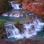
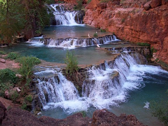
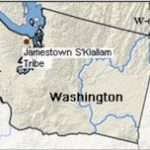
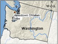 Address: S’Klallam Tribe,1033 Old Blyn Hwy, Sequim, WA 98382