In compliance with FTC guidelines, please assume the following about all links on this website that are outbound links: Since I share products and services I use and love with my readers, assume that I may receive a small commision if you buy something or subscribe to a service from a link on this website (at no additional cost to you). If you do buy something, thanks for your support !
Among others, we are a participant in the Amazon Services LLC Associates Program, an affiliate advertising program designed to provide a means for us to earn fees by linking to Amazon.com and affiliated sites. Pages on this site may include affiliate links to Amazon and its affiliate sites on which the owner of this website will make a referral commission.
The shopping links above this notice go to our own store, NativeCrafts.us
Today there are six federally recognized bands of Luiseño Indians based in southern California, and another that is not yet recognized by the US Government. They are:
The Penobscot tribe, together with the Mi’kmaq, Maliseet, Passamaquoddy, and Abenaki Indians, were once members of the old Wabanaki Confederacy, enemies of the Iroquois. These allies from the eastern seaboard region spoke related languages, and “Abenaki” and “Wabanaki” have the same Algonquian root, meaning “people from the east.” The Penobscot are not affiliated with the Abenakis today, and distance themselves from the Abenaki of New England.
Reservation: Penobscot Reservation and Off-Reservation Trust Land
Land Area: Tribal Headquarters: Time Zone:
Population at Contact:
Registered Population Today:
There are 3000 Penobscot Indians now, most of whom live in Maine.
Tribal Enrollment Requirements:
Genealogy Resources:
Government:
Charter: Name of Governing Body: Number of Council members: Dates of Constitutional amendments: Number of Executive Officers:
Elections:
Language Classification:
Language Dialects:
Number of fluent Speakers:
Dictionary:
Origins:
Bands, Gens, and Clans
Related Tribes:
Traditional Allies:
Traditional Enemies:
Ceremonies / Dances:
Modern Day Events & Tourism:
Legends / Oral Stories:
Art & Crafts:
Animals:
Clothing:
Housing:
Subsistance:
Economy Today:
Religion & Spiritual Beliefs:
Burial Customs:
Wedding Customs
Radio: Newspapers:
Penobscot People of Note:
Molly Spotted Elk was the stage name of Molly Dellis Nelson (November 17, 1903 – February 21, 1977), a Native American vaudeville and silent film actress and dancer.
Louis Sockalexis – First native american to play major league baseball
The federally recognized Picayune Rancheria of Chukchansi Indians of California have always lived in California. During the years after the Gold Rush (1849) anthropologists visited the land of the Chukchansi. They grouped California Tribes together by their languages; hence, the Chukchansi are grouped with approximately 60 other Tribes in the greater Central Valley.
These people were referred to by early researchers as “Yokuts”, meaning “people”. However, there is no Yokut Tribe, and each Tribe had its own name and its own traditional use areas.
Official Tribal Name: Picayune Rancheria of Chukchansi Indians of California
The Chukchansi have inhabited the fringes of the San Joaquin Valley and the foothills of the Sierra Nevada for more then 12,000 years.
Confederacy: Yokuts, Mono, Paiute
Treaties:
Reservation: Picayune Rancheria and Off-Reservation Trust Land
Land Area: Tribal Headquarters: Time Zone:
Population at Contact:
Registered Population Today:
Tribal Enrollment Requirements:
Genealogy Resources:
Government:
Charter: Name of Governing Body: Number of Council members: Dates of Constitutional amendments: Number of Executive Officers:
Elections:
Language Classification:
Language Dialects:
During the years after the Gold Rush (1849) anthropologists visited the land of the Chukchansi. They grouped California Tribes together by their languages; hence, the Chukchansi are grouped with approximately 60 other Tribes in the greater Central Valley. These groups had (and still do have) similar cultures, and speak the same language, but had different dialects.
Villages were situated where there was exposed bedrock to use in the processing of plant foods. The early settlements ranged from large villages, with hundreds of bedrock mortars, to smaller hunting camps. These villages were near the traditional plant harvesting locations. They are just as important cultural resources for the Chukchansi people today as they were thousands of years ago. There are at least 15 sites on the Rancheria and allotment lands and some of the bedrock mortars have as many as 95 holes.
Subsistance:
The Chukchansi were a hunter-gatherer society. They also did some farming and fishing. The Chukchansi hunted deer, rabbit, raccoons, and other game in the marshes and grass lands. The primary food source that was gathered during the summer season was derived from plants, particularly acorns, nuts, seeds, roots and berries.
The Pinoleville Pomo Nation is a federally recognized tribe of Pomo people in Mendocino County, California. They were originally a Pomo villiage that resided in the Ukiah Valley, and were just one of the many Pomo tribes in California.
Official Tribal Name: Pinoleville Pomo Nation Address: Phone: Fax: Email:
Official Website:
Recognition Status: Federally Recognized
Traditional Name / Traditional Meaning: Pomo originally meant “those who live at red earth hole” and was once the name of a village in southern Potter Valley near the present-day community of Pomo. In the Northern Pomo dialect, -pomo or -poma was used as a suffix after the names of places, to mean a subgroup of people of the place. By 1877, the use of Pomo had been extended in English to mean the entire people known today as the Pomo.
Common Name / Meaning of Common Name: Pinoleville Rancheria
Alternate names / Alternate spellings:
Formerly the Pinoleville Rancheria of Pomo Indians of California
Traditional Territory: The historic Pomo territory in northern California was large, bordered by the Pacific Coast to the west, extending inland to Clear Lake, and mainly between Cleone and Duncan’s Point on the coast. One small group, the Northeastern Pomo of the Stonyford vicinity of Colusa County, was separated from the core Pomo area by lands inhabited by Yuki and Wintuan speakers.The Pomo who became the Pinoleville Band lived in northern Ukiah Valley, but their ancestral lands were overrun by non-native settlers in the mid-19th century.
Confederacy: Pomo
Treaties:
Reservation: Pinoleville Rancheria
The Rancheria was terminated by the US Federal Government but it was restored in the 1980s. Their reservation was established in 1911 by the US Federal Government but was terminated in 1966 under the California Rancheria Act. They quickly lost 50% of their land base. In 1979 the Pinoleville Band joined Tillie Hardwick v. the United States, a class action suit that was decided in favor of the tribes. The Pinoleville Pomo were able to regain federal recognition and restore their original reservation to trust status. Land Area: The primary parcel of land occupies 99 acres (400,000 m2) in Mendocino County. A second parcel, located in Lake County, is 6.7 acres (27,000 m2). The tribe is trying to place this second parcel into trust and develop it with housing. Tribal Headquarters: Ukiah, California Time Zone:
Population at Contact:
The aboriginal population of all the Pomo has been variously estimated at from eight thousand to twenty-one thousand. The numbers were not evenly distributed among the seven linguistic groups: the Kashaya, Salt Pomo, and Southeastern Pomo were the smallest at about 5 percent each of the total. The Eastern were about 10 percent, the Central Pomo about 15 percent, and the Southern and Northern about 30 percent each.
The more numerous linguistic groups were divided into a larger number of politically independent village communities. In the devastation of the nineteenth century, over 90 percent of the population was lost, down to a low of about eight hundred. The population recovered somewhat, to twelve hundred by 1910 and has increased steadily since.
Registered Population Today:
Later censuses are quite inadequate, as they count only residents of current reservations and omit the great majority of the Pomo who live either on land whose Reserved status has been terminated or at other sites. About 70 members live on the Pinoleville Rancheria.
Tribal Enrollment Requirements:
Genealogy Resources:
Government:
Charter: Name of Governing Body: Number of Council members: Dates of Constitutional amendments: Number of Executive Officers:
Elections:
Language Classification: Hokan =>Pomoan
Language Dialects:
The seven language dialects of the Pomoan family are quite distinct; at the maximum divergence they are more different from each other than are English and German. At a deeper time depth, the Pomoan language family is postulated to have been related to other Indian languages, scattered from northern California southward into Mexico, in the Hokan linguistic stock.
The seven dialects are often differentiated by placing a direction before the word Pomo: Southwestern Pomo, Southern Pomo, Central Pomo, Northern Pomo, Northeastern Pomo, Eastern Pomo, and Southeastern Pomo. Two of these seven groups had a name for themselves as a whole and thus can be referred to by adaptations of their self-designations: “Kashaya” (Southwestern Pomo) and “Salt Pomo” (Northeastern Pomo). The others had names for their politically separate village communities but not for the language groups as a whole.
Number of fluent Speakers:
Dictionary:
Origins:
Bands, Gens, and Clans
Related Tribes:
The people called Pomo were originally linked by location, language, and cultural expression. They were not socially or politically linked as one large unified group. Instead, they lived in small groups or bands, linked by geography, lineage and marriage. The Pomo people lived in hundreds of independent communities.
There were about seventy-five tribelets and several hundred named former settlement sites, not all occupied at one time. The village sizes varied from hamlets of fifty to major centers of over five hundred. In the middle of the twentieth century there were twenty-one small reservations, some bought by the government and others by Pomo groups for themselves. In the 1960s fifteen of these were terminated. Many Pomo still live in their ancestral territory on small ranches or in adjacent towns where work is available; others are scattered across the United States.
Ceremonies were held for certain annual occasions. At any time a feast might be pledged, conditional on a sick family member recovering, and then the pledge is carried out by the kin group. The Pomo had a great variety of amusements, games, and sports. One rough team sport that could involve an entire village was a game similar to lacrosse. But, the game in which they took the most passionate interest was that called the hand game (it involves guessing which hand of the opponent holds a marked bone). This they could play all night and would often wager all their possessions on its outcome.
Modern Day Events & Tourism:
The Kashaya still hold some of these: in May the strawberry festival for the blessing of the first fruits of the year; in the fall an acorn festival; in summer four nights of sacred dances ending with a feast on the Fourth of July; and in winter possibly another dance.
The hand game is still played at many modern northern pow-wows by many tribes, still with lots of bets placed on the outcome of the hand game tournaments.
Legends / Oral Stories:
Art & Crafts:
The Pomo are most famous for their fine baskets, which have an extremely tight weave. Pomo baskets are considered by many to be the finest in the world. They are admired for the great variety of weaves and styles; the delicacy, evenness, and tightness of the stitching; and the artistry of the design.
Most spectacular is the sun basket whose surface pattern is made of feathers of different natural colors. The art form still lives and appears to be expanding; the finer work sells for very high prices. In the past century the women have vied in producing the largest baskets (which take many years to complete) and the smallest (which approach pinhead size).
The art of singing is well developed for almost any occasion: ceremonial dancing, blessing, doctoring, warding off evil, bringing good luck in the harvest, hunting, attracting a mate, gambling, and so on. Two-part singing is common: one sings the melody while another, called the “rock,” keeps the rhythm vocally. Rhythm was also kept with a split-stick rattle, a foot drum, and a two-toned whistle.
As money and as gifts, beads were produced in large numbers: most common were beads made from clam shells collected principally at Bodega Bay in Coast Miwok territory. More valuable were larger beads of magnesite, known as “Indian gold.” Pendants of abalone were also appreciated. Mortars and pestles of stone were shaped for grinding acorns and various seeds. Knives and arrowheads were of obsidian and chert. Boats of bundled tule were used on Clear Lake; only rafts were used on the coast.
There was aboriginally a considerable amount of trade among the various Pomo communities and with Neighboring non-Pomo. Items traded included salt from the Salt Pomo, and from the coastal groups came shells, magnesite, finished beads, obsidian, tools, basketry materials, skins, and food that one group might have in excess and another need. Beads were the measure of value, and the Pomo were adept in counting them to the tens of thousands.
Animals:
Clothing: Very little clothing was worn in the pre-contact era. Men usually went naked but in cold weather might wrap themselves in a robe or mantle of skin or tule; women wore a skirt of skins or of shredded bark or tule. Elaborate costumes of feathers and shells were, and still are, worn on ceremonial occasions.
Decoration: Tattooing of both the face and body were formerly common, but now the type and frequency of tattoos are no more than among the rest of the populace.
Housing: Three types of Pomo houses were constructed: large semi-subterranean ceremonial houses, semi-subterranean sweat houses, and dwellings. The dwellings on the coast were conical lean-tos of slabs of redwood bark, suitable for one family only; elsewhere the dwellings could hold several families and consisted of a framework of willow poles with grass thatching in the valleys such as Ukiah Valley, and tule thatching coverings near Clear Lake.
Subsistance: Traditionally the Pomo relied upon fishing, hunting and gathering for their food. They ate salmon, wild greens, gnats, mushrooms, berries, grasshoppers, rabbits, rats, and squirrels, and especially acorns, which are the nuts produced by oak trees.
From the coast, fish were taken, and shellfish and edible seaweed gathered. In the hills, valleys, and coastal plains, edible bulbs, seeds, nuts, and greens were collected, and deer, elk, rabbits, and squirrels hunted or trapped. From the rivers and streams fish were taken. In the lake, fish were plentiful, and in winter the migratory water-fowl numbered in the millions. The staple food for all the Pomo was the acorn. Both the coastal and lake dwellers allowed others to fish and take food from their unique environments.
The men did the hunting, fishing, and fighting. Women gathered the plant food and prepared the food; especially time consuming was the grinding and leaching of the staple acorn. Men made the beads, rabbit-skin blankets, weapons, coarsely twined burden baskets, and quail and fish traps. Women wove the fine baskets.
With few exceptions, land and hunting and gathering rights were possessed by the village community. Some Central Pomo had family ownership of certain oak trees, berry bushes, and bulb fields. For the Southeastern Pomo, land around their island villages was communally owned, but named tracts of land on the mainland were owned by individual families, who had exclusive gathering rights, although others might be allowed to hunt there.
Of twenty-one small reservations existing in the middle of the twentieth century, fourteen were terminated in the 1960s and the land allocated to individual ownership. Many sold their land, and thus outsiders are living among these groups. Many have also left these reservations and bought homes in towns near and far.
Economy Today:
In order to improve diets and the local environment the Pinoleville Pomo Nation created a horticultural program, which focuses on tribal youth — educating them about plants, to improve self-esteem and provide skills. Pinole Nation Gardens include a greenhouse, orchards, two gardens, and native plant restoration areas and are located in Ukiah.
Pinoleville Pomo Nation operates a housing program, an environmental department, Head Start, vocational training, and an historic preservation office.
The Pinoleville Pomo Nation will be the first tribe in California to grow medical marijuana, having announced a plan to open a 2.5-acre indoor growing facility on their land. The tribe said their pot profits will be used to help pay for the tribe’s social programs (such) as elder care, child care, health and education.
Religion & Spiritual Beliefs:
All the Pomo believed in a creator who made the world. Most equated this creator with Coyote, the animal and the mythological trickster. Some Eastern Pomo gave the creator a different name, separating him from the other roles of Coyote. All believed that there was a time in the distant past when animals could speak and had other human as well as animal attributes. Then all creatures changed to their present forms.
Supernatural forces abided in everything; specific named supernatural beings could appear to one who broke a rule, such as a childbirth or menstrual taboo on a woman or her husband, and by fright cause coma and death. In the early historical period, the Pomo were performing a Kuksu ceremony, in which dancers impersonated certain spirits.
In 1871, the Ghost Dance swept in from Nevada across northern California, predicting the return of the dead and the elimination of White people. This reached the Pomo in 1872 in a modification called the Earth Lodge Cult, which stressed a destruction of the world from which the faithful could be protected by gathering in subterranean lodges.
Pomo from as far away as the Kashaya streamed into the Clear Lake region to await this event. When the end did not come, the participants suffered great hardship and starvation, not being prepared for life to go on. A development, known as the Bole-Maru, abandoned the belief in imminent catastrophe and stressed belief in an afterlife and a supreme being.
Local dreamers and prophets among the various Pomo groups have guided further evolution, even to this day. Most Pomo now belong to some Christian church, but many still fear the consequences of breaking old restrictions.
Shamans may conduct Ceremonies and preach and prophesy or they may doctor. They may specialize in one function or the other, or do both. In the past, they may have inherited the position, but now the powers are usually received through dream inspiration plus apprenticeship. It is said that before 1870 most shamans were men, but now women predominate.
Today, minor physical ailments like rashes, boils, sore eyes, diarrhea, constipation, or indigestion are often treated herbally by poultices or infusions of various plants and plant parts. For obvious physical injuries and recognized diseases, a White doctor is now usually consulted.
Other ailments of unobvious origin might be attributed to the consequences of breaking some taboo or to poisoning (more magical than chemical) by enemies. A shaman, locally called an Indian doctor, is often successful in treating the latter problems by singing powerful songs, by the laying on of hands, or by sucking out the disease or poison. Indian doctors still practice their profession and are sometimes called in by local White people for relief of chronic ailments not helped by modern medicine.
Burial Customs:
The deceased were formerly cremated, but about 1870 a shift was made to burial. Mourners would bring gifts (beads, baskets, robes), some specifically designated to be burned with the dead, some to be distributed later; the bereaved family would later return an equivalent in value.
The house and personal property of the deceased were also burned, lest the ghost linger around the objects.
The Supernatural paraphernalia of a doctor, however, might be turned over to a successor apprentice.
One year after the Funeral, the bones of the deceased were dug up and burned again, along with more gifts, thus terminating the period of mourning.
Even now, after the shift to burial, valuable gifts may be thrown into the grave.
All the Pomo believed in an afterworld. It was important to have a sacred Indian name, bestowed from the family’s ancestral stock (from either the maternal or paternal side, or from both), to announce on reaching the afterworld so that ancestors who were already there could greet the newly arrived family member.
Land belonged to the community or family.
It was a grave insult to say the name of the dead in the presence of a living relative. In Kashaya, however, the dead could be referred to by a kinship term suffixed by -ya’, to indicate Respect.
Marriage / Wedding Customs:
Kin groups were the most important social unit. Such groups shared, and many still share, labor and its fruits, and support each other politically. There was an institution of “special friend” (with a term that worked like kin terms), which could be established between two Individuals by a ritual exchange of gifts. The chief with the largest kin group was usually the most powerful. Having no kin was the ultimate in poverty: there was no social security, no one to provide food when one’s own efforts failed. The kinless Person was fair game for any aggressor as there was no one to avenge a wrong.
The Pomo groups have elaborate systems of kin terms, distinguishing father’s father from mother’s father, and father’s mother from mother’s mother. Although there are distinct forms for grandchildren, in many families reciprocal terms are used. For example, in Southern Pomo, a woman who addresses or refers to her maternal grandmother by a word built on the root -ka-, or her paternal grandmother by one with -ma-, would in turn be addressed or referred to with words constructed with -ka- and -ma-, respectively.
The parents of the grandparents are often designated by the grandparent terms, or more specifically by a phrase, but Southeastern Pomo has unique terms for great-grandfather and great-grandmother.
The Kashaya kinship system has been labeled as of the Hawaiian type, that of the Southern Pomo as Crow, and the rest as Omaha. Nevertheless, most share certain features: siblings of grandparents are called by the same terms as the grandparents.
At the parent level, most of the languages have separate terms for one’s father’s older and younger brothers, and for mother’s older and younger sisters, but only one term for father’s older and younger sisters and one for mother’s older and younger brothers.
Descent is reckoned evenly on both the paternal and maternal sides.
Marriage partners could be arranged either by the young couple or by their families, though usually all parties would have to concur. The couple could be from the same village or different ones.
The man’s parents presented gifts (food, beads, blankets, baskets) to the bride’s parents, and gifts of nearly equal value were later returned. The young couple could take up residence with either set of parents, and they often moved from one to the other, returning to the woman’s parents for the birth of the first child.
Divorce was as simple as one party moving out.
The levirate and sororate were both known, meaning if the wife died, the husband would often marry her younger sister, or if the husband died, his younger brother would then wed the widow. In fact, the word for stepfather is usually the same as the term for father’s younger brother, and stepmother the same as mother’s younger sister.
Social / Political Organization:
The family and extended kin group was the most important social unit. Women had equal status to men. Many families were multi-generational, with usually three or even four generations living in the same household.
Children were raised permissively; threats and warnings are used much more than chastisement. Behavioral restrictions were often taught by means of stories in which the principal character breaks a rule and suffers through supernatural means, severe retribution, or often death. Children are often raised by their grandparents. Households unable to care for all their children might let some be raised by related couples who are otherwise childless.
The largest political unit was the tribelet or village community, which could consist of several villages. There were chiefs on several levels, hereditary and elected. There were kin group chiefs and assistant chiefs; if there were several such units in a village or village Community, one might be chosen as head chief. Duties varied and included giving counsel, negotiating with other groups, presiding over ceremonies, feasts, and work parties, and distributing the fruits of communal labor.
Breaking any of a vast array of restrictions or taboos could lead to sickness from supernatural agents; death could be averted only by timely treatment by a shaman. The kin group controlled the actions of its members. In case of transgression against non-kin by any group member, the kin group would have to pay compensation, and failure to do so would call forth a revenge attack, either a clandestine killing or magical poisoning. Death of any kin group member, not only of the individual transgressor, was proper vengeance.
Most conflict was in the form of feuds between kin groups and might arise from poaching or suspicion of causing sickness by magical poisoning. Alliances with other communities, even non-Pomo, might be made to carry out conflict on a larger scale. Peace was brought about by negotiation and the payment of reparations to the relatives of those killed.
Radio: Newspapers
Pomo Chiefs and Famous People:
Catastrophic Events:
In 1833, an epidemic, possibly cholera, took many; in 1838-1839, many more died of smallpox. From 1834 to 1847, thousands died from these causes and from Mexican military campaigns. Survivors were pressed into forced labor, both locally and, later, in distant gold mines.
Tribe History:
The Pomo were bordered on the north by the three Yukian groups—Coast Yuki, Yuki, Huchnom—on the northeast by the Patwin, on the southeast by the Wappo and Lake Miwok, and on the south by the Coast Miwok. The diversity of Languages in a compact area suggests that the Pomo have lived somewhere in their present territory, developing their unique speech forms, for a very long time, on the order of fifteen hundred years.
The Salt Pomo have a legend of migrating from a place next to other Pomo across the Inner Coast Range to their present location in recent prehistoric times. If this is so, they must have already possessed a distinct language, as its divergence from the other Pomoan languages is so great as normally to have taken a millennium or so.
The destruction of the Pomo began with the founding of the San Rafael Mission in 1817 and the Sonoma Mission in 1823, with the Southern Pomo the first to be severely affected. In the Russian River and Clear Lake regions, Mexican land grants, rapid settlement, and conversion of the land to grazing and farming deprived the Indians of their former livelihood.
Two White settlers particularly abusive of the Clear Lake Indians were killed in 1849; a U.S. cavalry punitive force swept through the area, northward along the lake and westward to the Russian River valleys, massacring along the way Southeastern, Eastern, Northern, and Central Pomo, most of whom had nothing to do with the killing of the pair of men.
Especially infamous was the slaughter of an innocent fishing party at a place known since as Bloody Island. In the next few years, the surviving Pomo were rounded up and forced onto the Mendocino Indian Reserve and the Round Valley Reservation (considerably north of Porno territory and mixed with non-Pomo groups). Some escaped to return to their ancestral homes, and the Mendocino Reserve was disbanded. These Indians could not renew their earlier life and became agricultural workers.
The Kashaya have a unique history among the Pomo. Their first contact with Europeans was not with Hispanic or Anglo-Americans but with Russians at the Fort Ross colony, 1811-1842. Because of their relative freedom from forced removal to missions and reservations and their isolation from the regions of densest settlement, they are now the culturally best preserved of the Pomo groups, with more speakers of their language (perhaps sixty) than all the rest of the Pomo combined.
Atsugewi comes from atsuke, the Native name for a place along the Hat Creek.
Common Name / Meaning of Common Name:
Pit River Indians – The Pit River is so named because of the local Indians’ practice of digging pits near the river for the purpose of catching game, particularly deer.
XL Ranch, Big Bend Rancheria, Likely Rancheria, Lookout Rancheria, Montgomery Creek Rancheria, Roaring Creek Rancheria, Hat Creek Indians, Pitt River Indians.
The Achumawi lived along the Pit River in northern California, in an area bounded by Mount Shasta to the northwest, Lassen Peak to the southwest, and the Warner range to the east. There were two Atsugewi groups: the Pine Tree People, who lived in the densely wooded area north of Mount Lassen; and the Juniper Tree People, who lived in the drier plains in and around Dixie Valley, northeast of Mount Lassen. Their homeland was located along the Pit River in northeastern California, from Big Bend to Goose Lake, extending to the present boundary between California and Oregon.
Confederacy: Pit River Tribes
Treaties:
The Pit River people never signed a treaty with the United States or the State of California. Their land was simply illegally taken.
Reservations: Pit River Trust Land plus Rancherias below.
The tribe owns trust lands in Lake County, California, Lassen, Mendocino, Modoc, and Shasta Counties. The Pit River Tribe also controls six reservations called rancherias. They are:
Big Bend Rancheria, Shasta County, 40 acres, population: 10
Likely Rancheria, Modoc County, 1.32 acres, tribal cemetery
Lookout Rancheria, Modoc County, 40 acres, population: 10
Montgomery Creek Rancheria, Shasta County, 72 acres, population: 15
Roaring Creek Rancheria, Shasta County, 80 acres, population: 14
XL Ranch, Modoc County, 9,254.86 acres, population: 40.
Population at Contact:
In the early 1800s there were about three thousand Achumawi and nine hundred Atsugewi. The Achumawi and Atsugewi were neighboring tribes who often intermarried.
Registered Population Today:
In 1990, when the two groups had combined as the Pit River Indians, 1,753 people identified themselves as Pit River Indians. The 2000 census showed 1,765 Pit River Indians.
Tribal Enrollment Requirements:
Genealogy Resources:
Government:
Charter: Name of Governing Body: Number of Council members: Dates of Constitutional amendments: On August, 1964, a Constitution was formally adopted by the Pit River Tribe. They were officially recognized as a tribe in 1976 and ratified their constitution in 1987. Each of the eleven bands is represented in the tribal council. Number of Executive Officers:
Tribal Headquarters: Burney, CA
Elections:
Language Classification: Hokan=> Achumawi and Atsugewi (Atsuge and Apwaruke).
Language Dialects:
The eleven bands of the Pit River Tribe speak two related languages. Nine speak Achumawi and two speak Atsugewi (Atsuge and Apwaruke). They are classified in the northern group of the postulated Hokan ‘superstock’ of languages, and a subgroup called Palaihnihan has been proposed for just these two languages.
Number of fluent Speakers:
Dictionary:
Origins:
Bands, Gens, and Clans
The Pit River Indians are divided into eleven bands:
The Pit River Indians were a fairly peaceful people. They did not like to fight and usually did so only when provoked. When challenged they sometimes sent a peacemaker to try to resolve issues with hostile tribes. The Achumawi and the Atsugewi were on good terms and frequently renewed friendship ties through marriage.
Traditional Enemies:
The Modoc, Paiute, and Klamath made frequent hostile invasions into their territory to capture their women and children for slaves. Some historians think Pit River Indian slaves may have been handed over to the Spanish in the Southwest in the early or mid-1700s, making that their actual first encounters with white people.
Ceremonies / Dances:
Modern Day Events & Tourism:
Legends / Oral Stories:
Art & Crafts:
Animals:
Clothing:
Housing:
Subsistance:
The Pit River Indians were hunter – gathers. Their main food sources were fish, acorns, grasshoppers, plants, and small animals.
Social Organization:
The Achumawi lived in a collection of villages that were organized individually, but maintained ties with one another. The Atsugewi tribe was made up of two distinct groups: the Pine Tree People and the Juniper Tree People who shared a language.
1833: Malaria epidemic kills many Pit River Indians.
1848: Gold is discovered in California; Pit River lands are overrun by gold miners.
1859: An entire Atsugewi tribe is killed by whites over a misunderstanding.
Tribe History:
American fur trappers entered the Pit River region in 1827, and soon the Native population was overcome by a malaria epidemic. More of their territory was taken after Mexico gave California to the United States in 1848. Hundreds of settlers passed through on their way to the coast, followed by gold seekers. Relations were hostile, and conflicts erupted throughout the 1850s.
In Shasta County, the two main groups of Pit River Indians were the Achumawi (now known as the Alturas Indian Rancheria), who lived in and around the Fall River Valley, and the Atsuegewi, who lived primarily in the Hat Creek area (now known as the Pit River Tribe).
Before Europeans came to colonize the area, the tribes often were victims of slaving raids from the fierce Klamath and Modoc tribes from the north. Like many Indians, they were devastated by diseases early Spanish and American explorers inadvertently carried with them.
By the time of the Gold Rush in the mid-1800s, when thousands of gold-hungry settlers moved east to California, diseases had already decimated the tribe. That didn’t stop some from fighting back, often with devastating consequences.
In 1855, a group of settlers moved to the valley. The following year, they attempted to build a ferry crossing on the Pit River. The tribe’s warriors attacked, killing two men, dismembering and mutilating their bodies. The whites responded by gathering dozens for an armed militia and put a bounty of $5.00 each on Pit River Indians.
The massacre started as soon as they arrived in the valley. Every village they found was attacked. At one village, over 100 Indian people were killed. In later raids, whites bragged about taking scalps and cutting off tribe members’ ears as trophies. Later, whites used strychnine to poison flour left out for starving Indians to eat.
Whites also stole Indian children and gave them to white families. Languages and traditions were outlawed or beaten out of children.
Most of the tribe members who were left were forced onto reservations.
The lingering animosity between the tribe and the whites boiled over in the late 1960s and early 1970s, during a national movement in which Indians across the country tried to reclaim their ancestral lands.
The most famous of the national protests began on Nov. 20, 1969, when a group of Indians occupied Alcatraz Island in San Francisco for nearly two years.
In an effort to reclaim 3.4 million acres of ancestral land, the Pit River tribe members followed suit and began holding occupations of their own, including on Pacific Gas and Electric property near Big Bend and on U.S. Forest Service land near Burney.
In 1970, about 100 Indians, including men, women and children, occupied a piece of forest land near the four-corners intersection of highways 299 and 89, five miles east of Burney.
Although the Indians claimed the land was theirs, the U.S. Forest Service held legal ownership of the site.
The Indians built a Quonset hut on the site and told authorities, they’d have to be killed if authorities went to tear it down, according to news reports from the time.
On Oct. 27, 1970, 52 armed officers, including federal agents, state troopers and sheriff’s deputies, converged on the site with more than 50 Forest Service personnel, many of whom carried crowbars.
The authorities claimed they were there to arrest people on warrants charging them with illegal timber cutting and to demand the Indians tear down the hut, but he Indians said later in trial testimony the force was sent with one mission: to break the back of the tribe’s effort to reclaim their lands.
News reports of the time describe an all-out melee when authorities began tearing down the hut and wrestling with the Indians who tried to stop them.
Indians, both men and women, fought with bare fists, tree limbs and planks of lumber. Officers and sheriff’s deputies swung billy clubs and sprayed mace.
In the end, more than two dozen Indians were arrested, but only one, who pleaded guilty to a lesser assault charge, actually served any sort of a sentence for the alleged assaults on officers.
The rest had their charges dismissed or were acquitted after a nearly two-month federal trial.
There were other, less-violent occupations, confrontations and arrests in the few years that followed.
The tribe’s lawyers also fought in court in failed bids to sue to reclaim their ancestral lands.
The tribe lingered largely in poverty over the following decades.
Then, in the mid-1990s, the tribe followed the lead of dozens of other California Indian groups and built a small casino outside Burney.
The Poarch Band of Creeks descends from Muscogee Creek Indians who sided with the United States in the Creek War of 1813–1814. Many Creeks remained in Alabama despite the Indian Removal Act of 1830. They are recognized by the Federal Government.
They have lived in Alabama as a distinct community for the last two centuries. The Poarch Band represents only some of the descendants of those who were not removed. Over the decades, many Indians intermarried with African-American or European-American neighbors, and some descendants assimilated into those social and cultural groups.
Official Tribal Name: Poarch Band of Creeks
Address: Phone: Fax: Email:
Official Website:
Recognition Status: Federally Recognized
Traditional Name / Traditional Meaning:
Common Name / Meaning of Common Name:
Alternate names / Alternate spellings:
Formerly known as the Poarch Band of Creek Indians of Alabama
Reservation: Poarch Creek Reservation and Off-Reservation Trust Land
The Poarch Creek Indian Reservation is located in southern Alabama near the city of Atmore, Alabama. Land Area: Tribal Headquarters: Time Zone:
Population at Contact:
Registered Population Today:
Tribal Enrollment Requirements:
Enrollment traces to one of three rolls: the 1870 U.S. Census of Escambia County, Alabama; 1900 U.S. Census of Escambia County, Alabama; or the 1900 U.S. Special Indian Census of Monroe County. A minimum blood quantum of 1/4 American Indian blood is also required, and you cannot be enrolled in any other tribe.
The tribe owns Poarch Creek Indian Gaming, which operates three casinos: Wind Creek Casino and Hotel in Atmore, Creek Casino Wetumpka (formerly Riverside Entertainment Center) in Wetumpka, and Creek Casino Montgomery (formerly Tallapoosa Entertainment Center) in Montgomery.
The Pokagon Band of Potawatomi Indians have occupied southern Michigan, northern Indiana, northwestern Ohio, north and central Illinois, and the shores of Lake Michigan in Wisconsin into the Dorr Peninsula for thousands of years.
Official Tribal Name: Pokagon Band of Potawatomi Indians
Potawatomi is an Algonquian language closely related to the Ojibwayan dialect complex.
Number of fluent Speakers:
The Potawatomi language is critically endangered and nearly extinct. It has about 50 first-language speakers in several widely separated communities in the US and Canada. These include the Hannahville Indian Community (Upper Peninsula of Michigan), the Pokagon and Huron Bands (southern Michigan), the Forest County Band (northern Wisconsin), the Prairie Band (eastern Kansas), and the Citizen Potawatomi Nation of Oklahoma. A few Potawatomi speakers also live among the Eastern Ojibwe in Ontario, particularly at the Walpole Island Reserve. The largest speech communities are in the Forest County and Prairie Bands, each with about 20 speakers, several conservatively fluent.
Jim Thorpe whose indian name was Wathohuck , meaning Bright Star (Sauk/Pottawatomi 1888–1953), athlete who won gold medals in the decathlon and pentathlon at the 1912 Stockholm Olympics
The Ponca Tribe signed several treaties in 1817, 1825, 1858, and was originally designated reservation lands along the Missouri River recognized in a treaty with the United States signed in 1865.
The Treaty of 1817 was a treaty of “peace and friendship” between the two nations. In the Treaty of 1825 the Poncas acknowledged that they lived within the “territorial limits of the United States” thereby recognizing the supremacy of the government. The Poncas also authorized the government to regulate all trade and commerce.
The third treaty, signed in 1858, nullified the Poncas’ title to all their lands occupied and claimed by them “except for a small portion on which to colonize or domesticate them.” The fourth and final treaty signed in 1865 ceded an additional 30,000 acres of their reserved land. This final treaty provided for a reservation of 96,000 acres in the present day Nebraska counties of Knox and Boyd.
It was the Fort Laramie Treaty of 1868 that forever altered the course of Ponca history. Among other things, it established the boundaries of the Great Sioux Reservation, which mistakenly included 96,000 acres of land that was the Ponca Reservation. The Ponca became trespassers in their own aboriginal homeland.
Reservations:
Land Area: Tribal Headquarters: Time Zone:
Population at Contact:
Registered Population Today:
The Ponca were never a large tribe. The tribe’s probable size in 1780 was estimated at 800. By 1804, largely because of smallpox, their numbers dwindled to around 200. By 1829, their population had increased to 600 and by 1842, to about 800. In 1906, the Ponca in Oklahoma numbered 570 and those in Nebraska, 263. The census of 1910 listed 875 Poncas, including 619 in Oklahoma and 193 in Kansas. By 1937, the Ponca population reached 1,222 with 825 in Oklahoma and 397 in Nebraska.
Tribal Enrollment Requirements:
Genealogy Resources:
Government:
Charter: Name of Governing Body: Number of Council members: Dates of Constitutional amendments: Number of Executive Officers:
On their journey westward in 1804, Lewis and Clark came upon the Ponca Tribe. Lewis and Clark reported that the tribe, once a part of the Omaha Tribe, separated and lived along a branch of the Red River near- Lake Winnipeg. However, the Sioux forced the Poncas, as well as many of the smaller plains cultures, to relocate to the west bank of the Missouri River in the early 1700’s.
Historically, the Ponca are believed to have been part of the Omaha Tribe, having separated by the time Lewis and Clark came upon them in 1804. At that time, they were situated along Ponca Creek, in Knox County, near present-day Verdel.
The Ponca Tribal homelands are located in portions of four noncontiguous counties located in the eastern third of the state of Nebraska and one county in central South Dakota. The counties are Knox and Madison, situated in the northeastern section of the state, Douglas and Lancaster, located in southeastern Nebraska and Charles Mix in south central South Dakota. The service area covers approximately 1,800 square miles.
The Ponca Tribe maintains the right and responsibility to provide environmental authority in compliance with Tribal and Federal law for protection of the land and resources within the exterior boundaries of the reservation through code development and regulatory mechanisms. This includes all rights-of-way, waterways, watercourses and streams running through any part of the reservation and to such others lands as may hereafter be added to the reservation under the laws of the United States.
Confederacy:
Treaties:
The Ponca Tribe signed several treaties in 1817, 1825, 1858, and was originally designated reservation lands along the Missouri River recognized in a treaty with the United States signed in 1865.
The Treaty of 1817 was a treaty of “peace and friendship” between the two nations. In the Treaty of 1825 the Poncas acknowledged that they lived within the “territorial limits of the United States” thereby recognizing the supremacy of the government. The Poncas also authorized the government to regulate all trade and commerce-
The third treaty, signed in 1858, nullified the Poncas’ title to all their lands occupied and claimed by them “except for a small portion on which to colonize or domesticate them.” The fourth and final treaty signed in 1865 ceded an additional 30,000 acres of their reserved land. This final treaty provided for a reservation of 96,000 acres in the present day Nebraska counties of Knox and Boyd.
It was the Fort Laramie Treaty of 1868 that forever altered the course of Ponca history. Among other things, it established the boundaries of the Great Sioux Reservation, which mistakenly included 96,000 acres of land that was the Ponca Reservation. The Ponca became trespassers in their own aboriginal homeland.
Reservation: Ponca Trust Land (NE)
The Ponca Tribe of Nebraska does not have a reservation; instead they have 15 service counties located in Nebraska, South Dakota, and Iowa. They currently have 1,307 members residing in the Service Delivery Area, which covers about 1,800 square miles. The rest are located throughout the United States and Canada.
Land Area: About 500 acres purchased by the tribe. Tribal Headquarters: The Tribal Headquarters is located in Niobrara, Nebraska. There are three field offices located within the service area in Lincoln, Norfolk, and Omaha, Nebraska, and one in Sioux City, Iowa. Time Zone: Central
Tribal Flag:
The border of the Ponca Flag consists of four colors: black, red, yellow, and white. The number four is sacred to the Ponca because it symbolizes the four winds (directions) and the four races of people. The center of the Ponca Flag shows a teepee surrounded by important symbols.The sun symbolizes the unity of all beings under Wakonda (the Creator). The pipe and crossed arrows represent peace and friendship. A spirit hoop with four eagle feathers circles everything.
Population at Contact:
The Ponca were never a large tribe. The tribe’s probable size in 1780 was estimated at 800. By 1804, largely because of smallpox, their numbers dwindled to around 200. By 1829, their population had increased to 600 and by 1842, to about 800. In 1906, the Ponca in Oklahoma numbered 570 and those in Nebraska, 263. The census of 1910 listed 875 Poncas, including 619 in Oklahoma and 193 in Kansas. By 1937, the Ponca population reached 1,222 with 825 in Oklahoma and 397 in Nebraska.
Registered Population Today:
In 2011, the Ponca Tribe of Nebraska had more than 3,190 enrolled members.
Tribal Enrollment Requirements:
You must trace your ancestry to an ancestor on the Ponca Base Rolls of 1934, 1935 or 1965. You must attach a State Certified birth certificate with a stamped or raised seal. (It will be returned).
If the Ponca parent is not listed on the birth certificate, a chain of custody DNA test must be done and the results of the test must be submitted directly to the Enrollment Office from the testing lab; the cost of the DNA test is the sole responsibility of the applicant or sponsor of the applicant. If the applicants name has been changed due to adoption, a copy of the court order showing the name change and the biological Ponca parents name must be submitted. Send completed Enrollment Application to:
Ponca Tribe of Nebraska Enrollment Department P.O. Box 288 Niobrara, NE 68760 Ph: 402-857-3391 Ext: 403 Fax: 402-857-3736 Email: enrollment@poncatribe-ne.org or Katrina Key, Enrollment Specialist, Email: kitrinak@poncatribe-ne.org
Genealogy Resources:
Government:
Charter: The Ponca Tribe operates under a constitution consistent with the Indian Reorganization Act of June 18, 1934. Name of Governing Body: Tribal Council Number of Council members: 7 Dates of Constitutional amendments: Number of Executive Officers: The Tribal Council consists of a Chairman, Vice-Chairman, Secretary, Treasurer and three additional Councilmen all of whom are elected by the tribal membership. The Tribal Council Chairman serves as the administrative head of the Tribe.
Elections:
The Tribal Chairman, Officers and Council serve a term of three years at-large without regard to residence in a particular district of the reservation.
Language Classification: Siouan -> Siouan Proper -> Central ->Mississippi Valley ->Dhegiha -> Omaha-Ponca
Language Dialects:
Omaha and Ponca. Ponca and Omaha are completely mutually inherently intelligible. Similar to Osage, Quapaw, and Kansa.
Number of fluent Speakers:
Omaha and Ponca combined: 85 (1986 SIL). 60 Omaha speakers (1993 V. Zeps): 25 fluent speakers over 60; a few semi-fluent speakers of Ponca. Omaha Journal Star (Aug 25, 2004) reported 70.
Dictionary:
Origins:
Although the Ponca tribe’s exact origin is unknown, some scholars believed the Ponca migrated from an area along the Red River near Lake Winnipeg. However, by the early 1700s, the Sioux had forced them to relocate to the west bank of the Missouri River.
Bands, Gens, and Clans
Related Tribes:
Traditional Allies: Omaha
Traditional Enemies: Sioux
Ceremonies / Dances:
Modern Day Events & Tourism:
Annual Northern Ponca Powwow – 2nd weekend in August
Ponca Tribal Museum and Library – Open Monday-Friday, 8-4 in Niobrara, Nebraska The Ponca Museum and Library houses artifacts, historical archives, a Tribal library, and a community learning center. It also serves as the offices for the Ponca Tribal Culture and Enrollment Departments.
Legends / Oral Stories:
Art & Crafts:
Animals:
Clothing:
Housing:
Traditionally, the Ponca lived in earth lodges. Today, most of the tribal members own their own homes or rent privately. The Ponca Tribe’s Housing activities are managed by the Northern Ponca Housing Authority, located in Norfolk, Nebraska. Currently, there are housing development activities occurring In Lincoln, Omaha, Niobrara, and Norfolk. In each area, housing is either being developed by new construction or acquired for members use (provided that the housing unit is less than 10 years old).
Subsistance:
The Ponca were primarily horticulturists, but went on seasonal hunting trips.As was true with most of the Missouri Valley Tribes, the economic base of the Ponca rested upon a combination of hunting, fishing, gathering, and horticulture. Hunting, being the most exciting of these activities, was accorded the highest prestige in Ponca culture.
From the Ponca village sites, the Tribe would go on Wah-ni-sa (buffalo hunt) up the Missouri River as far as the Rocky Mountains. There were two tribal hunts annually, one in the late spring or early summer, the other in the fall. These hunts were sacred to the Ponca because they depended upon the buffalo for the winter supply of dried meat. The Ponca also depended on the bison for clothing, shelter, tools, medicine, spiritual, and religious purposes.
Economy Today:
The Ponca Tribe of Nebraska has been reintroducing bison to the native homelands since the Tribe was restored in 1990. With assistance from the Intertribal Bison Cooperative (ITBC), the Ponca Tribe now has a herd of nearly 100 animals. The Ponca Tannery near Niobrara provides tribal members with employment, as well as offering an outlet for bison hide.
The tribe also operates Ponca Smoke Signals – smoke shops in Crofton and Carter Lake, Iowa, and Ponca House Services, which offers janitorial and administrative services in Omaha, Lincoln, Norfolk, Niobrara and Sioux City, and White Eagle Express, a drive thru convenience store and smoke shop in Lincoln, NE.
Religion & Spiritual Beliefs:
Wakonda (the Creator)
Burial Customs:
Wedding Customs:
Tribal College:Nebraska Indian Community College located on the Omaha Reservation at Macy, on the Santee Sioux Reservation at Santee, and in South Sioux City, was a group project of all the Indian tribes of Nebraska. Radio: Newspapers:
Ponca Chiefs and Famous People:
The principle chiefs of the Ponca Tribe were White Eagle and Standing Bear.
Big Snake – Brother to Standing Bear
Black Crow
Big Elk – Son of Lone Chief
White Eagle – Son of Iron Whip – Grandson to Little Bear
Standing Buffalo
Hairy Bear
White Swan – Frank LaFlesche – Brother to Joseph LaFlesche, Omaha Chief
Chief
Smoke Maker – Son of Two Bulls – Grandson of Little Bear
Lone Chief – Antoine Primeaux
Wash – Com-moni – Mitchell Cerre
Standing Bear – Son of Drum. Standing Bear will always be remembered for his trial in the Standing Bear vs. Crook case, which he won, and which set a precedent ruling that established that an Indian is a “person” in the eyes of the law.
Catastrophic Events:
Smallpox epidemics between 1780-1804 reduced the Ponca tribal population by 75%.
In the 1868 US-Sioux Treaty of Fort Laramie, the US mistakenly included all Ponca lands in the Great Sioux Reservation. Conflict between the Ponca and the Sioux/Lakota, who now claimed the land as their own by US law, forced the US to remove the Ponca from their own ancestral lands.
1877 – Ponca Trail of Tears. When governmental officials came in early 1877 to move the Ponca to their new land in Indian Territory, the chiefs refused, citing their earlier treaty. Most of the tribe refused and had to be moved by force. One third of the tribe died on the march. In their new location, the Ponca struggled with malaria, a shortage of food and the hot climate. One in four remaining members died within the first year.
Tribe History:
Because of the Ponca’s limited population, they were subject to both the Sioux and the advancing wave of white settlers.
The Ponca’s did not engage in any wars or other armed conflict after 1825. Nor do records exist showing that any member of the Ponca Tribe ever killed white settlers or soldiers.
In 1876, the government formulated a policy to consolidate as many tribes as possible in Indian Territory in Oklahoma. The Ponca Tribe was approached by a government agent who offered to take the Ponca chiefs to Oklahoma to look over several alternative reservation sites. Prior to their departure, the agent promised the chiefs that if they didn’t like the land they saw they could return to their Nebraska homeland.
The Ponca chiefs made the journey to Indian Territory, visiting many different land reserves which were equally barren and unsuitable for agriculture.The chiefs agreed not to exchange their land but instead return home.
Upon informing the agent of their decision, the agent threatened to withdraw all money and support, including the interpreter. The chiefs stubbornly refused to relinquish their Nebraska homeland so the agent departed without the Ponca chiefs. The chiefs, some of whom were advanced in years and ill, were forced to make the journey in the middle of winter without money, food, horses, or an interpreter.
Fifty days later, near starvation, the Ponca chiefs reached the Oto Reservation along the Kansas-Nebraska border. The Otos provided them with enough food and ponies to make their way back to Niobrara.
When the chiefs returned home, they found their people already preparing for the move. Federal troops were called in to enforce the removal orders. The long march took a heavy toll on the tribe, over half of which were women and children. Storms, poor roads and dangerous traveling conditions greatly impeded their journey, causing much suffering and death. Standing Bear’s daughter was among those who died along the way.
In the summer of 1878, the Ponca arrived in Indian Territory. The Ponca were quartered in tents they had brought with them. No other provisions had been made by the government for their accommodation. Discouraged, homesick, and homeless, the Ponca found themselves in the land of strangers, in the middle of a hot summer, on barren lands with no crops nor prospects for any.
Having been on the move through the summer of 1877 and 1878, the Ponca had been unable to cultivate the soil for two years. In 1878 they suffered greatly from malaria. As the Ponca had come from their northern home where such ills were little known, the disease was particularly fatal to them, and many died of it after they reached the Indian Territory.
In fact since the tribe had left Nebraska, one-third had died and nearly all the survivors were sick or disabled. Talk around the campfire was continually of the “old home” in the north.
Finally, the death of Chief Standing Bear’s eldest son set in motion events which were to bring a measure of justice and worldwide fame to the chief and his tribe. Unwilling to bury his child in the strange country, Standing Bear gathered a few members of his tribe and started for the Ponca burial ground in the North.
Because Indians were not allowed to leave their reservation without permission, Standing Bear and his followers were labeled as a renegade band. The Army advanced and took them into custody and were preparing to escort them back to their reservation in Indian Territory. The Omaha Daily Herald publicized the plight of the Ponca and two prominent attorneys decided that a writ of habeas corpus could prevent the Ponca from being forcibly returned to their reservation in Indian Territory. The government disputed the right of Standing Bear to obtain a writ of habeas corpus on the grounds that an Indian was not a “person” under the meaning of the law.
The case of Standing Bear vs. Crook was brought before Judge Elmer S, Dundy in U. S. District Court on April 30, 1879. On May 12, 1879, the judge filed in favor of Standing Bear. The government appealed Dundy’s decision, but on June 5, 1880 the Supreme Court of the United States dismissed the case leaving Standing Bear and his followers free and clear in the eyes of the law. Although Standing Bear and his followers were free, they had no home to return to. It wasn’t until August of 1881 that 26,236 acres of Knox County, Nebraska were returned to the Ponca.
Although a portion of their Nebraska homeland was reinstated, only half of the tribe returned to their previous home. Poverty and disease would continue to take their toll over the years. In 1945 the government formulated a policy which called for termination of Indian Tribes. This policy affected some 109 tribes and bands, which included 13,263 Native Americans and 1,365,801 acres of trust land.
In 1962, the Congress of the United States decided that the Northern Ponca Tribe should be terminated. In 1966 the Northern Poncas were completely terminated and all of their land and tribal holdings were dissolved. This termination removed 442 Ponca from the tribal rolls, dispossessing them of 834 acres and began the process of total decline.
During the 1970’s members of the Ponca Tribe, unwilling to accept their status as a terminated tribe, initiated the process of restoration to federal recognition. In 1986 representatives from the Native American Community Development Corporation of Omaha, Inc., Lincoln Indian Center, Sequoyah Inc., National Indian Lutheran Board and Ponca Tribe met to discuss what they needed to do to once again become a federally recognized tribe.
In the spring of 1987, the Northern Ponca Restoration Committee Inc. was incorporated as a non-profit organization in Nebraska and was the base for the federal recognition effort.
In April of 1988,Nebraska passed Legislative Resolution #128 giving state recognition to the Ponca Tribe and their members. This was an important step in the restoration efforts. The Ponca Restoration Bill was introduced in the United States Senate on October 11, 1989 by Senators James J. Exon and J. Robert Kerry. The Senate passed the Ponca Restoration Act by unanimous consent on July 18, 1990. The bill was signed into law on October 31, 1990 by President Bush.
Today, the Ponca Tribe of Nebraska headquarters is located in Niobrara, Nebraska. The Ponca are now rebuilding their land base, on their aboriginal homeland.
Since the Ponca Tribe of Nebraska was terminated in 1962 by an act of Congress, many of the cultural aspects of the Ponca people have disappeared. The Department of Cultural Affairs organizes programs to reintroduce the culture and language of the Ponca People to tribal members.
The Department of Cultural Affairs is in place to help tribal members research their families and tribal history, provide language restoration, and help tribal members become involved in the Ponca culture.
The Native American Graves Protection and Repatriation Act (NAGPRA) of 1990 enabled the Ponca Tribe to once again have in their possession artifacts that were housed in museums across the country. The return of these artifacts added a wealth of information to the history and culture of the Tribe.
Information on tribal history is contained in books that have been purchased for the tribal library as well as copies of articles that have been written and published about the Ponca are being collected and organized for the tribal archives. This historical information is available for tribal members to utilize.
Regaining the Ponca language is a responsibility of the Department of Cultural Affairs. The reintroduction of the language to Ponca members will be a major step towards the Ponca people regaining their culture.
The Department of Cultural Affairs assists in planning the annual Pow-Wow which includes the reintroduction of Ponca songs, Ponca drum groups, and Ponca dancers.
Oral histories of the Elders and history as it unfolds today are being recorded.
The Homeland of the Ponca Tribe of Nebraska is located around Niobrara, Nebraska and has sites that are of significant importance to the history of the Tribe. The Department of Cultural Affairs is documenting these sites and is in the process of locating related research materials from various universities and governmental departments. This information is being added to the tribal library.
The Department of Cultural Affairs is responsible for working with all cultural-related committees including the Cultural Committee, Pow-Wow Committee, and Cemetery Committee; administering the restoration of the Old Ponca Agency Building and gaining its designation in the National Register of Historical Places; grants for the enhancement of Ponca culture; administering the tribal museum and working with other museums in the area to create exhibits relating to the Ponca people.
Charter: Name of Governing Body: Number of Council members: Dates of Constitutional amendments: Number of Executive Officers:
Elections:
Language Classification:
Language Dialects:
Number of fluent Speakers:
Dictionary:
Origins:
Bands, Gens, and Clans
Related Tribes:
The Lower Elwha Klallam Tribe is one of the four Klallam tribes. Three are based in the Pacific Northwest of the United States and one in British Columbia, Canada. There are also Klallam people on several other reservations in the US. They are also related to the Sook and other Tribes of British Columbia, and to most of the Tribes of the Puget Sound Area.
Quinault Indian Nation (Quinault, Queets, Quileute, Hoh, Chehalis, Chinook, and Cowlitz)
Scia’new First Nation (Becher Bay Indian Band or Beecher Bay Indian Band), (Becher Bay Indian Reserve No. 1, Becher Bay Indian Reserve No. 2, Fraser Island Indian Reserve No. 6, Lamb Island Indian Reserve No. 5, Long Neck Island Indian Reserve No. 9, Twin Island Indian Reserve No. 1, Village Island Indian Reserve No. 7, and Whale Island Indian Reserve No. 8), Vancouver Island, British Columbia
The Rancheria is situated in the western slope of Potter Valley, just south of Centerville, California. Land Area: 10 acres Tribal Headquarters: Ukiah, CA Time Zone: Pacific
Population at Contact:
Registered Population Today:
Tribal Enrollment Requirements:
Genealogy Resources:
Government:
Charter: Name of Governing Body: Number of Council members: Dates of Constitutional amendments: Number of Executive Officers: Tribal Chairperson, Secretary, Treasurer
According to tradition, the Prarie Band of Potawatomi were closely associated with the Chippewa and Ottawa, with whom they reached the region at the upper end of Lake Huron. They were reported by the Jesuits as still living together as late as 1841. Today, in Kansas, the Prairie Band of Potawatomi is descended mainly from Indiana, Illinois and Michigan Potawatomi.
Official Tribal Name: Prairie Band Potawatomi Nation
Bode’wadmi– Firekeepers Neshnabek – The Potawatomi’s traditional name for themselves The name Potawatomink or Potawaganink meaning “people of the place of the fire” or “nation of fire” originally applied to the Potawatomi and their close neighbors, the Sauk.
The first contacts with non-Indians occurred in 1641. In 1670 a portion of the Potawatomi were living on the islands at the mouth of Green Bay in the vicinity of the Jesuit mission of St. Francis Xavier. They were moving southward and by the close of the 17th century had established themselves on the Milwaukee River at Chicago and on the St. Joseph River mostly in territory previously held by the Miami.
By the beginning of the 19th century they occupied country around the head of Lake Michigan from the Milwaukee River in Wisconsin to the Grand River in Michigan and extending southwest over a large part of northern Illinois, east across Michigan to Lake Eric and south into Indiana. Within this territory they had about 50 villages.
As white settlement rapidly pressed upon them, the Potawatomi sold their land piecemeal and removed west beyond the Mississippi. A part of the Potawatomi tribe remained in Indiana until forced out by the military. Some escaped into Canada and are now settled on Walpole Island in Lake St. Clair.
Those Potawatomi who went west were settled partly in West Iowa and partly in Kansas. In 1846 they were all united on a reservation in Kansas.
During the French and Indian War the Potawatomi sided actively with the French and were prominent in the uprising under Pontiac. On the breaking out of the American Revolution in 1775 they took up arms against the U.S. and continued hostilities until the treaty of Greenville in 1795. They again took up arms in the British interest in 1812 and made final treaties of peace in 1815.
The 1829 Treaty of Prairie du Chien reserved two sections of land near Paw Paw Grove, Illinois for Potawatomi Chief Shab-eh-nay and his Band. In 1849, the land was illegally sold through public auction by the U.S. Government. Since an act of Congress or a subsequent treaty is necessary to extinguish the Tribe’s rights to the reservation and it wasn’t included in the cession treaties, it continues legally to belong to the Prairie Band Potawatomi.
Two treaties, one in 1861 and another in 1867, carved the existing reservation with a land base of 568,223 acres into portions that accommodated individual interests. The railroad received over 338,000 acres, Jesuit interests 320 acres, Baptist interests 320 acres, and the rest was divided into separate plots. The Jesuits, although failing ultimately to make Kansas a center of Catholic interest, did eventually settle approximately 2,300 acres around St. Mary’s Mission.
The Prairie Band Potawatomi Reservation initially constituted 11 square miles in the northeast corner of the original reservation. Here, as elsewhere, the exploitation of the Indian lands became the key to the development of the white man’s economy. The total Potawatomi holdings began at 568,223 acres in 1846 and by 1867 had decreased by 87 percent to only 77,357 acres.
In 1887 Congress passed the Dawes Act or the General Allotment Act of 1887. The government deemed this law a “virtual necessity.” They said they could no longer protect Indian lands from further settlement and the demands of the railroads and other enterprises. The basic premise of the General Allotment Act was to give each Indian a private plot of land on which to become an industrious farmer. To hasten assimilation, the law provided for the end of tribal relationships, such as land held in common.
Reservation: Prairie Band of Potawatomi Nation Reservation
The original reservation in Kansas acquired under the Treaty of June 5 and 17, 1846, consisted of 576,000 acres but this treaty was modified by subsequent treaties and legislation which provided for allotment and for sale of surplus lands. The present reservation is located in Jackson County approximately 17 miles north of Topeka, Kansas, and 3 miles south of Horton, Kansas, in Jackson County. Land Area: The Prairie Band reservation is 11 miles square. It contains 19,682 acres of allotted land (individually owned) and 2,961 acres of tribal land. Tribal Headquarters: Time Zone:
Population at Contact:
The population of the Potawatomi never exceeded 3,000 in the 1600s. In 1812 it had increased fivefold to an estimated 12,000 after the Iroquois forced them out of Michichan and they moved to Wisconsin, where they became farmers.
The Indian Removal Act of 1830, which called for the removal of all Tribes east of the Mississippi to reservations west of the Mississippi, caused the breakup of the Potawatomi Tribes. Some members fled to Canada, some managed to stay in the east in hiding or on small reservations, and the other 7,000 to 8,000 persons moved to reservations in Missouri and Iowa.
In 1843 the population was recorded as 1,800, but that number does not include the number of Potawatomi who fled to Canada.
A treaty in 1846 forced the ceding of 5,000,000 acres in these two states for 576,000 acres of land in Kansas. Tribal population had been reduced by this time to about 3,200 people due to the effects of migration, epidemics, and forced marches.
In 1861 a large part of the Potawatomi Tribe took land in severalty and became known as the Citizen Potawatomi. The others known as the Prairie Band remained in Kansas except for a few in Wisconsin and the small Huron band in Michigan.
Registered Population Today:
While there are over 5000 enrolled Prairie Band Potawatomi tribal members, as of 2000, only about 463 live on the reservation. The total reservation population is about 900, with Potawatomi people only making up 46% of the reservation population. The rest are whites and a few Indians who are members of other tribes. The 1990 Census indicated that the non-Indian population on the Reservation was 580 persons.
Tribal Enrollment Requirements:
Enrollment has declined considerably since a May 2000 amendment to the constitution, which made it necessary for members to possess at least 1/4 Prairie Band Potawatomi Nation blood.
Genealogy Resources:
Government:
Charter: Indian Reorganization Act of 1934,as approved the Secretary of the Interior on February 19, 1976 Name of Governing Body: Tribal Council Number of Council members: A seven-member Tribal Council is elected by the Tribe’s General Council, which consists of all voting age members of the Tribe. Dates of Constitutional amendments: August 28, 1985 Number of Executive Officers: The Tribal Council consists of a Chairperson, a Vice Chairperson, a Secretary, a Treasurer and three Council members.
Elections:
Elections are held Annually for four-year terms (staggered)
Potawatomi is an Algonquian language closely related to the Ojibwayan dialect complex.
Number of fluent Speakers:
The Potawatomi language is critically endangered and nearly extinct. It has about 50 first-language speakers in several widely separated communities in the US and Canada. These include the Hannahville Indian Community (Upper Peninsula of Michigan), the Pokagon and Huron Bands (southern Michigan), the Forest County Band (northern Wisconsin), the Prairie Band (eastern Kansas), and the Citizen Potawatomi Nation of Oklahoma. A few Potawatomi speakers also live among the Eastern Ojibwe in Ontario, particularly at the Walpole Island Reserve. The largest speech communities are in the Forest County and Prairie Bands, each with about 20 speakers, several conservatively fluent.
Prior to A.D. 1500, the Tribe lived north of Lakes Huron and Superior. The Potawatomi were hunter-gatherers who subsisted by hunting, fishing and gathering wild plant foods. After 1500, the Potawatomi migrated to what is now the lower Michigan peninsula, settling in along Lake Michigan. The Sac, Fox and Kickapoo Tribes helped the Potawatomi learn to grow their own crops, such as beans, squashes, tobacco, melons, and corn. These crops provided surpluses that created a more secure life for the Potawatomi and increased their population five fold.
In the early 1600’s, the Europeans came to the lower Michigan peninsula. The Tribe began trading animal furs with the French for ammunition, metal goods, whiskey, tobacco and a few imported goods. This trading ended the Tribe’s self-sufficiency and began its subsequent history of displacement and dependency. The continued use of European technologies gradually destroyed the Indian’s ability to get along without them and made them a captive to rather than a partner in trade.
Jim Thorpe whose indian name was Wathohuck , meaning Bright Star (Sauk/Pottawatomi 1888–1953), athlete who won gold medals in the decathlon and pentathlon at the 1912 Stockholm Olympics
Catastrophic Events:
Tribe History:
Before the arrival of the Europeans, the Potawatomi Tribe (the Neshnabek in their native language) was a self-sufficient people. Prior to A.D. 1500, the Tribe lived north of Lakes Huron and Superior. The Potawatomi subsisted by hunting, fishing and gathering wild plant foods. After 1500, the Tribe migrated to what is now the lower Michigan peninsula, settling along Lake Michigan. The Sac, Fox and Kickapoo Tribes helped the Potawatomi to learn to grow their own crops, such as beans, squashes, tobacco, melons, and corn. These crops provided surpluses that created a more secure life for the Tribe.
In the early 1600’s, the Europeans came to the lower Michigan peninsula. The Tribe began trading animal furs with the French for ammunition, metal goods, whiskey, tobacco and a few imported goods. This trading ended the Tribe’s self-sufficiency and began its subsequent history of displacement and dependency. The continued use of European technologies gradually destroyed the Indian’s ability to get along without them and made them a captive to rather than a partner in trade.
In the 1650’s, the Potawatomi Tribe was forced from their homes in Michigan by the New York Iroquois Tribes. These Tribes were seeking new beaver producing territory to supply the fur trade with the Europeans. The Potawatomi Tribe was driven across Lake Michigan into Wisconsin, near Green Bay, where is prospered. By 1812, the Tribe’s population had increased fivefold to 12,000 and they inhabited the southeast part of Wisconsin, returned to southwest Michigan along the St. Joseph River and occupied portions of Illinois, Indiana and Ohio.
The Potawatomi Tribe’s primary trading partner and ally was France. Siding with the French against the British in the French and Indian War of 1754 to 1763 cost the Potawatomi Tribe dearly. The British blockade prevented the acquisition of the European trade goods the Tribe had become accustomed to and left the Tribe impoverished by the end of the war.
While the Tribe’s dealings with the French and British had left them impoverished, they still maintained possession of their lands. However, the experience with the new United States was quite different. Even though some groups of Potawatomi fought with the United States in its revolutionary war, the new Tribe believed they had won sovereignty over the lands of the Indians. War with the United States, the dependency on modern technologies, and the declining fur trade all combined to impoverish the Potawatomi Tribe and force it to sell their lands by treaty. These treaties were highly profitable to the trading companies, the federal government, and the States, but a total disaster for the Potawatomi.
The Indian Removal Act of 1830, which called for the removal of all Tribes east of the Mississippi to reservations west of the Mississippi, caused the breakup of the Potawatomi Tribes. Come members fled to Canada, some managed to stay in the east in hiding or on small reservations, and the other 7,000 to 8,000 persons moved to reservations in Missouri and Iowa. A treaty in 1846 force the ceding of 5,000,000 acres in these two states for 576,000 acres of land in Kansas. Tribal population had been reduced to about 3,200 people due to the effects of migration, epidemics, and forced marches.
The pressure for Potawatomi land continued in the 1860s due to the westward expansion of the white population along trails near and through the Reservation. The desire of railroad builders to put a transcontinental railroad through the Potawatomi lands and to acquire that land for resale to white settlers at inflated prices added to the pressure. An 1861 treaty, as amended in 1868, allowed the sale of over half the Reservation for less than one-fourth its free market value. The Mission Band Potawatomi favored the allotment of lands which many soon lost or sold and were rendered homeless paupers.
One group of conservative Potawatomi, now known as the Prairie Band, held out and were granted a small reservation, in 1861, which was owned in common. This Band of about 450 persons lived on their 77,440 acre reservation trying to maintain the traditional way of life. They practiced their old religion, hunted buffalo and attempted to maintain their cultural identity.
Even this small 11 mile square area was too much to let the Potawatomi keep. The General Allotment Act of 1887 provided a method for the federal government to attempt to break up communal ownership of reservation and eliminate tribal organizations. The Prairie Band initially resisted the allotment, under the leadership of an outspoken leader named Wakwaboshkok. However, they were forced to give in when the government withheld federal payments due them and started awarding allotments to whites, Indians from other Tribes, and the agents’ relatives. Within 30 years of the full allotment of the reservation, the Prairie Band Tribe was nearly landless. By 1978, approximately 80% of the land was owned by non-Indians and the Tribe had only 550 dispersed acres in communal ownership.
The Prairie Band survived attempts by the government to eliminate its tribal identity through the Indian Reorganization Act of 1934 and the 1950s policy of termination. The conservative Prairie Band resisted attempts to be absorbed into the American melting pot. However, in 1967, the Commissioner of Indian Affairs stepped in and the old leaders were cast out, a new constitution approved and new leaders elected by a membership of outsiders, largely marginal to the reservation community.
In the News:
Further Reading:
Prairie Island Indian Community in the State of Minnesota
Prairie Island Indian Community members are descendents of the Mdewakanton Band of Eastern Dakota, also known as the Mississippi or Minnesota Sioux. The Mdewakanton have lived on Prairie Island, located in south eastern Minnesota along the wooded shores of the Mississippi and Vermillion Rivers, for countless generations.
Official Tribal Name: Prairie Island Indian Community in the State of Minnesota
Mdewakanton, meaning “those who were born of the waters.”
Common Name: Minnesota Sioux
Meaning of Common Name:
Dakota is often reported as meaning “ally or friend,” but this is incorrect. The real definition of Dakota/Nakota/Lakota is “those who consider themselves kindred.” See this detailed explanation of Sioux Names.
The Pueblo of Acoma is located roughly 60 miles west of Albuquerque, New Mexico. The reservation consists of three main communities: Sky City (Old Acoma), Acomita, and McCartys. The traditional lands of Acoma Pueblo encompassed roughly 5 million acres. Of this, roughly 10 percent is included in the reservation.
The Rio Grande Pueblos are known as eastern Pueblos; Zuni, Hopi, and sometimes the Acomas and Lagunas are known as western Pueblos.
Official Tribal Name: Pueblo of Acoma
Address: Phone: Fax: Email:
Official Website:
Recognition Status:
Federally Recognized
Traditional Name / Traditional Meaning:
“Acoma” is from the Acoma and Spanish acoma, or acú, meaning “the place that always was” or “People of the White Rock.” “Pueblo” is from the Spanish for “village.” It refers both to a certain style of Southwest Indian architecture, characterized by multistory buildings made of stone and adobe (pueblo), and to the people themselves (Pueblo).
Common Name / Meaning of Common Name: Acoma Pueblo
Land Area: roughly 500,000 acres Tribal Headquarters: Time Zone:
Population at Contact: The pueblo’s population was about 5,000 in 1550.
Registered Population Today: In 1990, the tribal enrollment was roughly 4,000, with 2,548 living at Acoma Pueblo.
Tribal Enrollment Requirements:
Genealogy Resources:
Government:
Acoma Pueblo has been a member of the All Indian Pueblo Council since 1680. The cacique (a theological appointment, from the Antelope clan) appoints tribal council members, the governor, and his staff.
Charter: Name of Governing Body: Pueblo governments are derived from two traditions. Elements that are probably indigenous include the cacique, or head of the Pueblos, and the war captain, both chosen for life. These officials were intimately related to the religious structures of the pueblo and reflected the essentially theocratic nature of Pueblo government.
A parallel but in most cases distinctly less powerful group of officials was imposed by the Spanish authorities. They generally dealt with external matters and included a governor, two lieutenant governors, and a council. In addition, the All Indian Pueblo Council, dating from 1598, began meeting again in the twentieth century. Number of Council members: Dates of Constitutional amendments: Number of Executive Officers: Elections:
Language Classification: Keres – Is a dialect cluster spoken by the Keres Pueblo people in New Mexico. The varieties of each of the seven Keres pueblos are mutually intelligible with its closest neighbors. Keres is a language isolate. Edward Sapir grouped it together with a Hokan–Siouan stock. Morris Swadesh suggested a connection with Wichita. Joseph Greenberg grouped Keres with Siouan, Yuchi, Caddoan, and Iroquoian in a super-stock called Keresiouan. None of these proposals has gained the consensus of linguists.
Language Dialects: Western Dialect.
Number of fluent Speakers:
Eastern Keres: total of 4,580 speakers (1990 census)
Cochiti Pueblo: 384 speakers (1990 census)
San Felipe – Santo Domingo: San Felipe Pueblo: 1,560 speakers (1990 census), Santo Domingo Pueblo: 1,880 speakers (1990 census)
Zia–Santa Ana: Zia Pueblo: 463 speakers (1990 census), Santa Ana Pueblo: 229 speakers (1990 census)
Western Keres: total of 3,391 speakers (1990 census)
Acoma Pueblo: 1,696 speakers (1980 census)
Laguna Pueblo: 1,695 speakers (1990 census)
Number of fluent Speakers: Almost all the Acoma people speak both Acoma and English; many older people speak Spanish as well.
Dictionary:
Origins:
All Pueblo people are thought to be descended from Ancestral Puebloan, perhaps Mogollon, and several other ancient peoples. From them they learned architecture, farming, pottery, and basketry. Larger population groups became possible with effective agriculture and the development of ways to store food surpluses. In the context of a relatively stable existence, the people devoted increasing amounts of time and attention to religion, arts, and crafts.
The oldest tradition of the Acoma and Laguna peoples indicates they lived on an island off the California Coast. Their homes were destroyed by high waves, earthquakes, and red-hot stones from the sky. They escaped and landed on a swampy part of the coast of the North American mainland. From there they migrated inland to the north. Wherever they made a longer stay, they built a traditional White City, made of whitewashed mud and straw adobe brick, surrounded by white-washed adobe walls.
Their fifth White City was built in southern Colorado, near northern New Mexico. In the 1200s, the Ancestral Puebloans abandoned their traditional canyon homelands in response to climatic and social upheavals.
A century or two of migrations ensued, followed by the slow reemergence of their culture in the historic pueblos. Acoma Pueblo was established at least 800 years ago.
Bands, Gens, and Clans
Acoma Pueblo originally recognized roughly twenty matrilineal clans. Clanship affiliations are an important aspect of Pueblo culture. Nineteen clans remain, each organized by social function.
Several seasonal feasts and ceremonial dances are open to the public. Photography and sketching is generally discouraged in all the Pueblos.
Before drawing the area and its people, or taking pictures, you should inquire if it is allowed, and if so, what the rules are. Some pueblos charge a fee for picture taking, depending on what you plan to do with your pictures. Your camera may be confiscated and you may be fined or asked to leave if you take pictures without following their procedures. They take this VERY seriously.
The Acoma Pueblo and surrounding houses are private homes and should be treated as such. Do not enter any buildings unless invited, or clearly marked as open to the public.
Acoma artisans are best known for their beautiful pottery.
Animals:
The Acomas kept turkeys for meat and feathers. The Acomas also raised herds of sheep, goats, horses, and donkeys after the Spanish introduced these animals into the region.
Clothing:
Housing:
The Acoma pueblo feature three rows of three-story, apartment-style dwellings, facing south on top of a 350-foot-high mesa. The lower levels were reserved mainly for storage. The buildings were constructed of adobe (earth-and-straw) bricks, with beams across the roof that were covered with poles, brush, and plaster. The roof of one level served as the floor of another. The levels were interconnected by ladders. As an aid to defense, the traditional design included no doors or windows; entry was through the roof.
Baking ovens stood outside the buildings. Water was primarily obtained from two natural cisterns. Acoma also features seven rectangular pit houses, or kivas, that served as ceremonial chambers and clubhouses. The village plaza is the spiritual center of the village, where all the balanced forces of the world come together.
Today, many people still live in traditional adobe houses, with outside ovens, but increasingly one finds cement-block ranch and frame houses with exterior stucco. Most people live below the mesa, in the villages of Acomita and McCartys.
Subsistance:
The economy was basically a socialistic one, whereby labor was shared and produce was distributed equally. The Pueblo people were agrigarian, (farmers) who basically stayed in one place and had an advanced irrigation system.
Before the Spanish arrived, people living at the Acoma pueblo ate primarily corn, beans, and squash. Mut-tze-nee was a favorite thin corn bread. They also grew sunflowers and tobacco. They hunted deer, antelope, and rabbits and gathered a variety of wild seeds, nuts, berries, and other foods. Favorite foods as of circa 1700 included a blue corn drink, corn mush, pudding, wheat cake, corn balls, paper bread, peach-bark drink, flour bread, wild berries, and prickly pear fruit.
Irrigation techniques included dams and terraces. Pottery was an important technological adaptation, as were weaving baskets and weaving cotton and tanning leather. Farming implements were made of stone and wood. Corn was ground using manos and metates.
All Pueblos were part of extensive Native American trading networks that reached for 1,000 miles in every direction. With the arrival of other cultures, Pueblo Indians also traded with the Hispanic American villages and then U.S. traders.
At fixed times during summer or fall, enemies declared truces so that trading fairs might be held. The largest and best-known was at Taos with the Comanches. Nomads exchanged slaves, buffalo hides, buckskins, jerked meat, and horses for agricultural and manufactured pueblo products.
Pueblo Indians traded for shell and copper ornaments, turquoise, and macaw feathers. Trade along the Santa Fe Trail began in 1821. By the 1880s and the arrival of railroads, the Pueblos were dependent on many American-made goods, and the Native American manufacture of weaving and pottery declined and nearly died out.
Economy Today: The Acomas grow alfalfa, oats, wheat, corn, chilies, melon, squash, vegetables, and some fruits. They also raise cattle. Acoma has coal, geothermal, and natural gas resources. Nearby uranium mines served as major employers until the 1980s. Since then, the tribe has provided most jobs. Tribal income is generated through fees charged tourists to enter Sky City (Old Acoma) as well as the associated visitor’s center, and the tribe has plans to develop the tourist trade further. Arts and crafts (pottery, silverwork, leatherwork, and beadwork) also generate some individual income.
Acoma remains a relatively closed society, like other Keresan pueblos, especially in regard to religious matters. Acoma shares a junior/senior high school and a full-service hospital with neighboring Laguna Pueblo.
Since the uranium mines closed, Acoma has suffered high unemployment rates. The mines have also left a legacy of radiation pollution, resulting in some health problems and the draining of the tribal fishing lake.
Religion & Spiritual Beliefs:
One mechanism that works to keep Pueblo societies coherent is a pervasive aversion to individualistic behavior. Children were traditionally raised with gentle guidance and a minimum of discipline.
The Acoma have an intricate religious system which includes several hundred katsina (kachina) Gods. They have many sacred ceremonies, which are kept private for the most part. In modern times, photography by outsiders is discouraged and in some cases even strictly forbidden.
At Acoma, a formal, traditional education system under the direction of the kiva headmen includes courses on human behavior, the human spirit, the human body, ethics, astrology, child psychology, oratory, history, music, and dance.
Many of the old ceremonies are still performed; the religion and language are largely intact, and there is a palpable and intentional continuity with the past. Indian Health Service hospitals often cooperate with native healers.
Many Pueblo Indians, though nominally Catholic, have fused pieces of Catholicism onto a core of traditional beliefs. Since the 1970s control of schools has been a key in maintaining their culture.
Burial Customs:
The dead were prepared ceremonially and quickly buried. A vigil of four days and nights was generally observed.
Wedding Customs
Pueblo Indians were generally monogamous, and divorce was relatively rare.
Acoma Pueblo was first visited by non-Indians in 1539, probably by Estevan, an advance scout of the Coronado expedition. The following year the people welcomed Hernando de Alvarado, also a member of Coronado’s group.
In 1598, Juan de Oñate arrived in the area with settlers, founding the colony of New Mexico. However, that year Acomas killed some of his representatives, for which they faced a Spanish reprisal in 1599: The Spanish killed 800 people, tortured and enslaved others, and destroyed the pueblo. The survivors rebuilt shortly thereafter and began a process of consolidating several farming sites near Acoma, which were later recognized by the Spanish as two villages.
Oñate carried on the process, already underway, of subjugating the local Indians, forcing them to pay taxes in crops, cotton, and work and opening the door for Catholic missionaries to attack the Indians’ religion. The Spanish renamed the pueblos with saints’ names and began a program of church construction.
At the same time, they introduced such new crops as peaches, wheat, and peppers into the region. In 1620, a royal decree created civil offices at each pueblo; silver-headed canes, many of which remain in use today, symbolized the governor’s authority. In 1629, the Franciscan Juan Ramirez founded a mission at Acoma and built a huge church there.
The Pueblo Indians organized and instituted a general revolt against the Spanish in 1680. For years, the Spaniards had routinely tortured Indians for practicing traditional religion. They also forced the Indians to labor for them, sold them into slavery, and let Spaniard-owned cattle overgraze Indian land, a situation that eventually led to drought, erosion, and famine. Popé of San Juan Pueblo and other Pueblo religious leaders planned the revolt, sending runners carrying cords of maguey fibers to mark the day of rebellion.
On August 10, 1680, a virtually united stand on the part of the Pueblos drove the Spanish from the region. The Indians killed many Spaniards but refrained from mass slaughter, allowing them to leave Santa Fe for El Paso.
The Pueblos experienced many changes during the following decades: Refugees established communities at Hopi, guerrilla fighting continued against the Spanish, and certain areas were abandoned. By the 1700s, excluding Hopi and Zuni, only Taos, Picuris, Isleta, and Acoma Pueblos had not changed locations since the arrival of the Spanish.
Although Pueblo unity did not last, and Santa Fe was officially reconquered in 1692, Spanish rule was notably less severe from then on. Harsh forced labor all but ceased, and the Indians reached an understanding with the Church that enabled them to continue practicing their traditional religion.
The Acomas resisted further Spanish contact for several years thereafter, then bowed to Spanish power and accepted a mission.
In general, the Pueblo eighteenth century was marked by smallpox epidemics and increased raiding by the Apache, Comanche, and Ute. Occasionally Pueblo Indians fought with the Spanish against the nomadic tribes. The people practiced their religion, more or less in secret.
During this time, intermarriage and regular exchange between Hispanic villages and Pueblo Indians created a new New Mexican culture, neither Spanish nor strictly Indian, but rather a blend of the two.
Mexican “rule” in 1821 brought little immediate change to the Pueblos. The Mexicans stepped up what had been a gradual process of appropriating Indian land and water, and they allowed the nomadic tribes even greater latitude to raid.
As the presence of the United States in the area grew, it attempted to enable the Pueblo Indians to continue their generally peaceful and self-sufficient ways and recognized Spanish land grants to the Pueblos. Land disputes with neighboring Laguna Pueblos were not settled so easily, however.
During the nineteenth century, the process of acculturation among Pueblo Indians quickened markedly. In an attempt to retain their identity, Pueblo Indians clung even more tenaciously to their heritage, which by now included elements of the once-hated Spanish culture and religion.
By the 1880s, railroads had largely put an end to the traditional geographical isolation of the pueblos. Paradoxically, the U.S. decision to recognize Spanish land grants to the Pueblos denied the Indians certain rights granted under official treaties and left them particularly open to exploitation by squatters and thieves.
After a gap of more than 300 years, the All Indian Pueblo Council began to meet again in the 1920s, specifically in response to a congressional threat to appropriate Pueblo lands. Partly as a result of the Council’s activities, Congress confirmed Pueblo title to their lands in 1924 by passing the Pueblo Lands Act. The United States also acknowledged its trust responsibilities in a series of legal decisions and other acts of Congress.
Still, especially after 1900, Pueblo culture was increasingly threatened by highly intolerant Protestant evangelical missions and schools. The Bureau of Indian Affairs also weighed in on the subject of acculturation, forcing Indian children to leave their homes and attend culture-killing boarding schools. In 1922, most Acoma children had been sent away to such schools.
Following World War II, the issue of water rights took center stage at most pueblos. Also, the All Indian Pueblo Council succeeded in slowing the threat against Pueblo lands as well as religious persecution. Making crafts for the tourist trade became an important economic activity during this period.
Since the late nineteenth century, but especially after the 1960s, Pueblos have had to cope with onslaughts by (mostly white) anthropologists and seekers of Indian spirituality. The region is also known for its major art colonies at Taos and Santa Fe.
The Pueblo of Cochiti has been located roughly 25 miles southwest of Santa Fe, New Mexico for at least several centuries. With a relatively stable existence, the people have devoted increasing amounts of time and attention to religion, arts, and crafts.
Official Tribal Name: Pueblo of Cochiti
Address: Phone: Fax: Email:
Official Website:
Recognition Status: Federally Recognized
Traditional Name / Traditional Meaning:
Cochiti comes from the original Keresan via a Spanish transliteration. The word “pueblo” comes from Spanish for “village.” It refers both to a certain style of Southwest Indian architecture, characterized by multistory, apartmentlike buildings made of adobe, and to the people themselves.
Common Name / Meaning of Common Name: Cochiti Pueblo
Treaties: None of the Pueblo tribes signed any treaties with the United States.
Traditional Territory:
Reservations: Pueblo de Cochiti Land Area: Over 50,000 acres Tribal Headquarters: Time Zone:
Population at Contact: There were about 500 Cochitis living in the pueblo in 1700.
Registered Population Today: In 1990, 666 Cochitis lived on the pueblo, with perhaps at least as many living outside the pueblo.
Tribal Enrollment Requirements:
Genealogy Resources:
Government:
Pueblo governments are derived from two traditions. Elements that are probably indigenous include the cacique, or head of the Pueblo, and the war captains. These officials are intimately related to the religious structures of the pueblo and reflected the essentially theocratic nature of Pueblo government.
A parallel but in most cases distinctly less powerful group of officials was imposed by the Spanish authorities. Appointed by the traditional leadership, they generally dealt with external and church matters and included the governor, lieutenant governor, and fiscales.
In addition, the All Indian Pueblo Council, dating from 1598, began meeting again in the twentieth century. Although there is no constitution, the tribal council abandoned consensus-style decision making after World War II in favor of majority rule. Other than that, the Pueblo of Cochiti is governed according to tradition.
Charter: Name of Governing Body: All Indian Pueblo Council Number of Council members: Dates of Constitutional amendments: Number of Executive Officers: 6
Elections: Headmen of the three medicine societies (one of whom is the cacique, leader of the pueblo) annually select from the two kiva groups the war captain and his lieutenant, the governor and his lieutenant, and the fiscale and his lieutenant.
Language Classification: Keresan -> Eastern Keres -> Cochiti
Keresan is a dialect cluster spoken by the 7 Keres Pueblos in New Mexico. The varieties of each of the seven Keres pueblos are mutually intelligible with its closest neighbors. Keres is a language isolate. Edward Sapir grouped it together with a Hokan–Siouan stock. Morris Swadesh suggested a connection with Wichita. Joseph Greenberg grouped Keres with Siouan, Yuchi, Caddoan, and Iroquoian in a super-stock called Keresiouan. None of these proposals has gained the consensus of linguists.
Language Dialects: Cochiti
Number of fluent Speakers:
Eastern Keres: total of 4,580 speakers (1990 census)
Cochiti Pueblo: 384 speakers (1990 census)
San Felipe – Santo Domingo (mutually intelligible) San Felipe Pueblo: 1,560 speakers (1990 census), Santo Domingo Pueblo: 1,880 speakers (1990 census)
Zia–Santa Ana (mutually intelligible) Zia Pueblo: 463 speakers (1990 census), Santa Ana Pueblo: 229 speakers (1990 census)
Western Keres: total of 3,391 speakers (1990 census)
Acoma Pueblo: 1,696 speakers (1980 census)
Laguna Pueblo: 1,695 speakers (1990 census)
Primarily as a result of intermarriage and the general acculturation process, few Cochitis still speak Keresan or Spanish (before World War II many were trilingual). A growing number of Cochitis live off the pueblo, contributing to a general loss of language, traditions, and culture. Since the 1960s, children have attended a nearby day school, with children of nearby Latino communities; this has also affected the community’s homogeneity. Cochitis attend high school in Bernalillo, where they graduate in relatively high numbers. Few children are acquiring the language as a first languge ; most speakers now are over 30 years old.
Dictionary:
Origins: All Pueblo people are thought to be descended from Anasazi and perhaps Mogollon and several other ancient peoples, although the precise origin of the Keresan peoples is unknown.
Bands, Gens, and Clans
Related Tribes: Rio Grande pueblos are known as eastern Pueblos; Zuni, Hopi, and sometimes Acoma and Laguna are known as western Pueblos.
Traditional Enemies: Though often depicted as passive and docile, most Pueblo groups regularly engaged in warfare. The great revolt of 1680 against the Spanish stands out as the major military action, but they also skirmished at other times with the Spanish, and defended themselves against attackers such as Apaches, Comanches, and Utes.
They also contributed auxiliary soldiers to provincial forces under Spain and Mexico, which were used mainly against raiding Indians and to protect merchant caravans on the Santa Fe Trail.
After the raiding tribes began to pose less of a threat in the late nineteenth century, Pueblo military societies began to wither away, with the office of war captain changing to civil and religious functions.
Ceremonies / Dances:
Modern Day Events & Tourism:
The principal ceremony and major feast day is San Buenaventuras Day. Except for katsina dances, the tribe generally admits the public for its ceremonies. Photography, video recording, and sketching is generally discouraged in all the Pueblos.
Before drawing the area and its people, or taking pictures, you should inquire if it is allowed, and if so, what the rules are. Some pueblos charge a fee for picture taking, depending on what you plan to do with your pictures. Other times photography is not allowed under any circumstances. Your camera may be confiscated and you may be fined and/or asked to leave if you take pictures without following their procedures. They take this VERY seriously.
The Pueblo and surrounding houses are private homes and should be treated as such. Do not enter any buildings unless invited, or clearly marked as open to the public.
Art & Crafts: Cochiti arts include pottery, baskets, drums, and shell and turquoise ornaments. Songs, dances, and dramas also qualify as traditional arts. Many Pueblos experienced a renaissance of traditional arts in the twentieth century, beginning in 1919 with San Ildefonso pottery made for the influx of tourist trade brought by the railroads.
Animals: Spanish horses, mules, and cattle arrived at Cochiti Pueblo in the early 1600s.
Clothing: Men wore cotton kilts and leather sandals. Women wore cotton dresses and sandals or high moccasin boots. Deer and rabbit skin were also used for clothing and robes, and sandals were made of yucca.
Housing: In the sixteenth century, Cochiti Pueblo featured two- to three-story, apartment-style dwellings as well as individual houses, facing south. The buildings were constructed of adobe (earth and straw) bricks, with beams across the roof that were covered with poles, brush, and plaster. Floors were of wood plank or packed earth. The roof of one level served as the floor of another. The levels were interconnected by ladders. As an aid to defense, the traditional design included no doors or windows; entry was through the roof. Pit houses, or kivas, served as ceremonial chambers and clubhouses. The village plaza, around which all dwellings were clustered, is the spiritual center of the village where all the balanced forces of world come together.
Most houses on the pueblo today are built of adobe walls, beam and board under adobe roofs, and packed earth or wood plank floors. Some concrete block and frame housing is beginning to appear. Most houses have running water, sewers, telephones, and televisions.
Subsistance: The economy was basically a socialistic one, whereby labor was shared and produce was distributed equally. Cochitis were farmers. Before the Spanish arrived, they ate primarily corn, beans, and pumpkins. They also grew sunflowers and tobacco.
They hunted deer, mountain lion, bear, antelope, and rabbits. Occasionally, men from Cochiti and Santo Domingo Pueblos would travel east to hunt buffalo.
Cochitis also gathered a variety of wild seeds, nuts, berries, and other foods. The Spanish introduced wheat, alfalfa, sheep, cattle, and garden vegetables, which soon became part of the regular diet.
Precontact farming implements were wooden. Traditional irrigation systems included ditches as well as floodwater collection at arroyo mouths (ak chin). The Spanish introduced metal tools and equipment.
All Pueblos were part of extensive Native American trading networks. With the arrival of other cultures, Pueblo Indians also traded with the Hispanic American villages and then U.S. traders. At fixed times during summer or fall, enemies declared truces so that trading fairs might be held.
The largest and best known was at Taos with the Comanche. Nomads exchanged slaves, buffalo hides, buckskins, jerked meat, and horses for agricultural and manufactured pueblo products. Pueblo Indians traded for shell and copper ornaments, turquoise, and macaw feathers.
Trade along the Santa Fe Trail began in 1821. By the 1880s and the arrival of railroads, the Pueblos were dependent on many American-made goods, and the Native American manufacture of weaving and pottery declined and nearly died out.
Economy Today: Some people still farm, although more work for wages in nearby cities. In 1986, the tribe bought out a bankrupt company with whom they had signed very controversial long-term leases and contracts to develop businesses and schools. A lake associated with this development provides some recreational and other facilities; however, it has not brought a hoped-for prosperity to the tribe. Cochitis are particularly known for their fine aspen and cottonwood drums, ceremonial and tourist, as well as their excellent pottery, silver jewelry, and other arts. Unemployment in the early 1990s hovered around 20 percent.
Religion & Spiritual Beliefs:
In traditional Pueblo culture, religion and life are inseparable. To be in harmony with all of nature is the Pueblo ideal and way of life. The sun is seen as the representative of the Creator. Sacred mountains in each direction, plus the sun above and the earth below, define and balance the Pueblo world.
Many Pueblo religious ceremonies revolve around the weather and are devoted to ensuring adequate rainfall. To this end, Pueblo Indians evoke the power of katsinas, sacred beings who live in mountains and other holy places, in ritual and dance.
All Cochiti men belonged to katsina societies. The exact nature and purposes of these societies are closely guarded secrets not usually shared with the public, with a few exceptions
Cochiti Pueblo contains two circular kivas, religious chambers that symbolize the place of original emergence into this world, and their associated societies, Squash and Turquoise.
In addition to the natural boundaries, Pueblo Indians created a society that defined their world by providing balanced, reciprocal relationships within which people connect and harmonize with each other, the natural world, and time itself.
According to tradition, the head of each pueblo is the religious leader, or cacique, whose primary responsibility it is to watch the sun and thereby determine the dates of ceremonies. Much ceremonialism is also based on medicine societies, and shamans use supernatural powers for curing, weather control, and ensuring the general welfare of the people. Especially in the eastern pueblos, most ceremonies are kept secret.
Although the project of retaining a strong Indian identity is a difficult one in the late twentieth century, Pueblo people have strong roots, and in many ways the ancient rhythms and patterns continue. Many Cochiti Pueblo Indians, though nominally Catholic, have fused parts of Catholicism onto a core of traditional beliefs. Since the 1970s control of schools has been a key in maintaining their culture.
Occasional clan ceremonies are still held, and two of the three traditional medicine societies remain. The office of cacique also remains, though in a weakened form. Traditional medicine has largely given way to modern health centers.
Burial Customs:
The dead were prepared ceremonially and quickly buried with clothes, beads, food, and other items. A vigil of four days and nights was generally observed.
Wedding Customs:
Pueblo Indians were generally monogamous and divorce is relatively rare. One mechanism that works to keep Pueblo societies coherent is a pervasive aversion to individualistic behavior. Children are traditionally raised with gentle guidance and a minimum of discipline.
Cochiti Pueblo recognizes matrilineal clans, associated with the seasons, as well as two patrilineal kiva groups, which in turn are associated with medicine societies.
In the 1200s, the Anasazi abandoned their traditional canyon homelands in response to climatic and social upheavals. A century or two of migrations ensued, followed in general by the slow reemergence of their culture in the historic pueblos. For a time the Cochiti lived with the San Felipe people but divided before the Spanish arrived.
In 1598, Juan de Onate arrived in the area with settlers, founding the colony of New Mexico. Onate carried on the process, already underway in nearby areas, of subjugating the local Indians; forcing them to pay taxes in crops, cotton, and work; and opening the door for Catholic missionaries to attack their religion. The Spanish renamed the Pueblos with saints’ names and began a program of church construction (such as San Buenaventura mission at Cochiti). At the same time, the Spanish introduced such new crops as peaches, wheat, and peppers into the region. In 1620, a royal decree created civil offices at each pueblo; silver-headed canes, many of which remain in use today, symbolized the governor’s authority.
The Pueblo Indians, including Cochiti Pueblo, organized and instituted a general revolt against the Spanish in 1680. For years, the Spaniards had routinely tortured Indians for practicing traditional religion. They also forced the Indians to labor for them, sold Indians into slavery, and let their cattle overgraze Indian land, a situation that eventually led to drought, erosion, and famine. Pope of San Juan Pueblo and other Pueblo religious leaders planned the revolt, sending runners carrying cords of maguey fibers to mark the day of rebellion. Antonio Malacate of Cochiti Pueblo was also a prominent leader. On August 10, 1680, a virtually united stand on the part of the Pueblos drove the Spanish from the region. The Indians killed many Spaniards but refrained from mass slaughter, allowing them to leave Santa Fe for El Paso. The Cochiti abandoned their pueblo from 1683 to 1692, joining other Keresan people at the fortified town of Potrero Viejo.
The Pueblos experienced many changes during the following decades: Refugees established communities at Hopi, guerrilla fighting continued against the Spanish, and certain areas were abandoned. By the 1700s, excluding Hopi and Zuni, only Taos, Picuris, Isleta, and Acoma Pueblos had not changed locations since the arrival of the Spanish. Although Pueblo unity did not last, and Santa Fe was officially reconquered in 1692, Spanish rule was notably less severe from then on. Harsh forced labor all but ceased, and the Indians reached an understanding with the Church that enabled them to continue practicing their traditional religion.
In general, the Pueblo eighteenth century was marked by smallpox epidemics and increased raiding by the Apache, Comanche, and Ute. Occasionally Pueblo Indians fought with the Spanish against the nomadic tribes. The people practiced their religion but more or less in secret. During this time, intermarriage and regular exchange between Hispanic villages and Pueblo Indians created a new New Mexican culture, neither strictly Spanish nor Indian, but rather somewhat of a blend between the two.
Mexican “rule” in 1821 brought little immediate change to the Pueblos. The Mexicans stepped up what had been a gradual process of appropriating Indian land and water, and they allowed the nomadic tribes even greater latitude to raid. As the presence of the United States in the area grew, it attempted to enable the Pueblo Indians to continue their generally peaceful and self-sufficient ways, and recognized Spanish land grants to the Pueblos.
During the nineteenth century the process of acculturation among Pueblo Indians quickened markedly. In an attempt to retain their identity, Pueblo Indians clung even more tenaciously to their heritage, which by now included elements of the once-hated Spanish culture and religion. By the 1880s, railroads had largely put an end to the traditional geographical isolation of the pueblos. Paradoxically, the U.S. decision to recognize Spanish land grants to the Pueblos denied Pueblo Indians certain rights granted under official treaties and left them particularly open to exploitation by squatters and thieves.
After a gap of more than 300 years, the All Indian Pueblo Council began to meet again in the 1920s, specifically in response to a congressional threat to appropriate Pueblo lands. Partly as a result of the Council’s activities, Congress confirmed Pueblo title to their lands in 1924 by passing the Pueblo Lands Act. The United States also acknowledged its trust responsibilities in a series of legal decisions and other acts of Congress. Still, especially after 1900, Pueblo culture was increasingly threatened by highly intolerant Protestant evangelical missions and schools. The Bureau of Indian Affairs also weighed in on the subject of acculturation, forcing Indian children to leave their homes and attend culture-killing boarding schools.
In the 1930s, a concrete dam just north of Cochiti made possible new irrigation canals. With a sure water supply, ceremonialism largely based on the uncertainties of local agriculture declined steeply. Completion of a larger dam in 1975 flooded important archaeological sites as well as the best sources of potters’ clay and some acreage; however, farming had declined anyway.
Following World War II, the issue of water rights took center stage on most pueblos. Also, the All Indian Pueblo Council succeeded in slowing the threat against Pueblo lands as well as religious persecution. Making crafts for the tourist trade became an important economic activity during this period. Since the late nineteenth century, but especially after the 1960s, Pueblos have had to cope with onslaughts by (mostly white) anthropologists and seekers of Indian spirituality. The region is also known for its major art colonies at Taos and Santa Fe.
Jemez Pueblo is located along the east bank of the Jemez River, 25 miles north of Bernalillo, New Mexico, and approximately 50 miles northwest of Albuquerque. The Pueblo of Jemez (pronounced “Hay-mess” or traditionally as “He-mish”) is one of the 19 pueblos located in New Mexico.
Traditional Name / Traditional Meaning: Jemez is from the Spanish Jemez, taken from the Jemez self-designation. The word pueblo comes from the Spanish for “village.” It refers both to a certain style of Southwest Indian architecture, characterized by multistory, apartmentlike buildings made of adobe, and to the people themselves.
Common Name / Meaning of Common Name:
Alternate names / Alternate spellings:
Name in other languages:
Region:Southwest Rio Grande pueblos are known as eastern Pueblos; Zuni, Hopi, and sometimes Acoma and Laguna are known as western Pueblos.
Treaties: None of the Pueblo tribes signed any treaties with the United States.
Traditional Territory:
The Jemez people lived near Stone Canyon, south of Dulce, New Mexico, around 2,000 years ago. They moved to near their present location after the arrival of the Athapaskans, around the fourteenth century. However, some of them moved to the San Diego Canyon-Guadalupe Canyon area, south of Santa Fe, where they established numerous large fortresses and hundreds of small houses.
The Spaniards found them in 1540 and built a mission there (at Giusewa Pueblo) in the late sixteenth century. In 1621, they began another mission at the Pueblo de la Congregation, the present Jemez Pueblo. In 1628, Fray Martin de Arvide arrived at the Mission of San Diego de la Congregation with orders to unite the scattered Jemez communities, after which Jemez Pueblo became an important center for missionary activity.
Reservation: Jemez Pueblo
Land Area: 89,000 acres Tribal Headquarters: Time Zone:
Population at Contact: Perhaps 30,000 people lived there in 1530, and 100 in 1744.
Registered Population Today: About 3,400, most of whom reside in a puebloan village that is known as “‘Walatowa” (a Towa word meaning “this is the place”). Walatowa is located in North-Central New Mexico, within the southern end of the majestic Canon de Don Diego. It is located on State Road 4 approximately one hour northwest of Albuquerque (55 miles) and approximately one hour and twenty minutes southwest of Santa Fe.
Tribal Enrollment Requirements:
Genealogy Resources:
Government:
Pueblo governments derived from two traditions.The traditional government includes the spiritual and society leaders, a War Captain and Lt. War Captain. These officials are intimately related to the religious structures of the pueblo and reflected the essentially theocratic nature of Pueblo government. Traditional matters are still handled through this separate governing body that is rooted in prehistory. At Jemez, the leaders of the various religious societies appointed the cacique for a lifetime term. The authority of their offices is symbolized by canes.
A parallel but in most cases distinctly less powerful group of officials was imposed by the Spanish authorities. This secular Tribal Government appointed by the traditional leadership, generally deal with external and church matters and includes, at Jemez, the Jemez Governor, two Lt. Governors, two fiscales, and a sheriff. In addition, the All Indian Pueblo Council, dating from 1598, began meeting again in the twentieth century.
Charter:
Name of Governing Body: All Indian Pueblo Council
Number of Council members: Two, plus executive officers. Dates of Constitutional amendments: Number of Executive Officers: the Jemez Governor, two Lt. Governors, and a sheriff.
Language Dialects: Jemez is one of three dialects of Southern Tiwa, the other two are Isleta and Sandia. Jemez Pueblo is the only culture that speaks the Jemez (also known as Towa) dialect, and traditional law forbids the language from being translated into writing in order to prevent exploitation by outside cultures. It is closely related to the more northernly Picurís (spoken at Picuris Pueblo) and Taos (spoken at Taos Pueblo).
Number of fluent Speakers:
Dictionary:
Origins: All Pueblo people are thought to be descended from Anasazi and perhaps Mogollon and several other ancient peoples. Having originated from a place called “Hua-na-tota,” the Jemez Nation, migrated to the “Canon de San Diego Region” from the Four Corners area between AD 1275 and 1350. . By the time of European contact in the year 1541, the Jemez Nation was one of the largest and most powerful of the puebloan cultures, occupying numerous puebloan villages that were strategically located on the high mountain mesas and the canyons that surround the present pueblo of Walatowa.
These stone-built fortresses, often located miles apart from one another, were upwards of four stories high and contained as many as 3,000 rooms. They now constitute some of the largest archaeological ruins in the United States. Situated between these “giant pueblos” were literally hundreds of smaller one and two room houses that were used by the Jemez people during spring and summer months as basecamps for hunting, gathering, and agricultural activities.
Spiritual leaders, medicine people, war chiefs, craftsmen, pregnant women, elderly and the disabled lived in the giant pueblos throughout the year, as warriors and visitors could easily reach at least one of the giant pueblos within an hours walk from any of the seasonal homes.
In addition, impenetrable barriers were established with cliffs to guard access to springs and religious sites, to monitor strategic trail systems, and to watch for invading enemies. In general, the Jemez Nation resembled a military society that was often called upon by other tribal groups to assist in settling hostile disputes.
In1838, Jemez culture became diversified when the Towa speaking people from the Pueblo of Pecos (located east of Santa Fe) resettled at the Pueblo of Jemez in order to escape the increasing depredations of the Spanish and Comanche cultures. The Pecos culture was rapidly integrated into Jemez Society, and in 1936, both cultural groups were legally merged into one by an Act of Congress. Today, the Pecos culture still survives at Jemez. Its traditions have been preserved, and the Pueblo of Jemez still honorably recognizes a Governor of Pecos.
Traditional Enemies: Though often depicted as passive and docile, most Pueblo groups regularly engaged in warfare. Every Jemez man belonged to two societies, Eagle and Arrow, related to defense and war.
The great revolt of 1680 stands out as the major military action, but they also skirmished at other times with the Spanish and defended themselves against attackers such as Apaches, Comanches, and Utes.
The Jemez Pueblo also contributed auxiliary soldiers to provincial forces under Spain and Mexico, which were used mainly against raiding Indians and to protect merchant caravans on the Santa Fe Trail. After the raiding tribes began to pose less of a threat in the late nineteenth century, Pueblo military societies began to wither away, with the office of war captain changing to civil and religious functions.
Ceremonies / Dances:
Modern Day Events & Tourism:
Traditional dances are still held throughout the year at Jemez, many of which are not open to the public. Although the project of retaining a strong Indian identity is a difficult one in the late twentieth century, Pueblo people have strong roots, and in many ways the ancient rhythms and patterns continue.
At Jemez, most of the religious societies are still extant and active. Their ceremonialism is largely intact, as is their language. The two divisions, Squash and Turquoise, still race and dance. These ceremonies are generally closed to outsiders, but other dances, with strong Catholic elements, tend to be open to tourists.
The public is welcome to share in certain events, particularly the “Nuestra Senora de Los Angelas Feast Day de Los Persingula”, August 2nd (Pecos Feast of St. Persingula), the “San Diego Feast Day” on November 12th. Additional events open to the public occur at various times throughout the Christmas Holidays. Information regarding these events can be obtained at the Walatowa Visitor Center at the Pueblo of Jemez.
Photography and sketching is generally discouraged in all the Pueblos. At Pueblo of Jemez, cameras, video camcorders, tape recorders, sketchpads, alcohol and firearms are strictly forbidden at these and all events by the order of the Governor. If you ignore these rules, your camera or other equipment may be confiscated and you may be fined or asked to leave. They take this VERY seriously.
The Pueblo and surrounding houses are private homes and should be treated as such. Do not enter any buildings unless invited, or they are clearly marked as open to the public.
Art & Crafts: The Jemez Pueblo is internationally known for arts and crafts. Pottery such as bowls, seed pots, sgraffitto vessels (elaborately polished and engraved), wedding vases, figurines, holiday ornaments, and the famous storytellers of the Jemez Pueblo are now in collections throughout the world. In addition, Jemez artisans also create beautiful basketry, embroidery, woven cloths, exquisite stone sculpture, moccasins and jewelry.
The prehistoric presence of the Jemez Nation in the Canon de San Diego region is characterized by the manufacture and use of specific types of pottery.
They produce five basic types, a unique slipped and decorated type that is referred to by archaeologists as “Jemez Black-on-White;” a cruder, apparently short lived variant that is referred to as “Jemez Black-on-White Rough;” an unslipped, undecorated utility pottery referred to as “Jemez Plain Utility;” and a slightly corrugated variant of the plain utility ware that is referred to as “Jemez Indented Corrugated.”
The oral history of the Pueblo of Jemez, Walatowa, indicates that manufacturing of decorated pottery types of Jemez Black-on-White ceased sometime in the early to mid-eighteenth century when they reportedly shattered hundreds of the vessels, so that they would not get in to the hands of the Spanish.
Manufacturing of this type of pottery was never resumed, and for the next 200 years, the Jemez People relied on decorated pottery obtained from their Keresan neighbors, primarily the Pueblo of Zia. Eventually, many of the Zia designs were incorporated into a new style of pottery which the Jemez again, began to produce around the turn of the century. Though based on Zia design, this new style of Jemez pottery soon emerged with a distinctive Jemez signature of black-on-red and black/red on tan.
Animals: Spanish horses, mules, and cattle arrived at Jemez Pueblo in the seventeenth century.
Clothing: Men wore shirts made of tanned deer hides as well as cotton kilts. Women wore black cotton dresses belted with brightly colored yarn. Both wore moccasins with buckskin leggings. Rabbit skin was also used for clothing and robes.
Housing: More than any other pueblo, Jemez was built on the heights of mesas. It featured apartment-style dwellings of up to four stories, containing as many as 2,000 rooms, as well as one- and two-room houses.
The buildings were constructed of adobe (earth and straw) bricks, with pine beams across the roof that were covered with poles, brush, and plaster. Floors were of wood plank or packed earth. The roof of one level served as the floor of another. The levels were interconnected by ladders. As an aid to defense, the traditional design included no doors or windows; entry was through the roof. Two rectangular pit houses, or kivas, served as ceremonial chambers and clubhouses.
The village plaza, around which all dwellings were clustered, is the spiritual center of the village where all the balanced forces of the world come together. Jemez people also built cliff dwellings to guard access to important places and monitor trails.
Subsistance: Before the Spanish arrived, Jemez people ate primarily corn, beans, and squash. They also grew cotton and tobacco. They hunted deer, mountain lion, bear, antelope, and rabbits. Twice a year, after planting and again after the harvest, men would travel east to hunt buffalo.
The women also gathered a variety of wild foods including pinon seeds, yucca fruit, berries, and wild potatoes. The Spanish introduced wheat, alfalfa, chilies, fruit trees, grapes, sheep, cattle, and garden vegetables, which soon became part of the regular diet.
Precontact farming implements were wooden. Traditional irrigation systems used ditches to ferry water from the Rio Grande as well as floodwater collection at arroyo mouths (ak chin). Tools were made of bone and wood. Men hunted with bows and arrows. Pottery and yucca baskets were used for a number of purposes. The Spanish introduced metal tools and equipment.
All Pueblos were part of extensive Native American trading networks. With the arrival of other cultures, Pueblo Indians also traded with the Hispanic American villages and then U.S. traders. At fixed times during summer or fall, enemies declared truces so that trading fairs might be held.
The largest and best known was at Taos with the Comanche. Nomads exchanged slaves, buffalo hides, buckskins, jerked meat, and horses for agricultural and manufactured pueblo products. Pueblo Indians traded for shell and copper ornaments, turquoise, and macaw feathers.
During journeys east for buffalo the Jemez traded with Apaches, Comanches, and Kiowas. They also traded buffalo hides and fur blankets to the Spanish and Mexicans as well as pottery for Keresan ollas. Trade along the Santa Fe Trail began in 1821.
By the 1880s and the arrival of railroads, the Pueblos were dependent on many American-made goods, and the native manufacture of weaving and pottery declined and nearly died out.
Economy Today: Many Jemez people work for wages in Los Alamos, Santa Fe, and Albuquerque.
Especially since World War II and the Indian arts revival, Jemez artists have been making excellent pottery, yucca baskets, weaving, embroidery, and painting.
Many people keep gardens and grow chilies, some corn and wheat, and alfalfa for animals.
The Pueblo owns hydroelectric, natural gas, oil, and uranium resources. There are also jobs with the government and the tribe.
In the 1980s, the tribe successfully fought a geothermal development in the Jemez Mountains that threatened their religious practice. Jemez and Pecos Pueblos were formally consolidated in 1936 and maintain a special connection to the land around abandoned Pecos village, now Pecos National Historic Park.
Farming, including grape growing, has dwindled, mainly because of drought, government programs to discourage farming, the people’s increasing skills in other areas, welfare, and water usurpation.
Children generally attend the BIA day school, mission school, or public school. The Jemez people have been particularly successful in voting tribal members onto the local school board.
Most people at Jemez Pueblo retain their traditional language as their first language. English has replaced Spanish as a second language.
Religion & Spiritual Beliefs: In traditional Pueblo culture, religion and life are inseparable. To be in harmony with all of nature is the Pueblo ideal and way of life. The sun is seen as the representative of the Creator. Sacred mountains in each direction, plus the sun above and the earth below, define and balance the Pueblo world. Many Pueblo religious ceremonies revolve around the weather and are devoted to ensuring adequate rainfall.
To this end, Pueblo Indians evoke the power of katsinas, sacred beings who live in mountains and other holy places, in ritual and masked dance. There is no katsina organization per se at Jemez, but men and women do perform masked dances personifying supernaturals to bring rain.
In addition to the natural boundaries, Pueblo Indians have created a society that defines their world by providing balanced, reciprocal relationships within which people connect and harmonize with each other, the natural world, and time itself.
According to tradition, the head of each pueblo is the religious leader, or cacique, who serves for life and whose primary responsibility it is to watch the sun and thereby determine the dates of ceremonies.
Much ceremonialism is also based on medicine societies: About 20 men’s and women’s religious societies, such as curing, hunter, warrior, and clown, form the social and religious basis of Jemez society. Shamans, who derive powers from animal spirits, use their supernatural powers for curing, weather control, and ensuring the general welfare.
Each person also belongs to two patrilineal kiva groups, Squash and Turquoise. The people were further arranged into matrilineal clans with specific ceremonial functions.
Burial Customs: The dead were buried after being sprinkled with water, cornmeal, and pollen. Two days after death, a prayer feather ceremony was held to send the spirit to the land of the katsinas.
Wedding Customs: Pueblo Indians were generally monogamous and divorce was relatively rare. Intertribal marriage was also rare before World War II. Afterward, and especially after the Bureau of Indian Affairs (BIA)-sponsored relocation program in 1952, the population became more mixed with other cultures.
Despite the pueblo’s position as a missionary center, the Jemez people actively resisted Spanish efforts to undermine their religion. They joined in rebellion with the Navajo in about 1645, a crime for which 29 Jemez leaders were hanged. They also took a leading part in the Pueblo rebellion of 1680. For years, the Spaniards had routinely tortured Indians for practicing traditional religion.
They also forced the Indians to labor for them, sold Indians into slavery, and let their cattle overgraze Indian land, a situation that eventually led to drought, erosion, and famine. Pope of San Juan Pueblo and other Pueblo religious leaders planned the great revolt, sending runners carrying cords of maguey fibers to mark the day of rebellion.
On August 10, 1680, a virtually united stand on the part of the Pueblos drove the Spanish from the region. The Indians killed many Spaniards but refrained from mass slaughter, allowing most of them to leave Santa Fe for El Paso.
The Jemez people withdrew to sites on the top of the San Diego Mesa in 1681. When the Spanish left they descended, only to reascend in 1689 when they sighted a new Spanish force. Some returned again to the pueblo in 1692, when they, along with Keresans from Zia Pueblo, arrived at an understanding with the Spanish.
Most Jemez, however, still resisted the Spanish, a situation that resulted in fighting between the Jemez and the Keresan pueblos of Zia and Santa Ana. This in turn resulted in a punitive Spanish-Keresan expedition in 1694, ending in the death or capture of over 400 Jemez people. All prisoners were pardoned after they helped the Spanish defeat the Tewas at Black Mesa.
By 1696, Jemez Pueblo had been rebuilt and reoccupied at or near the original site. The following year, however, after joining again with the Navajo in an anti-Spanish revolt, the Jemez returned to their ancestral homeland near Stone Canyon.
Others went west to the Navajo country; of these, some eventually returned to Jemez but many remained with the Navajo. Some Jemez also fled to Hopi but were returned several years later by missionaries.
The Jemez exile did not end until the early eighteenth century, when members of the tribe returned and settled at Walatowa, 12 miles south of their former mesa homes. At that time they built a new church, San Diego de los Jemez.
The Pueblos experienced many changes during following decades: Refugees established communities at Hopi, guerrilla fighting continued against the Spanish, and certain areas were abandoned. By the 1700s, excluding Hopi and Zuni, only Taos, Picuris, Isleta and Acoma Pueblos had not changed locations since the arrival of the Spanish.
Although Pueblo unity did not last, and Santa Fe was officially reconquered in 1692, Spanish rule was notably less severe from then on. Harsh forced labor all but ceased, and the Indians reached an understanding with the Church that enabled them to continue practicing their traditional religion.
In general, the Pueblo eighteenth century was marked by smallpox epidemics, and increased raiding by the Apache, Comanche, and Ute. Occasionally Pueblo Indians fought with the Spanish against the nomadic tribes. The people practiced their religion but more or less in secret. During this time, intermarriage and regular exchange between Hispanic villages and Pueblo Indians created a new New Mexican culture, neither strictly Spanish nor Indian, but rather somewhat of a blend between the two.
Mexican “rule” in 1821 brought little immediate change to the Pueblos. The Mexicans stepped up what had been a gradual process of appropriating Indian land and water, and they allowed the nomadic tribes even greater latitude to raid. In 1837, a political rebellion by Indians and Hispanics over the issue of taxes led to the assassination of the governor of New Mexico and the brief installation of a Taos Indian as governor.
At about the same time, the last 20 or so Towa-speaking Pecos people joined the Jemez after abandoning their own pueblo due to Athapaskan raids, smallpox, factionalism, farming decreases, and land pressures from Hispanics. As the presence of the United States in the area grew, it attempted to enable the Pueblo Indians to continue their generally peaceful and self-sufficient ways; in 1858, Congress approved the old Spanish land grant of over 17,000 acres to Jemez Pueblo.
During the nineteenth century the process of acculturation among Pueblo Indians quickened markedly. In an attempt to retain their identity, Pueblo Indians clung even more tenaciously to their heritage, which by now included elements of the once-hated Spanish culture and religion.
By the 1880s, railroads had largely put an end to the traditional geographical isolation of the pueblos. Paradoxically, the U.S. decision to recognize Spanish land grants to the Pueblos denied Pueblo Indians certain rights granted under official treaties and left them particularly open to exploitation by squatters and thieves.
After a gap of more than 300 years, the All Indian Pueblo Council began to meet again in the 1920s, specifically in response to a congressional threat to appropriate Pueblo lands. Partly as a result of the Council’s activities, Congress confirmed Pueblo title to their lands in 1924 by passing the Pueblo Lands Act.
The United States also acknowledged its trust responsibilities in a series of legal decisions and other acts of Congress. Still, especially after 1900, Pueblo culture was increasingly threatened by highly intolerant Protestant evangelical missions and schools. The Bureau of Indian Affairs also weighed in on the subject of acculturation, forcing Indian children to leave their homes and attend culture-killing boarding schools.
Following World War II, the issue of water rights took center stage on most pueblos. Also, the All Indian Pueblo Council succeeded in slowing the threat against Pueblo lands as well as religious persecution. Making crafts for the tourist trade became an important economic activity during this period.
Since the late nineteenth century, but especially after the 1960s, Pueblos have had to cope with onslaughts by (mostly white) anthropologists and seekers of Indian spirituality. The region is also known for its major art colonies at Taos and Santa Fe.
Since at least the eighteenth century, Isleta Pueblo has been located on the Rio Grande several miles south of Albuquerque. The pueblo consists of a main village (San Agustfn) and two farm villages (Chikal and “Town Chief”) 3 miles to the south.
Traditional Name / Traditional Meaning: Isleta is from the Spanish missions San Antonio de la Isleta and San Augustin de la Isleta (isleta means “little island”). The word “pueblo” comes from the Spanish for “village.” It refers both to a certain style of Southwest Indian architecture, characterized by multistory, apartmentlike buildings made of adobe, and to the people themselves. The pueblos along the Rio Grande are known as eastern Pueblos; Zuni, Hopi, and sometimes Acoma and Laguna are known as western Pueblos.
Common Name / Meaning of Common Name:
Alternate names / Alternate spellings:
Name in other languages: The Tiwa name for Isleta Pueblo is Shiewhibak, meaning “flint kick-stick place.”
Treaties: None of the Pueblo tribes signed any treaties with the United States.
Reservation: Isleta Pueblo
In Pueblo tribes, the reservation is referred to as a pueblo. Land Area: Isleta Pueblo contains roughly 211,000 acres. Tribal Headquarters: Pueblo of Isleta, New Mexico Time Zone:
Population at Contact: Perhaps 410 lived there in 1790.
Registered Population Today: In 1990, 2,700 Isletas lived on the pueblo, out of a total population of 2,900. In 2007 there were approximately 4,000 Isleta people.
Tribal Enrollment Requirements:
Genealogy Resources:
Government:
Pueblo governments derived from two traditions. Offices that are probably indigenous include the cacique, or head of the Pueblo, and the war captains. These officials are intimately related to the religious structures of the pueblo and reflected the essentially theocratic nature of Pueblo government.
At Isleta, the corn group leaders appointed the town chief (cacique), who was never permitted to leave the pueblo. Because of his many ritual obligations he was publicly supported. The cacique appointed the war or bow priest. A bow rather than a cane symbolized his office. He was of roughly equal importance with the cacique and was primarily responsible for security.
Isleta also had a hunt chief, who led rituals for assuring health of animals and directed communal hunts, as well as an advisory group called the council of principales, composed of all religious officers and their first assistants.
A parallel but in most cases distinctly less powerful group of officials was imposed by the Spanish authorities. Appointed by the traditional leadership, they generally dealt with external and church matters and included the governor, two lieutenant governors, and two sheriffs. The authority of their offices was symbolized by canes.
Nontraditional positions also included a ditch boss, who was in charge of the irrigation ditches, as well as a town crier and sacristan. In addition, the All Indian Pueblo Council, dating from 1598, began meeting again in the twentieth century.
The last correctly installed cacique at Isleta died in 1896. After that date, disruptions of installation rituals caused the war chiefs to serve for decades as acting caciques. This situation came to a head in the 1940s, when a political revolution split the pueblo into several factions and postponed elections. With the help of the Bureau of Indian Affairs, a constitution was drawn up; elections were held and the proper officers installed in 1950.
Charter: Name of Governing Body: Tribal Council Number of Council members: Twelve Dates of Constitutional amendments: Its constitution was last revised in 1970. Number of Executive Officers: Govenor, President, Vice-President, Secretary
Elections: Men vote for the governor and an appointed council in elections held every two years.
Language Classification: Tanoan–Kiowa -> Tanoan -> Tiwa -> Southern Tiwa
Language Dialects: Isleta. The Southern Tiwa language is a Tanoan language spoken at Sandia Pueblo and Isleta Pueblo in New Mexico and Ysleta del Sur in Texas. Each pueblo has its own dialect. Trager reported that Sandía and Isleta were very similar and mutually intelligible. It is closely related to the more northernly Picurís (spoken at Picuris Pueblo) and Taos (spoken at Taos Pueblo).
Trager stated that Southern Tiwa speakers were able to understand Taos and Picurís, although Taos and Picurís speakers could not understand Southern Tiwa very easily. Harrington (1910) observed that an Isleta person (Southern Tiwa) communicated in “Mexican jargon” with Taos speakers as Taos and Southern Tiwa were not mutually intelligible.
The language is diminishing vigor at Isleta except among older adults, although a few families still speak it vigourously. Today, Isleta is used mainly in commerce on tribal land, and in traditional ceremonial life. Only the middle-aged or elderly are fluent but some younger people use the language and at least a few children are acquiring it. It is the only language of some of the elderly.
Number of fluent Speakers: As of 2007, about 1,600 mostly elderly people spoke Southern Tiwa, 1,500 Isleta speakers, and 100 Sandia speakers.
Dictionary:
Origins: All Pueblo people are thought to be descended from Anasazi and perhaps Mogollon and several other ancient peoples, although the precise origin of the Keresan peoples is unknown. From their ancestors they learned architecture, farming, pottery, and basketry.
Larger population groups became possible with effective agriculture and ways to store food surpluses. Within the context of a relatively stable existence, the people devoted increasing amounts of time and attention to religion, arts, and crafts.
In the 1200s, the Anasazi abandoned their traditional canyon homelands in response to climatic and social upheavals. A century or two of migrations ensued, followed in general by the slow reemergence of their culture in the historic pueblos.
The Tiwas were probably the first of the Tanoan Pueblo people to enter the northern Rio Grande region. Isleta itself grew from several prehistoric villages in the area, including Pure Tuay. The Spanish made contact with Isleta in the late sixteenth century, establishing a mission in 1613.
Modern Isleta is perhaps an eighteenth-century settlement; many disruptions occurred as a result of constant conquistador attacks.
Bands, Gens, and Clans:
Isleta Pueblo was organized into seven corn groups. Men led the groups, although there were women’s auxiliaries. The groups were ritual units more similar to kiva groups, functioning for personal crises and societal ceremonies. The tribe was also divided into Red Eyes/summer and Black Eyes/winter groups.
Each had a war captain and two or three assistants. Four men from each group served for life as grandfathers or disciplinarians. Each group had ceremonial, irrigation, clowning, hunting, ballplaying, and other group responsibilities.
Two medicine societies (for illness due to misbehavior or witchcraft) were the Town Fathers and the Laguna Fathers. A warrior’s society consisted of people who had taken a scalp and had been ritually purified. Closely associated with the kiva, this group also had a women’s component, with special duties.
Traditional Enemies: Though often depicted as passive and docile, most Pueblo groups regularly engaged in warfare.
The great revolt of 1680 stands out as the major military action, but they skirmished at other times with the Spanish and defended themselves against attackers such as Apaches, Comanches, and Utes. They also contributed auxiliary soldiers to provincial forces under Spain and Mexico, which were used mainly against raiding Indians and to protect merchant caravans on the Santa Fe Trail.
After the raiding tribes began to pose less of a threat in the late nineteenth century, Pueblo military societies began to wither away, with the office of war captain changing to civil and religious functions.
Ceremonies / Dances:
Modern Day Events & Tourism:
Several seasonal feasts and ceremonial dances are open to the public. Photography and sketching is generally discouraged in all the Pueblos.
Before drawing the area and its people, or taking pictures, you should inquire if it is allowed, and if so, what the rules are. Some pueblos charge a fee for picture taking, depending on what you plan to do with your pictures. Your camera may be confiscated and you may be fined or asked to leave if you take pictures without following their procedures. They take this VERY seriously.
The Isleta Pueblo and surrounding houses are private homes and should be treated as such. Do not enter any buildings unless invited, or clearly marked as open to the public.
Art & Crafts: In the Pueblo way, art and life are inseparable. Isleta arts included pottery and woven cotton items. Songs, dances, and dramas also qualify as traditional arts.
Isleta pottery became strongly influenced by Laguna immigrants in the 1880s. Many Pueblos experienced a renaissance of traditional arts in the twentieth century, beginning in 1919 with San Ildefonso pottery.
Animals: Spanish horses, mules, and cattle arrived at Isleta Pueblo in the seventeenth century.
Clothing: Men wore shirts, leggings, and moccasins made of deer hides tanned and colored red-brown with plant dye. Women’s wrapped leggings and moccasins were of white buckskin. Clothing was also made of spun cotton. Rabbit skin was also used for clothing and robes. Pueblo women wore knee-length cotton dresses called mantas. A manta fastened at a woman’s right shoulder, leaving her left shoulder bare.
Housing: Isleta Pueblo features apartment-style dwellings as high as five stories, as well as individual houses, facing south. The buildings were constructed of adobe (earth and straw) bricks, with beams across the roof that were covered with poles, brush, and plaster. Floors are of wood plank or packed earth. The roof of one level serves as the floor of another.
The levels are interconnected by ladders. As an aid to defense, the traditional design included no doors or windows; entry was through the roof. The Isleta Pueblo is still occupied by modern people, although some Isleta people also live in modern single family houses.
Pit houses, or kivas, serve as ceremonial chambers and clubhouses. The village plaza, around which all dwellings are clustered, is the spiritual center of the village where all the balanced forces of the world come together. A track for ceremonial foot races was also part of the village.
Subsistance: The economy was basically a socialistic one, whereby labor was shared and produce was distributed equally.The Isletas were and still are farmers. Before the Spanish arrived, they ate primarily corn, beans, and squash. They also grew cotton and tobacco.
The Isleta hunted deer, mountain lion, bear, antelope, and rabbits. Occasionally, men from Isleta would travel east to hunt buffalo.
Isletas also gathered a variety of wild seeds, nuts, berries, and other foods and fished in rivers and mountain streams. The Spanish introduced wheat, alfalfa, chilies, fruit trees, grapes (often made into wine for sale to Laguna Pueblo or nearby Spanish-American villages), sheep, cattle, and garden vegetables, which soon became part of their regular diet.
Precontact farming implements were wooden. Traditional irrigation systems used ditches to ferry water from the Rio Grande as well as floodwater collection at arroyo mouths (ak chin). Tanning tools were made of bone and wood. The Spanish introduced metal tools and equipment. Men hunted with bows and arrows.
All Pueblos were part of extensive Native American trading networks. With the arrival of other cultures, Pueblo Indians also traded with the Hispanic American villages and then U.S. traders.
At fixed times during summer or fall, enemies declared truces so that trading fairs might be held. The largest and best known was at Taos with the Comanche.
Nomads exchanged slaves, buffalo hides, buckskins, jerked meat, and horses for agricultural and manufactured pueblo products. Pueblo Indians traded for shell and copper ornaments, turquoise, and macaw feathers.
Isleta in particular traded for Jicarilla baskets; decorated pottery from other pueblos, especially Acoma, Zia, and Santo Domingo; and religious pictures from the Spanish, with whom they were in frequent contact.
Trade along the Santa Fe Trail began in 1821. By the 1880s and the arrival of railroads, the Pueblos were dependent on many American-made goods, and the native manufacture of weaving and pottery declined and nearly died out.
Social Structure: One mechanism that works to keep Pueblo societies coherent is a pervasive aversion to individualistic behavior. Children were traditionally raised with gentle guidance and a minimum of discipline.
Economy Today: Many people work for wages at the local air force base, for the tribe, or in Albuquerque. There is some cattle ranching and some farming. Most Pueblo land is leased for oil testing.
The Pueblo of Isleta’s Comanche Ranch is located west of Belen, NM along the western bank of the Rio Puerco River. It is a working cattle ranch consisting of about 1500 head of cattle. The Isleta have a resort and gaming casino in Albuquerque, a golf course, bowling alley, RV Park, convenience store and grill, and Isleta Travel Center and Subway restaurant.
Some arts and crafts are produced, especially silver jewelry and woven textiles, such as rugs. Most pottery is produced with commercial methods and materials and is strictly for the tourist trade, but there are still a few skilled potters who produce fine pottery using the traditional methods and materials.
Religion & Spiritual Beliefs:
In traditional Pueblo culture, religion and life are inseparable. To be in harmony with all of nature is the Pueblo ideal and way of life. The sun is seen as the representative of the Creator. Sacred mountains in each direction, plus the sun above and the earth below, define and balance the Pueblo world.
Many Pueblo religious ceremonies revolve around the weather and are devoted to ensuring adequate rainfall. To this end, Pueblo Indians evoke the power of katsinas, sacred beings who live in mountains and other holy places, in ritual and masked dance. The Isleta katsina cult was reestablished at Isleta around 1880 by refugees from Laguna Pueblo, when Laguna religious society heads banded together at Isleta to form a single curing organization, the Laguna Fathers.
In addition to the natural boundaries, Pueblo Indians have created a society that defines their world by providing balanced, reciprocal relationships within which people connect and harmonize with each other, the natural world, and time itself. At Isleta, each tribal division (Red Eyes/summer and Black Eyes/winter) is in charge of the pueblo’s ceremonies for half a year.
Each is responsible for one major dance a year. According to tradition, the head of each pueblo is the religious leader, or cacique, whose primary responsibility it is to watch the sun and thereby determine the dates of ceremonies. Much ceremonialism is also based on medicine societies, and shamans who derive powers from animal spirits use their supernatural powers for curing, weather control, and ensuring the general welfare. Isleta has one round prayer chamber, or kiva.
Ceremonies are held either in there or in the central plaza. Especially in the eastern pueblos, most ceremonies are kept secret.
Although the project of retaining a strong Indian identity is a difficult one in the late twentieth century, Pueblo people have strong roots, and in many ways the ancient rhythms and patterns continue. Some people still speak Isleta, and traditional ceremonies are still performed.
Children are born into ritual corn groups as well as one of the winter/summer ceremonial divisions. Many Pueblo Indians, though nominally Catholic, have fused pieces of Catholicism onto a core of traditional beliefs.
Since the 1970s control of schools has been a key in maintaining their culture. Health problems, including alcoholism and drug use, continue to plague the Pueblos. Isleta is the first community downstream from several highly polluting industries, including a huge landfill. Some nearby lakes have been seriously polluted.
Burial Customs: The dead were prepared ceremonially and quickly buried with clothes, beads, food, and other items, their heads facing south. A vigil of four days and nights was generally observed.
Wedding Customs: Pueblo Indians were generally monogamous, and divorce was relatively rare.
In 1598, Juan de Onate arrived in the area with settlers, founding the colony of New Mexico. Onate carried on the process, already underway in nearby areas, of subjugating the local Indians; forcing them to pay taxes in crops, cotton, and work; and opening the door for Catholic missionaries to attack their religion.
The Spanish renamed the Pueblos with saints’ names and began a program of church construction. At the same time, the Spanish introduced such new crops as peaches, wheat, and peppers into the region. In 1620, a royal decree created civil offices at each pueblo; silver-headed canes, many of which remain in use today, symbolized the governor’s authority.
Isleta did not participate in the general Pueblo revolt against the Spanish in 1680, either out of fear of the Spanish or perhaps a reluctance to take the unusual step of joining an all-Pueblo alliance. They, the Spanish refugees, and people from some pueblos south of Albuquerque went to El Paso.
Some Isletas reoccupied the pueblo in 1681; at that time, Spanish troops attacked and burned it and took hundreds of prisoners back to El Paso. Their descendants live today at Tigua Pueblo (Ysleta del Sur), south of El Paso. Some Southern Tiwas who did not go to El Paso went instead to Hopi and established a village (Payupki) on Second Mesa.
Two Spanish friars escorted over 400 Tiwa back from Hopi in 1742; the permanent occupation of Isleta Pueblo may date from that time.
The Pueblos experienced many changes during the following decades: Refugees established communities at Hopi, guerrilla fighting continued against the Spanish, and certain areas were abandoned. By the 1700s, excluding Hopi and Zuni, only Taos, Picuris, Isleta and Acoma Pueblos had not changed locations since the arrival of the Spanish.
Although Pueblo unity did not last, and Santa Fe was officially reconquered in 1692, Spanish rule was notably less severe from then on. Harsh forced labor all but ceased, and the Indians reached an understanding with the Church that enabled them to continue practicing their traditional religion.
In general, the Pueblo eighteenth century was marked by smallpox epidemics and increased raiding by the Apache, Comanche, and Ute. Occasionally Pueblo Indians fought with the Spanish against the nomadic tribes.
The people practiced their religion but more or less in secret. During this time, intermarriage and regular exchange between Hispanic villages and Pueblo Indians created a new New Mexican culture, neither strictly Spanish nor Indian, but rather somewhat of a blend between the two.
Mexican “rule” in 1821 brought little immediate change to the Pueblos. The Mexicans stepped up what had been a gradual process of appropriating Indian land and water, and they allowed the nomadic tribes even greater latitude to raid.
As the presence of the United States in the area grew, it attempted to enable the Pueblo Indians to continue their generally peaceful and self-sufficient ways, in part by recognizing Spanish land grants to the Pueblos.
During the nineteenth century the process of acculturation among Pueblo Indians quickened markedly. In an attempt to retain their identity, Pueblo Indians clung even more tenaciously to their heritage, which by now included elements of the once-hated Spanish culture and religion. By the 1880s, railroads had largely put an end to the traditional geographical isolation of the pueblos.
Paradoxically, the U.S. decision to recognize Spanish land grants to the Pueblos denied Pueblo Indians certain rights granted under official treaties and left them particularly open to exploitation by squatters and thieves.
Since the 1700s, Isleta had been without katsina masks owing to the presence and active interference of the Spanish. Shortly after Laguna Pueblo divided around 1880 over factional differences, Isleta accepted a number of Lagunas into their village. Isleta traded homes and land for ceremonial invigoration.
Within a few years, most of the Lagunas had returned to a village near their pueblo, but the katsina chief remained, as did his descendants, the masks, and the rituals.
After a gap of more than 300 years, the All Indian Pueblo Council began to meet again in the 1920s, specifically in response to a congressional threat to appropriate Pueblo lands. Partly as a result of the Council’s activities, Congress confirmed Pueblo title to their lands in 1924 by passing the Pueblo Lands Act.
The United States also acknowledged its trust responsibilities in a series of legal decisions and other acts of Congress. Still, especially after 1900, Pueblo culture was increasingly threatened by highly intolerant Protestant evangelical missions and schools. The Bureau of Indian Affairs also weighed in on the subject of acculturation, forcing Indian children to leave their homes and attend culture-killing boarding schools.
Pablo Abeita, a member of the reorganized All Indian Pueblo Council, fought to defeat the Bursum Bill, a plan to appropriate the best Pueblo lands.
The dynamic tension between Catholicism and traditional beliefs remains in flux at Isleta:
As recently as 1965 the Indians evicted a priest regarded as insufficiently sensitive to their traditions. Since the late nineteenth century, but especially after the 1960s, Pueblos have had to cope with onslaughts by (mostly white) anthropologists and seekers of Indian spirituality. The region is also known for its major art colonies at Taos and Santa Fe.
Laguna Pueblo is made up of six major villages in central New Mexico, 42 miles west of Albuquerque on Interstate 40. The residents of Laguna Pueblo live in six villages which are Laguna, Mesita, Paguate, Seama, Paraje, and Encinal. The Laguna Pueblo (and the Acoma Pueblo) lie in the river basin of the Rio San Jose. The Rio San Jose flows into the Rio Puerco near the southeast corner of the Laguna Reservation.
Traditional Name / Traditional Meaning: Kawaik, meaning lake. The laguna or lake was historically much larger than the present time and hosted waterfowl of many kinds, including ducks, geese and swans.
Common Name / Meaning of Common Name: Laguna is Spanish for “lake,” and refers to a large pond near the pueblo. The word “pueblo” comes from the Spanish word for “village.” It refers both to a certain style of Southwest Indian architecture, characterized by multistory, apartmentlike buildings made of adobe, and to the people themselves.
Mission San José de la Laguna was erected by the Spanish at the old pueblo (now known as Old Laguna), finished around July 4, 1699.
Treaties: None of the Pueblo tribes signed any treaties with the United States.
Traditional Territory: All Pueblo people are thought to be descended from Anasazi and perhaps Mogollon and several other ancient peoples, although the precise origin of the Keresan peoples is unknown. From them they learned architecture, farming, pottery, and basketry.
Larger population groups became possible with effective agriculture and ways to store food surpluses. Within the context of a relatively stable existence, the people devoted increasing amounts of time and attention to religion, arts, and crafts.
In the 1200s, the Anasazi abandoned their traditional canyon homelands in response to climatic and social upheavals. A century or two of migrations ensued, followed in general by the slow reemergence of their culture in the historic pueblos.
Laguna and Acoma Pueblos have a unique descent. They have lived continuously in the area since at least 3000 B.C.E. Tradition has it that their ancestors inhabited Mesa Verde. In any case, Laguna’s prehistory is closely connected with, if not identical to, that of Acoma.
Reservation: Laguna Pueblo and Off-Reservation Trust Land
There are also two outlying settlements of Laguna people, one at Gallup, New Mexico and one at Casa Blanca, New Mexico. Land Area: 528,079 acres of land situated in Cibola, Valencia, Bernalillo and Sandoval counties. Tribal Headquarters: Laguna Pueblo Time Zone:
Population at Contact: Roughly 330 people lived on the pueblo in 1700, plus about 150 more in four nearby villages. In 1990, 3,600 Lagunas lived on the reservation, with perhaps almost as many living away.
Registered Population Today: The population of the tribe exceeds 7,000 enrolled members.
Tribal Enrollment Requirements: Any person one-fourth (1/4) or more Laguna Indian blood can apply for a Regular Membership. (There is no time frame to apply for Regular Membership).
The following persons may appy for a Naturalization Membership:
Persons of at least one-half (1/2) degree of Indian blood of federally recognized tribes who possess at least one-eighth (1/8) degree of Laguna Indian blood can apply for a Naturalization Membership. (An individual must have one-eighth (1/8) or more Laguna blood ANDmust have a combined total Indian blood equaling one-half (1/2) from one or more federally recognized tribes.
In-laws who possess at least one-half (1/2) degree Indian blood and are enrolled with a federally recognized tribe. (In-laws married to a tribal member are eligible to be naturalized, however, an individual must possess at least one-half (1/2) total degree of Indian blood of a federally recognized tribe).
Persons who previously relinquished their membership with Laguna. (Returning relinquished Laguna members are eligible to be naturalized, provided that the blood quantum qualifications are met).
There is no time limit to apply for naturalization; however, if the applicant is age eighteen (18) or older, they must serve a five (5) year probationary period where the applicant must report to their respective Village Officials for five (5) consecutive years before they become a naturalized member.
Currently, naturalized members do not receive the same tribal benefits as regular members, however they are eligible for Indian Health and PHS services as well as all other government services.
Genealogy Resources: The Irish surname Riley was adopted by many members of the Laguna tribe in the 1800s, for legal use in European-American culture, while they retained their Laguna names for tribal use.
Government:
Pueblo governments derived from two traditions. One was indigenous and included, at Laguna, the town chief—”holding the prayer stick”— or cacique (although Lagunas speak of all leaders as caciques). This official is the overall pueblo leader as well as the religious leader, reflecting the essentially theocratic nature of Pueblo government.
Other indigenous officials included the “outside chief” or “white hands,” the war captains, and the hunt chief. A parallel but in most cases distinctly less powerful group of officials was imposed by the Spanish authorities.
Appointed by the religious hierarchy, they generally dealt with external and church matters and included, at Laguna, a governor, two lieutenant governors, capitanes, and fiscales. In addition, the All Indian Pueblo Council, dating from 1598, began meeting again in the twentieth century.
Charter: Name of Governing Body: All Indian Pueblo Council Number of Council members: 2 council members from each of the six villages, for a total of 12, plus executive officers Dates of Constitutional amendments: Number of Executive Officers: Govenor, 1st Lt. Governor, 2nd Lt. Governor, Head Fiscale, First Fiscale, Second Fiscale, Secretary, Treasurer, and Interpreter
Elections:
Language Classification: Keres – Is a dialect cluster spoken by the Keres Pueblo people in New Mexico. The varieties of each of the seven Keres pueblos are mutually intelligible with its closest neighbors.
Keres is a language isolate. Edward Sapir grouped it together with a Hokan–Siouan stock. Morris Swadesh suggested a connection with Wichita.
Joseph Greenberg grouped Keres with Siouan, Yuchi, Caddoan, and Iroquoian in a super-stock called Keresiouan. None of these proposals has gained the consensus of linguists.
Language Dialects: Western Dialect.
Number of fluent Speakers:
Eastern Keres: total of 4,580 speakers (1990 census)
Cochiti Pueblo: 384 speakers (1990 census)
San Felipe – Santo Domingo: San Felipe Pueblo: 1,560 speakers (1990 census), Santo Domingo Pueblo: 1,880 speakers (1990 census)
Zia–Santa Ana: Zia Pueblo: 463 speakers (1990 census), Santa Ana Pueblo: 229 speakers (1990 census)
Western Keres: total of 3,391 speakers (1990 census)
Acoma Pueblo: 1,696 speakers (1980 census)
Laguna Pueblo: 1,695 speakers (1990 census)
Dictionary:
Origins:
Bands, Gens, and Clans: Laguna Pueblo recognized seven matrilineal clans, important in marriage control and other secular activities. The clans also owned all farm land.
Traditional Allies: The Acoma Pueblo and Pueblo of Laguna have many ties, including location, language and a shared high school.
Traditional Enemies:
Ceremonies / Dances:
Modern Day Events & Tourism:
Each village annually holds feast days honoring patron saints as well as sacred ceremonial dances.Several seasonal feasts and/or ceremonial dances are open to the public. Photography and sketching is generally discouraged in all the Pueblos.
Before drawing the area and its people, or taking pictures, you should inquire if it is allowed, and if so, what the rules are. Some pueblos charge a fee for picture taking, depending on what you plan to do with your pictures. Your camera may be confiscated and you may be fined or asked to leave if you take pictures without following their procedures. They take this VERY seriously.
The Pueblo and surrounding houses are private homes and should be treated as such. Do not enter any buildings unless invited, or clearly marked as open to the public.
Arts& Crafts: Contemporary arts and crafts include fine embroidery, pottery, and yucca basketry.
Animals:
Clothing:
Housing:
Subsistance: As herd workers, Lagunas often used Navajo “slaves,” or people offered by their parents as children, raised with Laguna children, and freed as adults.
Economy Today: Lagunas still practice agriculture as well as sheep and cattle herding. Wage work is provided by a nearby electronics factory, a commercial center, Laguna Industries, and programs paid for by the tribe and the government. Laguna is considered a relatively wealthy and highly acculturated pueblo. Most Laguna people today live in new or remodeled homes.
The Pueblo owns coal, natural gas, oil, and uranium resources. It has a resort casino with hotels and restuarants.
The Laguna Development Corporation; founded in 1998, is a wholly owned subsidiary of the Pueblo of Laguna. The company develops and operates the tribe’s retail-based outlets, including two travel centers, a supermarket, a convenience store, an RV park, an arcade, a Superette and three casinos.
Other Laguna Development businesses provide basic services to local tribal communities.
Laguna Construction Company, a construction company owned by the Pueblo of Laguna, is one of the largest U.S. contractors in Iraq, with reconstruction contracts worth more than $300 million since 2004.
In addition to its headquarters at the pueblo, Laguna Industries, Inc. maintains offices in Albuquerque, New Mexico; San Antonio and Houston, Texas; Baghdad, Iraq, and Amman, Jordan. In 2007, Laguna Construction employed 75 people, most of whom belong to the pueblo.
From 1953 to 1982, the Anaconda Mineral Company (uranium) provided 800 well-paying jobs and brought much money to the tribe. However, yellow radioactive clouds drifted over the pueblo during those years, and people built roads and houses with radioactive ore and crushed rock from the mine. Today the groundwater is contaminated, and cancer rates are rising.
Religion & Spiritual Beliefs:
In traditional Pueblo culture, religion and life are inseparable. To be in harmony with all of nature is the Pueblo ideal and way of life. The sun is seen as the representative of the Creator. Sacred mountains in each direction, plus the sun above and the earth below, define and balance the Pueblo world.
Many Pueblo religious ceremonies revolve around the weather and are devoted to ensuring adequate rainfall. To this end, Pueblo Indians evoke the power of katsinas, sacred beings who live in mountains and other holy places, in ritual and dance.
At Laguna, all boys were initiated into the katsina society. Laguna Pueblo featured two above-ground kivas, religious chambers that symbolize the place of original emergence into this world.
In addition to the natural boundaries, Pueblo Indians have created a society that defines their world by providing balanced, reciprocal relationships within which people connect and harmonize with each other, the natural world, and time itself.
According to tradition, the head of each pueblo is the religious leader, or cacique, whose primary responsibility it is to watch the sun and thereby determine the dates of ceremonies.
Laguna ceremonialism was controlled by shamans and medicine societies. Each had a specialty, though all participated in ceremonies.
Particularly important ceremonies included winter solstice, fertility (which also ensured general health by clowning and making fun of evil spirits), reproduction of game animals and general hunting successes, war and precipitation, and curing.
Pueblo people have strong roots, and in many ways the ancient rhythms and patterns continue.
Many Pueblo Indians, though nominally Catholic, have fused pieces of Catholicism onto a core of traditional beliefs.
Since the 1970s control of schools has been a key in maintaining their culture. Indian Health Service hospitals often cooperate with native healers.
The Lagunas never replaced their religious hierarchy after the schism in the 1870s, although there is a growing interest in ceremonialism, and the people have built a modern “kiva.”
Burial Customs:
At Laguna, the dead were prepared ceremonially and quickly buried, heads facing east, with food and other items. A vigil of four days and nights was generally observed.
Wedding Customs:
Pueblo Indians were generally monogamous and divorce was relatively rare.
Education and Media:
The Laguna people value intellectual activity and education, so a scholarship program has led to many well educated Lagunas.
Uranium mining on Pueblo of Laguna land has contributed to this scholarship program as well as to skilled labor learning among Laguna members.
While many Native Americans love basketball, Lagunas and other Pueblos enjoy baseball and long distance running. In recent times, several Laguna runners have set multiple world records that have never been broken.
In 1598, Juan de Onate arrived in the area with settlers, founding the colony of New Mexico. Onate carried on the process, already underway, of subjugating the local Indians; forcing them to pay taxes in crops, cotton, and work; and opening the door for Catholic missionaries to attack their religion.
The Spanish renamed the Pueblos with saints’ names and began a program of church construction. At the same time, the Spanish introduced such new crops as peaches, wheat, and peppers into the region.
In 1620, a royal decree created civil offices at each pueblo; silver-headed canes, many of which remain in use today, symbolized the governor’s authority.
The Pueblo Indians, including Laguna, organized and instituted a general revolt against the Spanish in 1680. For years, the Spaniards had routinely tortured Indians for practicing traditional religion.
They also forced the Indians to labor for them, sold Indians into slavery, and let their cattle overgraze Indian land, a situation that eventually led to drought, erosion, and famine. Pope of San Juan Pueblo and other Pueblo religious leaders planned the revolt, sending runners carrying cords of maguey fibers to mark the day of rebellion.
On August 10, 1680, a virtually united stand on the part of the Pueblos drove the Spanish from the region. The Indians killed many Spaniards but refrained from mass slaughter, allowing them to leave Santa Fe for El Paso.
Although Pueblo unity did not last, and Santa Fe was officially reconquered in 1692, Spanish rule was notably less severe from then on. Harsh forced labor all but ceased, and the Indians reached an understanding with the Church that enabled them to continue practicing their traditional religion.
Still, the pueblos of Cochiti, Cieneguilla, Santo Domingo, and Jemez rebelled again in 1692. Over 100 people sought refuge at Acoma and Zuni and then some continued on to found the present village of Old Laguna at the very end of the century.
Peace with Spain was finally achieved in 1698. At that time, the Spanish officially recognized Laguna Pueblo, but questions of boundary, especially with Acoma Pueblo, persisted for over two centuries.
The Pueblos experienced many changes during the following decades: Refugees established communities at Hopi, guerrilla fighting continued against the Spanish, and certain areas were abandoned.
By the 1700s, excluding Hopi and Zuni, only Taos, Picuris, Isleta and Acoma Pueblos had not changed locations since the arrival of the Spanish. In general, the Pueblo eighteenth century was marked by smallpox epidemics and increased raiding by the Apache, Comanche, and Ute. Occasionally Pueblo Indians fought with the Spanish against the nomadic Athapaskan and Plains tribes.
The people practiced their religion but more or less in secret. During this time, intermarriage and regular exchange between Hispanic villages and Pueblo Indians created a new New Mexican culture, neither strictly Spanish nor Indian, but rather somewhat of a blend between the two.
Mexican “rule” in 1821 brought little immediate change to the Pueblos. The Mexicans stepped up what had been a gradual process of appropriating Indian land and water, and they allowed the nomadic tribes even greater latitude to raid.
By this time, sheep, horses, and mules had become important economically at Laguna. As the presence of the United States in the area grew, it attempted to enable the Pueblo Indians to continue their generally peaceful and self-sufficient ways and recognized Spanish land grants to the Pueblos.
Land disputes with neighboring Acoma Pueblo were not settled so easily, however.
By the 1880s, several factors had combined to create a cultural and political explosion at Laguna. These included Spanish settlement in 1700s, Anglo settlement in the 1800s, the proximity to railroad lines, and the presence of Protestant whites living and working on the pueblo as teachers, missionaries, surveyors, and traders.
Some of these people married into the tribe. Impatient with Catholic and native traditions, they wrote a constitution and were soon serving as tribal governors.
These changes inflamed simmering factionalism and led to charges and countercharges of witchcraft.
An Anglo governor in the 1870s had the two big kivas torn down. In the late 1870s, a group of traditionalists moved away to the nearby location of Mesita; some relocated to neighboring Isleta Pueblo.
After a gap of more than 300 years, the All Indian Pueblo Council began to meet again in the 1920s, specifically in response to a congressional threat to appropriate Pueblo lands.
Partly as a result of the Council’s activities, Congress confirmed Pueblo title to their lands in 1924 by passing the Pueblo Lands Act.
The United States also acknowledged its trust responsibilities in a series of legal decisions and other acts of Congress. Still, especially after 1900, Pueblo culture was increasingly threatened by Protestant evangelical missions and schools.
The Bureau of Indian Affairs also weighed in on the subject of acculturation, forcing Indian children to leave their homes and attend culture-killing boarding schools.
Following World War II, the issue of water rights took center stage on most pueblos. Also, the All Indian Pueblo Council succeeded in slowing the threat against Pueblo lands as well as religious persecution.
Making crafts for the tourist trade became an important economic activity during this period.
In 1950 the Laguna sheep herd stood at 15,000, reduced from 52,000 by government edict in the 1930s as a response to overgrazing. Since the late nineteenth century, but especially after the 1960s, Pueblos have had to cope with onslaughts by (mostly white) anthropologists and seekers of Indian spirituality.
The Jackpile Uranium Mine opened at Laguna in 1953, creating an economic boom until it closed in 1982.
Several seasonal feasts and ceremonial dances are open to the public. Photography and sketching is generally discouraged in all the Pueblos.
Before drawing the area and its people, or taking pictures, you should inquire if it is allowed, and if so, what the rules are. Some pueblos charge a fee for picture taking, depending on what you plan to do with your pictures. Your camera may be confiscated and you may be fined or asked to leave if you take pictures without following their procedures. They take this VERY seriously.
The Pueblo and surrounding houses are private homes and should be treated as such. Do not enter any buildings unless invited, or clearly marked as open to the public.
Treaties: None of the Pueblo tribes signed any treaties with the United States.
Traditional Territory:
Reservations: San Felipe Pueblo, San Felipe/Santa Ana joint use area Land Area: Tribal Headquarters: Time Zone:
Population at Contact:
Registered Population Today:
Tribal Enrollment Requirements:
Genealogy Resources:
Government:
Charter: Name of Governing Body: Number of Council members: Dates of Constitutional amendments: Number of Executive Officers:
Elections:
Language Classification: Keres – Is a dialect cluster spoken by the Keres Pueblo people in New Mexico. The varieties of each of the seven Keres pueblos are mutually intelligible with its closest neighbors. Keres is a language isolate. Edward Sapir grouped it together with a Hokan–Siouan stock. Morris Swadesh suggested a connection with Wichita. Joseph Greenberg grouped Keres with Siouan, Yuchi, Caddoan, and Iroquoian in a super-stock called Keresiouan. None of these proposals has gained the consensus of linguists.
Language Dialects: Eastern Dialect.
Number of fluent Speakers:
Eastern Keres: total of 4,580 speakers (1990 census)
Cochiti Pueblo: 384 speakers (1990 census)
San Felipe – Santo Domingo: San Felipe Pueblo: 1,560 speakers (1990 census), Santo Domingo Pueblo: 1,880 speakers (1990 census)
Zia–Santa Ana: Zia Pueblo: 463 speakers (1990 census), Santa Ana Pueblo: 229 speakers (1990 census)
Western Keres: total of 3,391 speakers (1990 census)
Several seasonal feasts and ceremonial dances are open to the public. Photography and sketching is generally discouraged in all the Pueblos.
Before drawing the area and its people, or taking pictures, you should inquire if it is allowed, and if so, what the rules are. Some pueblos charge a fee for picture taking, depending on what you plan to do with your pictures. Your camera may be confiscated and you may be fined or asked to leave if you take pictures without following their procedures. They take this VERY seriously.
The Pueblo and surrounding houses are private homes and should be treated as such. Do not enter any buildings unless invited, or clearly marked as open to the public.
Treaties: None of the Pueblo tribes signed any treaties with the United States.
Traditional Territory:
Reservations: Santa Ana Pueblo, San Felipe/Santa Ana joint use area
Land Area: Tribal Headquarters: Time Zone:
Population at Contact:
Registered Population Today:
Tribal Enrollment Requirements:
Genealogy Resources:
Government:
Charter: Name of Governing Body: Number of Council members: Dates of Constitutional amendments: Number of Executive Officers:
Elections:
Language Classification: Keres – Is a dialect cluster spoken by the Keres Pueblo people in New Mexico. The varieties of each of the seven Keres pueblos are mutually intelligible with its closest neighbors. Keres is a language isolate. Edward Sapir grouped it together with a Hokan–Siouan stock. Morris Swadesh suggested a connection with Wichita. Joseph Greenberg grouped Keres with Siouan, Yuchi, Caddoan, and Iroquoian in a super-stock called Keresiouan. None of these proposals has gained the consensus of linguists.
Language Dialects: Eastern Dialect.
Number of fluent Speakers:
Eastern Keres: total of 4,580 speakers (1990 census)
Cochiti Pueblo: 384 speakers (1990 census)
San Felipe – Santo Domingo: San Felipe Pueblo: 1,560 speakers (1990 census), Santo Domingo Pueblo: 1,880 speakers (1990 census)
Zia–Santa Ana: Zia Pueblo: 463 speakers (1990 census), Santa Ana Pueblo: 229 speakers (1990 census)
Western Keres: total of 3,391 speakers (1990 census)
Several seasonal feasts and ceremonial dances are open to the public. Photography and sketching is generally discouraged in all the Pueblos.
Before drawing the area and its people, or taking pictures, you should inquire if it is allowed, and if so, what the rules are. Some pueblos charge a fee for picture taking, depending on what you plan to do with your pictures. Your camera may be confiscated and you may be fined or asked to leave if you take pictures without following their procedures. They take this VERY seriously.
The Pueblo and surrounding houses are private homes and should be treated as such. Do not enter any buildings unless invited, or clearly marked as open to the public.
Several seasonal feasts and ceremonial dances are open to the public. Photography and sketching is generally discouraged in all the Pueblos.
Before drawing the area and its people, or taking pictures, you should inquire if it is allowed, and if so, what the rules are. Some pueblos charge a fee for picture taking, depending on what you plan to do with your pictures. Your camera may be confiscated and you may be fined or asked to leave if you take pictures without following their procedures. They take this VERY seriously.
The Pueblo and surrounding houses are private homes and should be treated as such. Do not enter any buildings unless invited, or clearly marked as open to the public.
Treaties: None of the Pueblo tribes signed any treaties with the United States.
Traditional Territory:
The Taos Indians have lived in the Taos Valley of New Mexico for more than 800 years. When the Spanish arrived in the Taos Valley in 1540, they believed that they had found the fabled golden city of Cibola.
Reservation: Taos Pueblo and Off-Reservation Trust Land
Land Area: Tribal Headquarters: Time Zone:
Population at Contact:
Registered Population Today:
Tribal Enrollment Requirements:
Genealogy Resources:
Government:
Charter: Name of Governing Body: Number of Council members: Dates of Constitutional amendments: Number of Executive Officers:
Attacks by neighboring Ute and Navaho tribes and battles with the whites killed many of the Taos.
Ceremonies / Dances:
Modern Day Events & Tourism:
Several seasonal feasts and ceremonial dances are open to the public. Photography and sketching is generally discouraged in all the Pueblos.
Before drawing the area and its people, or taking pictures, you should inquire if it is allowed, and if so, what the rules are. Some pueblos charge a fee for picture taking, depending on what you plan to do with your pictures. Your camera may be confiscated and you may be fined or asked to leave if you take pictures without following their procedures. They take this VERY seriously.
The Pueblo and surrounding houses are private homes and should be treated as such. Do not enter any buildings unless invited, or clearly marked as open to the public.
The people of Taos Pueblo are farmers. With the coming of the Europeans the Taos got involved in the raising of horses and cattle. They have also been hunters of the land. In the mountains and plains surrounding Taos Pueblo game was plentiful, including buffalo, deer, bear, elk and birds. Gathering parties would occasionally leave the village in search of wild vegetables, which could be added to the food supply. Parties were periodically also sent out to the saline lakes in the Estancia Valley for salt supplies.
Economy Today:
Religion & Spiritual Beliefs:
The people have a tradition of secrecy which has kept many of their sacred beliefs and customs from the outside world.
Burial Customs:
Wedding Customs
They have for centuries enforced a strict policy that forbids marriage outside of the Pueblo.
The Taos people played a prominent role in the great Pueblo Uprising of 1680. The leader of the rebellion, a warrior by the name of Pope, was headquartered at Taos Pueblo. The two missionaries stationed at Taos Pueblo were murdered. Fifteen years later the land was retaken by the Spanish and the missions were re-established.
After the Mexican War, the Taos people resisted the occupation of the Americans. They killed the newly appointed Governor, Charles Bent. The result of this was the invasion of Taos, Pueblo by the United States Army. About 150 Taos Indians were killed. Later 16 more Taos were executed for their part in the rebellion. Another rebellion threatened in 1910, when United States troops were again called to Taos Pueblo. This time, however, bloodshed was avoided.
Several seasonal feasts and ceremonial dances are open to the public. Photography and sketching is generally discouraged in all the Pueblos.
Before drawing the area and its people, or taking pictures, you should inquire if it is allowed, and if so, what the rules are. Some pueblos charge a fee for picture taking, depending on what you plan to do with your pictures. Your camera may be confiscated and you may be fined or asked to leave if you take pictures without following their procedures. They take this VERY seriously.
The Pueblo and surrounding houses are private homes and should be treated as such. Do not enter any buildings unless invited, or clearly marked as open to the public.
Treaties: None of the Pueblo tribes signed any treaties with the United States.
Traditional Territory:
Reservation: Zia Pueblo and Off-Reservation Trust Land
Land Area: Tribal Headquarters: Time Zone:
Population at Contact:
Registered Population Today:
Tribal Enrollment Requirements:
Genealogy Resources:
Government:
Charter: Name of Governing Body: Number of Council members: Dates of Constitutional amendments: Number of Executive Officers:
Elections:
Language Classification: Keres – Is a dialect cluster spoken by the Keres Pueblo people in New Mexico. The varieties of each of the seven Keres pueblos are mutually intelligible with its closest neighbors. Keres is a language isolate. Edward Sapir grouped it together with a Hokan–Siouan stock. Morris Swadesh suggested a connection with Wichita. Joseph Greenberg grouped Keres with Siouan, Yuchi, Caddoan, and Iroquoian in a super-stock called Keresiouan. None of these proposals has gained the consensus of linguists.
Language Dialects: Eastern Dialect.
Number of fluent Speakers:
Eastern Keres: total of 4,580 speakers (1990 census)
Cochiti Pueblo: 384 speakers (1990 census)
San Felipe – Santo Domingo: San Felipe Pueblo: 1,560 speakers (1990 census), Santo Domingo Pueblo: 1,880 speakers (1990 census)
Zia–Santa Ana: Zia Pueblo: 463 speakers (1990 census), Santa Ana Pueblo: 229 speakers (1990 census)
Western Keres: total of 3,391 speakers (1990 census)
Several seasonal feasts and ceremonial dances are open to the public. Photography and sketching is generally discouraged in all the Pueblos.
Before drawing the area and its people, or taking pictures, you should inquire if it is allowed, and if so, what the rules are. Some pueblos charge a fee for picture taking, depending on what you plan to do with your pictures. Your camera may be confiscated and you may be fined or asked to leave if you take pictures without following their procedures. They take this VERY seriously.
The Pueblo and surrounding houses are private homes and should be treated as such. Do not enter any buildings unless invited, or clearly marked as open to the public.
One day the father of all Indians came to this area and lived on a mountain near stillwater. It is said that he was created near Reese River. He was a very great and good man. He was very lonesome and wished he had someone to keep him company.
One day, much later, Woman heard about Man, but she was married to Bear. She wished that someday she might see Man, and this made Bear very jealous. One day Woman and Bear had a fight. They fought for a long time and finally she knocked him down and killed him with a club. She decided to leave the country and go north in search of Man. She had many interesting experiences on her trip. Even today, her footprints can be seen along Mono Lake.
Near Yerington, she fought a giant who tried to eat her. She managed to kill him and his body turned to stone, where it can also be seen today. She arrived at Stillwater Mountain at last. There she saw Man who was so handsome. She hid from him in for fear he might leave. One day, as Man was walking around he saw Woman’s tracks. He started to look for her, and called out, saying that he knew she was around. At last she came out from hiding. She was nervous and very tired from her trip. He noticed this and spoke to her kindly. He asked her to go with him to his camp where he would give her food. She meekly followed him.
After they finished eating, Man asked Woman to stay with him. That night she stayed near the fire. The next night she slept by the door. Each night she moved a little closer. On the fifth night they were married. They had many children.
Their first born was a boy who was very mean. He was always causing trouble among the other children. One day when they were fighting, the father called the children together to talk to them. He told them that if they continued to fight he would have to separate them. They started fighting before he finished talking.
Man became very angry. He stopped them and said, I am going to separate you now. I shall go up to my home in the sky. When you die you will come up to me. All you have to do is follow the dusty-road (pointing to the Milky-Way). You will reach my home where I shall be waiting. Some day I hope that you will all come to your senses and live together in peace
Slowly he called the oldest boy and gave him one of the girls. He sent them west. They became the Pitt-Rivers. The other children who were peaceful, he kept at home. He told them that they were to take good care of their mother whom he was leaving with them. They became the “Paiutes”. Then he went up into the mountains then up to the sky.
The Paiutes grew into a strong Tribe, but woman still grieved for her other children. Woman was so sad that she began to cry bitterly. She missed her other children very much. She cried more and more each day.
One day she decided to sit near a mountain where she could look toward Pitt River country. She sat there day after day crying. Her tears fell so fast that they formed a great lake beneath her. This became “Pyramid Lake”. She sat so long that she turned to stone. There she remained to this day, sitting on the Eastern shore of Pyramid Lake, with her basket by her side.
The “Kuyuidokado” (Pyramid Lake Paiutes/Cui-ui eaters) call her “Stone Mother”.
The Quartz Valley Indian Community of the Quartz Valley Reservation of California is a federally recognized tribe of Klamath, Karuk, and Shasta Indians in Siskiyou County, California. There are also a few Yurok people.
Official Tribal Name: Quartz Valley Indian Community of the Quartz Valley Reservation of California
The Quinault Indian Nation is a federally recognized tribe of Quinault, Queets, Quileute, Hoh, Chehalis, Chinook, and Cowlitz people. They are a Southwestern Coast Salish people of the Pacific Northwest Coast.
Buy this Ramona Band of Cahuilla Mission Indians T-Shirt The traditional Cahuilla territory was near the geographic center of Southern California. It was bounded to the north by the San Bernardino Mountains, to the south by Borrego Springs and the Chocolate Mountains, to the east by the Colorado Desert, and to the west by the San Jacinto Plain and the eastern slopes of the Palomar Mountains.
Confederacy: Cahuilla
Treaties:
Reservation: Ramona Village
Land Area: Tribal Headquarters: Time Zone:
Population at Contact:
Prior to European contact, when they occupied the better part of Riverside County and the northern portion of San Diego County, the collective Cahuilla bands numbered from 6,000 to 10,000 people. Some people estimate the population as high as 15,000 Cahuilla people, collectiively. There were once 22 bands of Cahuilla.
Registered Population Today:
Tribal Enrollment Requirements:
Genealogy Resources:
Government:
Charter: Name of Governing Body: Number of Council members: Dates of Constitutional amendments: Number of Executive Officers:
Elections:
Language Classification:
Language Dialects:
Number of fluent Speakers:
Dicionary:
Origins:
Bands, Gens, and Clans:
The Cahuilla can be generally divided into three groups based on the geographical region in which they lived: Desert Cahuilla, Mountain Cahuilla and Western (San Gorgonio Pass) Cahuilla. All three spoke the Cahuilla language, had similar lifestyles and practiced the same traditions. The Augustine Band of Cahuilla Indians are Desert Cahuilla, and are one of a total of nine Cahuilla Indian nations living on ten indian reservations.
The Cahuilla People were divided into two moieties: Wildcat and Coyote.
The Red Cliff Band is one of the successors of the Lake Superior Chippewa group of Ojibwe that moved west along the south shore of Lake Superior from Sault Ste. Marie.
Official Tribal Name: Red Cliff Band of Lake Superior Chippewa Indians of Wisconsin
Address:88385 Pike Road, Highway 13, Red Cliff, WI 54814 Phone: 715-779-3700 Fax: 715-779-3704 Email:
According to tradition, the Ojibwe came from the Atlantic coast via several stopping places to Chequamegon Bay directed by the Great Spirit {Gichi Manidoo} to find the “food that grows on water” (wild rice). Madeline Island represented the final stopping place.
During the 17th century, French fur traders and Jesuits arrived on Madeline Island and set up a trading post at La Pointe with a Catholic mission. In the 18th century, the La Pointe Ojibwe spread throughout the mainland of what would become Wisconsin and Minnesota. The Ojibwe that remained in the vicinity of Madeline Island were referred to as the La Pointe Band.
After a disastrous 1850 attempt at removing the Lake Superior bands resulting in the Sandy Lake Tragedy, the US Government agreed to setting up permanent reservations in Wisconsin with the Treaty of La Pointe (1854). At this point, the La Pointe band split with Roman Catholic members under the leadership of Chief Buffalo taking a reservation at Red Cliff, and those maintaining traditional Midewiwin beliefs settling at Bad River. The two bands, however, maintain close relations to this day.
Confederacy: Ojibwe (Chippewa)
Treaties:
The Red Cliff Band of Lake Superior Chippewa Indians retains rights under various treaties it signed with the United States in 1836, 1837, 1842, and 1854. This series of treaties ceded large tracts of land in northern Wisconsin, Michigan, and Minnesota to the federal government.
In exchange for these vast land cessions, the tribes were given promises of small amounts of money, schooling, equipment, and the like. In addition, the 1854 treaty included the reservation of land as a permanent home for many of the Chippewa bands, including Red Cliff.
It is under this treaty that the current reservation was established at Red Cliff.
In addition, under the various treaties the tribes, including Red Cliff, reserved certain “usufructuary” rights, namely, the right to hunt, fish, and gather on the lands ceded to the federal government. These treaty rights to hunt, fish, and gather within the ceded territory have been upheld in a series of federal and state court decisions over the past three decades.
Reservation: Red Cliff Reservation and Off-Reservation Trust Land
The Red Cliff Reservation was created through a series of treaties between the U.S. Government and the Red Cliff Band of Lake Superior Chippewa Indians (Red Cliff Band), the most recent being the treaty of 1854.
In 1854, the Commissioner of Indian Affairs arranged a treaty council in an attempt to get the Chippewa Indians to give up their titles to certain pieces of land on Lake Superior. Several Ojibwe chiefs responded to the call, and they convened in the town of La Pointe on Madeline Island, one of the 22 Apostle Islands in the Chequamegon Bay of Northern Wisconsin. Cheifs from all over traveled to this council, including Chief Buffalo.
Chief Buffalo was the “founder” of the Red Cliff reservation. So many supporters traveled with him to the treaty council, that in 1856 an executive order created a Reservation for his followers who had come for the council and decided to stay.
The reservation is approximately one mile wide and 14 miles long, located at the top of the Bayfield Peninsula, on the shores of Lake Superior in northern Wisconsin. Land Area: 14,541 acres
Tribal Headquarters: Red Cliff, WI Time Zone:
Population at Contact:
Registered Population Today: There are currently 5,312 Red Cliff tribal members.
Tribal Enrollment Requirements:
Genealogy Resources:
Government:
Charter: Name of Governing Body: Tribal Council Number of Council members: A nine-member council, including the executive officers, governs Red Cliff. Dates of Constitutional amendments: Number of Executive Officers:
Elections:
The council is elected to two-year staggered terms with elections held annually
Sandy Lake Tragedy – The Sandy Lake Tragedy was the culmination of a series of events centered in Sandy Lake, Minnesota, that resulted in the deaths in 1850 of about 400 Lake Superior Chippewa when officials of the Zachary Taylor Administration and Minnesota Territory tried to relocate several bands of the tribe to areas west of the Mississippi River.
Tribe History:
The tribe’s sovereign immunity from suit is akin to the immunity of the United States and is jurisdictional in nature. Sovereign immunity is an absolute bar to a lawsuit against the tribe. The doctrine of sovereign immunity from suit as it applies to Indian tribes has received continued and unqualified adherence by the U.S. Supreme Court for well over the last half-century. The tribe’s sovereign immunity from suit can only be waived by Congress, or by the tribe itself. Sovereign immunity from suit extends to state court subpoenas seeking to hail tribal officials and/or documents into state court.
The Red Lake Band of Chippewa Indians is the only Chippewa Band in Minnesota not affiliated with the Minnesota Chippewa Tribe, the umbrella governmental organization formed under the Indian Reorganization Act of 1934. The Red Lake Band of Chippewa Indians are part of the Algonquian family of aboriginal North Americans.
Official Tribal Name: Red Lake Band of Chippewa Indians
Address: Phone: Fax: Email:
Official Website:
Recognition Status: Federally Recognized
Traditional Name / Traditional Meaning
Anishinaabe– Original People.
Today the Anishinaabe have two tribes: Ojibway/Ojibwe/Chippewa (Algonquian Indian for “puckered,” referring to their moccasin style) and Algonquin (probably a French corruption of either the Maliseet word elehgumoqik, “our allies,” or the Mi’kmaq place name Algoomaking, “fish-spearing place).
The Chippewa originated on the Atlantic Coast and moved westward to the Shores of Lake Superior. In 1730, the Chippewa began a march against the Sioux in Central and Northern Minnesota. The Red Lake Band has occupied portions of Northwestern Minnesota since the early part of the 18th Century. The Red Lake Band was recognized as owning the entire northwest corner of Minnesota.
Confederacy: Ojibwe (Chippewa)
Treaties:
Reservation: Red Lake Reservation
Land Area: Tribal Headquarters: Time Zone:
Population at Contact:
Registered Population Today:
Tribal Enrollment Requirements:
Genealogy Resources:
Government:
Charter: Name of Governing Body: Number of Council members: Dates of Constitutional amendments: Number of Executive Officers:
The Reno-Sparks Indian Colony is a federally recognized Indian tribe located near Reno and Sparks, Nevada. The tribal membership consists of over 900 members from three Great Basin Tribes – the Paiute, the Shoshone, and the Washoe. They make up the majority of people who live within the reservation land base.
Numu , Washeshu, and the Newe
The people that inhabited the Great Basin prior to the European invasion were the Numu , Washeshu, the Newe, and the Nuwuvi. In each language these names meant “the People”
Common Name:
Reno-Sparks Colony
Meaning of Common Name:
The term “colony”, a type of Indian trust territory, began during the nineteenth century and is apparently unique to Nevada. Pushed out of the areas they lived on aboriginally, denied access to most sources of water, facing starvation, the native peoples of Nevada had to develop adaptive strategies to survive. One important strategy was to attach themselves to ranches which were developing where many of them had lived.
The transition to colonies represented another adaptive strategy. Many Indians moved to the outskirts of towns and cities which were developed in nineteenth-century Nevada. These settlements developed into colonies.
Only in the twentieth century did the “camps” of Indians sometimes actually become trust territory. Apparently in some cases the camps were on what had become regarded as public domain by whites, although no doubt many Indians still regarded the land as belonging to them; in other cases, the Indians were allowed to live on lands owned privately.
The latter was the case for the Reno-Sparks Indian Colony.
The Numu, taking their band names from their main food staples or geographic spot, occupied the land strip known as Western Nevada, Eastern Nevada, Eastern Oregon, and Southern Idaho. The Newe were to be found in what is today Eastern Nevada, Utah, and Southern California. The Nuwuvi inhabited the Colorado River Basin where they farmed corn, squash, wheat, and beans.
Confederacy: Paiute, Shoshone, and Washoe
Treaties:
Reservation: Reno-Sparks Indian Colony
Established:13 April, 1917 – purchase of 20 acres by the Authority of the Act of 18 May, 1916 (39 Stat. 123-145)
23 July, 1926 – purchase of 8.38 acres by Authority of the Act of 10 May, 1926 (44 Stat. 496)
23 August, 1986 – acquisition of 1,949.39 acres by Authority of the Act of 23 August, 1986 (100 Stat. 828)
Location: At East Second street adjacent to the city limits of Reno, Nevada, Washoe County, Nevada, and 10 miles North of Sparks, Washoe County, Nevada at Hungry Valley. The reservation lands consist of the original twenty-eight acre residential Colony located in downtown Reno and the 1,960 acre Hungry Valley reservation located nineteen miles north of the downtown Colony, in a more rural setting. Land Area: 1978.26 acres Tribal Headquarters: Time Zone:
Population at Contact:
Registered Population Today: Approximately 900 members.
Tribal Enrollment Requirements:
Genealogy Resources:
Government:
Charter: Organized under the Indian Reorganization Act of 18 June 1934 (48 Stat. 984) as amended. Constitution and By-Laws of the Reno/Sparks Indian Colony approved 15 January, 1936. Amended 08 January, 1971. Name of Governing Body: Tribal Council Number of Council members: 8 Dates of Constitutional amendments: Number of Executive Officers: Elected Chairman
Elections:
B.I.A. Agency:
Western Nevada Agency
Carson City, Nevada 89706
Phone:(702) 887-3500
Language Classification:
Each group spoke a different language: Washo, a Hokoan derivative; the others, dialects of Uto-Aztecan origin.
Numaga Indian Days Powwow at the Hungry Valley Community over Labor Day Weekend
Thanksgiving Craft Market
Christmas Craft Market
Reno-Sparks Indian Colony New Year’s Eve Powwow
Legends / Oral Stories:
Art & Crafts:
Animals:
Clothing:
Housing:
Subsistance:
Economy Today:
The Reno-Sparks Colony manages four business development sites, is landlord to 20 commercial tenants and operates Five Indian Smoke Shops.
The Rincon Band of Luiseño Indians are a federally recognized tribe of Luiseño who live on the Rincon Indian Reservation in the Valley Center CDP, San Diego County, California. It is one of six tribes in Southern California who collectively make up the Luiseño people. They are also known as Mission Indians.
Official Tribal Name: Rincon Band of Luiseno Mission Indians of the Rincon Reservation
Address: P.O. Box 68, Valley Center CA 92082 Phone: 760-749-1051 Fax: 760-749-8901 Email:
Luiseno is a name given them by the Spanish because they lived near the Mission San Luís Rey de Francia (The Mission of Saint Louis, King of France, also known as the “King of the Missions.”). Prior to that time, they were known as Cupeno or Cupa.
At the time of the first contacts with the Spanish in the 16th century inhabited the coastal area of southern California, ranging 50 miles from the present-day southern part of Los Angeles County to the northern part of San Diego County, and inland 30 miles.
Confederacy: Members of the Rincon Band belong to the Luiseño Tribe.
Treaties:
Reservation: Rincon Reservation
The Rincon Indian Reservation is in the northeastern corner of San Diego County, California, along the San Luis Rey River. The Rincon Reservation was established by an Executive Order on December 27, 1875. A second Executive Order on March 2, 1881, increased the land area of the reservation. The reservation was officially established on September 13, 1892, under the authority of the Act of 1891. Land Area: 5,000-acres Tribal Headquarters: Valley Center, CA Time Zone: Pacific
Population at Contact:
Registered Population Today: Tribal enrollment is about 651
Tribal Enrollment Requirements:
Genealogy Resources:
Government:
The tribe is organized under Articles of Association that were approved on March 15, 1960, by the secretary of the interior. A general council and a tribal business committee oversee the governing of the Rincon Reservation.
Charter: Name of Governing Body: Business Committee Number of Council members: 3 tribal members, plus executive officers Dates of Constitutional amendments: Number of Executive Officers: Chairperson, Vice-Chairperson
About 30 to 40 Luiseno people collectively speak the language.
Dictionary:
Origins:
Bands, Gens, and Clans
Related Tribes:
Today there are six federally recognized bands of Luiseño Indians based in southern California, and another that is not yet recognized by the US Government. They are:
The Rincon Band of Luiseño Indians used many of the native plants, harvesting many kinds of seeds, berries, nuts, fruits, and vegetables for a varied and nutritious diet. In particular, acorns were ground and used as a staple flour in a large variety of dishes.
The land also was inhabited by many different species of animals which the men hunted for game and skins. Hunters took antelopes, bobcats, deer, elk, bear, foxes, mice, mountain lions, rabbits, wood rats, river otters, ground squirrels, and a wide variety of insects. The Luiseño used toxins leached from the California buckeye to stupefy fish in order to harvest them in mountain creeks.
Economy Today:
Since the founding of the Rincon Reservation more than a century ago, residents have utilized their fertile soil for agriculture and livestock. By 1910 the average annual income of the reservation matched or exceeded that of local non-Native famers. The reservation operates a small citrus grove and a total of 150 acres of land are farmed.
In addition, the Rincon San Luiseño Band of Mission Indians Museum is located on the reservation.
This tribe also owns a Harrah’s Casino gaming facility on the reservation.
Robinson Rancheria is the home of primarily Pomo people. They also have some Athabascan or Dene People, and Algonquin people including the Wappo, Wiyot, Yuki, and Yurok. They are located in Lake County on the northwestern edge of Clear Lake in Northern California.
Reservation: Robinson Rancheria and Off-Reservation Trust Land
Robinson Rancheria Land Area: The location of the largest acreage of Robinson Rancheria’s land base is approximately 107 acres. Most of the tribal property lies adjacent to State Highway 20 between the small communities of Upper Lake and Nice.
The site was purchased in 1981, as a result of a unique set of circumstances stemming from a settlement agreement between members of the Robinson Rancheria and the United States government (Mabel Duncan, et.al. v. United States of America, 667 F. 2nd 36 (Ct. Cl. 1981). The court case held that the U.S. government illegally terminated the reservation status of the Indians at Old Robinson in 1956. Based on the cited court case, federal recognition was reinstated in the 1960s. Tribal Headquarters: Time Zone:
Population at Contact:
Registered Population Today: About 477 members.
Tribal Enrollment Requirements:
Genealogy Resources:
Government: In the 1978, the Robinson Rancheria organized a tribal government and adopted a Tribal Constitution in 1980.
Charter: Name of Governing Body: Number of Council members: 3 members-at-large, plus executive officers Dates of Constitutional amendments: Number of Executive Officers: Tribal Chairman, Vice-Chair, Secretary-Treasurer
Elections:
Language Classification:
Language Dialects:
Number of fluent Speakers: In 1956, ninety percent of the tribal members were relocated to urban areas as part of the termination process. This caused a generation of cultural heritage to be shamefully repressed, and then lost to the next two generations. As a result tradition, culture, and language were almost lost.
Housing: In the old days, the Pomo lived in brush covered wikiups. During 1985, 41 housing units were constructed on land acquired through the Department of Housing and Urban Development (HUD). A large number of tribal members now reside on the rancheria.
Subsistance: The Pomo were hunter gatherers. Their staple food was acorns. They also hunted small game and harvested other roots and berries.
Economy Today: The Robinson Rancheria owns a resort and casino, an RV park and marina, a recycling plant, and a smoke shop. Most members are employed in tribal government or tribal enterprises.
Lakota is commonly reported to mean “friend or ally.” This is actually incorrect. The real definition of Dakota/Nakota/Lakota is “those who consider themselves kindred.” See this detailed explanation of Sioux Names.
Who are the Round Valley Indian Tribes of the Round Valley Reservation?
The Round Valley Indians consists of the Covelo Indian Community. This community is an acculmination of small tribes; the Yuki, who were the original inhabitants of Round Valley, Concow, Little Lake and other Maidu, Pomo, Nomlaki, Cahto, Wailaki, and Pit River peoples. They were forced onto the land formerly occupied by the Yuki tribe. From years of intermarriage, a common lifestyle, and a shared land base, a unified community emerged. Their heritage is a rich combination of different cultures with a common reservation experience and history.
The Meskwaki established a permanent settlement near Tama, Iowa and are the Sac and Fox Tribe of the Mississippi in Iowa.With the turbulent years between the Removal and Reservation Periods, most tribes were being forced into reservations. The Meskwaki are the first and one of the few tribes that returned home. The Meskwaki with their perseverance and faith in their traditional Meskwaki religious beliefs plus trust in themselves and their leaders that they would prevail in order to return, purchased private land and remained in Iowa.
Official Tribal Name: Sac & Fox Tribe of the Mississippi in Iowa
The Fox call themselvesOsakiwug or Asakiwaki – which means “people of the outlet,” which refers to their original homeland on Michigan’s Saginaw Bay which gets its name from them – Saginaw meaning “place of the Sauk.” Often misinterpreted as “people of the yellow earth.”
The Sauk call themselves Meshkwakihug or Thakiwakior Sa ki wa ki, which means “red earth people.” Often misinterpreted as “people coming forth from the water.”
The name Fox was applied to the entire Tribe by the French, from the name of one clan, the Wagosh or “Red Fox” group.
Common Name / Meaning of Common Name: Sauk
Alternate names:
Sac & Fox Tribe of Oklahoma
Meskwaki – (from Fox) Sac and Fox Tribe of the Mississippi in Iowa
Sa ki wa ki – Sac and Fox Nation of Oklahoma
Ne ma ha ha ki – The Sac and Fox Nation of Missouri in Kansas and Nebraska.
Alternate spellings:
The Fox – Mesquakie (Meshkwahkihaki, Meskwaki, Meskwakihuk, Meskwakihugi)
Name in other languages:
FOX:
Renard (French for Fox) Asakiwaki (Sauk) Outagamie or Odugameeg (Ojibwe “people of the other shore”) Beshdeke (Dakota) Skenchioe (Iroquois) Skaxshurunu (Wyandot) Skenchiohronon (Huron) Mshkwa’kitha (Shawnee) Squawkies (British) Tochewahcoo (Arikara) Wacereke (Winnebago) Wakusheg (Potawatomi)
The original homeland of the Sacs and Fox was in the Great Lakes region, where the Sacs inhabited the upper Michigan peninsula and the Foxes, the south shore of Lake Superior.
By 1667, when Father Allovez made the first recorded white contact with the two Tribes, Iroquois and French pressure on the Sacs, and Chippewa pressure on the Foxes, had pushed both groups to the vicinity of the present Green Bay, Wisconsin.
French attacks on the Sacs and Foxes in the eighteenth century, attributed to Indians, contributed to a strengthened alliance amounting to confederation of the two Tribes. Forced to migrate south, they attacked the Illinois Tribe and forced them from their lands along the Mississippi in the present states of Illinois, Wisconsin and Iowa.
Those groups that stayed near the Mississippi river became known as the “Sac and Fox of the Mississippi” to distinguish them from the “Sac and Fox of the Missouri,” a large band that settled further south along the Missouri River.
Confederacy: Sauk & Fox
Treaties:
Reservation: Sac and Fox/Meskwaki Settlement
The Sac & Fox Tribe of the Mississippi in Iowa live on a settlement. This is different than a reservation because the land is owned by the tribe while a reservation is land set aside by the Government to allow tribes to reside. The Meskwaki Settlement is located in Central Iowa. Land Area: There are over 8,000 acres of land owned by the Meskwaki Nation in Tama County & Palo Alto County in Iowa. Tribal Headquarters: Time Zone:
Population at Contact:
At the time of their first contact with the French in 1666, both the Fox and the Sauk were living in Wisconsin. The initial French estimates placed the Fox at 5,000 and the Sauk at 6,500. Since both tribes had just endured 30 years of war, a relocation to Wisconsin, and numerous epidemics, it appears their original populations must have been at least twice this – approximately 10,000 for each tribe.
By 1712 the Fox had dropped to about 3,500. They lost half of these in the First French War (1712-14). They began the Second Fox War in 1728 with about 1,500, only 500 of whom survived the attempt by the French to remove them from the face of the earth. The Sauk relations with the French were friendly until they protected the Fox in 1734, and they numbered close to 4,000 at this time.
Later estimates are sometimes confused because the Fox and Sauk were treated as a merged tribe. Both tribes increased after 1737. Zebulon Pike in 1806 listed the Fox at 1,750 and the Sauk at 2,850. His estimate of the Sauk may actually have been too low. Government records in 1829 reported there were 5,000 Sauk, 1,600 Fox, and another 500 Sauk in Missouri.
After their removal from Iowa in 1846, the population of both tribes underwent a drastic decline. The Indian Bureau in 1845 stated 1,300 Fox and 2,500 Sauk had left Iowa, but only 700 Fox and 1,900 Sauk arrived in Kansas. The Missouri Band at this time numbered less than 200.
After a terrible smallpox epidemic, 300 Fox and 1,300 Sauk were all that remained on the Kansas reserve in 1852, but at least 300 Fox and an unknown number of Sauk were hiding in Iowa. Others were on the Kickapoo reserve or in places where no one could count them. Most of the Fox left shortly afterwards and returned to Iowa.
Following the Civil War, 600 Sauk and 100 Fox relocated to Oklahoma. Only the Missouri Band managed to stay in Kansas. The 1910 census listed 343 Fox in Iowa, 630 Sauk and Fox in Oklahoma, and 90 Sauk in Kansas.
Registered Population Today:
The Sac & Fox Tribe of the Mississippi in Iowa has nearly 1,400 enrolled tribal members.
Tribal Enrollment Requirements:
Genealogy Resources:
Government:
Charter: Name of Governing Body: Number of Council members: 7 Dates of Constitutional amendments: Number of Executive Officers: Chairman, Vice-Chairman, Secretary, Treasurer, 3 council members
Elections:
Language Classification:
The Sac and Fox tribes were always closely allied and speak very similar Algonquian languages, sometimes considered two dialects, instead of two languages.
Language Dialects:
Number of fluent Speakers:
Dictionary:
Origins:
Bands, Gens, and Clans
Descent was traced through their patrilineal clans: Bear, Beaver, Deer, Fish, Fox, Ocean, Potato, Snow, Thunder, and Wolf.
The two Tribes lived in bark houses in small villages in the warm weather and in oval flag-reed lodges in large villages during the winter.
Subsistance:
The Sac and Fox were semi-sedentary farmers. Although they established fixed villages and practiced extensive cultivation of maize, beans, squash and tobacco, they devoted much time to fishing, hunting of small game and buffalo, and harvesting wild rice. Travel was by dugout and birch-bark canoe.
Religion & Spiritual Beliefs:
The social and religious organization was a complex one in which the Grand Medicine Society played an important part.
Burial Customs:
Wedding Customs
Radio: Newspapers:
Historical Leaders:
Chief Poweshiek Cakewalk Moses Kaokuk Black Hawk Mokohoko Black Sparrow Hawk Wapello
Fox and Sauk chiefs fell into three categories: civil, war, and ceremonial. Only the position of civil chief was hereditary – the others were determined by demonstrated leadership ability or spiritual power.
Jim Thorpe whose indian name was Wathohuck , meaning Bright Star (Sauk/Pottawatomi 1888–1953), athlete who won gold medals in the decathlon and pentathlon at the 1912 Stockholm Olympics
Catastrophic Events:
Tribe History:
In 1804, at St. Louis, Missouri band chiefs were persuaded to sign a treaty ceding to the U.S. Government all Sac and Fox lands east of the Mississippi River, as well as some hunting grounds to the west of the river, which the other Sac and Fox knew nothing about.
Government efforts over several years to enforce the land surrender embittered the Sacs and Foxes, most of whom knew nothing about the 1804 Treaty. A brave and warlike people, they had aided the British in the war of 1812, and had fought constantly with the Sioux, Omahas, Menominees and other tribes.
Government attempts to remove the Sacs and Foxes caused a split in the confederation. The majority of the Tribes followed the conciliatory Sac chief Kaokuk, an intelligent and able (though somewhat pompous and ambitious orator and politician) who agreed to removal.
The remainder of the federation, however, supported his rival, Black Hawk, a brave Sac warrior who was bitterly opposed to the 1804 treaty and led his “British Band” into revolt and bolder skirmishes which became known as “Black Hawk’s War.” Despite broken promises of help from other tribes, and pursuit by superior U.S. Forces, Black Hawk skillfully led his followers north as far as Prairie du Cien, Wisconsin, where they were defeated and their leader was captured.
With the 1832 treaty of Ft. Armstrong, Sac and Fox power on the frontier came to an end. In 1833 they were removed to Iowa.
The Sac & Fox lived there for only thirteen years, then were moved to the Osage River Reservation in Kansas for a 23-year stay.
Although Sac and Fox warriors had been able to drive the Sioux from their Iowa lands during their stay there, and to win fights in Kansas with Comanches, Cheyennes, Iotas, Osages and other Tribes, the inexorable westward movement of white settlers resulted in still another removal of the Sacs and Foxes in 1869, this time to Indian Territory (Oklahoma).
Cakewalk, and later his son Moses, continued to lead the conciliatory faction of the Tribes, but most of the Foxes opposed the many cessions of land to the Government and, under the leadership of Chief Poweshiek, returned to Iowa in 1850 to join a small number who had steadfastly refused to leave.
In the News:
Further Reading:
Sac & Fox Nation of Missouri in Kansas and Nebraska
The Nemaha tribal government is located in Reserve, Kansas and the tribe is officially known as the Sac and Fox Nation of the Missouri in Kansas and Nebraska.
Official Tribal Name: Sac & Fox Nation of Missouri in Kansas and Nebraska
The Fox call themselvesOsakiwug or Asakiwaki – which means “people of the outlet,” which refers to their original homeland on Michigan’s Saginaw Bay which gets its name from them – Saginaw meaning “place of the Sauk.” Often misinterpreted as “people of the yellow earth.”
The Sauk call themselves Meshkwakihug or Thakiwakior Sa ki wa ki, which means “red earth people.” Often misinterpreted as “people coming forth from the water.”
The name Fox was applied to the entire Tribe by the French, from the name of one clan, the Wagosh or “Red Fox” group.
Common Name / Meaning of Common Name: Sauk
Alternate names:
Sac & Fox Tribe of Oklahoma
Meskwaki – (from Fox) Sac and Fox Tribe of the Mississippi in Iowa
Sa ki wa ki – Sac and Fox Nation of Oklahoma
Ne ma ha ha ki – The Sac and Fox Nation of Missouri in Kansas and Nebraska.
Alternate spellings:
The Fox – Mesquakie (Meshkwahkihaki, Meskwaki, Meskwakihuk, Meskwakihugi)
Name in other languages:
FOX:
Renard (French for Fox) Asakiwaki (Sauk) Outagamie or Odugameeg (Ojibwe “people of the other shore”) Beshdeke (Dakota) Skenchioe (Iroquois) Skaxshurunu (Wyandot) Skenchiohronon (Huron) Mshkwa’kitha (Shawnee) Squawkies (British) Tochewahcoo (Arikara) Wacereke (Winnebago) Wakusheg (Potawatomi)
The Sac and Fox Nation of Missouri people and their ancestors have been historically located in Canada, Michigan, Wisconsin, Illinois, Iowa, Missouri, Kansas and Nebraska.
The original homeland of the Sacs and Fox was in the Great Lakes region, where the Sacs inhabited the upper Michigan peninsula and the Foxes, the south shore of Lake Superior. Both of their oral histories tell of an earlier time when they migrated from the Atlantic coast via the St. Lawrence River. When this happened is unclear.
By 1667, when Father Allovez made the first recorded white contact with the two Tribes, Iroquois and French pressure on the Sacs, and Chippewa pressure on the Foxes, had pushed both groups to the vicinity of the present Green Bay, Wisconsin.
French attacks on the Sacs and Foxes in the eighteenth century, attributed to Indians, contributed to a strengthened alliance amounting to confederation of the two Tribes. Forced to migrate south, they attacked the Illinois Tribe and forced them from their lands along the Mississippi in the present states of Illinois, Wisconsin and Iowa.
Those groups that stayed near the Mississippi river became known as the “Sac and Fox of the Mississippi” to distinguish them from the “Sac and Fox of the Missouri,” a large band that settled further south along the Missouri River.
Confederacy: Sac & Fox
Treaties:
1804 – The Treaty of 1804 ceded Sac and Fox land to the United States
1815 – The Treaty of 1815 officially named the Sac and Fox Nation of Missouri as a distinct Tribe and they were removed to northeast Missouri from Iowa and Illinois.
1837 – The Treaty of 1837 removed the Sac and Fox Nation of Missouri into Kansas across the Missouri river to the Great Nemaha reservation in Doniphan and Brown counties. The Missouri band became officially know as the Sac and Fox Nation of Missouri in Kansas and Nebraska.
Reservations: Sac and Fox NationReservation and Off-Reservation Trust Land (KS-NE) , Kickapoo Reservation/Sac and Fox Nation (KS-NE) joint use area
Land Area: Tribal Headquarters: Time Zone:
Population at Contact:
At the time of their first contact with the French in 1666, both the Fox and the Sauk were living in Wisconsin. The initial French estimates placed the Fox at 5,000 and the Sauk at 6,500. Since both tribes had just endured 30 years of war, a relocation to Wisconsin, and numerous epidemics, it appears their original populations must have been at least twice this – approximately 10,000 for each tribe.
By 1712 the Fox had dropped to about 3,500. They lost half of these in the First French War (1712-14). They began the Second Fox War in 1728 with about 1,500, only 500 of whom survived the attempt by the French to remove them from the face of the earth. The Sauk relations with the French were friendly until they protected the Fox in 1734, and they numbered close to 4,000 at this time.
Later estimates are sometimes confused because the Fox and Sauk were treated as a merged tribe. Both tribes increased after 1737. Zebulon Pike in 1806 listed the Fox at 1,750 and the Sauk at 2,850. His estimate of the Sauk may actually have been too low. Government records in 1829 reported there were 5,000 Sauk, 1,600 Fox, and another 500 Sauk in Missouri.
After their removal from Iowa in 1846, the population of both tribes underwent a drastic decline. The Indian Bureau in 1845 stated 1,300 Fox and 2,500 Sauk had left Iowa, but only 700 Fox and 1,900 Sauk arrived in Kansas. The Missouri Band at this time numbered less than 200.
After a terrible smallpox epidemic, 300 Fox and 1,300 Sauk were all that remained on the Kansas reserve in 1852, but at least 300 Fox and an unknown number of Sauk were hiding in Iowa. Others were on the Kickapoo reserve or in places where no one could count them. Most of the Fox left shortly afterwards and returned to Iowa.
Following the Civil War, 600 Sauk and 100 Fox relocated to Oklahoma. Only the Missouri Band managed to stay in Kansas. The 1910 census listed 343 Fox in Iowa, 630 Sauk and Fox in Oklahoma, and 90 Sauk in Kansas.
Registered Population Today: As of January 2013, tribal enrollment was 469 enrolled members.
Enrollment Requirements:
a) All persons of Indian blood whose names appear on the official annuity roll of the tribe as of November 23, 1935: Provided, That within one year from adoption and approval of this Constitution and By-laws correction may be made in the said roll by the Tribal Council subject to approval of the Secretary of the Interior;
(b) All children born to any member of the Sac and Fox Tribe who is a resident of the Sac and Fox, Kickapoo, Potawatomi, or Iowa Reservations in Kansas and Nebraska at the time of the birth of said children, provided that any such member married to a non-member chooses to enroll such children in the tribe.
Genealogy Resources:
Government:
Charter: Name of Governing Body: Number of Council members: 5 Dates of Constitutional amendments: Number of Executive Officers: Chairman, Vice-Chairman, Secretary, Treasurer, 1 Council Member
Elections:
Language Classification:
Language Dialects: The Sac and Fox tribes were always closely allied and speak very similar Algonquian languages, sometimes considered two dialects, instead of two languages.
Number of fluent Speakers:
Dictionary:
Origins:
Bands, Gens, and Clans
Descent was traced through their patrilineal clans: Bear, Beaver, Deer, Fish, Fox, Ocean, Potato, Snow, Thunder, and Wolf.
The Sac & Fox Nation of Missouri celebrates its annual Pow-Wow the last weekend in August at the Sac and Fox Casino.
Legends / Oral Stories:
Art & Crafts:
Animals:
Clothing:
Housing:
The two Tribes lived in bark houses in small villages in the warm weather and in oval flag-reed lodges in large villages during the winter.
Subsistance:
The Sac and Fox were semi-sedentary farmers. Although they established fixed villages and practiced extensive cultivation of maize, beans, squash and tobacco, they devoted much time to fishing, hunting of small game and buffalo, and harvesting wild rice. Travel was by dugout and birch-bark canoe.
Economy Today:
The tribe operates a trading post in Reserve, Kansas, has a truck stop on Highway 75, and has Sac and Fox Casino on Highway 75 near Powhattan, Kansas. They also own approximately 1,446 acres of land primarily used for farming.
Religion & Spiritual Beliefs:
The social and religious organization was a complex one in which the Grand Medicine Society played an important part.
Burial Customs:
Wedding Customs
Tribal College:Nebraska Indian Community College located on the Omaha Reservation at Macy, on the Santee Sioux Reservation at Santee, and in South Sioux City, was a group project of all the Indian tribes of Nebraska. Radio: Newspapers:
Sac & Fox People of Note:
Chief Poweshiek Cakewalk Moses Kaokuk Black Hawk Mokohoko Black Sparrow Hawk Wapello
Fox and Sauk chiefs fell into three categories: civil, war, and ceremonial. Only the position of civil chief was hereditary – the others were determined by demonstrated leadership ability or spiritual power.
Jim Thorpe whose indian name was Wathohuck , meaning Bright Star (Sauk/Pottawatomi 1888–1953), athlete who won gold medals in the decathlon and pentathlon at the 1912 Stockholm Olympics
Catastrophic Events:
Tribe History:
In 1804, at St. Louis, Missouri band chiefs were persuaded to sign a treaty ceding to the U.S. Government all Sac and Fox lands east of the Mississippi River, as well as some hunting grounds to the west of the river, which the other Sac and Fox knew nothing about.
Government efforts over several years to enforce the land surrender embittered the Sacs and Foxes, most of whom knew nothing about the 1804 Treaty. A brave and warlike people, they had aided the British in the war of 1812, and had fought constantly with the Sioux, Omahas, Menominees and other tribes.
Government attempts to remove the Sacs and Foxes caused a split in the confederation. The majority of the Tribes followed the conciliatory Sac chief Kaokuk, an intelligent and able (though somewhat pompous and ambitious orator and politician) who agreed to removal.
The remainder of the federation, however, supported his rival, Black Hawk, a brave Sac warrior who was bitterly opposed to the 1804 treaty and led his “British Band” into revolt and bolder skirmishes which became known as “Black Hawk’s War.” Despite broken promises of help from other tribes, and pursuit by superior U.S. Forces, Black Hawk skillfully led his followers north as far as Prairie du Cien, Wisconsin, where they were defeated and their leader was captured.
With the 1832 treaty of Ft. Armstrong, Sac and Fox power on the frontier came to an end. In 1833 they were removed to Iowa.
The Sac & Fox lived there for only thirteen years, then were moved to the Osage River Reservation in Kansas for a 23-year stay.
Although Sac and Fox warriors had been able to drive the Sioux from their Iowa lands during their stay there, and to win fights in Kansas with Comanches, Cheyennes, Iotas, Osages and other Tribes, the inexorable westward movement of white settlers resulted in still another removal of the Sacs and Foxes in 1869, this time to Indian Territory (Oklahoma).
Cakewalk, and later his son Moses, continued to lead the conciliatory faction of the Tribes, but most of the Foxes opposed the many cessions of land to the Government and, under the leadership of Chief Poweshiek, returned to Iowa in 1850 to join a small number who had steadfastly refused to leave.
The Sac and Fox Nation is the largest of the three federally recognized tribes of Sauk and Meskwaki (Fox) Native Americans. They are located in Oklahoma and are predominantly Sauk. The Thakiwa tribal headquarters are in Stroud, Oklahoma and they are the Sac and Fox Nation of Oklahoma.
Official Tribal Name: Sac & Fox Nation
Address: Phone: Fax: Email:
Official Website:
Recognition Status: Federally Recognized
Traditional Name / Traditional Meaning
The Fox call themselvesOsakiwug or Asakiwaki – which means “people of the outlet,” which refers to their original homeland on Michigan’s Saginaw Bay which gets its name from them – Saginaw meaning “place of the Sauk.” Often misinterpreted as “people of the yellow earth.”
The Sauk call themselves Meshkwakihug or Thakiwakior Sa ki wa ki, which means “red earth people.” Often misinterpreted as “people coming forth from the water.”
The name Fox was applied to the entire Tribe by the French, from the name of one clan, the Wagosh or “Red Fox” group.
Common Name / Meaning of Common Name: Sauk
Alternate names:
Sac & Fox Tribe of Oklahoma
Meskwaki – (from Fox) Sac and Fox Tribe of the Mississippi in Iowa
Sa ki wa ki – Sac and Fox Nation of Oklahoma
Ne ma ha ha ki – The Sac and Fox Nation of Missouri in Kansas and Nebraska.
Alternate spellings:
The Fox – Mesquakie (Meshkwahkihaki, Meskwaki, Meskwakihuk, Meskwakihugi)
Name in other languages:
FOX:
Renard (French for Fox) Asakiwaki (Sauk) Outagamie or Odugameeg (Ojibwe “people of the other shore”) Beshdeke (Dakota) Skenchioe (Iroquois) Skaxshurunu (Wyandot) Skenchiohronon (Huron) Mshkwa’kitha (Shawnee) Squawkies (British) Tochewahcoo (Arikara) Wacereke (Winnebago) Wakusheg (Potawatomi)
The original homeland of the Sacs and Fox was in the Great Lakes region, where the Sacs inhabited the upper Michigan peninsula and the Foxes, the south shore of Lake Superior. Both of their oral histories tell of an earlier time when they migrated from the Atlantic coast via the St. Lawrence River. When this happened is unclear.
By 1667, when Father Allovez made the first recorded white contact with the two Tribes, Iroquois and French pressure on the Sacs, and Chippewa pressure on the Foxes, had pushed both groups to the vicinity of the present Green Bay, Wisconsin.
French attacks on the Sacs and Foxes in the eighteenth century, attributed to Indians, contributed to a strengthened alliance amounting to confederation of the two Tribes. Forced to migrate south, they attacked the Illinois Tribe and forced them from their lands along the Mississippi in the present states of Illinois, Wisconsin and Iowa.
Those groups that stayed near the Mississippi river became known as the “Sac and Fox of the Mississippi” to distinguish them from the “Sac and Fox of the Missouri,” a large band that settled further south along the Missouri River.
Confederacy: Sac & Fox
Treaties:
Reservations:
Land Area: Tribal Headquarters: Time Zone:
Population at Contact:
At the time of their first contact with the French in 1666, both the Fox and the Sauk were living in Wisconsin. The initial French estimates placed the Fox at 5,000 and the Sauk at 6,500. Since both tribes had just endured 30 years of war, a relocation to Wisconsin, and numerous epidemics, it appears their original populations must have been at least twice this – approximately 10,000 for each tribe.
By 1712 the Fox had dropped to about 3,500. They lost half of these in the First French War (1712-14). They began the Second Fox War in 1728 with about 1,500, only 500 of whom survived the attempt by the French to remove them from the face of the earth. The Sauk relations with the French were friendly until they protected the Fox in 1734, and they numbered close to 4,000 at this time.
Later estimates are sometimes confused because the Fox and Sauk were treated as a merged tribe. Both tribes increased after 1737. Zebulon Pike in 1806 listed the Fox at 1,750 and the Sauk at 2,850. His estimate of the Sauk may actually have been too low. Government records in 1829 reported there were 5,000 Sauk, 1,600 Fox, and another 500 Sauk in Missouri.
After their removal from Iowa in 1846, the population of both tribes underwent a drastic decline. The Indian Bureau in 1845 stated 1,300 Fox and 2,500 Sauk had left Iowa, but only 700 Fox and 1,900 Sauk arrived in Kansas. The Missouri Band at this time numbered less than 200.
After a terrible smallpox epidemic, 300 Fox and 1,300 Sauk were all that remained on the Kansas reserve in 1852, but at least 300 Fox and an unknown number of Sauk were hiding in Iowa. Others were on the Kickapoo reserve or in places where no one could count them. Most of the Fox left shortly afterwards and returned to Iowa.
Following the Civil War, 600 Sauk and 100 Fox relocated to Oklahoma. Only the Missouri Band managed to stay in Kansas. The 1910 census listed 343 Fox in Iowa, 630 Sauk and Fox in Oklahoma, and 90 Sauk in Kansas.
Registered Population Today:
Of the 3,794 enrolled tribal members, 2,557 live in Oklahoma.
Tribal Enrollment Requirements:
Membership to the tribe requires a minimum 1/8 blood quantum.
Genealogy Resources:
Government:
Charter: Name of Governing Body: Number of Council members: Dates of Constitutional amendments: Number of Executive Officers:
Elections:
Language Classification:
The Sac and Fox tribes were always closely allied and speak very similar Algonquian languages, sometimes considered two dialects, instead of two languages.
Language Dialects:
Number of fluent Speakers:
Dictionary:
Origins:
Bands, Gens, and Clans
Descent was traced through their patrilineal clans: Bear, Beaver, Deer, Fish, Fox, Ocean, Potato, Snow, Thunder, and Wolf.
The two Tribes lived in bark houses in small villages in the warm weather and in oval flag-reed lodges in large villages during the winter.
Subsistance:
The Sac and Fox were semi-sedentary farmers. Although they established fixed villages and practiced extensive cultivation of maize, beans, squash and tobacco, they devoted much time to fishing, hunting of small game and buffalo, and harvesting wild rice. Travel was by dugout and birch-bark canoe.
Religion & Spiritual Beliefs:
The social and religious organization was a complex one in which the Grand Medicine Society played an important part.
Burial Customs:
Wedding Customs
Radio: Newspapers:
Sac & Fox People of Note:
Chief Poweshiek Cakewalk Moses Kaokuk Black Hawk Mokohoko Black Sparrow Hawk Wapello
Fox and Sauk chiefs fell into three categories: civil, war, and ceremonial. Only the position of civil chief was hereditary – the others were determined by demonstrated leadership ability or spiritual power.
Jim Thorpe whose indian name was Wathohuck , meaning Bright Star (Sauk/Pottawatomi 1888–1953), athlete who won gold medals in the decathlon and pentathlon at the 1912 Stockholm Olympics
Catastrophic Events:
Tribe History:
In 1804, at St. Louis, Missouri band chiefs were persuaded to sign a treaty ceding to the U.S. Government all Sac and Fox lands east of the Mississippi River, as well as some hunting grounds to the west of the river, which the other Sac and Fox knew nothing about.
Government efforts over several years to enforce the land surrender embittered the Sacs and Foxes, most of whom knew nothing about the 1804 Treaty. A brave and warlike people, they had aided the British in the war of 1812, and had fought constantly with the Sioux, Omahas, Menominees and other tribes.
Government attempts to remove the Sacs and Foxes caused a split in the confederation. The majority of the Tribes followed the conciliatory Sac chief Kaokuk, an intelligent and able (though somewhat pompous and ambitious orator and politician) who agreed to removal.
The remainder of the federation, however, supported his rival, Black Hawk, a brave Sac warrior who was bitterly opposed to the 1804 treaty and led his “British Band” into revolt and bolder skirmishes which became known as “Black Hawk’s War.” Despite broken promises of help from other tribes, and pursuit by superior U.S. Forces, Black Hawk skillfully led his followers north as far as Prairie du Cien, Wisconsin, where they were defeated and their leader was captured.
With the 1832 treaty of Ft. Armstrong, Sac and Fox power on the frontier came to an end. In 1833 they were removed to Iowa.
The Sac & Fox lived there for only thirteen years, then were moved to the Osage River Reservation in Kansas for a 23-year stay.
Although Sac and Fox warriors had been able to drive the Sioux from their Iowa lands during their stay there, and to win fights in Kansas with Comanches, Cheyennes, Iotas, Osages and other Tribes, the inexorable westward movement of white settlers resulted in still another removal of the Sacs and Foxes in 1869, this time to Indian Territory (Oklahoma).
Cakewalk, and later his son Moses, continued to lead the conciliatory faction of the Tribes, but most of the Foxes opposed the many cessions of land to the Government and, under the leadership of Chief Poweshiek, returned to Iowa in 1850 to join a small number who had steadfastly refused to leave.
Traditional Name / Traditional Meaning: Anishinaabe– Original People.
Today the Anishinaabe have two tribes: Ojibway/Ojibwe/Chippewa (Algonquian Indian for “puckered,” referring to their moccasin style) and Algonquin (probably a French corruption of either the Maliseet word elehgumoqik, “our allies,” or the Mi’kmaq place name Algoomaking, “fish-spearing place).
Traditional Territory: The Chippewa remember a time when they lived close to a great sea, traditionally called the Land of the Dawn (Waabanakiing), where they were ravaged by sickness and death. It is theorized that they lived as far away as the Atlantic near the gulf of the St. Lawrence, but more than likely it was Hudson Bay. They have a pictograph engraved scroll written on birchbark that records their migration, which began more than 600 years ago.
Colder weather forced the Chippewas south to the East side of Lake Huron. They continued to expand west, south, and east through fur trade and wars with the Iroquois.
By the early 1700s the Chippewa controlled most of what would now be Michigan and southern Ontario. Further fur trade with the French brought them west of Lake Superior, and into a war with the Dakota Sioux in 1737. During their battles in the next century, they were able to force the Sioux out of northern Minnesota and Wisconsin.
By 1800 Chippewa people were living in Ontario, Manitoba, Saskatchewan, Michigan, Minnesota, North Dakota, Illinois, Indiana, and Ohio. No other tribe has ever controlled so much land. Canada recognizes more than 130 Ojibwe First Nations in Ontario, Manitoba, Saskatchewan, and Alberta. The United States gives federal recognition to 22 Chippewa groups.
Treaties: The Chippewa have signed 51 treaties with the U.S. government, more than any other tribe. They’ve also signed more than 30 treaties with the French, British, and Canadians.
Reservation: Isabella Reservation
Land Area: Tribal Headquarters: Time Zone:
Population at Contact:
Registered Population Today:
Tribal Enrollment Requirements:
Genealogy Resources:
Government:
Charter: Name of Governing Body: Number of Council members: Dates of Constitutional amendments: Number of Executive Officers:
The Ojibwe language is known as Anishinaabemowin or Ojibwemowin. Ojibwemowinis the fourth-most spoken Native language in North America (US and Canada) after Navajo, Cree, and Inuktitut. Many decades of fur trading with the French established the language as one of the key trade languages of the Great Lakes and the northern Great Plains.
Its sister languages include Blackfoot, Cheyenne, Cree, Fox, Menominee, Potawatomi, and Shawnee among the northern Plains tribes. Anishinaabemowin is frequently referred to as a “Central Algonquian” language; however, Central Algonquian is an area grouping rather than a linguistic genetic one.
Language Dialects: Ojibwemowin
Chippewa (also known as Southwestern Ojibwa, Ojibwe, Ojibway, or Ojibwemowin) is an Algonquian language spoken from upper Michigan westward to North Dakota in the United States. It represents the southern component of the Ojibwe language.
Chippewa is part of the Algonquian language family and an indigenous language of North America. Chippewa is part of the dialect continuum of Ojibwe (including Chippewa, Ottawa, Algonquin, and Oji-Cree), which is closely related to Potawatomi. It is spoken on the southern shores of Lake Superior and in the areas toward the south and west of Lake Superior in Michigan and Southern Ontario.
The speakers of this language generally call it Anishinaabemowin (the Anishinaabe language) or more specifically, Ojibwemowin (the Ojibwa language). There is a large amount of variation in the language. Some of the variations are caused by ethnic or geographic heritage, while other variations occur from person to person. There is no single standardization of the language as it exists as a dialect continuum: “It exists as a chain of interconnected local varieties, conventionally called dialects.” Some varieties differ greatly and can be so diverse that speakers of two different varieties cannot understand each other.
The Chippewa Language or the Southwestern dialect of the Ojibwe language is divided into four smaller dialects:
Upper Michigan-Wisconsin Chippewa: on Keweenaw Bay, Lac Vieux Desert, Lac du Flambeau, Red Cliff, Bad River, Lac Courte Oreilles, St. Croix and Mille Lacs (District III).
Central Minnesota Chippewa: on Mille Lacs (Districts I and II), Fond du Lac, Leech Lake, White Earth and Turtle Mountain.
Red Lake Chippewa: on Red Lake
Minnesota Border Chippewa: on Grand Portage and Bois Forte
Number of fluent Speakers: Treuer estimates only around 1,000 first-language speakers of the Chippewa dialect in the United States, most of whom are elderly.The Chippewa dialect of Ojibwemowin has continued to steadily decline. Beginning in the 1970s many of the communities have aggressively put their efforts into language revitalization, but have only managed to produce some fairly educated second-language speakers. Today, the majority of the first-language speakers of this dialect of the Ojibwe language are elderly, whose numbers are quickly diminishing, while the number of second-language speakers among the younger generation are growing. However, none of the second-language speakers have yet to transition to the fluency of a first-language speaker.
Arts & Crafts: The Chippewa are best known for birch bark contaniners and intricate beadwork, usually with a floral pattern, and their birch bark canoes.
Animals: Woodland Ojibwe rarely used horses or hunted buffalo, although there was a now extinct species of Woodland Bison in the Northeastern woods. Dogs were the only domestic animal and a favorite dish served at their feasts.
The more southerly Chippewas did adopt the horse and hunted buffalo like other Plains Cultures.
Clothing: The Chippewa wore buckskin clothing, with a buckskin shirt and fur cape in colder weather. In warmer weather men wore just breechcloths and leggings. Women also wore leggings with long dresses with removable sleeves. Later, the Chippewas adapted European costume such as cloth blouses and jackets, decorating them with fancy beadwork.
The Chippewa had distinctive moccasins with puffed seams that were colored with red, yellow, blue and green dyes. Men wore their hair in long braids in times of peace, and sometimes in a scalplock during wars. Women also wore their hair in long braids.
Many Chippewa warriors also wore a porcupine roach. In the 1800’s, Chippewa chiefs started wearing long headdresses like the Sioux. The Chippewas painted bright colors on their faces and arms for special occasions,using different patterns of paint for war and festive decoration. The Chippewas, especially men, also wore tribal tattoos.
Housing: Domed Wigwams covered with birch bark were the homes of the northern Chippewa. When a family moved, they rolled up the birch bark covering and took it with them, but left the pole frame behind. Plains Chippewa adopted the buffalo hide tipi of the Plains Culture, and took their poles with them when they moved, since trees were hard to find on the open Plains.
Subsistance: Most Ojibwe were classic Woodlands culture, but since different groups lived across such a wide area, there were significant differences in individual groups. Some Ojibwe villages in the southern part of their range were larger and permanent with the cultivation of corn, squash, beans, and tobacco; while others in the plains adopted the Buffalo culture, and developed different ceremonies, art, and clothing.
Most Chippewa lived in the northern Great Lakes area with a short growing season and poor soil. They were hunter-gatherers whose main harvests were wild rice and maple tree sap, which was boiled down into a thick syrup. The Chippewa generally mixed everything with maple syrup as seasoning.
Woodland Ojibwe had no salt to preserve food and kept their food in birch bark baskets because birch bark contains tannin, which is a natural preservative. Food in tightly sealed birch bark containers can be preserved for years. They often hid food in underground caches stashed along their seasonal routes, so when fresh foods were scarce there was always a stash of food nearby.
They were skilled hunters and trappers. Fishing, especially for sturgeon, which grow to over six feet long, provided much of the protein in their diet and became progressively more important in the northernmost bands.
Bark from birch trees was very important to the Chippewa. They used birchbark for almost everything: utensils, storage containers, wigwam covers and, most importantly, canoes. Coming in a variety of sizes depending on the purpose they were to be used for, the birchbark canoe was lighter than the dugouts used by the Sioux and other tribes.
Economy Today:
Religion & Spiritual Beliefs: The original religious society is known as Midewiwin or Grand Medicine. In modern times, the people may belong to the Midewiwin, one or more of the Big Drum societies, or a Christian Sect, primarily Catholic and Methodist.
Long before European settlers came onto Indian lands, the Chippewas lived in the east. Their westward migration may have happened as far back as 11,500 years ago. They followed the Saint Lawrence River and settled in several location including Mooniyaang (Montreal) and Baweting (Sault Ste. Marie). At Baweting, the Chippewas agreed to colonize new lands to the south, north, and west.
Those Chippewas who migrated south into the Lower Peninsula of Michigan, Ohio, Illinois, and Indiana are known as the Illini, Menominee, Miami, Potawatomi, Sac or Sauk, and Shawnee. Those Chippewas who migrated south all the way to the Gulf of Mexico including Florida, are the Chickasaw, Choctaw, Creek, and Seminole. In the Louisiana, Texas, and Mississippi region the Chippewas are known as the Atakapa, Natchez, Chitimacha, Tunica, and Tonkawa. In the far south, the Chippewas were largely mixed with other Indian Nations and blacks who all were under Chippewa protection.
The Chippewas who migrated to the north and northwest are the Chipewyan and Cree. The Chipewyan migrated northwest into far northern Ontario, Manitoba, Saskatchewan, Alberta, British Columbia, Northwest Territories, Nunavut, and Alaska. The Cree migrated up to northern Ontario, central Manitoba, central Saskatchewan, and central Alberta.
From Baweting, the Chippewas and Odawa or Ottawa of the Upper Peninsula of Michigan, migrated west along both the northern and southern shores of Lake Superior. They migrated into the region in northwestern Ontario, between the Ontario-Minnesota border and Fort Severn, Ontario. They eventually colonized the lands of southern Manitoba, southern Saskatchewan, southern Alberta, and southern British Columbia. They also colonized Wisconsin, Minnesota, the Dakotas, Nebraska, Kansas, Oklahoma, Texas, Mexico, Wyoming, Colorado, New Mexico, Arizona, Utah, California, Montana, Idaho, Washington, and Oregon. In California, they are known as the Wappo, Wiyot, Yuki, and Yurok.
Once they learned that Europeans were settling westward, they followed prophecies that were part of their culture and attempted to stop the settlements of Indian lands by the whites. For nearly 400 years they were constantly at war with the white invaders and their Indian allies.
Baweting was a very important location. Baweting was the capital of the eastern Lake Superior Chippewas who are also known as the Saulteaux Indians and the Nez Perce. The Amikwa Chippewas are also known as the Nez Perce.
Today the Anishinaabe have two tribes: Ojibway/Ojibwe/Chippewa (Algonquian Indian for “puckered,” referring to their moccasin style) and Algonquin (probably a French corruption of either the Maliseet word elehgumoqik, “our allies,” or the Mi’kmaq place name Algoomaking, “fish-spearing place).
Common Name / Meaning of Common Name:
Alternate names /Alternate spellings: Chippaway, Chippewyn, Chipewa, Chipawa, Ojibwe, Ojibwa, Ojibway, More names for Ojibwe
Reservation: Saint Croix Reservation and Off-Reservation Trust Land
Land Area: 4,689 acres
Tribal Headquarters: Webster, WI Time Zone: Central
Population at Contact:
Registered Population Today: Approximately 1,054 tribal members
Tribal Enrollment Requirements:
Genealogy Resources:
Government:
Charter: Name of Governing Body: Number of Council members: St. Croix is governed by a five person council. Dates of Constitutional amendments: Number of Executive Officers:
The St. Croix Chippewa Indians of Wisconsin is one of the largest employers in Northwest Wisconsin with over 2,000 employees in its Government center, casinos and enterprises. The Tribe operates two casinos, the St. Croix Casino and Hotel in Turtle Lake, WI and the St. Croix Casino in Danbury, WI. They also operate a convenience strore/gas station, an aquaculture facility and commercial fishery, a grocery store, a check cashing business, construction company, travel agency, an office building complex, a campground, four smokeshop/giftshops, a Drug and Alcohol halfway home, screen printing shop, and an Information Technology Software company.
Sandy Lake Tragedy – The Sandy Lake Tragedy was the culmination of a series of events centered in Sandy Lake, Minnesota, that resulted in the deaths in 1850 of about 400 Lake Superior Chippewa when officials of the Zachary Taylor Administration and Minnesota Territory tried to relocate several bands of the tribe to areas west of the Mississippi River.
The San Carlos Apache Indian Reservation, in southeastern Arizona, was established in 1872 as a reservation for the Ndehor Chiricahua Apache tribe. It was referred to by some as “Hell’s Forty Acres,” due to a myriad of dismal health and environmental conditions. Today, this tribe is known as the San Carlos Apache Tribe of the San Carlos Reservation.
Official Tribal Name: San Carlos Apache Tribe of the San Carlos Reservation
The San Carlos Apache Indian Reservation spans Gila, Graham, and Pinal Counties in southeastern Arizona, roaming over a landscape that ranges from alpine meadows to desert. The San Carlos Apache Reservation was established by executive order on November 9, 1871.
Over one-third of the community’s land is forested (175,000 acres) or wooded (665,000) acres. Forest lands, with their jumbled topography, create a naturally superior habitat for many wildlife species causing elk, mule deer, turkeys, black bear and mountain lion to be at home on this reservation. A portion of the reservation is contiguous with the largest stand of ponderosa pines in the world.
The great Chief Cochise was taken there, along with his followers, after his surrender in 1873. Geronimo led his followers away from this reservation when they broke for freedom from the oppression of the U.S. military in 1881 and 1884.
Their reservation was created in 1871 and reduced five separate times to accommodate white miners seeking copper and silver, and Mormons whose need for water led to the reduction around the Gila Valley.
The Apache bands on this reservation include the Aravaipa, Chiricahua, Coyotero, Mimbreno, Mogollon, Piñaleno, San Carlos, and Tonto. More Chiricahua Apaches live on the Mescalero Reservation, in southeast New Mexico. The Mescalero reservation contains roughly 460,000 acres of land and is home in addition to the Mescalero and Lipan Apaches. Roughly 100 (as of 1992) Chiricahua Apaches still live at Fort Sill, Oklahoma.
Land Area: 1,834,781 acres (Population Density: 3 persons per square mile)
Tribal Headquarters: San Carlos, AZ Time Zone:
Population at Contact:
Registered Population Today: 10,068 as of the 2010 Census, estimated at approximately 12,000 in 2015.
Tribal Enrollment Office: Ph. 928-475-2689
Genealogy Resources:
Government:
The San Carlos Apache Tribe is a federally recognized tribe. They have established tribal governments under the Indian Reorganization Act of 1934 (25 U.S.C. 461-279), also known as the Wheeler-Howard Act, and they successfully withstood attempts by the U.S. government to implement its policy during the 1950s of terminating Indian tribes.
They were granted U.S. citizenship under the Indian Citizenship Act of 1924. They did not legally acquire the right to practice their Native religion until the passage of the American Indian Religious Freedom Act of 1978 (42 U.S.C. 1996).
Other important rights, and some attributes of sovereignty, have been restored to them by such legislation as the Indian Civil Rights Act of 1966 (25 U.S.C. 1301), the Indian Self-Determination and Educational Assistance Act of 1975 (25 U.S.C. 451a), and the Indian Child Welfare Act of 1978 (25 U.S.C. 1901).
The Wheeler-Howard Act, however, while allowing some measure of self-determination in their affairs, has caused problems for virtually every Indian nation in the United States, and the Apaches are no exception. The act subverts traditional Native forms of government and imposes upon Native people an alien system, which is something of a mix of American corporate and governmental structures.
Invariably, the most traditional people in each tribe have had little to say about their own affairs, as the most heavily acculturated and educated mixed-blood factions have dominated tribal affairs in these foreign imposed systems.
Frequently these tribal governments have been little more than convenient shams to facilitate access to tribal mineral and timber resources in arrangements that benefit everyone but the Native people, whose resources are exploited. The situations and experiences differ markedly from tribe to tribe in this regard, but it is a problem that is, in some measure, shared by all.
Charter: Name of Governing Body: Number of Council members: Dates of Constitutional amendments: Number of Executive Officers:
Elections:
Language Classification:
Language Dialects:
Number of fluent Speakers:
Dictionary:
Origins: The Apaches are decendants of the Athabascan family, which migrated to the Southwest in the 10th century.
The Ndeh people have a clan system stretching back more than 10,000 years. The Apache tribe bands as they are classified today are the Chiricahua (Ndeh), Jicarilla, Lipans, Mescalero, Plains Apache, and Western Apache. The seventh Apachean group, the Navajo, are now considered as a separate tribe.
Social Organization:
For the Apaches, the family is the primary unit of political and cultural life. Apaches have never been a unified nation politically, and individual Apache tribes, until very recently, have never had a centralized government, traditional or otherwise.
Extended family groups acted entirely independently of one another. At intervals during the year a number of these family groups, related by dialect, custom, inter-marriage, and geographical proximity, might come together, as conditions and circumstances might warrant.
In the aggregate, these groups might be identifiable as a tribal division, but they almost never acted together as a tribal division or as a nation—not even when faced with the overwhelming threat of the Comanche migration into their Southern Plains territory.
The existence of these many different, independent, extended family groups of Apaches made it impossible for the Spanish, the Mexicans, or the Americans to treat with the Apache Nation as a whole. Each individual group had to be treated with separately, an undertaking that proved difficult for each colonizer who attempted to establish authority within the Apache homeland.
Traditional Enemies: Historically, the Apache made formidable enemies. Raiding was one of their most important activities. The main purpose of raiding, in which one sought to avoid contact with the enemy, was to gain wealth and honor. It differed fundamentally from warfare, which was undertaken primarily for revenge. Chiricahua Apaches did not generally take scalps, not did they maintain formal warrior societies.
Ceremonies / Dances:
Modern Day Events & Tourism:
Apache Stronghold Golf Course golf facilites include a grass range and large putting green, plus a pro shop and snack area/lounge. Stay and Play packages are available with the Best Western.
Apache Gold Casino featuring state-of-the-art video and reel slot machines and progressives, Black Jack “21” and bingo. Open 24 hours a day, every day.
The San Carlos Apache Cultural Center tells its own history from the perspecive of the San Carlos Apache people and includes the Window on Apache Culture exhibit.
Tonto National Forest on San Carlos Indian Reservation Photo By Janet Ward, (NOAA Photo Library: amer0013), CC BY 2.0,via Wikimedia Commons
The San Carlos Recreation and Wildlife Department manages four lakes on the reservation, which are a fisherman’s paradise. Their office issues fishing, hunting and camping permits. Phone – (928) 475-2343
All Star Bass Fishing Tournament, Inc. Location: San Carlos Lake Date: April Information: (928) 890-2547
Apache Independence Day Location: Apache Gold Casino Pavilion Date: June 18 Information: (928)475-2241 (Marketing)
Apache ‘Jii’ Celebration Location: Globe Date: October Information: (800) 804-5623
Annual Veteran’s Memorial Celebration Location: San Carlos Date: November Information: (928) 475-2361 (Tribal Office)
Annual Christmas Jubilee Location: Community Hall, San Carlos Date: December Information: (928) 475-2824
The San Carlos Apache Tribal Fair is celebrated annually over Veterans Day weekend at San Carlos, Arizona.
Location and Nearby Communities
The San Carlos Apache Indian Reservation is located 20 miles east of Globe and approximatly 90 miles east of Phoenix, Arizona.
Apache Museums:
Albuquerque Museum in Albuquerque, New Mexico American Research Museum in Santa Fe, New Mexico Art Center in Roswell, New Mexico Bacone College Museum in Muskogee, Oklahoma Black Water Draw Museum in Portales, New Mexico Coronado Monument in Bernalillo, New Mexico Ethnology Museum in Santa Fe, NM Fine Arts Museum in Santa Fe, NM Gilcrease Museum in Tulsa, Oklahoma Great Plains Museum in Lawton, Oklahoma Hall of the Modern Indian in Santa Fe, NM Heard Museum of Anthropology in Phoenix, Arizona Indian Hall of Fame in Anadarko, Oklahoma Institute of American Indian Arts in Santa Fe, NM Maxwell Museum in Albuquerque, NM Milicent Rogers Museum in Taos, New Mexico Northern Arizona Museum in Flagstaff, AZ Oklahoma Historical Society Museum in Oklahoma City, OK Philbrook Museum in Tulsa, OK Southern Plains Indian Museum in Anadarko, OK State Museum of Arizona in Tempe, AZ Stovall Museum at the University of Oklahoma in Norman, OK San Carlos Apache Cultural Center in Peridot, Arizona.
Art & Crafts: Traditional arts included fine basketry, pottery, and tanned hides. Items for daily use included baskets (pitch-covered water jars, cradles, storage containers, and burden baskets); gourd spoons, dippers, and dishes; and a sinew-backed bow. The people made musical instruments out of gourds and hooves. The so-called Apache fiddle, a postcontact instrument, was played with a bow on strings.
San Carlos Apache women are famous for their twined burden baskets. They are made in full size and in miniature. Another specialty is coiled basketry, featuring complex designs in black devil’s claw.
Animals: The horse was introduced into the region in the seventeenth century.
Clothing: The Chiricahua traditionally wore buckskin clothing and moccasins. Moccasins were sewn with plant fiber attached to mescal thorns. As they acquired cotton and later wool through trading and raiding, women tended to wear two-piece calico dresses, with long, full skirts and long blouses outside the skirt belts. They occasionally carried knives and, later, ammunition belts. Girls wore their hair over their ears, shaped around two willow hoops. Some older women wore their hair Plains-style, parted in the middle with two braids. Men’s postcontact styles included calico shirts, muslin breechclouts with belts, cartridge belts, moccasins, and headbands.
Housing: Chiricahua Apaches lived in dome-shaped brush wikiups, which they covered with hides in bad weather. The doors always faced east. Eastern Chiricahua sometimes used tipis.
Subsistance: Chiricahua Apaches were primarily hunters and gatherers. They hunted buffalo prior to the sixteenth century, and afterward they continued to hunt deer, elk, antelope, rabbits, and other game. They did not eat bear, turkey, or fish.
Wild foods included agave; cactus shoots, flowers, and fruit; berries; seeds; nuts; honey; and wild onions, potatoes, and grasses. Nuts and seeds were often ground into flour. The agave or century plant was particularly important. Baking its base in rock-lined pits for several days yielded mescal, a sweet, nutritious food, which was dried and stored.
Traditional farm crops were obtained from the Pueblos by trade or raid. The Chiricahua, particularly the Eastern Band, also practiced some agriculture: Corn, for instance, was used to make tiswin, a weak beer.
Economy Today:
Farming and ranching continue to provide employment for many Apaches, and Apaches have distinguished themselves as some of the finest professional rodeo performers.
By 1925, the Bureau of Indian Affairs had leased nearly all of the San Carlos Reservation to non-Indian cattlemen, who demonstrated no concern about overgrazing. Most of the best San Carlos farmland was flooded when Coolidge Dam was completed in 1930. Recreational concessions around the lake benefit mostly non-Natives.
By the end of the 1930s, the tribe regained control of its rangeland and most San Carlos Apaches became stockmen. Today, the San Carlos Apache cattle operation generates more than $1 million in sales annually. Cattle, timber, and mining leases provide additional revenue.
There is some individual mining activity for the semiprecious peridot gemstones.
The Tribe operates the Apache Gold Casino which opened in June, 1994. Construction is currently underway to expand the casino and add a hotel, restaurant and RV park.
The median household income for the San Carlos Apache Tribe is $26,915, less than the County ($37,580) and far less than the State ($51,310). 40% have an income under $20,000.
Poverty rates on the San Carlos Apache Tribe (46%) are triple those of the State (15%) and more than double those of the County (19%). Half (49%) of all children under 18 years of age are considered to be living in poverty, while one-third (39%) of tribal members between 18 and 64 also live in poverty. Almost half (45%) of persons living in families on the San Carlos Apache Tribe live in poverty, triple the rate of families in poverty at the state level (13%) or the County (17%). Almost half of persons over 65 years of age (45%) live in poverty, four to five times the State (8%) and County (10%) poverty rates for this age group.
Religion & Spiritual Beliefs:
The Apache are devoutly religious and pray on many occasions and in various ways. Recreated in the human form, Apache spirits are supposed to dwell in a land of peace and plenty, where there is neither disease or death. They also regarded coyotes, insects, and birds as having been human beings.
Apache religion is based on a complex mythology and features numerous deities. The sun is the greatest source of power. Culture heroes, like White-Painted Woman and her son, Child of the Water, also figure highly, as do protective mountain spirits (ga’an). The latter are represented as masked dancers (probably evidence of Pueblo influence) in certain ceremonies, such as the four-day girls’ puberty rite. (The boys’ puberty rite centered on raiding and warfare.)
Supernatural power is both the goal and the medium of most Apache ceremonialism. Shamans facilitate the acquisition of power, which can be used in the service of war, luck, rainmaking, or life-cycle events. Power could be evil as well as good, however, and witchcraft, as well as incest, was an unpardonable offense. Finally, Apaches believe that since other living things were once people, we are merely following in the footsteps of those who have gone before.
Burial / Funeral Customs:
Wedding Customs:
Apache women were chaste before marriage. Apache culture is matrilineal. Once married, the man went with the wife’s extended family, where she is surrounded by her relatives.
Spouse abuse is practically unknown in such a system. Divorce was unusual though relatively easy to obtain. Should the marriage not endure, child custody quarrels were also unknown: the children remained with the wife’s extended family.
Marital harmony is encouraged by a custom forbidding the wife’s mother to speak to, or even be in the presence of, her son-in-law. No such stricture applies to the wife’s grandmother, who frequently is a powerful presence in family life. The mother’s brother also played an important role in the raising of his nephews and nieces.
Although actual marriage ceremonies were brief or nonexistent, the people practiced a number of formal preliminary rituals, designed to strengthen the idea that a man owed deep allegiance to his future wife’s family.
San Manuel Band of Mission Indians is a federally recognized tribe located near the city of Highland, California. San Manuel is one of several clans of Serrano Indians, who are the indigenous people of the San Bernardino valley and highlands.
Official Tribal Name: San Manuel Band of Mission Indians
Address: 26569 Community Center Drive, Highland, CA 92346 Phone: (909) 864-8933 Fax: Email:
Those Serrano who lived at Yuhaviat, an area of pine trees near present day Big Bear Lake where the creator died, were called the Yuhaviatam or the People of the Pines. Members of the San Manuel Band of Mission Indians are the Yuhaviatam clan.
Common Name / Meaning of Common Name:
The origin of the name, San Manuel Band of Mission Indians, is the result of Yuhaviatam engagement with colonizing European and American powers. The first Spanish explorers to the area identified the Yuhaviatam as a clan of the Serrano people, the Spanish term for highlander.
The people at the San Manuel reservation are the indigenous people of the San Bernardino highlands, passes, valleys, and mountains.
Confederacy: Serrano
Treaties:
Reservations: Land Area: Tribal Headquarters: Time Zone:
Population at Contact:
Registered Population Today:
Tribal Enrollment Requirements:
Genealogy Resources:
Government:
Charter: Name of Governing Body: Number of Council members: Dates of Constitutional amendments: Number of Executive Officers:
Elections:
Language Classification:
Language Dialects:
San Manuel Band of Mission Indians believes that the Serrano language plays a central role in maintaining their culture. By introducing the language early, tribal children develop a deeper understanding of their living heritage. Today, the Serrano language is being preserved in part by the Serrano Language Revitalization Program who work with native speakers to pronounce the words in Serrano creating lesson plans developed to teach carefully chosen words including the names for plants, animals, and numbers.
Number of fluent Speakers:
Dictionary:
Origins
Bands, Gens, and Clans
Related Tribes:
Traditional Allies:
Traditional Enemies:
Ceremonies / Dances:
Singing has always played an integral role in the lives of the Serrano people. Unlike other American Indian musicians, traditional Serrano musicians do not use drums for rhythm but instead they fashion gourd rattles with palm tree seeds inside to make percussive sounds. In the past, songs of the Serrano people were used to prepare for hunting the bighorn sheep roaming their ancestral land. These songs reminded hunters that if the natural systems were in order, the sheep would be there and they would not come home empty-handed. The San Manuel Band of Mission Indians has been successful in preserving many of these songs. To this day, songs are sung to describe social customs, creation stories and history of the region’s indigenous people.
In recent times, elders from the neighboring Cahuilla tribe have taught bird songs to tribal members at the San Manuel reservation. Bird songs are sung throughout the Southern California area as well as the Mohave Desert and along the Colorado River. Bird songs are not directly about birds; rather the songs derive their name from the migration of birds that parallel the movement of people through their territory, telling the story of the creation, animals seen along the way, and sacred places.
Activities such as the Yaamava’ spring celebration, yucca harvest, and California Indian Cultural Awareness Conference, regularly bring together the families of the San Manuel Band of Mission Indians, members from local tribes, and noted American Indian scholars to educate people on and off the reservation about factual California Indian culture.
Modern Day Events & Tourism:
Legends / Oral Stories:
Art & Crafts:
The people of the San Manuel reservation are renowned basket weavers and take great pride in the imaginative and creative patterns of their basket weaving. These baskets continue to be made in the traditional way using juncus plant, deergrass, and yucca fiber. Baskets can be woven so tight they can carry water and are durable enough to hold hot stones to cook food.
Animals:
Clothing:
Housing:
The Serrano clans constructed their homes with the resources they gathered from the immediate environment. They used willow, branches, and yucca fiber (or willow thongs) to build their dome-shaped homes, called a Kiich, that measured approximately 12 feet to 14 feet across and were located in small villages near lakes, streams, springs and other water sources.
Subsistance:
The region is home to pine trees that provide an abundance of edible pinõn nuts; the black oak tree from which the people made their traditional food called Wiic; and the yucca plant whose blooms and stocks are harvested annually. These foods are still gathered today.
Economy Today:
Religion & Spiritual Beliefs:
Their creation story tells of the first people who tended to their creator Kruktat as he laid ill and dying high in the mountains. When the creator died, the people began to mourn and in their grief turned into pine trees. The nuts and acorns these trees scattered became food for the Serrano clans who would follow these first people.
Burial Customs:
Wedding Customs
Radio: Newspapers:
Serrano Chiefs & Leaders:
Catastrophic Events:
Tribe History
In the News:
Further Reading:
San Pasqual Band of Diegueno Mission Indians of California
The San Pasqual Band of Diegueno Mission Indians of California are one of the thirteen bands that originally made up the Kumeyaay Nation of California.
Official Tribal Name: San Pasqual Band of Diegueno Mission Indians of California
Address: P.O. Box 365, Valley Center CA 92082 Phone: 760-749-3200 Fax: 760-749-3200 Email:
Although one of the later-acquired reservations in southern California, much of the reservation has been removed from its original location. The original site is now occupied by Lake Wohlford and by an organization dedicated to the preservation of nature, the San Diego Wild Animal Park.
Compensatory land is now in five parcels, totaling 1,500 acres, on dry, scrub oak hills east of Valley Center. At least the lake provides the residents with some water that they would not otherwise have had.
Land Area: 1500 acres Tribal Headquarters: Time Zone:
Population at Contact:
Registered Population Today:
Tribal Enrollment Requirements:
Genealogy Resources:
Government:
Charter: Name of Governing Body: Number of Council members: Dates of Constitutional amendments: Number of Executive Officers:
Elections:
Language Classification:
Language Dialects:
Number of fluent Speakers:
Dictionary:
Origins:
The coastal country where the Kumeyaay lived and the Salton Sea margins contain archaeological evidence suggesting that they are some of the oldest known Indian-inhabited areas in the United States; middens, or refuse heaps, have been found that date back some 20,000 years.
Bands, Gens, and Clans
The Kumeyaay were organized along clan lines called Sh’mulq. The clans maintained complex familial, spiritual and militaristic alliances with each other. When threatened by an outside adversary the clans would come togther under a Kwachut G’tag to meet the threat. See Kumeyaay Bands
The traditional Cahuilla territory was near the geographic center of Southern California. It was bounded to the north by the San Bernardino Mountains, to the south by Borrego Springs and the Chocolate Mountains, to the east by the Colorado Desert, and to the west by the San Jacinto Plain and the eastern slopes of the Palomar Mountains.
Confederacy: Cahuilla
Treaties:
Reservation: Santa Rosa Reservation Land Area: Tribal Headquarters: Time Zone:
Population at Contact:
Prior to European contact, when they occupied the better part of Riverside County and the northern portion of San Diego County, the collective Cahuilla bands numbered from 6,000 to 10,000 people. Some people estimate the population as high as 15,000 Cahuilla people, collectiively. There were once 22 bands of Cahuilla.
Registered Population Today:
Tribal Enrollment Requirements:
Genealogy Resources:
Government:
Charter: Name of Governing Body: Number of Council members: Dates of Constitutional amendments: Number of Executive Officers:
Elections:
Language Classification:
Language Dialects:
Number of fluent Speakers:
Dictionary:
Origins:
Bands, Gens, and Clans
The Cahuilla can be generally divided into three groups based on the geographical region in which they lived: Desert Cahuilla, Mountain Cahuilla and Western (San Gorgonio Pass) Cahuilla. All three spoke the Cahuilla language, had similar lifestyles and practiced the same traditions. The Augustine Band of Cahuilla Indians are Desert Cahuilla, and are one of a total of nine Cahuilla Indian nations living on ten indian reservations.
The Cahuilla People were divided into two moieties: Wildcat and Coyote.
John Tortes “Chief” Meyers: A Baseball Biography – One of major league baseball’s first Native American stars, John Tortes “Chief” Meyers (1880-1971) was the hard-hitting, award-winning catcher for John McGraw’s New York Giants from 1908 to 1915 and later for the Brooklyn Dodgers. He appeared in four World Series and remains heralded for his role as the trusted battery mate of legendary pitcher Christy Mathewson. Unlike other Native American players who eschewed their tribal identities to escape prejudice, Meyers–a member of the Santa Rosa Band of the Cahuilla Tribe of California–remained proud of his heritage and became a tribal leader after his major league career.
Santa Ynez Band of Chumash Mission Indians of the Santa Ynez Reservation
The Santa Ynez Band of Chumash Indians (SYBCI) is made up of descendants of the Chumash people who once resided on a large, 7,000 square mile territory in Southern California. The territory encompassed what are now Malibu, Paso Robles, and northeastto the border of the San Joaquin Valley.
Confederacy: Chumash
Treaties:
Reservation: Santa Ynez Reservation
Land Area: Tribal Headquarters: Time Zone:
Population at Contact: Estimated at about 22,000.
Registered Population Today:
There are approximately 300 people living on the reservation.
Tribal Enrollment Requirements:
Genealogy Resources:
Government:
Charter: Name of Governing Body: Number of Council members: Dates of Constitutional amendments: Number of Executive Officers:
Elections:
Language Classification:
Language Dialects:
Dozens of different and diverse dialects were spoken, with a different dialect for almost every Chumash town.
Number of fluent Speakers:
Dictionary:
Origins:
Bands, Gens, and Clans
Related Tribes:
Traditional Allies:
Traditional Enemies:
Ceremonies / Dances:
There was a fall harvest ceremony and during the winter solstice, the shaman priests led several days of feasting and dancing to honor the power of their father, the Sun.
Modern Day Events & Tourism:
Legends / Oral Stories:
Art & Crafts:
The Santa Ynez Chumash were the finest boat builders among the California Indians. Pulling the fallen Northern California redwood trunks and pieces of driftwood from the Santa Barbara Bay, they learned to seal the cracks between the boards of the large wooden plank canoes using the natural resource of tar. This unique and innovative form of transportation allowed them access to the scattered Chumash villages up and down the coastline and on the Channel Islands.
Animals:
Clothing:
Housing:
Chumash ancestors lived in large, dome-shaped homes that were made of willow branches. Whalebone was used for reinforcing and the roofs were composed of tulle mats. The interior rooms were partitioned for privacy by hanging reed mats from the ceiling. As many as 50 people could live in one house. With platform beds built above the ground, the Chumash used the area under the platforms to store personal belongings.
Subsistance:
The Chumash were hunter gatherers. As the Chumash culture advanced with basketry, stone cookware, and the ability to harvest and store food, the villages became more permanent. The Chumash society became tiered and ranged from manual laborers to the skilled crafters, to the chiefs, and to the shaman priests.
Women could serve equally as chiefs and priests. Chieftains, known as wots, were usually the richest, and, therefore, the most powerful. It was not uncommon for one chief to hold responsibility for several villages. The son or daughter could inherit this position of authority for the Chumash community when the chief died.
Religion & Spiritual Beliefs:
Each Chumash village had a shaman/astrologer. These gifted astronomers charted the heavens and then allowed the astrologers to interpret and help guide the people. The Chumash believed that the world was in a constant state of change, so decisions in the villages were made only after consulting the charts.
In the rolling hills of the coastline, Chumash ancestors found caves to use for sacred religious ceremonies. The earliest Chumash Indians used charcoal for their drawings, but as their culture evolved, they began to colorfully decorate the caves using, red, orange, and yellow pigments. These colorful yet simple cave paintings included human figures and animal life. They used a technique of applying dots around the figures to make them more distinct. Many of the cave paintings still exist today, protected by the National Parks system.
Burial Customs:
Wedding Customs
Radio: Newspapers:
Chumash Chiefs & Famous People::
Catastrophic Events:
The Chumash Indian population was all but decimated in the 1700s and 1800s by the Spanish mission system.
Tribe History:
In 1769, a Spanish land expedition, led by Gaspar de Portola, left Baja California and reached the Santa Barbara Channel. In short order, five Spanish missions were established in Chumash territory. The Chumash population was eventually decimated, due largely to the introduction of European diseases. By 1831, the number of mission-registered Chumash numbered only 2,788, down from pre-Spanish population estimates of 22,000.
The modern day towns of Santa Barbara, Montecito, Summerland, and Carpinteria were carved out of the old Chumash territory. The town of Santa Barbara began with Spanish soldiers who were granted small parcels of land by their commanders upon retiring from military service. After mission secularization in 1834, lands formerly under mission control were given to Spanish families loyal to the Mexican government. Meanwhile, other large tracts were sold or given to prominent individuals as land grants. Mexican authorities failed to live up to their promises of distributing the remaining land among the surviving Chumash, causing further decline in the Chumash population.
By 1870, the region’s now dominant Anglo culture had begun to prosper economically. The Santa Barbara area established itself as a mecca for health seekers, and by the turn of the century it became a haven for wealthy tourists and movie stars. Around 1880, the region began to establish itself as an important hub of agriculture and horticulture. Most of the Chumash who remained in the area survived through menial work on area farms and ranches.
Dakota is commonly reported to mean “friend or ally.” This is actually incorrect. The real definition of Dakota/Nakota/Lakota is “those who consider themselves kindred.” See this detailed explanation of Sioux Names.
Tribal College:Nebraska Indian Community College located on the Omaha Reservation at Macy, on the Santee Sioux Reservation at Santee, and in South Sioux City, was a group project of all the Indian tribes of Nebraska. Radio: Newspapers:
Sioux Chiefs & Famous People:
Arthur Amiotte, (Oglala Lakota)-Painter, Sculptor, Author, Historian
Ancestors of the Sault Ste. Marie Tribe of Chippewa Indians were Anishinaabeg fishing tribes whose settlements dotted the upper Great Lakes around Lake Superior, Lake Michigan and Lake Huron, throughout the St. Marys River system and the Straits of Mackinac. Anishnaabeg legends recall the ice packs breaking on Lake Nipissing and archeologists have found Anishinaabeg sites from 3000 B.C. Legends speak of immigrations to and from the Great Lakes over the centuries.
Official Tribal Name: Sault Ste. Marie Tribe of Chippewa Indians
Address: 523 Ashmun St., Sault Ste. Marie, MI 49783 Phone: 906-635-6050 or Toll Free 1-800-793-0660 Fax: 906-635-4969 Email: chudak@saulttribe.net
Traditional Territory: The Chippewa remember a time when they lived close to a great sea, traditionally called the Land of the Dawn (Waabanakiing), where they were ravaged by sickness and death. It is theorized that they lived as far away as the Atlantic near the gulf of the St. Lawrence, but more than likely it was Hudson Bay. They have a pictograph engraved scroll written on birchbark that records their migrations.
Colder weather forced the Chippewas south to the East side of Lake Huron. They continued to expand west, south, and east through fur trade and wars with the Iroquois.
By the early 1700s the Chippewa controlled most of what would now be Michigan and southern Ontario. Further fur trade with the French brought them west of Lake Superior, and into a war with the Dakota Sioux in 1737. During their battles in the next century, they were able to force the Sioux out of northern Minnesota and Wisconsin.
By 1800 Chippewa people were living in Ontario, Manitoba, Saskatchewan, Michigan, Minnesota, North Dakota, Illinois, Indiana, and Ohio. No other tribe has ever controlled so much land. Canada recognizes more than 130 Ojibwe First Nations in Ontario, Manitoba, Saskatchewan, and Alberta. The United States gives federal recognition to 22 Chippewa groups.
Treaties: The Chippewa have signed 51 treaties with the U.S. government, more than any other tribe. They’ve also signed more than 30 treaties with the French, British, and Canadians. The first treaties with the United States in 1820 were signed by chiefs whose signatories identified them as members of the Sault (Soo) Band and other bands. The tribe has lived in the Great Lakes region for at least a 1,000 years.
Reservations: Sault Saint Marie Reservation and Off-Reservation Trust Land
The Sault Tribe was accorded federal recognition by memorandum of the United States federal government Commissioner of Indian Affairs on September 7, 1972. Land was first taken in trust for the tribe by deed dated May 17, 1973, and approved by the Bureau of Indian Affairs on March 7, 1974. The Commissioner of Indian Affairs formally declared the trust land to be a reservation for the tribe on February 20, 1975 with notice published in the Federal Register on February 27, 1975. The land is located in both the city of Sault Ste. Marie and in Sugar Island Township, east of the city.
Today, the Sault Tribe is located across the eastern Upper Peninsula counties of Chippewa, Luce, Mackinac, Schoolcraft, Alger, Delta and Marquette, Michigan, with housing and tribal centers, casinos, and other enterprises that employ both Natives and non-Natives and fund tribal programs. Land Area: Tribal Headquarters: The modern tribal organization has its roots on Sugar Island in the St. Mary’s River between the U.S. state of Michigan and the Canadian province of Ontario. Time Zone:
Population at Contact: Made up of numerous independent bands, the entire Ojibwe bands were so spread out that few early French estimates of them were even close. 35,000 has been suggested, but there were probably two to three times as many in 1600. The British said there were about 25-30,000 Ojibwe in 1764, but the the Americans in 1843 listed 30,000 in just the United States. The 1910 census (low-point for most tribes) gave 21000 in the United States and 25,000 in Canada – total 46,000. By 1970 this had increased to almost 90,000.
Registered Population Today: Approximately 44,000 Sault Ste. Marie tribal members. In 1979 a resolution was passed allowing Mackinac Band members to enroll, thus doubling the number of members. Some claim more than 51 percent of today’s Sault Tribe consist of Mackinac Bands. Some Mackinac Band members continue work on receiving their own federal recognition and have formed the state recognized tribe the Mackinac Bands of Chippewa and Ottawa Indians.
Collectively, there are 130,000 Ojibwe in United States and 60,000 in Canada. The 190,000 total represents only enrolled Ojibwe and does not include Canadian Métis, many of whom have Ojibwe blood. If these were added, the Ojibwe would be the largest Native American group north of Mexico.
Tribal Enrollment Requirements:
In February 1998, the membership rolls for the Sault Ste. Marie Tribe closed to all adults. The biological minor children of full bonifide members are still being enrolled. To enroll a minor child, at least one biological parent must be enrolled with the Sault Ste. Marie Tribe. Enrollment is free for children under 18. Applicants that are over 18 and under the age of 21 are subject to a $25.00 non-refundable enrollment application fee.
In 2011, the Tribal Membership Ordinance was amended to include applications for persons who were unable to trace ancestry due to sealed child custody records, unrecognized paternity, or out-of-home placements. These applicants must still be able to trace their ancestry pursuant to Section 11.106 of the Membership Ordinance and are subject to a $25.00 non-refundable application fee. Contact the Enrollment Office at 800-251-6597 for more information.
Genealogy Resources:
Government:
The board members represent the five units of the tribe’s service area in the Eastern Upper Peninsula of Michigan. Five board members represent Unit I, two board members represent Unit II, two board members represent Unit III, two board members represent Unit IV, and one board member represents Unit V. The chairperson is elected at large and serves as a member of the board.
Charter: Name of Governing Body: The governing body of the Sault Ste. Marie Tribe of Chippewa Indians is the Board of Directors.
Number of Council members: There are 12 board members and one chairperson who are all elected into office. Dates of Constitutional amendments: Number of Executive Officers: Chairman, plus following each election, the board of directors selects from within its membership a Vice Chairperson, a Treasurer and a Secretary.
Elections: Board terms are four years. Elections are held every two years and half of the board seats are up for election during each cycle, with the chairperson seat up for election every four years.
The Ojibwe language is known as Anishinaabemowin or Ojibwemowin. Ojibwemowinis the fourth-most spoken Native language in North America (US and Canada) after Navajo, Cree, and Inuktitut. Many decades of fur trading with the French established the language as one of the key trade languages of the Great Lakes and the northern Great Plains.
Its sister languages include Blackfoot, Cheyenne, Cree, Fox, Menominee, Potawatomi, and Shawnee among the northern Plains tribes. Anishinaabemowin is frequently referred to as a “Central Algonquian” language; however, Central Algonquian is an area grouping rather than a linguistic genetic one.
Language Dialects: Ojibwemowin
Chippewa (also known as Southwestern Ojibwa, Ojibwe, Ojibway, or Ojibwemowin) is an Algonquian language spoken from upper Michigan westward to North Dakota in the United States. It represents the southern component of the Ojibwe language.
Chippewa is part of the Algonquian language family and an indigenous language of North America. Chippewa is part of the dialect continuum of Ojibwe (including Chippewa, Ottawa, Algonquin, and Oji-Cree), which is closely related to Potawatomi. It is spoken on the southern shores of Lake Superior and in the areas toward the south and west of Lake Superior in Michigan and Southern Ontario.
The speakers of this language generally call it Anishinaabemowin (the Anishinaabe language) or more specifically, Ojibwemowin (the Ojibwa language). There is a large amount of variation in the language. Some of the variations are caused by ethnic or geographic heritage, while other variations occur from person to person. There is no single standardization of the language as it exists as a dialect continuum: “It exists as a chain of interconnected local varieties, conventionally called dialects.” Some varieties differ greatly and can be so diverse that speakers of two different varieties cannot understand each other.
The Chippewa Language or the Southwestern dialect of the Ojibwe language is divided into four smaller dialects:
Upper Michigan-Wisconsin Chippewa: on Keweenaw Bay, Lac Vieux Desert, Lac du Flambeau, Red Cliff, Bad River, Lac Courte Oreilles, St. Croix and Mille Lacs (District III).
Central Minnesota Chippewa: on Mille Lacs (Districts I and II), Fond du Lac, Leech Lake, White Earth and Turtle Mountain.
Red Lake Chippewa: on Red Lake
Minnesota Border Chippewa: on Grand Portage and Bois Forte
Number of fluent Speakers:
Dictionary:
Origins of the Ojibwes: The Ojibwe Peoples are a major component group of the Anishinaabe-speaking peoples, a branch of the Algonquian language family. The Anishinaabe peoples include the Algonquin, Nipissing, Oji-Cree, Odawa and the Potawatomi.
Bands, Gens, and Clans:
Dodems (clans) vary regionally. There are seven original clans: Crane, Loon, Bear, Fish, Marten, Deer and Bird. Cranes and loons are leaders, playing two different roles. Bear are police and healers. Fish are intellectuals and mediators. Marten are warriors. Deer are poets and peacemakers. Birds are spiritual people. There are more clans now, such as Wolf and Eagle. See Ojibwa, Chippewa and Potawatomi for a more detailed account of the migration of the bands and clans from the east coast to their present locations.
Today the Sault Ste. Marie Tribe consists of more than 20 bands, about half of which are Mackinac Band members.
The Midewiwin Society is well respected as the keeper of detailed and complex scrolls of events, oral history, songs, maps, memories, stories, geometry, and mathematics.
Traditional Allies: Ottawa and Potawatomi. These three were once all part of the same Ojibwe tribe and are thought to have separated about 1550. For the most part, the Ojibwe were a peaceful nation. The Chippewa were located well north of the early flow of European settlement, so they rarely had any conflicts with settlers.They were friendly with the white men, and even served as middlemen in trading between French fur traders and the Sioux.
Traditional Enemies: Iroquois Confederacy and the Sioux. The Chippewa took scalps, but as a rule they killed and did not torture, except for very isolated incidents. Like other Great Lakes warriors, there was ritual cannibalism of their dead enemies.
The Dakota Sioux were by far their biggest enemy. For 130 years, the Ojibwe and Sioux battled contiuously until the Treaty of 1825, when the two tribes were separated. The Sioux recieved what is now southern Minnesota, while the Chippewas received most of northern Minnesota.
The Chippewa were the largest and most powerful tribe in the Great Lakes area. The Sioux are perhaps better known today, but the Chippewa were the tribe who defeated the Iroquois in wars, and forced the Sioux from their native lands.
Animals: Woodland Ojibwe rarely used horses or hunted buffalo, although there was a now extinct species of Woodland Bison in the Northeastern woods. Dogs were the only domestic animal and a favorite dish served at their feasts.
The more southerly Chippewas did adopt the horse and hunted buffalo like other Plains Cultures.
Clothing: The Chippewa wore buckskin clothing, with a buckskin shirt and fur cape in colder weather. In warmer weather men wore just breechcloths and leggings. Women also wore leggings with long dresses with removable sleeves. Later, the Chippewas adapted European costume such as cloth blouses and jackets, decorating them with fancy beadwork.
The Chippewa had distinctive moccasins with puffed seams that were colored with red, yellow, blue and green dyes. Men wore their hair in long braids in times of peace, and sometimes in a scalplock during wars. Women also wore their hair in long braids.
Many Chippewa warriors also wore a porcupine roach. In the 1800’s, Chippewa chiefs started wearing long headdresses like the Sioux. The Chippewas painted bright colors on their faces and arms for special occasions,using different patterns of paint for war and festive decoration. The Chippewas, especially men, also wore tribal tattoos.
Housing: Domed Wigwams covered with birch bark were the homes of the northern Chippewa. When a family moved, they rolled up the birch bark covering and took it with them, but left the pole frame behind. Plains Chippewa adopted the buffalo hide tipi of the Plains Culture, and took their poles with them when they moved, since trees were hard to find on the open Plains.
Subsistance: Most Ojibwe were classic Woodlands culture, but since different groups lived across such a wide area, there were significant differences in individual groups. Some Ojibwe villages in the southern part of their range were larger and permanent with the cultivation of corn, squash, beans, and tobacco; while others in the plains adopted the Buffalo culture, and developed different ceremonies, art, and clothing.
Most Chippewa lived in the northern Great Lakes area with a short growing season and poor soil. They were hunter-gatherers whose main harvests were wild rice and maple tree sap, which was boiled down into a thick syrup. The Chippewa generally mixed everything with maple syrup as seasoning.
Woodland Ojibwe had no salt to preserve food and kept their food in birch bark baskets because birch bark contains tannin, which is a natural preservative. Food in tightly sealed birch bark containers can be preserved for years. They often hid food in underground caches stashed along their seasonal routes, so when fresh foods were scarce there was always a stash of food nearby.
They were skilled hunters and trappers. Fishing, especially for sturgeon, which grow to over six feet long, provided much of the protein in their diet and became progressively more important in the northernmost bands.
Bark from birch trees was very important to the Chippewa. They used birch bark for almost everything: utensils, storage containers, wigwam covers and, most importantly, canoes. Coming in a variety of sizes depending on the purpose they were to be used for, the birch bark canoe was lighter than the dugouts used by the Sioux and other tribes.
Economy Today: The Sault Ste. Marie Tribe of Chippewa Indians owns a furniture and flooring store, a carpet cleaning business, two convenience stores, five casinos and hotels, and two rental apartment complexes. It also owns Chi Mukwa (Big Bear) Recreation Center, which holds Olympic and NHL-size ice rinks, a basketball court, a volleyball court, aerobics room, and fitness areas in Sault Ste. Marie.
Since 1993, the Sault Tribe has disbursed 2 percent payments twice annually to Upper Peninsula communities and organizations. Funds are distributed to communities extending from St. Ignace to Manistique, to Marquette to Sault Ste. Marie. To date, more than $31 million has been awarded by the tribe based on 2 percent of slot revenue from the tribe’s Kewadin Casino properties in Sault Ste. Marie, St. Ignace, Hessel, Manistique and Christmas.
Religion & Spiritual Beliefs: The original religious society is known as Midewiwin or Grand Medicine. In modern times, the people may belong to the Midewiwin, one or more of the Big Drum societies, or a Christian Sect, primarily Catholic and Methodist.
Burial Customs:
Wedding Customs: A person is not allowed to marry someone within the same clan. Polygamy was rare.
Education and Media:
The tribe has emphasized education for its youth, offering several college scholarships for its members, and helped found the Joseph K. Lumsden Bahweting Anishnabe Public School Academy in Sault Ste. Marie. The school was renamed in 1998 to honor Lumsden, a late tribal leader who helped develop the tribe’s first housing, education and health programs.
Radio:
Newspapers:
Tribal elders named the Sault Tribe’s newspaper, now in its 36th year, Win Awenen Nisitotung, which means “One Who Understands.” Its role is to inform and educate tribal members and the public about Sault Tribe and important local, state and national issues that could affect the tribe or its members. But more than that, it brings tribal members news about their families and community.
The newspaper is published once each month and is mailed directly to elders and each tribal household requesting it. Paid subscriptions for the print edition are available to non-members and the digital edition is available at no charge. For a paid subscription or advertising information, or to submit a submission, contact 906-632-6398 or jdburton@saulttribe.net
Long before European settlers came onto Indian lands, the Chippewas lived in the east. Their westward migration may have happened as far back as 11,500 years ago. They followed the Saint Lawrence River and settled in several location including Mooniyaang (Montreal) and Baweting (Sault Ste. Marie). At Baweting, the Chippewas agreed to colonize new lands to the south, north, and west.
Those Chippewas who migrated south into the Lower Peninsula of Michigan, Ohio, Illinois, and Indiana are known as the Illini, Menominee, Miami, Potawatomi, Sac or Sauk, and Shawnee. Those Chippewas who migrated south all the way to the Gulf of Mexico including Florida, are the Chickasaw, Choctaw, Creek, and Seminole. In the Louisiana, Texas, and Mississippi region the Chippewas are known as the Atakapa, Natchez, Chitimacha, Tunica, and Tonkawa. In the far south, the Chippewas were largely mixed with other Indian Nations and blacks who all were under Chippewa protection.
The Chippewas who migrated to the north and northwest are the Chipewyan and Cree. The Chipewyan migrated northwest into far northern Ontario, Manitoba, Saskatchewan, Alberta, British Columbia, Northwest Territories, Nunavut, and Alaska. The Cree migrated up to northern Ontario, central Manitoba, central Saskatchewan, and central Alberta.
From Baweting, the Chippewas and Odawa or Ottawa of the Upper Peninsula of Michigan, migrated west along both the northern and southern shores of Lake Superior. They migrated into the region in northwestern Ontario, between the Ontario-Minnesota border and Fort Severn, Ontario. They eventually colonized the lands of southern Manitoba, southern Saskatchewan, southern Alberta, and southern British Columbia. They also colonized Wisconsin, Minnesota, the Dakotas, Nebraska, Kansas, Oklahoma, Texas, Mexico, Wyoming, Colorado, New Mexico, Arizona, Utah, California, Montana, Idaho, Washington, and Oregon. In California, they are known as the Wappo, Wiyot, Yuki, and Yurok.
Once they learned that Europeans were settling westward, they followed prophecies that were part of their culture and attempted to stop the settlements of Indian lands by the whites. For nearly 400 years they were constantly at war with the white invaders and their Indian allies.
Baweting was a very important location. Baweting was the capital of the eastern Lake Superior Chippewas who are also known as the Saulteaux Indians and the Nez Perce. The Amikwa Chippewas are also known as the Nez Perce.
The Seminoles of Florida call themselves the “Unconquered People,” descendants of just 300 Indians who managed to elude capture by the U.S. army in the 19th century.
The Seminole Tribe of Florida(The linking structure on this site is difficult to follow, but if you click around until you find the Site Map link, there is a wealth of information here.)
Recognition Status: Federally Recognized
Traditional Name / Traditional Meaning:
Common Name / Meaning of Common Name:
The 1770s is when Florida Indians collectively became known as the Seminole, a name meaning “wild people” or “runaway.”
Alternate names:
Formerly known as Seminole Tribe of Florida (Dania, Big Cyprus, Brighton, Hollywood, and Tampa Reservations)
Creek, Muskogee
The “Seminoles,” “Creeks,” and “Mikisúki” (the modern Tribe spells the word “Miccosukee”) are all descendants of the Maskókî-speaking peoples (possibly 400,000 of them) who lived in towns and villages across what are now the states of Florida, Georgia, Alabama, and parts of South Carolina, Tennessee, and Mississippi, when the first Europeans arrived in 1510. The Choctaws and Chickasaws are descendants of these peoples also.
Hollywood Reservation, Big Cypress Reservation, Brighton Reservation, Fort Pierce Reservation, Immokalee Reservation, Tampa Reservation, Seminole (FL) Trust Land, and Coconut Creek Trust Land.
Land Area: 98,500 acres included in six reservations in Florida: Big Cypress Reservation 52,338, Hollywood Reservation 497, Brighton Reservation 35,805, Immokalee Reservation 600, Tampa Reservation 39; Fort Pierce Reservation 50, plus other non-reservation parcels: the Coconut Creek Property, and the Yeehaw Junction Property. Tribal Headquarters: Hollywood, FL Time Zone: Eastern
Population at Contact:
400,000
Registered Population Today:
About 2,600
Tribal Enrollment Requirements:
Lineal Descendancy from someone listed on the 1957 Tribal Roll, Blood Quantum with minimum of one-quarter Florida Seminole blood, and must be sponsored by a currently enrolled tribal member.
Charter: Name of Governing Body: Tribal Council Number of Council members: The Tribal Council is composed of a Chairman, a Vice-Chairman and Council Representatives from each reservation. Dates of Constitutional amendments: In the late 1950s, a push among Indian tribes to organize themselves and draft their own charter began — this came as a result of federal legislation which allowed Indian reservations to act as entities separate from the state governments in which they were located. After surviving the first half of the 20th century through agriculture and by selling crafts, individuals saw that organizing as a constitutional form of government would be a positive step. The Seminole tribe improved their independence by adopting a constitutional form of government. This allowed them to act more independently. So on July 21, 1957, tribal members voted in favor of a Seminole Constitution which established the federally recognized Seminole Tribe of Florida. Number of Executive Officers:
Elections:
Language Classification:
Muskogean ->Eastern Muskogean -> Alabama-Koasati, Hitchiti-Mikasuki, and
Creek-Seminole
Language Dialects:
Today, the members of the Seminole tribe speak one or both of two languages: Maskókî and Mikisúkî. These are the only two left from among the dozens of dialects that were spoken by their ancestors here in the Southeast. Maskókî, erroneously called “Creek” by English speakers, is the core language. Mikisúkî is a dialect of Hitchiti, which was itself a dialect of the core language, Maskókî. Although Maskokî is spoken in Oklahoma as well as in Florida, Mikisukî is spoken in only one place on earth: in South Florida, by the members of the Seminole and Miccosukee Tribes.
Number of fluent Speakers:
Dictionary:
Origins:
Bands, Gens, and Clans
Related Tribes:
The difference between the Seminole and Miccosukee Tribes is political, not cultural. In 1957, many of the Native Americans in Florida formed a political organization called the Seminole Tribe of Florida. Others, wishing to make political decisions separately, formed the Miccosukee Tribe of Indians of Florida in 1962. Today, there are also about 100 individuals living in South Florida, especially near the western end of the Tamiami Trail and the lower Gulf Coast, who qualify for membership in either Tribe but also choose to remain separate. They are referred to as “Independents” or “Traditionals.”
Traditional Allies:
Traditional Enemies:
Ceremonies / Dances:
Modern Day Events & Tourism:
Legends / Oral Stories:
Art & Crafts:
The Seminole people are best known for their colorful fabrics and patchwork shawls, beadwork, baskets, and wood carvings..
Seminole patchwork shawl made by Susie Cypress from Big Cypress Indian Reservation, ca. 1980s Photo by Uyvsdi via Wikimedia Commons
Animals:
Clothing:
Housing:
Open sided, palm-thatched dwellings are called chickees. The sides can be left open to catch the breeze during warm weather, or may have palm fronds also covering the sides in cold weather. They are still used today on pow wow grounds and in some of the more remote areas. In modern times, sometimes the sides are covered with plywood. Depending where the chickee is located, it may have a raised wooden floor to keep it above water or to help keep out insects and snakes. Seminole people who live in towns and cities live in apartment buildings or modern houses like everyone else.
Subsistance:
Economy Today:
The Seminoles work hard to be economically independent. To do this, they’ve jumped into a number of different industries. Tourism and bingo profits pay for infrastructure and schools on their reservations, while citrus groves and cattle have replaced early 20th-century trade in animal hides and crafts as the tribe’s primary revenue sources.
Religion & Spiritual Beliefs:
Burial Customs:
Wedding Customs
Radio: Newspapers:
Seminole Chiefs andLeaders:
Osceola (Asiyahola), Abiaka (also known as Sam Jones), Hollater-Micco (more commonly known as Billy Bowlegs)
Catastrophic Events:
Tribe History:
Seminole history begins with bands of Creek Indians from Georgia and Alabama who migrated to Florida in the 1700s. Conflicts with Europeans and other tribes caused them to seek new lands to live in peace.
Groups of Lower Creeks moved to Florida to get away from the dominance of Upper Creeks. Some Creeks were searching for rich, new fields to plant corn, beans and other crops. For a while, Spain even encouraged these migrations to help provide a buffer between Florida and the British colonies.
The 1770s is when Florida Indians collectively became known as Seminole, a name meaning “wild people” or “runaway.”
In addition to Creeks, the Seminoles included Yuchis, Yamasses and a few aboriginal remnants. The population also increased with runaway slaves who found refuge among the Indians.
Run-ins with white settlers were becoming more regular by the turn of the century. Settlers wanted Indian land and their former slaves back.
In 1817, these conflicts escalated into the first of three wars against the United States. Future U.S. President Andrew Jackson invaded then-Spanish Florida and defeated the Seminoles.
After passage of the Indian Removal Act in 1830, the U.S. government attempted to relocate Seminoles to Oklahoma, causing yet another war — the Second Seminole War.
After defeating the U.S. in early battles of the Second Seminole War, Seminole leader Osceola was captured by the United States in Oct. 20, 1837, when U.S. troops said they wanted a truce to talk peace.
By May 8, 1858, when the United States declared an end to conflicts in the third war with the Seminoles, more than 3,000 of them had been moved west of the Mississippi River. That left roughly 200 to 300 Seminoles remaining in Florida, hidden in the swamps.
For the next two decades, little was seen of Florida Seminole. At least not until trading posts opened in late 19th century at Fort Lauderdale, Chokoloskee and other places, that’s when some Seminoles began venturing out to trade.
Official Tribal Name: Shakopee Mdewakanton Sioux Community of Minnesota
Address: Phone: Fax: Email:
Official Website:
Recognition Status: Federally Recognized
Traditional Name / Traditional Meaning:
Mdewakanton, meaning “those who were born of the waters.”
Common Name:
Dakota, Minnesota Sioux
Meaning of Common Name:
Dakota is often reported as meaning “ally or friend,” but this is incorrect. The real definition of Dakota/Nakota/Lakota is “those who consider themselves kindred.” See this detailed explanation of Sioux Names.
Alternate names / Alternate spellings:
Name in other languages:
Region:
State(s) Today:
Traditional Territory:
Confederacy: Sioux
Treaties:
Reservations: Shakopee Mdewakanton Sioux Community and Off-Reservation Trust Land
Land Area: Tribal Headquarters: Time Zone:
Population at Contact:
Registered Population Today:
Tribal Enrollment Requirements:
Genealogy Resources:
Government:
Charter: Name of Governing Body: Number of Council members: Dates of Constitutional amendments: Number of Executive Officers:
The members of the Shoalwater Bay Indian Tribe of the Shoalwater Bay Indian Reservation in southwestern Washington are descendants of the Willapa Chinook, Lower Chehalis, and Willapa Hills tribes.
Official Tribal Name: Shoalwater Bay Indian Tribe of the Shoalwater Bay Indian Reservation
Address: Phone: Fax: Email:
Official Website:
Recognition Status: Federally Recognized
Traditional Name / Traditional Meaning
Common Name / Meaning of Common Name:
Alternate names / Alternate spellings:
Formerly known as the Shoalwater Bay Tribe of the Shoalwater Bay Indian Reservation
Name in other languages:
Region:
State(s) Today:
Traditional Territory:
Confederacy:
Treaties:
Reservations: Shoalwater Bay Indian Reservation and Off-Reservation Trust Land
Land Area: Tribal Headquarters: Time Zone:
Population at Contact:
Registered Population Today:
Tribal Enrollment Requirements:
Genealogy Resources:
Government:
Charter: Name of Governing Body: Number of Council members: Dates of Constitutional amendments: Number of Executive Officers:
Elections:
Language Classification:
Language Dialects:
Number of fluent Speakers:
Dictionary:
Origins:
Bands, Gens, and Clans
Related Tribes:
Traditional Allies:
Traditional Enemies:
Ceremonies / Dances:
Modern Day Events & Tourism:
Legends / Oral Stories:
Art & Crafts:
Animals:
Clothing:
Housing:
Subsistance:
Religion & Spiritual Beliefs:
Burial Customs:
Wedding Customs
Radio: Newspapers:
Willapa Chinook, Lower Chehalis, and Willapa Hills Chiefs & Famous People
The Shoshone Tribe of the Wind River Reservation shares this reservation with the Arapaho. Eastern Shoshone people belong to the Uto-Aztecan linguistic family, which once stretched from the Cascades in the northwest, to the northern plains of Wyoming, and southward to Mexico. Except for the Washos of California, this linguistic group included all the Indians in the Great Basin Area, including the Shoshonis, the Paiutes, the Bannocks, the Commanches and the Utes.
Official Tribal Name: Shoshone Tribe of the Wind River Reservation
Address: Eastern Shoshone Business Council, PO Box 538,Ft. Washakie, WY 82514 Phone: (307) 332-3532 Fax: (307) 332-3055 Email:
The Eastern Shoshone formerly roamed freely between their summer homes in eastern Idaho and their ancestral hunting grounds in the Wind River Valley in Wyoming. The tribe was influenced by the diversity of its home territories and culturally they showed attributes associated with Plains Indians—the use of horses, reliance on bison, tipis for housing, etc.—as well as the influence of their Great Basin and Colorado Plateau kin. Their relatives, the Sheepeaters, were mountain Indians who lived in Wind River Country year round, following the annual migration of bighorn sheep from the high peaks of the Wind River and Absaroka Mountains down to the foothills for the winter.
As pressure from white settlement began to push tribes out of their traditional homelands, Chief Washakie determined that his people were best off moving permanently into Wind River Country, which was known for its mild winters, abundant game and plentiful mountain-fed streams.
In the early 1860s, however, other tribes were also vying for control of the Wind River Valley, in particular the Crow Indians, who lived in the northwestern corner of what is now Wyoming. Under Chief Big Robber, the Crow began encroaching into territory the Eastern Shoshone considered their own. Chief Washakie sent a message to the Crow offering a compromise, but Chief Big Robber ignored the request and killed the messenger sparking a fierce war between the tribes, which also included the Shoshone’s allies, the Bannock.
The fighting was inconclusive and finally the two chiefs agreed to a dual to determine the outcome and control of the Wind River Valley. The battle was hard-fought but ultimately Washakie prevailed and killed Big Robber. According to local legend, Washakie cut out Big Robber’s heart and put it on the end of his lance as a sign of respect for his fallen foe’s valor. Crowheart Butte, in the northwestern part of Wind River Country, is named in honor of this famous encounter.
Confederacy: Shoshone
Photo Courtesty of NSF, a federal agency created by Congress in 1950
Treaties:
The Great Treaty Council, officially known as the Fort Bridger Treaty Council of 1868, was highly significant as it was the last treaty council called for the purpose of establishing a reservation. Thereafter, all reservations were created by executive order.
Washakie and a council of tribal elders signed a treaty formally establishing the Wind River Reservation in Wyoming. Unlike most American Indian tribes, the Eastern Shoshone were the only one to have a say in the location of their permanent home.
Reservation: Wind River Reservation and Off-Reservation Trust Land
The reservation is an area about 3,500 square miles or 2,268,000 acres, just east of the Continental Divide. It is bordered roughly on the north by the Owl Creek Mountains that join the Rocky Mountains and east to the Wind River Canyon.
The Wind River Reservation serves as the contemporary home of the Eastern Shoshone and Northern Arapahoe tribes. The reservation covers more than 2.2 million acres in central Wyoming’s beautiful Wind River Basin. The Wind River Basin, the traditional home of the Shoshones for centuries, is called “The Warm Valley of the Wind River” by its native inhabitants.
Land Area: The reservation covers 2,268,008 acres. Tribal Headquarters: Fort Washakie, Wyoming Time Zone:
Population at Contact:
Enrolled Population Today:
There are 4,005 Eastern Shoshone.
Tribal Enrollment Requirements:
Genealogy Resources:
Government:
The Eastern Shoshone are located on the Wind River Reservation, which is located in the central region of the state of Wyoming. The reservation is home to two tribes: the Northern Arapaho and the Eastern Shoshone. The tribes operate as two separate tribal governments.
Charter: Name of Governing Body: Eastern Shoshone Business Council Number of Council members: 4 Dates of Constitutional amendments: Number of Executive Officers: Chairman and Vice-Chairman
Elections:
Language Classification
Language Dialects:
The Eastern Shoshone migrated onto the Plains from Nevada in the 1600s.
The vast territory belonging to the Shoshonean linguistic stock of the large Uto-Aztecan family once stretched from the rugged Cascades and Sierra Nevadas to the northern Plains, then southward almost into Mexico. With the exception of the Washos of California, it included all of the Indians in the Great Basin area-the Shoshonis, the Paiutes (Paviotsos), the Bannocks (Northern Paiutes), Commanches, and the Utes. There were a variety of dialects, but the natives had little difficulty understanding each other.
With their linguistic bond and cultural similarity, they were not readily distinguishable. Yet the Shoshoni (Snake) Indians, bearing the linguistic name and speaking the Shoshoni-Comanche dialect, are unique in that they show the influence of three distinct cultures-namely, the Basin, the Plateau, and the Plains. Their territory, separate from that of their kinsmen, the Paiutes and Utes, stretched continuously from the desert area of California, across the central and northwestern Nevada, then across Utah and Idaho into Wyoming, over the Rockies and on to the Plains, with the Comanche branch pushing southeastward through Colorado deep into Texas.
Number of fluent Speakers:
Dictionary:
Origins:
Bands, Gens, and Clans
Related Tribes:
Traditional Allies:
Traditional Enemies:
Ceremonies / Dances:
Modern Day Events & Tourism:
Legends / Oral Stories:
Art & Crafts:
Animals:
They were one of the first tribes to aquire horses from the Spanish settlements in New Mexico in the 1600s.
Clothing:
Housing:
The Eastern Shoshone lived in hide covered tipis.
Subsistance:
They were hunter-gatherers.
Religion & Spiritual Beliefs:
Burial Customs:
Wedding Customs
Tribal College: Wind River Tribal College
WRTC was chartered by the Northern Arapaho Business Council in September 1997. Radio: Newspapers:
Shoshone Chiefs & Famous People:
Chief Washakie (Whoshakik): A Biographical Sketch
Gahnacumah (headman in Washakie’s band, while Washakie was the principle war chief)
Horn Chief
Iron Wristband (Pahdahewakunda)
Little Chief (Mohwoomha or Mowama)
Cut Nose
Inkatoshapop (Incatashapa or Ungatushapa)
Fibebountowatsee (Tibebutowats or Tababooindowestay)
Cut Hair (Wakska or Wiskin )
Mono
Big Man (Oapich)
Catastrophic Events:
Tribe History:
The Eastern Band of Shoshone Indians were the original inhabitants of the Wind River Reservation, the only Indian reservation in Wyoming, which was established solely for the Shoshone Indians.
In 1878, the Arapahos were settled on the reservation when they were in need of a winter home. The Shoshones were rewarded $4,453,000 in 1938 for the eastern half of the reservation occupied by the Arapahos.
The Shoshone Tribal members principally occupy the western areas of the reservation including Fort Washakie, Crowheart, Burris, and the Dry Creek Ranch area.
The Arapaho Tribe principally occupies the eastern segments of the reservation at the towns of Ethete and Arapaho.
Members of both Tribes live in the Mill Creek-Boulder Flat areas.
EASTERN SHOSHONE TRIBAL GOVERNMENT:
The United States Government as defined by the United States Constitution has governmental relationships with International, Tribal, and State entities. The Tribal nations have a government-to-government relationship with the United States. The Northern Plains Arapaho Tribe signed treaties in the 1800’s with the United States which are the legal documents that established the boundaries and recognized Tribal rights as a sovereign government.
The Eastern Shoshone Tribal lands were originally reduced to a reservation with defined boundaries by the U.S. Congress in the Ft. Bridger Treaty of July 3, 1868. The reservation was further reduced by the Brunot Agreement of 1872 and the McLaughlin Agreement of 1898. The Tribal governments maintain jurisdiction within the boundaries of the reservation including all rights-of-way, waterways, watercourses and streams running through any part of the reservation and to such others lands as may hereafter be added to the reservation under the laws of the United States. The Tribal government operates under a constitution approved by the Tribal membership which is the General Council and is not under the Indian Reorganization Act of 1934. The Business Council of the Eastern Shoshone Tribe consists of a Chairman, Vice-Chairman, and four additional Council members which are elected by the Tribal members.
The Tribal Council Chairman is the administrative head of the Tribe and serves a two year term with the Vice-Chairman and the other members of the Tribal Council.
Tribal/Agency Headquarters:
Ft. Washakie, WY
Counties:
Fremont, Hot Springs, and Sublette Counties
Number of enrolled members:
5,703
Reservation Service Population:
4,297
Labor Force:
3,454
Unemployment rates:
65%
Language:
Arapaho and English
Land Status:
Acres
Total Area:
2,268,000
Tribal Owned:
1,701,705
Allotted Owned:
101,149
Total Tribal/Allotted Owned:
1,808,854
Government Owned:
1,235
Non-Indian Owned:
463,821
LAND:
The Wind River Reservation is the only Indian Reservation in Wyoming. The reservation is located in central Wyoming and is named after the scenic Wind River Canyon.The reservation is an area about 3,500 square miles just east of the Continental Divide. The reservation is bordered roughly on the north by the Owl Creek Mountains which join the Rocky Mountains and east to Wind River Canyon. The Bridger and Shoshone National Forests and the Wind River Mountains serve as a border for the western segment. From these areas, streams flow south and east into the foothills and plains which constitute two-thirds of the reservation.
The Wind River Indian Reservation is located in central Wyoming and includes portions of Fremont, Hot Springs, and Sublette counties with 99.5 percent of the Indian people residing in Fremont county. The Arapaho-St. Stevens area of the reservation covers approximately 50 square miles and lies southwest of the town of Riverton and 28 miles east of Fort Washakie. The major share of the homes are located in the vicinity of the Arapaho Public School and along the banks of the Big Wind River and Little Wind River. There is some farming and ranching in this area. There are approximately 2,067 Indian people residing in this area.
The total land area of the Eastern Shoshone reservation is 2,268000 acres with 1,701,795 acres Tribally owned and 101,149 acres individually owned. The land is an integral part of the Arapaho culture and the economic base of the reservation.
HISTORY:
The reservation was originally established by the Fort Bridger Treaty of July 2, 1863, and included 44,672,000 acres in Colorado, Utah, Idaho, and Wyoming. This area was reduced to 3,054,182 by the second Fort Bridget Treaty of July 3, 1868. The Brunot Agreement, dated September 26, 1872, ceded 710,642 acres from the southern border of the reservation to the United States. In 1957, the Shoshones received $443,013 for the land lost under this agreement.
The McLaughlin Agreement of April 2, 1898, transferred 55,040 acres from the northeast comer of the reservation to the United States. The second McLaughlin Agreement, April 21, 1904, ceded 1,480,000 acres to the United States for homestead purposes and the Riverton Reclamation Withdrawal that covered 325,000 acres.
In 1938, the Shoshones restored to the reservation the land alienated under the second McLaughlin Agreement. These lands, with the exception of the Riverton Reclamation Withdrawal, now belong to the reservation. Through these transactions, the reservation has been gradually reduced to its present size.
The reservation is now the home of 2 Tribes, the Eastern Band of the Shoshones and the Northern Band of the Arapaho. The Shoshones are original inhabitants of the reservation, which was established solely for that purpose. In 1878, the Arapahos were settled on the reservation when they were in need of a winter home. More than fifty years later, they are still there.
The Shoshones were rewarded $4,453,000 in 1938 for the eastern half of the reservation occupied by the Arapahos and used part of this settlement to restore to the reservation the land mentioned above. The Shoshone Tribal members principally occupy the western areas of the reservation including Fort Washakie, Crowheart, Burris, and the Dry Creek Ranch area. The Arapaho Tribe principally occupies the eastern segments of the reservation of Ethete and Arapaho. Members of both Tribes live in the Mill Creek-Boulder Flat areas.
CLIMATE:
Climatic conditions in the area of the Wind River Indian Reservation vary greatly due to the diversity of the land characteristics – mountainous terrain and plains. The annual mean temperature is 45oF. The temperature in January is approximately 18oF and in July 72oF, with an annual precipitation averaging between 15 to 20 inches. During a normal year, the sun shines 70 percent of the possible hours.
TRANSPORTATION:
The Shoshone and Arapaho Nation Transportation Authority (SANTA) provides public transportation carrying persons to various parts of the reservation or to Lander or Riverton. There are public bus lines that connect in Shoshoni for connections to Casper, Thermopolis, Worland, Cody, or Sheridan within Wyoming and to Billings, Montana. There are three small charter flight companies which operate single and multi-engine aircraft out of Riverton and Lander Municipal Airports.
TRIBAL ECONOMY:
Many of the tribal members work on expansive ranches and farms, including the Eastern Shoshone Ranch as agriculture is a big part of the economy of the people. The Bureau of Indian Affairs, Indian Health Service and the Tribal government provide employment for many tribal members. Leases in oil and gas are another large source of income for the reservation. Some private business and tourism also contribute to the economy.
Shopping and housing on the reservation itself is somewhat limited, although day-to-day amenities can be purchased there. The larger cities on the outskirts of the reservation, Lander, Riverton and Thermopolis, provide residents with more specialized shopping needs for their families. Recreational facilities such as swimming pools, golf courses, libraries, churches, and movie theaters are available in these three towns. Tribal government headquarters are located at Fort Washakie, as are the Indian Health (IHS) and the Bureau of Indian Affairs (BIA).
RECREATION:
For the outdoorsman, the reservation and surrounding areas offer a variety of sports including fishing, boating and water skiing on Boysen State Reservoir, or on any of the mountain streams and rivers. Camping, hiking and backpacking are always popular. The Wind River Canyon will provide hours of educational exploration for the amateur rock hound or geologist, as some of the oldest rock formations in the United States can be found there.
COMMUNITY SERVICES:
Grades K-12 are available on the reservation, or in any of the three surrounding towns. For those choosing to go further in school, but do not want to leave the area, Riverton’s Central Wyoming College offers a number of associate degree programs in association with the University of Wyoming.
Ambulatory medical specialist services are provided at the Arapaho Health Center. Full time optometry and dental services are available to all patients. The Eastern Shoshone Tribe operates the Community Health Representative Program providing services as paraprofessionals in quality outreach care, health promotion/disease prevention services throughout the communities.
HOUSING:
There are approximately 2,996 Indian homes located on the Wind River Reservation. The majority of available housing is provided through Mutual Help home ownership or Low Rent housing through the Department of Housing and Urban Development programs managed by the Tribal Housing Authority. BIA or IHS employees may choose comfortable, affordable housing at Fort Washakie, or they may choose to live in the larger communities of Thermopolis, Lander or Riverton. None of these three towns are more than an hour and a half drive from the reservation. Private housing stock is limited on the reservation.
In 1997, the Tribe’s environmental management staff identified the degradation of the water system that services 150 families at Boulder Flats as the primary environmental problem facing the Tribe.
Today the Bannock Tribe shares the Fort Hall Reservation in Idaho with the Shoshone Tribe. Collectively, they are a federally recognized indian tribe that once was two separate tribes, now known as the Shoshone-Bannock Tribes of the Fort Hall Reservation.
Official Tribal Name: Shoshone-Bannock Tribes of the Fort Hall Reservation
The northern division of the Bannock tribe were encountered by Washington Territory Governor Isaac Stevens in 1853, who found them living on the Salmon River in east Idaho. In all probability, these Salmon River Bannock had recently crossed the mountains from the east, escaping pressure from the Siksika (Blackfoot) Indians. Up to that time, the Bannock had claimed southwest Montana as their territory. Stevens stated that they had been more than decimated by the ravages of smallpox and battles with the Siksika.
Confederacy:
Treaties:
Reservations: Fort Hall Reservation and Off-Reservation Trust Land
The Fort Hall Reservation was set apart for them in 1869 and 600 Bannock and a large number of Shoshone consented to remain on it. However, most of them soon wandered away.
Land Area: Tribal Headquarters: Time Zone:
Population at Contact:
The first specific encounter with the Bannock was reported by Jim Bridger in 1829, who estimated they had about 1,200 lodges, indicating a population of about 8,000.
Registered Population Today:
Tribal Enrollment Requirements:
Genealogy Resources:
Government:
Charter: Name of Governing Body: Number of Council members: Dates of Constitutional amendments: Number of Executive Officers:
Elections:
Language Classification:
Language Dialects:
Number of fluent Speakers:
Dictionary:
Origins:
Bands, Gens, and Clans
Related Tribes:
Traditional Allies:
Traditional Enemies: Blackfeet
Ceremonies / Dances:
Modern Day Events & Tourism:
Legends / Oral Stories:
Art & Crafts:
Animals:
Clothing:
Housing:
Subsistance:
Early on, the Bannock subsisted primarily on fish and small game. They fished with harpoons, hand nets, and weirs built from woven willows. They also provided for their survival by gathering and using a number of plant foods. Later, they developed a horse culture and associated closely with the Northern Shoshone, and were a widely roving tribe.
By 1878, with the loss of their traditional hunting lands, dramatic reduction in the number of buffalo, and the failure of the government to provide assistance, the Bannock, led by Chief Buffalo Horn and joined by the Northern PaiuteIndians, began to raid white settlements in search of food. This soon led to what is known as the Bannock War when the U.S. Cavalry, under General Oliver Otis Howard, was sent in to crush the Bannock. The cavalry won two battles against the Indians in southern Idaho before killing some some 140 Bannock men, women and children at Charles’ Ford, Wyoming. Afterwards, the remaining Indians gave up and returned to the reservation.
In the News:
Further Reading:
Sisseton-Wahpeton Oyate of the Lake Traverse Reservation
The Sisseton–Wahpeton Oyate are two combined bands and two sub-divisions of the Isanti or Santee Dakota (Sioux) people located on the Lake Traverse Reservation in northeast South Dakota.
Official Tribal Name: Sisseton-Wahpeton Oyate of the Lake Traverse Reservation
Sisseton, meaning “People of the Fish Village(s)” (Sissetonwan) Wahpeton, meaning “People Dwelling among the Leaves” (Wahpetonwan) Oyate, meaning “people or nation.” Santee or Isanti
Common Name:
Eastern Dakota, Santee Sioux, Isanti Sioux
Meaning of Common Name
Dakotah is the preferred identification (and spelling) of the Sisseton and Wahpeton bands. Dakota is commonly reported to mean “friend or ally” in English. This is actually incorrect. The real definition of Lakota is “those who consider themselves kindred.” The Da syllable in Dakota means “like (or related) [to Lakota].”
Dakotah derives from the word ‘WoDakotah,” meaning “harmony – a condition of being at peace with oneself and in harmony with one another and with nature. A condition of lifestyle patterned after the natural order of nature.”
Reservation: Lake Traverse Reservation and Off-Reservation Trust Land
The Lake Traverse Reservation is located in the Northeastern part of South Dakota and a small portion of southeastern corner of North Dakota. The reservation boundaries extend across seven counties two in North and five in South Dakota. Land Area: Tribal Headquarters: Time Zone:
Population at Contact:
Registered Population Today: 13,177 tribal members
Tribal Enrollment Requirements:
Genealogy Resources:
Government:
Charter: Name of Governing Body: Number of Council members: Dates of Constitutional amendments: Number of Executive Officers:
The Tolowa Dee-ni’ Nation, previously known as Smith River Rancheria is a federally recognized tribe of Tolowa people in Del Norte County, California. Some Chetco and Yurok people are also members of this tribe.
Official Tribal Name: Tolowa Dee-ni’ Nation
Address: 140 Rowdy Creek Road, Smith River, CA 95567 Phone: (707) 487-9255 Fax: 707-487-0930 Email: Contact Form
The Tolowa Dee-ni’ traditional land lays along the Pacific Coast between the water sheds of Wilson Creek and the Smith River in California and the Winchuck, Chetco, Pistol, Rogue, Elk and Sixes Rivers, extending inland up the Rogue River throughout the Applegate Valley in Oregon. Their traditional lands roughly cover what are today Curry, Josephine and Del Norte Counties.
Confederacy: Tolowa, Wiyot-Yurok
Treaties:
Reservation: Smith River Rancheria and Off-Reservation Trust Land
Land Area: Over 500 acres Tribal Headquarters: Smith River, CA 95567 Time Zone: Pacific
Population at Contact:
Registered Population Today:
Approximately 1,609 enrolled members. About 1,000 are Tolowa, about a hundred are Chetco, and the rest are Yurok and other tribes.
Tribal Enrollment Requirements:
All persons listed on the Plan for Distribution of Assets of the Smith River Rancheria, July 28, 1960, and their lineal descendants, and their siblings, and lineal descendants of those siblings, are eligible for enrollment.
A person of Tolowa Indian blood who satisfies the requirements of 1 (c) of the Articles of Constitution may petition the Tribal Council for admission into membership. The Tribal Council shall submit the petition to the Nation’s membership in an election. Upon the concurrence of a majority of those voting in the election, the petitioner as well as the lineal descendants of such petitioner, upon submitting their enrollment application and who satisfy the requirements of 1 (c) shall be accepted into full membership with all rights and responsibilities of members, and her/his name shall be added to the official membership roll.
Genealogy Resources:
Government:
Charter: Name of Governing Body:Tribal Council Number of Council members: 7, including the executive officers. Dates of Constitutional amendments: Executive Officers: Chairperson, Vice-Chairperson, Secretary and Treasurer.
Elections:
Elections for tribal council are staggered, with 2 or 3 members elected each year for a three year term. Officers of the Council serve for a period of one year or until their successors are chosen and are elected in separate elections by the Tribal Council members at their first meeting after the General Election.
Any vacancies which occur on the Council as a result of recall, removal, resignation, or death shall be filled in the following manner:
When a vacancy occurs the Council shall appoint, by majority vote, a qualified member of the Nation to fill the vacancy until the next general election. The appointed member shall not serve in the capacity of an Officer of the Council. Should that appointed member be elected, that appointed member shall fulfill only the remainder of the original term of office.
Language Classification: Na-Dené => Athabaskan => Pacific Coast Athabaskan =>Tolowa
Language Dialects: Tolowa
The Tolowa Dee-ni’ Alphabet has 30 consonants; 6 are ejectives and 2 are glottalized, 5 vowels, 3 nasal vowels, 4 glottalized vowels and 4 diphthongs.
Number of fluent Speakers: There was 1 elderly semi-fluent speaker in 2001, making the language officially extinct. There is a language revitalization program in progress with a growing number of speakers with limited competence.
The tribe owns Lucky 7 Casino, Lucky 7 Fuel Mart, Rowdy Creek Fish Hatchery, Howonquet Head Start and Day Care, Howonquet Lodge, House of Howonquet Restaurant, and controls access to Kamph Park and Pelican Beach. Plans are underway for development and construction of a RV park and hotel on Tribal land.
Religion Today:
Traditional Religion & Spiritual Beliefs:
Yan’-daa-k’vt (Yontocket) located at the mouth of the Smith River is the Dee-ni’ place of Genesis. The Dee-ni’ Waa-tr’vslh-‘a~ (Religion) centers around the act of Genesis, the K’vsh-chuu-lhk’i (White-Redwood) and the Nee-dash (World-Renewal) Ceremony. At Yan’-daa-k’vt the Creators, completed Creation, set forth life, the first human beings and prescribed the laws for life. The Dee-ni’ and their neighbors made an annual pilgrimage to attend the ten-day Nee-dash Ceremony to participate in the re-making of the universe. Srxii-yvlh-‘a(Baby-Sender) foretold that the Dee-ni’ would expand across the land and become differing people speaking unique languages.
The Dee-ni’ know that they come from the pool of life of Yvtlh-xay (Daylight), their Father before birth upon the sacred Nvn-nvst-‘a~ (Earth), their Mother. The mountain ridges and peaks are the Dee-ni’ temples for prayer and meditation. The Tr’vm-dan’ (Early) Dee-ni’ practiced the Xuu-cha~ (Sacred) Way of life during their time here. They knew everything in the universe has a place in creation, a spirit and is sacred. They prayed daily at dawn before they bathed and dusk before they retired for the night. They made offering and sang for each animal, fruit and herb taken in its season and purpose.
Burial / Death Customs:
The Dee-ni’ believe that after death they will travel to live with their ancestors, the Yaa-me’ Dee-ni’(Sky People).
Today there are six federally recognized bands of Luiseño Indians based in southern California, and another that is not yet recognized by the US Government. They are:
Today the Anishinaabe have two tribes: Ojibway/Ojibwe/Chippewa (Algonquian Indian for “puckered,” referring to their moccasin style) and Algonquin (probably a French corruption of either the Maliseet word elehgumoqik, “our allies,” or the Mi’kmaq place name Algoomaking, “fish-spearing place).
Common Name / Meaning of Common Name:
Alternate names / Alternate spellings / Misspellings: Chippaway, Chippewyn, Chipewa, Chipawa, Ojibwe, Ojibwa, Ojibway, More names for Ojibwe
According to tribal history, these Indians had been promised land by a treaty signed with Franklin Pierce. This agent, who was to confirm the treaty and secure the land for them, drowned on his return trip from Washington. The tribe, to this day, actively pursues any knowledge or document to support their claim to the original treaty lands.
Reservation: Sokaogon Chippewa Community and Off-Reservation Trust Land
This area lies in southwestern Forest County, near Crandon, Wisconsin. Land Area: 4,904.2 acres Tribal Headquarters: Time Zone:
Population at Contact:
In 1930, a roll had been taken in the Mole Lake area and 199 Indians were determined to be in this band.
Registered Population Today:
There are currently 1,377 Sokaogon Chippewa Community Tribal Members.
Tribal Enrollment Requirements:
Genealogy Resources:
Government:
The Sokaogon Chippewa Community is a sovereign nation chartered by the Bureau of Indian Affairs, Federally recognized as a Native American Tribe/Nation, and operates under a ratified constitution.
Charter: Under the provisions of the 1934 Reorganization Act, 1,745 acres of land were purchased for the Mole Lake Reservation. Name of Governing Body: Tribal Council Number of Council members: Six member council, including executive officers. Dates of Constitutional amendments: Number of Executive Officers:
Elections:
Elections are held annually for council members not holding officer positions. Officer elections are held every two years.
The Sokaogon Chippewa Community has a limited economic base that is highly dependent on tourism dollars. Plans are underway to improve the utility infrastructure which will allow for a diversification of business enterprises to begin.
Mole Lake Casino and Bingo
Mole Lake New Business Incubator (Niijii)
Sokaogon Chippewa Community C-Store
Café Manoomin Restaurant
New in 2008 – 75 Room Hotel with Pool Facilities Attached to Casino
Before the reservation was incorporated, the Mole Lake Chippewa lived in extreme poverty. These Chippewa welcomed the Reorganization Act and accepted a constitution on October 8, 1938.
At that time, the principle means of gaining a livelihood for this group were boat building, wild rice, wreath greens, selling souvenir bows and arrows, and other novelties. The soil, a sandy loam with gravel outcroppings, yields fair crops of potatoes, short season vegetables, oats, clover, and timothy hay. The game on the reservation included deer, bear, fox, muskrats, and water fowl.
With the advent of gambling casinos and bingo, the tribe has continued with an age-old Chippewa tradition of playing games of chance. The introduction of bingo and casinos drastically altered unemployment on the reservation. Rates fell from 80% to 10% within a couple of years. The surrounding communities have also benefited financially and reduced their dependency on federal aid.
Today, the Sokaogon Chippewa Community continues to harvest wild rice and spear fish in traditional ways. And now, utilizing state of the art technology, they continue to protect the resources of their environment for future generations. The tribe continues to use its money wisely by investing in cultural preservation and restoration projects, environmental planning of their resources, education of their community members, and social programs that enhance the general health and welfare of the Sokaogon Chippewa Community.
In the News:
Further Reading:
Southern Ute Indian Tribe of the Southern Ute Reservation
Traditional Territory: The Ute people are the oldest residents of Colorado, inhabiting the mountains and vast areas of Colorado, Utah, Wyoming, Eastern Nevada, Northern New Mexico and Arizona. Archeologists say ancestors of the Ute appear to have occupied this area or nearby areas for at least a thousand years. According to tribal history, they have lived here since the beginning of time.
Ancestors of the Utes were the Uto-Aztecs, who spoke one common language; they possessed a set of central values, and had a highly developed society.
The Utes settled around the lake areas of Utah, some of which became the Paiute, other groups spread north and east and separated into the Shoshone and Comanche people, and some traveled south becoming the Chemehuevi and Kawaiisus. The remaining Ute people became a loose confederation of tribal units called bands. The names of the bands and the areas they lived in before European contact are as follows:
The Mouache band lived on the eastern slopes of the Rockies, from Denver south to Trinidad, Colorado, and further south to Las Vegas, New Mexico.
The Caputa band lived east of the Continental Divide, south of the Conejos River and in the San Luis Valley near the headwaters of the Rio Grande. They frequented the region near Chama and Tierra Amarilla. A few family units also lived in the shadow of Chimney Rock, now a designated United States National Monument.
The Weenuchiu occupied the valley of the San Juan River and its north tributaries in Colorado and Northwestern New Mexico. The Uncompahgre (Tabeguache) were located near the Uncompahgre and Gunnison, and Elk Rivers near Montrose and Grand Junction, Colorado.
The White River Ute (Parianuche and Yamparika) lived in the alleys of the White and Yampa river systems, and in the North and middle park regions of the Colorado Mountains, extending west to Eastern Utah. The Uintah lived east of Utah Lake to the Uinta Basin of the Tavaputs plateau near the Grand and Colorado River systems.
The Pahvant occupied the desert area in the Sevier Lake region and west of the Wasatch Mountains near the Nevada boundary. They inter-married with the Goshute and Paiute in Southern Utah and Nevada. The Timonogots lived in the south and eastern area of Utah Lake, to North Central Utah. The Sanpits (San Pitch) lived in the Sapete Valley, Central Utah and Sevier River Valley. The Moanumts lived in the upper Sapete Valley, Central Utah, in the Otter Creek region of Salum, Utah and Fish Lake area; they also intermarried with the Southern Paiutes. The Sheberetch lived in the area now known as Moab, Utah, and were more desert oriented. The Comumba/Weber band was a very small group and intermarried and joined the Northern and Western Shoshone.
Today, the Mouache and Caputa bands comprise the Southern Ute Tribe and are headquartered at Ignacio, Colorado. The Weenuchiu, now known as the Ute Mountain Utes are headquartered at Towaoc, Colorado. The Tabeguache, Grand, Yampa and Uintah bands comprise the Northern Ute Tribe located on the Uintah-Ouray reservation next to Fort Duchesne, Utah.
Confederacy: Ute
Treaties:
Following acquisition of Ute territory from Mexico by the Treaty of Guadalupe-Hidalgo the United States made a series of treaties with the Ute:
1849 treaty of peace
1863 treaty relinquishing the San Luis Valley
Treaty with The Ute March 2, 1868 by which the Ute retained all of Colorado Territory west of longitude 107° west and relinquished all of Colorado Territory east of longitude 107° west.
Treaty with the Capote, Muache, and Weeminuche Bands establishing the Southern Ute Reservation and the Mountain Ute Reservation
Reservation: Southern Ute Reservation
The Southern Ute Indian Reservation lies in southwestern Colorado, USA, along the northern border of New Mexico. Its largest communities are Ignacio and Arboles.
Established in 1873, it is the reservation of the Southern Ute Indian Tribe, a federally recognized Ute tribe. Land Area: 1,058.785 sq mi Tribal Headquarters: Ignacio, Colorado Time Zone:
Population at Contact:
Registered Population Today: The 1990 Ute population was 1044.
Tribal Enrollment Requirements:
Genealogy Resources:
Government:
Charter: Indian Reorganization Act of 1934 Name of Governing Body: Tribal Council Number of Council members: Dates of Constitutional amendments: Number of Executive Officers: Chairman,
Elections:
Language Classification: Uto-Aztecan -> Shoshonean
Subsistance: Prior to acquiring the horse, the Utes lived off the land establishing a unique relationship with the ecosystem. They would travel and camp in familiar sites and use well established routes such as the Ute Trail that can still be seen in the forests of the Grand Mesa, and the forerunner of the scenic highway traversing through South Park, and Cascade, Colorado.
Religion & Spiritual Beliefs:
Burial Customs:
Wedding Customs
Radio: Newspapers:
Historical Leaders:
Polk, Ute-Paiute chief
Posey, Ute-Paiute chief
Chief Ouray – leader of the Uncompahgre band of the Ute tribe
Chipeta – Ouray’s wife and Ute delegate to negotiations with federal government
Actors:
Raoul Trujillo – dancer, choreographer, and actor
Athletes:
Artists:
Authors:
Joseph Rael, (b. 1935), dancer, author, and spiritualist
Drum Groups:
Musicians:
R. Carlos Nakai – Native American flutist
Other Famous Contemporary People:
Catastrophic Events:
Tribe History:
Prior to the arrival of Mexican settlers, the Utes occupied significant portions of what are today eastern Utah, western Colorado, including the San Luis Valley, and parts of New Mexico and Wyoming.
The Utes were never a unified group within historic times; instead, they consisted of numerous nomadic bands that maintained close associations with other neighboring groups.
The 17 largest known groups were the Capote, Cumumba, Moache, Moanumts, Pah Vant, Parianuche, San Pitch, Sheberetch, Taviwach, Timanogots, Tumpanawach, Uinta, Uncompahgre, White River, Weeminuche, and Yamperika.
The original homeland of the Uto-Aztecan languages is generally considered to have existed along the border between the United States and Mexico, perhaps in the area of Arizona and New Mexico, as well as part of the Northern Mexican states of Chihuahua and Sonora. From this area, speakers of Uto-Aztecan languages gradually diffused northward and southward, to include tribes such as the Shoshone and Comanche on the north and east, and the Aztecs in the south.
Unlike many other tribal groups in this region, the Utes have no tradition or evidence of historic migration to the areas now known as Colorado and Utah—and ancestors of the Ute appear to have occupied this area or nearby areas for at least a thousand years. The last partial migration of the Utes within this area was in the year 1885.
The Spirit Lake Tribe (formerly Devils Lake Sioux) is a federally recognized Sisseton Wahpeton tribe based on a reservation located in east-central North Dakota on the southern shores of Devils Lake.
Official Tribal Name: Spirit Lake Tribe
Address: PO Box 359, Fort Totten, ND 58335 Phone: (701) 766-4221 Fax: (701) 766-4126 Email:
Official Website:
Recognition Status: Federally Recognized
Traditional Name / Traditional Meaning:
Mni Wakan Oyate Sisseton, meaning “People of the Fish Village(s)” (Sissetonwan) Wahpeton, meaning “People Dwelling among the Leaves” (Wahpetonwan) Oyate, meaning “people or nation.”
Common Name:
Santee Sioux , Eastern Dakota
Meaning of Common Name:
Dakotah is the preferred identification (and spelling) of the Sisseton and Wahpeton bands. Dakota is commonly reported to mean “friend or ally” in English. This is actually incorrect. The real definition of Lakota is “those who consider themselves kindred.” The Da syllable in Dakota means “like (or related) [to Lakota].”
Dakotah derives from the word ‘WoDakotah,” meaning “harmony – a condition of being at peace with oneself and in harmony with one another and with nature. A condition of lifestyle patterned after the natural order of nature.”
See this detailed explanation of <a href=”http://www.aaanativearts.com/indian-tribes-by-confederacy/329-sioux-nation/1024-the-sioux-name-game.html” title=”explanation of Sioux naming system”>Sioux Names</a>.
Alternate names / Alternate spellings:
Formerly Devils Lake Sioux
Name in other languages:
Region:
State(s) Today: North Dakota
Traditional Territory:
Confederacy: Sioux Nation
Treaties:
The Spirit Lake Tribe reservation was established by Treaty between the United States Government and the Sisseton Wahpeton Sioux Bands in 1867.
Reservation: Spirit Lake Reservation
The Spirit Lake Tribe Indian Reservation is located in East Central North Dakota. The topography of the Reservation is generally consistent with the Northern Plains region, with both flat terrain and rolling hills, and some wooded areas. The major surface water feature of the Reservation is Devils Lake, which comprises 90,000 acres of area stretched over 200 miles. There are also numerous small lakes on the Reservation, including; Twin Lakes, Spring Lake, Free Peoples Lake, Elbow Lake, and Skin and Bone Lake. Land Area: Total acres as of 1998 was as follows; total tribally owned is 26,283 acres, allotted (trust) land; (trust) is 34,026 acres, U.S. Government and State is 375 acres. And fee land is 184,451 acres. Total acres within the exterior boundaries is total land 245,141 acres. Tribal Headquarters: Time Zone:
Population at Contact:
Registered Population Today:
6,677 enrolled members as of 2005
Tribal Enrollment Requirements:
Genealogy Resources:
Government:
Charter: Name of Governing Body: Number of Council members: Dates of Constitutional amendments: Number of Executive Officers:
Spokane Indians lived along the Spokane River in three bands known as the Upper, Middle and Lower Spokane Indians . They fished the Spokane River and used the grand Spokane Falls as a gathering place, as well as roaming 3 million acres in the Plateau Culture Region.
Official Tribal Name: Spokane Tribe of the Spokane Reservation
The Spokane Tribe of Indians are an Interior Salish tribe, which has inhabited northeast Washington, northern Idaho and western Montana for many centuries, utilizing over 3 million acres of land. They traveled east to Idaho, south to the Columbia River, as far west as the Cascades, and north to Canada. They shared this land and the resources with the many tribes of the Plateau region and beyond.
While the Spokane Indians have lived in their current reservation location since 1877, in January 1881, President Rutherford B. Hayes formally declared the Spokane Indian Reservation officially the new and smaller home of the Spokane Indians. The Spokane Indians were split up and some found new homes on the Coeur d’Alene Indian Reservation, the Flathead Indian Reservation, and the Colville Indian Reservation. The rest are on the Spokane Indian Reservation.
Land Area: 159,000 acres Tribal Headquarters: Wellpinit, Washington, (approximately 50 miles northwest of Spokane, WA) Time Zone: Pacific
Population at Contact:
According to Lewis and Clark, in the early 19th century they lived in the vicinity of the Spokane River and numbered around 600.
Registered Population Today:
As of January 2006, tribal membership includes 2,441 people.
Tribal Enrollment Requirements:
Genealogy Resources:
Government:
Charter: Name of Governing Body: Spokane Tribal Business Council Number of Council members: 2 council members plus Executive Officers Dates of Constitutional amendments: Number of Executive Officers: Tribal Chairman, Vice Chairman, Tribal Secretary
The Interior Salish languages are one of the two main branches of the Salishan language family, the other being Coast Salish. It can be further divided into Northern and Southern sub-branches. Spokane-Kalispel-Flathead is one of three dialects of Montana Salish, and while it is related to others in the language family, it is unique in many ways.
Number of fluent Speakers:
All Salish languages are endangered and most fluent speakers are over sixty years old. The Spokane tribe does have a language revitalization program, including an immersion program for grade school children, and has the highest concentration of Salish speakers of all the Salish tribes.
100th Annual Labor Day Celebration and Pow Wow (2014) – Labor Day weekend.
Legends / Oral Stories:
Art & Crafts:
The Spokane tribe was known for its copper jewelry in ancient times.
Animals:
At the turn of the 18th century, other influences on the Spokane came from Plains Indians residing east of the Rockies — the major one being the horse. The Spokane probably started using horses in 1730 when they were brought into the Palouse region of present-day eastern Washington.
Clothing:
Housing:
By the 13th century, the Spokane had developed permanent winter villages typically situated on rivers, especially along rapids and other places where fish were plentiful. Those dwellings were elongated and semi-subterranean. To hunt and gather roots and berries in the summer, they lived in camps on mountain valley meadows. Those shelters were cone-shaped huts covered with mats.
From the 13th to 17th centuries, gradual changes to the Spokan culture appear to have arrived from the west. The Plateau peoples became influenced by the rich and intricate Northwest Coast culture of Washington and Oregon’s Pacific coasts. A few of the influences included plank houses, and wood and bone carvings depicting animals.
Social Organization:
The typical Spokane kinship unit was the nuclear family, plus the father’s and mother’s nearest relatives. Polygamy was acceptable, but uncommon.
Subsistance:
The Spokane Indians were hunter gatherers who primarly fished in the Columbia River and Spokane River for their sustenance. The Spokane Falls were the tribe’s center of trade and fishing. They also made seasonal trips to Montana to hunt buffalo, and hunted other large land animals such as deer, elk and bear, as well as smaller animals and birds. They also harvested plant foods such as camas root, huckleberries, chokecherries, wild turnips, carrots and onions, and a variety of medicinal plants.
Economy Today
Today, many of the same fishing and hunting practices are used, just as the same roots and berries are collected by modern Spokane Tribal families.
The modern Spokane Tribal Enterprises include 2 casinos, a houseboat rental service, 5 gas stations, 4 fast food restaurants, a credit union, construction company, a laboratory that does drug and water testing, and a trading post. Many individual members on the reservation are ranchers, raising cattle and horses. The reservation is also only 50 miles from the large urban area of Spokane, which also provides many jobs.
Uranium was discovered on the reservation and mined from an open pit 1956-1962 and 1969–1982, at the Midnite Mine. The now inactive mine is on the list of Superfund cleanup sites with contaminates including metals, radionuclides and acidic drainage.
Religion Today:
Roman Catholic, Protestant, Tradtional Religion
Traditional Religion & Spiritual Beliefs:
The spiritual life of the Spokane was closely interwoven with the land and living things. The beliefs of all Plateau Indians held many commonalities with religions of other North American Indians. The Spokane believed in a Great Spirit. There also were such atmospheric spirits as the wind and thunder, and numerous supportive animal spirits that people sought for personal guardians. Firstling rites were celebrated for the first-caught salmon, or the first berries, roots and fruits harvested during the summer season.
Roman Catholic and Protestant missionaries entered the region to convert the Native Americans and improve their lot. Missionaries usually meant well, but they deliberately sought to extinguish the natives’ religion as well as many of their customs.
Burial Customs:
Wedding Customs
Tribal College:
Spokane Tribal College (STC) is accredited under Salish Kootenai College of Pablo, Montana through the The Northwest Commission on Colleges and Universities (NWCCU). STC currently offers two-year Associates Degrees and one-year Certificates of Completion. Courses include Associate’s Degrees in Business Management, Liberal Arts, Business Technology, Media Design, and Native American Studies, and one-year Certificate programs in Office Professions and Native Studies.
Radio:
Newspapers: The Rawhide Press is a monthly community paper. This publication is free to Spokane Tribal Members 18 +. The cost is $20.00 in-state for a yearly subscription and the fee for out-of-state is $25.00.
Spokane Chiefs & Famous People:
Chief Spokan Garry – 19th-century tribal leader and diplomat.
Charlene Teters – Artist and activist, of the Spokane Nation. Teeter has been referred to as the “Rosa Parks” of the American Indians. She campaigned against her alma mater, the University of Illinois, for using a Native American-looking effigy – Chief Illiniwek – dresses in feathers and war paint, as their school mascot. Chief Illinewek would dance to a drumbeat at local football games, humiliating and offending Teeters and others. She began protesting against the Indian mascot at the University of Illinois, then created an 1994 exhibit called “It Was Only an Indian: Native American Stereotypes” which identified Native American racism and stereotypes in the media and corporation advertising. She eventually became the subject of the highly acclaimed documentary, “In Whose Honor” of which Brenda Farnell, Professor of Antropology from the University of Illinois said, “It is an important piece of work, perfect for waking students up to contemporary issues facing Native peoples today.”
Sherman Alexie (Spokane-Coeur d’Alene), author and filmmaker.
Early in the 19th century, Indian and white fur trappers out of the east came into the northern Columbia Plateau forests. They were friendly with the native people they encountered. They often lived with them, took on their customs, and intermarriage was not uncommon.
In 1810, the Spokane commenced major trading with white men. The Northwest Company’s Spokane House was established on their lands; it was moved to Fort Colville in 1826.
However, smallpox, syphilis, influenza and other diseases, unwittingly introduced by the white man, proved to be disastrous to native peoples, including the Spokane. Entire villages were wiped out.
Following the 1849 Gold Rush in California, prospectors looked for gold elsewhere in the West. Gold seekers arrived in Washington territory in the 1850s and ’60s. They were frequently unruly, caring little about Indians and their rights. If a white man was killed, U.S. soldiers would get involved — regardless of what he had done. Indian wars in the inland Northwest erupted as a result. Native veterans of the wars were assumed to be murderers and were killed.
From 1860 onward, the Spokane shared the fate of numerous other tribes in the Northwest and elsewhere. Land-hungry homesteaders poured into the Plateau region and forced off the original inhabitants. Indians from disparate tribes were concentrated onto reservations, which compromised their tribal identity. The Prophet Dance of the 19th century seems to have been a reaction against the increasing compromise of ancestral culture by the new influences.
Natural resources that Native Americans had depended upon were exploited to the point of destruction. Off-reservation burial grounds and ancient villages were often disrupted and destroyed by earthmoving and house construction.
The Indian agent (federal reservation supervisor), imposed regulations and restrictions on his native charges. There was an open effort to suppress the Indians’ language and culture; for example, they were assigned English names. Indians endured the prejudice of the dominant white society. Alcoholism and other diseases exacted an awful toll.
In the latter part of the 19th century, there occurred two major agreements between the Spokane and the federal government:
In August 1877, the Lower Spokane agreed to relocate to what would be the Spokane Reservation by November 1. In January 1881, President Hayes formally declared the territory a reservation by executive order.
Then in March 1887, the Upper and Middle Spokane agreed to move to the Colville, Flathead or Coeur d’Alene reservation.
In 1906, 651 members of the Spokane tribe were allotted 64,750 acres to be divided into individual plots.
In August 1951, the tribe filed significant claims:
The first concerned land ceded to the federal government in the mid-19th century; the tribe argued that the amount of monetary compensation the federal government offered then had been negligently paltry.
The other was that the government had mismanaged some of the tribe’s funds and properties held in trust.
The foregoing were combined, and the Indian Claims Commission sanctioned a settlement of $6.7 million. The tribe accepted the offer in December 1966. Half of the funds were distributed among 1,600 members; minors’ shares were placed in trust. The other half was disbursed for various tribal programs.
The tribe filed another claim in the Court of Claims for the mismanagement of commission judgment funds as well as other monies. The tribe was compensated in the amount of $271,431 in 1981.
Following the construction of Grand Coulee Dam on the Columbia River in central Washington (1939), salmon were prevented from migrating, thus disrupting the Spokane fishery. In addition, the waters behind the dam rose nearly 400 feet, which flooded numerous tribal lands and cultural sites. The tribe struggled for years to win compensation from the federal government, which culminated in H.R. 1753, submitted by U.S. Rep. George R. Nethercutt Jr. and two co-sponsors in April 2003.
The bill would provide for equitable compensation of the Spokane Tribe of Indians of the Spokane Reservation in settlement of claims of the Tribe concerning the contribution [sacrifice made] of the Tribe to the production of hydropower by the Grand Coulee Dam, and for other purposes.”
In October 2003, the bill was scheduled for subcommittee hearings. In 2004, the Spokane Settlement Bill was passed by the U.S. Senate, but died in the House. In 2005, Representative Cathy McMorris Rodgers introduced and supported passage of settlement legislation in the House, but the bill died in the Senate.
The Colville Tribe received a one-time payment of $53 million to compensate for its loss of land after Congress passed legislation in 1994 to provide the tribe a share of hydroelectric power revenue. Attempts by the Spokane Tribe to gain similar compensation have fizzled, with both chambers failing to act on two separate occasions in the last eight years.
Today, the “Spokane Tribe of Indians of the Spokane Reservation Grand Coulee Dam Equitable Compensation Settlement Act” has been introduced in Congress under bill numbers S. 1388 and H.R. 3097.
The Squaxin Island Tribe of the Squaxin Island Reservation is made up of several Lushootseed clans living along several inlets of southern Puget Sound in Washington state, including the Noo-Seh-Chatl of Henderson Inlet, Steh Chass of Budd Inlet, Squi-Aitl of Eld Inlet, Sawamish/T’Peeksin of Totten Inlet, Sa-Heh-Wa-Mish of Hammersley Inlet, Squawksin of Case Inlet and S’Hotle-Ma-Mish of Carr Inlet.
Official Tribal Name: Squaxin Island Tribe of the Squaxin Island Reservation
Address: 10 SE Squaxin Lane, Shelton, WA 98584 Phone: 360-426-9781 Fax: Email:Contact Form
The modern tribe is named after the Squawksin of Case Inlet – meaning “in between” or “piece of land to cross over to another bay” in the Lushootseed language.
Their traditional territory extended from the Cascades on the east to the Black Hills on the west, and from Mt. St. Helens to the Skookumchuck and Chehalis Rivers on the south and Wilke’s Portage Vashon Island and the divide between the Puyallup and White Rivers on the North.
The treaty negotiated on Christmas Day in 1854 was written in Chinook Jargon, a trade language inadequate to convey the complex issues of treaty making. This treaty, signed on December 26, was the first in Washington Territory. Approximately 660 people attended the negotiations, although it was raining and miserably cold. More could not attend because of the severity of the weather. The ancestral lands ceded to the United States government (by the Squaxin Island, Nisqually and Puyallup Tribes) in the 1854 Treaty of Medicine Creek included 4,000 square miles, or 2,560,000 acres.
Reservation: Squaxin Island Reservation and Off-Reservation Trust Land
The Squaxin Island Indian Reservation is in southeastern Mason County, Washington. Most of the main reservation is composed of Squaxin Island, but there is also a small plot of 26.13 acres at Kamilche, in addition to two parcels of off-reservation trust land near Kamilche, as well as a plot of 6.03 acres across Pickering Passage from Squaxin Island and a plot of 35.93 acres on Harstine Island, across Peale Passage.
Although there are no year-round residents on Squaxin Island today, it is used for fishing, hunting, shellfish gathering, camping, and other activities. Only tribal members are allowed on the island, but permits can be obtained through the Tribe’s Natural Resources Department for tribal members to take friends on the island with them.
Land Area: 1,715.46 acres Tribal Headquarters: Kamilche, WA Time Zone: Pacific
Population at Contact:
Registered Population Today:
Approximately 1,071 as of 2016.
Tribal Enrollment Requirements:
As of April 13, 2009, the Tribal Council put a moratorium on enrollment, except for children born to a tribal member with at least 1/8 Indian blood. Enrollment must be applied for within one year of birth.
There will be DNA Testing on all new applicants.
The Tribe will assume the cost of the the DNA test, provided the applicant and his/her family members are tested at a laboratory scheduled by Tribal Enrollment. If the applicant becomes enrolled, the Tribe will deduct $25 per test from the applicant’s first per capita payment. Testing can also be done in the Enrollment Office for your convenience.
Please contact the Enrollment Office with any questions.
Charter: Name of Governing Body: Tribal Council Number of Council members: 3 plus executive officers Dates of Constitutional amendments: Executive Officers: Chairman, Vice-Chairman, Secretary, Treasurer
Elections:
Language Classification: Salishian => Coast Salish => Lushootseed => Southern Lushootseed or Whulshootseed / Twulshootseed (Southern Puget Sound Salish) => Squaxin Island
The language was spoken by many Puget Sound region peoples, including the Duwamish, Steilacoom, Suquamish, Squaxin Island Tribe, Muckleshoot, Snoqualmie, Nisqually, and Puyallup in the south and the Snohomish, Stillaguamish, Skagit, and Swinomish in the north.
Language Dialects: Lushootseed consists of two dialect groups which can be further divided into subdialects. Squaxin Island is one of the subdialects of the Southern Lushootseed.
Number of fluent Speakers:
The last fluent speaker of Lushooseed was Vi Hilbert, who died in 2008. She helped linguists study and extensively document the language before her death. A revitalization program is in progress and language programs have been established at several universities and by other Lushootseed speaking tribes.
As of 2013, the Tulalip Tribes’ Lushootseed Language Department teaches classes in Lushootseed, and its website offers a Lushootseed “phrase of the week” with audio. The Tulalip Montessori School teaches Lushootseed to young children. As of 2013, an annual Lushootseed conference is held at Seattle University.
A course in Lushootseed language and literature is offered at Evergreen State College. Lushootseed has also been used as a part of environmental history courses at Pacific Lutheran University. It has been spoken during the annual Tribal Canoe Journeys that take place throughout the Salish Sea.
There are also revitalization efforts within the Puyallup Tribe. They have created their own language department which operates a Lushooseed language website and a Facebook page available to assist anyone wanting to learn. Their website and social media are updated often.
In the summer of 2016, the first ever adult immersion program in Lushootseed will be offered at the University of Washington’s Tacoma campus. It will be taught by Assistant Professor Danica Miller, a member of the Puyallup Tribe, in the School of Interdisciplinary Arts and Sciences.
the Sahewamish (Sa-Heh-Wa-Mish / Sahe’wabsh) of Hammersley Inlet (Big Skookum) watershed (between Oakland Bay and Shelton Inlet to the Nisqually River and Allister (Medicine) Creek, there were about six villages, including the main village of Sahe’wabsh at Arcadia, Washington, and a village opposite the town of Shelton, Washington, main group of the modern Squaxin Island Tribe, sometimes identified as a subgroup of the Nisqually people)
the Noo-Seh-Chatl / Noosehchatle of Henderson Inlet watershed (their main village Tuts’e’tcaxt / Tutse’tcakl was in the Woodard Bay area on the western shore of the inlet, a subdivision of the Sahewamish/Sa-Heh-Wa-Mish/ Sahe’wabsh tribe, therefore sometimes identified as a subgroup of the Nisqually people)
the Steh-Chass / Statca’sabsh of Budd Inlet watershed (southernmost arm of Puget Sound, lived along the Deschutes River – former Steh-Chass River, their main village was Bus-chuthwud at todays Tumwater, Washington, a subdivision of the Sahewamish/Sa-Heh-Wa-Mish/ Sahe’wabsh tribe, therefore sometimes identified as a subgroup of the Nisqually people)
the Squi-Aitl / Skwayaithlhabsh of Eld Inlet watershed or Mud Bay (a subdivision of the Sahewamish/Sa-Heh-Wa-Mish/ Sahe’wabsh tribe, therefore sometimes identified as a subgroup of the Nisqually people)
the T’Peeksin / Tapi’ksdabsh of Totten Inlet watershed (their main village was on Oyster Bay or Totten Inlet below the town of Oyster Bay, a subdivision of the Sahewamish/Sa-Heh-Wa-Mish/ Sahe’wabsh tribe, sometimes identified as a subgroup of the Nisqually people)
the Squawksin (Squaxin) of Case Inlet watershed, and
Today the tribal economy is primarly based on tourism and seafood. In 1976 the Squaxin Island Tribe purchased the Kamilche Valley School which became its first official Tribal Center, police headquarters and Kamilche Trading Post (a convenience grocery and gas station). Shortly thereafter the Tribe purchased Harstine Oyster Company (now Salish Seafoods) which includes 5 acres of uplands and 5 acres of tidelands on Harstine Island.
Subsidiaries and related businesses now include several Trading Post gas stations and convenience stores, Salish Seafoods, the Ta-Qwo-Ma Business Development Center, Skookum Creek Tobacco Company, Skookum Creek Distributing, SI Distribution, and Island Search & Consulting.
The tribe owns Little Creek Casino and Resort. Several tribal members offer guided kayak trips, traditional canoe rides, guided one day or weekend hiking trips, fishing trips, horseback riding and seasonal ski packages to Crystal Mountain Ski Resort. They also operate a nightclub and an entertainment venue that books entertainment throughout the Pacific Northwest.
Squaxin Island was one of the first 30 tribes in the nation to enter into the Self Governance Demonstration Project with the federal government. Now the Tribe establishes its own priorities and creates budgets for funds previously administered by the Bureau of Indian Affairs.
The Dakota and Nakota people of Standing Rock include the Upper Yanktonai (in their language called Ihanktonwana, which translates to “little end villages”) and Yanktonai from the Cut Head Band. The Cut Heads, whose name is literally translated, get their title from the fact that when they withdrew from the Yanktonais, there was a row over the secession and a fight ensued. Their leader sustained a scalp wound and the name Cut Head was given. The Yankton and Yanktonais are called the Wiceyala or Middle Sioux.
Official Tribal Name: Standing Rock Sioux Tribe of North & South Dakota
Address: PO Box D, t. Yates, ND 58538-0522
Phone: (701) 854-8500 Fax: (701) 854-8595 Email:
Official Website:
Recognition Status: Federally Recognized
Traditional Name / Traditional Meaning
The Lakota, as the largest division of the nation, are subdivided into the Oceti Sakowin or Seven Council Fires. The Lakota people of the Standing Rock Reservation included two of these subdivisions, the Hunkpapa, means “campers at the Horn” and Sihasapa or “Blackfeet,” not to be confused with the Algonquian Blackfeet of Montana and Canada, which are an entirely different group.
The Hunkpapas get their name from their hereditary right of pitching their tepees at the outer edge of the village as defenders of the camp. The Sihasapa name comes from walking across a burned prairie after an unsuccessful expedition and their feet blackened, thus they were called the Blackfeet.
Common Name:
Sioux Dakota and Nakota
Meaning of Common Name:
Dakota is commonly reported to mean “friend or ally” in English. This is actually incorrect. The real definition of Lakota is “those who consider themselves kindred.” The Da syllable in Dakota means “like (or related) [to Lakota].”
Dakotah derives from the word ‘WoDakotah,” meaning “harmony – a condition of being at peace with oneself and in harmony with one another and with nature. A condition of lifestyle patterned after the natural order of nature.”
The Ojibwa or Annishinaabe called the Lakota and Dakota “Nadouwesou” meaning “adders” or “little snakes”. This was a derogatory term, indicating they were enemies and not to be trusted.This term was then shortened and corrupted by French traders, eventually resulting in retention of the last syllable as “Sioux.”
The Hunkpapas and Sihasapa ranged in the area between the Cheyenne River and Heart Rivers to the south and north and between the Missouri River on the east and Tongue River to the west. Before they moved West, when the Sioux were still a part of the Woodland Culture, they were centered around the Great Lakes.
Standing Rock Indian Reservation Land Area: 562,366 acres in SD Tribal Headquarters: Fort Yates, North Dakota Time Zone: Mountain (South Dakota side), Central (North Dakota side)
Population at Contact:
Registered Population Today:
10,133 enrolled members lived on the Standing Rock Reservation, as of 2010.
Tribal Enrollment Requirements:
Genealogy Resources:
Government:
Charter: Organized under the Constitution and Bylaws of IRA. Approved: April 24, 1959 Name of Governing Body: Standing Rock Sioux Tribal Council Number of Council members: Fourteen (14) Councilmen. Eight are elected from election districts, six are residents of the reservation without regard to residence in any district or state. Dates of Constitutional amendments: May 11, 1984; October 15, 1984 Number of Executive Officers: Chairman, Vice-Chairman, and Secretary
Elections:
Language Classification:
Siouan-Catawban -> Mississippi Valley Siouan (a.k.a. Central Siouan) -> Dakotan -> Sioux -> Yankton-Yanktonai -> * Yankton * Yanktonai Lakota (a.k.a. Lakhota, Teton, Western Sioux)
They are best knoiwn for their beautiful beadwork.
Animals:
Before they acquired the horse, dogs were used as pack animals, most often hitched to a travois. Excess puppies were eaten as a food source.
Clothing:
Housing:
Hide tipis.
Subsistance:
The Lakota Hunkpapas and Sihasapa are northern plains people and practically divested themselves of all woodland traits of their Dakota ancestors. The culture revolved around the horse and buffalo; the people were nomadic and lived in hide tepees year round.
Religion & Spiritual Beliefs:
Wakan Tanka was the supreme spiritual being, also known as The Great Mystery. There are many other lesser spirits with varying degrees of power. They believe both animate and inanimate objects have spirits, or souls, including trees, plants, and rocks, as well as all the birds and animals.
Man is equal to, but not superior to all other life forms. One could obtain one or more personal guardian spirits in dreams or on vision quests. The Sioux Drum
Burial Customs:
Wedding Customs
Tribal Collegse: Sitting Bull College, Ft. Yates, ND United Tribes Technical College Radio: KLND 89.5 FM, Little Eagle, SD Newspapers: Teton Times, McLaughlin, SD and Corson/Sioux Co. News-Messenger, McLaughlin, SD
Sioux Chiefs and Famous People:
Sitting Bull – A Hunkpapa leader, was an influencial and respected man. Not only did he serve as a spiritual leader, he also was the last known leader of the “Cante Tinza,” an elite warrior society. Sitting Bull helped to defeat Custer at the Battle of Little Big Horn. After the Sioux went on indian reservations, he traveled with Buffalo Bill Cody’s “Wild West Show” for a time. Sitting Bull was killed by Indian police on Dec. 15, 1890.
Arthur Amiotte, (Oglala Lakota)-Painter, Sculptor, Author, Historian
Patricia Locke (Ta Wacin Waste Win) – A Hunkpapa Lakota and Chippewa, lives on the Standing Rock Reservation. A MacArthur Fellow, 1991-1996, she has assisted 17 tribes in establishing community colleges on their reservations. Locke has taught at major American universities including the University of California at Los Angeles. She is the author of 29 articles and publications.
Catastrophic Events:
Tribe History:
When the Middle Sioux moved onto the prairie, they had contact with the semisedentary riverine tribes such as the Mandan, Hidatsa and Arikara. Eventually the Yanktonai displaced these tribes and forced them upstream.
However, periodically the Yanktonai did engage in trade with these tribes and eventually some bands adopted the earth lodge, bullboats and horticultural techniques of these people, though buffalo remained their primary food sources.
The Yanktonai also maintained aspects of their former Woodland lifestyle. Today Yanktonai people of Standing Rock live primarily in communities on the North Dakota portion of the reservation.
The Stockbridge-Munsee Community is a federally recognized Indian tribe. They are descended from Algonkian-speaking Indians, primarily Mohicans (also spelled Mahican or Mahikan, but not to be confused with the Mohegan Tribe of Connecticut) and Munsee Delawares, who migrated from New York, Pennsylvania, and New England to Wisconsin in the 1820s and 1830s. The Stockbridge originally lived in western Massachusetts and moved to north central New York between 1783 and 1786 to form a new Christian community near the Oneida. Hendrick Aupaumut, a Stockbridge sachem (leader), later chose to relocate the Stockbridge-Munsee to Indiana where they settled near the Miami tribe.
Official Tribal Name: Stockbridge Munsee Community
Address: Phone: Fax: Email:
Official Website:
Recognition Status: Federally Recognized
Traditional Name / Traditional Meaning
Common Name / Meaning of Common Name:
Alternate names / Alternate spellings:
Name in other languages:
Early Swedish sources listed the Lenape as the Renappi.
Charter: Name of Governing Body: Number of Council members: Dates of Constitutional amendments: Number of Executive Officers:
Elections:
Language Classification:
Language Dialects:
Number of fluent Speakers:
Dictionary:
Origins:
Bands, Gens, and Clans
Related Tribes:
The Delaware Tribe of Indians, sometimes called the Eastern Delaware and formerly known as the Cherokee Delaware, are based in Bartlesville, Oklahoma.A small group of separately-organized Delawares (the Absentees) called the Delaware Nation are located in Anadarko, Oklahoma on lands they jointly control with the Wichitas and Caddos. The Stockbridge Munsee Community is made up of Mohican and Munsee (Lenape) peoples. They are located in Shawano County, Wisconsin. More Lenape or Delaware people live in Canada.
Prior to contact with Europeans and Euro-Americans, the Agai Panina Ticutta controlled at least 2,800 square miles of land, including into what is now the states of Oregon and California.
Confederacy: Northern Paiute
Treaties:
Reservation: Summit Lake Reservation
Remote even by Nevada standards, Summit Lake is almost 40 miles from the nearest paved road. The almost 20-square-mile reservation was established in 1913 and sits between Sheldon National Wildlife Refuge and Black Rock Desert-High Rock Canyon Emigrant Trails National Conservation Area in northwestern Nevada.
The Tribe’s Reservation is surrounded by Humboldt County in Northwest, Nevada. The Reservation is about 50 miles south of the Oregon state line, and about 50 miles east of the California state line.
At one time, the Reservation was part of a military reservation, known as Camp McGarry that was established by Executive order in 1867. The military reservation was abandoned in 1871 and transferred from the War Department to the Department of the Interior.
Due to the reservation’s fragile ecosystem, most of it is off limits to non-tribal members.
Establishment: 14 January, 1913 – By order of Executive Order #1681 03 March, 1928 – Public Law 89 of the 70th Congress (45 Stat. 160) 20 April, 1949 – Deed approved 04 January, 1950 – Deed approved 14 January, 1950 – Transfer Order of Inherited Interest 10 June, 1959 – By Authority of the 86th Congress 9,489.49 acres
Location: Approximately eighty miles Southwest of Denio, Humboldt County, Nevada. Access via State Route 140 and unimproved road 8A.
Land Area: The total acreage of the Reservation today is about 12,573 acres including the lake surface. Summit Lake is a terminal lake; meaning that no water flows outward from it. The total surface of the lake fluctuates between 560 and over 900 acres between the snow melt in spring and the dry summer conditions. 765 acres are allotments held in trust by the federal government for individual tribal members. 40 acres are public domain land, and another 40 acres are owned in fee simple by non-Indians.
Tribal Headquarters: Winnemucca, Nevada Time Zone:
Population at Contact:
Registered Population Today: Approximately 120 members.
Tribal Enrollment Requirements:
Effective January 14, 2013, please contact Jerry Barr, Council Enrollment Liaison, cell 775-685-6467 or e-mail jerry.barr@summitlaketribe.org for enrollment issues and to schedule appointments for a tribal enrollment identification card.
Genealogy Resources:
Government:
Charter: Organized under the Indian Reorganization Act of 18 June 1934 (48 Stat. 984) as amended. Constitution and By-Laws of the Summit Lake Paiute Tribe approved 08 January, 1965. Name of Governing Body: Summit Lake Paiute Tribal Council Number of Council members: 5 including the executive officers Dates of Constitutional amendments: Number of Executive Officers: 3 – Chairwoman, Vice-Chairwoman and Secretary/Treasurer
Elections:
B.I.A. Agency:
Western Nevada Agency Carson City, Nevada 89702 Phone:(702) 887-3500
The Paiutes lived in conical brush houses called wickiups.
Subsistance:
The Summit Lake Paiutes were hunter- gatherers. They foraged for a wide range of medicinal and edible plants, and also used plant fibers to make their functional baskets, rope, and many other objects used in their daily life. Lahontan cutthroat trout from Pyramid Lake, Walker Lake, Summit Lake and Lake Tahoe were a major food source for Northern Paiute, Western Shoshone and Washoe Native Americans. Caught and dried, the trout were stored and eaten during the cold winter months.
Another food staple was the pine nuts gathered in the fall. These would be ground into a flour to make bread and thicken soups. They also hunted small game, especially rabbits, and some larger game such as antelope, deer and mountain goat.
The Suquamish are a Lushootseed (Puget Salish) speaking people that traditionally lived along the Kitsap Peninsula, including Bainbridge and Blake Islands, across Puget Sound from present Seattle.
Official Tribal Name: Suquamish Indian Tribe of the Port Madison Reservation
Susanville Indian Rancheria is a federally recognized tribe of Washoe, Achomawi (Pit River), Mountain Maidu, Northern Paiute, and Atsugewi (Pit River) Indians.
Charter: Name of Governing Body: Number of Council members: Dates of Constitutional amendments: Number of Executive Officers:
Elections:
Language Classification:
Language Dialects:
Number of fluent Speakers:
Dictionary:
Origins:
The coastal country where the Kumeyaay lived and the Salton Sea margins contain archaeological evidence suggesting that they are some of the oldest known Indian-inhabited areas in the United States; middens, or refuse heaps, have been found that date back some 20,000 years.
Bands, Gens, and Clans
The Kumeyaay were organized along clan lines called Sh’mulq. The clans maintained complex familial, spiritual and militaristic alliances with each other. When threatened by an outside adversary the clans would come togther under a Kwachut G’tag to meet the threat. See Kumeyaay Bands
Reservation: Table Mountain Rancheria Land Area: 650 acres Tribal Headquarters: Friant, CA Time Zone: Pacific
Registered Population Today: There are approximately 160 enrolled members. The reservation population is approximately eleven people, with 34 tribal members living in the general area.
Tribal Enrollment Requirements: Direct lineal descent from a member on the 1933 roll.
Table Mountain Rancheria owns and operates Table Mountain Casino, Eagle Springs Golf Course, the Eagle’s Landing restaurant, Mountain Feast Buffet, and TM Cafe, all located in Friant, California.
In 1916. the United States purchased a parcel of land in Fresno County, California and thereafter held this land in trust for the Table Mountain Band of Indians. The land became known as the Table Mountain Rancheria. The Rancheria was considered an Indian reservation and Indian country. Rancheria residents were recognized as Indians for purposes of federal law.
The Government provided little if any infrastructure, barely habitable substandard housing, scarce substandard healthcare (if at all), and substandard education (if at all). While building a national highway system and secondary road system, dirt roads and pathways were provided to the Indians. No schools were built on the reservations to educate the Table Mountain children. Employment opportunities were scarce.
In 1958, the Congress appointed non-Indian bureaucrats from the Bureau of Indian Affairs to “help” the Indians govern themselves rather than permitting the Indians to continue with their own governmental structure. When it was clear that the reservation system merely added to the deprivations of the Indians and in an effort to allegedly integrate the Indian population into mainstream American society and to end discrimination against the Indians in property ownership, education, healthcare, employment and other areas of American life, Congress passed the California Rancheria Termination Act Public Law 85-671 (CRTA).
CRTA provided a voluntary process by which Indians who lived on the Rancheria could decide whether or not to exchange their privileged status under the 1918 trust, for a parcel of land which was part of the reservation. The Indian would own that land in fee simple.
CRTA called for the distribution of rancheria lands and assets to the members of the Tribe as well as the other residents of the Rancheria. It called for a plan “for distributing to individual Indians who resided on the Table Mountain Rancheria, the assets of the reservation i.e. the Rancheria, including the assigned and the unassigned lands, or for selling such assets and distributing the proceeds of sale, or conveying such assets to a corporation or other legal entity organized or designed by the group, or for conveying such assets to the group, as tenants in common.
The Distributees were simply those Indians who lived on, and used, the rancheria at the time of the termination whether a member of the tribe or not. Before the termination plan could be implemented and the land could be distributed, CRTA called for the government to give notice to all Indians of the Rancheria who were recognized and designated as Indians under the 1916 Act.
The only notice published was a minute publication in a local throw-away newspaper that had no subscribers and a circulation of less than 250 persons. The newspaper, the Mountain Press” is located in an unincorporated area of Fresno county. It was not part of the Table Mountain Rancheria and was not located on the Trust Land where the Indians resided.
Said termination plan did not become effective until approved by a majority of adult Indians who were eligible to participate in the distribution plan.There were hundreds of Indians living on Table Mountain Rancheria in 1958, but most of them did not see the notice, so the Department of the Interior chose and selected twelve heads of households to vote in that election and failed to notify the others.
In addition, the government was required to do a survey of land on the Rancheria. The government was also required to improve or construct all roads serving the Rancheria, to install or rehabilitate the irrigation, sanitation, and domestic water systems, and to exchange land held in trust for the Rancheria.
Any Table Mountain Indian who received a portion of the assets was ineligible to receive any more federal services rendered to him/her based on their status as Indians. Their status as United States citizens was not affected by this transfer. All Table Mountain Indians who did not receive a portion of the assets [land] continued to be eligible to receive federal services rendered to them based on their status as Indians under the 1916 Act.
However, because the United States contended that all of the Indians who were eligible to receive any of the assets, had been given notice, and had participated in the distribution, none of the Table Mountain Indians were considered eligible for any further federal services. This left the bulk of the Table Mountain Indians without any federal services.
Any land or asset not conveyed to an individual Indian, was to be held by the Association as tenants-incommon by all of the Table Mountain Indians and to be administered by the Association under the special fiduciary duty owed by the Association to the Indian people who did not participate in the distribution/termination plan.
During the period from the enactment of CRTA in 1958 until March 28, 1983, the Secretary of the Interior failed to comply with his fiduciary duty to the Indians who did not receive any land under CRTA and who should have continued to be recognized as Indians after CRTA.
On December 23, 1980, Respondents filed an action in the United States District Court for the Northern District of California (Table Mountain Rancheria Association v. Watt, C-80-4595-MHP (N.D.Cal. 1983)) That court was not the proper venue to hear the matter.
The matter was filed in the Northern District so as to avoid any publicity at Table Mountain where Appellants resided. Respondents sought to conceal the lawsuit from the local residents so they could accomplish a scheme to acquire the Trust land for their purposes and use. On or about March 28, 1983, the United States District Court for the Northern District of California [the action entitled Table Mountain Rancheria Association et all v. James Watt et al. Case No. C-80-4595 MHP) entered a Stipulated Entry of Judgment which declared the 1958 distribution plan unconstitutional and re-instated Appellants [who had not participated in the 1958 distribution] as Indians under the laws of the United States prior to the 1958 CRTA and whose benefits which they enjoyed prior to 1958 were re-instated.
Many of the benefits restored by the Watt Stipulation are property rights as defined under California Law. The affected Indians consist of all persons named in the distribution plan of the Table Mountain Rancheria as distributees of the assets of the Table Mountain Rancheria, who, by reason of having participated in the distribution of the assets of the Table Mountain Rancheria at any time have been considered by the United States government or any governmental entity to have lost their status as Indians under the laws of the United States of America.
The affected Indians also consist of all persons not named in the distribution plan of the Table Mountain Rancheria as distributees of the assets of the Table Mountain Rancheria, who, by reason of not having participated in the distribution of the assets of the Table Mountain Rancheria at any time have been considered by the United States government or any governmental entity to have lost their status as Indians under the laws of the United States of America. Affected Indians also consist of all persons listed or otherwise considered to be dependent members of the families of residents of the Table Mountain Rancheria who resided there prior to 1958.
On or about March 28, 1983, the United States District Court for the Northern District of California ordered the Secretary of the Interior to prepare and provide a list of federal services, benefits, and programs and the eligibility criteria which were available to Indians because of their status as Indians between May 2, 1973 and June 25, 1975.
The Secretary of the Interior failed to prepare and provide a list of said federal services, benefits, and programs and the eligibility criteria to receive those services, benefits and programs. The Secretary of the Interior never provided any list of federal services, benefits, programs and/or any eligibility criteria for receiving those federal services, benefits, or programs.
Many of the services, benefits and programs restored by the Watt Stipulation are property rights as defined under California Law. The essence of understanding one of the major complaints is understanding the unlawful transaction that took place conveying the Trust land from the Association to the United States in trust for the Band of Table Mountain Indians.
In the 1958, the Table Mountain Rancheria Association was formed to accept all lands not claimed by individuals Indians and to manage the water, sanitation and roads within Table Mountain Rancheria. It did so for almost twenty years.
In 1980, the Table Moutain Rancheria Association, represented by eight members, not all its members, and those eight members as individuals, sued the United States concerning the 1958 distribution plan and the United States’ failure to implement the 1958 distribution plan. They sued in the Northern District not in the Eastern District where each of them resided and where Table Mountain Rancheria was located.
The litigation was filed in 1980 and continued until a stipulation was agreed upon in March 1983. The notice was published beginning in April 1983 (ER 565) after the Stipulation was executed and filed. There was no notice to anyone while the litigation was pending and a careful examination of the contents of the notice shows it is not legible to the everyday lay person.
These persons then entered into a stipulation with the government in settlement of the case. (ER 45.) The Stipulation contained a factually impossible clause. The Stipulation stated: “Within one year. . . plaintiff Band shall convey to the United States all community-owned lands [Trust land] within the Table Mountain Rancheria to which the United States issued fee title in connection with or as a result of distribution of the assets of the Rancheria.The The Stipulation called for the Table Mountain Band of Indians to convey land which its did not have title to and did not own. The Trust land was owned in fee simple by the Association not the Band.
However, because the disenrolled tribal members did not file suit within the time limit allowed, the US Courts upheld their disenrollment — and when it re-formed in 1987, it based its membership on the people who were actually on the rancheria at the moment. That turned out to only be the descendants of four of the many who were on the 1915 list. The disenfranchised members do no share in casino profits today.
All disenfranchised members of the Table Mountain Rancheria have to prove that they are descended from a 1933 tribal roll, not the original 1915 roll.
Disenfranchised tribal members say they are being unfairly, excluded from what is legitimately theirs. They see the tribal councils as greedy, fat cats trying to hoard all of the gaming revenues for themselves and their families. The tribal councils see the latecomers as people who left during hard times and thus without the same rights as those who endured the years of hardship on the ancestral homelands.
The Battle Mountain Band, Elko Band, South Fork Band, and the Wells Bandcollectively make up the Te-Moak Tribe of Western Shoshone Indians. The Te-Moak Tribal Council has total jurisdiction over all tribal lands, while the bands (colonies) retain sovereignty over all the other affairs, and each band has its own separate governing Band Council.
Total Area: 683.3 acres Tribally owned: 683.3 acres
Total labor force: 145
Total reservation population: 165
Tribal enrollment: 516
LOCATION AND LAND STATUS
The Battle Mountain Reservation is located on the west side of the city limits of the town of Battle Mountain, Nevada. It consists of two separate parcels of land totaling 683.3 acres. The original 677.05-acre reservation was established by Executive Order on June 18, 1917, for Shoshones living near Winnemucca and Battle Mountain. By an Act of Congress on August 21, 1967, an additional 6.25 acres were added to colony lands.
CULTURE AND HISTORY
The Battle Mountain Colony is one of four separate colonies that comprise the Te-Moak Tribe of Western Shoshone Indians. The Battle Mountain region was the boundary area between the Newe (the ancestors of the Shoshone) and the Northern Paiutes; it was known to the Newe as “Tonomudza.” Several Newe bands lived in the area, which was a focal point for rabbit and antelope drives. An influx of whites soon claimed the fertile regions along the Humboldt and its tributaries.
The 1870’s saw the coming of the Central Pacific Railroad and the town of Battle Mountain was founded. After the 1880’s the Newe continued to live on the outskirts of the town, and some found work at the ranches.
In 1917, the colony received official recognition for their lands. In the 1930’s the Colony began building residential homes and a community development with the purchase and renovation of houses from the Getchell Mine near Winnemucca. In addition, the Community Building was renovated and a playground, park, and picnic grounds were added.
GOVERNMENT
The Battle Mountain Colony is a member of the Te-Moak Tribe of Western Shoshone Indians, with tribal headquarters in Elko, Nevada. The Battle Mountain colony has its own tribal council, consisting of a chairman, vice-chairman, and five council members. Each serve a three-year term of office. The Colony is organized under the Indian Reorganization Act of 1934, with its charter ratified on December 12, 1938, and its constitution and by-laws sanctioned on August 26, 1982.
ECONOMY
There is relatively little economic activity on the reservation. One source of tribal income is a smokeshop/convenience store.
Total area: 192.8 acres Federal trust: 192.8 acres
High school graduate or higher: 6% Total labor force: 585 Per capita income: $7,000
Tribal enrollment: 1,143
LOCATION AND LAND STATUS
The Elko Colony is located in the high desert of northeastern Nevada, near the Humboldt River. The reservation encompasses 192.80 noncontiguous acres adjacent to the city of Elko, the county seat of Elko County, Nevada. Elko is the only major city near the reservation. Reno, Nevada, lies 289 miles southeastward along U.S. Interstate 80. The Elko Colony was established by Executive Order on March 25, 1918 which reserved 160 acres for Shoshone and Paiute Indians living near the town of Elko. Today, 192.8 acres remain in federal trust.
CULTURE AND HISTORY
The Elko Colony is one of the four separate colonies that comprise the Te-Moak Tribe of Western Shoshone Indians. Representatives of the Central Pacific Railroad founded the town of Elko, Nevada, in 1868. Many Shoshone families began comping nearby and working at mining and railroad jobs in the community. For almost half a century, they lived in a series of camps in the Elko area.
Finally, in 1918 an Executive Order established a 160-acre reservation near the city of Elko. The 250 Shoshones of Elko were forcibly moved once more before receiving their present parcel of land in 1931. Since Elko remains the largest town in northeastern Nevada, many Shoshones have continued to migrate there for railroad and mining work.
In recent years, the Western Shoshone people have filed numerous law suits against the federal government in an attempt to regain traditional lands now classified as Federal Public Lands. Decisions in several of these cases are still pending. The tribe is also passing the Shoshone language on to younger generations.
GOVERNMENT
The Indian Reorganization Act of 1934 allowed the Elko band of Shoshone to organize a government “on a reservation basis only.” The Te-Moak Tribal Council has total jurisdiction over all tribal lands, though the colonies retain sovereignty over all other affairs. Several bands joined together to form the Te-Moak Tribe and formed a collective tribal council in 1938.
An Elko Colony constitution was ratified on August 26, 1982. The Elko Community Council, composed of seven popularly elected members, handles tribal business. The council is led by a chairman, and members serve three-year terms. Council candidates must belong to the Te-Moak Tribe, be at least 21, have at least one-fourth Shoshone blood, and have lived on the reservation for one year.
The council governs the colony, contracting with county, municipal, and federal agencies to provide social services and economic development programs. The Elko Band also elects two representatives to serve on the Te-Moak Council and the Inter-Tribal Council of Nevada.
EMPLOYMENT
The tribal government employs seven persons. The tribe owns and operates a smokeshop and convenience store within the reservation.
The tribe is not directly involved with the ownership or operation of mines in the Elko area. However, the tribal community depends upon the employment provided by the mining industry.
Many tribal members work at seasonal agriculture and ranching jobs throughout the region.
TOURISM AND RECREATION
The Elko Colony lies in close proximity to several scenic recreation areas. The Humboldt National Forest is approximately 20 miles east of the reservation. The Ruby Lake National Wildlife Refuge lies some 75 miles to the southeast, and scenic Hole in the Mountain Peak is approximately 75 miles northeast of the reservation.
INFRASTRUCTURE
U.S. Interstate 80, runs east to west in close proximity to the Elko Colony. Nevada State Highway 275 runs north from the reservation, while State Highway 228 runs due south. Private and commercial air facilities are located at Elko Airport, two miles from the reservation. Commercial buslines are located in Elko, as are most major freight carriers. Passenger railway service is unavailable, but there is commercial railways service to the Elko area.
COMMUNITY FACILITIES
The tribe operates a community center in Elko. Individual tribal members receive electricity and gas from local power companies in Elko. Individual residences on the reservation pay for Elko municipal water and sewer services. The reservation receives telephone service from Frontier Communications. The Indian Health Service operates a clinic on the reservation with one doctor and two nurses. Hospital and ambulance services are provided by Elko County. Tribal youth attend the public schools in Elko. The Colony operates a child care center for preschoolers.
South Fork Band Council
Address: South Fork Band Colony, P.O. Box B-13, Lee, Nevada 89829 Phone: (775) 744-4273 Fax: (775) 738-0569
Total area: 13,049 acres Tribally owned: 13,049 acres
Total labor force: 158 High school graduate or higher: 44% Per capita income: $6,689
Total reservation population: 75 Tribal enrollment: 260
LOCATION AND LAND STATUS
The South Fork Band Colony covers approximately 13,050 acres in northeastern Nevada, 28 miles south of the city of Elko. The reservation sits on rugged high desert terrain typical of northern Nevada and Utah. It is located just west of the Humboldt National Forest and in the foothills of the Ruby Mountains.
The colony was established by Executive Order in 1941 under the provisions of the 1934 Indian Reorganization Act. Land purchases between 1937 and 1939, totaling 9,500 acres, were put toward the newly established band’s land base. Subsequent land purchases brought the colony to its present size.
CULTURE AND HISTORY
The South Fork Band Colony is one of four separate colonies that comprise the Te-Moak Tribe of Western Shoshone Indians. The South Fork Band was one of the groups of Western Shoshone that refused to move to Duck Valley and remained living in the headwaters of the Reese River, near the present Battle Mountain Colony, until lands in that area were purchased for them in 1937.
GOVERNMENT
The South Fork Band Colony is under the overall governance of the Te-Moak Tribe of Western Shoshone Indians. The South Fork Band has its own council as well, composed of seven members. Members include a chairperson, vice-chairperson, and five other members. All council members serve three-year terms. The corporate charter was ratified on December 12, 1938, while the band’s constitution and by-laws were ratified on August 26, 1982. South Fork also belongs to the Inter-Tribal Council of Nevada.
ECONOMY
Though the tribal government actually employs very few people, the tribe’s primary source of income is the various federal contracts administered by the Council. For the South Fork Band, cattle-raising represents the second most significant source of tribal income behind federal contracts.The South Fork Band currently has 2,800 acres under cultivation, primarily in hay for consumption by its livestock herd. This herd numbers over 700 head, primarily of cattle, but also some horses.
ECONOMIC DEVELOPMENT PROJECTS
The tribe has several projects in the planning stage, including a tribal store, expansion of the tribal livestock herd, a child care facility, and commercial hunting and fishing operations.The band is considering the development of a recreational fishing industry on the reservation. It has also directed some research into the region’s fisheries for the Nevada Fish and Game Commission.
TOURISM AND RECREATION
Though the colony is currently undeveloped, its beautiful naturl surroundings represent its most commercially viable resource. Located at the foothills of the scenic Ruby Mountains, the possibilities for development of an RV park, a motel, or even a resort are being considered.
INFRASTRUCTURE
State Highways 228 and 46 provide road access to the colony from Elko and points beyond. The nearest air, bus, and rail service is located in Elko, 28 miles from the reservation. UPS and other trucking companies provide direct service to the tribal community.
COMMUNITY FACILITIES
The tribe maintains a community center, which houses the tribal administration at the town of Lee. Health care services are provided by the Indian Health Services. Propane is supplied by a local distributor while electricity is provided on an individual basis to the 45 residences on the reservation by the regional electrical utility.
Water is provided primarily through individual wells, though 15 of the reservation residences share a large well and storage tank. Sewer service is provided through individual septic tanks.
The tribe owns some military surplus machinery, which consist of a grader, a backhoe, and a small crawler, all of which are occasionally used for maintenance projects on the reservation. The tribe owns a 13-passenger shuttle van for transporting members to Elko and the neighboring colonies. Students on the reservation attend public schools in Elko.
Total labor force: 79 High School graduate or higher: 67% Per capita income: $7,000
Population (Wells Colony): 34 Tribal enrollment: 177
LOCATION AND LAND STATUS
The Wells Colony is located in the high desert of northeastern Nevada, just west of the city of Wells, in Elko County. Elko, the major population center in northeastern Nevada, lies approximately 45 miles southwest of the Wells Colony via Interstate 80. The reservation was established by an Act of Congress on October 15, 1977. The Wells Band of Western Shoshone retain 80 acres of federal trust land.
CULTURE AND HISTORY
Members of the Wells Band of Western Shoshone or “Newe” (The People) are descendants of several Newe bands which once hunted and gathered throughout the valleys, near the present-day town of Wells.
They named themselves Kuiyudika, after a desert plant used for food; within this group were at least two other smaller groups, the Doyogadzu Newenee (end-of-the-mountain people) and the Waiha-Muta Newenee (fire-burning-on ridge people). Clover Valley served as a rendezvous spot among these small Newe bands.
The arrival of Euro-Americans in the middle 19th century brought an end to the Newe’s semi-nomadic life-style. Congress established the Nevada Territory in 1861. Although they were not members of the Te-Moak Band, the Kuiyudika were included in the Ruby Valley Treaty of 1863 between the United States and the Te-Moak Band of Western Shoshone.
Newe people lived and worked in Wells from its beginning as a railroad station in 1870. For many years, the Wells area Newe languished due to an insufficient land base, low wages, and poor living conditions. During the 1970s, the Wells Band organized the Wells Community Council to address these issues.
In 1976, the Te-Moak Bands of Western Shoshone recognized the community council as a committee. Congress established the Wells Colony on 80 acres in 1977. Since then, the Te-Moak and Wells Bands have worked to improve conditions at the Wells Colony by supplementing the land base with acreage from Bureau of Land Management and improving on-reservation facilities.
GOVERNMENT
A constitution and by-laws approved in 1982 established the Te-Moak Western Shoshone Council, of which the Wells Colony is a member. The governing body within the Wells Colony is the Wells Band Council comprised of a chairperson, vice-chairperson and five members, all of whom serve three-year terms.
ECONOMY
A smokeshop, the reservation’s main source of income, sells discount tobacco and cigarettes, and has a small gift shop. The Te-Moak Council employs three persons. Tribal members also work seasonally for the USDA Forest Service as firefighters.
The Wells Colony is planning to open a cutting and sewing operation.
TOURISM AND RECREATION
The tribe holds an annual pow wow, which is open to the public. Recreational areas near the Wells Colony include Humboldt National Forest and scenic Hole-in-the-Mountain Peak.
INFRASTRUCTURE
The Wells Colony is located near the intersection of north-south U.S. 93 and east-west U.S. Interstate 80. Private air service is available in the city of Wells. Wells is also served by UPS package delivery service. Union Pacific and Southern Pacific Railways provide freight-hauling services to the Wells area.
COMMUNITY FACILITIES
The Wells Colony maintains a small park and plans to build a community center for elders and tribal youth.
The tribe pays half the electricity bill for the 25 homes located on reservation land. The Wells Colony receives sewer and water services from the city of Wells. The reservation has partial telephone service.
Health care is provided to members of the Wells Band by the Indian Health Service’s Southern Band Clinic in Elko and the Northeastern Nevada Regional Hospital and Regional Clinic (50 miles southwest of Wells). There is one private physician in Wells. Tribal youth attend public schools in Wells.
Te-Moak Tribe of Western Shoshone Indians of Nevada
The Te-Moak Tribe of Western Shoshone Indians are a confederation of Western Shoshone bands, each living in an Indian Colony located in Nevada. The tribe consists of the Battle Mountain Band, Elko Band, South Fork Band, and the Wells Band.
Official Tribal Name: Te-Moak Tribe of Western Shoshone Indians of Nevada
The traditional Western Shoshone territory covered southern Idaho, the central part of Nevada, portions of northwestern Utah, and the Death Valley region of southern California.
Confederacy: Western Shoshone
Treaties:
The Treaty of Ruby Valley in 1863, granted the tribe ownership of much of eastern Nevada. When, nearly a century later, the government agreed to pay $26 million in compensation, the tribe rejected the offer, insisting on a return of the land instead.
Reservations:Battle Mountain Reservation, Elko Colony, Wells Colony, South Fork Reservation and Off-Reservation Trust Land
At the beginning of the 20th century there was but a single Western Shoshone reservation, located in Duck Valley along the Nevada-Idaho border. The BIA planned to coerce all the Shoshones of the Great Basin region to move there. Ultimately, less than one-third of them agreed to this arrangement, however, so the government encouraged Northern Paiutes from Oregon and Nevada to join the Western Shoshones still not living on reservation land.
The government set aside thousands of acres for various “colonies” (in California) as alternatives to full-size reservations like Duck Valley.
The bands that make up the Te-Moak Shoshone Tribe refused to relocate to the Duck Valley Reservation when it was established in 1877, forcing the U.S. government to grant them territory closer to their ancestral tribal lands.
The Te-Moak Shoshone tribal lands consist of colonies in Battle Mountain, Elko, and Wells, plus South Fork Indian Reservation. The separate colonies, while part of the same tribe, each reflect the variety between different bands of Te-Moak Shoshone.
The almost 700-acre Battle Mountain Indian Colony was established in 1917. In addition to homes for the Battle Mountain Band’s members, it includes a senior center and smoke shop/convenience store that offers fireworks and traditional arts and crafts.
The Elko Indian Colony was founded near the city in 1918. The community consists of the Elko Smoke Shop and numerous tribal member homes—its location in northeastern Nevada’s largest city preempts the need for tribe-specific services. The Northeastern Nevada Museum in Elko includes artifacts from Shoshone who once practiced traditional nomadic ways of life throughout the region. The Elko Band Powwow in October is among the state’s largest and includes food vendors, arts and crafts booths, and displays of traditional dancing.
The 80-acre Wells Indian Colony was established in 1977, but the Te-Moak Shoshone people had frequented the Humboldt Wells springs near the town for many centuries before Wells was founded in 1868. The community includes a small park and the Wells Smoke Shop.
At more than 20 square miles, South Fork Indian Reservation is the largest tract of Te-Moak Shoshone tribal land in the state. The reservation is at the foot of the Ruby Mountains 28 miles south of Elko via State Routes 227 and 228. Established in 1941, South Fork has been developed only lightly in the intervening decades aside from the small town of Lee, its community center, and a hay crop to feed the tribe’s cattle herd, its largest source of revenue.
Location: Territory of the Tribe is that land within the Elko Colony, and Reservation or Colony sites occupied by members of the Te-Moak Bands who have voted to be made a part of such Te-Moak Territory. Land Area: See bands linked to below for more information on each colony. Tribal Headquarters: Elko, Nevada Time Zone:
Population at Contact:
Registered Population Today:
Each band colony maintains it’s own tribal enrollment rolls. Collectively, the four bands have about 2,096 members.
Charter: Organized under the Indian Reorganization Act of 18 June 1934 (48 Stat. 984) as amended. The four Nevada colonies that united to form the Te-Moak Tribe of Western Shoshone adopted a constitution in 1938, which was recognized by the federal government. The Constitution and By-Laws of the Te-Moak Tribe of Western Shoshone Indians was approved August 24, 1938. Name of Governing Body: The Te-Moak Tribal Council has total jurisdiction over all tribal lands, though the colonies retain sovereignty over all the other affairs, and each band has its own separate governing Band Council who exercise limited authority over local matters. Number of Council members: 5 plus executive officers. Dates of Constitutional amendments: Amended in 1982. Number of Executive Officers: Chairman, Vice-Chairman
Prior to contact with white culture, the Te-Moak Tribes were hunter-gatherers. They divided themselves into small extended family groups who confined themselves to specific areas for hunting and gathering.
Economy Today:
For many of the Western Shoshone bands, cattle ranching has served as the main source of income during the 20th century. Many tribal members work at seasonal agriculture and ranching jobs throughout the region. The tribe owns a combination convenience store/smoke shop, which employs six people. The tribal government employs 20 people. A mine filter cleaning business employs 3 people. Few other employment opportunities exist on their reservation lands.
Thlopthlocco Tribal Town is both the name of a federally recognized Native American tribe and a traditional township of Muscogee Creek Indians that was located in what is now the state of Alabama. Most of the Muscogee Creek people were relocated to Oklahoma by force. Those that remained in Florida are known today as the Seminole Tribe.
Traditional Name / Traditional Meaning: Thlopthlocco Tribal Town (pronounced by English speakers as “Rop-ro-co) was the name of their principle village. It means “Tall Cane” or “Big Reed.”
Common Name / Meaning of Common Name: Same as traditional.
Reservations: No reservation. In 1941 the Secretary of the Interior placed 1900 acres of land in trust for the Thlopthlocco Tribal Town for its exclusive use and benefit. On a tract of those lands near the North Canadian River, the Town members constructed a council house made of hand hewn stone. This land was divided into allotments of land to individual households under the Dawes Commission of 1896.
Presently, the Town owns 2,330 acres of land in Okfuskee and Hughes Counties Oklahoma, consisting of trust and fee simple lands. It also owns 120 acres which holds their tribal headquarters and casino.
Tribal Headquarters: Okemah, Oklahoma. Branch offices in Clearview, Oklahoma.
Time Zone: Central
Population at Contact:
Registered Population Today: Approximately 845.
Tribal Enrollment Requirements: Based on matrilineal descendancy from a base enrollee of the 1890 Creek Census Roll or 1895 Creek Payroll of the Thlopthlocco Tribal Town, or if mother has no Creek blood, father must be an enrolled member in the tribe.
Charter: In 1938, Thlopthlocco Tribal Town ratified its constitution and bylaws under the provisions of the Oklahoma Indian Welfare Act of June 26, 1936, and ratified its federal charter of incorporation in 1939. Name of Governing Body: Business Committee Number of Council members: A five-person advisory council is appointed by the 5 elected officials. Dates of Constitutional amendments: Executive Officers: Town King (Mekko), two Warriors, a Secretary and a Treasurer.
The Muscogee language (Mvskoke in Muscogee), also known as Creek, Seminole, Maskókî or Muskogee, is a Muskogean language spoken by Muscogee (Creek) and Seminole people, primarily in the U.S. states of Oklahoma and Florida.
Historically the language was spoken by various constituent groups of the Muscogee or Maskoki in what are now Alabama and Georgia. It is related to but not mutually intelligible with the other primary language of the Muscogee confederacy, Hitchiti/Miccosukee, spoken by the kindred Miccosukee (Mikasuki), as well as other Muskogean languages.
Number of fluent Speakers: About 5,000 fluent speakers, most of them in Oklahoma. About 200 Florida Seminoles are fluent.
The tribe maintains a close relationship with the Muscogee (Creek) Nation and falls under the jurisdiction of their tribal courts.
Traditional Allies:
Traditional Enemies:
Ceremonies / Dances:
Modern Day Events & Tourism:
The tribe owns Golden Pony Casino.
Legends / Oral Stories:
Art & Crafts:
Animals:
Clothing:
Housing:
Subsistance:
Weapons: Blow guns were made from the cane reeds that grew near Thlopthlocco.
Social Organization:
The Creek were a matrilineal society, meaning bloodlines were traced from the mother. Thlopthlocco was known as a Red Town and the red towns carried red beads and were in charge of making war in Creek society.
Thlopthlocco Tribal Town was formed toward the end of the eighteenth century near what is now Wetumka, Alabama. It was an upper Creek town of the old Creek Confederacy that was situated in Alabama and Georgia in historical times.
Thlopthlocco Tribal Town was one of the forty-four (44) or more Creek tribal towns that immigrated to Indian Territory after the famous Removal Treaty of March 24, 1832 was signed. Members of the Thlopthlocco Tribal Town settled along the north fork of the North Canadian River and the Town was one of the most western settlements of the Creeks.
In the News:
Further Reading:
Three Affiliated Tribes of the Fort Berthold Reservation
The Three Affiliated Tribes of the Fort Berthold Reservation are the remnants of the Arikara, Hidatsa, and Mandan tribes. They still maintain separate ceremonies, clan systems, and bands and maintain their separate cultural identities, but share a political alliance as one modern tribe.
Official Tribal Name: Three Affiliated Tribes of the Fort Berthold Reservation
Address: Three Affiliated Tribes,404 Frontage Road,New Town, ND 58763 Phone: 701-627-4781 Fax: 701-627-3503 Email:Contact Forms
The Arikara call themselves Sahnish, which means, “the original people from whom all other tribes sprang.”
The Hidatsa name for themselves is Nuxbaaga, meaning “Original People.”
The Mandan call themselves Rųwą́ʔka·ki , meaning the “People of the First Man.”
Rųwą́ʔka·ki, meaning “men, people” before 1837. (transcribed by European Americans as Numakaki, Numangkake)
Wį́ʔti Ų́tahąkt , meaning “East Village” (after the village of the same name): late 19th century (transcribed as Metutahanke or Mitutahankish)
Rų́ʔeta , meaning “ourselves, our people” (originally the name of a specific division): this is the term the people now use.
The Mandan probably used Rųwą́ʔka·ki to refer to a general tribal entity. Later, this word fell to disuse and instead two division’s names were used, Nuweta or Ruptare (i.e., Mandan Rų́ʔeta). Later, the term Rų́ʔeta was extended to refer to a general tribal entity. The name Mi-ah´ta-nēs recorded by Ferdinand Vandeveer Hayden in 1862, reportedly means “people on the river bank”, but this may be a folk etymology.
Various other terms and alternate spellings that occur in the literature including: Mayátana, Mayátani, Mąwádanį, Mąwádąδį, Huatanis, Mandani, Wahtani, Mantannes, Mantons, Mendanne, Mandanne, Mandians, Maw-dân, Meandans, les Mandals, Me-too´-ta-häk, Numakshi, Rųwą́’kši, Wíhwatann, Mevatan, and Mevataneo. Gloria Jahoda in Trail of Tears states that they also call themselves the “Pheasant people.” George Catlin states the Mandans called themselves See-pohs-kah-nu-mah-kah-kee, meaning “people of the pheasants.”
Alternate names / Alternate spellings:
The Hidatsa were known as Minnetaree, or Gros Ventre. The name Minnetaree, spelled in various ways, means “to cross the water.”
The Arikara were also known as the Pandani, Panimaha, Ree, Ricari, Ricaree, Sanish, Starrahhe.
Fort Berthold Indians, Atsinia, Aricara, Arickara, Panai
Common Name / Meaning of Common Name:
Arikara tribe – The name Arikara means “horn, referring the tribe’s former custom of wearing the hair with two pieces of bone standing up like horns on each side of their heads.
Hidatsa tribe – The name Hidatsa, said to mean “willows,” was that of a band’s village. When the villages consolidated, the tribe used that name for their people as a whole.
Mandan tribe – The English name Mandan is derived from the French-Canadian explorer Pierre Gaultier, Sieur de la Verendrye, who heard it as Mantannes from his Assiniboine guides in 1738.
Three Affiliated Tribes
Name in other languages:
In Indian sign language, the Arikara are designated as “corn eaters.”
The Hidatsa were called Moennitarri by their allies, the Mandan.
The Cree called the Mandans Ouachipouennes, meaning “the Sioux who go underground.”
It is believed by archeologists that the Mandan moved from the area of southern Minnesota and northern Iowa to the plains in South Dakota about 900 A.D., and slowly migrated north along the Missouri River to North Dakota about 1000 A.D., and the Hidatsa moved from central Minnesota to the eastern part of North Dakota near Devils Lake, and moved to join the Mandan at the Missouri River about 1600 A.D.
The Mandan and Hidatsa believe they were created in this area and have always lived there. According to anthropologists, the Arikara people lived in an area that extended from the Gulf of Mexico, across Kansas, Nebraska, and South Dakota.
The oral history of the Arikara people is taken from sacred bundles and is verified by archeological findings. Ancient objects and ceremonies are part of the oral history of the people. Their history has its roots in eastern Nebraska where numerous village sites were found. Oral history tells of a person called “Chief Above” who brought these villages together in a union for protection against waiting tribes. Archeologists confirm there was a drawing together into large villages on the Elk Horn River in what is now called Omaha, Nebraska, at the end of the prehistoric and beginning of the proto-historic period.
Confederacy: Three Affiliated Tribes
Treaties:
Reservations: Fort Berthold Reservation Land Area: Tribal Headquarters: Time Zone:
Population at Contact:
There may have been as many as 15,000 Mandans before the four smallpox epidemics.
Registered Population Today:
About 14,900 members, with about 6,000 living on the reservation. Most members of the tribe have varying amounts of Mandan, Hidatsa and Arikara ancestry. There are only about 30 full-blood Mandans and 30 fullblood Hidatsa people remaining. There are more Arikara full bloods.
Tribal Enrollment Requirements:
Individuals must have at least 1/8 Mandan, Hidatsa, or Arikara ancestry (the equivalent of one full-blooded great-grandparent) to become an enrolled member.
Genealogy Resources:
Government:
Charter: Indian Reorganization Act of 1934 Name of Governing Body: Tribal Business Council Number of Council members: six Segment Representatives plus executive officers. Dates of Constitutional amendments: November 3, 2010, July 30, 2013 Number of Executive Officers: Chairman, Vice-Chairman, Executive Secretary, Treasurer
Elections:
Elections are held every 4 years and there are no term limits. Candidates for public office must have at least 1/4 Mandan, Hidatsa, or Arikara ancestry (the equivalent of one full-blooded grandparent) to qualify as a candidate for the Tribal Business Council.
Language Classification:
Language Dialects:
The Arikara are an Indian tribe of the northern group of the Caddoan linguistic family. In language they differ only dialectically from the Pawnee.
The Hidatsa language is related to that of the Crow nation. They have been considered a parent tribe to the modern Crow in Montana. The Hidatsa have sometimes been confused with the Gros Ventre, another tribe which was historically in Montana. In 1936, the Bureau of Indian Affairs compiled the Tribe’s Base Roll listing all Hidatsa as “G.V.”, for Gros Ventre.
Number of fluent Speakers:
Dictionary:
Origins:
Bands, Gens, and Clans
Related Tribes:
Traditional Allies:
Traditional Enemies:
Ceremonies / Dances:
Modern Day Events & Tourism:
Legends / Oral Stories:
Art & Crafts:
The Mandan were known for the crafting of Knife River flint.
Animals:
Clothing:
Housing:
The Mandan built earth lodges, some 40 feet (12 m) in diameter, surrounding a central plaza, and made villages of considerable technical skill. Some explorers described the Mandan and their structures as having “European” features. In the 19th century, a few people used such anecdotes to speculate that the Mandan were, in part, descended from lost European settlers who had arrived at North America before 1492, the voyage of Christopher Columbus. One legend associated them with having Welsh ancestry. Historians and anthropologists have found no evidence to support such a theory.
Subsistance:
The Mandan were more sedentary than most Plains Tribes and were primarily farmers, although they did hunt buffalo and other game animals for their meat and materials to make clothing, other tools and lodge coverings. They were known for their skill in cultivating maize (a kind of corn), and they grew many different varieties of this crop.
Religion & Spiritual Beliefs:
Burial Customs:
Arikara – The dead were placed in a sitting posture, wrapped in skins, and buried in mound graves. The property, except such personal belongings as were interred with the body, was distributed among the kindred, the family tracing descent through the mother.
Arikara, Hidatsa, & Mandan Chiefs & Famous People:
Catastrophic Events:
1792 smallpox epidemic.
1836 smallpox epidemic.
The 3rd smallpox epidemic of 1837–1838 decimated the Mandan, reducing their numbers from 1,800 to approximately 125 survivors and destroying their society. They banded together with the Hidatsa to survive. When the epedemic was over, it was estimated seven- eighths of the Mandan and one-half of the Arikara and Hidatsa had not survived.
In 1856, the fourth smallpox outbreak occurred in the Star Village at Beaver Creek.
Tribe History:
In 1874, Arikara scouts guided Custer on the Black Hills Expedition, during which his party discovered gold and prompted European-American desire for the lands, which the Lakota considered sacred.
In 1876, a large group of Arikara men accompanied Custer and the 7th Cavalry on the Little Big Horn Expedition. Arikara scouts were in the lead when US Army forces attacked the widespread encampment of thousands of Sioux and Cheyenne warriors and families.
Several scouts drove off Lakota horses, as they had been ordered, and others fought alongside the troopers. Three Arikara men were killed: Little Brave, Bobtail Bull, and Bloody Knife.
During the subsequent confusion, when the scouts were cut off from the troopers, they returned to the base camp as they had been directed. After the battle, in which Custer and some 260 other US troops were killed, the search for scapegoats resulted in some critics mistakenly accusing the scouts of having abandoned the soldiers.


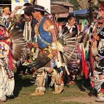
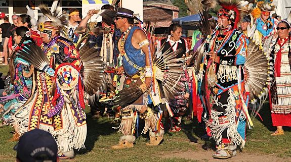

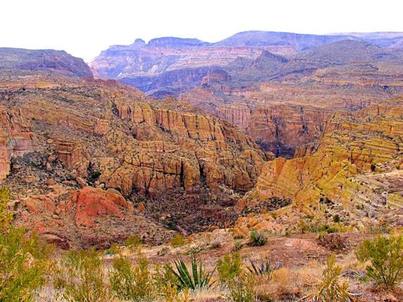
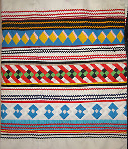
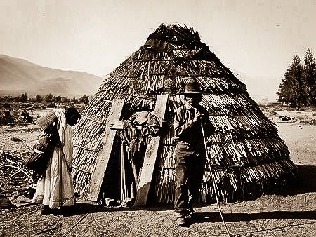 Housing: