Tohono O’odham Nation of Arizona
Last Updated: 3 years
The Tohono O’odham people live on one of the four separate pieces of land that make up the federally recognized Tohono O’odham Nation of Arizona. There are also Tohono O’odham who live in Mexico.
Official Tribal Name: Tohono O’odham Nation of Arizona
Address:
Phone: Phone Directory
Fax:
Email: Contact Form
Official Website: www.tonation-nsn.gov
Recognition Status:mFederally Recognized
Traditional Name / Traditional Meaning: Tohono O’odham (pronounced TOHN-oh AUTH-um), meaning “Desert People.”
Common Name / Meaning of Common Name: Papago Tribe. Pima name for them adopted by Spanish conquistadores. The Pima were competitors and referred to them as Ba:bawĭkoʼa, meaning “eating tepary beans.” That word was pronounced papago by the Spanish and adopted by later English speakers.
Alternate names / Alternate spellings:
Name in other languages:
Region: Southwest
State(s) Today: Arizona and northwestern Mexico
Traditional Territory:
Confederacy:
Treaties:
Reservation: Tohono O’odham Nation Reservation and Off-Reservation Trust Land
Land Area: 2.8 million acres (4,460 square miles), approximately the size of the State of Connecticut
Of the four lands bases, the largest contains more than 2.7 million acres. Boundaries begin south of Casa Grande and encompass parts of Pinal, Pima and Maricopa Counties before continuing south into Mexico.
San Xavier is the second largest land base, and contains 71,095 acres just south of the City of Tucson. Smaller parcels include San Lucy District located near the city of Gila Bend and Florence Village, which is located near the city of Florence.
Tribal Headquarters: Sells, Arizona
Time Zone: Mountain
Population at Contact:
Registered Population Today: Approximately 28,083 (as of 2007)
Tribal Enrollment Requirements:
Ph. (520) 383-8700
Genealogy Resources:
Government:
The Tohono O’odham Nation is comprised of three branches of government; Executive (which houses the Chairman and Vice-Chairman’s office), Legislative (which houses the tribal council representatives-two reps from each of the 12 districts) and Judicial (which houses the courts and judges).
Charter:
Name of Governing Body: Tribal Council
Number of Council members: 24, two from each district, plus executive officers
Dates of Constitutional amendments:
Executive Officers: Chairman, Vice Chairman over the whole tribe, plus each district is comprised of a Chairman, Vice-Chairman, Secretary and Treasurer.
Elections:
Tribal Emblem:
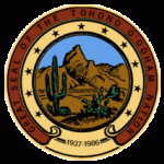
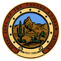 The Great Seal of the Nation consists of items that are symbolic to the Tohono O’odham. Starting from the outside of the Seal is a purple border containing the words “Great Seal of the Tohono O’odham Nation.” Inside the yellow border there are eleven stars which represent one of the eleven districts of the Tohono O’odham Nation: Pisinemo, Hickiwan, Gu Vo, Chukut Kuk, San Lucy, San Xavier, Baboquivari, Sif Oidak, Schuk Toak, Sells and Gu Achi.
At the bottom of this border are the dates 1937-1986. 1937 is the year in which the original constitution and by-laws of the Papago Tribe was approved by the United States Department of the Interior. 1986 represents the year in which the Nation adopted a new constitution and changed its name from the Papago Tribe to the Tohono O’odham Nation.
The inside picture has a view of the sacred mountain, Baboquivari Peak, home of I’itoi. Also in view is a saguaro, prickly pear and barrel cactus from which the O’odham pick fruit and have various uses from each of these cactus to cook and use for building materials.
Language Classification: Uto-Aztecan => Southern Uto-Aztecan => Pimic (Tepiman) => Pima-Papago (Upper Piman) => O’odham
Language Dialects: The O’dham language has a number of dialects.
- Cukuḍ Kuk
- Gigimai
- Hu:huʼula
- Huhuwoṣ
- Totoguañ
Number of fluent Speakers:
Dictionary:
Origins:
Debates surround the origins of the O’odham. Claims that the O’odham moved north as recently as 300 years ago compete with claims that the Hohokam, who left the Casa Grande Ruins, are their ancestors. Recent research on the Sobaipuri, the now extinct relatives of the O’odham, shows that they were present in sizable numbers in the southern Arizona river valleys in the fifteenth century.
Bands, Gens, and Clans
Related Tribes:
Traditional Allies:
The Tohono O’odham share linguistic and cultural roots with the closely related Akimel O’odham (People of the River), whose lands lie just south of present-day Phoenix, along the lower Gila River. The Sobaipuri are ancestors to both the Tohono O’odham and the Akimel O’odham, and they resided along the major rivers of southern Arizona.
Traditional Enemies:
Historically, the O’odham-speaking peoples were at odds with the nomadic Apache from the late seventeenth until the beginning of the twentieth centuries. According to their history, the Apache would raid them when they ran short on food, or hunting was bad. Conflict with European settlers encroaching on their lands resulted in the O’odham and the Apache finding common interests. The O’odham word for the Apache ‘enemy’ is ob. The relationship between the O’odham and Apache was especially strained after 92 O’odham joined the Mexicans and Anglo-Americans and killed close to 144 Apaches during the Camp Grant massacre in 1871. All but eight of the dead were women and children; 29 children were captured and sold into slavery in Mexico by the O’odham.
Considerable evidence suggests that the O’odham and Apache were friendly and engaged in exchange of goods and marriage partners before the late seventeenth century. O’odham oral history, however, suggests that intermarriages resulted from raiding between the two tribes caused the intermarriages. It was typical for women and children to be taken captive in raids, to be used as slaves by the victors. Often women married into the tribe in which they were held captive and assimilated under duress.
Ceremonies / Dances:
O’odham musical and dance activities lack “grand ritual paraphernalia that call for attention” and grand ceremonies such as pow-wows. Instead, they wear muted white clay. O’odham songs are accompanied by hard wood rasps and drumming on overturned baskets, both of which lack resonance and are “swallowed by the desert floor.” Dancing features skipping and shuffling quietly in bare feet on dry dirt, the dust raised being believed to rise to atmosphere and assist in forming rain clouds.
Modern Day Events & Tourism:
Every February the Nation holds the annual Sells Rodeo and Parade in its capital. The rodeo has been an annual event since being founded in 1938. It celebrates traditional frontier skills of riding and managing cattle.
Legends / Oral Stories:
Art & Crafts:
Animals:
Clothing:
Housing:
Subsistance:
The O’odham were a settled agricultural people who raised crops. The original O’odham diet consisted of regionally available wild game, insects, and plants. Through foraging, O’odham ate a variety of regional plants, such as ironwood seed, honey mesquite, hog potato, and organ-pipe cactus fruit. While the Southwestern United States did not have an ideal climate for cultivating crops, the O’odham cultivated crops of white tepary beans, Papago peas, and Spanish watermelons. They hunted Pronghorn antelope, gathered hornworm larvae, and trapped pack rats for sources of meat. Preparation of foods included steaming plants in pits and roasting meat on an open fire.
Since the 1960s, many tribal members adopted “Western” diets that were not healthy for them, suffering obesity, and a rise in type 2 diabetes. Half to three-quarters of all adults are diagnosed with the disease, and about a third of the tribe’s adults require regular medical treatment.
Religion & Spiritual Beliefs:
The San Xavier District is the location of a major tourist attraction near Tucson, Mission San Xavier del Bac, the “White Dove of the Desert,” founded in 1700 by the Jesuit missionary and explorer Eusebio Kino. Both the first and current church building were constructed by the Tohono O’odham. The second building was constructed also by Franciscan priests during a period extending from 1783 to 1797. The oldest European building in the current Arizona, it is considered a premier example of Spanish colonial design. It is one of many missions built in the southwest by the Spanish on their then-northern frontier.
The beauty of the mission often leads tourists to assume that the desert people had embraced the Catholicism of the Spanish conquistadors. Tohono O’odham villages resisted change for hundreds of years. During the 1660s and again in the 1750s, two major rebellions rivaled in scale the 1680 Pueblo Rebellion. Their armed resistance prevented the Spanish from increasing their incursions into the lands of Pimería Alta. The Spanish retreated to what they called Pimería Baja. As a result, the desert people preserved their traditions largely intact for generations.
It was not until more numerous Americans of Anglo-European ancestry began moving into the Arizona territory that the outsiders began to oppress the people’s traditional ways. Major farmers established the cotton industry, initially employing many O’odham as agricultural workers. Under U.S. Federal Indian policy from the late 19th century, the government required native children to attend Indian boarding schools, where they were forced to use English, practice Christianity, and give up much of their culture in an attempt to promote assimilation into the American mainstream.
The Tohono O’odham have retained many traditions into the twenty-first century, and still speak their language. Since the late 20th century, however, American mass culture has penetrated and in some cases eroded O’odham traditions as their children adopt new trends in technology and other practices.
Burial Customs:
Wedding Customs
Tribal College: Tohono O’odham Community College
Radio:
Newspapers:
O’odham Chiefs & Famous People:
Catastrophic Events:
Tribe History:
In the News:
Further Reading:
Tonawanda Band of Seneca
Last Updated: 3 years
The Tonawanda Band of Seneca are a federally recognized band of Seneca Indians residing in the state of New York. They split from the main body of Seneca to form their own Band over disagreements with the terms of 1838 Treaty of Buffalo Creek.
Official Tribal Name: Tonawanda Band of Seneca
Address: 7027 Meadville Road, Basom, NY 14013
Phone: (716) 542-4244
Fax: (716) 542-4008
Email:
Official Website:
Recognition Status: Federally Recognized
Traditional Name / Traditional Meaning:
Common Name / Meaning of Common Name:
Alternate names / Alternate spellings:
Formerly known as the Tonawanda Band of Seneca Indians of New York.
Name in other languages:
Region: Eastern => Iroquois => Seneca
State(s) Today: New York, Oklahoma
Traditional Territory:
Confederacy: Iroquois Confederacy, Seneca Tribe
Treaties:
1838 Treaty of Buffalo Creek
1857 Treaty with the Seneca, Tonawanda Band
Reservation: Tonawanda Reservation
Other Seneca Reservations: Allegany Reservation, Cattaraugus Reservation, Oil Springs Reservation
Land Area:
Tribal Headquarters:
Time Zone: Eastern
Population at Contact:
Registered Population Today: About 10,000 Seneca live in the United States and Canada, primarily on reservations in western New York, with others living in Oklahoma and near Brantford, Ontario.
Tribal Enrollment Requirements:
Genealogy Resources:
Government:
Charter: The Tonawanda Band of Seneca still govern under their traditional tribal system of hereditary Sachems appointed by Clan Mothers. Sachems generally govern for life, unless they do something that causes a Clan Mother to remove them. There is one Sachem and one Clan Mother from each of the eight clans.
Name of Governing Body: Council of Chiefs
Language Classification: Iroquoian => Northern Iroquoian => Seneca–Cayuga => Seneca
Language Dialects:
Number of fluent Speakers: The language is severely endangered, with fewer than 50 fluent speakers. In 1998, the Seneca Faithkeepers School was founded as a five-day-a week school to teach K-5 children the Seneca language and traditions. A revitalization program is in progress.
In 2013, the first public sports event in modern times was held in the Seneca language, when middle school students served as announcers for a lacrosse match.
Dictionary:
Origins:
Bands, Gens, and Clans
The Tonawanda Band consists of eight clans: the Snipe, the Heron, the Hawk, the Deer, the Wolf, the Beaver, the Bear, and the Turtle. Each clan appoints a clan mother, who in turn appoints an individual to serve as Chief [from hereditary maternal lines]. The clan mother retains the power to remove a Chief and, in consultation with members of the clan, provides recommendations to the Chief on matters of tribal government. The clan mothers cannot disregard the views of the clan, nor can the Chiefs disregard the recommendations of the clan mothers.
Related Tribes: Seneca, Oneida, Mohawk, Onondaga, Cayuga, and Tuscarora make up the Iroquois Confederacy.
Traditional Allies:
Member tribes of the Haudenosaunee (Iroquois) Confederacy
Traditional Enemies:
Beginning in 1609, the Iroquois League engaged in a decades-long series of wars, the so-called Beaver Wars, against the French, their Huron allies, and other neighboring tribes, including the Petun, Erie, and Susquehannock.
Ceremonies / Dances:
Modern Day Events & Tourism:
Seneca Legends / Oral Stories
Art & Crafts:
Animals:
Clothing:
Housing:
Subsistance:
Social Organization:
The Seneca have a matrilineal kinship system; hereditary chiefs are selected through the maternal line by clan mothers. Under their traditional government, hereditary chiefs typically serve for life. They govern by a consensus of leaders of the clans, which formed the basis of the band. Seneca chiefs are called sachems.
Children were considered born into the mother’s clan and took their status from her people. Descent and property are passed through the maternal line.
Religion & Spiritual Beliefs:
Burial Customs:
Wedding Customs
Radio:
Although Seneca-owned radio station WGWE (whose call sign derives from “gwe,” a Seneca word roughly translating to “what’s up?”) broadcasts primarily in English, it features a daily “Seneca Word of the Day” feature prior to each noon newscast, broadcasts a limited amount of Seneca-language music, and makes occasional use of the Seneca language in its broadcasts in a general effort to increase awareness of the Seneca language by the general public.
Newspapers: A newsletter, Gae:wanöhge′! Seneca Language Newsletter, is available online.
Seneca Chiefs & Famous People
Catastrophic Events: Smallpox epidemics.
Tribe History:
The Beaver Wars
In 1687, Jacques-René de Brisay de Denonville, Marquis de Denonville, Governor of New France from 1685 to 1689, set out for Fort Frontenac with a well-organized force. They met with 50 hereditary sachems from the Onondaga council fire, who came under a flag of truce. Denonville recaptured the fort for New France and seized, chained, and shipped the 50 Iroquois chiefs to Marseilles, France, to be used as galley slaves.
He ravaged the land of the Seneca, landing a French armada at Irondequoit Bay, striking straight into the seat of Seneca power, and destroying many of its villages. Fleeing before the attack, the Seneca moved farther west, east and south down the Susquehanna River. Although great damage was done to the Seneca homeland, the Senecas’ military might was not appreciably weakened. The Confederacy and the Seneca developed an alliance with the English who were settling in the east. The destruction of the Seneca land infuriated the members of the Iroquois Confederacy. On August 4, 1689, they retaliated by burning to the ground Lachine, a small town adjacent to Montreal. Fifteen hundred Iroquois warriors had been harassing Montreal defenses for many months prior to that.
They finally exhausted and defeated Denonville and his forces. His tenure was followed by the return of Frontenac, who succeeded Denonville as Governor for the next nine years (1689–1698). Frontenac had been arranging a new plan of attack to lessen the effects of the Iroquois in North America. Realizing the danger of continuing to hold the sachems, he located the 13 surviving leaders of the 50 originally taken and returned with them to New France in October 1689.
In 1696, Frontenac decided to take the field against the Iroquois, although at this time he was seventy-six years of age. On July 6, he left Lachine at the head of a considerable force and traveled to the village of the Onondaga, where he arrived a month later. With support from the French, the Algonquian nations drove the Iroquois out of the territories north of Lake Erie and west of present-day Cleveland, Ohio, regions which they had conquered during the Beaver Wars. In the meantime, the Iroquois had abandoned their villages. As pursuit was impracticable, the French army commenced its return march on August 10. Under Frontenac’s leadership, the Canadian militia became increasingly adept at guerrilla warfare, taking the war into Iroquois territory and attacking a number of English settlements. The Iroquois never threatened the French colony again.
King William’ War
During King William’s War (North American part of the War of the Grand Alliance), the Iroquois were allied with the English. In July 1701, they concluded the “Nanfan Treaty”, deeding the English a large tract north of the Ohio River. The Iroquois claimed to have conquered this territory 80 years earlier. France did not recognize the validity of the treaty, as it had settlements in the territory at that time and the English had virtually none. Meanwhile, the Iroquois were negotiating peace with the French; together they signed the Great Peace of Montreal that same year.
Treaty of Buffalo Creek
On 15 January 1838, the United States government entered into the Treaty of Buffalo Creek, with nine Indian nations of New York, including the Seneca Nation. The treaty was part of the US’ Indian Removal program, by which they persuaded or forced Native American peoples from eastern states to move west of the Mississippi River to lands reserved for them in the Kansas Territory. The US wanted the Seneca and other New York tribes to move there to free up lands in New York for European-American development. Under the treaty, the US acknowledged that the Ogden Land Company was going to buy the four remaining Seneca reservations in New York. The proceeds would be used to pay for the nation’s removal to Kansas Territory.
In 1842, the US modified the 1838 treaty by the “Treaty with the Seneca of 1842”. The new treaty reflected that the Ogden Land Company had purchased only two reservations, including the Tonawanda Reservation. The Seneca retained the Cattaraugus and Allegany reservations. At this time, the Seneca of the Tonawanda Reservation protested they had not been consulted on either treaty, nor had their chiefs signed either treaty. They refused to leave their reservation.
In 1848, the Seneca Indians of the Cattaraugus and Allegany reservations held a constitutional convention. They adopted a new form of constitution and government modeled on that of the United States, including tribal elections of chiefs. This was not their traditional practice, in which chiefs were selected by clan mothers and ruled for life (unless one displeased his clan’s mother.)
The Tonawanda Band did not want to make such changes, and seceded from the main Seneca nation. They reorganized and re-established their traditional government with a Council of chiefs from each of their eight clans. In 1857, under the “Treaty with the Seneca, Tonawanda Band”, the Tonawanda Band of Seneca Indians secured federal recognition as an independent Indian nation. With their share of proceeds from the earlier land sale, they bought back most of the Tonawanda Reservation. They reorganized under a traditional government, where chiefs typically served for life. This traditional form governed by a consensus of leaders of the clans, which formed the basis of the band.
In the News:
Further Reading:
Tonkawa Tribe of Indians of Oklahoma
Last Updated: 5 years
Due to loyalty of the Tonkawa Indians to the Confederacy during the American Civil War, pro-Union tribes fought against them in 1862 in a battle known as the Tonkawa Massacre, killing 133 of the remaining 309 Tonkawa. The surviving Tonkawa were removed to Indian Territory near present-day Kay County, Oklahoma, and are now a federally recognized indian tribe.
Official Tribal Name: Tonkawa Tribe of Indians of Oklahoma
Address:
Phone:
Fax:
Email:
Official Website:
Recognition Status: Federally Recognized
Traditional Name / Traditional Meaning
Tickanwa•tic (meaning “real people”).
Common Name / Meaning:
The name Tonkawa is derived from the Waco tribal word, Tonkaweya, meaning “they all stay together.”
Alternate names / Alternate spellings:
Name in other languages:
Region: Plains Culture Region
State(s) Today: Oklahoma and Texas
Traditional Territory:
Confederacy:
Treaties:
Reservations:
Land Area:
Tribal Headquarters:
Time Zone:
Population at Contact:
In the 15th century, the Tonkawa Tribe probably numbered around 5,000 with their numbers diminishing to around 1,600 by the late 17th century due to disease and warring with other tribes, most notably the Apache. By 1921, only 34 tribal members remained.
Registered Population Today:
Today, they number about 600.
Tribal Enrollment Requirements:
Genealogy Resources:
Government:
Charter:
Name of Governing Body:
Number of Council members:
Dates of Constitutional amendments:
Number of Executive Officers:
Elections:
Language Classification:
The Tonkawa once spoke the now-extinct Tonkawa language, believed to have been a language isolate not related to any other indigenous tongues.
Origins:
Bands, Gens, and Clans
The Tonkawa were actually made up of various bands, many of which are no longer known by name. The following groups are generally counted as Tonkawa:
- Awash
- Choyopan
- Haiwal
- Hatchuknni
- Kwesh
- Nilhailai
- Ninchopen
- Pakani
- Pakhalateh
- Sanukh
- Talpkweyu
- Titskanwaticha
Related Tribes:
Traditional Allies:
Traditional Enemies:
Ceremonies / Dances:
Modern Day Events & Tourism:
The annual Tonkawa Powwow is held annually on the last weekend in June to commemorate the end of the tribe’s own Trail of Tears when the tribe was forcefully removed and relocated from its traditional lands to present-day Oklahoma.
Legends / Oral Stories:
Art & Crafts:
Animals:
Clothing:
Housing:
Subsistance:
Economy Today:
The Tonkawa Tribe operates a number of businesses which have an annual economic impact of over ten million dollars. Along with several smoke shops, the tribe runs both the Tonkawa Indian Casino located in Tonkawa, Oklahoma, and the Native Lights Casino in Newkirk, Oklahoma.
Religion & Spiritual Beliefs
Burial Customs:
Wedding Customs
Radio:
Newspapers:
Tonkawa Chiefs & Famous People:
Catastrophic Events:
Tribe History:
Scholars used to think the Tonkawa originated in central Texas. Recent research, however, has shown that the tribe inhabited northeastern Oklahoma in 1601.By 1700, the stronger and more aggressive Apache had pushed the Tonkawa south to the Red River which forms the border between current-day Oklahoma and Texas.
In the 1740s some Tonkawa were involved with the Yojuanes and others as settlers in the San Gabriel Missions of Texas along the San Gabriel River.
In 1758 the Tonkawa along with allied Bidais, Caddos, Wichitas, Comanches and Yojuanes went to attack the Lipan Apache in the vicinity of Mission Santa Cruz de San Sabá, which they destroyed.
The tribe continued their southern migration into Texas and northern Mexico where they allied with the Lipan Apache.
In 1824, the Tonkawa entered into a treaty with Stephen F. Austin (the Father of Republic of Texas), pledging their support against the Comanche Tribe. In 1840 at the Battle of Plum Creek and again in 1858 at the Battle of Little Robe Creek, the Tonkawa fought alongside the Texas Rangers against the Comanche.
At least as late as 1862, the Tonkawa practiced cannibalism, which served as a pretext for the Comanche and other tribes to attack the Tonkawa, despite the other tribes’ true agenda, which was most often military and political.
Due to Tonkawa loyalty to the Confederacy during the American Civil War, pro-Union tribes fought against them in 1862 in what is now known as the Tonkawa Massacre killing 133 of the remaining 309 Tonkawa. The surviving Tonkawa were removed to Indian Territory and were resettled in the area of present-day Kay County, Oklahoma.
The Tonkawa fought alongside the 4th US Cavalry in its battles with the Comanche during both the 1871 Battle of Blanco Canyon and the 1872 Battle of the North Fork of the Red River.
In October 1884, the federal government relocated more than 90 Tonkawa from their lands on the Brazos River Reservation in Texas to lands north of Texas referred to as the Indian Territory. During the train journey which began in Cisco, Texas, a Tonkawa baby was born en route and was given the name, “Railroad Cisco.”
On October 21, 1891, the tribe signed an agreement with the Cherokee Commission to accept individual allotments of land.
In the News:
Further Reading:
Tonto Apache Tribe of Arizona

Last Updated: 3 years
The Tonto Apache tribe are a Western Apache tribe located in Arizona’s Rim Country. The elders of the Tonto Apache tribe are doing their very best to sustain both their language and culture by passing old customs and beliefs down to their tribe’s younger members.
Official Tribal Name: Tonto Apache Tribe of Arizona
Address:
Phone:
Fax:
Email:
Official Website:
Recognition Status: Federally Recognized
Traditional Name / Traditional Meaning: Tinde, meaning grey ones.
Common Name / Meaning of Common Name:
Tonto is a Spanish word meaning “crazy or foolish,” and was given to these Native American settlers by the other Apaches because of their willingness to live near the white man.
Alternate names / Alternate spellings:
Name in other languages:
Region: Southwest
State(s) Today: Arizona
Traditional Territory:
The earliest inhabitants of Arizona Rim Country were a people known as the Mogollons, members of a Native American tribe that moved into Arizona from New Mexico about 300 B.C. Living in loosely connected villages, they made clothing from fur and feathers, hunted by bow and arrow, and grew corn, squash, and beans.
By 1500 A.D., the Mogollon culture had been absorbed by two tribes new to the area, the Hohokams from the south and the Pueblos from the east.
It wasn’t long after the Mogollons faded from the scene that the Apaches arrived. An athletic people more interested in hunting than gardening, they lived wherever their bows and arrows led them. The Apaches were here when the Spanish Conquistadors passed through, and they were here when Union soldiers arrived to secure the region from Confederate intrusion. In fact, the soldiers dubbed this area “Apacheria”.
Once the Civil War ended, these soldiers turned their attention to making the Rim area safe for miners and ranchers. A major campaign was launched including soldiers from many forts, camps and posts. Troops radiated out from Tonto Basin in a thorough search for “hostile” Indians. With superior firepower and overwhelming numbers of mounted cavalry, they easily defeated the Apaches who were forcibly herded to reservations in the south.
With the capture of Geronimo in 1886, the guards were removed from the San Carlos reservation. Reduced from thousands, the 50 or so Tonto Apaches began the long walk back to their Arizona Rim Country home. More peaceful than other Apache tribes, they settled once again in the area and began farming. One of their chiefs recalled that in the early days in Payson many cattails grew in the rivers and streams. The returning Apaches used them for medicine, for food, and for religious ceremonies.
Confederacy: Apache Nations
Treaties:
Reservation: Tonto Apache Reservation
Land Area:
Tribal Headquarters:
Time Zone:
Population at Contact:
Registered Population Today: There are about 100 Tonto Apache today.
Tribal Enrollment Requirements:
Genealogy Resources:
Government:
The Tonto Apache Tribe is a federally recognized tribe. They have established tribal governments under the Indian Reorganization Act of 1934 (25 U.S.C. 461-279), also known as the Wheeler-Howard Act, and they successfully withstood attempts by the U.S. government to implement its policy during the 1950s of terminating Indian tribes.
They were granted U.S. citizenship under the Indian Citizenship Act of 1924. They did not legally acquire the right to practice their Native religion until the passage of the American Indian Religious Freedom Act of 1978 (42 U.S.C. 1996).
Other important rights, and some attributes of sovereignty, have been restored to them by such legislation as the Indian Civil Rights Act of 1966 (25 U.S.C. 1301), the Indian Self-Determination and Educational Assistance Act of 1975 (25 U.S.C. 451a), and the Indian Child Welfare Act of 1978 (25 U.S.C. 1901).
The Wheeler-Howard Act, however, while allowing some measure of self-determination in their affairs, has caused problems for virtually every Indian nation in the United States, and the Apaches are no exception. The act subverts traditional Native forms of government and imposes upon Native people an alien system, which is something of a mix of American corporate and governmental structures.
Invariably, the most traditional people in each tribe have had little to say about their own affairs, as the most heavily acculturated and educated mixed-blood factions have dominated tribal affairs in these foreign imposed systems.
Frequently these tribal governments have been little more than convenient shams to facilitate access to tribal mineral and timber resources in arrangements that benefit everyone but the Native people, whose resources are exploited. The situations and experiences differ markedly from tribe to tribe in this regard, but it is a problem that is, in some measure, shared by all.
Charter:
Name of Governing Body:
Number of Council members:
Dates of Constitutional amendments:
Number of Executive Officers:
Elections:
Language Classification:
Language Dialects:
Number of fluent Speakers:
Dictionary:
Origins:
Apache Bands and Clans
Social Organization:
For the Apaches, the family is the primary unit of political and cultural life. Apaches have never been a unified nation politically, and individual Apache tribes, until very recently, have never had a centralized government, traditional or otherwise.
Extended family groups acted entirely independently of one another. At intervals during the year a number of these family groups, related by dialect, custom, inter-marriage, and geographical proximity, might come together, as conditions and circumstances might warrant.
In the aggregate, these groups might be identifiable as a tribal division, but they almost never acted together as a tribal division or as a nation—not even when faced with the overwhelming threat of the Comanche migration into their Southern Plains territory.
The existence of these many different, independent, extended family groups of Apaches made it impossible for the Spanish, the Mexicans, or the Americans to treat with the Apache Nation as a whole. Each individual group had to be treated with separately, an undertaking that proved difficult for each colonizer who attempted to establish authority within the Apache homeland.
Related Tribes
Traditional Allies:
Traditional Enemies:
Ceremonies / Dances:
Modern Day Events & Tourism:
The Tonto Apache and Yavapai-Apache perform public dances each year at the Coconino Center for the Arts, Flagstaff, Arizona, on the Fourth of July.
Apache Museums:
Albuquerque Museum in Albuquerque, New Mexico
American Research Museum in Santa Fe, New Mexico
Art Center in Roswell, New Mexico
Bacone College Museum in Muskogee, Oklahoma
Black Water Draw Museum in Portales, New Mexico
Coronado Monument in Bernalillo, New Mexico
Ethnology Museum in Santa Fe, NM
Fine Arts Museum in Santa Fe, NM
Gilcrease Museum in Tulsa, Oklahoma
Great Plains Museum in Lawton, Oklahoma
Hall of the Modern Indian in Santa Fe, NM
Heard Museum of Anthropology in Phoenix, Arizona
Indian Hall of Fame in Anadarko, Oklahoma
Institute of American Indian Arts in Santa Fe, NM
Maxwell Museum in Albuquerque, NM
Milicent Rogers Museum in Taos, New Mexico
Northern Arizona Museum in Flagstaff, AZ
Oklahoma Historical Society Museum in Oklahoma City, OK
Philbrook Museum in Tulsa, OK
Southern Plains Indian Museum in Anadarko, OK
State Museum of Arizona in Tempe, AZ
Stovall Museum at the University of Oklahoma in Norman, OK
San Carlos Apache Cultural Center in Peridot, Arizona.
Tonto Apache Legends / Oral Stories:
Art & Crafts:
Animals:
Clothing:
Housing:
Subsistance:
Religion Today:
Religion & Spiritual Beliefs:
The Apache are devoutly religious and pray on many occasions and in various ways. Recreated in the human form, Apache spirits are supposed to dwell in a land of peace and plenty, where there is neither disease or death. They also regarded coyotes, insects, and birds as having been human beings.
Apache religion is based on a complex mythology and features numerous deities. The sun is the greatest source of power. Culture heroes, like White-Painted Woman and her son, Child of the Water, also figure highly, as do protective mountain spirits (ga’an). The latter are represented as masked dancers (probably evidence of Pueblo influence) in certain ceremonies, such as the four-day girls’ puberty rite. (The boys’ puberty rite centered on raiding and warfare.)
Supernatural power is both the goal and the medium of most Apache ceremonialism. Shamans facilitate the acquisition of power, which can be used in the service of war, luck, rainmaking, or life-cycle events. Power could be evil as well as good, however, and witchcraft, as well as incest, was an unpardonable offense. Finally, Apaches believe that since other living things were once people, we are merely following in the footsteps of those who have gone before.
Burial Customs:
Wedding Customs:
Apache women were chaste before marriage. Apache culture is matrilineal. Once married, the man went with the wife’s extended family, where she is surrounded by her relatives.
Spouse abuse is practically unknown in such a system. Divorce was unusual though relatively easy to obtain. Should the marriage not endure, child custody quarrels were also unknown: the children remained with the wife’s extended family.
Marital harmony is encouraged by a custom forbidding the wife’s mother to speak to, or even be in the presence of, her son-in-law. No such stricture applies to the wife’s grandmother, who frequently is a powerful presence in family life. The mother’s brother also played an important role in the raising of his nephews and nieces.
Although actual marriage ceremonies were brief or nonexistent, the people practiced a number of formal preliminary rituals, designed to strengthen the idea that a man owed deep allegiance to his future wife’s family.
Radio:
Newspapers:
Tonto Apache Chiefs and Famous People
Catastrophic Events:
Tribe History:
In the News:
Further Reading:
Torres Martinez Desert Cahuilla Indians
Last Updated: 3 years
The Torres-Martinez Desert Cahuilla Indians are a federally recognized tribe of Cahuilla and Chemehuevi Indians. They are one of the tribes also known as Mission Indians.
Official Tribal Name: Torres Martinez Desert Cahuilla Indians
Address: 66725 Martinez Rd, P.O. Box 1160, Thermal, CA 92274
Phone: 619-397-8144
Fax: 760-397-3925
Email:webmaster@torresmartinez.org
Official Website: www.torresmartinez.org
Recognition Status: Federally Recognized
Traditional Name / Traditional Meaning:
Mau-Wal-Mah Su-Kutt Menyil, meaning “among the palms, deer moon.”
Common Name / Meaning of Common Name:
Cahuilla has been interpreted to mean “the master,” “the powerful one,” or “the one who rules.”
Alternate names / Alternate spellings:
Formerly the Torres-Martinez Band of Cahuilla Mission Indians of California
Name in other languages:
Region: California
State(s) Today: California
The traditional Cahuilla territory was near the geographic center of Southern California. It was bounded to the north by the San Bernardino Mountains, to the south by Borrego Springs and the Chocolate Mountains, to the east by the Colorado Desert, and to the west by the San Jacinto Plain and the eastern slopes of the Palomar Mountains.
Confederacy: California Mission Indians, Cahuilla Tribes
Treaties:
Reservation: Torres-Martinez Reservation
The Torres-Martinez Indian Reservation is a federal reservation in Imperial and Riverside Counties, California. Established in 1876, it was named for the village of Toro and the Martinez Indian Agency.
Land Area: 24,024 acres (9,722 ha)
Tribal Headquarters: Thermal, California
Time Zone: Pacific
Population at Contact:
Prior to European contact, when they occupied the better part of Riverside County and the northern portion of San Diego County, the collective Cahuilla bands numbered from 6,000 to 10,000 people. Some people estimate the population as high as 15,000 Cahuilla people, collectiively. There were once 22 bands of Cahuilla.
Registered Population Today: As of 2010, there were 5,594 enrolled members.
Tribal Enrollment Requirements:
Genealogy Resources:
Government:
Charter: Constitution adopted November 9, 1997
Name of Governing Body: Tribal Council
Number of Council members: 2 council members, plus executive officers.
Dates of Constitutional amendments: Amended November 20, 2004
Executive Officers: Chairman, Vice-Chairmain, Secretary, Treasurer
Elections:
Language Classification:
Uto-Aztecan -> Northern Uto-Aztecan -> Takic -> Cupan -> Cahuilla–Cupeno -> Cahuilla
Anthropological and archeological evidence suggests that the ancestral homeland of the Uto-Aztecan peoples was in the present day state of Nevada. Like all of the desert Tribes, the Cabazon share a common ancestry to the Uto-Aztecan family, Cahuilla linguistic group.
Cahuilla is a member of the Takic branch of the Uto-Aztecan language family. Within Takic, it is most closely related to Cupeño, Juaneño, and Luiseño, and more distantly to Gabrielino, Kitanemuk, Serrano, and Tataviam. The other Uto-Aztecan languages of California are Tubatulabal and the Numic languages (Chemehuevi-Southern Paiute-Ute, Comanche, Kawaiisu, Mono, Northern Paiute, Panamint, and Shoshone).
Language Dialects:
Three Cahuilla dialects are known to have existed, referred to as Desert Cahuilla, Mountain Cahuilla, and Pass Cahuilla. The Torres Martinez Band spoke the Desert Cahuilla dialect.
Number of fluent Speakers:
A 1990 census revealed 35 speakers in an ethnic population of 800. Cahuilla is nearly extinct, since most speakers are middle-aged or older.
The Cahuilla language was traditionally spoken in the San Gorgonio Pass (around Banning), to the east in the Coachella Valley to the vicinity of the Salton Sea, and to the south on the western slopes of the San Jacinto and Santa Rosa Mountains. In pre-contact times, there were around 2500 speakers of Cahuilla (Kroeber 1925). Today, there are half a dozen first-language speakers (Golla 2011).
Dictionary:
Origins:
Bands, Gens, and Clans
The Cahuilla can be generally divided into three groups based on the geographical region in which they lived: Desert Cahuilla, Mountain Cahuilla and Western (San Gorgonio Pass) Cahuilla. All three spoke the Cahuilla language, had similar lifestyles and practiced the same traditions. There are nine Cahuilla Indian nations living on ten indian reservations.
The Cahuilla People were divided into two moieties: Wildcat and Coyote.
Related Tribes:
Augustine Band of Cahuilla Indians, Cabazon Band of Mission Indians, Agua Caliente Band of Cahuilla Indians, Morongo Band of Mission Indians, Cahuilla Band of Mission Indians, Ramona Band of Cahuilla Indians, Santa Rosa Band of Mission Indians and Los Coyotes Band of Cahuilla Indians. There are also some Los Coyotes in the Los Coyotes Band of Cahuilla and Cupeno Indians.
Traditional Allies:
Traditional Enemies:
Ceremonies / Dances:
Modern Day Events & Tourism:
The tribe owns and operates the Red Earth Casino in Salton City, California. The 10,000 square foot, modest Red Earth Casino opened March 31, 2007 with 349 slot machines, six table games, and 180 employees making them the 10th Tribe to join the Inland gaming world.
The Torres-Martinez Historical District consists of three buildings believed to be the oldest standing Indian Agency buildings in California and was placed on the National Registry of Historical Places in 1973 and is a California Point of Historical Interest.
Cahuilla Legends
Art & Crafts:
Animals:
Clothing:
Housing:
Subsistance:
Religion & Spiritual Beliefs:
Burial Customs:
The Torres Martinez Desert Cahuilla have a small cemetery on Martinez Road in Thermal that has 48 interments.
Wedding Customs:
Radio:
Newspapers:
Catastrophic Events:
Approximately 12,000 acres of the Reservation were flooded by the Colorado River when the Salton Sea was formed in 1905-1907 and are still submerged.
Tribe History:
In the News:
Torres Martinez tribe to grow medical pot on tribal land
Articles about the Torres Martinez tribe in the L.A. Times
Further Reading:
Tule River Indian Tribe of the Tule River Reservation
Last Updated: 3 years
The Tule River Indian Tribe of the Tule River Reservation is a federally recognized tribe made up of Yokuts, about 200 Yowlumne, Wukchumnis band of Yokuts, Western Mono and Tübatulabal people. The nearest town to the reservation is East Porterville and/or Springville, California.
Official Tribal Name: Tule River Indian Tribe of the Tule River Reservation
Address: 340 N. Reservation Road, BIA Rd 70, Porterville, CA 93257
Phone: (559) 781-4271 ext 1000
Fax: (559)781-4610
Email: email@tulerivertribe-nsn.gov
Official Website: www.tulerivertribe-nsn.gov
Recognition Status: Federally Recognized
Traditional Name / Traditional Meaning
Common Name / Meaning of Common Name:
Alternate names / Alternate spellings:
Yokuts, Yowlumne, Wukchumnis band of Yokuts, Western Mono, Tübatulabal, Koyeti, Yaudanchi, Chunuts, Yokodo, Kaweah, Wukchumne, Punkalachi, Kumachisi.
Name in other languages:
Region: California
State(s) Today: California
Traditional Territory:
The original inhabitants of the San Joaquin Valley were the Yokut-speaking tribes- about 50 dialect groups occupying the territory along the rivers and creeks flowing from the Sierras and around Tulare Lake.
Confederacy: Yocuts
Treaties:
The Unratified Treaties of 1851
Reservation: Tule River Reservation and Off-Reservation Trust Land
The Tule River Reservation was established in 1873 by an US Executive Order in the foothills of the Sierra Nevada Mountains. It is south of Fresno and north of Bakersfield. It was established as a homeland for Tule River, Kings River, Owens River, Monache Cajon and other scattered bands of Indians.
Land Area: 55,356 acres (224.02 km2). Enlarged by Executive Order on October 3, 1873 to 91,837 acres. On August 3, 1878, by Executive Order of President Rutherford B. Hayes, the reservation lands were reverted back to the size of the first Executive Order of President Grant.
Tribal Headquarters: Porterville, CA
Time Zone: Pacific
Population at Contact: In 1864, the population consisted of 450 Tule River Indians and 350 Owens River Indians who were relocated there from Fort Tejon. Traditionally, 60 Yokut tribes lived in south central California to the east of Porterville.
Registered Population Today: Tribal enrollment is approximately 1,794.
Tribal Enrollment Requirements:
Genealogy Resources:
Government:
Charter: The main piece of governing legislation is the Tule River Indian Tribe Constitution and Bylaws approved January 15, 1936.
Name of Governing Body: Tribal Council
Number of Council members: The Tule River Tribal Council Consists of nine council members. Each member is voted for by the Tule River Tribal Members. The elected officials then decide who among them will hold the executive offices.
Dates of Constitutional amendments: 1974
Executive Officers: Chairman, Vice Chairman, Secretary, and Treasurer
Elections:
Language Classification:
Language Dialects: Over 50 dialects of primarily the Yocuts language were originally spoken on this reservation.
Number of fluent Speakers:
Dictionary:
Origins:
Bands, Gens, and Clans
Related Tribes:
Traditional Allies:
In 1917, some Kitanemuk people lived on the reservation, as well.
Traditional Enemies:
Ceremonies / Dances:
Modern Day Events & Tourism:
Tule River Legends / Oral Stories:
Painted Rock is a formation located next to the Tule River, on the Reservation. Many of the stories told by the elders of the Tule River Indian reservation have been recorded on this rock.
Art & Crafts:
Baskets were traditionally used for cooking, gathering and storage. They were woven from materials such as pine needles, willow, and sour berry. Basket weaving is a revived art amoung the Tule River Indian Tribe.
Animals:
Clothing:
Housing:
Subsistance:
Economy Today:
Eagle Mountain Casino
Eagle Mountain Casino is the only full service casino in Tulare County offering local residents gaming 24 hours a day. With over 1400 of the newest slot machines, 12 table games, live poker tournaments, the River Steakhouse and many other dining options.
Tule River Aero Industries
Tule River Aero-Industries is a 20,000-square-foot (1,900 m2) facility that is an FAA major engine and airframe repair station equipped with a full line aircraft sales department. TRAI is a unique blend of entrepreneurship, aviation, public and private cooperation with Native American culture. Having service expertise in both general and business aviation aircraft.
Eagle Feather Trading Post
Eagle Feather Trading Post is one of the largest convenience stores in Tulare County, located on Hwy 190 just above Lake Success. The store has a full line of groceries; cold beer, wine, fishing and bait supplies. They carry National and Native brands of cigarettes and tobacco products. Gas, diesel, and propane are the cheapest price available. Subway sandwich shop is located within the store. For the RVers they also have a free dump station and a pet run. Plenty of parking is available for customers, with security on site 24 hours a day.
Religion & Spiritual Beliefs:
Burial Customs:
Wedding Customs
Radio:
Newspapers:
Famous Yocuts
Catastrophic Events:
By the end of the 19th century, their population was reduced by 75% due to warfare and high fatalities from European diseases. The ravages of disease were compounded by injustice and starvation. In 1860 the Indian population in California was only 20% of what it had been ten years earlier.
Tribe History:
Following the Tule River Indian War of 1856, a farm attached to the Tejon Agency was established in 1858 at the base of the foothills, near the present town of Porterville. The farm was established on 1,280 acres (5.2 km2) on the South Fork of Tule River. In 1860, Thomas Madden, an Indian service employee, gained personal title to the Tule River Farm, by using state school warrants. The federal government rented the Tule River Farm and paid Madden $1,000 per year.
In 1864, the Tule River Farm became the Tule River Reservation, one of five Indian reservations authorized by Congress.
Tribes represented on the original reservation were the Koyeti, Yaudanchi, Chunuts, Yokodo, Kaweah, Wukchumne, Punkalachi, Kumachisi, Yowlumne, according to historical records.
The total acreage of the first reservation was 1,280 acres, and in 1864 the population there was 800 Indian people
When the United States defeated the Native Americans in the Owens Valley Indian War of 1863, they were removed to the reservation, whose population nearly doubled.
Tule River Indian War of 1856
In the News:
Further Reading:
Tulalip Tribes of Washington
Last Updated: 3 years
The Tulalip Tribes of Washington is a federally recognized tribe of South and Central Coast Salish peoples of the Pacific Northwest Coast. They include Duwamish, Samish, Skagit, Snohomish, Snoqualmie, Stillaguamish and Suiattle peoples.
Official Tribal Name: Tulalip Tribes of Washington
Address: 6406 Marine Dr, Tulalip, WA 98271
Phone: 1-800-869-8287
Fax:
Email: Contact Form
Official Website: www.tulaliptribes-nsn.gov
Recognition Status: Federally Recognized
Traditional Name / Traditional Meaning:
Common Name / Meaning of Common Name: Tulalip comes from Snohomish and means “a bay shaped like a purse.”
Alternate names / Alternate spellings:
Formerly known as the Tulalip Tribes of the Tulalip Reservation
Name in other languages:
Region: Northwest Coast
State(s) Today: Washington
Traditional Territory:
Confederacy: Salish
Treaties: Treaty of Point Elliott signed on January 22, 1855
Reservation: Tulalip Reservation and Off-Reservation Trust Land
Land Area: 22,000 acres
Tribal Headquarters: Tulalip, Washington
Time Zone: Pacific
Population at Contact:
Registered Population Today: As of 2004, the Tulalilp Tribes had 3,611 members.
Tribal Enrollment Requirements:
Must be born to a Tulalip Tribal Member – at the time of the applicant’s birth the parent had to have been enrolled with the Tulalip Tribe.
The Tribal member’s parent had to reside on the Tulalip Reservation for at least 12 continuous months at anytime prior to the birth of the applicant and be able to prove it.
Unless adopted by non-tribal parents, they must apply before they are 25 years of age.
There is no blood quantum requirement.
Genealogy Resources:
Government:
Charter: Approved by Executive Order of US President Ulysses S. Grant on 22 January 1873. Organized under the Indian Reorganization Act of 1934. The Tulalip Constitution and Bylaws were approved January 24, 1936, and a charter ratified October 3, 1936.
Name of Governing Body: General Council
Number of Council members: 3 Board Members, plus Executive Officers.
Dates of Constitutional amendments:
Executive Officers: Chairman, Vice-Chairman, Secretary, Treasurer
Elections:
Language Classification: Salishian => Coast Salish => Central Salish => Lushootseed
Language Dialects:
Northern
- Skagit (a.k.a. Skaǰət)
- Snohomish (a.k.a. Sduhubš)
Southern
- Duwamish-Suquamish (a.k.a. Dxʷduʔabš)
- Puyallup (a.k.a. Spuyaləpubš)
- Nisqually (a.k.a. Sqʷaliʔabš)
Number of fluent Speakers:
Dictionary:
The language is written in the Latin script and a dictionary and grammar have been published.
Origins:
Bands, Gens, and Clans
Related Tribes:
Traditional Allies:
Traditional Enemies:
Ceremonies / Dances:
Modern Day Events & Tourism:
In August 2011, the tribe opened the 23,000 square feet (2,100 m2) Hibulb Cultural Center and Natural History Preserve. The center includes museum exhibits of Tulalip history and artifacts, classrooms, archaeological repository, a longhouse, and research library; attached is a 50 acres (20 ha) nature preserve.
The tribes host numerous annual events, including Treaty Days, typically in January to commemorate the signing of the Point Elliot Treaty on 22 January 1855; First Salmon Ceremony, to bless the fishermen; Winter Dancing; and a Veteran’s Pow Wow during the first weekend of every June.
Arts and Crafts:
Arts and crafts consisted primarily of basket weaving and carvings. There were several kinds of baskets. The hard basket was used for cooking food. Water and heated rocks were put into the basket with the food to be cooked. The clam basket was an open weave basket that was used when clam digging, so that the clams could be washed in the basket. Berry baskets were made of cedar root and used for berry picking. Some baskets were worn as hats.
Clothing:
Tanned deerskin was used for shirts, leggings and capes. Clothes of fur and capes of bearskin or sealskin were also made. Cedar bark clothing was made from prepared cedar bark. Caps of basketry, wolf, otter, beaver or bear skins were worn. Blankets were highly prized, and were made from mountain goat wool or wooly dog hair. They were made with carded, spun wool, which was then woven on a standing loom. Sometimes, soft duck down feathers or fireweed were added. Blankets were used for sleeping or worn as capes.
Salish Legends
Subsistence:
The Tulalip tribes relied primarily on fishing and shellfish as their primary food sources, but they also hunted deer and elk and other small mammals and birds, and seasonally foraged for roots, berries, and medicinal plants. Cattail tubers were roasted similar to a potato, and cattail reeds were also used as a material for home furnishings and temporary shelters.
They harvested five kinds of salmon (spring, humpback, silver, dog, and sockeye), steelhead, sturgeon, smelt, herring, flounder, trout, cod, rock cod, and skate. Shellfish included clams, oysters, barnacles and crabs. Fish eggs from salmon and herring, and bird eggs from pheasant, lark and duck were used.
Berries included salmonberries, huckleberries, elderberries, salal berries, blackcaps, blackberries, wild strawberries, and wild raspberries. Brake fern, wood fern, dandelion, cattail, camas, and tiger lily were favorite greens, bulbs and tubers.
Economy Today:
Within the reservation limits is Quil Ceda Village, a business park and municipality that provides jobs and tax income for the reservation. Situated alongside Interstate 5, it is home to the reservation’s first casino, Quil Ceda Creek Casino; the second, the $72 million Tulalip Resort Casino, and a $130 million associated 12-story luxury hotel. In addition, the municipality has a popular 100-store outlet mall.
The Tulalip Tribes own and operate Tulalip Bingo, Quil Ceda Deli, Tulalip Casino, Canoes Carvery, Cedars Cafe, Eagles Buffet, Tulalip Bay Restaurant, Journeys East, The Draft Sports Bar & Grill, Tulalip Resort Casino, Quil Ceda Creek Nightclub and Casino, Torch Grill, and Q Burgers, all located in Tulalip, Washington.
Of the 3,200 employees working for Tulalip Tribes, more than two-thirds are working in the Tribes’ business enterprises: Tulalip Casino/Resort/Bingo, Leasing, Tulalip Broadband, Tulalip Marina, Tulalip Liquor & Smoke Shop and the Quil Ceda Village Business Park.
Housing:
The Tulalip Tribes had permanent villages consisting of Long Houses built from cedar planks split from tree trunks and smoothed with an adze. Size of long houses varied from 100 to about 200 feet long. Long house posts were decorated with carvings. They had a shed type roof sloping from one side of house to the other, with adjustable boards over the fire areas to control the escape of smoke. Fires used for heat and cooking were located along the sides near seating platforms, and shared by two to three families.
Long houses were shared by several related families. Some longhouses were divided across into rooms with doors that opened directly outside. Platforms ran along the sides for seating and shelves for storage were located above the platforms, reached by ladders. Cattail mats hung on walls for insulation, were put on floors for seating, hung as partitions, and used for padded mattresses. There was an open isle down the middle of the longhouses for walking.
Temporary mat houses were primarily used in the summers when traveling on hunting or fishing expeditions. Cattail mats were overlapped over pole supports to make a quick waterproof shelter.
Transportation:
The primary mode of transportation was by foot or canoe. They had several types of canoes, distinguished by the shape of their hull and size.
The Trolling Canoe:
- Carries two to three people;
- Primarily used for hunting and fishing;
- Considered to be a swift canoe.
The One Man Canoe:
- Designed for one person;
- A swift canoe;
- Light enough to be carried over distances;
- Used for fishing and hunting ducks.
The Large Canoe (The West Coast Canoe):
- Held six to 15 people;
- Painted black on the outside and red on the inside;
- Primarily used for traveling.
The Shovel-Nose Canoe:
- Fast canoe with a flat bottom;
- Bow and stern alike;
- Commonly used for river travel and fishing.
Religion & Spiritual Beliefs:
Burial Customs:
Wedding Customs
Schools:
The Marysville School District serves both the reservation and the city. To accommodate a growing population, in 2008 it opened three new schools, built of prefab, modular units that operate and look like traditional construction, at its site on the reservation. This large campus is now called the Marysville Secondary Campus; it contains Heritage High School, Marysville Arts and Technology High School, and a Middle School. The two high schools share a gym and commons center.
Radio:
Newspapers:
Famous Duwamish
Famous Snohomish
Famous Snoqualmie
Famous Skagit
Famous Suiattle
Famous Samish
Famous Stillaguamish
Catastrophic Events:
1833 – Possible date of Camano Head falling and burying a Snohomish village below it, causing a large number of deaths.
1916 – Destruction of fish habitat begins through logging, dredging, agriculture, industry and the creation of dams, sewage systems and housing developments.
Tribe History:
In the News
Tulalip School Shooter’s Father Gets Two Years in Prison
First Salmon Ceremony welcomes the returning salmon
Further Reading:
Tunica-Biloxi Indian Tribe
Last Updated: 5 years
The Tunica-Biloxi Tribe is one of four federally recognized Native American tribes in the state of Louisiana. The tribal members are primarily Tunica and Biloxi Indians. Descendants of Ofo (Siouan-speakers), Avoyel (a Natchez people), and Mississippi Choctaw (Muskogean) are also enrolled in the tribe. Although, technically the ancestry of members is often mixed through intermarriages, tribal members identify either as Tunica, Biloxi or Biloxi-Choctaw.
Official Tribal Name: Tunica-Biloxi Indian Tribe
Address: 150 Melacon Rd, Marksville, LA 71351
Phone: (318) 253-9767
Fax:
Email: Contact Form
Official Website: www.tunicabiloxi.org
Recognition Status: Federally Recognized in 1981.
Traditional Name / Traditional Meaning:
Common Name / Meaning of Common Name:
Alternate names / Alternate spellings:
Formerly known as the Tunica-Biloxi Indian Tribe of Louisiana. The Tunica people were a group of linguistically and culturally related Native American tribes in the Mississippi River Valley, which include the Tunica (also spelled Tonica, Tonnica, and Thonnica); the Yazoo; the Koroa (Akoroa, Courouais); and possibly the Tioux.
Name in other languages
Region: Southeast
State(s) Today: Mississippi and east central Louisiana
Traditional Territory:
It is theorized that the peoples of the Central Mississippi Valley, from Pacaha in the north to the Provinces of Anilco and Utiangüe in the south on the Arkansas River, were all Tunican people.
They first encountered Europeans in 1541 – members of the Hernando de Soto expedition. At that time, related groups covered a large region extending along both sides of the Mississippi River in present-day Mississippi and Arkansas.
It was another 150 years before another European group recorded the Tunica. In 1699 when encountered by the LaSource expedition (coming downriver from Canada), the Tunica were a modest-sized tribe numbering only a few hundred warriors, with about 900 people in total. While the Spanish had been in their territory only for a short time, their encounter had devastating effects. The accidental introduction of Eurasian infectious diseases, such as smallpox, ravaged the native populations, who had no acquired immunity. In addition, the expedition had played off local political rivalries, causing more conflict.
The French established a mission among the Tunica around the year 1700, on the Yazoo River near the Mississippi River in the present-day state of Mississippi. Archaeological evidence suggests that the Tunica had recently migrated to the region from eastern Arkansas, in the late 1600s.
By the time the French arrived, the Central Mississippi Valley was sparsely occupied by the Quapaw, a Dhegiha Siouan-speaking people hostile to the Tunica. In the intervening century and a half since the de Soto Expedition, the Tunica and Koroa had relocated further south to the mouth of the Yazoo River in west central Mississippi.
Over the next centuries, under pressure from hostile neighbors, the Tunica migrated south from the Central Mississippi Valley to the Lower Mississippi Valley. By 1706 the Tunica decided to move again. With their enemies the Natchez to their immediate south, they decided to move further, across the Mississippi and south to its confluence with the Red River, the next major river junction. This location enabled them to keep control of their salt trade, as the Red River also connected to their salt source in the Caddoan areas. They established a loose collection of hamlets and villages at their new home in present-day Angola, Louisiana.
The Tunica and Biloxi people settled on their current lands near the strategic trade route of the Red River after 1779. They moved west to a site on the Red River named Avoyeles, where they were subsequently granted land by the Spanish. Other tribes also settled in the area, such as the Ofo, Biloxi, and Avoyel. In 1794 a Sephardic Jewish immigrant from Venice, Italy, named Marco Litche (the French recorded him as Marc Eliche), established a trading post in the area.[ The settlement he founded became known as Marksville. It was noted on Louisiana maps as of 1809, after the United States acquired the territory by the Louisiana Purchase.
Confederacy: Tunica-Biloxi
Treaties:
Reservation: Tunica-Biloxi Reservation
Land Area: Approximately 1,717 acres of Trust and Fee property in Avoyelles and Rapides Parishes.
Tribal Headquarters: Marksville, LA
Time Zone: Central
Population at Contact: About 900 in 1669. In 1806, an Indian Commissioner for Louisiana noted that the Tunica numbered only about 25 men, lived in Avoyelles Parish, and made their livings by occasionally hiring out as boatmen.
Registered Population Today:
There are approximately 1,226 enrolled Tunica-Biloxi tribal members interspersed throughout Louisiana, Texas, Illinois and other parts of the United States. Approximately 42 percent live either on or in close proximity to the reservation and designated tribal lands located in central Louisiana. The majority of tribal families in Louisiana reside in Avoyelles and Rapides parishes.
The second highest concentration of tribal families resides in Texas with the majority of members in Harris and Brazoria County. Illinois has the third highest with the majority living in Cook County.
Tribal Enrollment Requirements:
Enrollment Department, (800) 272-9767, ext. 6403
Genealogy Resources:
Government:
Charter:
Name of Governing Body:
Number of Council members: 4 Board Members, plus Executive Officers
Dates of Constitutional amendments:
Executive Officers: Chairman, Vice-Chairman, Secretary-Treasurer
Elections:
Language Classification:
Siouan-Catawban => Siouan => Ohio Valley Siouan (AKA Southeastern Siouan) => Mississippi Siouan (AKA Ofo–Biloxi) => Biloxi and Ofo
The Tunica (or Tonica, or less common form Yuron) language was a language isolate spoken only in the Central and Lower Mississippi Valley in the United States by Native American Tunica peoples.
The Tunica tribe lived close to the Ofo and Avoyelles tribes in present-day Louisiana. They communicated with each other using Mobilian Jargon or French.
Language Dialects:
Number of fluent Speakers:
When the last-known native Tunica speaker, Sesostrie Youchigant, died in 1950, the language became extinct.
In an effort to re-awaken the Tunica language, the tribe partnered with the Tulane University Linguistics Program in 2010 to start the Tunica Language Project. The Tulane partnership led to creation of the Language & Culture Revitalization Program (LCRP) in 2014.
LCRP holds four 8-week series of Tunica language classes each year in the Fall and Spring. Classes are held after school from 4 – 5 p.m. on Tuesdays for ages 5-10 and Wednesdays for ages 11-17.
Dictionary:
Linguist Mary Haas had worked with Youchigant to describe what he remembered of the language. She published the description in A Grammar of the Tunica Language in 1941, followed by Tunica Texts in 1950, and Tunica Dictionary in 1953.
A Structural and Lexical Comparison of the Tunica, Chitimacha, and Atakapa Languages
Dictionary Of Biloxi And Ofo Languages – Accompanied With Thirty-one Biloxi Texts And Numerous Biloxi Phrases
Origins:
Bands, Gens, and Clans
Related Tribes:
Traditional Allies:
Traditional Enemies:
By the early 1700s, the Chickasaw raided the Indian tribes along the lower Mississippi River to capture people for the English slave trade in South Carolina. They took an estimated 1,000 to 2,000 captives from the Tunica, Taensa, and Quapaw tribes during this period.
Quapaw, Natchez
Ceremonies / Dances:
Corn Feast
Modern Day Events & Tourism:
The annual Tunica-Biloxi Pow Wow is held the third full weekend in May.
Legends / Oral Stories:
Art & Crafts: Pine needle basketry, cane basketry.
Adornment:
The Tunica tattooed themselves.
Animals:
The Tunica were prominent horse traders, selling to the French in the 1700s.
Clothing:
Housing:
They had a permanent network of villages.
Subsistance:
The Tunica were originally an agricultural society, with great fields of maise. The crops were cultivated by the men, who did not hunt. By the mid to late 1700s, the Tunica began to rely more on hunting for their sustenance than farming, and often worked for Europeans as hunters or guides.
The trade in salt was an ancient profession among the Tunica, as evidenced by de Soto’s noting salt production when visiting the village of Tanico. Salt was extremely important in the trade between the French and the various Caddoan groups in northwestern Louisiana and southwestern Arkansas. Scholars believe the Tunica were middlemen in the movement of salt from the Caddoan areas to the French.
Economy Today:
The tribe owns Paragon Casino Resort and Golf Club, Acacia Entertainment, MobiLoans, and Tunica-Biloxi Holdings, Inc.
The Tunica-Biloxi Cultural and Educational Resources Center (CERC) is a 40,000-square-foot building including a museum exhibit hall, conservation and restoration laboratory, gift shop, library, auditorium, classrooms, distance learning center, meeting rooms and tribal government offices.
Religion & Spiritual Beliefs:
The Tunica (and the nearby Taensa and Natchez) had a complex religion. They had built temples, created cult images, and had a priest class. The Tunica, Taensa, and Natchez retained chiefdom characteristics, such as a complex religion and, in the case of the Natchez, use and maintenance of platform mounds, after they had disappeared elsewhere.
Burial Customs:
Many possessions were buried with the dead.
Wedding Customs:
Since the early 19th century, the Tunica have intermarried with the Biloxi tribe, an unrelated Siouan-speaking people from the vicinity of Biloxi, Mississippi.
Radio:
Newspapers:
Chiefs & Famous People:
Catastrophic Events:
By the 17th century, they had suffered a high rate of fatalities due to Eurasian infectious diseases, warfare and social disruption.
Tribe History:
In the News:
In the 1960s a treasure hunter named Leonard Charrier began searching for artifacts at the Trudeau Landing site in West Feliciana Parish, Louisiana. The Tunica, who felt he had stolen tribal heirlooms and desecrated the graves of their ancestors, were outraged. In the 1970s the site was excavated by archaeologists, uncovering large amounts of pottery, European trade goods and other artifacts deposited as grave goods by the Tunica from 1731 to 1764 when they occupied the site. A lawsuit, with help from the State of Louisiana, was begun by the tribe for the title to the artifacts, which has subsequently become known as the “Tunica treasure”. A decade was to pass in the courts, but the ruling became a landmark in American Indian history, and helped lay the groundwork for new federal legislation, the Native American Graves Protection and Repatriation Act, passed in 1990.
Further Reading:
Mobilian Jargon: Linguistic and Sociohistorical Aspects of a Native American Pidgin
The Natchez Indians: A History to 1735
Tunica Treasure (Papers of the Peabody Museum of Archaeology and Ethnology)
Native American Legends of the Southeast: Tales from the Natchez, Caddo, Biloxi, Chickasaw, and Other Nations
Tuolumne Band of Me-Wuk Indians of the Tuolumne Rancheria of California
Last Updated: 3 years
The Tuolumne Band of Me-Wuk Indians is a federally recognized tribe of Yokuts and Sierra Miwok people from California.
Official Tribal Name: Tuolumne Band of Me-Wuk Indians of the Tuolumne Rancheria of California
Address: PO Box 699, 19595 Mi-Wu Street, Tuolumne, CA 95379
Phone: (209) 928-5300
Fax: (209) 928-1677
Email: tmtc@mlode.com
Official Website: mewuk.com
Recognition Status: Federally Recognized
Traditional Name / Traditional Meaning:
Common Name / Meaning of Common Name:
Alternate names / Alternate spellings: Miwok, Mi Wok, Mewuk, Digger Indians
Name in other languages:
Region: California
State(s) Today: California
Traditional Territory:
Me-Wuk peoples have a very long and rich history dating back for thousands of years. The Plains and Sierra Miwok traditionally lived in the western Sierra Nevada between the Fresno River and Cosumnes River, in the eastern Central Valley of California, and in the northern Sacramento–San Joaquin River Delta region at the confluences of the Cosumnes River, Mokelumne River, and Sacramento River.
Confederacy: Miwok
Treaties: Treaty E – 18 Unratified Treaties between 1851-1852 between the California Indians and the US Government
Reservation: Tuolumne Rancheria
The rancheria was established in 1910, and is located near Yosemite National Park.
Land Area: 1700 fee and trust land acres
Tribal Headquarters: Tuolumne, California
Time Zone: Pacific
Population at Contact: Prior to outside contact, first noted by the Spanish Explorers in the Moraga Second Expedition to Central California, which passed through Tuolumne County in 1806, the Sierra Miwok population was somewhere around 10,000. This number fell drastically to 679 by the 1910 census.
Registered Population Today: About 400, half of which live on the Tuolumne Rancheria.
Tribal Enrollment Requirements:
Genealogy Resources:
Government:
Charter: The Tuolumne Band of Me-Wuk Indians has a constitution written during the Indian Reorganization Act (IRA) period of Indian Policy. The present constitution and by-laws were originally approved on January 15, 1936.
Name of Governing Body: Community Council
Number of Council members: 87 members. Prospective Community Council members have to meet a criterion of eligibility and be voted into the group by the other members of the Community Council.
Dates of Constitutional amendments:
Executive Officers: Chairman, Vice-chairman, Secretary, and Treasurer. The Officers are elected annually from within the Community Council membership.
Committees, Boards, Commissions, and Authorities are established to assist the Community Council in carrying out its’ responsibilities, to provide quality services to the Tribal membership and to develop, maintain, and protect the assets and interests of the Tribe. The tribe has nine standing committees:
- Business & Finance
- Constitution & By-Laws
- Cultural & Historic Preservation
- Education & Recreation
- Enrollment
- Integrated Resource Management Plan
- Personnel
- Planning & Development
- Social Services Advisory
- Tribal Housing Authority
- Tribal Law Enforcement Commission
- Tuolumne Me-Wuk Indian Health Board
Executive Director: The Executive Director is responsible and accountable for the day-to-day operations of tribal government programs and services. The Executive Director provides leadership by suggesting strategy, goals, objectives, and targets for tribal government programs and services. The Executive Director regularly attends the meetings of the various committees of the Community Council.
Administration Supervisor: The Administration Supervisor is responsible for various executive administrative and support activities related to the responsibilities of the Tribal Chairman and Executive Director. Under their general direction the Administration Supervisor serves as an information source regarding policies and procedures, as well as supervision of administrative staff. The Administration Supervisor regularly coordinates and monitors special employee and tribal projects.
Governmental Affairs and Administrative Specialist: The Governmental Affairs and Administrative Specialist is the liaison for the Tribe to coordinate with federal, state and local agencies on proposed projects.
Enrollment Specialist: The Enrollment Specialist is the custodian of the membership records and database of Tribal demographics for the Tuolumne Band of Me-Wuk Indians. The Enrollment Specialist works closely with the Enrollment Committee to process enrollment applications during open enrollment, verify enrollment status, and serves as the initial contact for all enrollment related information. The Enrollment Specialist provides technical review and administrative support to the Enrollment Committee as well as providing statistical data, mailing lists and various other reports to other Tribal Departments.
Recording Secretary: The Recording Secretary maintains the official record of tribal government actions. The office is responsible for taking and processing the minutes of the Community Council meetings and other tribal meetings as prescribed. The Recording Secretary functions as a liaison between tribal members, tribal program staff, and tribal entities. The Recording Secretary disseminates information regarding actions taken by the Community Council and/or Committees of the Community Council. The Office of the Recording Secretary is responsible for storage of the Constitution and amendments, ordinances, resolutions, committee and Council meeting minutes, and any other recommended actions. The Recording Secretary serves as the point of origin for the tribal newsletter and the community calendar of events.
Tribal Hall Receptionist: The Receptionist serves as the initial point of contact whether it is by phone, fax, or in-person. The receptionist greets, and directs individuals to the relevant entity. The receptionist serves as the starting place for general information on upcoming events, meetings, training seminars, and other scheduled Tribal activities and provides clerical support to the Administrative staff and Tribal members as needed.
Elections: Eligible voting members are members of the tribe that live within the community enclosed by the borders of the Tuolumne Rancheria. Committee members are elected annually while special board members usually have staggered terms of varying duration.
Language Classification:
Language Dialects:
Number of fluent Speakers:
Up until the 1950s the Central Sierra Miwok language was spoken fluently by a majority of the Elders of the Tribe. However, the children who grew up in the Boading School era mostly forgot their native language.
Dictionary:
Origins:
Bands, Gens, and Clans
Related Tribes:
Traditional Allies:
Traditional Enemies:
Ceremonies / Dances:
Modern Day Events & Tourism:
Held annually the second weekend of September, the tribe holds an Acorn Festival and intertribal gathering. The 50th Annual Acorn Festival will be held on September 10th and 11th, 2016.
The Indian Market, celebrated in the spring, is another annual traditional event.
Legends / Oral Stories:
Art & Crafts:
Baskets were used throughout the stages of acorn processing, as well as for other tasks. Coiled Basketry was the most common style utilized. Approximately 20 different traditional basket types could be made with this one style. Willow and red bud were the most widespread materials utilized for basketry. Women were responsible for creating and maintaining the family’s baskets.
Northern Shafted Flicker Bird wing and tail feathers are popular for adorning ceremonial objects and dance regalia.
Animals:
Clothing:
| A Sierra Miwok cedar bark umuucha cabin reproduction in Yosemite Valley. The material came from lumbering operations of 19th century miners. Previously the Miwok lived in rounded huts made of brush and mud |
|
| By Urban, CC-BY-SA-3.0, via Wikimedia Commons |
Housing:
The typical village consisted of umachas (cedar bark homes), chakkas (acorn granaries) and a hangi (ceremonial roundhouse). The ceremonial roundhouse was the epicenter of village life. The roundhouse was used for a variety of purposes by different groups. It was typically 30 to 40 feet in diameter and covered by earth, bark, or shingles.
Subsistance:
The Miwok were hunter-gatherers. When resources became scarce around their village, they would migrate to a new area where they could trade with other tribes. The primary food staples were fish, acorns, and deer meat. The diet was also supplemented with various wild berries, seeds and nuts. Abalone shell was often used for trade or used for ceremonial purposes. Washington Clam Shell discs were used for trade or money or wedding gifts.
Economy Today:
The Tuolumne Band of Me-Wuk Indians own and operate the Black Oak Casino, Black Oak Cafe, Seven Sisters Restaurant, The Mill Bar, Kingpins, Willow Creek Lounge, Manzanita Bar, the Bear Creek Convenience Store and Gas Station, the Underground Arcade, West Side Cherry Valley Golf Club, and Brunswick Bowling Center in Tuolumne.
They also operate the Four Seasons Native Plant Nursery. The primary focus is oriented toward the gathering of native plant species in use by the Indian people for traditional, ceremonial, medicinal, and spiritual purposes as well as preservation and restoration of selected gathering areas. They have researched and identified approximately ninety species that are native to this area and are used by the Me-Wuk people.
Religion & Spiritual Beliefs:
Burial Customs:
Wedding Customs
Education:
Between about 1890 and 1930, children were forcibly taken away from their families at a very early age and were sent to government Indian Schools, where they were forbidden to practise their religion, culture or speak their native language.
Radio:
Newspapers:
Me-Wuk Chiefs & Famous People:
Catastrophic Events:
The California Gold Rush era impacted the Miwok people in many traumatic ways, changing their lives forever. In a very short time, the land and environment that had sustained the people for generations was irreparably altered. Stream channels were disturbed, sometimes re-routed, and eventually the land was blasted away causing huge amounts of soil to enter the streams and rivers, destroying the habitat of fish and other aquatic species that once were food for the Miwok people.
Gathering areas that had supplied the Miwok with many foods were unintentionally damaged or cleared for cattle grazing. The cattle also ate the acorns, a major source of food for the Miwok people.
Disease brought in by the newcomers entered the world of the Miwok taking many lives due to the people’s lack of immunity.
There were many attempts by miners and militias commissioned by the federal government to address the “Indian problem,” to control or annihilate the Miwok population. The Miwok people were forced to flee from their homes and seek refuge in more isolated areas for protection and survival. In 1852 the Governor of California offered a $.25 bounty for each Indian scalp. In 1860 the bounty was increased to $5.00.
Tribe History:
In 1924 two significant events in Miwok history were observed. First, the Miwok name officially came into use. Before this time Me-Wuk people were referred to as Digger Indians. On Sunday, April 20th, 1924 an effigy of a digger Indian was burned in a ceremony to change the Tribe’s name from Digger to Miwok. This was the culmination of a three day celebration, part of an annual cry ceremony that was held each year by the local Miwok. Then on June 2, 1924, Congress granted citizenship to all Native Americans born in the United States.
In the News:
Further Reading:
Turtle Mountain Band of Chippewa Indians of North Dakota
Last Updated: 12 months
The Turtle Mountain Band of Chippewa Indians (Mikinaakwajiw-ininiwag) is a Native American tribe of Ojibwa and Métis peoples, based on the Turtle Mountain Indian Reservation in Belcourt, North Dakota. The tribe has approximately 30,100 enrolled members (as of the 2000 census).It is federally recognized.
Official Tribal Name: Turtle Mountain Band of Chippewa Indians of North Dakota
Address: P.O. Box 900, Hwy. 5 West, Belcourt, North Dakota 58316
Phone: (701) 477-2600
Fax: (701) 477-6836
Email:
Official Website: http://tmbci.kkbold.com/
Recognition Status: Federally Recognized
Traditional Name / Traditional Meaning:
Anishinaabe– Original People. In the Ojibway language if you break down the word Anishinabe, this is what it means:
| ANI |
NISHINA |
ABE |
| From whence |
lowered |
the male of the species |
Today the Anishinaabe have two branches or tribes: Ojibway/Ojibwe/Chippewa (Algonquian Indian for “puckered,” referring to their moccasin style) and Algonquin (probably a French corruption of either the Maliseet word elehgumoqik, “our allies,” or the Mi’kmaq place name Algoomaking, “fish-spearing place).
Common Name:
Turtle Mountain Band of Chippewa Turtle Mountain Band of Chippewa Indians of North Dakota »»
Tuscarora Nation
Last Updated: 2 years
The Tuscarora Nation of New York is an Iroquoian tribe with members in North Carolina and New York in the US. There is also a Tuscarora First Nation band in Canada.
Official Tribal Name: Tuscarora Nation of New York
Address: 5616 Walmore Road, Lewiston, NY 14092
Phone: (716)297-4990
Fax:
Email:
Official Website:
Recognition Status: Federally Recognized
Traditional Name / Traditional Meaning:
Skarureh , meaning “long shirt people,” which refers to the long shirt worn by Tuscarora men.
Common Name / Meaning of Common Name:
Tuscarora meaning “hemp gatherers,”referring to the Indian hemp or milkweed which they used in many aspects of their society.
Alternate names / Alternate spellings:
Formerly known as the Tuscarora Nation of New York.
Name in other languages:
Algonquian Languages – Mangoag
Region: Northeast => Tuscarora Nation
State(s) Today: New York, North Carolina in the US, and Ontario, Canada
Traditional Territory:
The Tuscarora lived around the Great Lakes, likely about the same time as the rise of the Five Nations of the historic Iroquois Confederacy. Well before the arrival of Europeans in North America, the Tuscarora had migrated south and settled in the region now known as Eastern Carolina.
The most numerous indigenous people in the area, they lived along the Roanoke, Neuse, Tar, and Pamlico rivers. The historic homeland of the Tuscarora in eastern North Carolina was in and around the Goldsboro, Kinston, and Smithfield areas. Some Tuscarora descendants, though few, still live in this region.
They first encountered European explorers and settlers in the colonies of North Carolina and Virginia.
After the Tuscarora War of 1711–1713 against English colonists and their Indian allies, most of the surviving Tuscarora left North Carolina and migrated north to Pennsylvania and New York, over a period of 90 years. They aligned with the Iroquois in New York, because of their ancestral linguistic and cultural connections.
Confederacy: Iroquois Confederacy
Treaties:
- 1784 Treaty with Six Nations
- 1789 Deed From The Six Nations of Indians to the State of Pennsylvania
- 1789 Articles of Agreement Between Six Nations and Pennsylvania
- 1789 Treaty with Six Nations
- 1792 Articles of Agreement (Five Nations)
- 1794 Treaty of Canandaigua
- 1794 Treaty With The Tuscarora, Oneida and Stockbridge Indians
- 1796 Jay Treaty of Amity Commerce and Navigation
- 1796 Treaty with the Seven Nations of Canada
- 1797 Treaty with the Mohawk
- 1797 Treaty with the Senecas
- 1797 Treaty Of Big Tree
- 1803 Treaty with the Tuscarora Nation
- 1838 Treaty at Buffalo Creek
Reservation: Tuscarora Nation Reservation
Land Area: 9.3 mi² (24.0 km²)
Tribal Headquarters: Lewiston, NY
Time Zone: Eastern
Population at Contact:
Estimated population precontact is about 25,000. In late 1600s and early 1700s North Carolina, European colonists reported two primary branches of the Tuscarora: a northern group led by Chief Tom Blunt, and a southern group led by Chief Hancock. Varying accounts c. 1708 – 1710 estimated the number of Tuscarora warriors at 1200 to 2000 men.
An early 1800s historian wrote that the Tuscarora in North Carolina traditionally were said to occupy the “country lying between the sea shores and the mountains, which divide the Atlantic states,” in which they had 24 large towns and could muster 6,000 warriors.
Historians estimate their total population may have been three to four times the number of warriors, adding in the elderly, women, and children.
Registered Population Today:
The Tuscararoa Nation emollment in 1995 was 1,200. Approximately 20,000 Tuscarora live in Canada.
Tribal Enrollment Requirements:
Genealogy Resources:
Government:
Charter:
Name of Governing Body:
Number of Council members:
Dates of Constitutional amendments:
Number of Executive Officers:
Elections:
Language Classification: Iroquoian => Northern => Lake Iroquoian => Tuscarora–Nottoway => Tuscarora (Skarure)
Language Dialects:
Number of fluent Speakers:
Tuscarora is a severely endangered language. As of the mid-1970s, only about 52 people spoke the language on the Tuscarora Reservation (Lewiston, New York) and the Six Nations of the Grand River First Nation (near Brantford, Ontario).
The Tuscarora School in Lewiston has strived to keep the language alive, teaching children from pre-kindergarten to sixth grade. However, the only fluent native speakers are older adults.
Dictionary:
Origins:
Bands, Gens, and Clans
Related Tribes:
About 1700, the Chowanoc and Weapemeoc people gradually abandoned their lands. Some became slaves, indentured servants, and others migrate south to join the Tuscarora.
Several bands, groups, and organizations with members claiming Tuscarora descent reside in North Carolina. Since the late 20th century, they have organized and reformed in various configurations. None has state or federal recognition.
They have included the following:
- Tuscarora Indian Nation of North Carolina, org. date: per Sec. of State, NC 05/08/1972, Robeson Co.
- Southern Band Tuscarora Indian Tribe, Windsor;
- Tuscarora Tribe of Indians Maxton (1979) effective date per Sec. of State NC, 08/20/1990,
- Tuscarora Nation One Fire Council at Robeson County, North Carolina (formed in 2010 from several bands in Robeson County)
- Tosneoc Tuscarora Community, Wilson County, original Homeland, Stantonsburg/Contentnea Creek area, North Carolina
- Skaroreh Katenuaka Nation
Tuscarora tribal officials in New York dispute claims that anyone in North Carolina has continuity as a tribe with the Tuscarora. The Tuscarora Nation of New York, says that the great majority of the tribe moved north to New York. New York leaders consider any individuals remaining in North Carolina as no longer having tribal status, although they have Tuscarora genetic ancestry.
Both the New York Tuscarora and the North Carolina Tuscarora bands claim the historical name of the tribe. As the New York tribe is federally recognized and is the longest organized as a tribal government, it is considered the legal successor to the historic tribe.
Members of North Carolina bands claim descent and continuity with the ancient Skarure. Some North Carolina Tuscarora feel that the Tuscarora that left North Carolina abandoned the home lands, and that both groups should be allowed to have a relationship with the federal government.
In the 1930s, the Department of Interior conducted physical examinations of 209 individuals residing in Robeson County and determined that 22 possessed at least 1/2 or more degree of Indian blood, and that 18 more were borderline or near-borderline cases.
Scholars and scientists no longer consider such physical exams to be a valid method of determining biological ancestry. Each federally recognized tribe has the authority to determine membership criteria and establish its own rules. These are generally based on documented descent from a historical list of agreed-upon members or descent from known living members.
In the 1960s, the surviving eight of these 22 people, with many of their descendants and approximately 2,000 other individuals in their communities organized an official Tuscarora political infrastructure in Robeson County. On November 12, 1979 the “Tuscarora Tribe of Indians Maxton” were accepted into the National Congress of American Indians.
Various factions of the Robeson County-based Tuscarora, who have split since their initial organization in the 1960s, have worked for state and federal recognition. A petition by the Hatteras Tuscarora, submitted to the federal government in 1978, was placed on hold.
In 1989, the Solicitor of the Department of Interior ruled that the Lumbee Act of 1956, which acknowledged the Lumbee as Native American, at the same time barred all Indians within Robeson and adjoining counties from consideration as a federally recognized tribe within the “Branch of Acknowledgement and Research” petitioning process.
Leaders of the Lumbee had agreed to this provision at the time the legislation was passed. This provision was applied to the Lumbee petition of 1986 seeking federal recognition as a tribe. Gerald M. Sider states that rather than challenging this ruling, “The Lumbee subsequently removed their petition from active consideration by the BIA in a way that also prevented the Tuscarora petitions from being considered.”
In 2006 the Skaroreh Katenuaka Nation, “AKA: Tuscarora Nation of Indians of North Carolina”, filed a federal lawsuit for recognition. Skaroreh Katenuaka Nation, the Hatteras Tuscarora, and the Tuscarora Nation of the Carolinas are all based in Robeson County. Members are closely related to one another.
In May 2010 leaders and individuals from the various Tuscarora factions in the Robeson County area came together to form the Tuscarora Nation One Fire Council (TNOFC). The TNOFC is an interim, un-incorporated government; they have based it on provisions outlined in wampum 96 of the Haudenosaunee (Iroquois League) Great Law of Peace.
The TNOFC assembles weekly. Its members are working toward developing and implementing solutions to problems that have created division among them in the past. The TNOFC maintains separate membership enrollment from, and their members are not part of, the state-recognized Lumbee Tribe of North Carolina.
The Lumbee are the largest state-recognized tribe in North Carolina and are also located in Robeson County.
Some Tuscarora descendants live in Oklahoma. They are primarily descendants of Tuscarora groups absorbed in the early decades of the nineteenth century in Ohio by relocated Iroquois Seneca and Cayuga bands from New York. They became known as Mingo while in the Midwest, coalescing as a group in Ohio.
The Mingo were later forced in Indian Removals to Indian Territory in present-day Kansas, and lastly, in Oklahoma. In 1937 descendants reorganized and was federally recognized as the Seneca-Cayuga Tribe of Oklahoma. The nation occupies territory in the northeast corner of the former Indian Territory.
Following the Tuscarora War, many Meherrin moved to the Tuscarora reservation in Bertie County. When the reservation closed in 1802, some moved to N.Y. Descendants of those who remained live in Northampton County and surrounding counties. Present day Meherrin claim Iroquois, both Tuscarora and Algonquin ancestry.
The Nottaway or Notowega were found in western North Carolina. Some may have merged with the Meherrin or Tuscarora.
The Waccamaw lived on the Waccamaw River in NC and the Lower Pee Dee River in SC. Some may have moved to Lumber River and Green Swamp areas of N.C., with descendants among the Tuscarora, Lumbee and Waccamaw-Siouan.
Traditional Allies:
Mohawk, Oneida, Onondaga, Cayuga, and Seneca, Coree and Machapunga Indians
Traditional Enemies:
Ceremonies / Dances:
Fall Harvest Celebration
The Tuscarora Nation Picnic and Field Days takes place each July.
Modern Day Events & Tourism:
Legends / Oral Stories:
Art & Crafts:
Animals:
Clothing:
Housing:
Subsistance:
Religion & Spiritual Beliefs:
Religions Today: Christianity, Longhouse, Handsome Lake, other Indigenous religions.
Burial Customs:
Wedding Customs
Schools:
Students who reside on the Tuscarora Nation enter Tuscarora Indian School for Pre-Kindergarten to 6thGrade. Students transition to Edward Town Middle School for 7th Grade and complete high school from Niagara Wheatfield Central School District.
Radio:
Newspapers:
Tuscarora Chiefs & Famous People
Catastrophic Events:
1738–1739 – A smallpox epidemic decimates the Indian population in NC.
Tribe History:
Sponsored by the Oneida, they were accepted in 1722 as the Sixth Nation of the Iroquois Confederacy.. After the American Revolution, in which they and the Oneida allied with the colonists, the Tuscarora shared reservation land with the Oneida before gaining their own.
Those Tuscarora who allied with the British in the American Revolution resettled with other Iroquois tribes in present-day Ontario, where they are part of the Six Nations of the Grand River First Nation. Only the tribes in New York and Ontario have been recognized officially by the respective national governments.
After the migration was completed in the early 1700s, the Tuscarora in New York no longer considered those remaining in North Carolina as members of the tribal nation. Since the late 20th century, some North Carolina remnants have formed bands in which they identify as Tuscarora. As of 2010, several bands in Robeson County have united on an interim basis as the Tuscarora Nation One Fire Council.
The historic nation encountered by Europeans in North Carolina had three tribes:
- Kǎ’tě’nu’ā’kā’ (People of the Submerged Pine-tree), also written Kautanohakau;
- Akawěñtc’ākā’ (meaning unknown), also Kauwetseka ; and
- Skarū’ren’ (long shirt wearers), also Tuscarora (hemp gatherers).
These affiliations continued to be active as independent groups after the tribe migrated to New York and, later, Ontario.
Chief Blunt occupied the area around what is present-day Bertie County, North Carolina, on the Roanoke River. Chief Hancock lived closer to present-day New Bern, occupying the area south of the Pamlico River. Chief Blunt became close friends with the colonial English Blount family of the Bertie region and lived peacefully.
By contrast, Chief Hancock had to deal with more numerous colonists’ encroaching on his community. They raided his villages and kidnapped people to sell into slavery. The colonists transported some Tuscarora to Pennsylvania to sell into slavery. Both groups of Tuscarora suffered substantial population losses after exposure to Eurasian infectious diseases. Both also suffered territorial encroachment. By 1711 Chief Hancock believed he had to attack the settlers to fight back. Chief Tom Blunt did not join him in the war.
The southern Tuscarora collaborated with the Pamlico, the Cothechney, the Coree, the Mattamuskeet and the Matchepungoe nations to attack the settlers in a wide range of locations within a short time period. Their principal targets were against the planters on the Roanoke, Neuse and Trent rivers, as well as the city of Bath. They attacked on September 22, 1711, beginning the Tuscarora War. The allied Indian tribes killed hundreds of settlers, including several key political figures among the colonists.
Governor Edward Hyde called out the North Carolina militia and secured the assistance of South Carolina, which provided 600 militia and 360 allied Native Americans under Col. John Barnwell. In 1712, this force attacked the southern Tuscarora and other nations in Craven County at Fort Narhontes, on the banks of the Neuse River. The Tuscarora were “defeated with great slaughter; more than three hundred were killed, and one hundred made prisoners.”
The governor offered Chief Blunt leadership of the entire Tuscarora Nation if he would assist in defeating Chief Hancock. Blunt succeeded in capturing Hancock, who was tried and executed by North Carolina officials. In 1713 the Southern Tuscarora were defeated at their Fort Neoheroka (formerly spelled Neherooka), with 900 killed or captured in the battle.
After defeat in the battle of 1713, about 1500 Tuscarora fled to New York to join the Iroquois Confederacy, while as many as 1500 additional Tuscarora sought refuge in the colony of Virginia. Although some accepted tributary status in Virginia, the majority of the remaining Tuscarora ultimately returned to North Carolina. In 1715, seventy of the southern Tuscarora went to South Carolina to assist against the Yamasee. Those 70 warriors later asked permission to have their wives and children join them, and settled near Port Royal, South Carolina.
Under the leadership of Tom Blunt, the Tuscarora who remained in North Carolina signed a treaty with the colony in June 1718. It granted them a 56,000 acres (230 km2) tract of land on the Roanoke River in what is now Bertie County. This was the area occupied by Chief Blunt and his people. The colonies of Virginia and North Carolina both recognized Tom Blunt, who had taken the last name Blount, as “King Tom Blount” of the Tuscarora.
Both colonies agreed to consider as friendly only those Tuscarora who accepted Blount’s leadership. The remaining Southern Tuscarora were forced to remove from their villages on the Pamlico River and relocate to the villages of Ooneroy and Resootskeh in Bertie County. In 1722, the Bertie County Reservation, which would officially become known as “Indian Woods,” was chartered by the colony.
As colonial settlement surrounded Indian Woods, the Tuscarora suffered discrimination and other acts: they were overcharged or denied use of ferries, restricted in hunting, and cheated in trade; their timber was illegally logged, and their lands were continuously encroached upon by herders and squatters. Over the next several decades, the colonial government continually reduced the Tuscarora tract, forcing cessions of land to the encroaching settlers. They sold off portions of the land in deals often designed to take advantage of the Tuscarora.
Many Tuscarora were not satisfied with the leadership of Tom Blount, and decided to leave the reservation. In 1722, 300 fighting men; along with their wives, children, and the elderly, resided at Indian Woods. By 1731 there were 200 warriors, in 1755 there were 100, with a total population at Indian Woods of 301. When in 1752 Moravian missionaries visited the reservation, they had noted “many had gone north to live on the Susquehanna” and that “others are scattered as the wind scatters smoke.”
In 1763 and 1766 additional Tuscarora migrated north to settle with other Iroquoian peoples in Pennsylvania (where the Susquehannock and Erie people both had territory) and to New York. By 1767 only 104 persons were residing on the reservation in Bertie County. In 1804 the last band to leave North Carolina went to New York. By then, only “ten to twenty Old families” remained at Indian Woods.
In 1802 the last Indian Woods Tuscarora negotiated a treaty with the United States, by which land would be held for them that they could lease. As the government never ratified the treaty, the North Carolina Tuscarora viewed the treaty as null and void. In 1831 the Indian Woods Tuscarora sold the remaining rights to their lands. By this point their 56,000 acres (230 km2) had been reduced to 2,000 acres (8.1 km2).
Although without a reservation, some Tuscarora descendants remained in the southern regions of the state. They intermarried with other residents. In 1971 the Tuscarora in Robeson County sought to get an accounting of their lands and rents due them under the unratified treaty of 1803. At least three bands have organized in Robeson County. In 2010 they united as one group.
The Iroquois Five Nations of New York had penetrated as far as the Tuscarora homeland in North Carolina by 1701, and nominally controlled the entire frontier territory lying in between. Following their discovery of a linguistically related tribe living beyond Virginia, they were more than happy to accommodate their distant cousins within the Iroquois Constitution as the “Sixth Nation”, and to resettle them in safer grounds to the north. (The Iroquois had driven tribes of rival Indians out of Western New York to South Carolina during the Beaver Wars several decades earlier, not far from where the Tuscarora resided.)
Beginning about 1713 after the war, contingents of Tuscarora began leaving North Carolina for the north. They established a main village at present-day Martinsburg, West Virginia, on what is still known as Tuscarora Creek. Another group stopped in 1719–1721 in present-day Maryland along the Monocacy River, on the way to join the Oneida nation in western New York. After white settlers began to pour into what is now the Martinsburg area from around 1730, the Tuscarora continued northward to join those in western New York. Other Tuscarora bands sojourned in the Juniata River valley of Pennsylvania, before reaching New York.
During the American Revolutionary War, part of the Tuscarora and Oneida nations in New York allied with the rebel colonists. Most of the warriors of the other four Iroquois nations supported Great Britain, and many participated in battles throughout New York. They were the main forces that attacked frontier settlements of the central Mohawk and Cherry valleys. Late in the war, the pro-British Tuscarora followed Chief Joseph Brant of the Mohawk, other British-allied tribes, and Loyalists north to Ontario, then called Upper Canada by the British. They were part of establishing the reserve of the Six Nations of the Grand River First Nation in what became Ontario, Canada.
In 1803 a final contingent of southern Tuscarora migrated to New York to join the reservation of their tribe in Niagara County. After that, the Tuscarora in New York no longer considered southern remnants as part of their nation. Some descendants of the southern remnants have continued to identify as Tuscarora and have organized some bands. Through the generations they had intermarried with neighbors but identify culturally as Tuscarora.
During the War of 1812 in the British attack on Lewiston, New York on December 19, 1813, a band of Tuscarora living in a village on an escarpment just above the town fought to save Americans fleeing the invasion force. The British were accompanied by allied Mohawk and some American Tories disguised as Mohawk.[15] The American militia fled, leaving only the Tuscarora—outnumbered 30 to one—to fight a delaying action that allowed some townspeople to escape. The Tuscarora sent a party of braves to blow horns along the escarpment and suggest a larger force, while another party attacked downhill with war whoops, to give an exaggerated impression of their numbers.[16] The British force burned Lewiston, as well as the Tuscarora village, then undefended.
The Tuscarora have continued to struggle to protect their land in New York. In the mid-20th century, New York City commissioner Robert Moses generated controversy by negotiating with the Tuscarora Sachem council and purchasing 550 acres of the Tuscarora reservation for the reservoir of the new hydroelectric project along the Niagara River, downriver from Niagara Falls. (At the time of first power generation in February 1962, it was the largest project in the world.) The plant continues to generate cheap electricity for households located from the Niagara area to as far away as New York City.
In the News:
Further Reading:
Twenty-Nine Palms Band of Mission Indians of California
Last Updated: 12 months
The Twenty-Nine Palms Band of Mission Indians are a federally recognized tribe of Chemehuevi people who inhabited the desert area of the Oasis of Mara (Mar’rah) in the vicinity of today’s Joshua Tree National Park. Today’s reservation is located near the city of Twentynine Palms and near the city of Coachella, California.
Official Tribal Name: Twenty-Nine Palms Band of Mission Indians of California
Address: 46-200 Harrison Place, Coachella, CA 92236
Phone: 760-863-2444
Fax: 760-863-2449
Email:
Official Website: 29palmstribe.com
Recognition Status: Federally Recognized
Traditional Name / Traditional Meaning: Nuwu, meaning “the People.”
Common Name / Meaning of Common Name: Chemehuevi
Alternate names / Alternate spellings: Southern Paiute
Name in other languages:
Region: California
State(s) Today: California
Traditional Territory:
The 29 Palms Band of Mission Indians trace their origin back to the Chemeheuvi, a nomadic tribe of Southern Paiute, whose territory once covered Utah, Arizona, and southern Nevada. In 1853, the land they had resided on for generations was declared public domain by the federal government.
The Chemeheuvi then migrated from the Colorado River Valley to the more remote areas of the Mojave Desert, traveling between the Colorado River and the Tehachapis and between Death Valley and the San Gabriel and San Bernardino Mountains.
In 1867, a group of Chemeheuvi settled at the Oasis of Twenty-Nine Palms (the present day Oasis of Mara).
In the 1870s another small group of Chemehuevis made up of Maria and William Mike, Jim Mike and his wife and their children came to the Oasis and lived there together with the Pine and Ramirez family until the early 1900s. The Mike family constitutes the membership of the Twenty-Nine Palms Band.
Confederacy: Paiute
Treaties:
Reservation: Twenty-Nine Palms Reservation
The Twenty-Nine Palms Band of Mission Indians of California has two reservations, one located near the cities of Indio and Coachella in Riverside County, and the other in the city of Twentynine Palms in San Bernardino County, California.
The portion of the Twenty-Nine Palms Reservation in San Bernardino County was established in 1895 and occupies 402 acres (163 ha). It is adjacent to the city of Twentynine Palms and Joshua Tree National Park.
The Riverside County reservation was shared with the Cabazon Band of Mission Indians prior to 1976, when the reservation was split by Congressional Act. The larger Cabazon Indian Reservation lies adjacent to the main section of the reservation, mostly to the south and southeast, but surrounding it in every direction except its eastern border. The main reservation lies partly in the service area of the Indio post office (zip code 92201) and partly in that of the Coachella post office (zip code 92236), although it is not part of either city.
Tribal Headquarters: Coachella, CA
Time Zone: Pacific
Population at Contact:
Registered Population Today:
Tribal Enrollment Requirements:
Genealogy Resources:
Government:
Charter:
Name of Governing Body:
Number of Council members:
Dates of Constitutional amendments:
Number of Executive Officers:
Elections:
Language Classification:
Language Dialects:
Number of fluent Speakers:
Dictionary:
Origins:
Bands, Gens, and Clans
Related Tribes:
Traditional Allies: The neighboring Serrano.
Traditional Enemies:
Ceremonies / Dances:
Modern Day Events & Tourism:
Chemehuevi Legends / Oral Stories
Art & Crafts:
Animals:
Clothing:
Housing:
Subsistance:
The water at the Mara Oasis made it possible for the Chemehuevi to garden, and the surrounding area provided plant foods to gather and good hunting. As non-Indians moved into the area with their livestock, the animals depleted the plant resources provided by the area, which sustained both the Indians and the animals they hunted. The white settlers, who used guns to hunt, quickly depleted the animals the Indians depended on for meat.
The Chemehuevis were eventually reduced to working for wages and buying processed foods, but they continued to practice their traditional life way and seasonal rounds. They would live part of the year at Twentynine Palms and would travel and stay another part of the year in the Indio area and Banning area for agricultural work.
Economy Today:
The Twenty-Nine Palms Band established the Spotlight 29 Casino in Coachella in 1995 and the Tortoise Rock Casino in Twentynine Palms in 2014.
Religion & Spiritual Beliefs:
Their spiritual connection with the world remains the core of their culture, and tribal elders pass along knowledge of spiritual matters through the oral tradition, which includes songs and stories.
Burial Customs:
Wedding Customs
Radio:
Newspapers:
Chemehuevi Chiefs & Famous People
Catastrophic Events:
Tribe History:
The Chemehuevi received a patent in 1895, for establishment of a reservation near the Oasis and came under the jurisdiction of the Mission Indian Agency. The establishment of the reservation transferred to the Indians 160 acres of marginal farm land in return for hundreds of thousands of acres rich in mineral and other resources that had been theirs in traditional times and were stolen by individual Americans with government concurrence.
The land set aside for the reservation, however, was not at the Oasis but a ways to the south. It contained no water and the people were never able to live there. Even though it had probably become awkward for them to exercise their traditional custom of visiting places in what is now Joshua Tree National Park when it was time to harvest valued resources, their right to do so was probably implicit in the situation until the reservation was set aside.
Today the Twenty-Nine Palms Band has established a working relationship with Joshua Tree National Park and with the Smith family at the Twenty-Nine Palms motel which is at the site of the village oasis.
A Chemehuevi Burial Ground in the city of Twentynine Palms was officially established in 1976 when an acre of land containing fifty to sixty graves, one half mile south of the intersection of Highway 62 and Adobe Road in Twentynine Palms, was conveyed to the Twentynine Palms Park and Recreation District by Congress.
In 1909 fifty to sixty marked graves were reported on the site, including the grave of Old Jim Boniface, leader of the tribe, who died in 1903 at the age of ninety. Other marked graves included thirteen of fourteen children of Jim and Matilda Pine, possibly victims of smallpox, and Mrs. Waterman (tribal name: Ticup), who was beaten to death by Willie Boy after she threw his rifle and ammunition into a pond.
After the Willie Boy incident, the tribe left Twentynine Palms and went to live with the Mission Creek Reservation.The State of California declared the Chemeheuvi Cemetery a Point of Historical Interest by the State of California in 1974.
In 1908, most of the people who then remained at Twenty-nine Palms moved to Morongo Reservation in the wake of the Office of Indian Affairs’ determination that all Indian children should go to school. In this instance, they were forcibly enrolled at St. Boniface in Banning.
After Jim and Matilda Pine, a number of whose children were buried in the cemetery there, remained at Twenty-nine Palms. In 1909 after the leader of the Mike family was killed by Willie Boy, the remaining Chemehuevi left Twentynine Palms and moved to Indio or Banning.
Although the members of the band for whom the Twenty-nine Palms reservation was set aside retained their identity as a group separate from the Chemehuevi who were members of the Chemehuevi reservation on the Colorado River and those on various reservations in the Coachella Valley, they kept in touch with their fellow Chemehuevis. By the late 20th century, they had numerous family ties with other southern California Indians.
In 1910, the government issued a trust patent for 640 acres jointly to the Cabazon and Twenty-nine Palms Bands of Mission Indians, and encouraged the Twentynine Palms Chemehuevi to live at Cabazon at Indio rather than out in the desert at Twentynine Palms, which was so distant from other reservations that the OIA felt it too far for Indian agents to travel.
This section was added to the already-existing Cabazon Reservation. When, in the course of time, conflict arose between the Chemehuevis and Cahuillas on the reservation, most of the Chemehuevis left, some of them returning, at least for a time, to the Twenty-nine Palms Reservation.
Others “moved to live with the Paiutes in Nevada, Chemehuevis near Parker, Arizona, the Luisenos and Cahuillas at Soboba Reservation, the Agua Caliente Reservation in Palm Springs, or one of the other reservations in Southern California.” Some went to live in the desert towns of the Coachella Valley or elsewhere . The only Chemehuevi family who remained at the Cabazon Reservation was that of Susie Mike Benitez (1997:96).
Four hundred acres of the 640 acres held jointly by the two bands was allotted to eight Desert Cahuilla tribal members and two Chemehuevi tribal members , a division of the allotted acres that gave four times as much land to the Cahuilla members as to Chemehuevi members. In the early 1970s, the Chemehuevi, feeling that they had never been full parties in the reservation, began to press for a larger share of the section.
Because the Cabazon Tribal Council was at the time investigating the possibility of economic development, and especially Indian gaming, it was likely considered advisable to clear title to their land by bringing to an end the joint tenancy of the 240 remaining acres of the section. The Council, after due deliberation, decided that the 240 acres of the section held in joint tenancy that had not been allotted should go to the Twenty-nine Palms Band in view of the fact that members of that band had received less than the Chemehuevi share of the allotted 400 acres.
The Tribe thereupon petitioned Congress that Section 30 be divided between the Cabazon Reservation and the Twenty-nine Palms Reservation, with the latter receiving the 240 acres plus cash and interest. Congress under the terms of Public Law 94-271 authorized the division in 1976. This division of a reservation between two groups has been extremely rare in the history of this country. Now the Twenty-nine Palms Band had a land base in the Coachella Valley to which they had clear title.
In the 1980s, the members of the Band decided to start a tribally owned business on their land. Band members who had business experience elsewhere returned to the Coachella Valley and made a considerable contribution to the project. In January, 1995, taking advantage of the fact that highway rights-of-way passed through the land they owned, they opened the Spotlight 29 Casino on it.
In addition to gaming, it offers its patrons popular music and other entertainment, as well as Native American singing and dancing. They have also opened a first class restaurant for their patrons.
In the News:
Further Reading:
“A Chemehuevi Song: The Resilience of a Southern Paiute Tribe” is the first book-length history of the Twenty-Nine Palms Band of Mission Indians and traces the tribe’s history and cultural practices through individual and family stories.
Southern Paiutes: Legends, Lore, Language and Lineage
Boundaries Between: The Southern Paiutes, 1775-1995
Survival Arts Of The Primitive Paiutes
United Auburn Indian Community of the Auburn Rancheria of California
Last Updated: 3 years
Brief Summary:
Official Tribal Name: United Auburn Indian Community of the Auburn Rancheria of California
Address:
Phone:
Fax:
Email:
Official Website:
Recognition Status: Federally Recognized
Traditional Name / Traditional Meaning:
Common Name / Meaning of Common Name:
Alternate names / Alternate spellings:
Name in other languages:
Region: California
State(s) Today: California
Traditional Territory:
Confederacy:
Treaties:
Reservation: Auburn Rancheria and Off-Reservation Trust Land
Land Area:
Tribal Headquarters:
Time Zone:
Population at Contact:
Registered Population Today:
Tribal Enrollment Requirements:
Genealogy Resources:
Government:
Charter:
Name of Governing Body:
Number of Council members:
Dates of Constitutional amendments:
Number of Executive Officers:
Elections:
Language Classification:
Language Dialects:
Number of fluent Speakers:
Dictionary:
Origins:
Bands, Gens, and Clans
Related Tribes:
Traditional Allies:
Traditional Enemies:
Ceremonies / Dances:
Modern Day Events & Tourism
Legends / Oral Stories:
Art & Crafts:
Animals:
Clothing:
Housing:
Subsistance:
Religion & Spiritual Beliefs:
Burial Customs:
Wedding Customs
Radio:
Newspapers:
Chiefs & Famous People:
Catastrophic Events:
Tribe History:
In the News:
Further Reading:
United Keetoowah Band of Cherokee Indians in Oklahoma
Last Updated: 3 years
The United Keetoowah Band of Cherokee Indians have always been known to be the most traditional and conservative of the Cherokee, holding on to the old ways of the full-blood Cherokee. Legends say that if these ways ever discontinue, the Cherokee will be no more. The United Keetoowah Band of Cherokee Indians in Oklahoma are the keepers of Cherokee tradition. United Keetoowah Band of Cherokee Indians in Oklahoma »»
Upper Sioux Community
Last Updated: 5 years
Brief Summary:
Official Tribal Name: Upper Sioux Community
Address: PO Box 147, 5722 Travelers Lane, Granite Falls, Minnesota
Phone:
Fax:
Email:
Official Website: http://www.uppersiouxcommunity-nsn.gov/
Recognition Status: Federally Recognized
Traditional Name / Traditional Meaning:
Dakota Oyate
Pejuhutazizi Oyate
Common Name / Meaning of Common Name:
Dakota is commonly reported to mean “friend or ally” in English. This is actually incorrect. The real definition of Lakota is “those who consider themselves kindred.” The Da syllable in Dakota means “like (or related) [to Lakota].”
Dakotah derives from the word ‘WoDakotah,” meaning “harmony – a condition of being at peace with oneself and in harmony with one another and with nature. A condition of lifestyle patterned after the natural order of nature.”
Dakotah is the preferred spelling. See this detailed explanation of Sioux Names.
Alternate names / Alternate spellings:
Name in other languages:
Region:Great Plains
State(s) Today: Minnesota
Traditional Territory:
The land called Pejuhutazizi Kapi (The place where they dig for yellow medicine) has been the homeland for the Upper Sioux, the Dakota Oyate (Nation), for thousands of years. They have always occupied this area bordering the Minnesota River Valley, with the exception of a short period of time in the late 1800s following the US/Dakota Conflict of 1862. At that time they were either exterminated, forcibly moved to reservations elsewhere, or fled to avoid harm.
Confederacy: Great Sioux Nation
Treaties:
Reservation: Upper Sioux Community
Land Area:
Tribal Headquarters:
Time Zone:
Population at Contact:
Registered Population Today:
453 tribal members
Tribal Enrollment Requirements:
Genealogy Resources:
Government:
Charter:
Name of Governing Body: Board of Trustees
Number of Council members: 5
Dates of Constitutional amendments:
Number of Executive Officers:
Elections:
Staggered 4 year terms
Language Classification:
Language Dialects:
Number of fluent Speakers:
Dictionary:
Origins:
Bands, Gens, and Clans
Related Tribes:
Traditional Allies:
Traditional Enemies:
Ceremonies / Dances:
Modern Day Events & Tourism:
Legends / Oral Stories:
Create your own reality
Lakota Star Knoledge
Legend of the Talking Feather
The End of the World according to Lakota legend
The Legend of Devil’s Tower
The White Buffalo Woman
Tunkasila, Grandfather Rock
Unktomi and the arrowheads
Art & Crafts:
Animals:
Clothing:
Housing:
Subsistance:
Religion & Spiritual Beliefs:
The Sioux Drum
Burial Customs:
Wedding Customs
Radio:
Newspapers:
Sioux Chiefs & Famous People:
Arthur Amiotte, (Oglala Lakota)-Painter, Sculptor, Author, Historian
Bryan Akipa, flutist (Sisseton-Wahpeton Oyate)
Catastrophic Events:
Tribe History:
Descendants Remember Battle of Little Big Horn
In the News:
Further Reading:
Upper Skagit Indian Tribe
Last Updated: 4 years
Brief Summary:
Official Tribal Name: Upper Skagit Indian Tribe of Washington
Address:
Phone:
Fax:
Email:
Official Website:
Recognition Status: Federally Recognized
Traditional Name / Traditional Meaning:
Common Name / Meaning of Common Name:
Alternate names / Alternate spellings:
Formerly known as Upper Skagit Indian Tribe of Washington
Name in other languages:
Region:
State(s) Today:
Traditional Territory:
Confederacy:Salish
Treaties:
Reservation: Upper Skagit Reservation
Land Area:
Tribal Headquarters:
Time Zone:
Population at Contact:
Registered Population Today:
Tribal Enrollment Requirements:
Genealogy Resources:
Government:
Charter:
Name of Governing Body:
Number of Council members:
Dates of Constitutional amendments:
Number of Executive Officers:
Elections:
Language Classification:
Language Dialects:
Number of fluent Speakers:
Dictionary:
Origins:
Bands, Gens, and Clans
Related Tribes:
Traditional Allies:
Traditional Enemies:
Ceremonies / Dances:
Modern Day Events & Tourism:
Legends / Oral Stories:
Art & Crafts:
Animals:
Clothing:
Housing:
Subsistance:
Religion & Spiritual Beliefs:
Burial Customs:
Wedding Customs
Radio:
Newspapers:
Chiefs & Famous People::
Catastrophic Events:
Tribe History:
In the News:
Further Reading:
Ute Indian Tribe of the Uintah & Ouray Reservation
Last Updated: 3 years
The Ute Indian Tribe of the Uintah & Ouray Reservation is made up of the Whiteriver, Uintah, and Uncompahgre bands. The Uncompahgre Ute Indians from central Colorado are one of the first documented groups of people in the world known to utilize the effect of mechanoluminescence through the use of quartz crystals to generate light, likely hundreds of years before the modern world recognized the phenomenon.
Official Tribal Name: Ute Indian Tribe of the Uintah & Ouray Reservation
Address:
Phone:
Fax:
Email:
Official Website:
Recognition Status: Federally Recognized
Traditional Name / Traditional Meaning:
A northern Ute is called Nuchu. Various bands have more complex names and each name has a meaning.
Common Name / Meaning of Common Name:
Northern Ute Tribe, Ouray Ute, Uintah Ute
Alternate names / Alternate spellings:
Name in other languages:
Region: Plateau
State(s) Today: Colorado
Traditional Territory: The Ute people are the oldest residents of Colorado, inhabiting the mountains and vast areas of Colorado, Utah, Wyoming, Eastern Nevada, Northern New Mexico and Arizona. Archeologists say ancestors of the Ute appear to have occupied this area or nearby areas for at least a thousand years. According to tribal history, they have lived here since the beginning of time.
Ancestors of the Utes were the Uto-Aztecs, who spoke one common language; they possessed a set of central values, and had a highly developed society.
The Utes settled around the lake areas of Utah, some of which became the Paiute, other groups spread north and east and separated into the Shoshone and Comanche people, and some traveled south becoming the Chemehuevi and Kawaiisus. The remaining Ute people became a loose confederation of tribal units called bands. The names of the bands and the areas they lived in before European contact are as follows:
The Mouache band lived on the eastern slopes of the Rockies, from Denver south to Trinidad, Colorado, and further south to Las Vegas, New Mexico.
The Caputa band lived east of the Continental Divide, south of the Conejos River and in the San Luis Valley near the headwaters of the Rio Grande. They frequented the region near Chama and Tierra Amarilla. A few family units also lived in the shadow of Chimney Rock, now a designated United States National Monument.
The Weenuchiu occupied the valley of the San Juan River and its north tributaries in Colorado and Northwestern New Mexico. The Uncompahgre (Tabeguache) were located near the Uncompahgre and Gunnison, and Elk Rivers near Montrose and Grand Junction, Colorado.
The White River Ute (Parianuche and Yamparika) lived in the alleys of the White and Yampa river systems, and in the North and middle park regions of the Colorado Mountains, extending west to Eastern Utah. The Uintah lived east of Utah Lake to the Uinta Basin of the Tavaputs plateau near the Grand and Colorado River systems.
The Pahvant occupied the desert area in the Sevier Lake region and west of the Wasatch Mountains near the Nevada boundary. They inter-married with the Goshute and Paiute in Southern Utah and Nevada. The Timonogots lived in the south and eastern area of Utah Lake, to North Central Utah. The Sanpits (San Pitch) lived in the Sapete Valley, Central Utah and Sevier River Valley. The Moanumts lived in the upper Sapete Valley, Central Utah, in the Otter Creek region of Salum, Utah and Fish Lake area; they also intermarried with the Southern Paiutes. The Sheberetch lived in the area now known as Moab, Utah, and were more desert oriented. The Comumba/Weber band was a very small group and intermarried and joined the Northern and Western Shoshone.
Today, the Mouache and Caputa bands comprise the Southern Ute Tribe and are headquartered at Ignacio, Colorado. The Weenuchiu, now known as the Ute Mountain Utes are headquartered at Towaoc, Colorado. The Tabeguache, Grand, Yampa and Uintah bands comprise the Northern Ute Tribe located on the Uintah-Ouray reservation next to Fort Duchesne, Utah.
Confederacy: Ute
Treaties:
Following acquisition of Ute territory from Mexico by the Treaty of Guadalupe-Hidalgo the United States made a series of treaties with the Ute:
- 1849 treaty of peace
- 1863 treaty relinquishing the San Luis Valley
- Treaty with The Ute March 2, 1868 by which the Ute retained all of Colorado Territory west of longitude 107° west and relinquished all of Colorado Territory east of longitude 107° west.
- Treaty with the Capote, Muache, and Weeminuche Bands establishing the Southern Ute Reservation and the Mountain Ute Reservation
Reservation: Uintah and Ouray Reservation and Off-Reservation Trust Land in northeastern Utah.
Land Area:
Tribal Headquarters:
Time Zone:
Population at Contact:
Registered Population Today:
Tribal Enrollment Requirements:
Genealogy Resources:
Government:
Charter: Name of Governing Body: Tribal Council
Number of Council members:
Dates of Constitutional amendments:
Number of Executive Officers:
Elections:
Language Classification: Uto-Aztecan -> Shoshonean
Language Dialects: Shoshonean.
Number of fluent Speakers:
Dictionary:
Origins:
Bands, Gens, and Clans
Related Tribes:
It is believed that the people who speak Shoshonean separated from other Ute-Aztecan speaking groups, such as the Paiute, Goshute, Shoshone-Bannock, Comanche, Chemehuevi and some tribes in California.
Traditional Allies:
The Utes traded with various Puebloan peoples such as the Taos and were close allies with the Jicarilla Apache who shared much of the same territory.
Traditional Enemies:
The enemies of the Ute included the Cheyenne, Crow, Shoshone, Blackfeet, and Arapaho to the north of Ute territory. East and southeast of Ute territory they fought with the Sioux, Pawnee, Osage, Kiowa, Comanche, and Plains Apache. To the west and south they encountered Navajo, Paiute, and Western Shoshone.
Ceremonies / Dances:
Each spring the Utes (Northern and Southern) hold their traditional Bear Dances. Origin of the Bear Dance can be traced back several centuries. Each year, a mid-summer fasting ceremony known as the Sun Dance is held; this ceremony has important spiritual significance to the Ute.
Modern Day Events & Tourism:
Legends / Oral Stories:
Art & Crafts:
The Northern Utes are exceptional artists and produced extraordinary examples of religious and ceremonial beadwork, unusual art forms, and designed and decorated weapons of war in their traditional culture. The Ute obtained glass beads and other trade items from early trading contact with Europeans and rapidly incorporated their use into religious, ceremonial, and spartan objects.
The Ute constructed special ceremonial rattles made from buffalo rawhide which they filled with clear quartz crystals collected from the mountains of Colorado and Utah. When the rattles were shaken at night during ceremonies, the friction and mechanical stress of the quartz crystals impacting together produced flashes of light which partly shone through the translucent buffalo hide. These rattles were believed to call spirits into Ute Ceremonies, and were considered extremely powerful religious objects.
Animals:
Clothing: Blankets would be made from rabbit skin. Clothing would be made of fringed buckskin.
Housing: The Utes originally lived in wickiups. These were conical, pole framed shelters that were covered with juniper bark or tule. Later they were to adapt to the tipi, which they borrowed from the Plains Tribes after they acquired horses. Women prepared and constructed the tipis, and they were also the owners of it and all the property it contained, except hunting and war weapons.
Subsistance: Prior to acquiring the horse, the Utes lived off the land establishing a unique relationship with the ecosystem. Prior to the arrival of the horse, the Utes travelled on foot. They would travel and camp in familiar sites and use well established routes such as the Ute Trail that can still be seen in the forests of the Grand Mesa, and is the forerunner of the scenic highway traversing through South Park, and Cascade, Colorado.
The travels of the nomads would be in accordance with seasonal changes. While the men would hunt, the women were busy gathering seed grasses, nuts, berries, roots and greens. The bow used by the Utes were made of cedar, chokecherry and sheep horn. Knives were made from flint.
Life changed dramatically with the arrival of the horse, acquired from the Spanish. The Ute were soon raising horses, as well as cattle and sheep. They were now also able to engage upon communal bison hunts. By 1830, however, the bison had virtually disappeared from Ute territory.
They would engage in raiding parties. They became respected warriors and feared enemies. The Utes also became involved in the trading of horses as well as in the slave trade.
Religion & Spiritual Beliefs:
Shamans were powerful medicine men who , it was believed, could control the weather. The powers of the Shaman came from dreams. The Utes are a religious people who practiced an animalistic type of worship, attributing different powers and fields of wisdom to different animals.
Like their southern neighbors, the Diné (Navajo), today a large percentage of Northern Ute are members of the Native American Church and participate in sacred ceremonies that use peyote, a small spineless cactus.
Traditional Ute healers use peyote to treat infections, and a variety of other plants, including Elk Root, Bear Root (Ligusticum porteri), and tobacco sage. The Ute have integrated peyote religion into their culture; its artistic and expressive influences pervade their art and rich cultural and ceremonial objects.
There is evidence the Ute have used peyote obtained through trade and other potent ceremonial plants used as entheogens since ancient times, such as the dried leaves of Larb (a species of Manzanita), tobacco sage collected from the Escalante area (a mild hallucinogen when smoked), and the potent and narcotic White Uinta water lily.
Tobacco Sage was also brewed into a tea with Elk Root and the root of the Yellow Uinta water lily, and used to treat tumors and cancer. (While the root of the Yellow Uinta water lily is toxic in large amounts, small amounts can be used to strengthen the heart muscle in people with heart ailments.)
Ute religious beliefs borrowed much from the Plains Indians after the arrival of the horse. The Northern and Uncompahgre Ute were the only group of Indians known to create ceremonial pipes out of salmon alabaster, as well as a rare black pipestone found only in the creeks that border the southeastern slopes of the Uinta Mountains in Utah and Colorado.
Although Ute pipe styles are unique, they resemble more closely the styles of their eastern neighbors from the Great Plains. The black pipestone is also used to make lethal war clubs that warriors used to great effect from the back of a horse.
The Ute have a religious aversion to handling thunderwood (wood from a tree struck by lightning) and believe that the thunder beings would strike down any Ute Indian that touched or handled such wood. This is also a Diné (Navajo) belief. There is extensive evidence that contact between the two groups has existed since ancient times.
Burial Customs:
Wedding Customs: The Utes practised polygamy. A man would customarily marry sisters. He would also take into his family the widow of his brother.
Radio:
Newspapers:
Ute Chiefs & Famous People:
- Polk, Ute-Paiute chief
- Posey, Ute-Paiute chief
- Chief Ouray – leader of the Uncompahgre band of the Ute tribe
- Chipeta – Ouray’s wife and Ute delegate to negotiations with federal government
- Raoul Trujillo – dancer, choreographer, and actor
- Joseph Rael, (b. 1935), dancer, author, and spiritualist
- R. Carlos Nakai – Native American flutist
Catastrophic Events:
Tribe History:
Prior to the arrival of Mexican settlers, the Utes occupied significant portions of what are today eastern Utah, western Colorado, including the San Luis Valley, and parts of New Mexico and Wyoming.
The Utes were never a unified group within historic times; instead, they consisted of numerous nomadic bands that maintained close associations with other neighboring groups.
The 17 largest known groups were the Capote, Cumumba, Moache, Moanumts, Pah Vant, Parianuche, San Pitch, Sheberetch, Taviwach, Timanogots, Tumpanawach, Uinta, Uncompahgre, White River, Weeminuche, and Yamperika.
The original homeland of the Uto-Aztecan languages is generally considered to have existed along the border between the United States and Mexico, perhaps in the area of Arizona and New Mexico, as well as part of the Northern Mexican states of Chihuahua and Sonora. From this area, speakers of Uto-Aztecan languages gradually diffused northward and southward, to include tribes such as the Shoshone and Comanche on the north and east, and the Aztecs in the south.
Unlike many other tribal groups in this region, the Utes have no tradition or evidence of historic migration to the areas now known as Colorado and Utah—and ancestors of the Ute appear to have occupied this area or nearby areas for at least a thousand years. The last partial migration of the Utes within this area was in the year 1885.
With the coming of the Mormons, the southern Utes were pressured to adopt a more agrarian lifestyle. The Northern Utes, however resisted the farming way of life. They felt that it was folly to stay in one place. The Mormons, however, continued to settle down on more and more of their land.
The Northern Utes (Ouray’s) embarked on a series of raids against Mormon settlers. This led to what has become known as the Walker War, fought during 1853 and 1854. In 1869 the defeated Northern Utes were forced onto the Uintah Valley Reservation.
Chief Ouray was the last great Utah chief. In the 1870’s he travelled with his wife to Washington, D.C. to try to save his people from being moved to the reservation. But after some of his young warriors wreaked havoc in what has come to be known as the Meeker massacre, Ouray’s people were moved to a reservation at Ignacio, Colorado.
Some believe that the Northern Ute disfranchised the other Ute groups when they reorganized during the mid-20th century and gained control of the Uintah and Ouray Indian Reservation as a result. The people of the U & O reservation are well aware of their own ancestries. Lawsuits and litigation have been commonplace between mixed-blood Utes and the Northern Ute Tribe for rights to tribal enrollment and privileges. As a part of the federal Indian termination policy the US government partitioned the tribe in 1954 automatically classifying any tribal member with 1/2 or less blood quantum as a mixed-blood.
With the repudiation of the termination policy in 1970, mixed-bloods hoped for restoration to the tribe. Since 2002, they have been seeking civil action to repeal the Ute Partition Act. Mixed-blood Utes with a lower percentage of Ute ancestry have accused the tribe of disfranchisement in terms of rights to tribal lands and equal legal treatment.
Some affiliates, descendants of certain Northern Ute families who in earlier years decided against enrollment and federal recognition of their native ancestry, live on the reservation land holdings owned by particular families since the Federal government forced relocation in 1881. The Affiliate Utes have recently applied for federal recognition and are involved in litigation with the United States and the Northern Ute tribe. The Affiliates should not be confused with other mixed-blood Utes, which families did not choose to be unrecognized. Some Utes of partial descent are enrolled as Northern Utes, but are also active members of the Affiliates.
Northern Utes can be found all over the world. They have learned to adapt to various societies. Over the years the Northern Ute language has changed extensively with the combinations of different dialects and English language influences.
The Northern Ute Tribe began repurchasing former tribal lands following the Indian Reorganization Act Hill Creek Extension by the federal government in 1948. More recent court decisions of the 1980s have granted the Northern Utes “legal jurisdiction” over three million acres (12,000 km²) of alienated reservation lands. Discoveries of oil and gas on Ute land in Utah hold the promise of increased living standards for tribal members.
In 1965, the Northern Tribe agreed to allow the US Bureau of Reclamation to divert a portion of its water from the Uinta Basin (part of the Colorado River Basin) to the Great Basin. The diversion would provide water supply for the Bonneville Unit of the Central Utah Project. In exchange, the Bureau of Reclamation agreed to plan and construct the Unitah, Upalco, and Ute Indian Units of the Central Utah Project to provide storage of the tribe’s water.
By 1992, the Bureau of Reclamation had made little or no progress on construction of these facilities. To compensate the Tribe for the Bureau of Reclamation’s failure to meet its 1965 construction obligations, Title V of the Central Utah Project Completion Act contained the Ute Indian Rights Settlement. Under the settlement, the Northern Tribe received $49.0 million for agricultural development, $28.5 million for recreation and fish and wildlife enhancement, and $195 million for economic development.
In the News:
Further Reading:
Ute Mountain Tribe of the Ute Mountain Reservation
Last Updated: 4 years
The Ute Mountain Ute Tribe is one of three federally recognized tribes of the Ute Nation, and are mostly descendants of the historic Weeminuche Band who moved to the Southern Ute reservation in 1897.
Official Tribal Name: Ute Mountain Tribe of the Ute Mountain Reservation
Address:
Phone:
Fax:
Email:
Official Website:
Recognition Status: Federally Recognized
Traditional Name / Traditional Meaning:
Common Name / Meaning of Common Name:
Alternate names / Alternate spellings:
Name in other languages:
Region: Plateau
State(s) Today: southwestern Colorado, northwestern New Mexico and small sections of Utah
Traditional Territory:
The Ute Indians, for whom the State of Utah is named, ranged across the Colorado Plateau for thousands of years prior to the arrival of the white man. There were originally seven Ute tribes located in and around the Rocky Mountains. These were the Uintah, the Yampa, the Grand River, the Tabaguache, the Mouache, the Capote and the Weeminuche. These tribes were scattered over an area comprising some 150,000 square miles.
Two thousand years ago, the Utes lived and ranged in the mountains and desert over much of the Colorado Plateau: much of present day eastern Utah, western Colorado, northern Arizona and northwestern New Mexico. The use of lands in the Four Corners area, where the Ute Mountain Ute tribe now live, though, came later.Most anthropologists agree that Utes were established in the Four Corners area by 1500 A.D.
The Ute people are the oldest residents of Colorado, inhabiting the mountains and vast areas of Colorado, Utah, Wyoming, Eastern Nevada, Northern New Mexico and Arizona. Archeologists say ancestors of the Ute appear to have occupied this area or nearby areas for at least a thousand years. According to tribal history, they have lived here since the beginning of time.
Ancestors of the Utes were the Uto-Aztecs, who spoke one common language; they possessed a set of central values, and had a highly developed society.
The Utes settled around the lake areas of Utah, some of which became the Paiute, other groups spread north and east and separated into the Shoshone and Comanche people, and some traveled south becoming the Chemehuevi and Kawaiisus. The remaining Ute people became a loose confederation of tribal units called bands. The names of the bands and the areas they lived in before European contact are as follows:
The Mouache band lived on the eastern slopes of the Rockies, from Denver south to Trinidad, Colorado, and further south to Las Vegas, New Mexico.
The Caputa band lived east of the Continental Divide, south of the Conejos River and in the San Luis Valley near the headwaters of the Rio Grande. They frequented the region near Chama and Tierra Amarilla. A few family units also lived in the shadow of Chimney Rock, now a designated United States National Monument.
The Weenuchiu occupied the valley of the San Juan River and its north tributaries in Colorado and Northwestern New Mexico. The Uncompahgre (Tabeguache) were located near the Uncompahgre and Gunnison, and Elk Rivers near Montrose and Grand Junction, Colorado.
The White River Ute (Parianuche and Yamparika) lived in the alleys of the White and Yampa river systems, and in the North and middle park regions of the Colorado Mountains, extending west to Eastern Utah. The Uintah lived east of Utah Lake to the Uinta Basin of the Tavaputs plateau near the Grand and Colorado River systems.
The Pahvant occupied the desert area in the Sevier Lake region and west of the Wasatch Mountains near the Nevada boundary. They inter-married with the Goshute and Paiute in Southern Utah and Nevada. The Timonogots lived in the south and eastern area of Utah Lake, to North Central Utah. The Sanpits (San Pitch) lived in the Sapete Valley, Central Utah and Sevier River Valley. The Moanumts lived in the upper Sapete Valley, Central Utah, in the Otter Creek region of Salum, Utah and Fish Lake area; they also intermarried with the Southern Paiutes. The Sheberetch lived in the area now known as Moab, Utah, and were more desert oriented. The Comumba/Weber band was a very small group and intermarried and joined the Northern and Western Shoshone.
Today, the Mouache and Caputa bands comprise the Southern Ute Tribeand are headquartered at Ignacio, Colorado. The Weenuchiu, now known as the Ute Mountain Utes are headquartered at Towaoc, Colorado. The Tabeguache, Grand, Yampa and Uintah bands comprise the Northern Ute Tribe located on the Uintah-Ouray reservation next to Fort Duchesne, Utah.
Confederacy: Ute
Treaties:
Following acquisition of Ute territory from Mexico by the Treaty of Guadalupe-Hidalgo the United States made a series of treaties with the Ute:
- 1849 treaty of peace
- 1863 treaty relinquishing the San Luis Valley
- Treaty with The Ute March 2, 1868 by which the Ute retained all of Colorado Territory west of longitude 107° west and relinquished all of Colorado Territory east of longitude 107° west.
- Treaty with the Capote, Muache, and Weeminuche Bands establishing the Southern Ute Reservation and the Mountain Ute Reservation
Reservation: Ute Mountain Reservation and Off-Reservation Trust Land
Ute Mountain Ute Indian Reservation in southwestern Colorado, northwestern New Mexico and small sections of Utah.
Land Area:
Tribal Headquarters: Towaoc, Colorado
Time Zone:
Population at Contact:
Registered Population Today:
Tribal Enrollment Requirements:
Genealogy Resources:
Government:
Charter:
Name of Governing Body:
Number of Council members:
Dates of Constitutional amendments:
Number of Executive Officers:
Elections:
Language Classification:
Language Dialects:
Number of fluent Speakers:
Dictionary:
Origins:
Bands, Gens, and Clans
Related Tribes: Most of the Ute Mountain Utes are descended from the Weeminuche band who moved to the Southern Ute reservation in 1897.
Traditional Allies:
Traditional Enemies:
Ceremonies / Dances:
The major events of their spiritual calendar are the Bear Dance, which is held annually in the Spring time. The Sun Dance is held annually in the middle of Summer.
Modern Day Events & Tourism:
Legends / Oral Stories:
Art & Crafts:
Animals:
Clothing:
Blankets would be made from rabbit skin. Clothing would be made of fringed buckskin.
Housing:
The Utes originally lived in wickiups. These were conical, pole framed shelters that were covered with juniper bark or tule. Later they were to adapt to the tipi, which they borrowed from the Plains Tribes after they acquired horses. Women prepared and constructed the tipis, and they were also the owners of it and all the property it contained, except hunting and war weapons.
Ute in the western part of their territory, they usually lived in wickiups and ramadas; Hide tipis were used in the eastern reaches of their territory.
Subsistance:
Prior to the arrival of the horse, the Utes travelled on foot. The travels of the nomads would be in accordance with seasonal changes. While the men would hunt, the women were busy gathering seed grasses, nuts, berries, roots and greens. The bow used by the Utes were made of cedar, chokecherry and sheep horn. Knives were made from flint.
Life changed dramatically with the arrival of the horse, acquired from the Spanish. The Ute were soon raising horses, as well as cattle and sheep. They were now also able to engage upon communal bison hunts. By 1830, however, the bison had virtually disappeared from Ute territory.
They would engage in raiding parties. They became respected warriors and feared enemies. The Utes also became involved in the trading of horses as well as in the slave trade.
Religion & Spiritual Beliefs:
Shamans were powerful medicine men who , it was believed, could control the weather. The powers of the Shaman came from dreams. The Utes are a religious people who practice an animalistic type of worship.
Burial Customs:
Wedding Customs
The Utes practised polygamy. A man would customarily marry sisters. He would also take into his family the widow of his brother.
Radio:
Newspapers:
Ute Chiefs & Famous People:
- Polk, Ute-Paiute chief
- Posey, Ute-Paiute chief
- Chief Ouray – leader of the Uncompahgre band of the Ute tribe
- Chipeta – Ouray’s wife and Ute delegate to negotiations with federal government
- Raoul Trujillo – dancer, choreographer, and actor
- Joseph Rael, (b. 1935), dancer, author, and spiritualist
- R. Carlos Nakai – Native American flutist
Catastrophic Events:
Tribe History:
In the News:
Further Reading:
Utu Utu Gwaitu Paiute Tribe of the Benton Paiute Reservation
Last Updated: 12 years
Brief Summary:
Official Tribal Name: Utu Utu Gwaitu Paiute Tribe of the Benton Paiute Reservation
Address:
Phone:
Fax:
Email:
Official Website:
Recognition Status: Federally Recognized
Traditional Name / Traditional Meaning:
Common Name / Meaning of Common Name:
Alternate names / Alternate spellings:
Name in other languages:
Region:
State(s) Today:
Traditional Territory:
Confederacy: Paiute
Treaties:
Reservations: Benton Paiute Reservation
Land Area:
Tribal Headquarters:
Time Zone:
Population at Contact:
Registered Population Today:
Tribal Enrollment Requirements:
Genealogy Resources:
Government:
Charter:
Name of Governing Body:
Number of Council members:
Dates of Constitutional amendments:
Number of Executive Officers:
Elections:
Language Classification:
Language Dialects:
Number of fluent Speakers:
Dictionary:
Origins:
Bands, Gens, and Clans
Related Tribes:
Traditional Allies:
Traditional Enemies:
Ceremonies / Dances:
Modern Day Events & Tourism:
Legends / Oral Stories:
Art & Crafts:
Animals:
Clothing:
Housing:
Subsistance:
Religion & Spiritual Beliefs:
Burial Customs:
Wedding Customs
Radio:
Newspapers:
Paiute Chiefs & Famous People:
Catastrophic Events:
Tribe History:
In the News:
Further Reading:
Walker River Paiute Tribe of the Walker River Reservation
Last Updated: 9 months The Walker River Paiute Tribe of the Walker River Reservation call themselves the Agai-Dicutta Band of Northern Paiute Nation. They say they have occupied the Walker Lake Basin area of the Great Basin Region since time immemorial. Walker River Paiute Tribe of the Walker River Reservation »»
Wampanoag Tribe of Gay Head
Last Updated: 9 months The ancestors of Wampanoag people have lived for at least 10,000 years at Aquinnah (Gay Head) and throughout the island of Noepe (Martha’s Vineyard), pursuing a traditional economy based on fishing and agriculture. The Wampanoag Tribe of Gay Head is a federally recognized indian tribe. Wampanoag Tribe of Gay Head »»
Community Bands of Washoe Tribe of Nevada & California
Last Updated: 3 years
Brief Summary:
The Washoe Tribe of Nevada/California is located on the Nevada/California border. The Washoe are an ancient people with ties to the California and Great Basin cultures. Lake Tahoe, Nevada was the center of Washo culture.
The Tribe has four communities, three in Nevada (Stewart, Carson, and Dresslerville), and one in California (Woodfords). There is also a Washoe community located within the Reno-Sparks Indian Colony. Each of these communities have two representatives on the Washoe Tribal Council.Off reservation Washoe people also have two representatives on the tribal council. Each community also has a Community Tribal Council with five members from their community on their council.
Official Tribal Name: Washoe Tribe of Nevada & California
Address: 2900 S. Curry Street, Carson City, NV 89703
Phone: 775-883-6459
Fax: 775-883-6467
Email: Email this tribe
Official Website: http://www.washoetribe.us
Recognition Status: Federally Recognized
Region: California, Great Basin
States Today: California, Nevada
Traditional Territory:
The present day Washoe Tribe has deep roots in the past, radiating from Lake Tahoe, a spiritual and cultural center, and encompassing an area that stretches from Honey Lake to Mono Lake.
Bands, Gens, and Clans
Traditionally, the tribe included three geographic bands of Washoe: the Welmelti (northern band), Hungalelti (southern band), and the Pauwalu (valley people).
The term “colony”, a type of Indian trust territory, began during the nineteenth century and is apparently unique to Nevada. Pushed out of the areas they lived on aboriginally, denied access to most sources of water, facing starvation, the native peoples of Nevada had to develop adaptive strategies to survive. One important strategy was to attach themselves to ranches which were developing where many of them had lived.
The transition to colonies represented another adaptive strategy. Many Indians moved to the outskirts of towns and cities which were developed in nineteenth-century Nevada. These settlements developed into colonies. Only in the twentieth century did the “camps” of Indians sometimes actually become trust territory. Apparently in some cases the camps were on what had become regarded as public domain by whites, although no doubt many Indians still regarded the land as belonging to them; in other cases, the Indians were allowed to live on lands owned privately.
Today, the Washoe tribe is organized in communities:
Dresslerville Community
Off-Reservation
Reno-Sparks Indian Colony
Stewart Community
Woodfords Community
Carson Colony
Address: Carson Colony Community Council
2900 South Curry St., Carson City, NV 89703
Phone: 775-883-6459
Fax: 775-883-6467
In 1917, the US government, despite local protest, purchased a tract of land for the Washoe, that became the Carson Colony. Established in 1917, the 16-acre (65,000 m2) community had 275 resident members in 1991. This colony is located in Carson City, Nevada and owns a gymnasium for recreation, youth programs, and hosting tribal events. They have four community representatives on their Community Council.
Dresslerville Community
Address: Dresslerville Community Council
919 Highway 395, South Gardnerville, NV 89410
Phone: 775-265-4191
Fax: 775-265-6240
Dresslerville together with the Washoe Ranch is the largest Colony. It also has the highest population. As of the 1993 tribal census, there were 503 persons in 165 households .
It was not until 1917 that the Dresslerville and Carson Parcels began to reestablish a homeland for the Washoe People. From the 1840’s on, the Washoe were relentlessly stripped of their Eastern Sierra lands that had sustained them for thousands of years. The influx of miners, emigrants and farmers proved to be unstoppable, and by the 20th Century, the Washoe’s lifestyle became one of camping along rivers and at the edges of ranches.
Some of the new residents in Western Nevada eventually began to recognize that the Washoe Tribe must have some kind of homeland. In the second decade of the 20th Century, Washoe leaders, who continued to petition the Federal Government for land which they could use to sustain themselves, and supported by prominent persons from Nevada, finally began to make their case.
In testimony in the US Senate in 1916, Senator Harry Lane “who also referred to the Indians as Washoes and said that he had known `personally of those Indians for the reason that I was born in that country,’ explained to the committee that `they are camping on the old camp grounds’ that their ancestors camped on hundreds of years ago, and the town has come in there and they do not desert their camp ground any further than they have to.”
Dresslerville is a collection of several old ranches, the earliest dating back to 1859, which pioneered the development of irrigation systems utilizing the Carson River. Additionally, the site of “12-Mile House,” where the present-day Washoe Smokeshop on HWY 395 is located, was a great crossroads of territorial toll-roads. The Cradlebaugh or Esmeralda Toll Roads proceeded east, the Van Sickle and Haines Toll Roads, west to Kingsbury, and the Bryan and Desert Creek Toll Roads went south.
In 1917, William F. Dressler, a local rancher who had employed many of the Tribal members, deeded 40 acres to the government for the Washoe. By 1929, under the supervision of the Bureau of Indian Affairs, a water system was installed and “nearly 300 Washoe lived on the 40 acres.” The Dresslerville Public School “taught children and served hot lunches daily.”
In 1929 Winfield Scott, a Baptist minister, wrote a letter to Senator Oddie asking for “electricity, fire hydrants, and extension of the telephone line and a policeman’s house and salary.” In 1936, seven new homes were built at Dresslerville with funds provided by the “resettlement administration.” The Dresslerville School, which adjoined the Colony was staffed by three teachers.
Through the Indian Reorganization Act, the Washoe acquired the 755 acres known as the Washoe Ranch, between the years of 1936 and 1940. One of the first maps of the complete Parcel titled “New Washoe Indian Colony,” illustrates the initial 40 acres, plus 17 new lots along the River bluff. These lots were approximately 500 feet long by 75 feet wide, 0.86 acre. This shape may have indicated that they were laid out for farming although the lands located above the bluff are unsuitable for cultivated row crops.
In 1973, a metes and bounds survey of Dresslerville was completed. The
surveyed center line of the Carson River serves as the boundary for
2.15 miles. The Parcel is unique in that the location provides rich, river-bottom farmland and abundant water resources, along with level lands above the 100-year floodplain, suitable for community development.
In all, the Dresslerville Community encompasses 795 acres.
Off-Reservation
The Off-Reservation tribal community is spread out throughout the United States and includes all the Washoe people who do not reside on a reservation. Two representatives from this group are chosen by popular vote to represent all the Washoe that don’t live on reservation lands on the Washoe Tribal Council.
Reno-Sparks Indian Colony
Address: Reno-Sparks Indian Colony
98 Colony Road, Reno, NV 89502
Phone: 775-329-2936
Fax: 775-329-8710
Official Website: http://www.rsic.org/
The Reno-Sparks Indian Colony is a federally recognized Indian Tribe located near Reno and Sparks, Nevada. The tribal membership consists of over 900 members from three Great Basin Tribes – the Paiute, the Shoshone, and the Washoe. They make up the majority of people who live within the reservation land base. The reservation lands consist of the original twenty-eight acre residential Colony located in downtown Reno and the 1,960 acre Hungry Valley Reservation located nineteen miles north of the downtown Colony, in a more rural setting. The Reno-Sparks Indian Colony was established in the early 1900’s and formed a more formal Tribal Government in 1935 under the Indian Reorganization Act. The Reno-Sparks Indian Colony began on donated land.
Stewart Community
Address: Stewart Community Council
919 Highway 395, South Gardnerville, NV 89410
Phone: 775-883-7794
Fax: 775-883-5679
Located at the south side of Carson City, the Stewart Community was established in 1990. It has 2,960 acres (12.0 km2), with 90 members. They have the Stewart Community Center. Their five community representatives are chaired by Wanda Batchelor.
Woodfords Community
Address: Woodfords Community Council
96A Washoe Blvd., Markleeville, CA 96120
Phone: 530-694-2170
Fax: 530-694-1890
The only Washoe community in California, Woodfords Community is located in Markleeville, CA. They have the Woodfords Indian Education Center and a community center. Their five community representatives are chaired by DeAnn Roberts. Established in 1970, the 80-acre (320,000 m2) community had 338 resident members in 1991.
Related Tribes:
In the News:
Washoe Tribe of Nevada & California
Last Updated: 9 months The Washoe Tribe of Nevada & California is located on the Nevada/California border. The tribal government has jurisdiction over trust and allotments in both Nevada and California, with additional tribal trust parcels located in Alpine, Placer, Sierra, Douglas, Carson and Washoe Counties. The Washoe are an ancient people with ties to the California and Great Basin cultures. Lake Tahoe, Nevada was the center of Washo culture. Washoe Tribe of Nevada & California »»
White Mountain Apache Tribe of the Fort Apache Reservation
Last Updated: 5 years
The White Mountain Apache Tribe are Western Apache. They are closely related to the people of San Carlos, Payson, and Camp Verde. With differences in language, history, and culture, they are more distantly related to the Chiricahua, Mescalero, Jicarrilla, Lipan, and Kiowa-Apache peoples.
Official Tribal Name: White Mountain Apache Tribe of the Fort Apache Reservation
Address:
Phone:
Fax:
Email:
Official Website:
Recognition Status: Federally Recognized
Traditional Name / Traditional Meaning:
Ndee, meaning “the people”
Common Name / Meaning of Common Name:
White Mountain Apache, after their sacred mountain
Alternate names / Alternate spellings:
Name in other languages:
Region: Southwest
State(s) Today: Arizona
Traditional Territory:
Confederacy: Apache Nations
Treaties:
Reservations: White Mountain Apache Reservation
Land Area: 1.67 million acres (over 2,600 square miles) in east-central Arizona
Tribal Headquarters: Whiteriver, Arizona
Time Zone:
Population at Contact:
Registered Population Today: Approximately 15,000 members.
Tribal Enrollment Requirements:
Genealogy Resources:
Government:
The White Mountain Apache Tribe is a federally recognized tribe. They have established tribal governments under the Indian Reorganization Act of 1934 (25 U.S.C. 461-279), also known as the Wheeler-Howard Act, and they successfully withstood attempts by the U.S. government to implement its policy during the 1950s of terminating Indian tribes.
They were granted U.S. citizenship under the Indian Citizenship Act of 1924. They did not legally acquire the right to practice their Native religion until the passage of the American Indian Religious Freedom Act of 1978 (42 U.S.C. 1996).
Other important rights, and some attributes of sovereignty, have been restored to them by such legislation as the Indian Civil Rights Act of 1966 (25 U.S.C. 1301), the Indian Self-Determination and Educational Assistance Act of 1975 (25 U.S.C. 451a), and the Indian Child Welfare Act of 1978 (25 U.S.C. 1901).
The Wheeler-Howard Act, however, while allowing some measure of self-determination in their affairs, has caused problems for virtually every Indian nation in the United States, and the Apaches are no exception. The act subverts traditional Native forms of government and imposes upon Native people an alien system, which is something of a mix of American corporate and governmental structures.
Invariably, the most traditional people in each tribe have had little to say about their own affairs, as the most heavily acculturated and educated mixed-blood factions have dominated tribal affairs in these foreign imposed systems.
Frequently these tribal governments have been little more than convenient shams to facilitate access to tribal mineral and timber resources in arrangements that benefit everyone but the Native people, whose resources are exploited. The situations and experiences differ markedly from tribe to tribe in this regard, but it is a problem that is, in some measure, shared by all.
Charter:
Name of Governing Body:
Number of Council members:
Dates of Constitutional amendments:
Number of Executive Officers:
Elections:
Language Classification:
Language Dialects:
Number of fluent Speakers:
Dictionary:
Origins:
Apache Bands and Clans
Social Organization:
For the Apaches, the family is the primary unit of political and cultural life. Apaches have never been a unified nation politically, and individual Apache tribes, until very recently, have never had a centralized government, traditional or otherwise.
Extended family groups acted entirely independently of one another. At intervals during the year a number of these family groups, related by dialect, custom, inter-marriage, and geographical proximity, might come together, as conditions and circumstances might warrant.
In the aggregate, these groups might be identifiable as a tribal division, but they almost never acted together as a tribal division or as a nation—not even when faced with the overwhelming threat of the Comanche migration into their Southern Plains territory.
The existence of these many different, independent, extended family groups of Apaches made it impossible for the Spanish, the Mexicans, or the Americans to treat with the Apache Nation as a whole. Each individual group had to be treated with separately, an undertaking that proved difficult for each colonizer who attempted to establish authority within the Apache homeland.
Related Tribes
Traditional Allies:
Traditional Enemies:
Ceremonies / Dances:
Modern Day Events & Tourism:
The White Mountain Apache host The Apache Tribal Fair, which usually occurs on Labor Day weekend, at Whiteriver, Arizona.
Apache Museums:
Albuquerque Museum in Albuquerque, New Mexico
American Research Museum in Santa Fe, New Mexico
Art Center in Roswell, New Mexico
Bacone College Museum in Muskogee, Oklahoma
Black Water Draw Museum in Portales, New Mexico
Coronado Monument in Bernalillo, New Mexico
Ethnology Museum in Santa Fe, NM
Fine Arts Museum in Santa Fe, NM
Gilcrease Museum in Tulsa, Oklahoma
Great Plains Museum in Lawton, Oklahoma
Hall of the Modern Indian in Santa Fe, NM
Heard Museum of Anthropology in Phoenix, Arizona
Indian Hall of Fame in Anadarko, Oklahoma
Institute of American Indian Arts in Santa Fe, NM
Maxwell Museum in Albuquerque, NM
Milicent Rogers Museum in Taos, New Mexico
Northern Arizona Museum in Flagstaff, AZ
Oklahoma Historical Society Museum in Oklahoma City, OK
Philbrook Museum in Tulsa, OK
Southern Plains Indian Museum in Anadarko, OK
State Museum of Arizona in Tempe, AZ
Stovall Museum at the University of Oklahoma in Norman, OK
San Carlos Apache Cultural Center in Peridot, Arizona.
White Mountain Apache Legends / Oral Stories:
Art & Crafts:
Animals:
Clothing:
Housing: Apaches lived in dome-shaped brush wikiups, which they covered with hides in bad weather. The doors always faced east.
Subsistance:
Economy Today:
The Fort Apache Timber Company in Whiteriver, Arizona, owned and operated by the White Mountain Apache, employs about 400 Apache workers. It has a gross annual income of approximately $30 million, producing 100 million board feet of lumber annually (approximately 720,000 acres of the reservation is timberland).
The tribe also owns and operates the Sunrise Park Ski Area and summer resort, three miles south of McNary, Arizona. It is open year-round, and contributes both jobs and tourist dollars to the local economy. The ski area has seven lifts and generates $9 million in revenue per year.
Another tribally owned enterprise is the White Mountain Apache Motel and Restaurant. The White Mountain Apache Tribal Fair is another important event economically.
Religion Today:
Traditional Religion & Spiritual Beliefs:
The Apache are devoutly religious and pray on many occasions and in various ways. Recreated in the human form, Apache spirits are supposed to dwell in a land of peace and plenty, where there is neither disease or death. They also regarded coyotes, insects, and birds as having been human beings.
Apache religion is based on a complex mythology and features numerous deities. The sun is the greatest source of power. Culture heroes, like White-Painted Woman and her son, Child of the Water, also figure highly, as do protective mountain spirits (ga’an). The latter are represented as masked dancers (probably evidence of Pueblo influence) in certain ceremonies, such as the four-day girls’ puberty rite. (The boys’ puberty rite centered on raiding and warfare.)
Supernatural power is both the goal and the medium of most Apache ceremonialism. Shamans facilitate the acquisition of power, which can be used in the service of war, luck, rainmaking, or life-cycle events. Power could be evil as well as good, however, and witchcraft, as well as incest, was an unpardonable offense. Finally, Apaches believe that since other living things were once people, we are merely following in the footsteps of those who have gone before.
Burial Customs:
Wedding Customs:
Apache women were chaste before marriage. Apache culture is matrilineal. Once married, the man went with the wife’s extended family, where she is surrounded by her relatives.
Spouse abuse is practically unknown in such a system. Divorce was unusual though relatively easy to obtain. Should the marriage not endure, child custody quarrels were also unknown: the children remained with the wife’s extended family.
Marital harmony is encouraged by a custom forbidding the wife’s mother to speak to, or even be in the presence of, her son-in-law. No such stricture applies to the wife’s grandmother, who frequently is a powerful presence in family life. The mother’s brother also played an important role in the raising of his nephews and nieces.
Although actual marriage ceremonies were brief or nonexistent, the people practiced a number of formal preliminary rituals, designed to strengthen the idea that a man owed deep allegiance to his future wife’s family.
Radio:
KNNB-FM (88.1), P.O. Box 310, Whiteriver, Arizona 85941
Eclectic and ethnic format 18 hours daily.
Newspapers:
White Mountain Apache Chiefs and Famous People
Catastrophic Events:
Tribe History:
When the United States took control of New Mexico during the Mexican-American War, some of the White Mountain Apache leaders went to Santa Fe to meet with those authorities. By the time the U.S. Army came to their lands, they knew much more about them than they did about the Apaches.
In July 1869 Brevet Colonel Major John Green of the U.S. 1st Cavalry led a scouting expedition of more than 120 troops into the White Mountains area from Camp Goodwin and Camp Grant to the south. Seeking to kill or capture any Apache people they encountered, the expedition headed north up the San Carlos River, across the Black River, and to the White River in the vicinity of the future site of Fort Apache.
Army scouts reported finding over 100 acres of cornfields along the White River. Escapa–an Apache chief that the Anglos called Miguel–visited the camp, and invited Col. Green to visit his village. Green sent Captain John Barry, urging him “if possible to exterminate the whole village.”
When Captain Barry arrived at Miguel’s village, however, he found white flags “flying from every hut and from every prominent point,” and “the men, women and children came out to meet them and went to work at once to cut corn for their horses, and showed such a spirit of delight at meeting them that the officers said if they had fired upon them they would have been guilty of cold-blooded murder.”
Green returned to the White Mountains in November, and met again with the Apache leaders Escapa (Miguel), Eskininla (Diablo), Pedro, and Eskiltesela. They agreed to the creation of a military post and reservation, and directed Green to the confluence of the East and North Forks of the White River.
Green wrote in a military report, “I have selected a site for a military post on the White Mountain River which is the finest I ever saw. The climate is delicious, and said by the Indians to be perfectly healthy, free from all malaria. Excellently well wooded and watered. It seems as though this one corner of Arizona were almost its garden spot, the beauty of its scenery, the fertility of its soil and facilities for irrigation are not surpassed by any place that ever came under my observation. Building material of fine pine timber is available within eight miles of this site. There is also plenty of limestone within a reasonable distance.”
“This post would be of the greatest advantage for the following reasons: It would compel the White Mountain Indians to live on their reservation or be driven from their beautiful country which they almost worship. It would stop their traffic in corn with the hostile tribes, they could not plant an acre of ground without our permission as we know every spot of it. It would make a good scouting post, being adjacent to hostile bands on either side. Also a good supply depot for Scouting expeditions from other posts, and in fact, I believe, would do more to end the Apache War than anything else.”
The following spring troops from the 21st Infantry and 1st Cavalry were ordered to establish a camp on the White Mountain River.
On May 16, 1870 they began construction of Camp Ord. Over the course of the next year, the remaining troops at Camp Goodwin moved to the site, and the camp would be renamed Camp Mogollon, then Camp Thomas , and finally, Camp Apache. The post was designated Fort Apache in 1879.
The Army abandoned Fort Apache in 1922. In 1923 the site became the home of the Bureau of Indian Affairs’ Theodore Roosevelt Indian Boarding School. First intended to serve Diné (Navajo) children, by the 1930s a majority of students at the school were Apache. Today T.R. School continues to serve as a middle school, under the administration of a school board selected by the Tribal Council.
In 1871 General George Crook was named commander of the Department of Arizona. Crook recognized that his regular soldiers were no match for the Native people he was sent to subdue, so he enlisted the aid of Indian men as scouts. In August 1871 he made his first visit to Fort Apache and engaged about 50 men from Pedro and Miguel’s bands to serve as Apache Scouts. The Scouts would play a decisive role in the success of the Army in the so-called “Apache Wars” of the next fifteen years, ending with the final surrender of the Chiricahua leader Geronimo in 1886.
In part because of the Scouts’ service, the White Mountain Apache were able to maintain a portion of their homeland as the White Mountain Apache Reservation. When Fort Apache was abandoned by the Army in 1922, the Apache Scouts transferred to Fort Huachuca in southern Arizona , where they continued to serve until the last three Apache Scouts retired in 1947.
In the News:
Further Reading:
Wichita and Affiliated Tribes
Last Updated: 5 years
The Wichita and Affiliated Tribes are made up of descendants of the Wichita, Waco, Tawakoni, Taovaya, and Kichai people.
Official Tribal Name: Wichita and Affiliated Tribes
Address:
Phone:
Fax:
Email:
Official Website:
Recognition Status: Federally Recognized
Traditional Name / Traditional Meaning
Common Name / Meaning of Common Name:
Alternate names / Alternate spellings:
Wichita, Keechi, Waco & Tawakonie
Name in other languages:
Region:
State(s) Today: Oklahoma
Traditional Territory:
Confederacy:
Treaties:
Reservations:
Land Area:
Tribal Headquarters:
Time Zone:
Population at Contact:
Registered Population Today:
Tribal enrollment Requirements:
Genealogy Resources:
Government:
Charter:
Name of Governing Body:
Number of Council members:
Dates of Constitutional amendments:
Number of Executive Officers:
Elections:
Language Classification:
Language Dialects:
Number of fluent Speakers:
Dictionary:
Origins:
Bands, Gens, and Clans
Related Tribes:
Traditional Allies:
Traditional Enemies:
Ceremonies / Dances:
Modern Day Events & Tourism:
Legends / Oral Stories:
Art & Crafts:
Animals:
Clothing:
Housing:
Subsistance:
Religion & Spiritual Beliefs:
Burial Customs:
Wedding Customs
Radio:
Newspapers:
Wichita Chiefs & Famous People:
Waco Chiefs & Famous People:
Tawakoni Chiefs & Famous People:
Taovaya Chiefs & Famous People:
Kichai Chiefs & Famous People:
Catastrophic Events:
Tribe History:
In the News:
Further Reading:
Wilton Rancheria
Last Updated: 5 years
Wilton Rancheria is a federally recognized Native American tribe of Miwok people. They were formed from Wilton Rancheria Miwok and the Me-Wuk Indian Community of the Wilton Rancheria. They are descendants of the Plains and Sierra Miwok who lived and prospered in the Sacramento Valley.
Official Tribal Name: Wilton Rancheria
Address: 9728 Kent Street, Elk Grove, CA, 95624
Phone: 916-683-6000
Fax: 916-683-6015
Email: tribaloffice@wiltonrancheria-nsn.gov
Official Website: wiltonrancheria-nsn.gov/
Recognition Status: Federally Recognized
Traditional Name / Traditional Meaning: Mi-wuk means “people.”
Common Name / Meaning of Common Name: Wilton Rancheria
Alternate names / Alternate spellings: Miwok, Me-Wuk, Mi-wuk
Name in other languages:
Region: California
State(s) Today: California
Traditional Territory:
Confederacy:
Treaties:
Reservations: Wilton Rancheria
Land Area: 38.5 acres
Tribal Headquarters: Elk Grove, California
Time Zone: Pacific
Population at Contact:
Registered Population Today: Approximately 600 people.
Tribal Enrollment Requirements: All persons listed as distributees or dependant members in A Plan for Distribution of the Assets of the Wilton Rancheria, According to the Provisions of Public Law 85-671, Enacted by the 85th Congress, Approved August 18, 1958, as approved by the deputy commissioner of the Interior Department’s Bureau of Indian Affairs on July 6, 1959; and all lineal descendants of an individual listed therein.
Genealogy Resources:
Government:
Charter:
Name of Governing Body: Tribal Council
Number of Council members: 5 councilmen, plus executive officers
Dates of Constitutional amendments:
Number of Executive Officers: Chairman, Vice-Chairman, 2 Spokespersons
Elections:
Language Classification:
Language Dialects:
Number of fluent Speakers:
Dictionary:
Origins:
Bands, Gens, and Clans
Related Tribes:
Traditional Allies:
Traditional Enemies:
Ceremonies / Dances:
Modern Day Events & Tourism:
Legends / Oral Stories:
Art & Crafts:
Animals:
Clothing:
Housing:
Subsistance:
Religion & Spiritual Beliefs:
Burial Customs:
Wedding Customs
Radio:
Newspapers:
Chiefs & Famous People:
Catastrophic Events:
Tribe History:
This tribe was terminated in 1958 under the California Rancheria Act, an Indian termination policy. The tribe regained federal recognition as a federal tribe on June 13, 2009.
In the News:
Further Reading:
Winnebago Tribe of Nebraska
Last Updated: 5 years
The Winnebago Tribe of Nebraska is one of two federally recognized tribes of Ho-Chunk (formerly called Winnebago Indians) Native Americans. Ho-Chunk, Inc. is the tribe’s corporation that provides construction services, professional services, and business and consumer products.
Official Tribal Name: Winnebago Tribe of Nebraska
Address: 100 Bluff Street – PO Box 687 Winnebago, NE 68071
Phone: (402) 878-2272
Fax: (402) 878-2963
Email: info@winnebagotribe.com
Official Website: www.winnebagotribe.com
Recognition Status: Federally Recognized
Traditional Name / Traditional Meaning: Bāwa’tigōwininiwŭg, means ‘people of the big voice’
Common Name / Meaning of Common Name: Winnebago comes from a Sauk and Fox word, Ouinepegi, meaning “People of the Stinky Waters” or “People of the Bad Water” or “People of the Filthy Water,” depending on the source of the translation.
Alternate names / Alternate spellings: Ho Chunk, Ho-Chunk, Ho-Chungara, Hocągara, Hocąks
Name in other languages:
Region: Northeast
State(s) Today: Nebraska, Iowa
Traditional Territory:
For as long as anyone can remember, the Winnebago lived in the vicinity of Green Bay in northeastern Wisconsin. The most powerful tribe in the region, they dominated the western shore of Lake Michigan from Upper Michigan to southern Wisconsin.
As part of major climatic change in North America sometime around 1400, three closely related tribes – Ojibwe, Potawatomi, and Ottawa – began moving west along the shore of Lake Huron towards the point where Lakes Superior, Huron, and Michigan meet. The Ottawa stopped at Manitoulin Island, but the Ojibwe occupied the north shore of Lake Huron including Upper Michigan near Sault Ste. Marie.
About 1500 the Potawatomi crossed over the Strait at Mackinac into northern part of the Lower Michigan peninsula. The invasion drove the original tribes of the region south and west. Among the victims were the Menominee and possibly the Cheyenne, Sutai, and Arapaho. The Menominee were forced south where they became tributary and allies of the Winnebago. The Cheyenne and Arapaho, however, were set adrift to the west until they reached the Great Plains.
The Winnebago were obviously powerful enough for the moment to prevent the Ojibwe from moving further south, but the loss of territory and and a growing population must have stressed the resources available to them. From subsequent events, it appears that the Winnebago tried to solve this by moving into southern Wisconsin creating confrontations with the tribes of the Illinois Confederation.
With no place to expand, the Winnebago began to separate. Sometime around 1570, the Iowa, Missouri, and Otoe left the Winnebago near Green Bay and moved west. Passing down the Wisconsin River, they crossed the Mississippi and settled in Iowa before separating into individual tribes. Weakened by this defection, the remaining Winnebago concentrated into large villages near Green Bay to defend their homeland against the Ojibwe from the north or Illinois in the south.
The Winnebago Tribe lived near the Missouri River in present day Nebraska in the days prior to diplomatic relations with the United States government.
Confederacy: Winnebago
Treaties:
The Winnebago Tribe was originally designated reservation lands along the Missouri River recognized in treaties with the United States signed on March 8, 1865 and June 22, 1874.
Reservation: Winnebago Reservation and Off-Reservation Trust Land
Winnebago Reservation – The Winnebago Tribal homelands are located in the northeast corner of Nebraska, overlapping into a small portion of western Iowa. The Winnebago Reservation is located 26 miles southeast of Sioux City, Iowa and seventy miles north of Omaha, Nebraska on state highways 75 and 77. The Winnebago Reservation, established in 1863, is located in Thurston and Dixon Counties, Nebraska and Woodbury County, Iowa.
The Missouri River is the eastern boundary of the reservation. The Omaha Reservation borders the southern side of the reservation. The terrain consists of low rolling hills marked by creeks and undergrowth, leveling off into agricultural land. There are some wooded areas consisting of cottonwood, various brushes, and shrubs along the Missouri River which borders the eastern side of the reservation.
The Winnebago Indian Reservation lies in the northern half of Thurston County in northeastern Nebraska. The largest community on the Reservation is the Village of Winnebago. Located on the eastern side of the Reservation, Winnebago is home to most Winnebago tribal members and accounts for almost thirty percent of the Reservation’s resident population. The closest large urban centers are Sioux City, Iowa, about 20 miles north of the Reservation, and Omaha, Nebraska, approximately 80 miles to the south.
Over ninety per cent of the lands within the reservation boundaries are owned by the Tribe and Tribal members.
Land Area: 30,647 acres, with 8,679 acres tribally owned and 20,368 acres individually allotted
Tribal Headquarters: Winnebago, Nebraska
Time Zone:
Population at Contact:
Registered Population Today:
Around 4,100 enrolled members. About 1,200 of those live on the reservation.
Tribal Enrollment Requirements:
Previously, the tribe required at least one-quarter Winnebago blood relationship to qualify as an enrolled member. Now, those who have a parent or grandparent that belongs to the tribe can count blood relationship with other federally recognized tribes to meet the one-fourth “blood quantum” criteria.
Genealogy Resources:
Government:
Charter: The Winnebago Tribe operates under a constitution consistent with the Indian Reorganization Act of June 18, 1934.
Name of Governing Body: General Council
Number of Council members: 9, plus executive officers
Dates of Constitutional amendments:
Number of Executive Officers: The Tribal Council consists of a Chairman, Vice-Chairman, Secretary, Treasurer and nine additional Councilmen all of whom are elected by the tribal membership.
Elections:
The Tribal Council Chairman serves as the administrative head of the Tribe. The Tribal Chairman and Officers are elected from within the Council and serve a one year term as officers. The elected leadership on the Council serve a term of three years at-large without regard to residence in a particular district of the reservation.
Language Classification: Souian => Western Siouan => Mississippi Valley => Chiwere-Winnebago =>Winnebago
Language Dialects:
Number of fluent Speakers:
Dictionary:
Origins:
Bands, Gens, and Clans
Related Tribes:
They are most closely related to the Chiwere peoples (the Ioway, Oto, and Missouria), and more distantly to the Dhegiha (Quapaw, Kansa, Omaha, Ponca, and Osage).
Ho-Chunk Nation of Wisconsin
Traditional Allies:
Menominee, Fox, Sauk, and Potawatomi
Traditional Enemies:
Iroquois, Illinois
Ceremonies / Dances:
Modern Day Events & Tourism:
The Winnebago 147th annual homecoming Veteran’s Pow-Wow the third weekend in July is the oldest continuous powwow in Indian country today and is open to the public. The celebration commemorates the return of Chief Little Priest and the Fort Omaha Scouts, Company A, Nebraska Volunteers of the Winnebago Tribe of Nebraska.
The tribe operates the Winna Vegas Casino and Hotel 20 min. south of Sioux City, Iowa, the Iron Horse Casino in Emerson, Nebraska, and the Native Star Casino in Winnebago, Nebraska.
The Winnebago Tribe is involved in restoring bison to our native grasslands on the reservation. The Tribe maintains a herd just across the highway from Ho-Chunk Village.
The Winnebago Tribe operates the Angel Decora Memorial Museum/Research Center on the Little Priest Tribal College campus.
Winnebago Legends / Oral Stories
Art & Crafts:
The Winnebago people have been noted for their basket weaving skills.
Animals:
Clothing:
Housing:
Subsistance:
Economy Today:
The Winnebago Tribe’s major economic occupations are Tribal and Federal government administration, farming including both tribal and non-tribal operators, or staff positions relative to the tribal casino operation. The majority of employment is provided by the Winnebago Tribe, the Casino, Bureau of Indian Affairs, and the Indian Health Service.
Commercial business by private operators includes a gas station, two grocery stores, baitshop, arts and
handcrafts. The major commercial center for service area residents is Sioux City, IA, 26 miles north.
The Winnebago Tribe has some of finest hunting and fishing around with local guides and baitshops available. Water sports are enjoyed by many also. The reservation has several beach areas and boat ramps for fishing and water sports.
Religion & Spiritual Beliefs:
The Bear Clan is strongly associated with the kaǧi, a term that denotes the raven and northern crow. It is also the name by which the Hocągara know the Menominee.
On account of his vision, a great Menominee (Kaǧi) chief commanded that all manner of supplies be assembled at a white sand beach on Lake Michigan. And when all this had been done and set in order, as the sun reached its zenith the vision came to life: in the pure blue sky of the eastern horizon a single dark cloud began to form and move irresistibly towards them. It was a great flock of ravens (kaǧi), spirit birds with rainbow plumage of iridescent colors. The instant that the first of these landed, he materialized into a naked, kneeling man. The Menominee chief said to his people, “Give this man clothing, for he is a chief.” And the others landed in like fashion, and were given great hospitality. They were the Hocąk nation, and that is how they came to Red Banks (now known as Green Bay, Wisconsin).
Red Horn (also known as ‘He Who Wears (Human) Faces on His Ears’) is found in the oral traditions of the Ioway, and Hocągara (Winnebago) (whose ethnology was recorded by anthropologist Paul Radin, 1908–1912). The Red Horn Cycle depicts his adventures with Turtle, the thunderbird Storms-as-He-Walks (Mą’e-manįga) and others who contest a race of giants, the Wąge-rucge or “Man-Eaters”, who have been killing human beings whom Red Horn has pledged to help. Red Horn eventually took a red haired giant woman as a wife. Archaeologists have speculated that Red Horn is a mythic figure in Mississippian art, represented on a number of Southeastern Ceremonial Complex (SECC) artifacts.
Burial Customs:
Wedding Customs
Tribal Colleges:
The Winnebago Tribe of Nebraska chartered Little Priest Tribal College in May of 1996. The major focus of LPTC is to provide two-year associate degrees, and to prepare students to transfer and successfully complete a major at a four-year institution. Equally as important, and included in the college’s mission statement, is the commitment to offer language and culture classes. These classes provide students with the opportunity to improve their knowledge of Ho-Chunk language and culture and also help build self esteem. The college is named after Chief Little Priest, the last true war chief of the Winnebago Tribe.
Nebraska Indian Community College located on the Omaha Reservation at Macy, on the Santee Sioux Reservation at Santee, and in South Sioux City, was a group project of all the Indian tribes of Nebraska.
Radio:
Newspapers:
Famous Winnebago
Catastrophic Events:
The Beaver Wars
One out of four Winnebago died during a smallpox epidemic in 1836.
Tribe History:
In the News:
Further Reading:
Winnemucca Indian Colony of Nevada
Last Updated: 12 months
The Winnemucca Indian Colony of Nevada is a federally recognized indian tribe made up of Northern Paiute and Western Shoshone Indians in western Nevada.
Official Tribal Name: Winnemucca Indian Colony of Nevada
Physical Address: 322 W. 6th Street, PO Box 1370, Winnemucca, Nevada 89446.
Alternate Address: Thomas R Wasson, Chairman, 245 East Liberty Street, Suite 450, Reno, Nevada 89501
Alternate Mailing Address: P.O. Box 1797, Woodbridge, Ca 95258
Phone: (530)310-5034
Fax:
Email: admin@winnemuccaindiancolony.com
NOTE: There has been a dispute between the Paiute and Shoshone factions of this tribe over who is the current legally elected tribal council. Please refer to this information about upcoming Winnemucca Indian Colony Tribal Council Elections.
Official Website: http://www.winnemuccaindiancolony.com
Recognition Status: Federally Recognized
Traditional Name / Traditional Meaning:
Common Name / Meaning of Common Name:
Alternate names / Alternate spellings:
Also known as: The Western Band of the Western Bands of the Shoshone Nation of Indians.
Also known as: Tsoso-Wee Band of Western Bands of Western Shoshone Nation
Also known as: Western Band of Western Shoshone
Also known as: Pah-Utah Indians
Name in other languages:
Region: Great Basin
State(s) Today: Nevada
Traditional Territory:
Confederacy:
Treaties:
Reservation: Winnemucca Indian Colony
Establised: 18 June, 1917 – Executive Order 60 acres were set aside
08 February, 1918 – Executive Order 60 acres were set aside
21 May, 1928 – (45 Stat. 618) added 10 acres
29 May, 1928 – (45 Stat. 899) added 10 acres
Location: One block West of Bridge Street, three-quarters of a mile South of downtown Winnemucca, Humboldt County, Nevada
Land Area: 340 acres of Tribal Land
Tribal Headquarters: Winnemucca, Nevada
Time Zone:
Population at Contact:
Registered Population Today:
17 enrolled members in 1992.
Tribal Enrollment Requirements:
Basically, you must be at least 1/4 Western Shoshone or Northern Paiute and be descended from someone on the Winnemucca Indian Colony Census of 1916.
Tribal Enrollment Orndinances for the Winnemucca Indian Colony
Genealogy Resources:
Government:
Charter: Organized under the Indian Reorganization Act of 18 June 1934 (48 Stat. 984) as amended. Constitution and By-Laws of the Winnemucca Colony approved 05 March, 1971.
Name of Governing Body: Winnemucca Indian Colony Tribal Council (WIC)
Number of Council members: 5
Dates of Constitutional amendments:
Number of Executive Officers: an elected Chairman
Elections:
B.I.A. Agency:
Western Nevada Agency
Carson City, Nevada 89701
Phone:(702) 887-3500
Language Classification:
Language Dialects:
Number of fluent Speakers:
Dictionary:
Origins:
Bands, Gens, and Clans
Related Tribes:
Death Valley Timbisha Shoshone |
Duck Valley Paiute | Pyramid Lake Paiute | Fallon Paiute-Shoshone Tribe | Fort Independence Paiute | Ft. McDermitt Paiute-Shoshone Tribe | Goshute Confederated Tribes | Kaibab Band of Paiute | Las Vegas Paiute Tribe | Lovelock Paiute Tribe | Moapa River Reservation | Reno/Sparks Indian Colony | Summit Lake Paiute Tribe | Walker River Paiute Tribe | Yerington Paiute Tribe
Ely Shoshone Tribe | Duckwater Shoshone | Yomba Shoshone Tribe | Te-Moak Tribe of Western Shoshone Indians (comprised of the Battle Mountain Band, Elko Band, South Fork Band, and Wells Band)
Traditional Allies:
Traditional Enemies:
Ceremonies / Dances:
Modern Day Events & Tourism:
Legends / Oral Stories:
Art & Crafts:
Animals:
Clothing:
Housing:
Subsistance:
Religion & Spiritual Beliefs:
Burial Customs:
Wedding Customs
Radio:
Newspapers:
Shoshone Chiefs & Famous People:
Catastrophic Events:
Tribe History:
In the News:
Further Reading:
Wiyot Tribe
Last Updated: 3 years
The Wiyot Tribe is a federally recognized tribe of Wiyot people from Humboldt Bay, Mad River, and lower Eel River, California. They first encountered Europeans in 1802 and non-native settlers overran Wiyot lands during the California Gold Rush during 1849.
Official Tribal Name: Wiyot Tribe
Address: 1000 Wiyot Drive, Loleta, California 95551
Phone: 707-733-5055 | 800-388-7633
Fax: 707-733-5601
Email: Contact Form
Official Website: www.wiyot.com
Recognition Status: Federally Recognized
Traditional Name / Traditional Meaning:
Common Name / Meaning of Common Name:
Alternate names / Alternate spellings:
Formerly the Table Bluff Reservation—Wiyot Tribe. Wishosk, Wiyote
Name in other languages:
Region: California
State(s) Today: California
Traditional Territory:
Confederacy: Ojibway Indians of California
Treaties:
Reservations: Table Bluff Reservation
Land Area:
Tribal Headquarters: Loleta, California
Time Zone: Pacific
Population at Contact: Approximately 2,000.
Registered Population Today: Approximately 92 members.
Tribal Enrollment Requirements:
Genealogy Resources:
Government:
Charter:
Name of Governing Body: Tribal Council
Number of Council members: 7 including executive officers
Dates of Constitutional amendments:
Executive Officers: Tribal Chair, Vice Chairman, Secretary, Treasurer
Elections:
Language Classification: Algic => Wiyot
Language Dialects:
Number of fluent Speakers: The last fluent speaker of Wiyot, Della Prince, died in 1962. Wiyot, along with its geographical neighbor Yurok, were first identified as relatives of the Algonquin languages by Edward Sapir in 1913, though this classification was disputed for decades in what came to be known as the “Ritwan controversy.” Due to the enormous geographical separation of Wiyot and Yurok from all other Algonquin languages, the validity of their genetic link was hotly contested by leading Americanist linguists. Shortly before her death, Della Prince helped Karl V. Teeter compile the first descriptive grammar of Wiyot, which was published in 1964. His data was crucial to the establishment of the genetic relationship between Algonquin and Wiyot, and effectively ended the scholarly conflict surrounding the issue. . The language is written in the Latin script, and a dictionary and grammar has been published for Wiyot
The Wiyot tribe has a language revitalization program, but there are no fluent speakers at this time.
Dictionary:
Origins:
Bands, Gens, and Clans
Related Tribes:
- Big Lagoon Rancheria (Yurok and Tolowa )
- Blue Lake Rancheria (Wiyot, Yurok, Tolowa, and Cherokee)
- Cher-Ae Heights Indian Community of the Trinidad Rancheria (Chetco, Hupa, Karuk, Tolowa, Wiyot, and Yurok)
- Confederated Tribes of the Lower Rogue (Chetco and Tututni) (U)
- Confederated Tribes of Siletz Indians of Oregon (5,000 members from 29 tribes, including about 3,500 Chetco and Tututni)
- Elk Valley Rancheria (Tolowa)
- Hoopa Valley Tribe (Hupa and Yurok)
- Klamath Tribes (Klamath, Modoc, and Yahooskin)
- Quartz Valley Indian Community of the Quartz Valley Reservation of California (Klamath, Karuk, Shasta, and Yurok)
- Resighini Rancheria (Yurok)
- Rohnerville Rancheria (Wiyot)
- Trinidad Rancheria (Tolowa, Wiyot)
- Tolowa Dee-ni’ Nation (Tolowa, Chetco, Yurok)
- Yurok Tribe of the Yurok Reservation
- Wiyot Tribe
Traditional Allies:
Traditional Enemies:
Ceremonies / Dances:
Modern Day Events & Tourism:
Wiyot Legends
Art & Crafts:
Animals:
Clothing:
Housing:
Subsistance:
Wiyot people lived in permanent villages along the waterways which also served as travel and trade routes. Seasonal camps were made on the tribal lands and prairies, and mountainous regions provided berries, acorns, pine nuts, wild game, and fish.
Religion & Spiritual Beliefs:
Burial Customs:
Wedding Customs
Radio:
Newspapers:
Catastrophic Events: Wiyot Massacre, now known as the Indian Island Massacre
Wiyot Tribe History:
Wiyots were killed in the Rogue River Indian War in 1852.
On 26 February 1860, as the Wiyote people were celebrating their world renewal ceremony, European-American people ambushed Wiyot elders, women, and children in the Wiyot Massacre, (now known as the Indian Island Massacre) on what is now Gunther Island.
The young men were off collecting supplies for the next day’s ceremony leaving the village defenseless, allowing for a group of men from Eureka (who had been planning the massacre) to row across the bay carrying silent weapons to avoid alarming the nearby city. When the Wiyot men came back, their families were piled up leaving only one survivor, a hidden infant. Two other villages were also massacred that night. Post massacre numbers were estimated to be around 200.
In the News:
Further Reading:
Yankton Sioux Tribe of South Dakota
Last Updated: 5 years
The Yankton Sioux Tribe of South Dakota is a federally recognized tribe of Yankton Western Dakota people, located in South Dakota.
Official Tribal Name: Yankton Sioux Tribe of South Dakota
Address: PO Box 1153, Wagner, SD 57380
Phone: (605) 384-3641
Fax: (605) 384-5687
Email:
Official Website: http://yanktonsiouxtribe.com/
Recognition Status: Federally Recognized
Region: Great Plains
State(s) Today: South Dakota
Traditional Territory:
Confederacy: Great Sioux Nation
Treaties:
The Treaty of Washington was signed April 19, 1858.
Reservation: Yankton Reservation
Yankton Reservation; part of Charles Mix County, South Dakota
Land Area: Approximately 40,000 acres
Tribal Headquarters: Wagner, SD
Time Zone: Central
Traditional Name / Traditional Meaning:
Division: Yankton
Bands: Ihanktonwan
Ihanktonwan Dakota Oyate, meaning “People of the End Village.”
Common Name:
Yankton Sioux,
Dakota
Meaning of Common Name:
Dakota is commonly reported to mean “friend or ally” in English. This is actually incorrect. The real definition of Lakota is “those who consider themselves kindred.” The Da syllable in Dakota means “like (or related) [to Lakota].”
Dakotah derives from the word ‘WoDakotah,” meaning “harmony – a condition of being at peace with oneself and in harmony with one another and with nature. A condition of lifestyle patterned after the natural order of nature.”
See this detailed explanation of Sioux Names.
Alternate names / Alternate spellings:
Name in other languages:
Population at Contact:
Registered Population Today:
3,500 enrolled members
Tribal Enrollment Requirements:
Genealogy Resources:
Government:
Charter: None; Constitution and Bylaws: Yes – non-IRA
Name of Governing Body: Yankton Sioux Tribal Business and Claims Committee
Number of Council members: 5 committee members
Dates of Constitutional amendments: March 20, 1975
Number of Executive Officers: 4 – Chairman, Vice-Chairman, Secretary, Treasurer
Elections:
2 year terms, elections are not staggered.
Language Classification:
Language Dialects:
Dakota
Number of fluent Speakers:
Dictionary:
Origins:
Bands, Gens, and Clans
Assiniboine Band
Sioux divisions, tribes, and bands
Lakota
Related Tribes:
The Great Sioux Nation is actually made up of 18 separate tribes, or bands in the US, and 12 in Canada. These are divided into three language divisions: the Lakota Sioux, Dakota Sioux, and the Nakota Sioux. Each division speaks a different, but similar, Siouan language dialect. While the languages are slightly different dialects, this is not a political division, and the culture of all three groups is basically the same, except for language.There are also numerous subdivisions of the Sioux tribe, some included in the three main Siouan language division bands, and some recognized now as tribes separate from the Sioux Nation.
Related Groups who are now recognized as tribes separate from the Sioux:
Biloxi Indians
Cape Fear Indians
Cheraw Indians
Congaree Indians
Hidatsa Indians
Kansa Indians
Mahpekute Indians
Missouri Indians
Occaneechi Indians
Oohenonpa Indians
Sissipahaw Indians
Sugeree Indians
Waccamaw Indians
Wateree Indians
Waxhaw Indians
Woccon Indian
Traditional Allies:
Traditional Enemies:
Ceremonies / Dances:
Modern Day Events & Tourism:
Legends / Oral Stories:
Create your own reality
Lakota Star Knoledge
Legend of the Talking Feather
The End of the World according to Lakota legend
The Legend of Devil’s Tower
The White Buffalo Woman
Tunkasila, Grandfather Rock
Unktomi and the arrowheads
Art & Crafts:
Animals:
Bison was the most important food souce before they went onto the reservation. The tribe maintains a free-ranging bison herd today.
Clothing:
Housing:
Subsistance:
Economy Today:
Major Employers: Fort Randall Casino, Indian Health Service, tribal office, Bureau of Indian Affairs, Marty Indian School. The tribe owns and operates the Fort Randall Casino and Hotel in Pickstown, South Dakota, as well as Lucky Lounge and Four Directions Restaurant.
Religion & Spiritual Beliefs:
The Sioux Drum
Burial Customs:
Wedding Customs
Tribal College: Marty Indian School
Radio:
Newspapers:
Sioux Chiefs & Famous People::
Long Fox-To-Can-Has-Ka,
Tachana
Padaniapapi (Struck-by-The-Ree) – According to local legend, when Meriwether Lewis learned that a male child had been born near the expedition’s encampment in what is today southeastern South Dakota, he sent for the child and wrapped the new born baby boy in an American flag during the council at Calumet Bluff in late August 1804. Lewis declared the baby an American. This boy grew up to become a headman (chief) of the Ihanktonwan Dakota (Yankton Sioux), known as Struck By-the-Ree. However, the journals of the expedition make no mention of this incident.
Struck-by-the-Ree and several other headmen journeyed to Washington, D.C., in late 1857 to negotiate a treaty with the federal government. For more than three and a half months, they worked out the terms of a treaty of land cession. The Treaty of Washington was signed April 19, 1858.
Returning from Washington, Padaniapapi (Struck-by-The-Ree) told his people, “The white men are coming in like maggots. It is useless to resist them. They are many more than we are. We could not hope to stop them. Many of our brave warriors would be killed, our women and children left in sorrow, and still we would not stop them. We must accept it, get the best terms we can get and try to adopt their ways.”
Arthur Amiotte, (Oglala Lakota)-Painter, Sculptor, Author, Historian
Bryan Akipa, flutist (Sisseton-Wahpeton Oyate)
Catastrophic Events:
Tribe History:
Descendants Remember Battle of Little Big Horn
In the News:
Further Reading:
Yavapai-Apache Nation of the Camp Verde Indian Reservation
Last Updated: 5 years
The Yavapai-Apache Nation is a federally recognized Native American tribe in Verde Valley, Arizona. Tribal members share two culturally distinct backgrounds and speak two indigenous languages, the Yavapai language and the Western Apache language.
Official Tribal Name: Yavapai-Apache Nation of the Camp Verde Indian Reservation
Address:
Phone:
Fax:
Email:
Official Website:
Recognition Status: Federally Recognized
Region:
State(s) Today:
Traditional Territory:
Confederacy: Apache Nations
Treaties:
Reservation: Yavapai-Apache Nation Reservation
Land Area:
Tribal Headquarters:
Time Zone:
Traditional Name / Traditional Meaning
Common Name / Meaning of Common Name:
Alternate names / Alternate spellings:
Name in other languages:
Population at Contact:
Registered Population Today:
Tribal Enrollment Requirements:
Genealogy Resources:
Government:
The Yavapai-Apache Nation is a federally recognized tribe. They have established tribal governments under the Indian Reorganization Act of 1934 (25 U.S.C. 461-279), also known as the Wheeler-Howard Act, and they successfully withstood attempts by the U.S. government to implement its policy during the 1950s of terminating Indian tribes.
They were granted U.S. citizenship under the Indian Citizenship Act of 1924. They did not legally acquire the right to practice their Native religion until the passage of the American Indian Religious Freedom Act of 1978 (42 U.S.C. 1996).
Other important rights, and some attributes of sovereignty, have been restored to them by such legislation as the Indian Civil Rights Act of 1966 (25 U.S.C. 1301), the Indian Self-Determination and Educational Assistance Act of 1975 (25 U.S.C. 451a), and the Indian Child Welfare Act of 1978 (25 U.S.C. 1901).
The Wheeler-Howard Act, however, while allowing some measure of self-determination in their affairs, has caused problems for virtually every Indian nation in the United States, and the Apaches are no exception. The act subverts traditional Native forms of government and imposes upon Native people an alien system, which is something of a mix of American corporate and governmental structures.
Invariably, the most traditional people in each tribe have had little to say about their own affairs, as the most heavily acculturated and educated mixed-blood factions have dominated tribal affairs in these foreign imposed systems.
Frequently these tribal governments have been little more than convenient shams to facilitate access to tribal mineral and timber resources in arrangements that benefit everyone but the Native people, whose resources are exploited. The situations and experiences differ markedly from tribe to tribe in this regard, but it is a problem that is, in some measure, shared by all.
Charter:
Name of Governing Body:
Number of Council members:
Dates of Constitutional amendments:
Number of Executive Officers:
Elections:
Language Classification:
Language Dialects:
Number of fluent Speakers:
Dictionary:
Origins:
Apache Bands and Clans
Social Organization:
For the Apaches, the family is the primary unit of political and cultural life. Apaches have never been a unified nation politically, and individual Apache tribes, until very recently, have never had a centralized government, traditional or otherwise.
Extended family groups acted entirely independently of one another. At intervals during the year a number of these family groups, related by dialect, custom, inter-marriage, and geographical proximity, might come together, as conditions and circumstances might warrant.
In the aggregate, these groups might be identifiable as a tribal division, but they almost never acted together as a tribal division or as a nation—not even when faced with the overwhelming threat of the Comanche migration into their Southern Plains territory.
The existence of these many different, independent, extended family groups of Apaches made it impossible for the Spanish, the Mexicans, or the Americans to treat with the Apache Nation as a whole. Each individual group had to be treated with separately, an undertaking that proved difficult for each colonizer who attempted to establish authority within the Apache homeland.
Related Tribes
Traditional Allies:
Traditional Enemies:
Ceremonies / Dances:
Modern Day Events & Tourism:
The Tonto Apache and Yavapai-Apache perform public dances each year at the Coconino Center for the Arts, Flagstaff, Arizona, on the Fourth of July.
Yavapai-Apache Legends / Oral Stories:
Art & Crafts:
Animals:
Clothing:
Housing:
Subsistance:
Economy Today:
For the Yavapai-Apache, whose small reservation has fewer than 300 acres of land suitable for agriculture, the tourist complex at the Montezuma Castle National Monument—where the tribe owns the 75 acres of land surrounding the monument—is an important source of employment and revenue.
Religion Today:
Traditional Religion & Spiritual Beliefs:
Burial Customs:
Wedding Customs:
Apache women were chaste before marriage. Apache culture is matrilineal. Once married, the man went with the wife’s extended family, where she is surrounded by her relatives.
Spouse abuse is practically unknown in such a system. Should the marriage not endure, child custody quarrels are also unknown: the children remain with the wife’s extended family.
Marital harmony is encouraged by a custom forbidding the wife’s mother to speak to, or even be in the presence of, her son-in-law. No such stricture applies to the wife’s grandmother, who frequently is a powerful presence in family life.
Radio:
Newspapers:
Apache Museums:
Albuquerque Museum in Albuquerque, New Mexico
American Research Museum in Santa Fe, New Mexico
Art Center in Roswell, New Mexico
Bacone College Museum in Muskogee, Oklahoma
Black Water Draw Museum in Portales, New Mexico
Coronado Monument in Bernalillo, New Mexico
Ethnology Museum in Santa Fe, NM
Fine Arts Museum in Santa Fe, NM
Gilcrease Museum in Tulsa, Oklahoma
Great Plains Museum in Lawton, Oklahoma
Hall of the Modern Indian in Santa Fe, NM
Heard Museum of Anthropology in Phoenix, Arizona
Indian Hall of Fame in Anadarko, Oklahoma
Institute of American Indian Arts in Santa Fe, NM
Maxwell Museum in Albuquerque, NM
Milicent Rogers Museum in Taos, New Mexico
Northern Arizona Museum in Flagstaff, AZ
Oklahoma Historical Society Museum in Oklahoma City, OK
Philbrook Museum in Tulsa, OK
Southern Plains Indian Museum in Anadarko, OK
State Museum of Arizona in Tempe, AZ
Stovall Museum at the University of Oklahoma in Norman, OK
San Carlos Apache Cultural Center in Peridot, Arizona.
Yavapai-Apache Chiefs and Famous People
Catastrophic Events:
Yavapai-Apache Tribe History:
In the News:
Further Reading:
Yavapai-Prescott Indian Tribe
Last Updated: 12 years
Brief Summary:
Official Tribal Name: Yavapai-Prescott Indian Tribe
Address:
Phone:
Fax:
Email:
Official Website:
Recognition Status: Federally Recognized
Region:
State(s) Today:
Traditional Territory:
Confederacy:
Treaties:
Reservation: Yavapai-Prescott Reservation
Land Area:
Tribal Headquarters:
Time Zone:
Traditional Name / Traditional Meaning
Common Name / Meaning of Common Name:
Alternate names / Alternate spellings:
Formerly known as the Yavapai-Prescott Tribe of the Yavapai Reservation
Name in other languages:
Population at Contact:
Registered Population Today:
Tribal Enrollment Requirements:
Genealogy Resources:
Government:
Charter:
Name of Governing Body:
Number of Council members:
Dates of Constitutional amendments:
Number of Executive Officers:
Elections:
Language Classification:
Language Dialects:
Number of fluent Speakers:
Dictionary:
Origins:
Bands, Gens, and Clans
Related Tribes:
Traditional Allies:
Traditional Enemies:
Ceremonies / Dances:
Modern Day Events & Tourism:
Legends / Oral Stories:
Art & Crafts:
Animals:
Clothing:
Housing:
Subsistance:
Religion & Spiritual Beliefs:
Burial Customs:
Wedding Customs
Radio:
Newspapers:
Yavapai-Prescott Chiefs & Famous People:
Catastrophic Events:
Yavapai-Prescott Tribe History:
In the News:
Further Reading:
Yerington Paiute Tribe of the Yerington Colony & Campbell Ranch Index
Last Updated: 3 years
The Paiute (PY-yoot) tribe is actually many different bands distributed across a large part of the western United States.The vast desert area used by the Paiutes extends from central Oregon southward through Las Vegas Valley to land along the Colorado River in Arizona and Southern California and eastward to southwestern Idaho. The Yerington Paiute Tribe of the Yerington Colony and Campbell Ranch is a federally recognized tribe of Northern Paiute Indians in western Nevada.
Official Tribal Name: Yerington Paiute Tribe of the Yerington Colony & Campbell Ranch
Address: 171 Campbell Lane, Yerington, Nevada 89447 Phone: (702) 463-3301 or (702) 883-3895 Fax: (702) 463-2416 Email:
Official Website: http://yeringtonpaiute.us
Recognition Status:
The Yerington Paiute Tribe of the Yerington Colony and Campbell Ranch gained federal recognition under the 1934 Indian Reorganization Act.
Region:Great Basin
State(s) Today: Nevada
Traditional Territory:
The numerous Paiutes bands are often recognized in three main groups: (1) the Northern Paiutes of northwestern Nevada, northeastern California, southeastern Oregon, and southwestern Idaho, (2) the Owens Valley Paiutes, who traditionally inhabited the Owens River watershed of southeastern California, and, (3) the Southern Paiutes of southeastern California, southern Nevada, northwestern Arizona, and western Utah.
Confederacy: Paiute
Treaties:
Reservations: Campbell Ranch, Yerington Colony
The Yerington Reservation and Trust Lands, in Lyon County, Nevada, were established in 1916 and 1936 and includes 1,653 acres (6.69 km2).
Colony 18 May 1916 – Act of (39 Stat.123) $ (39 Stat. 143) a purchase of 9.456 acres. 16 January 1978 – Purchase of 12.91 acres
Adjacent to Yerington, Nevada
Ranch 10 December 1936 – By Authority or the Indian Reorganization Act, purchase of 1,018.88 acres 01 August 1941 – addition of 120 acres 11 April 1979 – purchase of 480 acres
Two miles West of U.S. Alternate 95, approximately ten miles North of Yerington, Lyon County, Nevada.
Tribal Headquarters: Yerington, Nevada Time Zone: Pacific
B.I.A. Agency:
Western Nevada Agency Carson City, Nevada 89701 Phone:(702) 887-3500
Traditional Name / Traditional Meaning
The Paiutes call themselves Numu, meaning “People.” Individual bands within the tribe were usually named after the principle food they ate. The Yerington Paiute band name was Poo-zi Ticutta, meaning ‘bulb eaters.’
Common Name / Meaning of Common Name:
Paiute means “true Ute” or “water Ute,” reflecting the group’s relationship to the Ute Indians of Utah.
Alternate names:
Yerington Colony, Campbell Ranch, Northern Paiute. Paiute peoples were also historically called Snakes and Bannocks by whites and were even confused with Northern Shoshone who shared many cultural and linguistic traits, as well as overlapping traditional territories.
Alternate spellings / Misspellings:
Piautes, pieyoots
Name in other languages:
Population at Contact:
Registered Population Today:
The Yerrington Paiute tribe had 659 enrolled members in 1992.
Tribal Enrollment Requirements:
The membership of the Yerington Paiute Tribe consists of the following:
(a) Any person of Paiute Indian blood who was a resident of the Yerington Colony Site at the time of the adoption of their Constitution and By-laws.
(b) Any Paiute Indian residing in Smith and Mason Valleys at the time of the adoption of their Constitution and By-laws, whose name appears on the official Indian census roll of Smith and Mason Valleys as of January 1, 1935, shall be a member of the Tribe upon written application to the Yerington Paiute Tribal Council. (c) Any child, born to a member of the Yerington Paiute Tribe, provided such member was a resident of lands within the jurisdiction of the Tribe at the time of birth of said child, shall be a member of the Tribe.
The Tribal Council except as provided in section 1 (b) of this Article, shall have the power, by an affirmative vote of two-thirds to admit to tribal membership:
(a) Persons of Paiute Indian blood married to a member of the Yerington Paiute Tribe. (b) Any person of one-half or more Indian blood married to a member of the Tribe.
The Tribal Council shall cancel the membership of any adult person who makes application to sever his or her tribal relations, and thereafter such person shall cease to hold membership in the Tribe.
Genealogy Resources:
Government:
Charter:
Organized under the Indian Reorganization Act of 18 June 1934 (48 Stat. 984) as amended. On January 4, 1937, the Yerington Paiute Tribe ratified its Constitution and ByLaws
Name of Governing Body: Yerington Paiute Tribal Council
Number of Council members: 8
Dates of Constitutional amendments:
Number of Executive Officers: 4
Elections:
Elections are held every two years.
Language Classification:
Uto-Aztecan -> Northern Uto-Aztecan -> Numic -> Western Numic -> Mono -> Northern Paiute (also known as Paviotso)
Language Dialects:
Northern Paiute is a dialect chain with main regional varieties being Southern Nevada, Northern Nevada, Oregon, and Bannock. Some linguists have taken this pattern as an indication that Numic speaking peoples expanded quite recently from a small core, perhaps near the Owens Valley, into their current range. This view is supported by lexicostatistical studies. Fowler’s reconstruction of Proto-Numic ethnobiology also points to the region of the southern Sierra Nevada as the homeland of Proto-Numic language approximately 2,000 years ago. Recent mitochondrial DNA studies have supported this linguistic hypothesis.
Number of fluent Speakers:
Because the Northern Paiute dialect spoken by the Yerington Paiute is a regional dialect, it is likely that no more than 600 or so individuals spoke this language in the pre-reservation era. Today, about 300 people are still fluent in this language and speak it as a first language.
Dictionary:
Origins:
Bands, Gens, and Clans
Related Tribes:
Duck Valley | Pyramid Lake Paiute Tribe | Ely Shoshone Tribe | Duckwater Reservation | Fallon Paiute-Shoshone Tribe | Ft. McDermitt Paiute-Shoshone Tribe | Confederated Tribes (Goshute Reservation) | Las Vegas Paiute Tribe | Lovelock Paiute Tribe | Moapa River Reservation | Reno/Sparks Indian Colony | Summit Lake Paiute Tribe | Winnemucca Colony | Walker River Paiute Tribe | Yomba Shoshone Tribe | Te-Moak Tribe of Western Shoshone Indians (comprised of the Battle Mountain Band, Elko Band, South Fork Band, and Wells Band) | Washoe Tribe of Nevada/California (comprised of the Carson Community Council, Dresslerville Community Council, Stewart Community Council, and Woodfords Community Council) | Yerington Paiute Tribe of the Yerington Colony & Campbell Ranch
Traditional Allies:
Traditional Enemies:
Ceremonies / Dances:
Paiute songs are performed by individuals or by groups in unison. A striking characteristic of Paiutes is the very limited traditional use of musical instruments. Drums, commonly used elsewhere by Native groups, were not used until after white contact. The primary traditional instruments were Shaman’s rattles and sticks beaten during hand games. At Round Dances, the oldest music style in Paiute tradition, only the singer’s voice is used for music. For some curing practices, healers use a small flute made of elderberry stems.
Popular Paiute songs are associated with hand games, Round Dances, and doctor’s curing. Variations on the Round, or Circle, Dance were traditionally the most common dance form and the oldest. The Northern Paiute Hump Dance represented one variation. In a Round Dance, the participants form a circle and dance around often in a clockwise direction to music made by a singer situated in the center. A Round Dance is commonly held three times a year, during the Spring fishing season, just before fall pine-nut harvest, and during the November rabbit drives. Such dances serve to periodically affirm social unity and focus participants on the particular subsistence tasks at hand.
Modern Day Events & Tourism:
Legends / Oral Stories:
Art & Crafts:
Basketry and basket hats.
Animals:
Clothing:
Paiute men and women traditionally wore a skin breechcloth or double-apron of skin or vegetable fiber such as sagebrush bark or rushes. The cloth was suspended from a belt made from cliffrose bark or antelope skin. They also typically wore animal-skin moccasins sometimes ankle high or woven yucca or sagebrush bark sandals on their feet.
In the winter, they used robes of rabbit fur strips or skin capes. Southern Paiute men and women reportedly wore twined-bark leggings and Northern Paiute men wore simple buckskin shirts. Members of some Paiute bands wore hats decorated with bird, often quail, feathers. Except in Oregon, women wore basketry hats. Throughout Paiute country men wore tanned hide hats.
By the mid-nineteenth century men’s shirts and leggings and women’s full-length dresses were made from fringed hide, which was most likely adopted from the Ute.
Housing:
Due to their nomadic existence, most traditional Paiute homes were small, temporary huts and were made of willow poles and covered with brush and reeds or woven mats. The dome-shaped, mat-covered house (kani, nobi) was the most common winter structure for most of the Nevada Northern Paiute groups. A smoke hole was left in the top and a doorway in one side, usually facing east or away from prevailing winds. A fire for cooking and warming was in the center inside. The size of the house varied depending on the size of the family, but 8 feet to 15 feet (2.4384 to 4.572 meters) in diameter seems to have been the standard. Unlike Western Shoshone houses, some Northern Paiute winter houses were semi-subterranean. Sometimes families used caves or rock shelters as homes. During the summer, windbreaks or sun shades were sometimes utilized. Other structures constructed included sweathouses.
Subsistance:
The Yerington Paiute were hunter-gatherers. The Northern Paiutes were a nomadic people, moving about a widely varying region that covered an area approximately 600 miles long by 300 miles wide to gather various food sources. The means of subsistence depended to a large extent on their particular locations at a particular time. In general, the Paiutes ate vegetables such as camas, cattail and sunflower roots, rice grass seeds, as well as berries. Piñon pine nuts were a staple food heavily relied on. They used stones to grind seeds and nuts into flour for making bread, to thicken soups, and for a breakfast mush.
The Paiutes hunted ducks, rabbits, antelope (they utilized the powers of a shaman during antelope drives), deer and bighorn mountain sheep using bows and arrows or long nets. The men hunted big game with bow and arrows, while smaller animals such as rabbit were rounded up in a big net in the fall, in a drive that involved the entire community. Small game such as marmots, porcupines,grouse, and ground squirrels were also eaten. Some bands in mountainous regions fished, while others in arid desert regions dug for lizards, grubs, and insects, which were valuable protein sources when food was scarce.
Fishing was also very important to the Northern Paiutes. Techniques varied depending on the type of fish and its habitat. Fishing platforms, nets, harpoons, weirs, and basket traps were used for river fishing. They used gill nets, hooks and lines, spears, and harpoons when fishing in lakes. Ice fishing was conducted during the winter months.
These various fishing techniques were used to catch cutthroat and other trout, Tahoe suckers, cui-ui, dace, chub, redsides, minnows, and other fish.
Tule, willow, and sagebrush provided materials for clothing and various other items. Tule was used to make house roofs, small rafts, bird decoys, fishing nets, bags, mats, dresses, and aprons. Twined conical baskets and hats, basket caps, baby cradles, seed beaters, and purses were made from willow materials. Men’s shirts and women’s aprons were made from twined sagebrush bark.
Religion & Spiritual Beliefs:
Northern Paiute religion was based on shamanism. Stewart (1941) listed three ways in which one became a shaman: through dreams, through inheritance from a close relative, or by visiting particular caves within Northern Paiute territory. It was believed that some shamans were evil.
Deep lakes and other bodies of water that are inhabited by Water Babies (pa§ oha§a) and other creatures, like Water Horses (paapuku) are considered sacred.
In 1889 Wovoka, a Southern Paiute, founded the Ghost Dance religion. In a vision, he saw the earth reborn in a natural state and returned to the Indians and their ancestors, free from white man’s control. Wovoka taught his followers that they could achieve this vision by dancing, chanting, and eliminating all traces of white influence from their lives. The Ghost Dance incorporated the earlier Round Dance elements, including the lack of a percussion accompaniment. The Ghost Dance religion not only spread to the Northern Paiute, but to many of the Great Plains tribes.
Burial Customs:
The burial practices of the Northern Paiutes were similar to those of the Western Shoshones. Cremation was practiced; however, it was generally reserved for witches. In most burials, the corpse was placed in a sitting position with arms crossed on the chest, although some corpses were buried laid out in a supine position, probably due to later influence of Europeans. They were usually buried with some favorite symbols of wealth, such as shell necklaces, and some food, which indicates they believed in an afterlife.
The deceased might be buried in dirt, covered with rocks, or placed in rock crevices, caves or rock shelters, or on a hillside. The method of burial varied, depending on how hard it was to dig in the particular area where the death occurred. The deceased’s houses were either torn down or burned and their belongings distributed among their relatives during the funeral ceremonies.
If someone was killed in a battle far from home, he was buried where he had fallen, but if it was close to home, the corpse was taken to the villiage to be buried at the family burial plot.
Wedding Customs
Though marriage traditionally had no important associated rituals, the Paiutes did observe two related rituals. One was for young women at the time of their first menstrual period, and the other for young couples expecting their first child.
In the menarche ritual, the young woman was isolated for four days. During this time, she observed taboos against touching her face or hair with her hands, eating animal-based foods, and drinking cold liquids. She also ran east at sunrise and west at sunset, and sat with older women of the tribe to learn about her responsibilities as a woman. After the four days of isolation, a series of rituals were performed to bring the menarche ceremony to a close. The young woman was bathed in cold water, her face was painted, the ends of her hair were singed or cut, and she had to eat animal foods and bitter herbs and to spit into a fire.
The ritual for couples expecting their first child was very similar, but traditionally lasted 30 days. The pregnant woman observed the same taboos and received advice from older women, while the expectant father ran east at sunrise and west at sunset.
Education and Media:
The Yerington Paiutes operate their own education program, environmental program (overseeing air and water quality and wetlands), police force, USDA Commodities program, and social services.
Radio: Newspapers:
Economy
Economic development enterprises include the Arrowhead Market, a fuel and convenience store in Yerington, and Campbell Ranch, which grows alfalfa.
Paiute Chiefs & Famous People:
Catastrophic Events:
Epidemics of smallpox, cholera, and other diseases swept through Paiute communities in the 1830s and 1840s.
The limited contact with Euro-American explorers, fur trappers, and settlers changed abruptly when large-scale migration over the Oregon Trail began in the mid-1840s. The majority of conflicts with whites took place after 1848, when the discovery of gold in California brought a flood of settlers through the center of the tribe’s territory. In 1859 a major silver strike occurred at Virginia City in western Nevada. The rapid influx of miners and ranchers into the region led to hostilities with Northern Paiutes, which escalated to the Pyramid Lake War.
Yerington Paiute Tribe History:
In the News:
Further Reading:
Yocha Dehe Wintun Nation Index
Last Updated: 5 years
The Yocha Dehe Wintun Nation are Native Americans who live in what is now Northern California. They are part of a loose association of peoples known collectively as the Wintun.
Official Tribal Name: Yocha Dehe Wintun Nation
Address:
Phone:
Fax:
Email:
Official Website: http://www.yochadehe.org/
Recognition Status: Federally Recognized
Region: California
State(s) Today: California
Traditional Territory:
The original range of the Yocha Dehe Wintun Nation was approximately from what is present-day Lake Shasta to San Francisco Bay, along the western side of the Sacramento River to the Coast Range.
Confederacy: Wintun
Treaties:
Reservation: Rumsey Indian Rancheria
Land Area:
Tribal Headquarters:
Time Zone:
Traditional Name / Traditional Meaning
Common Name / Meaning of Common Name:
Alternate names:
Formerly the Rumsey Indian Rancheria of Wintun Indians of California.
Alternate spellings:
Wintuan
Name in other languages:
Population at Contact:
Registered Population Today:
Tribal Enrollment Requirements:
Genealogy Resources:
Government:
Charter:
Name of Governing Body:
Number of Council members:
Dates of Constitutional amendments:
Number of Executive Officers:
Elections:
Language Classification: Penutian -> California Penutian -> Wintuan (Wintu)
Language Dialects: Wintuan
Number of fluent Speakers:
Dictionary:
Origins:
Bands, Gens, and Clans
Related Tribes:
Traditional Allies:
Traditional Enemies:
Ceremonies / Dances:
Modern Day Events & Tourism:
Legends / Oral Stories:
Art & Crafts:
Animals:
Clothing:
Housing:
Subsistance:
Religion & Spiritual Beliefs:
Burial Customs:
Wedding Customs
Radio:
Newspapers:
Wintun Chiefs & Famous People:
Catastrophic Events:
Wintun Tribe History:
In the News:
Further Reading:
Yomba Shoshone Tribe of the Yomba Reservation
Last Updated: 5 years
The Yomba Shoshone Tribe of the Yomba Reservation is a federally recognized tribe of Western Shoshone Indians in central Nevada.
Official Tribal Name: Yomba Shoshone Tribe of the Yomba Reservation
Address: Hc 61 Box 6275, Austin, Nevada 89310
Phone: (775) 964-2466
Fax: (702) 964-2443
Email:
Official Website:
Recognition Status: Federally Recognized
Region: Great Basin
State(s) Today: Nevada
Traditional Territory:
Confederacy:
Treaties:
Reservation: Yomba Reservation
Established: 18 June, 1934 – By Authorization of the Indian Organization Act (48 Stat. 984).
10 July, 1937 – 1,560.86 acres
12 November, 1937 – 2,200.72 acres
01 November, 1940 – 480 acres
28 February, 1941 – 476.91 acres
Location: Approximately fifty-five miles South by improved State Route 21, of Austin at Reese River, Nye County, Nevada.
Land Area: 4,718.49 acres of Tribal Land
Tribal Headquarters:
Time Zone:
Traditional Name / Traditional Meaning
Common Name / Meaning of Common Name:
Alternate names / Alternate spellings:
Name in other languages:
Population at Contact:
Registered Population Today:
Tribal Enrollment Requirements:
Genealogy Resources:
Government:
Charter: Organized under the Indian Reorganization Act of 18 June 1934 (48 Stat. 984) as amended. Constitution and By-Laws of the Yomba Shoshone Tribe, approved 20 December, 1939.
Name of Governing Body:
Number of Council members:
Dates of Constitutional amendments:
Number of Executive Officers:
Elections:
B.I.A. Agency:
Western Nevada Agency
Carson City, Nevada 89701
Phone:(702) 887-3500
Language Classification:
Language Dialects:
Number of fluent Speakers:
Dictionary:
Origins:
Bands, Gens, and Clans
Related Tribes:
Death Valley Timbisha Shoshone | Ely Shoshone Tribe | Duckwater Shoshone | Fallon Paiute-Shoshone Tribe | Ft. McDermitt Paiute-Shoshone Tribe | Winnemucca Colony | Yomba Shoshone Tribe | Reno/Sparks Indian Colony | Te-Moak Tribe of Western Shoshone Indians (comprised of the Battle Mountain Band, Elko Band, South Fork Band, and Wells Band)
Traditional Allies:
Traditional Enemies:
Ceremonies / Dances:
Modern Day Events & Tourism:
Legends / Oral Stories:
Art & Crafts:
Animals:
Clothing:
Housing:
Subsistance:
Religion & Spiritual Beliefs:
Burial Customs:
Wedding Customs
Radio:
Newspapers:
Shoshone Chiefs & Famous People::
Catastrophic Events:
Yomba Shoshone Tribe History:
In the News:
Further Reading:
Ysleta Del Sur Pueblo
Last Updated: 5 years
The Ysleta Del Sur Pueblo of Texas is one of three tribes located in Texas and the only Pueblo located in the state. The Tribal community, known as “Tigua”, was established in 1682 after the Pueblo Revolt of 1680. Since then, the Tribe has retained a significant presence in the El Paso region that helped pave the way for the development of the area. The Tribe maintains its traditional political system and ceremonial practices and continues to flourish as a Pueblo community.
Official Tribal Name: Ysleta Del Sur Pueblo
Address:
Phone:
Fax:
Email:
Official Website: http://www.ysletadelsurpueblo.org/
Recognition Status: Federally Recognized
Region:
State(s) Today:
Traditional Territory:
Confederacy: Puebloan
Treaties:
Reservation: Ysleta Del Sur Pueblo and Off-Reservation Trust Land
Land Area:
Tribal Headquarters:
Time Zone:
Traditional Name / Traditional Meaning:
Common Name / Meaning of Common Name:
Alternate names / Alternate spellings:
Formerly known as Ysleta Del Sur Pueblo of Texas
Name in other languages:
Population at Contact:
Registered Population Today:
Tribal Enrollment Requirements:
Genealogy Resources:
Government:
Charter:
Name of Governing Body:
Number of Council members:
Dates of Constitutional amendments:
Number of Executive Officers:
Elections:
Language Classification:
Language Dialects:
Number of fluent Speakers:
Dictionary:
Origins:
Bands, Gens, and Clans
Related Tribes:
Traditional Allies:
Traditional Enemies:
Ceremonies / Dances:
Modern Day Events & Tourism:
Several seasonal feasts and ceremonial dances are open to the public. Photography and sketching is generally discouraged in all the Pueblos.
Before drawing the area and its people, or taking pictures, you should inquire if it is allowed, and if so, what the rules are. Some pueblos charge a fee for picture taking, depending on what you plan to do with your pictures. Your camera may be confiscated and you may be fined or asked to leave if you take pictures without following their procedures. They take this VERY seriously.
The Pueblo and surrounding houses are private homes and should be treated as such. Do not enter any buildings unless invited, or clearly marked as open to the public.
Legends / Oral Stories:
Art & Crafts:
Animals:
Clothing:
Housing:
Subsistance:
Religion & Spiritual Beliefs:
Burial Customs:
Wedding Customs
Radio:
Newspapers:
Pueblo Chiefs & Famous People
Catastrophic Events:
Ysleta Del Sur Pueblo History:
In the News:
Further Reading:
Yurok Tribe of the Yurok Reservation Index
Last Updated: 3 years
The Yurok Tribe of the Yurok Reservation is the largest federally recognized native american tribe in California.
Official Tribal Name: Yurok Tribe of the Yurok Reservation
Address: 190 Klamath Blvd., Klamath, CA 95548
Phone: 707-482-1350
Fax: 707-482-1377
Email: mgrant@yuroktribe.nsn.us
Official Website: http://www.yuroktribe.org
Recognition Status: Federally Recognized
Region: California
State(s) Today: California
Traditional Territory:
The earliest Yurok archaeological discoveries date back to 1310. The Yurok lived in the northwestern corner of California along the lower Klamath River and along the Pacific Coast. Prior to the arrival of Europeans the Yurok lived in two main areas—along the coast or in the interior either on lagoons, at the mouths of streams, or along the lower course of the Klamath River.
Confederacy: Ojibway Indians of California, Yurok, Klamath Tribes
Treaties:
When gold miners established camps along the Klamath and Trinity Rivers, the government sent Indian agent Redick McKee to initiate treaty negotiations. The treaties negotiated by McKee were sent to Congress, which rejected the treaties and failed to notify the tribes of this decision.
Reservation: Yurok Reservation
The Federal Government established the Yurok Reservation in 1855, which was much smaller than their traditional territory, which caused hardships for Yurok families. In 1862 some Yurok people were relocated to the Smith River Reservation, which was subsequently closed in July 1867.
When the Hoopa Valley Reservation was established, many Yurok people were sent to live there. Throughout the 1800s the U.S. government continued to move some of the people to another reservation and several small rancherias.
The Yurok Reservation is now located near the Pacific Coast in northwestern California about 30 miles (48 kilometers) south of the Oregon border. Yurok territory extends 1 mile (1.6 kilometers) on either side of the Klamath River from the mouth upriver for 44 miles (71 kilometers). The rancherias are also located in northwestern California near the Oregon border.
Land Area: 63,035 acres (25,509 ha)
Tribal Headquarters: Klamath, CA 95548
Time Zone: Pacific
The Yurok reservation has an 80% poverty rate and 70% of the inhabitants do not have telephone service or electricity.
Traditional Name / Traditional Meaning:
The Yurok sometimes called themselves Olekwo’l (“the people”) or Pulikla (“downriver”), but they usually used village or clan names rather than a general tribal name. Some of the words they use to refer to themselves are:
Oohl, meaning Indian people.
Pue-lik-lo’ meaning Down River Indian.
Those on the upper Klamath and Trinity Rivers are Pey-cheek-lo’ meaning Up River Indian.
Yurok living on the coast are Ner-‘er-ner’ meaning Coast Indian.
Common Name / Meaning of Common Name:
Yurok, meaning Down River in Karok.
Alternate names / Alternate spellings:
Yurok tribes were also known as the Pohlik-la, Ner-er-er, Petch-ik-lah, and Klamath River Indians. Other names include Alequa, Aliquois, Eurocs, Kanuck, Kyinnaa, Polikla, Tiamath, Ulrucks, Weits-pek, Youruk, and the alternate spelling Yurock.
Name in other languages:
Yurok (pronounced YOOR-ock ) comes from the word yuruk, meaning “downriver” in the Karok language.
First European Contact:
Because the Yurok were sheltered from land contact, the first explorers reached them by sea. In 1775 Juan Francisco de la Bodega (1743–1794) reached Trinidad Bay and spent several days there. He noted that the Yurok were already using iron. Other writers mentioned that the Yurok had a system of math and a calendar.
Other than providing the people with trade goods, the few vessels that arrived in Yurok territory during the eighteenth century did not have much impact on Yurok culture. It wasn’t until 1827 that Europeans arrived among the inland peoples. Fur traders from the Hudson’s Bay Company were the first.
The following year Jedediah Smith (1799–1831), a fur trader, sailed down the Trinity River and traded beads and tools for beaver pelts. Later the Spanish established missions.
Population at Contact:
Before the Europeans arrived approximately 2,500 Yurok lived in fifty villages. In 1910 the U.S. Bureau of the Census counted the population at 688 Yurok; in 1930 there were 471.
Registered Population Today:
The Yurok Tribe of the Yurok Reservation is California’s largest Native American tribe with 4,466 enrolled members as of 2004.
Tribal Enrollment Requirements:
Those persons on the Settlement Roll who made or were deemed to have made an election pursuant to the Yurok Tribal Membership option shall constitute the Base Membership Roll of the Yurok Tribe. Those who took the buyout option are not eligible for membership.
Applicants for membership must have a biological parent on the roll and have at least one-eighth (1/8) degree of Indian Blood. Indian Blood is defined as all U.S. Native American Indian or Alaskan Natives.
Alternatively:
a) Applicant must possess at least one-eighth (1/8) degree of Indian Blood (as defined in Article II, Section 2), and be
b) A full or half sibling or an allottee of land on the Yurok Reservation with the same qualifying ancestry, and lineal descendants of such parents, or
c) Any adopted person whose biological parents (parent) would have qualified, or would have qualified if alive for the Yurok Membership Roll, or
d) Allottees of the Yurok Reservation, and lineal descendants of such persons, when that applicant and lineal ancestors have not been enrolled members of another Tribe.
Genealogy Resources:
Government:
Charter: The Yurok constitution was written in 1993.
Name of Governing Body: Yurok Tribal Council
Number of Council members: 7 plus executive officers
Dates of Constitutional amendments:
Executive Officers: Chairman, Vice-Chairman
Elections:
Language Classification: Algonquian => Algic => Wiyot–Yurok (Ritwan) =>Yurok
Language Dialects: Yurok
Number of fluent Speakers:
By the early 1900s the Yurok language was near extinction. It took less than 40 years for the language to reach that level. Archie Thompson, the last first language Yurok speaker, died in 2013, making this language officially extinct, but there are still eleven L2 or second language bilingual speakers.
L2 speakers have learned an additional language after the onset of puberty, and although generally considered fluent, are usually slightly less fluent than a first language speaker and their accent is usually influenced by their first language and is not perfect.
The language is passed on through master-apprentice teams and through singing. Yurok language classes have been offered through Humboldt State University and through annual language immersion camps.
After a decade of language restoration activities, the Yurok Tribe most recently documented that there are still only 11 fluent Yurok speakers, but they now have 37 advanced speakers, 60 intermediate speakers and approximately 311 basic speakers.
Dictionary:
Origins:
Bands, Gens, and Clans
Related Tribes:
- Bear River Band of the Rohnerville Rancheria (Wiyot and Mattole)
- Big Lagoon Rancheria (Yurok and Tolowa )
- Blue Lake Rancheria (Wiyot, Yurok, Tolowa, and Cherokee)
- Cher-Ae Heights Indian Community of the Trinidad Rancheria (Chetco, Hupa, Karuk, Tolowa, Wiyot, and Yurok)
- Confederated Tribes of the Lower Rogue (Chetco and Tututni) (U)
- Confederated Tribes of Siletz Indians of Oregon (5,000 members from 29 tribes, including Yurok and about 3,500 Chetco and Tututni)
- Elk Valley Rancheria (Tolowa and Yurok)
- Hoopa Valley Tribe (Hupa and Yurok)
- Klamath Tribes (Klamath, Modoc, Yahooskin, and Yurok)
- Quartz Valley Indian Community of the Quartz Valley Reservation of California (Klamath, Karuk, Shasta, and Yurok)
- Resighini Rancheria (Yurok)
- Tolowa Dee-ni’ Nation (Tolowa, Chetco, Yurok)
- Yurok Tribe of the Yurok Reservation
- Wiyot Tribe
Some Yurok share rancherias with the Hupa, Tolowa, Wiyot (Weott), and Kuroki.
Traditional Allies:
The Yurok traded with and maintained friendly relations with many neighboring tribes such as the Hupa, Chilula, Shasta, Wiyot, Tututni, and Karok. These tribes sometimes intermarried with the Yurok, especially the Wiyot.
Traditional Enemies:
Similar to many California tribes, the Yuroks rarely engaged in war, except for revenge. The worst battle occurred in the early 1800s between the village of Rekwoi and a Hupa village. Both settlements were destroyed. Generally, though, the Yurok people had good relations with all of their neighbors.
The tribes of the area established laws and boundaries. If a member of another tribe committed a crime in Yurok territory, Yurok law applied and the Yurok imposed the penalties.
If a Yurok wronged someone on Hupa or Karok lands, he or she was subject to the laws of those tribes. Most Yuroks spoke their own language as well as that of their immediate neighbors, so there was less chance of misunderstandings leading to conflict.
Ceremonies / Dances:
The White Deerskin Dance, Jump Dance and Brush Dance are still part of tribal ceremonies today. The canoe is an important part of the White Deerskin Dance ceremonies, and is used to transport the dancers and ceremonial people. Other dances include the Doctor Dance, Kick Dance, Flower Dance, and Boat Dance.
Modern Day Events & Tourism:
Wiyot and Yurok Legends
Art & Crafts:
Basket weaving and woodcarving are important arts and crafts.
Animals:
Clothing:
Housing:
The Yurok built plank houses like many Northwest tribes of redwood or pine.
Subsistance:
Natural resources provided abundant food and allowed them to live in permanent, year-round villages. A peaceful people, they generally maintained good relations with neighboring tribes and learned to speak other languages so they could communicate.
The Yuroks were fishing people, and fish and acorns were their staple foods. Yurok men caught fish and mollusks from their canoes. They fished for salmon, sturgeon, candlefish, and steelhead along rivers, gathered ocean fish, eels, and shellfish, and hunted game, such as sea lions, deer, elk, and other small game.
Yurok women gathered acorns and ground them into a meal, collected seaweed, berries and roots. Teas were an important part of their culture, both for health and ceremonies. Fishing, hunting, and gathering remain important to tribal members today.
The major currency of the Yurok was the Dentalium shell. Strands of ten shells were a common denomination used for trade. Dentalia were used to settle debts, pay dowry, and purchase large or small items needed by individuals or families.They could also be used for payment of fines for social crimes and criminal acts or to settle revenge feuds.
Tattoos on men’s arms were used to measure the length of the dentalia.
Economy Today:
Located in the heart of Redwood country and near ocean beaches and the Klamath River, the Yurok Tribe’s economy today is based on tourism. It owns and operates the Redwood Hotel Casino, Abalone Bar & Grill, Riverside RV Park, Redwood RV Park, a service station, Requa Inn (Bed & Breakfast), Requa Resort (full service campground), and members operate two fishing guide services: Blue Creek Guide Service and Spey-Gee Point Guide Service. The area offers world class salmon and steelhead fishing.
Su-Mêg Village is a recreated seasonal Yurok village, consisting of traditional style family houses, a sweathouse, changing houses, a redwood canoe, and a dance house. Located at Patrick’s Point State Park, the reconstructed village site is used to share Yurok culture with the public. It is also used for yearly Yurok traditional ceremonies.
Part of the Coastal Trail, Hidden Beach Trail is a beautiful 4 mile hike following coastal bluffs to Lagoon Creek. Scenic Klamath Beach Drive is a dirt road and has an alternate route for trailers and RV’s at Alder Camp Road.
It has unobstructed views of the mouth of the Klamath River and the ocean below at several overlooks.
At one overlook, a trail leads to a World War II-era Radar station disguised as a farmhouse and barn. Eight miles down the road you will connect with the Newton B. Drury Scenic Byway in Prairie Creek Redwoods State Park, home to a resident herd of Roosevelt Elk.
Fern Canyon is one of the most spectacular hikes on the north coast. It is a very narrow, very steep rock canyon – draped in lush ferns- in the middle of an old-growth redwood forest. It is a one-of-a-kind geological formation that starts on an isolated, wind-swept beach.
There are two State and National Parks located within Yurok ancestral territory. The Redwood National Park, Patrick’s Point State Park, Jedediah Smith State Park and Prairie Creek State Park are all nearby.
Other area attractions include a jet boat tour and a tour through the Trees of Mystery, a sub-tropical rain forest. Vehicles can drive through the center of a hollowed out, old-growth redwood tree. Ride the Skytram, a gondola which offers a unique vantage point of ancient redwood forests.
You’ll also find the End of the Trail Museum, a 3,000 square foot space filled with Native American artifacts from all over the United States, including the Yurok Tribe. The collection is expansive and admission is free.
Klamath Jet-Boat Tours is open May thru October. The tour takes a 50-mile scenic adventure ride up the Klamath River. The tour includes a narrated history of the area, information about Yurok culture and the area’s wildlife.
From the comfort of the jet-powered speed boat you may enjoy sighting many of the local wildlife such as elk, deer, bears, osprey, salmon, hawks, eagles and more.
Social Organization:
The thirty to fifty Yurok villages traded among themselves and with other area tribes. They were different from many Native American peoples in that wealth determined status in the tribe. The Yurok believed in individual ownership of not only possessions, but also of land.
Religion Today:
Traditional Tribal Religion, Christianity
Traditional Religion & Spiritual Beliefs:
They shared similar religious and cultural practices with other California Indians, attempting to keep the world in balance through good stewardship, hard work, wise laws, and constant prayers to the Creator.
Burial Customs:
Wedding Customs:
Radio:
Newspapers:
Yurok Chiefs & Famous People
Catastrophic Events:
During the gold rush in the 1850s, the Yurok were faced with disease and massacres that reduced their population by 75%.
Yurok Tribe History:
In 1855, a group of “vigilante” Indians (who were known as Red Cap Indians) initiated a revolt against settlers. The Red Cap Indians were believed to be a mix of tribal groups who were fighting settlers.
The Red Cap War nearly brought a halt to the non-Indians settlement effort. The government was able to suppress the Red Cap Indians and regained control over the upper Yurok Reservation.
Early logging practices were unregulated and resulted in the contamination of the Klamath River, depletion of the salmon population and destruction of Yurok village sites and sacred areas.
The Yurok canneries were established near the mouth of the Klamath River beginning in 1876.
Western education was imposed on Yurok children beginning in the late 1850s at Fort Terwer and at the Agency Office at Wauk-ell. This form of education continued until the 1860s when the Fort and Agency were washed away. Yurok children, sent to live at the Hoopa Valley Reservation, continued to be taught by missionaries.
In the late 1800s children were removed from the Reservation to Chemawa in Oregon and Sherman Institute in Riverside, California. Today, many elders look back on this period in time as a horrifying experience because they lost their connection to their families, and their culture.
Many were not able to learn the Yurok language and did not participate in ceremonies for fear of violence being brought against them by non-Indians.
Eventually, Indian children were granted permission to enroll in public schools. Although they were granted access, many faced harsh prejudice and stereotypes.
These hardships plagued Indian students for generations, and are major factors in the decline of the Yurok language and traditional ways.
In the News:
1983: The Yurok, Karok, and Tolowa win a ten-year battle over a sacred site in Six Rivers National Forest.
1988: The Hoopa-Yurok Settlement Act divides the reservations.
2007: Department of the Interior awards the Yurok tribe $90 million—their share of the Hoopa-Yurok Settlement Act.
2010: 217 sacred artifacts were returned to the Yurok tribe by the Smithsonian Institution. The condor feathers, headdresses and deerskins had been part of the Smithonian’s collection for almost 100 years and represent one of the largest Native American repatriations.
Further Reading:
Zuni Tribe of the Zuni Reservation

Last Updated: 5 years
The Zuni Indians are one of 19 original tribes that once inhabited the area that is now called New Mexico and Arizona. The Zuni tribe is said to have originated from the Ancient Puebloans, a large society that encompassed large amounts of land, riches and many distinct cultures and civilizations. Zuni Tribe of the Zuni Reservation »»
Blackfeet Nation debates lowering blood quantum requriement for enrollment
Last Updated: 3 years
A debate over whether to expand the eligibility requirements to enroll as a Blackfeet tribal member is dividing the Blackfeet Nation.
The Blackfeet tribe in 2011 had 16,924 enrolled members, according to tribal enrollment office statistics. But there are about 105,000 people who identified themselves as `Blackfeet Indian’ on the 2010 U.S. Census.
 The Blackfeet’s original constitution, written in 1935, included a requirement that tribal members be at least 1/16th Blackfeet. The constitution was amended in 1962 to raise that requirement to a quarter.
All Blackfeet children living on the reservation prior to Aug, 30, 1962, were also included as tribal members. But in some cases their children do not meet the blood quantum requirement and are excluded from tribal rolls.
For the past 50 years, Blackfeet tribal eligibility has been determined by whether a person is at least one-quarter Blackfeet, meaning that at least one grandparent must be a full-blooded Blackfeet. A majority of federally recognized tribes use that measure, known as blood quantum, to determine eligibility, according to the Oklahoma Indian Affairs Commission.
But an organization called Blackfeet Enrollment Amendment Reform is collecting signatures for a petition seeking to change that standard. Its members want enrollment eligibility to include anyone who has proof of being the child, grandchild or great-grandchild of an enrolled tribal member.
Supporters say the change would lead to more tribal inclusion and unity.
Those opposed to the proposed lineal descent eligibility include members of the Blackfeet Against Open Enrollment movement, who say blood quantum separates those with a close affiliation to Native American life and cultural values from others with little or no personal connection to their ancestral heritage.
Robert Hall’s parents are enrolled members but with a 15/64 blood quantum, he is not. He grew up on the reservation, speaks the Blackfeet language and identifies with Blackfeet cultural values.
Hall told the Great Falls Tribune that he believes blood quantum system is racist.
“We are literally living in a caste system – people with certain genetic qualities who are denied access to resources because of their racial makeup. If any other group in America was advocating this type of racial purity, they would be condemned as racists,” Hall said.
Opponents of the proposed change are angered by racism allegations, saying those advocates are in effect campaigning to assimilate the Blackfeet people into white culture. Within a few generations, the cultural and ethnic characteristics that make the Blackfeet people unique would be lost by expanding enrollment, they said.
“When we go back and we look through history, Indians have fought assimilation and we have won – and we’re still winning today,” said Nathan DeRoche, an enrolled tribal member and an opponent of expanded enrollment. “But if we open that enrollment, they have won. Then we are a defeated people.”
Absentee Shawnee Enrollment Requirements
Last Updated: 12 years
Enrollment requirements for membership in the federally recognized Shawnee Tribe of Indians of Oklahoma consists of the following:
SECTION 1. The membership of the Absentee Shawnee Tribe of Indians of Oklahoma shall consist of the following persons:
(a) All persons of Indian blood enrolled or who were entitled to be enrolled on the official census roll of the tribe as of January 1, 1937. All Indian blood shown on that roll shall be considered to be blood of the Absentee Shawnee Tribe.
(b) All children of Absentee Shawnee blood born to any member of the tribe between January 1, 1937 and April 17, 1954, the effective date of Amendment II to the 1938 constitution and bylaws.
(c) All individuals with at least one-eight (1/8) degree Absentee Shawnee blood. (Amendment 2, ratified November 19, 2010, decreased blood degree from 1/4 to 1/8.)
SECTION 2. From and after the effective date of this Constitution no person shall be enrolled as a member of the Absentee Shawnee Tribe unless he possesses at least one-eight (1/8) degree Absentee Shawnee Indian blood.
SECTION 3. Any person entitled to membership who has been enrolled as a member of another tribe may be enrolled in the Absentee Shawnee Tribe; provided that person has not shared in land or money as a member of another tribe: and provided further, that person relinquishes in writing and officially terminates membership in the other tribe.
SECTION 4. All persons, desiring to be enrolled members of the tribe, who are not presently enrolled, must submit an enrollment application to the Secretary of the Executive Committee for subsequent approval or disapproval of the Executive Committee. Applications for membership must be supported by birth certificates or other records recognized by State or Federal officials. Such documents or copies thereof shall be kept by the Executive Committee for their permanent records.
SECTION 5. The General Council shall have power to prescribe rules and regulations by ordinance, covering future membership including adoptions and the loss of membership.
Absentee-Shawnee Tribe of Indians of Oklahoma Index

Last Updated: 10 months
Who are the Absentee-Shawnee tribe?
The ancestral homelands of the Shawnees are in the northeastern United States. During the 19th century, the tribe was removed by the U.S. Government to what is now the state of Kansas. The group which became known as the Absentee Shawnee Tribe absented itself from the reservation in Kansas in 1845 (thus their name), and traveled southwards to Texas. Absentee-Shawnee Tribe of Indians of Oklahoma Index »»