The Chelan Indians are an Interior Salish people speaking the Wenatchi dialect. The Chelan Indians were historically located at the outlet of Lake Chelan in Washington State. They are now one of the twelve bands or tribes that make up the federally recognized Confederated Tribes of the Colville Reservation.
Official Tribal Name:
Confederated Tribes of the Colville Reservation
Address: PO Box 150, Nespelem, WA 99155-0150
Phone: 1-888-881-7684
Fax: (509) 634-2149
Email: See http://www.colvilletribes.com/council.htm
Official Website: http://www.colvilletribes.com
Common Name:
Chelan Tribe
Traditional Name:
Tsi - Laan or Tsill-ane, later spelled Chelan. (Chelan is derived from this Wenatchi word, pronounced sha-lan)
75 (includes 39 Columbia speakers). All fluent speakers are older adults.
Tribal Enrollment Requirements:
1/4 blood quantum of any of the member tribes, and at least one parent must have been an enrolled member at time of the birth and living on the reservation. If living off the reservation, at least one parent must have had a permanent residence in US and application must be filed within 6 months of birth. Members can also be adopted into the tribe with a 2/3 majority vote of the entire tribe.
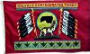
Tribal Flag:
Colville Reservation Flag
Tribal Emblem:
Related Tribes:
The Chelan indians are thought to have splintered off from the Wenatchi tribe. Later, the Chelan formed a confederacy with the Colville, Nespelem, Sanpoil, Sinixt, Palus, Wenatchi, Entiat, Methow, southern Okanagan, Sinkiuse-Columbia (also known as Moses-Columbia), and the Nez Perce of Chief Joseph's Band to form the federally recognized tribe called the Confederated Tribes of the Colville Reservation.
Origins:
The Chelan Indians say they have been there around Lake Chelan since the beginning of time. Archeologists theorize that they crossed the Berring Land Bridge and migrated south from Alaska as the glaciers from the last Ice Age receded about 8,000 to 10,000 years ago.
Traditional Territory:
The Chelan were historically located at the outlet of Lake Chelan in Washington State, where they spent the winter months. Lake Chelan is 55 miles long and a mile wide, and is the third-deepest freshwater lake in the United States and the ninth deepest in the world with a maximum depth of 1,486 feet. Fed by streams from the Cascade Range, the lake flows into the Columbia River from the Chelan River.
During the salmon runs, they fished the outlet where the lake meets the river and also moved down to the Wenatshapam Fishery on the Columbia River to fish and trade with other tribes.
The Chelan tribe also had several permanent villages in the lower Chelan valley. One at Willow Point, near Manson, had up to 500 occupants. Another on Wapato Point was home to about 100 people. They were frequently on the move, traveling in and out of the mountains with the seasons, collecting plants and hunting game.
The watery highway of Lake Chelan provided a relatively easy transportation route from the Columbia River deep into the Cascades. Occasionally, to trade with or visit coastal relatives, the Chelans would canoe up to the head of the lake where they knew of a route which followed a swift stream between high peaks.
Crossing between the glaciers and cliffs on the crest of the mountains, they descended through the tall forests to the land of the Skagits. The Chelan Indians often traded mountain goat wool for dried clams and salmon, or for seashells, which they used for future trade or ornamentation.
Original Reservation:
The non-treaty indians who followed Chief Moses were promised their own reservation, and one was established for a short time. On April 19, 1879 and March 6, 1880, two tracts of land where the present day City of Wenatchee lies, north to the Canadian border between the crest of the Cascades and the Okanogan River, were established by Presidential Executive Order for the Chief Moses tribes consisting of the Columbia, Chelan, Entiat and Wenatchi.
Three years later, Chief Moses was talked out of his entire reservation for a thousand dollar a year annuity. On July 7, 1883, this reservation land was taken back and Chief Moses and his people were given the choice to either move to the Colville Indian Reservation or accept an allotment of 640 acres for the head of each family.
Any farm that was located on non-Reservation land required the Indian to give up his tribal rights in order to keep it. A few families took the allotments near Lake Chelan, but most Chelan Indians objected to either choice and refused to move. They were eventually moved to the Colville Reservation after troops from Fort Spokane forcibly evicted them from their homes.
The Colville Reservation was originally over 3 million acres. The first reduction in size ocurred only 3 months after it was formed, and at one point it was reduced to only 300,000 acres.
Current Reservation / Settlements:
Colville Reservation in Okanogan and Ferry Counties is now 1.4 million acres (2008). Allotment lands around Lake Chelan in Chelan County northwest of the city of Chelan.
Traditional Allies:
Moses-Columbia, Entiat and Wenatchi.
At the time of contact, about two dozen tribes lived in the Plateau Region. Most of these belonged to the Salish or Sahaptin language families, but there were also Athapaskans, Chinookans, Pend d'Oreille, Flathead, Cayuse and Kootenai. Alliances changed frequently.
Traditional Enemies:
Shoshone, Kwalhioqua, Blackfoot. Nez Perce at times, at others they were allies.
Territorial boundaries shifted frequently in the Plateau Region, as tribes competed for the best hunting grounds. After the arrival of the horse, Plateau tribes faced more competition from the Plains Indians and indians from the Great Basin. Intertribal war in the area faded out as alliances were made to fight their common enemies.
By the 1860s, smallpox epedemics had virtually ended tribal warfare, due to the drastic decrease in population. From 1840 onward, the US government tried to move all indians to reservations. The resulting wars between the 1840s to the 1870s were the final push to tame the West.
Ceremonies / Dances:
The 4th of July Pow Wow at Nespelem is the main cultural event of the year for the Confederated Tribes of the Colville Reservation.
They also have competition tribal dances and play a traditional game called sla-hal (also called the Bone Game or Stick Games) and hold a traditional horse race they have held for hundreds of years now called the 'Suicide Race' at the annual Omak Stampede rodeo held the 2nd weekend of August each year in Omak.
An annual ceremony is held for the gathering of the camas root and another for the harvesting of the salmon.
Crafts:
The Chelan indians are best known for tule and grass baskets and beadwork. Basketry was a well-developed skill, and baskets were used to collect, process, store, and even cook most of the foods.
Famous Contemporary People:
Historical Leaders:
Chief Moses (Sulk-stalk-scosum - "The Sun Chief") - was the last Columbia chief who led the Sinkiuse-Columbia, the Wenatchi, Eniat, and Chelan non-treaty indians during the last three years before they went onto the reservation.
Long Jim - Last Chief of the Chelan Tribe.
Nmosize (Innomoseecha Bill) - Chelan Chief who disliked the Catholic priests. In 1880 he burned down the mission of Father Alexander Diomedi, S.J. when he wasn't present. Indian parrisoners built a new church along the lake near what would become the town of Manson.
Chelan Bob -Had an allotment near the first apple orchards in Okanogan County in what is now the town of Manson. One day he was found on the floor of his cabin nearly dead with a pick axe sticking into his face. He recovered, and after that he was referred to as "Crooked Mouth Bob," but probably not in his hearing. He would never reveal the name of his assailant.
Catastrophic Events:
Smallpox epedemics began to appear before Lewis & Clark visited in 1804, and were the greatest in the Columbia Valley, which as the main artery of travel and trade was frequently exposed to epidemics. Especially bad outbreaks ocurred in 1780 and from 1825-1835, hitting the younger generation especially hard, and within a few years the greater part of the once teeming populations of the lower valley were practically wiped out of existence.
Treaties:
On June 9, 1855, the Wenatchee chief Tecolekun and 13 other Native American leaders signed the Yakima Treaty at the Walla Walla Council with Governor Isaac Stevens. This extinguished the indigenous people's title to 10.8 million acres of north central Washington in exchange for a much smaller reservation, cash, and other incentives. The treaty lumped together the Chelans and Wenatchees as part of the "Consolidated Tribes and Bands of the Yakima Nation" even though they spoke a language different from that spoken by the Yakimas.
Almost immediately after the 1855 treaties were signed, many tribes, including most of the Chelan Indians, repudiated the agreements being imposed by Stevens and war broke out with the whites all over the territory. This became known as the Yakima War. Chief Moses and his followers agreed to remain neutral in this war, although they did not acknowledge the treaty as being valid. They became known as the "non-treaty" indians.
Other claims to lands and to the Wenatshapam Fishery guaranteed to Native Americans were gradually abrogated. Only a few small allotments near Lake Chelan remained in Native American hands. Most Wenatchees and the Chelans eventually settled on the Colville Reservation.
History:
The great earthquke of 1872
In December of 1872, there was a great earthquake in the North Cascades country centered around Lake Chelan that had 142 distinct shockwaves and continued at irregular intervals for 42 days. Water from the lake was thrown 200 feet into the air, and on half a dozen days during that winter, the sun was completely blocked from view due to the debris still circling in the air. Slight tremors continued off and on for more than a year.
The seat of the earthquake seems to have been just below the lake and some 15 or 20 miles from the Columbia. The Chelan Indians say the noise resembled thunder, and was an almost daily occurrence, and that at one time there was an issue of salt water from a fissure in the earth, that covered the ground knee deep, which had a horrific smell. Perhaps it was sulphurous.
Prior to this time, there was a stream or outlet to Lake Chelan about a quarter of a mile long, by which the waters of the lake were emptied into the Columbia. After the earthquakes, the river changed its course so that it runs right to the lower end of the lake, and the two bodies of water now unite.
Chelan elders say that about thirty miles below White Stone a high cliff or mountain which formerly stood on the right bank of the Columbia river now stands on the left, and that they can now easily ford the river at that point.
After the big earthquake, an indian prophet emerged who gathered a great following, and he gave a great prophesy to the people. However, the content of this prophesy was not shared with whites.
The Columbia Reservation
All of present Okanogan County was at one time in Indian reservation. That part east of the Okanogan River is the Colville Reservation. That part west of the river was part of an area proclaimed on April 18, 1879, as the Columbia Reservation for Chief Moses and his tribe, the Columbias. Chief Moses' band included remnants of the Wenatchi, Eniat, and Chelan tribes.
The Secretary of the Interior opened a "bee hive" in giving these Indians the land bounded on the east by the Okanogan River. And the Columbia River from the mouth of the Okanogan to the mouth of the Chelan River; south along the latter and Lake Chelan to the summit of the Cascades; and west along the Cascade summit to the Canadian border, which was the northern boundary.
Approximately the same bounds formed a mining district organized in 1860 by the Okanogan and Similkameen Mining District. After the United States Mining Laws of May 10, 1872, had been adopted by Congress, declaring mineral deposits free and open to exploration, occupation and purchase and giving exclusive right to possession and enjoyment to the locator.
The mining district residents met on the Fourth of July 1873, and drew up articles of by-laws after reorganizing as the Similkameen Mining District. At a January 2, 1874, meeting the name was again changed, this time to the Mount Chopaka and Similkameen Mining District.
Immediately, on learning their district had been given to Moses, the miners met on July 9, 1879, near Lake Osoyoos and drew up a set of resolutions and demands which they sent to the Secretary of the Interior.
Pressures brought to bear over the next three years on Congress to restore the land were of atomic force. Fearing the loss of energies already invested in the locations, some 26 recorded locations and relocations prior to April 18, 1879, the miners dared not add to their improvements.
The U.S. District Attorney for California was locating new claims during this time in spite of a precedent-setting opinion in 1864 that no mining claims are allowed on a military establishment.
The Interior Department yielded the job of administering the Columbia Reservation to the War Department since Moses would not accept Interior supervision by an agent. The miners wanted reimbursements in excess of ten million dollars for their improvements if they could not have their mines.
The military located a camp at the south end of Lake Chelan where it could keep a watchful eye on the Indians. Moses complained to the military officials of the settlers on his reservation, since he had been promised they would keep the white settlers off his lands.
Colonel Henry C. Merriman, the commander, sent Captain H.C. Cook north on August 19, 1880, to enumerate and determine the value of improvements on the reservation and to ask the owners to "pack up" and leave. Those he found at home were Alvin R. "Albert" Thorp, George "Old George" Sutherland, Robert "Old Bob" Clayton, James Palmer, George W. "Tenas George" Runnels, Thomas G. Moore, and Alexander "Alex" or "Slick" McCauley. Cook valued these peoples' improvements at $3,577, considerably less than the $11,000 they had submitted.
Cook also contacted Smith, who lived just off the reservation on the east side of Osoyoos Lake. Smith sent a letter to Cook stating he was replying to his interrogation "in regard to the value of the silver mines located in pursuance of an Act of Congress, passed May 10, 1872 on Moses Reservation, so called and owned conjointly by Marshall Blinn, Phelps, Henry Wellington and Smith. Smith claimed their seven mines had a prospective value of 10 million dollars.
While the military emissary did not remove the reservation intruders,the presence of those who paid him lease money disturbed Moses very little. The miners, most of whom were investors living elsewhere, were determined to get back the mineral rich land in the northern part of the reservation.
Late in the summer of 1880 President Rutherford B. Hayes, accompanied by General W.T. Sherman, visited the northwest and learned first hand of the error the government had made in giving Moses lands on which miners held claims. Hayes was apologetic and asked Territorial Delegate Thomas H. Grents to assemble and present to Congress information on the problem. Mining people asked the President to restore the land to the public domain.
Miners circulated numerous petitions, one to the effect that they are allowed to obtain title to their claims, another that a ten-mile strip be shaved off from the Indian land and saved for them. Washington territorial Governor Elisha P. Ferry notified Schurz of the "ten mile strip" petition. On December 19, 1880, officials of the Eagle Mining Company wrote General Sherman that a petition had been sent to delegate Brents and requested the general's influence. Attorneys were hired to lobby Interior officials. Delegations visited Washington, D.C., to contact lawmakers first hand.
With pressure on government officials at the bursting point, the Interior department officials decided to negotiate with Moses to purchase a strip of land. Colville agent John A. Simms, whom Moses did not like, was designated contact man. Knowing that the potentially explosive matter would have to be settled in some manner and soon, General Miles, whom Moses respected, sent A.J. Chapman to the chief independent of the Interior's investigation to ascertain the chief's feeling in the matter. With the information he gained, the general agreed that to prevent war, a part of Moses' reservation should be purchased by the government so it could be returned to those who claimed ownership and opened to others wanting to locate there.
Smith, kingpin of the miners, continued to alert the Secretary of the Interior with messages and suggestions, which were becoming bolder. On September 19, 1881, he asked that a fifteen-mile ribbon be cut from the reservation and placed back in the public domain. He suggested a portion of the south end of the Colville Reservation (already given to other tribes) be traded to Moses for the fifteen miles. The miners had help from Okanogan Indian Chief Tonasket, who favored selling a part of the reservation, and giving the money to ALL Indians, not just Moses. Even some of Okanogan Chief Sar-sarp-kin's people came out in favor of opening up the area to miners who made a ready market for garden products these Indians raised.
Governor William A. Newell, speaking to the Eighth Biennial Washington Territorial Legislature on October 5, 1881, spoke in favor of abolishing reservations and opening the land for settlement. Moses and his people were naturally disturbed and uneasy over the grabby attitude of anxious whites.
With a rumor that the Government might lease portions of the reservation, a meeting was called for the mining district members on December 1, 1881, at which time they drew up resolutions. The miners complained that the military had advised the miners and settlers to abandon their homes and property. Cook had valued their property at considerably under estimates of those living on the land.
Runnels had been taken under escort to the military camp (recently moved from Lake Chelan to the mouth of the Spokane River) for refusing to obey the military. The land was given to Moses after they located mines on the reservation, and the Surveyor General of Washington Territory refused to survey their claims. Moses and his band did not occupy the area, less then than one hundred Indians lived on the area.
The declaration that Moses did not live on the land given him was correct. The first winter after being kicked out of the Columbia Basin, he and his people holed up in the Kartar Valley on the Colville Reservation. After that he wintered for a couple years near the mouth of the Nespelem River and finally in the Nespelem Valley where he located permanently.
The situation became more acute through the next year. Hal Price, then Commissioner of Indian Affairs, suggested on August 1, 1882, to the Secretary of the Interior that an inspector be sent to council with Moses to get him to relinquish the mineral rich strip of his reservation.
Inspector Robert S. Gardner was sent from Washington, D.C., to the Colville Agency to confer with Moses. An interpreter was sent to Moses' camp to bring in the chief, who refused to come because one of his wives, a daughter and brother were sick with smallpox. (Moses' wife and brother died.)
Eventually, Moses and other chiefs were taken to Washington, D.C., where, after conferences, they signed an agreement July 7, 1883, for the Government to purchase the entire reservation from the Indians.
By act of Congress on July 4, 1884, the entire Columbia Reservation was restored to the public domain. It was May 1, 1886, before the area was officially opened for white entry and settlement. The influx of people was so great that Okanogan County, which includes a large chunk of the former Moses Reservation, was split from Stevens County and became a separate county two years later.
Treaties:
The aboriginal tribes of the Methow, Okanagan, San Poil, Lakes, Colvilles, Kalispels, Spokane, Coeur d’Alene, and other scattered tribes who were not parties to any treaty were confined to the original Colville reservation.
Nespelem Oral History The town of Nespelem, situated on the Colville Indian Reservation derived its name from an Indian word meaning "large meadow beside a stream."
Sinixt Lake indians Most Sinixt or Lake indians are now part of the Colville tribe in Washington state, but once roamed both Washington and British Columbia.
Chelan Indians
The Chelan Indians were historically located at the outlet of Lake Chelan in Washington State.
Marriage and Wedding Customs Men of the Plateau Tribes usually had at least two wives at the same time, more if they were wealthy.
In compliance with FTC guidelines, please assume the following about all links on this website that are outbound links: Since I share products and services I use and love with my readers, assume that I may receive a small commision if you buy something or subscribe to a service from a link on this website (at no additional cost to you). If you do buy something, thanks for your support !
Among others, we are a participant in the Amazon Services LLC Associates Program, an affiliate advertising program designed to provide a means for us to earn fees by linking to Amazon.com and affiliated sites. Pages on this site may include affiliate links to Amazon and its affiliate sites on which the owner of this website will make a referral commission.
The shopping links above this notice go to our own store, NativeCrafts.us
Not Found
Apologies, but the page you requested could not be found. Perhaps searching will help.