| Canada First Nation Reserves | |||||||
 |
 |
 |
 |
 |
 |
 |
 |
|
|
|||||||
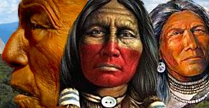
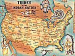
| native american indian tribes of the US | |||||||
| |
||||||
Canadian Reserves
|
Artifact Replicas|Jewelry|Clothing|Figurines|On Sale|New ProductsThe size of Canadian Reserves varied greatlyWhen it came to setting aside land for the exclusive use of First Nations (i.e., for the creation of Indian Reserves), in most cases only very small parcels of land were allocated for such purposes. These tended to be sites of permanent villages and associated "farm" lands (i.e., gardens adjacent to these villages) as well as specific, and highly localized, sites used for resource extraction (e.g., strategic fishing sites). All lands outside of these restricted areas were made available for pre-emption (purchase at a nominal fee) to white settlers. And, except in a small number of cases (i.e., the 14 Douglas treaties signed on Vancouver Island between 1850 and 1864 and Treaty 8 covering the northeast corner of the province, signed in 1899), no compensation was ever paid to First Nations for the loss of these lands. Those responsible for creating the Indian reserve system were largely ignorant of, and insensitive to, of First Nations' land and resource needs. Furthermore, as Harris (2002) describes, the dominant colonial and settler mentality was that First Nations needed to be ‘civilized’ or assimilated into Euro-American culture. Many simply felt that First Nations were quickly on their way to extinction, a perception based in part perhaps on declining populations and the poor state of health of many Native communities at that time due to the impact of introduced diseases (a major smallpox epidemic swept through coastal British Columbia in the early 1860s, causing massive mortality in First Nation communities. With First Nations in decline so there was no need to bother with them, or such was a prevalent view. In any case, allocating large parcels of land to First Nations was not deemed worthwhile, as this land would simply be “wasted.” Much better, it was argued argued, to give the land to colonists who would “improve” the land and put it to “better” use (i.e., clear the land, plant crops, or graze cattle). A quote from Philip Henry Nind, the gold commissioner at Lytton, illustrates the colonial view. In a letter he wrote to the Colonial Secretary in 1865, and in reference to a claim made by 500 Indians to a large area between Kamloops and Shuswap Lake, Nind observed: These Indians do nothing more with their land than cultivate a few patches of potatoes here and there; they are a vagrant people who live by fishing, hunting and bartering skins; and the cultivation of their ground contributes no more to their livelihood than a few days digging of wild roots. (Cited in Harris 2002, 56) In the end, the network of Indian Reserves created in British Columbia between 1850 and 1898, reflected the narrow perspective of colonial authorities and was wholly inadequate to sustain First Nations cultures and economies. And as First Nation populations recovered in the 20th Century, the scarcity of land became increasingly serious. It should be noted that relative to other areas in Canada, most Indian Reserves created in British Columbia were very small. Northwest British Columbia, covered under Treaty 8, was an exception. Here, Treaty 8 allotted land for reserves based on one square mile (259 hectares) of land per family of five or 160 acres (65 hectares) “in severalty” (i.e., per individual). This formula was similar to that for other “numbered treaties” in Canada. (The numbered treaties were the 11 major treaties negotiated with First Nations across Canada between 1871 and 1921.) For Treaties 1, 2 and 5 the formula was 160 acres (65 hectares) of reserve land for every family of five; for the other treaties, the formula was one square mile (259 hectares) per family of five (Dickason 2002, 255). In contrast, in British Columbia (apart from the Treaty 8 area), there was no clear formula for the size of reserves. Douglas’ approach to this question was rather haphazard. At one point, he suggested that reserves be based on a minimum of 20 acres per family. At another point, he instructed surveyors to allow local First Nation leaders to mark out their own reserves. Some reserves were marked out under this principle, all of which were later greatly reduced in size. After Douglas retired, Joseph Trutch became the most influential figure in dealing with the Indian land question. Trutch became the Chief Commissioner of Land and Works in 1864 and, as Harris (2002, 45) described it, essentially became a “mouthpiece for prevailing settler opinion.” Compared to Douglas and Sproat, he was much more restrictive in the amount of land he thought should be allocated to Indian Reserves. After 1871, Trutch also came into conflict with Dominion (federal) authorities in Ottawa, who assumed responsibility for Indian affairs after confederation. Dominion authorities, for example, proposed the allocation of 80 acres of land per Native family in British Columbia. On Trutch’s urging, the Province argued for a maximum of 20 acres per family. In the end, the Province won the argument and 20 acres per family became the maximum land allowed for reserves (Harris 2002, 74-75). In an effort to maintain good relations with the Province, the federal government did not advocate strongly on the behalf of First Nations in British Columbia. As a result, Trutch won out on almost every point. Believing that some of the reserves Douglas and Sproat had created were too large, he authorized the “adjustment” of reserves so that each family should receive a maximum of ten acres each. Through such “adjustments” approximately 40,000 acres of reserve land across British Columbia was taken back and made available to white settlers (McKee 2000, 19). These so-called “cut-off” lands became an ongoing point of contention between First Nation leaders and government authorities. ...Read More about First Nation Reserves FIRST NATION RESERVES IN CANADACanadian reserves #451 to 500 (P to S)
|
 Site Designed by: Mazaska Web Design © 1999-2017 AAANativeArts.com Website Ranking file: canadian reserves |